Tag: technology

  • Time to shake the 2D complacency and move to 3D

    Image: Polaris Wireless
    Image: Polaris Wireless

    The world is not flat – so why has the geolocation industry been operating in two dimensions?

    By Matt Rothschild, Polaris Wireless

    For an industry that makes its living identifying people and objects at a particular point in space, the geolocation industry — made up of applications providers, mapping companies and device manufacturers — has been very slow to make the move from two dimensions (2D) to three dimensions (3D). There is no excuse for this, as the ability to locate in 3D is fully tested and operable. What explains the holdup and what is being done to meet the growing need for 3D solutions?

    Industry participants recognize the inevitable move towards 3D but give four main reasons for the delay:

    • There is a lack of awareness about some of the robust, scalable solutions that are available for deployment today
    • Businesses continue to make money from 2D applications
    • The investment required for 3D applications is too high
    • The eco-system for 3D applications is not fully developed

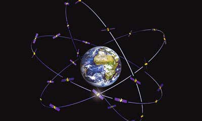
    It seems that applications using location data simply rely on whatever information is made available through devices, mostly driven by GPS. There are more specific location technologies that offer fully tested, citywide vertical location solutions.

    Despite years of deployments and generating effective use cases in two dimensions, the industry must do a better job of keeping up with technology advancements, especially those most likely to benefit from 3D location, and articles like this help!

    But why is there a lag in the industry to move to a 3D world?

    2D complacency

    The explanation for the lag in moving to 3D is that the geolocation industry is still making money from 2D applications and, as the old saying goes, “If it’s not broken don’t fix it.”

    While it’s true that many non-mission critical applications are getting along fine using 2D and will for the foreseeable future, the need for 3D is now. At a basic level, traffic directions don’t really require a 3D layout of the topography of your daily commute, although I could argue the traffic use case would benefit from knowing whether traffic on a map is on an overpass or ground level roadway. Certainly rideshare companies could benefit from communicating to their customers what level in a parking garage or airport they are on.

    Other use cases are demanding more sophisticated 3D technology. One of the initial drivers for high-accuracy 3D (and indoor) location has been the needs of the public safety community. When lives are at stake, first responders require the most specific possible location accuracy in order to quickly find emergency callers and others needing help.

    Beginning in April 2021, Emergency Communications Centers (911 call centers) will receive vertical location of emergency callers from wireless carriers. Computer-aided dispatch (CAD) systems are exploring how best to incorporate this information and direct first responders to the 911 caller’s 3D or floor-level location.

    The benefit is obvious, as emergency callers cannot always provide their exact location to the 911 operator, so technology fills the gap. Other industries ranging from mining to healthcare to enterprise security similarly are also demonstrating demand for 3D applications, and we are seeing moves to meet this demand, but there is a long way to go.

    High stakes

    Another reason for the relatively slow development of 3D applications is the investment required. Even with a demonstrable demand across several industries, many players in the geospatial industry aren’t willing to invest funds to pioneer new solutions.

    For every big player like Samsung or Apple, who have committed to developing state-of-the-art 3D sensors in their devices, there are many small players who must instead follow the market and adopt white-label solutions that don’t require as much upfront investment.

    While it’s true that some 3D technologies can require significant investment and a committed strategy on the part of geospatial industry players, locating devices in 3D is possible today and there is a huge potential to serve new markets and improve business and consumer applications.

    The 3D eco-system

    As the market for commercial applications reaches a tipping point where 3D is not just a curiosity but is becoming a must-have for many consumers and businesses, the industry ecosystem must step up and deliver all parts of the solution. The mapping industry presents an interesting use case in this regard.

    Digital maps have been in use for years, since the advent of the first fleet tracking devices in the 1980s, which led to the widespread use of consumer car tracking systems, and then onto Waze and other Smartphone-based mapping applications. Even these maps, which are huge advancements over their predecessors, do not fully reflect the 3D world we live in, and generally do not include accurate maps of the indoor environments in which we spend most of our time.

    The next step in mapping is the digitization of entire buildings and other structures to create accurate 3D representations. However, even pioneers in this space aren’t fully utilizing 3D technology throughout their product roadmap, and, until there is a fully developed 3D ecosystem, it’s difficult for a company to go ahead alone.

    As one leading company explained to us, without a consistent protocol for the use of 3D data and its conversion into 3D maps, they can’t justify converting their entire production from 2D, so they instead create 3D maps as one-offs where needed. They haven’t yet seen the critical mass in the industry required to go full 3D, and they are still working with, and making money from, 2D partners.

    They are preparing for the time when the industry is fully 3D, which they believe will come soon.

    A 3D world

    Stepping back and taking a broader view of where we are, I think we are witnessing an industry in transition. With the deployment of city-wide, scalable location solutions that incorporate location data from a variety of sources, the initial building blocks are in place for the move to a fully 3D world.

    Pioneering companies are going after growing demand (and in some cases creating that demand), even with limited resources, and seeding an ecosystem for others to build upon. I would in fact challenge the industry to produce a use case that would not benefit from improved location and 3D awareness — from the daily commute through complex freeway systems to shoppers navigating a multi-story mall to find a specific retailer, to protecting workers running large hotels, and more, the applications are endless and promise to multiply as users realize the benefits of 3D technology.

    It is only a matter of time until the location industry will fully embrace the fact that the world indeed is not flat.


    About Matt Rothschild

    Headshot: Matt Rothschild
    Matt Rothschild

    Matt Rothschild is the Mountain View-based Head of 3D Location Customer Engagement for Polaris Wireless. He is a wireless and telecommunications industry leader with more than 20 years’ experience leading sales, marketing, product and operations organizations internationally. Rothschild successfully led sales and marketing teams for Nokia in Asia (Singapore), the Middle East & Africa (Dubai) and the Americas (Miami/Silicon Valley). Most recently, Rothschild led the Nokia/Microsoft acquisition and integration for North America, building partnerships with key mobile operators and channel partners, as well as building important ecosystem and developer relationships for the Windows platform.

  • Esri provides mapping software for organizations fighting COVID-19

    Communities in need of resources can access location intelligence technology at no cost with six-month trial

    Logo: EsriLocation intelligence company Esri is making its software available to public and private sector organizations fighting the coronavirus (COVID-19) pandemic.

    The COVID-19 outbreak has escalated rapidly across the globe, and with municipalities struggling to respond, Esri has built out resources to help organizations understand the potential impact of the disease on public health, as well as potential community risk areas and their capacity to respond.

    A COVID-19 GIS Hub site provides much of this essential data, including case locations and social vulnerability, that communities and health organizations can use to inform their response.

    To help public health agencies and other organizations jump-start their response, Esri is providing the ArcGIS Hub Coronavirus Response template at no cost through a complimentary six-month ArcGIS Online subscription with ArcGIS Hub. The template includes examples, materials, and configurations to rapidly deploy a local ArcGIS Hub environment. ArcGIS Hub is a framework to build a website to visualize and analyze the crisis in the context of an organization’s or community’s population and assets.

    “Esri has always prioritized assisting communities during large-scale emergencies and natural disasters,” said Jack Dangermond, Esri founder and president. “For the past 25 years, our Disaster Response Program provides data, software, configurable applications, and technical support for emergency operations. We consider it part of our mission to provide these services free of cost during this time of national crisis.”

    For more information on the complimentary software and the disaster relief support, visit esri.com/disaster.

  • Cesium to collaborate with Smithsonian to stream high-resolution 3D models online

    Streaming 3D geospatial technology company Cesium will support the Smithsonian Institution by streaming 3D models of massive objects in its collection, such as the Space Shuttle Discovery. The models will be streamed over the internet in high resolution for the first time.

    The collaboration is part of the Smithsonian’s Open Access Initiative. Through the initiative, the Smithsonian will release about 2.8 million 2D and 3D images, public collections metadata, and institutional research data sets as Creative Commons (CCo) for any purpose, such as education, research, commercial endeavors, creative reuse, computational analysis, and innovative explorations.

    “The Smithsonian Open Access Initiative aligns perfectly with Cesium’s vision to make the world’s collection of data more useful and accessible,” said Cesium CEO Patrick Cozzi. “We are proud that our technology will give researchers, educators, and the public the ability to study 3D models in the Smithsonian’s collection in the highest resolution detail from anywhere in the world.”


    Cesium Stories enable 3D storytelling

    Cesium Stories enable creation and sharing of 3D geospatial presentations on the web, without requiring any writing of code. An intuitive interface enables story creation using Cesium’s 3D world terrain basemap, the user’s own 3D data, or a combination of multiple datasets, fused into interactive scenes. Learn more here.


    Making massive high-resolution 3D models shareable begins at the intersection of Cesium’s core competencies of computer graphics, 3D data and open standards. With Cesium, glTF models are converted to 3D Tiles, an open specification developed by the company and adopted by the Open Geospatial Consortium (“OGC”) to make sharing massive amounts of 3D data as simple as sending a link.

    Cesium develops, supports, and promotes open standards with organizations like the OGC and The Khronos Group to advance technology, encourage collaboration and fuel cross-disciplinary innovation.

    The Space Shuttle Discovery — on display at the James S. McDonnell Space Hangar at the National Air and Space Museum’s Steven F. Udvar-Hazy Center in Chantilly, Virginia — is one of the largest objects in the Smithsonian’s collection. It is more than 122 feet long and weighs more than 4.5 million pounds.

    Now, a shareable, high-resolution 3D rendering will enable anyone to rotate, zoom in, and study its details from anywhere in the world.

    Explore the 3D model at www.cesium.com/smithsonian.

  • On the cusp of 2020: From Y2K to today’s technology

    On the cusp of 2020: From Y2K to today’s technology

    Image: GPS.gov
    Image: GPS.gov

    As we close the book on 2019 and head into the next decade, much has changed during the 2010s and the 21st century. This article will focus on the technological changes that made a significant impact on the surveying world, with the biggest advances being specifically GNSS-based improvements.

    No, we will not debate the true beginning of a century (Jan. 1, 2000, versus Jan. 1, 2001), but instead look at the predicted issues with computers and the Y2K hysteria leading up to the end of 1999 as part of our nostalgic tour.

    For the millennials and Gen-Z readers, bear with us old-timers for a few paragraphs while we take a trip down memory lane.

    The tale of two centuries…

    “It was the best of times, it was the worst of times, it was the age of wisdom, it was the age of foolishness, it was the epoch of belief, it was the epoch of incredulity, it was the season of Light, it was the season of Darkness, it was the spring of hope, it was the winter of despair, we had everything before us, we had nothing before us, we were all going direct to Heaven, we were all going direct the other way — in short, the period was so far like the present period, that some of its noisiest authorities insisted on its being received, for good or for evil, in the superlative degree of comparison only.”

    In 1859, Charles Dickens wrote this opening paragraph for his well-known novel, “Tale of Two Cities,” to describe two environments (in this case being London versus Paris) at a significant transitional time. Such was the case for surveying and technology in the late 1990s with the rapid utilization of GNSS technology, expanded capability of robotic equipment and data collection. Some practitioners were excited about the new century while others yearned for bygone eras of less complicated procedures.

    “Gonna party like it’s 1999…”

    A 1999 Gateway PC refurbished by LRG. (Screenshot: LRG video, click to view)
    A 1999 Gateway PC refurbished by LRG. (Screenshot: LRG video, click to view)

    With apologies to the late singer Prince and his 1982 hit song, the news surrounding the year 2000 was bleak when it came to computers and technology. For many of our readers, the technology available in 1999 might seem like the Stone Age. Most homes still used telephone land lines, “state of the art” cellphones were being produced by Nokia, personal computers (manufactured by Dell, Gateway, HP and IBM) were utilizing Pentium III processors (at a whopping 450 MHz!) with 5-10 GB storage. Internet Explorer was the web browser of choice, and Napster was gaining users exponentially sharing music downloads. Google was only one year old but rapidly replacing AltaVista and WebCrawler for our internet search engines. Life seemed good, but a storm was brewing…

    The Y2K bug was front and center in all media outlets as many computerized systems were not programmed with the year 2000 in mind. This issue was unique in that it was a software and hardware problem to address. Replacement or patching of software, while taking a significant amount of time and money, can be much easier than computers and hardware loaded with chipsets that cannot be reprogrammed.

    The Napster logo
    The Napster logo

    Most system programming utilized a two-digit year designation instead of a four-digit version (99 versus 1999) and thus a date entry for January 1, 2000, normally composed as 1/1/00 in older systems would be recognized as January 1, 1900, instead. Because of this situation, many experts were predicting a global meltdown with government, utility company and banking disruptions that would render most computer systems unusable.

    In the United States alone, over $100 billion was spent on computer upgrades and troubleshooting of the potential crisis. Thankfully, most of these systems had already been taken offline and replaced, but a few still lingered in critical systems. Because of pre-Y2K upgrade planning, many systems were tested and proven to be immune from the potential crash.

    Specific Y2K issues that took place within the U.S. satellite system were isolated mostly to the units dedicated to surveillance, and not the navigation section used by surveyors. There was a small issue with the U.S. Naval Observatory, in which the date was deemed to be “Jan. 1, 19100” but that was rectified quickly.

    The U.S. spy satellites, however, were knocked out by a faulty software patch rather than the original programming. These units were producing unusable information for three days before programmers were able to fix the problem. Imagine if that situation had happened to the navigational satellites and was impacting surveyors; we can only hope the GNSS system would have simply provided obvious bogus information.

    Embracing RTK

    By 1999, surveying had begun to embrace RTK systems for everyday measurement needs. Because of the constant focus of GPS technology moving forward, the operating systems for RTK were ahead of the curve for the Y2K issue. Fortunately, the navigational satellites as mentioned above did not fail with the date and time issues that were being predicted.

    Logo of the now-defunct U.S. government Y2K website.
    Logo of the now-defunct U.S. government Y2K website.

    The Y2K bug did, however, affect a few users of older technology and software. Older data collectors, including ones based upon handheld calculators, were susceptible to date issues. Systems that were designed in the 1970s and ’80s should have been replaced with newer technology before 2000, but old surveyors stick to the adage: “If it isn’t broke, don’t fix it!”

    For many, it wasn’t simply an upgrade in technology, but more of a radical change in known processes and procedures. New instruments and data collectors required new computers, which required new software, which required learning a completely new system.

    Handheld GPS technology, introduced in the mid-1990s, was beginning to grow as the general public was embracing the new ability to determine geographical positions. While their use is quite simplified by today’s standards, nonetheless these devices captured the tech lover’s need for more accurate location determination.

    In the end, Y2K wasn’t nearly the technological apocalypse many educated minds feared. While there were a few isolated incidents worldwide, everyday life went on without much of a blip on the radar. Planes didn’t fall out of the sky; financial systems didn’t come crashing down and life went on. Thankfully, surveyors everywhere went about their business on Monday, Jan. 3, 2000 as if nothing happened.

    Then 20 years go by…

    The new millennium has brought the surveying community many new exciting technologies and vast enhancements to age-old procedures. Field book notes has been mostly replaced with electronic data collectors, cellphone cameras and point clouds. Data is efficiently transferred between field and office with a remote connection and a blink of an eye. These past 20 years has seen a landslide of technological improvements, yet the future looks incredibly bright with more to come.

    With the new year and decade, let’s look at where we are today and what advances we are anticipating:

    GNSS CAPABILITY

    • GPS (Global Positioning System)  began working in the U.S. in 1978 and as a true global system in 1994. This system was originally designed to work strictly for the United State military, but was discovered to have consumer applications shortly after implementation. There are currently 30 operational satellites in the GPS constellation with two (2) Block III versions being evaluated at press time. A total of ten (10) Block III satellites are planned to be operational by late 2023 or early 2024. These Block III versions will have an enhanced signal capability (L5 band) and will provide more accuracy and increased protection from jamming and spoofing.
    • GLONASS (GLObal NAvigation Satellite System) is the navigation system designed and implemented by Russia. This system was deemed operational in 1993 and currently has 28 operational satellites. Most surveying equipment in the United States has GLONASS tracking capability to greatly increase the accuracy and precision of most GNSS receivers.

      China launched two more BeiDou satellites on Aug. 25, 2018. (Photo: CCTV)
      China launched two more BeiDou satellites on Aug. 25, 2018. (Photo: CCTV)
    • Galileo is the satellite constellation system created by the European Union. It reached limited capability in 2016 with full expanded reach targeted for 2020. However, the reliability of the system is now in question as a total system outage occurred for seven days in July 2019. The satellites themselves were operational; it was the main control center that experienced the shutdown during a system maintenance upgrade. The overall integrity of the system has been restored and the planned rollout of full operational capability is still scheduled for 2020.
    • BeiDou, the national navigation system of China, has achieved 35 operational satellites with 13 additional vehicles currently being evaluated for implementation. With the increased number of satellites, many GNSS receiver manufacturers are including BeiDou as standard channel reception to greatly increase accuracy and precision for navigational purposes.
    • Two additional regional systems, QZSS (Quasi-Zenith Satellite System) from Japan and IRNSS (Indian Regional Navigation Satellite System) from India are currently working to install more satellites and provide navigation signals soon. Because these are regional systems, access to these signals for U.S.-based surveyors will not be available.

    In 20 short years, we went from having two good systems to four very robust systems and two regional organizations.

    While it is still unclear how political relationships will affect the ability to use a system from another country, the simple fact is that more vehicles in space will only increase the coverage, reliability and effectiveness of GNSS navigational data. Increased signal type and strength will also provide many benefits, so surveyors should look forward to even better GNSS days ahead.

    ADDITIONAL CELLPHONE CAPABILITY

    Several increases in cellphone technology will greatly enhance not only the consumer’s use of GNSS but the surveyor’s. This involves a two-step increase in value with the rollout of 5G signal technology and dual-frequency GNSS receiver hardware within the cellphone.

    5G is being introduced in various markets around the country, but won’t see full potential until 2021 and beyond. Those who can use it in the short term will see greater bandwidth for data connectivity, but surveyors will start utilizing navigational enhancements because of the signal and transmitter technology.

    Photo: Broadcom
    Broadcom’s latest dual-frequency chip. (Photo: Broadcom)

    Add to this mix the future implementation of dual-frequency GNSS chipsets to provide much more accurate location, and the surveyor will have more data-collection power in their pocket. Dual frequency was a gamechanger for GPS receivers in their infancy, so one can only imagine how much it will enhance the navigation accuracy when included in the cellphone.

    REAL-TIME NETWORKS (GNSS)

    Most urban and suburban surveyors already enjoy the benefit of a real-time network, either from a private or public system. With 5G and expanded use of more satellites and L5 signal, the RTN will become a better tool for surveyors everywhere. A reduction of setting up a base station increased productivity, less theft and less equipment costs. The RTN will become a standard operational tool just like having a total station in your survey rig.

    DATA COLLECTORS

    Photo: Spectra Geospatial
    Photo: Spectra Geospatial

    The technology hasn’t stopped with the unveiling of new data collectors and platforms. Small handheld devices used to rule the field surveyor’s world; now those devices have become bigger and more advanced than ever.

    While most collectors already had touchscreens, the actual screen is increasing in size and functionality. Some are adopting the tablet-style format (8- and 10-inch screens), others are incorporating larger screens (7 inches) within the body of the traditional collector. All of them are including better cameras and enhanced connection capability through Wi-Fi, Bluetooth and cellular methods.

    Also catching on is the use of bring-your-own-device (BYOD) with specialized apps for connecting to newer GNSS receivers. This allows surveyors to keep down costs of equipment by not having to purchase a dedicated data collector. As mentioned previously, once the cellphone becomes equipped with 5G and/or dual-frequency GNSS, it will become an excellent system for surveying that will produce extraordinary value for the surveyor.

    SPATIAL DATA

    The biggest revolution for surveyors in the coming years will be the ability to collect spatial data through a variety of equipment and sensors. Besides the obvious explosion of UAV capability, the small-format laser scanner is becoming user- and drafter-friendly as well as much more affordable. Now a surveyor can perform dozens (if not more) of small area scans with simplified orientation and scan formatting to create a great looking point cloud for data extraction and/or Building Information Modeling (BIM). Surveyors are beginning to understand how to utilize this technology and data to reach inaccessible areas and densified regions quickly. In addition to scanning technology, SLAM (simultaneous localization and mapping) will also become more mainstream as more surveyors are adopting the method for data collection.

    What we’ve learned

    “The days are long, but the years are short.” – Gretchen Rubin, author

    Gretchen hit the nail on the head, as these past two decades have rolled on. When the end of 1999 was upon us, it seemed to be a big deal because of the potential of Y2K issues. There we were, surveyors with exciting technology in our hands, and now the forefathers of computers were going to erase it all due to not looking ahead to the next century.

    We easily got past it, yet the memories of Y2K still linger on for some of us. The jump to 2010 didn’t foreshadow any drama (other than climbing out of a recession) and I personally didn’t think any different while moving the calendar to January 2020. But somehow in the last few months of 2019, there were many stories about the Y2K predicament, and it rekindled old memories of those weeks leading up to January 1, 2000.

    Long story short, we survived and lived to survey many more days. Having time to look back and compare where we were 20 years ago to where we are now, I find it simply amazing. No, Rick Deckard isn’t flying by in his car catching bad guys (Blade Runner was set in 2019!), but surveying continues to amaze me with continued technological changes.

    I wonder what the next 20 years will bring.

  • SimActive speeds stockpile measurement with drones

    logo: SimActiveSimActive Inc., a developer of photogrammetry software, released an enhanced workflow in Correlator3D to accelerate stockpile measurement. The new capability allows users to automatically assess multiple volumes within the same project and output comprehensive reports.

    If the same area is regularly flown, the new workflow also allows easy comparison of volumetric values to assess differences in time. In addition, change detection can be performed to precisely quantity variations in topography.

    “Facilitating volume calculation reduces the associated costs for our clients,” said Louis Simard, CTO at SimActive. “Our new workflow is thus a definite advantage for users in multiple industries, including mining, forestry and construction.”

  • Bluesky awarded lidar contract to map Wales from the air

    This image of Wales is color-coded to show the relative height of the land. (Image: Bluesky)
    This image of Wales is color-coded to show the relative height of the land. (Image: Bluesky)

    Aerial mapping company Bluesky International has been awarded a contract by Natural Resources Wales, on behalf of Welsh Government, to capture a high-resolution laser mapped aerial survey of the whole of Wales.

    Working alongside Natural Resources Wales and the Welsh government, Bluesky will capture the data at a resolution of 2 points per metre before processing and delivering lidar data for more than 20,000 square kilometers of rural and urban landscapes.

    The Bluesky lidar data will be employed in a range of policy areas including flood modeling, forestry management, coastline monitoring, urban planning and archaeological conservation.

    In addition to use internally by Welsh Government and Natural Resources Wales, the lidar data will also be made publicly available in due course, via Welsh Government’s Lle Geo-Portal website and Bluesky’s Mapshop.

    “Historically, lidar data has been acquired over Wales at various points in time from the 1990s onwards,” said Paul Isaac, project manager at Natural Resources Wales. “However, since these datasets have been collected for different reasons a patchwork of data exists that is inconsistent in terms of capture technology, coverage and resolution. Also, many of the high-altitude, mountainous areas have not been captured at all resulting in key habitats and ecosystems remaining unmapped.”

    “This pattern of largely uncoordinated acquisitions would likely have continued with different programmes and projects funded from various sources,” he added. “Therefore, rather than different public sector bodies securing data individually — leading to inefficiencies and discrepancies — Welsh Government proposed to capture one consistent dataset to cover the whole country. A further key driver for the projects is the wider economic benefit as organizations and individuals will no longer have to fund separate data capture.”

    Bluesky was awarded the National Lidar for Wales contract following a formal tender process with responses evaluated on technical ability as well as price. All tenders were required to provide a detailed methodology of how they would complete the project to the published specification.

    “Bluesky was able to provide evidence that they could provide the required services at a competitive price,” Isaac said. “Bluesky also showed they had extensive experience in this field having successfully delivered a number of related projects.”

    “We are delighted to be working with Natural Resources Wales on this nationally significant project,” said Rachel Tidmarsh, managing director of Bluesky International. “As a team, we have great experience delivering large scale projects of this nature to the required specification and timescales.”

  • GeoComm provides GIS for California’s Next Generation 9-1-1

    Photo: sturti/E+/Getty Images Plus
    Photo: sturti/E+/Getty Images Plus

    GIS company GeoComm is partnering with Atos Public Safety LLC on its contract with the State of California to transform the state’s 9-1-1 system.

    The upgrade will turn the state’s system to a broadband communication platform. The upgrade will give California — a state with a population of 40 million, more than many countries — the ability to intelligently route, manage and deliver a broad array of real-time information to 9-1-1, including text messages.

    The change also allows for an exchange of information within the 9-1-1 centers to reduce response time, enhance situational awareness and increase first responder safety.

    GeoComm, in partnership with Atos, will serve as the State of California’s statewide Next Generation 9-1-1 (NG9-1-1) GIS data services provider.

    Reliable and up-to-date GIS data is critical in NG9-1-1 to ensure accurate routing of 9-1-1 calls in an Emergency Services IP Network (ESInet). GeoComm’s public-safety GIS solution will power the underlying GIS data quality delivered through the Atos NG9-1-1 IP network and the regional networks as the authoritative NG9-1-1 GIS data for the state.

    In August 2019, Atos was awarded a five-year, $198 USD million contract with the State of California to transform the state’s 9-1-1 system to leading-edge broadband communication platforms that advance emergency services for the public, 9-1-1 professionals and first responders.

    “Access to a secure, reliable NG9-1-1 IP network will have a tremendous impact on the effectiveness of communications between emergency callers and first responder resources within communities,” said Phil Rotheram, Atos. “Atos Public Safety has been entrusted to migrate some of the world’s most mission-critical environments and we are happy to partner with GeoComm in the State of California for the critical statewide GIS element,”

    “GeoComm continues to be recognized throughout the country as the leader in NG9-1-1 GIS solutions and services,” said Erik Loberg, GeoComm vice president of product management. “We are honored to be working with Atos Public Safety LLC and the State of California for this exciting NG9-1-1 transformation project as the state migrates its 9-1-1 network, advancing emergency services for the public, 9-1-1 professionals, and first responders.”

  • Pléiades Neo imaging satellites on track for mid-2020 launch

    The first two Airbus-built Pléiades Neo imaging satellites have started comprehensive environmental testing to ensure they are ready for in-orbit operation, according to Airbus.

    During the tests, the satellites are subjected to extreme temperatures and vacuum, vibration and acoustic noise, as well as electromagnetic interference. This will ensure they can withstand the harsh conditions they will experience during launch and their mission in orbit.

    These first two new generation very high-resolution satellites are on schedule for launch in mid-2020. They will join the Airbus constellation of optical and radar satellites, improving both the revisit and resolution capacities.

    Entirely funded, manufactured, owned and operated by Airbus, Pléiades Neo will provide institutional and commercial customers with high-level insights for the next 12 years. Each satellite will be adding half a million km² per day at 30-cm resolution to Airbus’ offering.

    The images will be streamed into the OneAtlas online platform, thanks to an innovative cloud-based ground segment architecture, allowing customers to have immediate access to freshly acquired and archived data as well as analytics.

  • 1Spatial announces mobile platform for spatial data collection

    New product enables collection, correction and confirmation of spatial data in the field

    1Spatial LMAP logoThe new Location Mobile App Platform (LMAP) by 1Spatial enables easy and flexible spatial data collection in the field. Leveraging existing expertise in data management and data quality into a mobile app platform delivers an easy to use user interface, flexibility in integration and in-built validation based upon business rules.

    LMAP can be configured to provide a solution to any number of spatial data challenges facing businesses and has been made available to offer complete integration and configuration flexibility to customers. Utilities, for instance, have geographically dispersed assets and the need for quality-driven spatial data editing via a field-based workforce.

    LMAP helps guide users to capture the right data at the right time and, crucially, make sure that the data is right first time.

    “We have a host of great customers and always strive to create solutions that make all parts of data collection easier,” said Sarah Gadd, product manager at 1Spatial. “We know that our clients love the reliability and power of our patented rules engine and want to bring that to the field. Simple and powerful apps tailored to our customers’ needs is our next big step in delivering spatial data quality to every stage of the data journey.”

    For more information and for a demo of LMAP, join 1Spatial for a free webinar on March 10 at 2 p.m. GMT. Register here.

  • Are your sewers GIS-ready?

    Are your sewers GIS-ready?

    By Emily Constantine Mercurio

    Our nation’s sewers are under critical examination now more than any other time in history. The act of collecting sewage and stormwater, transporting it to the treatment system, and processing waste is no doubt a feat of science and engineering that we take for granted in the developed world.

    Sewer infrastructure is a critical public asset whose importance in modern life cannot be overestimated, and to keep things running properly takes round-the-clock maintenance and operations. It’s only when the system fails or floods that we fully appreciate our dependence on it.

    At last count, there are at least 16,000 publicly owned wastewater treatment systems (also called Publicly Owned Treatment Works, or POTWs) in the United States, providing sewer service for more than 245 million people. Additionally, about 860 communities have combined sewer systems (CSS) that serve about 40 million people.

    These CSS capture both sewage and stormwater before the combined mixture is treated and either reused, recycled or discharged to the environment. In wet weather events, untreated waste and stormwater can escape capture due to overfilled combined storm sewers, known as combined sewer overflow (CSO). These CSO events can spill sewage into rivers and streams, creating a major source of water pollution across the country.

    To make matters even more complicated, the effects of climate change and increased rainfall in some areas have created new challenges to our nation’s sewer infrastructure.

    Additionally, federal and state regulations like those for municipal separate storm sewer systems (MS4) that discharge untreated runoff into the environment have added new demands of our publicly owned entities that manage these systems.

    A map of the continental U.S. depicting POTWs, from the EPA Facility Registry Service’s Wastewater Treatment Plants Dataset. (Screenshot: CivicMapper)
    A map of the continental U.S. depicting POTWs, from the EPA Facility Registry Service’s Wastewater Treatment Plants Dataset. (Image: CivicMapper)

    The impact of sewer overflow is especially felt in the eastern United States where the combination of aging infrastructure and increasingly frequent and severe rainfall events have presented significant challenges in the capture, handling and treatment of sewage.

    With some eastern cities receiving record rainfall in the past few years, it’s now more important than ever to understand our sewer infrastructure, including: where it is, who is responsible for it, when it was installed, how it is networked, and what are its defining characteristics. These data are essential for performing maintenance, for planning growth, and for undertaking new construction projects. The need for better understanding, visualizations, and communication of sewer data assets is a perfect use case for Geographic Information Systems.

    The Case for Mapping Sewer Networks

    There are many moving parts to a sewer network. Representing each manhole, sewer line, pump station, inlet, and outlet within a unified map requires expertise in the art and science of mapping. Spatial data from a breadth of sources like engineering drawings, as-builts, CAD datasets, spreadsheets, field surveys, sewer cameras, flow meters, and aerial imaging have traditionally been the go-to datasets for constraining the topology, attributes, and capacities of sewer networks. Additionally, new kinds of data procured from emerging geospatially-enabled technologies like subsurface robotic pipe inspections and simultaneous localization and mapping (SLAM) provide a glimpse of where sewer map data will come from in the future. For POTWs and their stakeholders, information from both old and new sources can synergistically come together in a GIS as part of a greater asset management program.

    Creating a unified map of sewer infrastructure from many data sources requires time and effort to construct proper geospatial data topology, correct directionality, and accurate attributes. These undertakings are greatly supported by the development of data models, workflows, tool sets, metadata, and documentation that will make it easier for workers to maintain sewer data now and in the future. The added bonus of developing these data for use in a GIS is a highly valuable and functional data asset that can be used to inform operational and business processes at every level of the organization.

    An organization’s data represents the outcomes of some of the mostly costly investments and operational endeavors undertaken by that entity. When big or important projects are completed, it is the data collected during the work that lives on after staff turnover and retirements. With respect to mapping sewers, many POTWs already have much of the data they need to put into a mapping system, whether it be in a CAD file, on paper, or living in a spreadsheet. GIS liberates these data so that it becomes a living product and enables them to be leveraged in powerful ways and across multiple operational areas.

    Implementing a sewer GIS increases the return on investment of data, creates a platform for data sharing across other systems, and sets the stage for innovation and efficiency improvements.

    While creating and maintaining a sewer GIS might sound like a big-ticket item, modern mapping tools are making it more cost effective than ever before. Competitively priced software licensing, open-source GIS technologies, cloud computing, and in-browser processing can lower the costs of geospatial application development. Further, establishing geospatial data pipelines and application programming interfaces (APIs) can reduce the time needed to condition data before they are ingested into mapping systems and across multiple software platforms.

    Taking sewer GIS to the next level with network tracing

    One of the most exciting applications of a sewer GIS is the capability to perform network tracing. These traces can show the locations and direction of wastewater flow from any point within the system and are commonly performed by POTW engineering personnel. The ability to perform a sewer network trace within a GIS is valuable for several reasons.

    An example of a network trace map. (Image: CivicMapper)
    An example of a network trace map. (Image: CivicMapper)

    The trace helps operators and engineers better visualize the contributing sources to main sewers that collect wastewater from the many lateral and branch sewers that service buildings, businesses, and homes. Enabling this capability in a GIS environment makes it more accessible to other personnel, and especially those working on site. Allowing POTW easier access to network tracing through a GIS helps teams across the organization stay informed on what addresses are connected to which sewer mains, facilitating better communication and collaboration on maintenance and expansion projects.

    The network trace can operate upstream to locate which buildings might be contributing to problems downstream. From any manhole or service location, the sources of industrial or commercial waste violations or exceedances can be better identified through upstream sewer tracing. The ability to query any point along the sewer network and constrain the sewershed from that point saves time and resources of field personnel when diagnosing problems and finding solutions.

    Sewer systems are vital, publicly funded resources yet most people know very little about the way their homes and businesses connect to this system. Inviting the public to view a unified and continuous map that represents their sewer network is a great learning resource and facilitates increased awareness and familiarity with the work of the POTW.

    Once such example is the Flush-It web application. This app allows the public to interact with an engaging map that shows the path their flush takes on its way to the treatment facility. The tool was built on open source geospatial technology and uses a unified, topologically correct sewer data set as the backbone of the network trace. Applications like these are also great for educating students on the importance of science and engineering on daily life.

    The Flush-It web application, built on a sewer network GIS dataset. (Image: CivicMapper)
    The Flush-It web application, built on a sewer network GIS dataset. (Image: CivicMapper)

    The process of building a GIS of networked sewer map from a set of historic and disparate set of data sources might seem daunting for many POTWs, but the benefits of doing so profoundly outweigh the headaches.

    This type of mapping system saves time and money in the long run by ensuring that the best and most current data are shared across multiple operational units and opens up new pathways for innovation and outreach.

    As cities continue facing the complications of aging infrastructure and a changing climate, there is no better time than the present to modernize sewer data and use this amazing data resource to both protect communities and equip them with the information needed to tackle future challenges.


    Emily Constantine Mercurio is the CEO and co-founder of CivicMapper. Emily grew up in Pennsylvania’s coal country, and at a young age became interested in geoscience, maps, and the interplay of nature and human activity. Her career has centered on creating innovative, data-driven, and tangible solutions to support decisions at the intersection of our natural and built environments. She leverages more than 25 years of experience with Earth science data and geospatial technologies for leading the development of CivicMapper’s products and services. Emily has a Ph.D. in Geology and is a licensed professional geologist.

  • FAA, AUVSI to co-host fifth annual FAA UAS Symposium

    FAA, AUVSI to co-host fifth annual FAA UAS Symposium

    Logo: FAA UAS SymposiumThe Federal Aviation Administration (FAA) and Association for Unmanned Vehicle Systems International (AUVSI) will co-host the 5th Annual FAA Unmanned Aircraft Systems (UAS) Symposium June 16-18 in Baltimore. The event will take place at the Baltimore Convention Center.

    The symposium will bring together representatives from the FAA, other government agencies, the industry and academia. According to the show organizers, the presenters and panelists will discuss the latest information and advancements related to the diverse uses of unmanned aircraft, and how these new entrants are being safely integrated into the National Airspace System.

    The show will include four primary educational tracks, including public safety, technology and innovation, international and policy. The public safety track will explore topics such as addressing community concerns, security, and using drones to conduct safer and more effective public safety missions. The technology and innovation track will cover how drones and drone technologies are innovating rapidly and fundamentally changing aviation. The international track will feature discussions on how national and international UAS experts, industry representatives, civil society stakeholders, non-governmental organizations and policy makers are working to integrate and use drones across the globe. Finally, the policy track will allow attendees to hear directly from policy decision makers and get their thoughts on regulatory, operational and technical concerns.

    In addition, the FAA will operate as an on-site resource center to answer questions from UAS owners and operators. Subject matter experts will be on hand to answer questions about airspace authorizations, waivers, the Part 107 small UAS rule, changes in hobbyists’ drone operations, the Remote Identification rulemaking, and other policies and regulations, the organizers added.

  • 1Spatial forms strategic partnership with Neueda

    1Spatial forms strategic partnership with Neueda

    Duncan Guthrie (left) of 1Spatial and Peter Russell of Neueda. (Photo: 1Spatial)
    Duncan Guthrie (left) of 1Spatial and Peter Russell of Neueda. (Photo: 1Spatial)

    1Spatial has formed a strategic partnership with international technology company Neueda. 1Spatial and Neueda will jointly provide digital solutions that enable customers to transform and improve the way they do business.

    1Spatial is a software solutions provider and global expert in managing location and geospatial data.

    Neueda provides digital transformation services to customers in the private sector, public sector and capital markets across the globe. Headquartered in Belfast, Neueda has bases in Dublin, London, Malaga and New York.

    As a software solutions provider and global experts in managing location and geospatial data, 1Spatial will complement Neueda’s services by provisioning geospatial digital services that support customer transformation and improvement projects.

    “We are excited to announce this partnership with Neueda and really look forward to working together with their highly talented specialists,” said Duncan Guthrie, managing director, 1Spatial. “We both have a similar approach with our customers and always ensure we deliver the best solutions to meet their business needs. Through this partnership we look forward to delivering success for our customers and helping them unlock the value of their spatial data.”

    “We are delighted to formally partner with 1Spatial and look forward to working with a global leader in geospatial data,” said Peter Russell, managing director, Enterprise Services, Neueda. “Neueda sees data as a key enabler to true digital transformation and geospatial data is certainly a key challenge for many of our customers. We hope this partnership will also allow us to develop joint propositions to break into new markets.”