Tag: Trimble TerraFlex

  • Trimble Terra Office workflow integrates with Esri ArcGIS Pro

    Trimble Terra Office workflow integrates with Esri ArcGIS Pro


    Image: Trimble Geospatial 
    Image: Trimble Geospatial

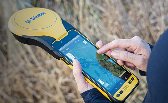
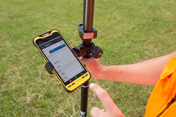
    Trimble has released the Trimble Terra Office add-in for Esri ArcGIS Pro. The add-in is a part of Trimble’s Terra Office suite of desktop solutions for integrating Trimble TerraFlex field data collection software with GIS systems of record.

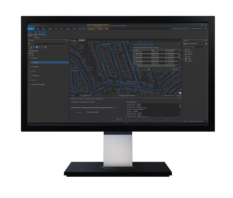
    With a streamlined user interface, the new Terra Office add-in for ArcGIS Pro enables users to connect TerraFlex workflows directly to the ArcGIS platform from within ArcGIS Pro — Esri’s desktop GIS application. ArcGIS Pro users can now create and manage TerraFlex geospatial data collection projects without leaving ArcGIS.

    Organizations that collect data in TerraFlex and bring it into ArcGIS through the add-in can also use the Trimble Offline GNSS Corrections service, for situations where real-time correction services are intermittent or unavailable. With this service, all data from the field is automatically processed in the cloud without user intervention, and the most accurate real-time or post-processed position is stored for each feature and made available for download through the Terra Office add-in for ArcGIS Pro.

    For more information on the Terra Office add-in and its availability, click here.

  • Trimble introduces high-accuracy mapping solution for GIS field applications

    Trimble introduces high-accuracy mapping solution for GIS field applications

    Trimble has announced a new high-performance data collector for its Mapping and Geographic Information Systems (GIS) portfolio — the Trimble TDC650 handheld. Built for GIS data collection, inspection and asset management activities, the TDC650 provides users a rugged solution with scalable high-accuracy GNSS positioning for professional field workflows.

    The TDC650 is fully integrated with today’s demanding GIS data environment, powered by the Trimble Software Development Kit (SDK) that enables precision GNSS positioning for apps such as Esri ArcGIS Field Maps and Trimble TerraFlex software. The TDC650 is also a scalable solution that allows customers to choose their desired accuracy down to the centimeter-level to meet needs and budget requirements.

    “This is an ideal tool for customers tasked with modernizing critical utilities including electric, gas and telecommunications networks,” said Gareth Gibson, marketing director, Trimble Mapping and GIS. “The precision, quality and data integration workflows needed to map the physical world to a digital one in these projects requires a modern data-collection platform like the TDC650.”

    City, state and local governments and utilities will benefit from this solution, which is part of the larger Trimble Public Sector ecosystem that includes Cityworks software for stormwater inspections and Trimble Unity for monitoring municipal water pressure and hazards. As GIS data continues to grow more complex, Trimble helps simplify, visualize and make sense of the data so customers can make better decisions in managing their communities’ assets.

    Photo: Trimble
    Photo: Trimble
  • Trimble DA2 GNSS receiver launched for Catalyst positioning

    Trimble DA2 GNSS receiver launched for Catalyst positioning

    The Trimble DA2 receiver boosts the performance of the Trimble Catalyst GNSS positioning service. (Photo: Trimble)
    The Trimble DA2 receiver boosts the performance of the Trimble Catalyst GNSS positioning service. (Photo: Trimble)

    Trimble has launched the Trimble DA2 GNSS receiver for the Trimble Catalyst positioning service. The DA2 — the second-generation receiver and antenna for the Catalyst service — now includes the Trimble ProPoint GNSS engine for enhanced performance.

    Unique to the latest Trimble GNSS solutions, ProPoint technology reduces convergence times and improves positioning accuracy when operating near trees and buildings.

    Trimble Catalyst is a subscription-based GNSS positioning service for location-enabled field applications. The service is available in accuracy-based packages from centimeter- to submeter-level for a wide range of mapping and mobile geographic information system (GIS) data-collection projects. Catalyst continues to support a broad range of GIS field applications, including Trimble TerraFlex software, for form-based GIS data collection.

    “Trimble Catalyst brings easy-to-use precise positioning to location-enabled workforces,” said Gareth Gibson, marketing director, Trimble Mapping & GIS. “The addition of ProPoint technology, together with the DA2’s support for iOS devices, means Catalyst can now deliver Trimble quality positioning to more geospatial professionals than ever before.”

    Trimble Catalyst subscriptions are available through Trimble’s Authorized Distribution Network. The Catalyst DA2 digital GNSS receiver, sold separately, is expected to be available in the fourth quarter. Trimble TerraFlex software subscriptions are available separately through Trimble Geospatial distribution partners.

  • Trimble TerraFlex now has offline data transfer

    Trimble TerraFlex now has offline data transfer

    TerraFlex users can now synchronize data directly to their on-premise Esri geographic information system without cloud services.

    Photo: Trimble
    Photo: Trimble

    The new software workflow — called offline data transfer — is possible through the integration of Trimble TerraFlex and the Trimble Positions Desktop add-in for Esri ArcGIS Desktop.

    TerraFlex is a field solution that enables mobile workers to easily collect, manage and edit their geospatial feature data.

    The new workflow provides an alternative to using Trimble cloud services for storing and transferring GIS feature data collected with the TerraFlex platform. In addition, TerraFlex field data collected via this workflow using a Trimble GNSS receiver can be post-processed directly inside the Trimble Positions Desktop add-in for improved positional accuracy.

    “With this new feature, TerraFlex fulfills the need of organizations such as government agencies and utility providers who cannot keep their data in the cloud because of regulatory constraints or business rules,” said Rachel Blair-Winker, business area manager for Trimble Mapping & GIS solutions.

    “By introducing the new workflow to our TerraFlex software platform, customers who prefer direct desktop methods of transferring data between field and office (such as USB) and need post-processing capabilities can now benefit using this new solution without having to change their current business practices,” Blair-Winker said.

    Trimble TerraFlex is available online or through Trimble’s Authorized Geospatial distribution channel. The mobile apps are available in Apple’s App Store and the Google Play store.

    The Trimble Positions Desktop add-in is available through the Trimble Geospatial distribution channel. The new workflow functionality will require the latest version of both applications.