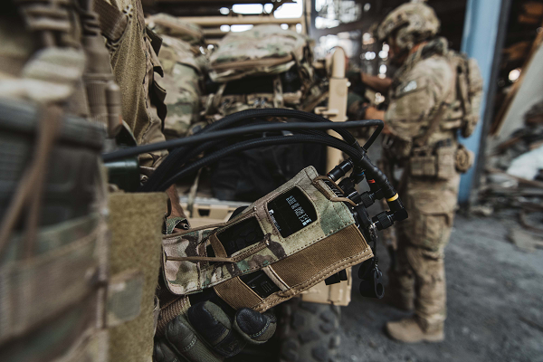
DroneShield has begun releasing a software update across its counter-unmanned-aerial-system (C-UAS) devices, including portable, vehicle-based and fixed-site devices. The devices are used by the military, the intelligence community, U.S. Homeland Security, law enforcement, critical infrastructure and others.
The updates will be rolling out across DroneShield devices globally in the coming week, with heightened urgency given the widespread use of drones in Ukrainian and Middle Eastern conflicts. The technology upgrade is validated by deployments with the U.S. Air Force and Australian Army.
Enrolled devices receive quarterly firmware updates of the proprietary DroneShield RFAI artificial intelligence engine. Some of these updates are major enhancements, such as this 2Q22 release.
Major upgrades include:
Site Install Wizard. The new Spectrum Viewer mode, in which C-UAS detection devices scan the deployment area for optimal sensor placement
Machine Learning in the Loop. This option enhances the RFAI engine from the data received by the user.
Both features were added in response to end-user requirements.
LIFT Aircraft Co. has been awarded a U.S. Air Force contract to continue experimentation and flight test efforts around its HEXA copter.
LIFT Aircraft Co. has been awarded a Phase 3 contract through the U.S. Air Force’s Agility Prime Program to continue experimentation and flight test efforts around HEXA, LIFT’s all-electric, single-seat vertical-takeoff-and-landing (VTOL) aircraft.
Since 2020, LIFT Aircraft has conducted flight testing with the support of the U.S. Air Force under a Phase 2 Small Business Innovation Research (SBIR) contract.
Working with Air Force subject-matter experts, LIFT achieved initial military airworthiness approval (military flight release) and proven transportability by moving the aircraft inside a C-130 military cargo plane. The company also explored a multitude of potential use-cases alongside the Agility Prime Test Team.
The Phase 3 contract will continue experimentation and use-case development through a fast-paced, rigorous flight testing program. The program will begin at Eglin AFB and may expand to other locations. It includes efforts such as flight envelope expansion, acoustics testing and developmental testing of a modular cargo adaptation for the airframe.
The aim is to accelerate and further develop HEXA for public and military applications such as emergency first response, personnel transport, base logistics and search-and-rescue missions. The development effort will also help accelerate the testing required for LIFT’s planned rollout of commercial flight locations.
“This partnership provides continued access to the unmatched expertise of the U.S. Air Force,” said LIFT Director of Business Development, Kevin Rustagi. “We’re excited about continuing to explore and develop a unique capability to the military: an aircraft that offers air mobility at a cost point comparable with ground transportation that, in the future, with mere hours of training, allows any service member to become a pilot.”
Testing will initially be performed at Eglin Air Force Base near Destin, Florida, alongside the 96th Test Wing and with the support of Air Force eVTOL initiative, Agility Prime.
LIFT has already begun coordinating with Col. Doug Creviston of the 96th Operations Group, which has tested systems for the F-15 Eagle, F-16 Falcon and A-10 Thunderbolt.
Photo: Lift
“LIFT is a great example of why Agility Prime exists — to further applications of eVTOL technology for both military and civilian use,” said Lt. Col. John Tekell, Air Force Agility Prime Lead at AFWERX.
Agility Prime has taken a flexible approach to contracting with the Phase 3 SBIR for LIFT. The contract is designed to be as agile as possible — it allows not only the Air Force, but any governmental entity to contract for flight-test activities with LIFT’s HEXA aircraft on an as-needed basis.
“This contract was designed to enable flexible flight test as a service of multiple HEXA aircraft for any government stakeholder, location and desired experiment,” said Sterling Alley, technology transition lead and LIFT program manager at Agility Prime. “We want it to be able to serve as a contract vehicle that accelerates HEXA towards fielding not just for the USAF, but the DOD and USG in general. We have a large number of interested stakeholders looking at use-cases for the aircraft and welcome growing the community even further in the future.”
“LIFT’s Phase III SBIR contract award is a meaningful vote of confidence from the U.S. Air Force,” said Eric Horan, former U.S. Navy government contracting officer and founding partner of Decisive Point, a venture capital firm that invests in dual-use technology startups and has invested in LIFT. “It means the Air Force has determined LIFT’s previous development and testing contracts were successful. This is an important step towards scaling access to LIFT’s HEXA eVTOL aircraft throughout the Department of Defense and federal government at large.”
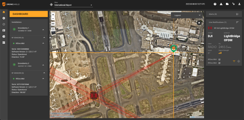
DroneSentry-C2 with Nearmap location data. (Screenshot: DroneShield)
DroneShield Limited, an Australian/U.S. global leader in artificial-intelligence-based platforms for protection against advanced threats such as drones and autonomous systems, has announced an enhanced version of its DroneSentry-C2 command-and-control software in partnership with location intelligence firm Nearmap.
Nearmap provides city-scale 3D content, artificial-intelligence data sets, geospatial tools, and high-resolution aerial imagery in Australia, New Zealand and North America.
DroneSentry-C2 provides an intuitive and feature-rich software platform, providing counter-UAS awareness and reporting capability. It integrates both DroneShield and third-party C-UAS sensors and effectors. Those include multiple AI-enabled sensing and tracking products, such as RfOne long-range direction-finding sensors for UAS detection and tracking, and camera-agnostic DroneOptID optical/thermal camera AI software.
DroneSentry-C2 will come with a standard mapping solution for cost-sensitive customers, and an optional Nearmap mapping upgrade for mapping data for markets requiring high performance, such as government, intelligence, Homeland Security and defense.
The software comes as an on-premises, air-gapped solution for intelligence, Homeland Security and defense users, or secure cloud for enterprise customers. The on-premises solution also includes a high-grade physical server. Both options come with regular mapping updates, including the ability for the user to load their own maps for sensitive locations.
“One of DroneShield’s differentiators is that we are both a sensor manufacturer and an integrator,” said Oleg Vornik, DroneShield CEO. “Providing a streamlined and standardized hardware / software bundle that gives our user community an easy-to-deploy and run command-and-control software will be critical as more fixed and pop-up site users seek to deploy counter-UAS products. Importantly, the offering is already validated by deployments such as U.S. Air Force and Australian Army, among a number of other tier 1 end users globally.”
A U.S. Secretary of Defense once predicted that navigation would eventually be based on inertial devices that were set at the factory, and then always knew where they were forever after. Recently published research has reported on steps in that direction. However, according to navigation expert Brad Parkinson, the outlook is not as bright as some might think.
RNT Foundation President Dana A. Goward recently discussed the issue with him.
Goward: Dr. Parkinson, you are well known for your contributions as the chief architect of the Global Positioning System. But you have more than a passing familiarity with inertial systems also, is that right?
Parkinson: I do. Long before I was involved in radio navigation, I was the chief analyst for all the U.S. Air Force testing of inertial navigation systems. I earned my masters degree in Doc Draper’s Inertial Lab at MIT in 1961. I am a major advocate and defender of inertial systems. I also have in-depth understanding of their limitations.
Goward: Have you been following the recent media coverage about advances with inertial systems?
Parkinson: I enjoy reading about these advances in physics devices. At the same time, I am a little impatient with media articles that do not appreciate the differences between building a device that measures specific force (or senses rotation) and a working inertial navigation system.
Goward: What are some of the inherent limitations of these systems?
Parkinson: I find it interesting that some of the articles speculate they may be able to supplant GPS and other GNSS. There is no way an inertial navigation system, even with perfect gyros and force sensors, can provide its accurate position (say, better than 10 meters) after extended periods (hours to days). In fact, attaining better than 200 meters accuracy after a few hours will be very difficult in a moving vehicle.
Today, farmers require even greater accuracy from GPS. They routinely use GPS for row operations, with accuracies of a few centimeters. The economic value is indirectly measured by the farmer’s purchase of such equipment — the agriculture market for GPS equipment is well over a billion dollars a year. Thus, a general replacement for GPS must provide centimeter accuracies.
Goward: So, what is it about inertial systems that stands in the way of them becoming autonomous substitutes for GPS?
Parkinson: There are some very simple and fundamental reasons that inertial positioning systems cannot hope to deliver such capability.
First, force sensors are not accelerometers, because they cannot sense gravity. To find acceleration, one needs to add vector gravity to their outputs. But gravity, or g force, varies a lot at the micro-g levels, and the inaccuracies are fed to the double integration that produces position. Errors grow as time or time squared and, without outside reset, are essentially unbounded. The physics devices described in some of these articles are definitely instruments that Doc Draper described as “specific force sensors.”
What we loosely call g force, or just g, is actually the inverse of the reaction to maintain stationarity on Earth. G is defined to include the centrifugal force due to Earth’s rotation, which varies greatly as a function of latitude — the radius of the merry-go-round called Earth. Mountains and chasms affect the local g. Further, it is a vector quantity: its direction can change locally by many arc seconds. In other words, down does not generally point to Earth’s center. Gravity gradiometers might be of limited help, but they are very large and not made for dynamic environments.
In a nutshell, estimating acceleration requires calculating and adding gravity to the three-dimensional specific force sensor.
Second, to use these devices for extended navigation, coordinate frames would have to be defined and stable to milli-arc seconds. All instruments would have to have input axes and cross-axis sensitivity calibrated to corresponding levels. Generally, this problem is ignored in many lab projects.
Third, for inertial navigation sensors to work, they need to accurately know their initial position. Any initial velocity or position errors will grow as a function of time.
Fourth, the vertical position axis is inherently unstable and diverges exponentially.
Physicists have been enamored with instruments that can use atoms to sense specific force and rotation. While scientifically interesting, even if perfect they cannot overcome these challenges.
Goward: But there is still a role for inertial systems in navigation, isn’t there? How good are they, and what are some of the applications?
Parkinson: I suspect the best inertial systems of today (which are in nuclear submarines) can maintain an accuracy of about 0.1 nautical miles or about 200 meters for a few days. I am sure the real number is classified. These systems are very large, expensive and complicated. They rely on a very low acceleration environment and are periodically reset with GPS. Furthermore, they probably use gravity gradiometry to calculate the local variations in gravity to the first order. They do not calculate the vertical position, and use water density and knowledge of the local geoid to keep the vertical axis stable.
An aircraft with inertial can, to some extent, keep the vertical dimension errors bounded, provided it has knowledge from elsewhere of local sea-level barometer settings and by assuming adiabatic pressure variations.
I strongly support the inertial/GPS/directional antenna marriage for users who want assured PNT. Aviation is a good use case for this. Inexpensive inertial components (called micro-electromechanical systems, or MEMS) can improve the jamming resistance of the GPS receiver by 15 dB or more. This step alone can reduce the effective line-of-sight jammer denial area by more than 95%.
Goward: So, inertials can be a good part of the solution but are not necessarily the whole solution themselves.
Parkinson: Exactly. Despite what some media outlets might publish to lure in readers.
At the ION GNSS+ 2021 conference in St. Louis, Missouri, the annual meeting of the Satellite Division of the Institute of Navigation, Brad Parkinson bestowed Lakshay Narula with the division’s Bradford W. Parkinson Award for his Ph.D. thesis “Towards Secure & Robust PNT for Automated Systems” at the University of Texas at Austin. The award honors Parkinson, known as the “father of GPS,” for his leadership in establishing both GPS and the Satellite Division of the ION. Narula is now an applied scientist at Amazon Lab126 in Sunnyvale, California, where he researches robust navigation and state estimation methods for robots, from self-driving cars to aerospace applications. (Photo: ION)
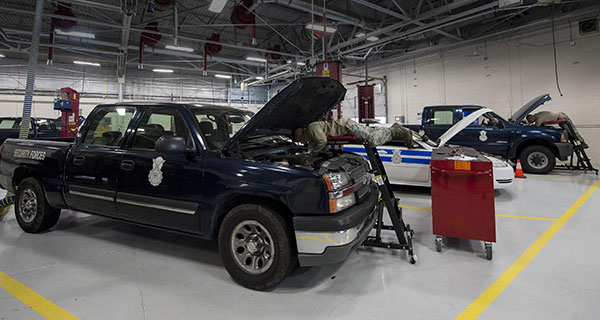
U.S. Air Force Airmen repair government-operated general-purpose vehicles at Moody Air Force Base, Georgia. (Photo: U.S. Air Force/Airman 1st Class Lauren M. Johnson)
The U.S. Air Force will equip its 21,000 general-purpose vehicles with Geotab fleet-management technology after the company was awarded a sole-source contract.
Geotab received FIPS 140-2 validation for its cryptographic library in February 2019 as well as FedRAMP authorization and ISO 27001 certification for its telematics platform. These compliance certifications and authorizations validate Geotab’s system and organizational processes, enabling the company to offer its fleet-management services to all levels of federal, state and local government agencies.
Geotab’s fleet-management technology for the Air Force is secure and customized. It includes the following features to help the service more effectively manage its vehicles:
automated odometer capturing
engine diagnostics
problem predictive analytics
fuel data
custom reporting
GHG reduction dashboards
fleet right-sizing reporting
Selected for its integration capacity and proven commitment to information security, the sole-source award from the Department of the Air Force yields an Authorization to Operate (ATO) within the Department of Defense (DoD). The authorization will allow other DoD agencies to leverage Geotab services by piggybacking off of this DAF ATO.
Geotab fleet-management products are used by more than 2,000 government agencies and departments at all levels to capture, measure and analyze crucial fleet data with deep granularity. “Winning this sole-source contract from the Department of the Air Force further solidifies Geotab’s ability to collaborate with agencies that operate at the highest levels of national data security and to provide a customized and highly secured telematics solution,” said Dan Zdarko, business development manager, federal government, Geotab.
“It is vitally important that the technology we deploy in our fleets meet the highest standards of data security put forth by the U.S. government,” said Tim Patterson, program management flight chief from the U.S. Air Force’s 441st Vehicle Support Chain Operations Squadron at Langley Air Force Base in Virginia. “Our objective is to enhance fleet-management strategies and reduce the total cost of ownership longer term across the Department of the Air Force.”
Are ‘”flying cars” unmanned aerial vehicles, manned aircraft, electric aircraft or just regular aircraft? Or perhaps a mix of all of these? Flying cars raise so much interest because of their potential to fulfill the space-age Jetsons promise, with the regular family parking one at their house, then using it to go to work, go grocery shopping and take the kids to school — all the things we do today in cars on roads.
The U.S. Air Force recognized that flying cars could also revolutionize how it operates, and in 2020 started putting effort and cash into promising commercial flying-car ventures. Since then, the Air Force has begun to make progress. Its AFWERX Agility Prime program has helped four companies — Kitty Hawk Aero, Beta Technologies, Joby Aviation and Lift Aircraft — develop prototype commercial flying-cars and expand their capabilities.
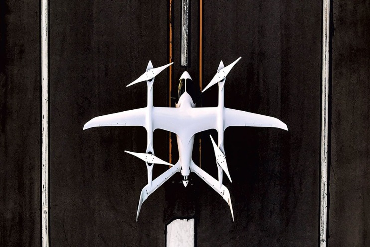
The Kitty Hawk Aero Heaviside
Kitty Hawk Aero in Palo Alto, California, has been working on its electric vertical take-off and landing (eVtol) aircraft for several years and claims to have proven its tilting propeller concept through several hundred vertical take-off/landing to horizontal flight transitions.
The aircraft — known as Heaviside — has just been granted airworthiness approval by the Agility Prime program, enabling Kitty Hawk to further participate in specialized trials funded by the Air Force.
Heaviside takes off vertically. (Photo: Kitty Hawk)Heaviside comes in for a landing. (Photo: Kitty Hawk)
The majority of flight testing flown by Heaviside has been remote without on-board crew (one or two pilots). This has enabled Kitty Hawk to expand the flight envelope without risking lives. For instance, you might assume those initial vertical to horizontal transitions could have carried a degree of risk, even though those switches in flight mode are now considered virtually risk free.
Nevertheless, the aircraft is also equipped with an on-board parachute recovery system that has been demonstrated to gently lower the aircraft to the ground in the event of a complete electrical failure. The design has minimized weight, even though the aircraft carries sufficient battery power to provide a range of more than 100 miles. A speed of up to 180 mph has been achieved.
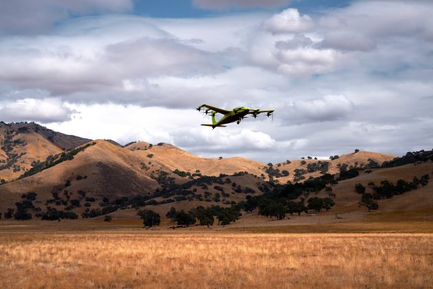
The Beta Technologies Alia
Another AFWERX participant in the Agility Prime project is also well along in its flight test program. Beta Technologies has been flying its Alia prototypes on routes of more than 100 miles and pushing velocities of 150 mph.
Alia eVtol aircraft. (Photo: Brian Jenkins/Beta Technologies)
Alia is large — it’s in the 7,000-pound aircraft category with a 50-foot wingspan. Alia is designed to carry six people over 250-mile routes, with a cargo capacity of 1,500 pounds. It is powered by on-board lithium-ion batteries. The Air Force expressed serious interest in the design and flight-test planning phase before Alia became airborne. The craft has since proven it is capable of safe, reliable flight over routes such as Plattsburg to New York. The Federal Aviation Administration has authorized such flights ahead of time, but Beta also just received additional airworthiness authorization from the Agility Prime office to enable further trials.
The Air Force clearly has great faith in Beta Technologies. The company received an even greater boost to its Beta eVtol program from the commercial sector. BLADE Urban Air Mobility has already ordered 20 of these electric aircraft, and UPS has also ordered 10, with the expectation that their order could grow to up to 150. UPS can clearly see the time and cost advantage of landing aircraft directly at its package-sorting facilities, then loading and vertically launching Alai onto delivery routes, either manned or autonomously as a cargo UAV. United Therapeutics, which is developing artificial organs for human implantation, is another key sponsor, presumably to find the shortest transit time to client hospitals.
Amazon also may become involved following Beta’s recent successful $368 million funding round led by Fidelity and Amazon’s Climate Fund, giving the company stratospheric “unicorn” valuation of more than $1 billion. Maybe there could be Amazon package delivery service in Beta’s future.
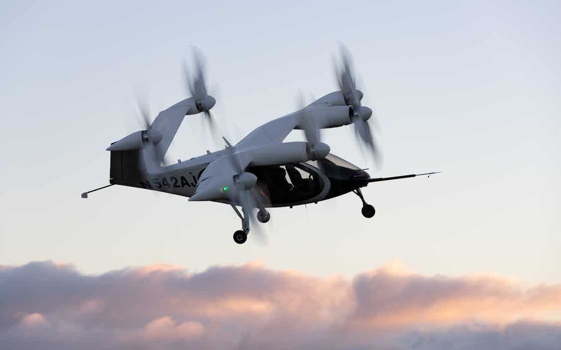
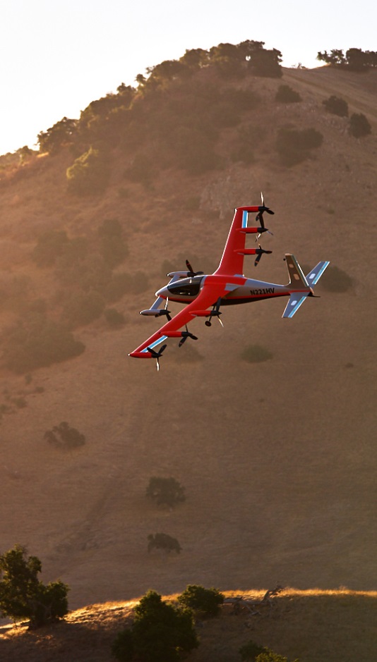
The Joby Aviation Craft
Joby Aviation is another earlier participant in the U.S. Air Force’s Agility Prime program and was granted airworthiness authorization in 2020. Joby first flew a subscale prototype in 2015 and a full-size aircraft in 2017, with the objective of proving the viability of a tilt-rotor, four-passenger flying taxi/eVTOL aircraft.
Joby eVTOL in flight in Northern California. (Photo: Joby Aviation)
Joby’s story may be similar to the other companies developing electric flying cars, save that it has been doing this since 2009. Over time, Joby has won significant funding and support from key industry sponsors including Toyota, Uber, Elevate and Agility Prime. A study by Lufthansa in 2021 touted Joby as the leader in the eVtol competition.
The FAA has agreed that Joby can proceed down a certification path applying regular general aviation part 23-64 rules, plus special conditions that include special attention for batteries and fly-by-wire controls. Joby is making good progress toward certification objectives, having already flown more than 1,000 times with different prototypes.
With six tilt-rotors driven by electric motors, Joby’s yet-to-be-named four-passenger aircraft is capable of 200 mph with a +150-mile range, weighs 4,000 pounds and is apparently one of the quietest, measuring only 65 dBA at ~110 yards while hovering. A low noise profile is key to acceptance of these relatively low-altitude flying-cars as they buzz across densely populated areas — and all manufacturers have come up with low-noise-profile designs.
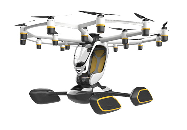
The Lift Aircraft Hexa
Lift Aircraft has taken a different path toward introducing flying-car technology into everyday use by borrowing more closely from existing drone capabilities. The company hopes acceptance will be quicker under its adopted FAA’s Powered Ultralight classification (FAR Part 103), which does not require a pilot’s license to fly.
The Lift approach also intends to take so many precautions and use so much automation that anyone can fly its Hexa. Floats prevent sinking for forced landings on water; triplex flight-computers, GPS and IMUs add to the fail-safe design; and an automatic parachute release in the event of an in-flight incident deploys a “whole-aircraft air bag.” Along with 18 redundant electric-motor-driven propellers (only 12 are needed for a safe landing), these features add up to safety for the uninitiated.
Hexa single-pilot drone-car. (Photo: Lift)
The single joystick control is simple to use and allows the unskilled to fly the drone-car safely. The system comes with extensive monitoring built in, so remote safety operators can intervene in extreme situations. Flight is currently only allowed in geo-referenced airspace defined by Lift. The vehicle has the capability to fly itself out of potentially dangerous situations and avoid mapped obstacle locations. Flight is semi-autonomous and take-off and landings are automated.
Agility Prime joined with Lift in April 2020 to support the company’s safety testing, and in August 2020, funded expansion of the Hexa flight envelope. The Air Force has loaded a Hexa drone-car into a C-130 transport aircraft and flown it to another location to verify transportability for remote deployments. Lift has also won another contract from the Air Force for autonomous cargo retrieval based on a subset of the Hexa design elements.
It is possible that many people will see Hexa in operation during a coming demonstration tour planned for major population centers across America – 15,000 people have apparently already signed up to fly Hexa when the tour gets underway, possibly later this year.
Wrapping It Up
So are these craft flying cars, or drones carrying people? It’s still hard to say definitively, but for sure many experts believe in the forecast of 160,000 flying taxi-cars by 2050, with airport shuttle and air-taxi markets reaching a market value of $500 billion. Certainly the Agility Prime program seems to have got it right and taken the necessary steps to ensure this technology gets out of its emerging, curio stage and out into a world eager to adopt it. If only we could accelerate the extremely lengthy civilian certification phase while still embedding increasing levels of safety. Perhaps the Air Force program can get us there quicker.
PNT beacons can be deployed in orbit to penetrate the lunar surface and enable consistent wireless connectivity. (Image: Masten Space Systems)
Masten Space Systems has been awarded a U.S. Air Force contract to develop and demonstrate a lunar positioning and navigation network prototype that functions much like GPS.
The Phase II Small Business Innovation Research (SBIR) contract was awarded through the Air Force Research Laboratory’s AFWERX program. AFWERX connects innovators across government, industry and academia.
The navigation network will enhance cislunar security and awareness by enabling navigation and location tracking for spacecraft, assets, objects and astronauts on the lunar surface or in lunar orbit. As the lunar infrastructure grows, the network will help advance lunar science and resource use by improving landing accuracy and hazard avoidance near critical lunar sites.
“Unlike Earth, the Moon isn’t equipped with GPS so lunar spacecraft and orbital assets are essentially operating in the dark,” said Matthew Kuhns, vice president of research and development at Masten. “As a result, each spacecraft is required to carry heavy navigation hardware and sensors on-board to estimate positioning and detect potential hazards. By establishing a shared navigation network on the Moon, we can lower spacecraft costs by millions of dollars, increase payload capacity, and improve landing accuracy near the most resource-rich sites on the Moon.”
In Phase I, Masten completed the concept design for the network prototype that offloads positioning, navigation, and timing (PNT) beacons from a spacecraft into a dedicated sensor array on the Moon.
In Phase II of the project, scheduled to be complete in 2023, Masten will develop PNT beacons equipped to survive harsh lunar conditions. Masten is collaborating with Leidos to build shock-proof beacon enclosures that can be deployed in lunar orbit to penetrate the lunar surface and create an autonomous surface-based network. Similar to a mesh network, the surface-based network can enable consistent wireless connectivity to lunar spacecraft, objects, and orbital assets.
“Leidos is proud to collaborate with Masten Space Systems in their quest toward a successful lunar surface-based positioning and navigation network,” said Thomas Sereno, vice president and division manager of the Applied Science operation at Leidos. “We are prepared to support the team as they progress through the next phase of the contract.”
In Phase II of the project, the PNT technology will also be tested aboard Masten’s rocket-powered lander, Xodiac, to demonstrate payload integration and beacon operations in a terrestrial environment, enabling a path towards lunar demonstration.
Masten has more than a decade of experience maturing PNT systems, including Jet Propulsion Laboratory’s lander vision system that was tested on Masten’s Xombie rocket to enable a successful Mars mission for the NASA Perseverance rover.
“As one of the first commercial companies sending a lunar lander to the Moon, we’re in a unique position to develop and deploy a shared navigation system that can support other government and commercial missions and enable a thriving lunar ecosystem,” said Masten CEO Sean Mahoney. “We are literally blazing the trail with this effort, creating the pathway for regular, ongoing and reliable access to the Moon.”
The Navigation Technology Satellite-3 (NTS-3) program is making major strides in developing a new navigation spacecraft for in-space demonstration. The NTS-3 is scheduled to launch to geosynchronous orbit from Cape Canaveral in 2023.
This summer, Northrop Grumman Corp. delivered the ESPAStar-D spacecraft bus to L3Harris Technologies of Palm Bay, Florida.
“The transfer of the bus allows L3Harris to move forward building the NTS-3 spacecraft,” said 2nd Lt. Charles Schramka, the program’s deputy principal investigator. “L3Harris will perform tests and begin integrating the NTS-3 PNT payload onto the bus. Together the bus and payload will form the NTS-3 spacecraft.”
Following L3Harris’s work, the Air Force Research Laboratory (AFRL) will test the bus with the NTS-3 ground control and user equipment segments, and will perform its own integrated testing on the overall NTS-3 system architecture.
Northrop Grumman has successfully delivered an ESPAStar-D spacecraft bus to L3Harris in support of the NTS-3 mission. (Photo: U.S. Air Force)
NTS-3 in the Vanguard. In 2019, the U.S. Air Force designated NTS-3 as one of three Vanguard programs — priority initiatives to deliver new capabilities for national defense. The NTS-3 mission is to advance technologies to responsively mitigate interference to position, navigation and timing (PNT) capabilities, and increase system resiliency for GPS military, civil and commercial users.
“This is the first time an ESPAStar bus has been built and delivered as a commercially available commodity,” said Arlen Biersgreen, NTS-3 program manager. “NTS-3 is using a unique acquisition model for the ESPAStar line that fully exercises the commercial nature of Northrop Grumman’s product line, in order to provide the bus to another defense contractor for payload integration using standard interfaces.”
The ESPAStar-D bus, built in Northrop Grumman’s satellite manufacturing facility in Gilbert, Arizona, includes critical subsystems such as communications, power, attitude determination and control, in addition to configurable structures to mount payloads.
The bus will “provide affordable, rapid access to space,” according to Northrop Grumman. Its configuration, using an Evolved Expendable Launch Vehicle (EELV) Secondary Payload Adapter (ESPA), allows multiple separate experimental payloads to be stacked together on one launch vehicle. AFRL developed the ESPA ring to transport space experiments, allowing for lower cost and more frequent trips to space for government and industry users.
Besides the bus delivery, there are other advances in the program.
GNSSTA receiver. In June, AFRL took delivery of an experimental receiver — GNSS Test Architecture (GNSSTA). The receiver was developed by the AFRL unit the Sensors Directorate, located at Wright-Patterson Air Force Base in Ohio, and Mitre Corporation. GNSSTA is a reprogrammable software-defined signal receiver that will allow the Air Force to receive both legacy GPS and advanced signals generated by NTS-3.
AFRL will continue its integration efforts through 2022 to ensure all parts are working together for the fall of 2023 NTS-3 launch.
“With the delivery of the bus we are entering into the next phase of payload integration,” Biersgreen said. “These recent breakthroughs allow the program to continue to move forward and prepare for launch of the first U.S. integrated satellite navigation experiment in over 45 years.”
Artist’s concept for NTS-3 in geostationary orbit. (Artist’s concept: 2d Lt. Jacob Lutz, AFRL)
It’s only a few weeks into the new year, yet there’s plenty happening in “UAV land” already. I expect another year of innovations, novel developments and groundbreaking firsts in unmanned aircraft.
This month’s question: What’s a Skyborg? The U.S. Air Force (USAF) has awarded contracts to Kratos, Boeing and General Atomics to prove their approaches to the UAV program.
All three have fielded existing, company-developed drones which are intended to fly alongside and be controlled by the latest frontline U.S. fighter aircraft. The idea is to have expendable force-multiplier unmanned aircraft support the capabilities of high tech, hugely expensive aircraft in order to undertake perhaps more risky missions, with the potential improvement acceptable versus unacceptable losses.
Flying alongside frontline fighter aircraft, these jet-powered unmanned aircraft could undertake more risky close support parts of the mission, where loss of the UAV might be more likely, while the manned aircraft remains outside the high-risk envelope. Hence the term attritable is now being applied to these unmanned accompanying vehicles, which are intended to have a reduced cost profile so that loss of the UAV might be more tolerable.
The Air Force Life Cycle Management Center (AFLCMC) has awarded Skyborg Vanguard Program contract amounts to Boeing ($25.7 million), General Atomics ($14.3 million) and Kratos ($37.8 million) for initial prototyping. All appear to have Skyborg prototypes in development.
Kratos has subsequently announced other contract modifications related to the U.S. Air Force Research Laboratory (AFRL) Low Cost Attritable Aircraft Technology (LCAAT) program.
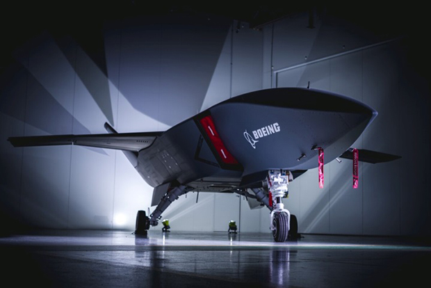
Boeing will offer a variant of the Airpower Teaming System (ATS) drone being developed in Australia for the Australian Air Force. Engine runs and initial taxi tests were recently completed, however the program went into a short hiatus at the end of 2020 because of high COVID-19 infection rates in and around Sydney.
Boeing will offer a variant of the ATS drone being developed for the Australian Air Force. (Photo: Boeing)
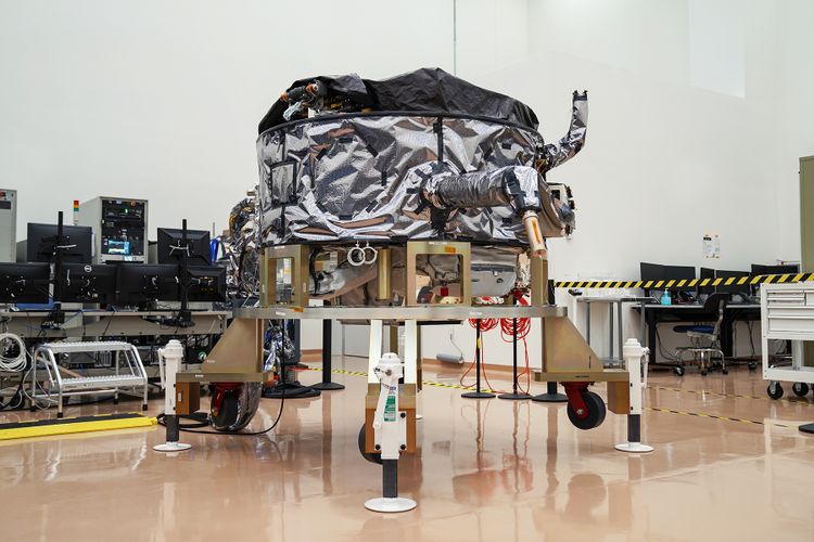
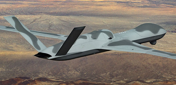
General Atomics Aeronautical Systems Inc. (GA-ASI) is in the process of modifying two company-owned Avenger UAVs to incorporate upgraded datalinks and the Skyborg System Design Agent (SDA) software. Flight trials will investigate Artificial Intelligence capability for autonomous control of the UAVs while operating alongside manned aircraft – with the object of demonstrating that “a mix of manned and unmanned aircraft can communicate, collaborate, and operate together,” said David R. Alexander, president of GA-ASI.
General Atomics Avenger unmanned aircraft. (Photo: GA-ASI)
The jet-powered Avenger aircraft has been under development and evaluation for more than 10 years so it is well characterized, and its performance as a UAV is already understood.
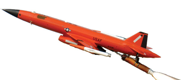
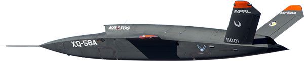
The XQ-58A Valkyrie UAV has benefited from earlier generations of Kratos high-speed jet-powered target systems — something none of the other Skyborg competitors have in their bag of tricks. Kratos has been providing high-speed target drones to the military for a number of years, so jet powered drones are something they have been developing and fielding for a long time.
The Valkyrie UAV was developed under the LCAAT program to demonstrate unmanned low-cost capabilities, and to fly as a stealthy companion to manned aircraft. It is intended to carry internal and wing mounted weapons. The turbine division of Kratos is also investigating lower cost jet engine options for attritable UAVs.
Meanwhile, continuing developments in detect and avoid (DAA) are progressing, moving towards a solution for one of the main problems holding back integration of unmanned aircraft into controlled airspace.
A number of these solutions are based on ADS-B or Automatic Dependent Surveillance Broadcast, whereby the UAV location – usually position provided by onboard GPS — is transmitted at a regular interval by an equipped UAV. So any similarly equipped manned or unmanned aircraft can receive the ADS-B signal, has knowledge of where such flying obstacles might be and is therefore able to avoid a potential collision.
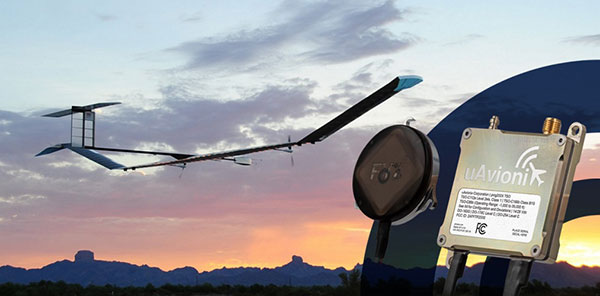
And for pseudo-satellite applications like the Airbus Zephyr which must transition between low-level airspace and the stratosphere, having on-board certified ADS-B is essential so that other aircraft and FAA air-traffic control have full visibility of such a delicate airframe which is lacking great maneuverability during climb-out, on station at altitude and during descent.
Zephyr pseudo-satellite UAV with uAvionix ADS-B transponder and GPS. (Photo: uAvionics)
Since Zephyr transitions through Class A airspace, the manufacturer Airbus decided that it should be equipped with an ADS-B transponder and GPS source which had undergone FAA recognized qualification testing and which meets known Technical Standard Order (TSO) requirements.
The equipment also needed to be small and use little power — at 70 grams and using only 2 watts, the uAvionix ping 200X transponder and truFYX GPS provide high power (54 dBm), high integrity transmissions of ADS-B and transponder mode data to Air Traffic Control (ATC) and other suitably equipped aircraft.
Zephyr is an all-electric vehicle, using sunlight to derive power from large photo-voltaic arrays which cover its upper surfaces. Batteries store surplus energy which is not consumed during daylight and provide power in order to maintain aircraft station through the night hours. From a perch at around 70,000ft, Zephyr is apparently focused on Earth-observation capability with payloads envisaged to include Electro Optical, Infrared, Hyper spectral, Passive Radio Frequency (RF) Radar, Synthetic Aperture Radar (SAR), plus Early Warning, Lidar and Automatic Identification System (AIS).
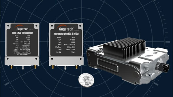
The Hover DAA solution. (Photo: Sagetech)
“Sagetech is another DAA supplier which is currently working with both fixed and rotary wing UAS customers who are incorporating DAA systems in their design and type certification projects,” said Tom Furey, CEO of Sagetech. “Sagetech is providing regulatory guidance, transponders and interrogators, and system design to ensure these UAV systems in development will satisfy the anticipated certification requirements. Sagetech itself, through technology development and partnerships with companies including Hover Inc., expects to offer a complete DAA prototype system by the end of this year.”
So, lots of progress towards Skyborg drone teaming systems with $78min awards by the Air Force Life Cycle Management Center from an anticipated budget of around $400m, while certified Detect and Avoid solutions help move commercial drones towards potential regular flight in controlled airspace.
Raytheon Intelligence & Space, a Raytheon Technologies business, delivered its 3,000th MAGR 2000-S24 GPS system to the U.S. Air Force. The MAGR2K is a secure, resilient GPS receiver that allows the warfighter to navigate the battlespace with protection against interference and jamming.
The MAGR2K is an upgrade to the legacy miniaturized airborne GPS receivers and is in service aboard 20 types of fixed-wing and rotary-wing platforms from Department of Defense and Foreign Military Sales customers.
“In the battlespace, disruptions to navigation are not an option,” said Eric Ditmars, vice president of Secure Sensor Solutions at RI&S. “Our MAGR2K GPS receivers enhance GPS acquisition and performance ensuring military forces reliable and assured GPS data they can act on. Delivery of the 3,000th unit is a significant milestone for our team.”
Raytheon Intelligence & Space continues to upgrade the MAGR2K technology to stay current with the evolving battlespace. Development is underway for the MAGR-2K-M, which uses the company’s M-code technology.
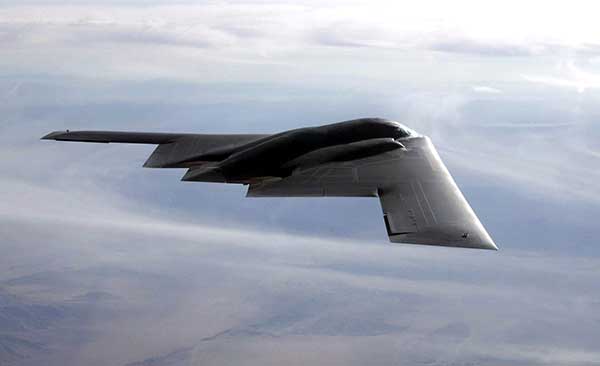
The first production readiness units are undergoing platform integration on the U.S. Air Force’s B-2 platform.
B-2 Spirit multi-role bomber capable of delivering both conventional and nuclear munitions. In December 2017, the Air Force completed a series of successful flight tests of M-code GPS using a Raytheon Company receiver on board a B-2 Spirit at Edwards Air Force Base, California. (Photo: U.S. Air Force/Bobby Garcia)
Ellen Hall, president & CEO, Spirent Federal Systems
The history of GPS is fascinating. In 1957, a study by JHU’s Advanced Physics Laboratory (APL) utilized the Doppler effect to monitor the recently launched Sputnik, allowing researchers to pinpoint the satellite’s position. This endeavor led to the development of the Navy Transit program, the first satellite navigation system, which was successfully testing in 1960. The United States Global Positioning System (GPS) was officially launched in 1973 as a worldwide solution designed to overcome previous limitations. The U.S. Air Force developed the GPS, which designated 24 satellites for full operational capability (FOC) in 1995.
As a result of a horrific incident in 1983, in which Korean Air Lines Flight 007 wandered into Soviet airspace due to a navigation error and was subsequently shot down by the Soviets, the Reagan administration ordered worldwide access to GPS to ensure a tragedy like this could never happen again. The Clinton administration discontinued Selective Availability to make GPS more responsive and accurate to civil and commercial needs. This led to prolific global use and dependence on GPS for everything from providing data for precision farming applications to the critical timing of financial transactions. This increasing demand for and dependence on GPS has accentuated the importance of securing and safeguarding the system. Vulnerability testing, anti-jamming measures and alternative navigation solutions have become vital in both augmentation and backup for this critical utility.
As often happens with inventions created through government-sponsored studies, civilian uses become so ubiquitous that the original studies that led to GPS are long forgotten. It is as if GPS has simply always existed. Accordingly, the ground-breaking contributions of certain individuals should be remembered, such as Gladys West for her work in the development of computational techniques necessary for GPS precision. Pioneers such as Roger L. Easton of the Naval Research Lab, Ivan A. Getting of The Aerospace Corporation and Brad Parkinson of APL are credited with inventing GPS and changing, quite literally, how the world works.
I cannot imagine the world without GPS in some form. The content of what was once only in sci-fi movies is quickly becoming reality with driverless cars, pilotless aircraft and spacecraft. There are no limits on the possibilities in this field. The excitement about the future motivates brilliant minds from classified military installations to the latest civilian laboratories financed by the “Rocket Billionaires,” such as Elon Musk and Steve Bezos.
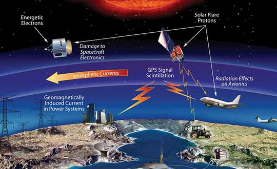
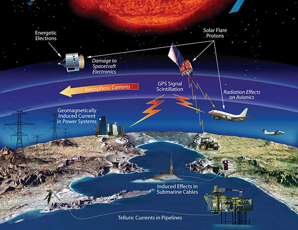
The effects of space weather on critical Earth systems. (Image: NASA)
The United States Congress has passed bipartisan legislation to address how the government deals with threats posed by emissions from the Sun to critical infrastructure such as GPS.
The Promoting Research and Observations of Space Weather to Improve the Forecasting of Tomorrow (PROSWIFT) Act S.881 now awaits signature by the president.
The bill sets forth provisions to improve the ability of the United States to forecast space weather events and mitigate its effects.
It provides statutory authority for the National Science and Technology Council’s Space Weather Operations, Research, and Mitigation Working Group, which coordinates executive branch efforts to understand, prepare, coordinate, and plan for space weather.
The bill directs the Office of Science and Technology Policy, National Oceanic and Atmospheric Administration (NOAA), National Science Foundation, Air Force, Navy, National Aeronautics and Space Administration (NASA), National Security Council, and Federal Aviation Administration (FAA) to carry out specified space weather activities.
The legislation
assigns roles and responsibilities to agencies involved in space weather research and forecasting
ensures agency coordination to better predict severe space weather events and mitigate impacts
calls for coordination between the government and the non-governmental space weather community including academia, the commercial sector and international partners.
Senators Gary Peters (D-MI) and Cory Gardner (R-CO) introduced the first version of the bill in 2016 and a successor passed the Senate in 2017. Reps. Ed Perlmutter (D-CO) and Mo Brooks (R-AL) shepherded it through the House, which passed it Sept. 16.