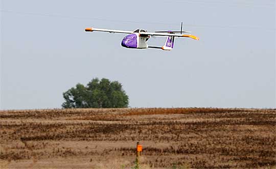
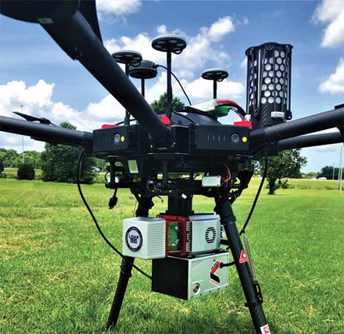
Flirtey, a pioneer of the commercial drone delivery, has unveiled the Flirtey Eagle, along with a video of the next-generation delivery drone performing consumer and automated external defibrillator (AED) deliveries to homes.
Flirtey’s system is designed to safely get packages to customers with the delivery goal of less than 10 minutes using drones.
Along with the Flirtey Eagle, the aircraft designer and manufacturer unveiled the Flirtey Portal, a sophisticated takeoff and landing platform that enables scalable store-to-door operations. Also part of the system is an autonomous software platform that enables drones to deliver safely to American homes.
Flirtey said it is on course to conduct drone deliveries to U.S. homes as early as 2019.
Here are highlights of the UAV’s technology.
Flirtey’s aircraft is designed to operate in 95% of wind and weather conditions, making it highly reliable for flight.
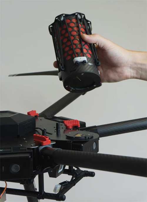
The Flirtey Eagle is designed to fit 75% of packages that get delivered to its customers’ homes during last-mile deliveries.
The Flirtey Eagle safely and precisely delivers its contents by lowering a tether, while the drone is suspended in air, and once the package is delivered, it then retracts the tether.
Flirtey’s aircraft is controlled by its autonomous software platform, which has received Federal Aviation Administration (FAA) approval for the first multi-drone delivery operation in the United States, enabling a single remote pilot to simultaneously oversee ten Flirtey drones.
Flirtey’s Portal is a sophisticated takeoff and landing platform that fits into one parking space, making its infrastructure easily scalable to the company’s partners for store-to-door delivery.
Flirtey’s drone delivery technology has been developed from the ground up, originating from NASA’s drone program. Flirtey Founder and CEO Matthew Sweeny has brought together a team of aviation industry veterans from NASA, Raytheon, Lockheed Martin, and SpaceX, as well as military veterans from the army, navy, and air force.
“We expect Flirtey’s advanced drone delivery system will become the industry standard in America,” said Matthew Sweeny, Flirtey founder and CEO. “Flirtey’s latest technology makes life-saving and commercial drone delivery to homes in the United States an imminent reality.”
The Flirtey Eagle builds upon the advanced technologies developed for Flirtey’s previous generation aircraft that conducted the first Federal Aviation Administration (FAA)-approved drone delivery in the United States, which is going on display alongside the Wright Flyer in the Smithsonian National Air and Space Museum in Washington, D.C. Flirtey’s goal is to not only meet, but to surpass the rigorous safety standards of the FAA. Flirtey’s regulatory approvals include:
Approval to conduct multi-drone delivery operations, enabling a single remote pilot to simultaneously oversee 10 Flirtey drones
Approval to conduct drone delivery flights beyond visual line of sight (BVLOS), enabling Flirtey to conduct drone delivery operations with a pilot controlling the flights from a remote location
Approval to conduct drone delivery flights at night, making drone delivery accessible at any time
Flirtey and the City of Reno were chosen for the FAA and Department of Transportation’s Unmanned Aircraft System (UAS) Integration Pilot Program (IPP). Within the IPP, Flirtey and the City of Reno have partnered with REMSA, local emergency medical services provider, to deliver AEDs to those in need. Flirtey’s AED delivery technology has the potential to save 150,000 lives per year, the company said.
Based on demand from customers, Flirtey expects demand initially to outstrip supply. Flirtey’s drone delivery system was designed from the outset to meet the anticipated high demand.
Skyfront’s Perimeter 4 long-range hybrid gas-electric drone this summer successfully performed the first civilian beyond-visual-line-of-sight (BVLOS) flight without visual observers under the FAA’s Part 107 rules.
The flight serves as a significant step toward the safe integration of unmanned aerial vehicles into the national airspace, according to the company.
During the round-trip flight, the Perimeter UAV flew over mountainous, rugged terrain along a four-mile stretch of the Trans-Alaska pipeline. The UAV maintained a constant above-ground altitude of 400 feet with multiple ascents and descents of 1,000 feet on 45-degree slopes. Radio-based telemetry, command and control of the vehicle was uninterrupted during the flight.
FAA representatives observed all aspects of the mission, including planning, system setup and ground-station operation. The Perimeter “did [the flight] safely, effectively and efficiently. It accomplished a beyond-visual-line-of-sight mission, and it was approved by the FAA,” said Robert Huber, program manager for the Integration Pilot Program (IPP) of the FAA.
“Today’s flight was a milestone in the unmanned community,” said Troy Mestler, CEO of Skyfront. “We at Skyfront are excited to be pushing the limits of unmanned aerial vehicles here in the United States.”
The Perimeter UAV was integrated with Iris Automation’s Casia collision avoidance system and was observed by Echodyne’s ground-based detect and avoid systems.
The University of Alaska Fairbanks and the Alaska Center for Unmanned Aircraft Systems Integration purchased the UAV and organized the flight over the pipeline, with the approval of the Alyeska Pipeline Service Company.
UAvionix is offering free pingRX unmanned aircraft system (UAS) ADS-B receivers to first responders and UAS service organizations participating in rescue and recovery efforts associated with Hurricane Dorian.
Hurricane Dorian is expected to travel along the Eastern coast of the U.S. northward at a slow pace, creating extensive damage from winds and flooding.
UAvionix is a designer and manufacturer of communications, navigation and surveillance (CNS) equipment for unmanned and manned aircraft.
The pingRX. (Photo: uAvionix)
PingRX is a dual-frequency ADS-B receiver designed for use onboard a UAS. Retailing for $249 and weighing 5 grams, pingRX can provide the operator with a digital view of ADS-B-equipped aircraft in the airspace up to hundreds of miles away.
When integrated with a compatible autopilot — such as ARDUPILOT, Pixhawk, PX4 or the Cube — local ADS-B traffic is displayed on the ground control station (GCS) display.
Image: National Weather Service
The FAA’s mandate for ADS-B OUT equipage on manned aircraft has a deadline of Jan. 1, 2020, so equipage levels are currently high. Users are cautioned, however, that equipage is not at 100%, so reliance on ADS-B as a sole means of detect and avoid (DAA) is not advised.
In 2017, in response to Hurricane Harvey’s landfall in Houston, Texas, UAS were used extensively for the first time in recovery and rescue efforts. The use of UAS has continued to grow in response to hurricane efforts ever since.
Photos: NOAA
“Over the past few years, the use of drones in hurricane and natural disaster recovery efforts has increased significantly due to the value of the real-time data collected in combination with ease of deployment,” said Christian Ramsey, uAvionix president. “First responders and recovery crews will undoubtedly work tirelessly for weeks in response to Dorian. We hope to make these efforts just a bit safer and encourage good airspace safety practices with the use of the pingRX systems.”
The FAA has published guidance for UAS operators, urging strict adherence to Notices to Airmen (NOTAMS) and Temporary Flight Restrictions (TFR). The airspace in these areas can be crowded and unpredictable.
First responders and UAS service organizations are encouraged to contact uAvionix at [email protected] for details on the offer.
Grand Bahama Island before Hurricane Dorian. (Photo: Google)
Safely integrating autonomous drones into global airspace is the goal of Altitude Angel.
The company has completed its involvement in the Gulf of Finland (GOF) U-Space project, declaring the trials to have been a “huge success” and an “amazing showcase” of its unmanned traffic management (UTM) technologies.
The GOF U-space demonstrations are funded by the SESAR Joint Undertaking for European sky air traffic management research.
In July and August, advanced drone operational demonstrations took place across Estonia and Finland, showcasing use cases that involved both manned and unmanned aircraft in shared airspace. The demonstrations relied on systems such as Altitude Angel’s GuardianUTM O/S to remain safe.
GuardianUTM, the company’s core system, is already helping drones operate in controlled airspace. It powers the UK’s national UTM system, operated by NATS, the UK’s main air navigation service provider.
Altitude Angel was a key UTM partner for the trials, providing services that included integration to the FIMS (flight information management system) for the transport of flight plans, telemetry/position reports, AIM (geofencing/volume reservations), as well as alerts and registration data to-and-from the drone operators and manned aviation which were involved in the trials.
Altitude Angel was able to demonstrate its UTM platform across a number of scenarios that varied in scope and range, and included:
urban drone fleet operations with police intervention,
long-distance multisensory inspection flights over forests,
urban drone operations in controlled airspace,
powerline inspection in rural areas, maritime search and rescue, and
international parcel delivery.
The demonstration series concluded with an urban Volocopter air taxi flight around Vantaa International Airport, Helsinki.
“We’ve been working with the SESAR team for over a year on this project. It’s been a great few months in Finland and Estonia supporting the live demonstrations which have been huge success and an amazing showcase of our world-leading UTM technologies,” said Simon Wynn-Mackenzie, Altitude Angel’s head of products.
“Not only did the scenarios give us another opportunity to demonstrate our production UTM platform in another real-life environment, they went a long way to showing the public how drones can be used in a positive and socially beneficial way on a daily basis,” Wynn-Mackenzie said.
“Our only disappointment was that we were not able to demonstrate our world-first Conflict Resolution Service which we unveiled in July, as the trial scenarios had already been agreed. However, we’ll be looking to showcase our constantly evolving platform and several new services very soon,” he said.
Other UTM demonstrations. In November 2018, Altitude Angel led the team behind Operation Zenith, which gave a view of the future of air traffic management and drone integration into busy, complex airspace, demonstrating how by using the right technology, it’s possible to safely integrate unmanned traffic into controlled airspace and open the skies to commercial airspace worldwide.
The U-space initiative. The GOF U-space project, with a broad consortium of 19 members, demonstrates Europe is on course with its implementation of U-space, an initiative that aims to ensure safe and secure drone traffic management, taking into account the rapid growth in the use of drones.
The GOF concept enables shared situational awareness for all aviation stakeholders. The success of the project is based on deep air traffic management experience of all consortium members, including three world-leading UTM technology vendors and two air navigation services providers, developing interoperability and data-sharing solutions that are aligned with SESAR’s overall U-space architecture.
The U-Space project has received funding from the SESAR Joint Undertaking under the European Union’s Connection Europe Facility (CEF) programme under grant agreement SJU/LC/343-CTR.
Lynx–Lawrence & Mayo, an Indian engineering equipment providers, has expanded its portfolio to include specialized drones, through its partnership with ideaForge, India’s largest UAV manufacturer.
As part of the agreement, ideaForge’s drones equipped with more than a decade of UAV design expertise, will be accessible to Lynx – Lawrence and Mayo for applications across urban development, weather monitoring and testing, agro-technology and other sectors.
Developed by a team of Indian Institute of Technology Bombay graduates, ideaForge has been celebrated for its innovations in the unmanned aerial vehicle (UAV) domain. It built a small, light autopilot in 2009 and India’s first autonomous quadcopter UAV. Their designs have led the development of world class, indigenous UAVs for security and surveillance, reconnaissance, mapping, photogrammetry and other industrial applications. Now, their UAVs even come with the capability to meet the DGCA regulations, to ensure NPNT compliance.
Through this partnership, Lynx–Lawrence & Mayo will have access to ideaForge’s fleet of UAVs for inspection, surveillance, traffic and crowd management, and disaster management. The fleet includes:
Switch UAV – A fixed-wing vertical take-off and landing (VTOL) hybrid for terrain-independent deployment with long range, high endurance and high altitude capabilities.
Q-Series UAV – Enterprise specialist VTOL quadcopter built with military design philosophies.
Ninja UAV – Lightweight and economical micro UAV built specifically for mapping and advanced surveillance.
Netra Pro – Rugged quadcopter for maximum redundancy in extreme conditions.
Netra V-Series – Field-proven UAVs for mission-critical applications, integrated with high zoom HD real-time video transmission.
“We at Lynx have been driving innovation and excellence in advanced precision equipment for engineering and industry. With the addition of innovative UAVs from ideaForge, we are delighted to add a range of advanced and futuristic drones to our portfolio,” said Glenford D’souza , Lynx senior general manager. “We will be strategically deploying these products to create an integrated and specialised service/solution offering to our existing and potential clients. We look forward to a long term and fruitful partnership.”
IdeaForge has deployed more than 700 systems and has trained more than 1,200 pilots in services including the Indian Army, Navy and Air Force; state police forces; Indian railways; and many more agencies.
IdeaForge drones have been used in defense and homeland security for border monitoring, anti-terror operations, counter insurgency operations, disaster management, traffic monitoring, campus surveillance, crowd management and more.
With the flexibility to customize their drones for an array of requirements, ideaForge also provides end-to-end UAV solutions and services to the industrial and commercial sectors.
Kansas receives approval for first beyond-visual-line-of-sight drone flight in the nation using only onboard detect and avoid.
The Kansas Department of Transportation (KDOT) has received permission to conduct the first beyond-visual-line-of-sight (BVLOS) drone operation in the nation leveraging only onboard detect-and-avoid systems.
This is the first U.S. Federal Aviation Administration (FAA) authorized operation to fly without a requirement for visual observers or ground-based radar. It is the result of the 31-member Kansas UAS Integration Pilot Program (IPP) team efforts to advance drone technologies.
In a collaborative effort among Kansas State University Polytechnic Campus (K-State Polytechnic), Westar Energy, Iris Automation and KDOT, the Kansas IPP team will fly a nine-mile track to evaluate technologies to inspect power lines in rural Kansas. This approval is the first of its kind for long line linear infrastructure and is the first step to enable routine commercial infrastructure inspection across the state.
This is the first unmanned aerial vehicle (UAV) flight to leverage onboard sense and avoid systems alone for collision avoidance. It also marks the first required automated avoidance action.
Historically, all FAA-issued Part 107 BVLOS waivers have required visual observers or ground-based radar. These mitigations limit the possibility of true BVLOS flights, as they are typically prohibitively expensive and limit operations to pre-defined corridor areas with radar coverage.
This important milestone is facilitated by Kansas UAS IPP partner Iris Automation’s Casia onboard collision-avoidance system.
“The UAS industry has worked over 10 years to demonstrate the most significant commercial benefit of drone operations within the United States,” said Bob Brock, KDOT director of aviation. “We are proThe Applied Aviation Research Center on the K-State Polytechnic Campus, which assisted in development of the safety case that ultimately led to FAA approval, will be responsible for the training and flight operations with a cross-functional team from the KDOT IPP. Flights will take place over the next few months, providing the FAA with much-needed data on true BVLOS activity.d of the joint state, university and industry team that made this landmark decision possible.”
“The ability to fly BVLOS missions without ground-based radar or visual observers is a significant advancement, and Westar Energy views this as an opportunity to play a key role in shaping the future of UAS operations within the utility industry,” said Mike Kelly, Westar Energy Senior UAS coordinator. “Being able to operate under this waiver allows the Kansas IPP team the ability to research and develop truly scalable BVLOS UAS operations for the automated inspection of linear infrastructure.”
“We look forward to leveraging this waiver to integrate UAS technology into the transmission line inspection process,” said Kurt Carraway, UAS Executive Director of the K-State Polytechnic Applied Aviation Research Center. “We are certain that utilities will be able to quickly realize a return on investment while mitigating safety to their maintenance personnel and increasing the reliability of their infrastructure to the general public.”
“Flying rural missions like these without a human pilot onboard or costly radar on the ground is exponentially safer and more cost effective,” said Iris Automation CEO and Co-Founder Alexander Harmsen. “The FAA is trusting us to pave the way for a safer, scalable future together with this precedent-setting second approval of our system.”
The U.S. Department of Transportation selected Kansas Department of Transportation as one of nine participants in the FAA UAS IPP. This program allows state, local and tribal governments to conduct advanced UAS operations to gather data to assist the rulemaking process that will set the boundaries for UAS operations in the United States.
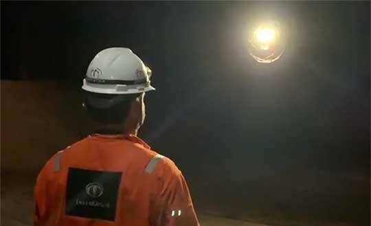
Terra Drone Brazil, a group company of Japan-based Terra Drone Corp., has successfully completed Brazil’s first drone inspection of an offshore FPSO tank. The unmanned FPSO tank inspection was undertaken for Brazil’s state-owned oil company Petrobras.
The ballast tank inspection using drones was conducted aboard P-66, a floating production, storage and offloading (FPSO) unit from Petrobras that is operating in the Pre Salt Area at Santos Basin. An FPSO is a floating vessel used by the offshore oil and gas industry for the production and processing of hydrocarbons, and for the storage of oil.
Petrobras needs its cargo and ballast tanks inspected regularly for maintenance. Any kind of corrosion, cracks, fractures or welding anomalies must be identified quickly before they can damage the structural integrity of the ship.
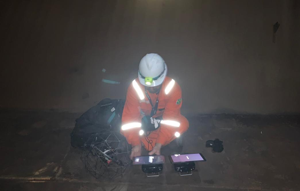
The drones are prepped for the tank inspection. The UAV inspection just over an hour. (Photo: Terra Drone)
Traditionally, this inspection is done by sending a team of up to four men inside the confined tank space using scaffolds or rope access. This kind of close-up visual inspection of one tank alone can take from half a day to a full day, and pose a safety threat to the workers inside the tank.
Using drones reduces the need for workers to enter the tank. “Not only is unmanned FPSO tank inspection safer, but it is also much quicker and more precise than manual inspection,” said Marcelo Belleti, executive director at Terra Drone Brazil. “Further, drone inspections for cargo tanks can lead to potential cost-savings as well.”
Terra Drone Brazil completed the inspection of a ballast tank for Petrobras in little over an hour with a team of only two men. The high-definition pictures and videos captured by the drone ensured a quality deliverable report for all 40 points pre-defined for the close-up inspection.
Terra Drone Brazil is certified by ABS (American Bureau of Shipping), DNV GL (Det Norske Veritas and Germanisher Lloyds) and Loyd’s Register as a service supplier approved for surveying using Remote Inspection Techniques (drones) as an alternative means for a close-up survey of the structure of ships and mobile offshore units. The Petrobras P-66 is ABS-certified.
A roundup of recent products in the GNSS and inertial positioning industry from the July 2019 issue of GPS World magazine.
OEM
Inertial sensors
Sensor fusion with GNSS receiver
Photo: xsens
The MTi 600-series of inertial sensors comes in a 31.5 x 28.0 x 13.0 millimeter IP51-rated case. It produces roll and pitch readings accurate to ±0.2 degrees. GNSS-assisted heading (yaw) measurements are accurate to ±1.0°. Xsens’ sensor fusion algorithms optimize output from new accelerometer, gyroscope and magnetometer components. It also has a CAN bus interface. The MTi 600-series modules are the first from Xsens to include an NMEA-compatible interface for GNSS receivers. Users can choose any GNSS receiver chip, module or system to work alongside the MTi-670, a GNSS/INS device that supplements the pitch, roll and yaw outputs available from other MTi 600-series products with global positioning information. Xsens, www.xsens.com
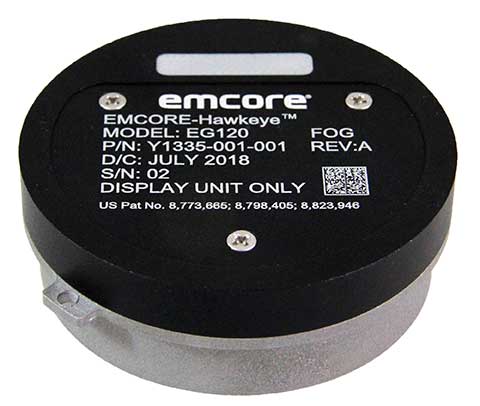
Fiber-optic gyroscope
For medium accuracy platforms
Photo: Emcore
The Emcore-Hawkeye series EG-120 FOG module is an ultra-compact, state-of-the-art design that is a small, affordable closed-loop FOG. The EG-120 delivers advantageous size, weight and power (SWaP) and is 35% smaller than Emcore’s previous generation FOGs. The Emcore-Hawkeye EG-120 incorporates advanced, next-generation field programmable gate array (FPGA) electronics that deliver increased performance and reliability combined with low cost. The Emcore-Hawkeye series features performance specifications for medium accuracy platform stabilization applications such as camera systems used in aircraft, unmanned aerial vehicles (UAVs) and gun stabilization systems. A wide variety of other guidance, navigation and aeronautics applications are supported. Emcore, www.emcore.com
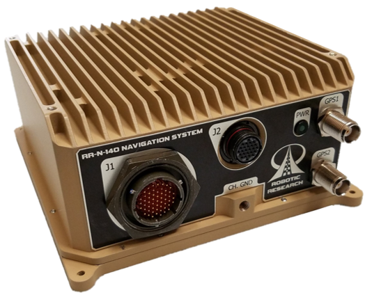
Navigation system
Customizable for ground vehicles of all sizes
Photo: Robotic Research
The RR-N-140 navigation system provides accurate, absolute and relative 3D localization information for ground vehicles of all sizes. It features dual-antenna GNSS for zero-speed heading detection and redundancy. The device delivers exceptional localization performance in GPS-denied or compromised areas. It is designed specifically for use on unmanned ground vehicles and is customizable to incorporate a wide variety of sensor inputs into the navigation solution. Robotic Research, www.roboticresearch.com
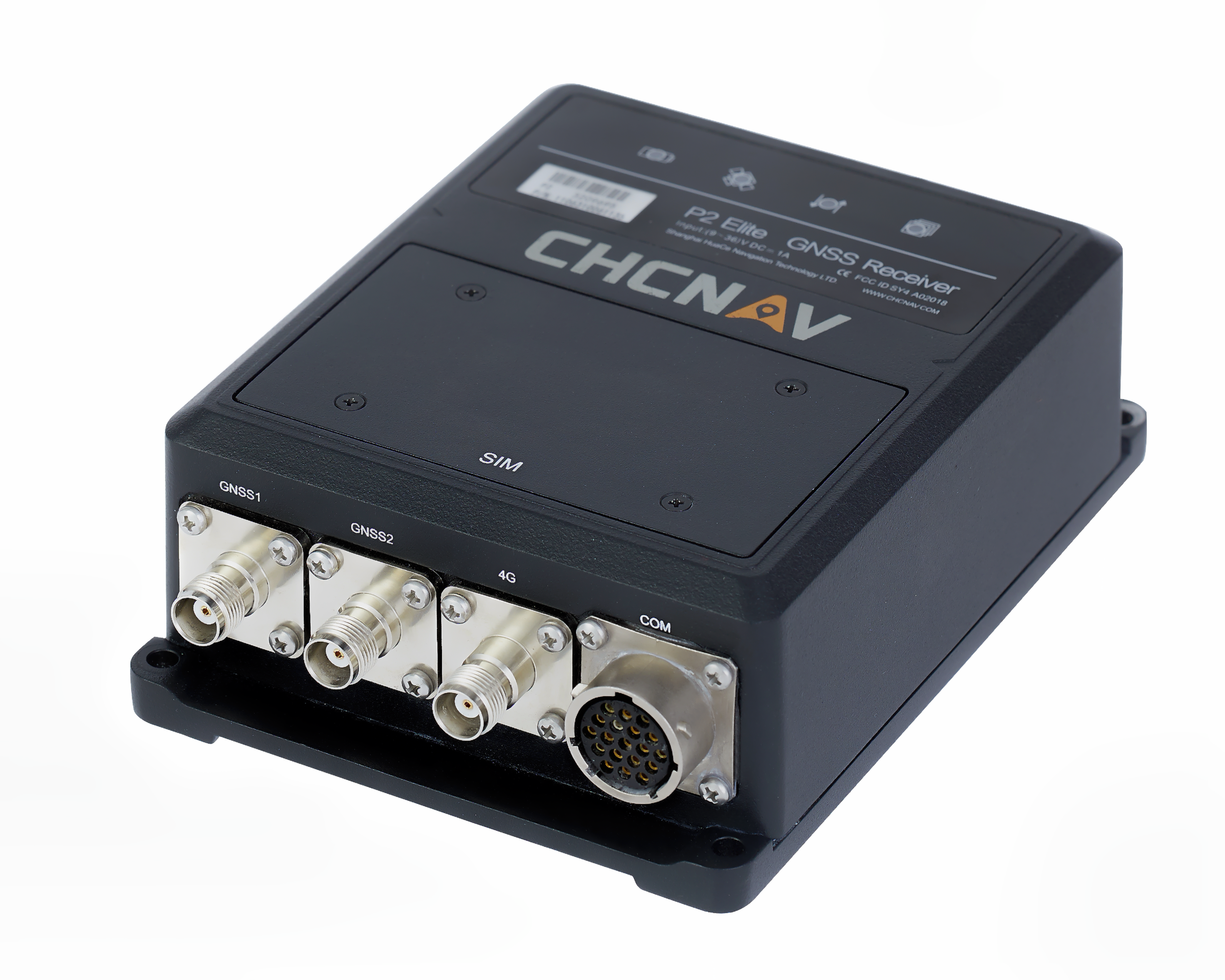
GNSS sensors
Combines numerous interfaces to speed system integration
The P2 Elite GNSS sensor. (Photo: CHC Navigation)
CHC Navigation’s new P2 GNSS sensor series provides high-accuracy positioning and heading in a compact, rugged enclosure. The series is suitable for a wide variety of applications such as reference stations, marine systems, unmanned navigation, industrial automation, robotics and machine control. The P2 GNSS series is designed to significantly reduce system integration efforts by combining numerous connectivity interfaces including RS232, low-latency PPS output, Ethernet, CAN bus protocol and a comprehensive web interface for configuration set-up. The series integrates the latest GNSS technology in a rugged IP67 and lightweight enclosure. It delivers reliable, uninterrupted, high-accuracy, real-time positioning and heading measurements. The P2 GNSS sensor offers cost-effective and powerful real-time kinematic (RTK) positioning. The P2 Pro GNSS adds a dual-antenna input for precise heading data. The P2 Elite integrates additional 4G and UHF modems to provide a powerful, all-in-one GNSS sensor. CHC Navigation, www.chcnav.com
TRANSPORTATION
Correction stream
Data enables precision positioning
RTX Auto is a GNSS software library for use in safety-critical automotive applications. The RTX Auto library can be integrated with any GNSS device and enables the decoding of Trimble’s RTX correction stream for centimeter-level absolute positioning accuracy. It works with other on-vehicle sensors to deliver a certified positioning solution that satisfies advanced driver assistance systems (ADAS) and autonomous driving requirements. It provides RTX-based absolute positioning for General Motors’ Super Cruise, a hands-free driving system for the freeway. After 2020, Super Cruise will will be available on all General Motors brands. Trimble, trimble.com
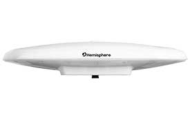
Smart antenna
Atlas-capable for marine markets
Photo: Hemisphere GNSS
The Vector V200 single-frequency, multi-GNSS smart antenna with integrated Atlas L-band is designed for general marine applications and markets. Powered by Hemisphere’s Crescent Vector technology, the V200 multi-GNSS compass system utilizes GPS, GLONASS, BeiDou, Galileo and QZSS (with future firmware upgrade and activation) for simultaneous satellite tracking to offer heading, position, heave, pitch and roll output. With support for NMEA 0183 and NMEA 2000, the V200 provides accurate position and heading information to autopilots, chart plotters and other general marine navigation applications. Hemisphere GNSS, www.hemispheregnss.com
Driver safety solution
Security for intelligent driving
The Proactive Security Solution for Intelligent Driving will enhance safety by supporting ADAS and driver monitoring systems (DMS). It integrates Quectel multi-mode LTE Cat 6 smart modules SC600Y/SC600T and an artificial intelligence (AI) algorithm from a third party to realize ADAS and DMS capabilities including monitoring irregular driving behaviors, conducting precise detection of vehicles and traffic signs, sending warnings of potential risks and more. For ADAS, it can precisely identify and locate vehicles, pedestrians, lanes and traffic signs and will send alerts to drivers if an imminent collision or an unintended lane departure is detected. The DMS supports facial recognition and detection, and is able to monitor driver attentiveness and measure eye blinks as well as head movements so that drivers will receive warnings of distractions, smoking, yawning or looking around. Quectel Wireless Solutions, www.quectel.com
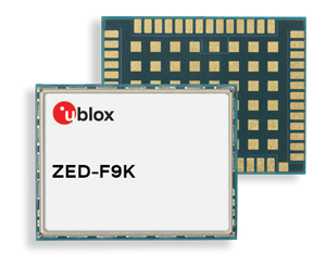
Automotive module
Aimed at urban lane accuracy
The ZED-F9K module is designed to keep cars in their lanes. (Photo: u-blox)
The ZED-F9K GNSS and dead-reckoning module brings continuous lane-accurate positioning to challenging urban environments. Building on the F9 platform, the module offers both high-precision multi-band GNSS and inertial sensors. It combines the latest generation of GNSS receiver technology, signal processing algorithms and correction services to deliver down to decimeter-level accuracy within seconds. The real-time kinematic (RTK) receiver module receives GNSS signals from all orbiting constellations. The inertial sensors constantly monitor changes in the moving vehicle’s trajectory and continue to deliver lane-accurate positioning when satellite signals are obstructed, such as in parking garages, tunnels, urban canyons or forested areas. The module’s accuracy and low latency make it suitable for automotive OEMs and Tier 1 automakers developing V2X (vehicle-to-everything) communication systems. By continuously sharing their location, V2X systems help increase overall road safety and reduce congestion. u-blox, www.u-blox.com
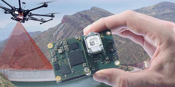
The Quanta UAV series is a line of inertial navigation systems (INS) dedicated to UAV-based surveying integrators. The small, lightweight and low-power INS is offered with two levels of accuracy. Quanta UAV and Quanta UAV Extra have been developed for compact lidar to high-end beyond-visual-line-of-site (BVLOS) mapping solutions. They provide precise orientation and centimeter-level position data both in real time and in post processing, eliminating the need for ground control points and reducing the need for overlaps. SBG’s post-processing software Qinertia gives access to offline real-time kinematic (RTK) corrections from more than 7,000 base stations in 164 countries. SBG Systems, www.sbg-systems.com
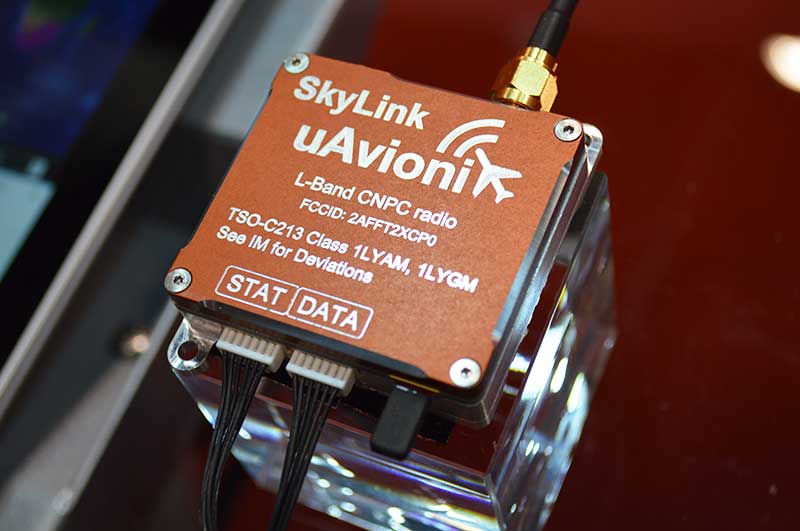
CNPC radio prototype
Being tested as command and non-payload control UAS radio
Photo: Allison Barwacz
SkyLink is an L-band frequency-modulated CNPC radio intended for point-to-point or networked BVLOS UAS operations. uAvionix has focused on minimizing size, weight, and power consumption (SWaP) while maximizing range and spectrum efficiency. The current 50-gram 10-Watt prototype is testing successfully at ranges exceeding 40 miles at low altitude. uAvionix is testing under an experimental transmit license and approval from the Federal Communications Commission and Federal Aviation Administration, respectively. uAvionix, uavionix.com
Thermal drone
Designed for solar farm inspections
The senseFly Solar 360 UAV is designed to enable the automated and efficient inspection of solar farms. Created in collaboration with software company Raptor Maps, the efficient thermal drone solution enables the automatic assessment of solar plant performance at a sub-module level. Created by combining eBee X fixed-wing drone technology, senseFly’s Duet T thermal mapping camera and Raptor Maps software, senseFly Solar 360 is a fast and fully automated drone. It can be integrated into solar management workflows without requiring either drone piloting skills or the manual analysis of aerial solar-farm data. Solar-farm inspection can be reduced from days to hours, with inspection of utility-scale solar farms completed more quickly, easily and accurately. SenseFly, www.sensefly.com Raptor Maps, raptormaps.com
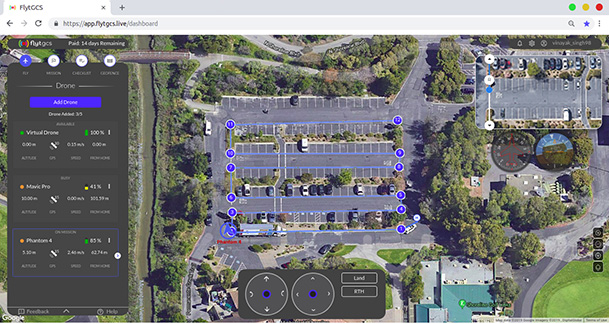
Remote operations
Cloud-based, enables BVLOS
Photo: FlytBase
FlytGCS is built for subject-matter experts, drone operations managers and UAV operators who wish to automate, simplify and scale their missions. To support automated BVLOS missions, FlytGCS offers features such as connectivity and control over 4G/LTE/5G, live high-definition video feed, fleet management, unlimited missions, remote gimbal control, pre-flight checklist and geofence, mission planner and cockpit view from a web dashboard. FlytGCS is a hardware-agnostic solution that helps securely deploy drones using a mobile app (for DJI drones) or onboard single-board computers (for Ardupilot and PX4 drones). FlytBase, flytgcs.live
Inspection drone
Collects data in dangerous areas
The Elios 2 is a collision-tolerant drone for indoor inspections. (Photo: Flyability)
The Elios 2 UAS is designed for inspection tasks. Routine inspection jobs indoors, underground and around complex pipework become quicker, safer and are fully documented by high-resolution video and stills. The Elios 2 includes a rotatable thermal and high-definition visual camera payload, 10,000-lumen oblique lighting system, and reversible rotors that enable the UAV to back out of tricky situations. The drone’s geodesic-like cage makes it collision-tolerant and enables flight in restricted areas such as refinery enclosures, mines, vats, cargo holds and nuclear containment vessels. Flyability, www.flyability.com
SURVEY
Battery upgrade
Long-life battery for extended fieldwork
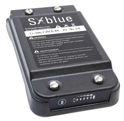
Photo: Geneq
SXblue receivers now have an extended-life battery equipped with 4 Li-ion rechargeable cells that boost its capacity from 3900 mAh to 6000 mAh. When fully charged, the battery can last up to 16 hours depending on the SXblue model and Bluetooth connectivity — an up to 50% increase. The colored LEDs for the battery charge indicator have been enhanced for a better contrast. With only a 6-mm increase in thickness and the same weight as previous models, the user will not notice any change in handiness and ergonomics. The new battery is compatible with all past SXblue II and III models and current iSXblue II+ GPS, SXblue II+ GPS, iSXblue II+ GNSS, SXblue II+ GNSS and SXblue Platinum. Geneq, geneq.com
Fieldwork tablet
Captures detailed images
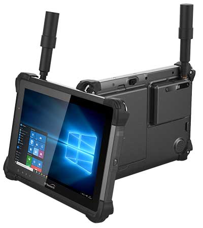
DT301X-TR rugged tablet. (Photo: DT Research)
The DT301X-TR rugged tablet includes an Intel RealSense 3D camera. The lightweight military-grade tablet is built to enhance precision for bridge and construction inspections, 3D surveying and mapping of underground utilities. It provides multi-frequency GNSS real-time kinematic (RTK) with carrier phase for mapping and positioning, and supports GPS, GLONASS, BeiDou, Galileo and QZSS. An optional foldable antenna supports high-accuracy field work, which can be measured with RTK GNSS positioning directly or used to connect to an external antenna for higher precision. DT Research, www.dtresearch.com
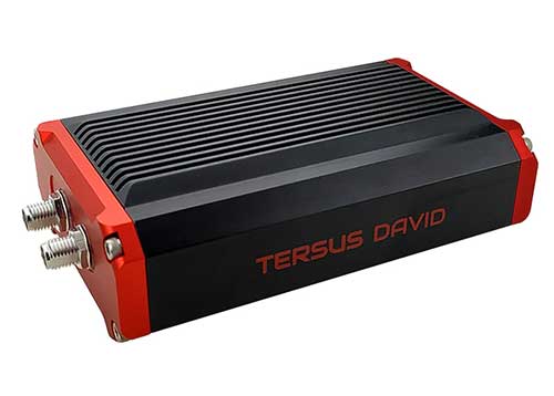
GNSS Receiver
Dual-antenna receiver with heading
Photo: Tersus GNSS
The David Plus dual-antenna GNSS receiver offers centimeter-accurate positioning and heading for intelligent transportation, construction, machine control, precision agriculture and navigation. Designed for efficient and rapid integration, the compact, lightweight receiver tracks GPS, GLONASS and BeiDou signals: GPS L1/L2, GLONASS L1/L2, BeiDou B1/B2 from the primary antenna, and GPS L1/GLONASS L1 or GPS L1/BeiDou B1 from the secondary antenna. The modular and flexible design can provide robust positioning and heading accuracy in a compact footprint for UAVs and other smaller autonomous projects. Tersus GNSS, www.tersus-gnss.com
Tilt compensation
Android and Windows compatible
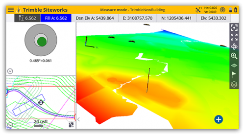
Screenshot: Trimble
Siteworks Software version 1.1 features GNSS tilt-compensation functionality and support for the Android operating system, meaning field workers can use smartphones or tablets. Contractors can run Siteworks on either Windows 10 or Android. Using Trimble Siteworks and a Trimble SPS986 GNSS smart antenna, construction surveyors can take measurements faster and perform more efficient stakeouts. It is designed to shield magnetic interference and can be used effectively anywhere on a construction site. Construction surveyors can capture accurate points without leveling the pole. Three modes support tilt compensation, so contractors can record accurate points while standing, walking or driving the site in a vehicle. Trimble, www.trimble.com
RTK receiver
Multi-band centimeter-accuracy
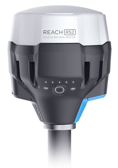
Photo: Emlid
The Reach RS2 is a multi-band GNSS receiver that features a built-in LoRa radio, a 3.5G modem, and a survey app for iOS and Android. The receiver determines a fixed solution in seconds and provides positional accuracy down to several millimeters. It tracks GPS/QZSS (L1, L2), GLONASS (L1, L2), BeiDou (B1, B2), Galileo (E1, E5) and SBAS (L1C/A), and reliably works in RTK mode on distances up to 60 kilometers and 100 kilometers in PPK mode. A multi-feed antenna with multipath rejection offers robust performance even in challenging conditions. RINEX raw data logs are compatible with OPUS, CSRS-PPP, AUSPOS and other PPP services so users can now get centimeter-precise results. Emlid, emlid.com
Mapping
High-speed camera
High resolution for aerial imaging
Photo: Teledyne
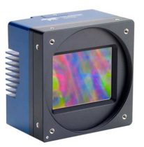
The Falcon 4 is a 86-megapixel ultra-high resolution and high-speed complementary metal oxide semiconductor (CMOS) camera. It offers capabilities for large-area, high-resolution, high-speed imaging. With 86 megapixels at 16 frames per second and a global shutter, the camera offers capabilities for large-area, high-resolution, high-speed imaging. Available in both color and monochrome models, the camera is sensitive into the near-infrared spectrum. The Falcon4’s high resolution and throughput serve a
variety of challenging applications including aerial imaging, reconnaissance, security and surveillance, 3D metrology and flat panel display inspection.
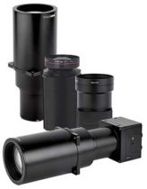
Three new high-performance lenses are designed for high-altitude aerial photography and long-range aerial and ground inspection applications. The 300mm AF, 180mm, and 150mm MK II lenses are designed to enhance the performance and flexibility of Phase One Industrial’s iXM-RS and iXM aerial camera series. Each offers precision imagery, taking advantage of the cameras’ ultra-high resolution backside-illuminated CMOS sensors, to maintain a smaller ground sample distance while flying at higher altitudes.
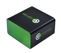
The SORA-P60L, part of Cepton’s SORA family of lidar scanners, is purpose-built to deliver long-range, high-resolution imaging for UAVs. It offers a 400-Hz frame rate, enabling drones to fly faster while maintaining high point-cloud density. With a 550-gram payload, the SORA-P60L prolongs UAV flight time allowing more ground to be covered in a single trip. Cepton’s Micro-Motion Technology faces all lasers downward at all times, providing a dense, uniform point cloud that, in combination with the high scan rate, makes it suitable for fixed-wing and fast-moving rotary-wing UAVs.
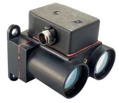
The WASP-200 LRF rangefinder is designed to measure ranges with accuracy and precision. It can be used for precision agriculture applications and as a proximity-to-ground sensor on board small or large unmanned aerial vehicles. It has 1-centimeter resolution and 10-centimeter accuracy, and is compatible with the Collins Aerospace Piccolo (CAN Bus and RS-232) and Pixhawk drivers. The WASP series of rangefinders also feature single-shot laser ranging for fast scanning and moving platforms; programmable burst mode averaging; and an IP-67 option. The rangefinders are suitable for robotics and UAVs, sense and avoid, industrial automation, height and distance measurements, and maritime operations.
The Leica BLK2GO is a small, portable, integrated handheld imaging scanner that offers mobility for scanning complex indoor environments. It combines visualization, lidar and edge-computing technologies to scan in 3D while in motion, allowing users to be more agile and efficient in capturing objects and spaces. Its dual-axis lidar scans up to 700,000 points per second. The handle contains WLAN connectivity, a rechargeable 45-minute battery, data storage for six hours of scans, a USB-C port for fast data transfer, and edge computing. The BLK2GO has a wide range of applications from adaptive reuse projects in the architecture and design industries to location scouting, pre-visualization, and VFX workflows for media and entertainment.
With tariffs, trade wars and sanctions ruling the day, how is a self-respecting UAS manufacturer supposed to make a buck? And to whom are the manufacturers of defense UAS able to sell their wares?
To NATO and other friendly countries, comes the ready answer, but there may still be a problem selling drones with armaments and offensive capabilities. Another layer of governmental review could swing into action when a company wants to sell to friendly countries like Saudi Arabia or perhaps to allies within the old Russian USSR block.
Last year, General Atomics lost sales to Saudi Arabia and the United Arab Emirates (UAE) for Predators and/or Reapers, large-bodied medium-altitude, long-endurance unmanned aircraft systems (or MALES). The deal went instead to a competing Chinese outfit. General Atomics complained bitterly about the loss of this business, which it blamed on restrictive U.S. export rules. The Administration responded by apparently loosening the regulations, in fact easing the way for most international sales. In response, it is possible that UAV manufacturers have also undertaken some changes which make U.S. drones even more competitive for export.
Business matters appear to have improved significantly. In May this year, the State Department actually used emergency provisions within the Arms Control Act to bypass Congressional review of a proposed sale to Saudi Arabia, UAE and Jordan of a package of Insitu Blackjack drones and launchers, worth $80 million.
The competition for world-wide sales of U.S. UAS products is increasingly tough, especially against Chinese suppliers with equivalent or perhaps less capable mil-spec drones. Hence the export rule changes which now appear to be working in the right direction.
Chinese Drones in the U.S.
Meanwhile, in an effort to accommodate U.S. concerns about the potential for user data somehow “leaking” to DJI — the Chinese supplier of almost 75% of U.S. drone purchases — DJI has implemented a “Government Edition” which apparently addresses the risk of data loss.
When US-based 3D Robotics stopped supplying 3DR Solo drones, the Interior Department found itself in a bind, as it had already bought hundreds of these devices for its inspection/surveillance operations. As the department searched for a new source for UAVs, it came to the conclusion that U.S. supplied drones were much less capable or up to ten times more expensive than equivalent DJI units. So they began working with DJI to solve the issue with potential data loss, and went on to test the results extensively
Working with the U.S. Interior Department for over 18 months, DJI has equipped drones and their controllers with modified hardware and custom software that ensure that the drones only operate in local data mode: information collected in flight is stored on the UAV alone and must be manually downloaded after flight. The drone is actually loaded with custom software by the user prior to flight to ensure this mode of data collection.
Even with these modifications, for now the use of DJI drones is still restricted to non-sensitive applications.
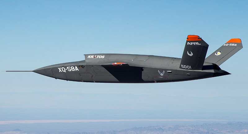
USAF/Kratos XQ-58A
The XQ-58A Valkyrie demonstrator, a long-range, high subsonic UAV completed its inaugural flight March 5, 2019, at Yuma Proving Grounds, Arizona. (Photo: U.S. Defense Department)
Kratos is working with the U.S. Air Force to develop a jet-powered UAV system that can fly alongside manned fighter aircraft to multiply their effectiveness. At much lower cost than manned aircraft, the concept appears to be that more risk can be taken with the ‘loyal wingman’ UAVs to not only support the mission of the attack aircraft, but to also keep it safe.
We reported earlier on the XQ-58A after its first flight in March of this year. Now the Valkyrie is back in the flight test program with its second flight lasting 71 minutes over the Yuma test range on June 11. In the long- erm, it is hoped that both ground controllers and flight crew would operate these extensively autonomous drones.
A parallel “Skyborg” program is also underway to develop the hardware and artificial intelligence software capability to enable this type of drone to fly and fight alongside manned aircraft.
In conclusion, trade wars and tariffs aside, let’s hope that good UAV products can still make headway on their merits alone.
The Federal Aviation Administration has added new airspace restrictions — effective July 11 — on unmanned aircraft systems (UAS) attempting to fly over national-security-sensitive locations.
The FAA has been cooperating with federal partners to address concerns about malicious drone operations by using the agency’s existing authority under Title 14 of the Code of Federal Regulations Section 99.7 (14 CFR § 99.7), Special Security Instructions, to establish UAS specific flight restrictions over select, national security sensitive locations.
The FAA’s Notice to Airmen (NOTAM), FDC 8/3277, defines these special security instructions. The FAA published a NOTAM, FDC 9/3332, which alerts UAS operators and others in the aviation community of this change and points to FDC 8/3277.
The additional 12 restricted locations requested by the U.S. Department of Defense are identified below.
Raven Rock Mountain Complex in Adams, PA
Lake City Army Ammunition Plant in Independence, MO
Pine Bluff Arsenal in White Hall, AR
Tooele Army Depot in Tooele, UT
Hawthorne Army Depot in Hawthorne, NV
Pueblo Chemical Depot in Pueblo, CO
Iowa Army Ammunition Plant in Middletown, IA
Watervliet Arsenal in Watervliet, NY
Blue Grass Army Depot in Richmond, KY
Letterkenny Army Depot in Chambersburg, PA
Rivanna Station in Charlottesville, VA
Maui Space Surveillance Site in Maui, HI
UAS operators, in particular, are urged to review the special security instructions prescribed by FDC 8/3277 and the important supporting information provided by the FAA’s UAS Data Delivery System (UDDS) website.
The UDDS website provides easy access to the text of FDC 8/3277 and other UAS-specific security NOTAMs; a current list of the airspace to which these special security instructions have been applied, supported by an interactive map and downloadable geospatial data; and other crucial details. A link to these restrictions is also included in the FAA’s B4UFLY mobile app.
The new UAS flight restrictions highlighted above and by FDC 9/3332 are pending until they become effective on 07/11/2019. UAS operators should keep in mind that access to the airspace identified by FDC 8/3277 and UDDS is strictly controlled.
Operators who violate these flight restrictions may be subject to enforcement action, including potential civil penalties and criminal charges.
The FAA is continuing to consider additional requests by eligible Federal security agencies for UAS-specific flight restrictions using the agency’s 14 CFR § 99.7 authority as they are received. The FAA will announce any future changes, including additional locations, as appropriate.
For further, broader information regarding flying drones in the National Airspace System, including frequently asked questions, please refer to the FAA’s UAS website.
Raytheon Company has signed a strategic agreement with AirMap, an airspace intelligence platform for drones, to collaborate on projects to safely integrate unmanned aerial systems (UAS) into the national airspace system. This will help unlock the positive economic and social benefits of expanded commercial drone operations, the companies said.
Unmanned air traffic control advances will unlock safe, efficient and scalable drone operations with a myriad of economic and social benefits.
“AirMap is ushering in a new era in drone aviation,” said Matt Gilligan, vice president of Raytheon’s Intelligence, Information and Services business. “Drones must safely operate in an already complex ecosystem, which is where our experience matters.”
The agreement combines the two companies’ expertise:
Raytheon’s Standard Terminal Automation Replacement System, or STARS, is used by air traffic controllers across the U.S. to provide safe and efficient aircraft spacing and sequencing guidance for more than 40,000 departing and arriving aircraft daily at both civilian and military airports.
AirMap is a global provider of airspace intelligence for UAS operations, with over 250,000 registered users. In 2018, U.S. registered commercial drone pilots used AirMap to request more than 45,000 automated authorizations to fly in controlled airspace.
“Raytheon technology has helped safely and effectively manage airspace in the most complex, dense controlled airspace in the world for decades,” said Ben Marcus, AirMap co-founder and chairman. “They are an ideal partner to join AirMap on the path toward enabling safe, efficient, and scalable drone operations in U.S. low-altitude airspace between 0 and 400 feet.”
The two companies are working toward an integrated demonstration that will showcase how AirMap’s unmanned aircraft traffic management platform can increase air traffic controllers’ awareness of potential conflict between drones and manned aircraft near airports to ensure overall safety of the airspace.
Lidar USA is now offering the option of the Drone Rescue Systems parachute system with all of its DJI M600 UAVs.
As UAVs become increasingly common for mapping applications, the likelihood of a crash increases. The number-one concern for any pilot should be the safety of all people in the vicinity. Equipment safety is number two.
Any mapping-equipped drone will have enough weight to potentially harm a person even if falling from a low altitude flight. The Drone Rescue System greatly mitigates this danger and gives pilots the added assurance that, should the system fail, they have gone the extra mile to prevent harm to any bystanders.
Effective as low as 10 meters with a descent of 3 meters per second, the equipment will land without a hard impact yet quickly enough to keep from being dragged far away.
Photo: Lidar USA
Weighing in at 430 grams in a repackable canister 160 x 75 millimeters in size, the DRS-M600 is designed to auto-release using a patented, airplane-friendly ejection mechanism within milliseconds of detecting a system failure. The size and weight are a major bonus when combined with the airplane-friendly feature, especially for field workers, according to the company.
“We performed our own tests of the Drone Rescue system to ensure the system really worked as advertised,” said Daniel Fagerman, CTO of Lidar USA. “We weren’t disappointed. While it’s an expensive test if it fails, the good news is it that the system worked as well as could be expected. The M600 incurred very little damage that was easily repaired. We feel confident this will be more than just an accessory for our clients but rather a necessity.”
Lidar USA is offering the parachute option to any M600 owners. Watch a video of one of the company’s test flights.