Tag: UAV

  • Drones and imagery: Utilities turn to artificial intelligence

    How AI and machine learning algorithms redefine the way utility companies manage their infrastructure

    By Jaro Uljanovs, Lead AI Developer and Data Scientist, Sharper Shape

    Artificial intelligence (AI) boasts a wide range of potential applications, across nearly every industry imaginable — healthcare, automotive, retail, even fast food. But it’s the utility industry where AI and machine learning (ML) are beginning to demonstrate some of their most impactful effects on many aspects of the business. Power companies are increasingly leaning on AI to improve their electricity delivery and prevent potential wildfires, and AI is actually enhancing, rather than eliminating, human jobs.

    From data collection and analysis to their presentation of actionable insights, AI and ML algorithms are quickly redefining how utility companies manage their electric infrastructure.

    Consolidating and classifying data

    Utility companies oversee massive infrastructure networks, comprising poles, conductors, substations and transmission and distribution lines that span thousands of miles. The vegetation surrounding this key infrastructure must also be monitored, as it presents a danger of fire or outage.

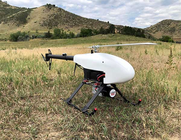
    Taking a comprehensive snapshot of these assets means utilizing a variety of different sensors for network inspections. These sensors include lidar, color (RGB), hyperspectral and thermal imagery.

    This allows the system to capture everything — from vegetation proximity, to infrastructure assets, to individual components (such as insulators on poles) and their operational integrity, to hot spots indicating potential fire risks.

    That’s a lot of data to capture, catalog and process. And there are a lot of individual elements within that data — even in just one image — to pinpoint and classify, let alone do so accurately. Classifying billions of data points across all of those images is an impossibly time-consuming task to do manually.

    Photo: shaunl/E+/Getty Images
    Photo: shaunl/E+/Getty Images

    AI and ML tools can accomplish that same work — scanning thousands of images collected across thousands of miles of utility infrastructure — in seconds. Lidar point cloud segmentation can detect conductors (quite a difficult component-type to segment) with an accuracy of over 90%, while hyperspectral image segmentation can identify vegetation species with an accuracy of up to 99%.

    More than that, when paired with drone sensors, these algorithms can also improve the upfront collection of images and data. AI and ML tools help to adjust sensor positioning in real time, in the event a signal is lost or the drone veers slightly away from its inspection flight path.

    By helping to readjust the sensors’ bearings while in flight, AI not only ensures more accurate data collection, but also that the flight doesn’t need to be done again or prematurely ended because of faulty data collection, saving time and money. AI pinpoints any faults in the sensors or the drone’s flight path while in the air, recalibrating as needed and identifying individual elements within the data as it comes through the sensor’s video feed.

    Breaking down silos to create a holistic data approach

    Key to all of this is eliminating the silos that tend to naturally build up between different data segments. In the utility inspection space, asset management, vegetation management, different sensors and so on all produce their own disparate, walled-off sets of data.

    When data is kept siloed like this, it becomes unnecessarily difficult if not impossible for teams to derive companywide insights or conclusions from the information being collected. And what good is all that data if it can’t be used to check against itself and enhance other sets of data?

    The northwest fire line of the wildfire that devastated Santa Rosa, California, taken by satellite Oct. 10. (Satellite image ©2017 DigitalGlobe)
    The northwest fire line of the wildfire that devastated Santa Rosa, California, taken by satellite Oct. 10. (Satellite image ©2017 DigitalGlobe)

    Good data management can’t exist in a piecemeal approach. It needs to be holistic, and AI provides the impetus to make that happen. AI provides a central resource for pooling all these data sources together, making it easier to cross-analyze for potential problems — like wildfire-prone vegetation or damaged components. When these issues are collected in one system, it becomes much easier to identify faults and resolve them — and do so far faster than it would be to manually sift through countless images of poles or vegetation maps.

    And for all the stereotypical concerns about AI eliminating work for human beings, at utility companies AI actually enhances the role that people have to play in the network inspection process. Because the AI is what analyzes the data, it’s not something that is dependent on the potentially biased expertise of a professional human inspector, nor is it prone to fatigue and the anomalous results that can come from that. But at the same time, AI can’t do everything itself. It’s a tool for presenting clearer, more accurate and more actionable information for the people to then act on with their own judgment.

    There’s a lot of easy-to-make assumptions, both good and bad, about AI. But at the end of the day, what AI really means for the utility industry is a more efficient and effective tool for providing the right information about a power company’s infrastructure — its transmission and distributions lines, its poles, and its nearby vegetation — into the hands of its key decision makers.

  • The rise of UAVs in agriculture, airports, more

    The rise of UAVs in agriculture, airports, more

    UAVs are finding places in the lives of more people than ever — farmers employing crop-spraying drones to counter a locust infestation in Pakistan, finding the way towards useful inspection tasks at an operating airport in the U.K., large airborne vehicles providing joy-rides around the U.S., and unfortunately showing up where they are not wanted so security staff have to use protection systems to deal with them.

    Crop Spraying

    New unmanned air vehicle (UAV) applications keep appearing. Once they do, they start to spread locally and even around the world. Crop management using UAVs has significantly progressed.

    The U.S. has used crop spraying to improve crop yield for many years, defending against insect infestation and plant diseases. GNSS guidance systems for crop-spraying aircraft was an early satnav equipment application that eventually became a standard for any fliers contacted by farmers to apply pesticides to protect their crops. Then companies began offering turn-key spraying, which was highly efficient and effective.

    UAVs are now entering this segment — they are capable of carrying higher capacity tanks, and autonomous/semi-autonomous navigation enables spraying with minimum supervision. This option is becoming more readily available to the farmer and costs less than using manned aircraft.

    Both Japan and China have used UAVs extensively for crop spraying; other countries turning to the solution are Africa, the U.S. and India. In China, more than a hundred different types of UAV are in use in agricultural applications.

    Farms around the mega-city of Karachi, Pakistan, have been infested by locusts, but the local government is short of the helicopters and ground applicators normally used for spraying pesticides. A recent graduate returning from his doctoral course in China brought with him knowledge of unmanned vehicle use in agriculture, and is urging rapid local adoption of UAV technologies to combat the locust infestation.

    Pakistani agriculture expert Shahzad Nahiyoon claims that UAVs are better suited to crop protection for small farms within difficult contours of the surrounding region. They are less expensive to operate than manned fixed-wing and rotary aircraft, may be operated locally from outside spray contamination zones, and can spray in confined areas. Equipped with a 20-liter tank, spraying one or two 20-meter-wide swaths, 6 to 10 hectares per hour can be treated.

    Drones at the airport

    Growing a little weary of drone incidents around airports, I was pleased to see a report I had overlooked from a year ago which indicated that trials at Manchester airport in UK had demonstrated airport and drone compatibility. This basically happened because an Air Traffic Control (ATC) system for unmanned aircraft or Unmanned Traffic Management (UTM) was shown to keep drones flying around the airport under full control while integrated with regular airport and drone operations.

    The trial — referred to as Operation Zenith — sponsored by the National Air Traffic Systems (NATS), made us of the GuardianUTM airspace management system, supplied by Altitude Angel, as the control system for eight trial drone missions at the airport. The drone UTM system was connected to the real-time Air Traffic Management (ATM) system which manages ground and air traffic at the airport, to ensure the control and safe separation of drones and aircraft. The UTM system also provided controllers with a real-time view of all operating drones.

    The trial demonstrated the efficient regulation of drone traffic within and around the extremely sensitive airport region. Everyone engaged in the trial made use of real-time electronic map displays driven by the UTM system, showing everything flying in and around the airport; aircraft and drones. Drone pilots used this information to ensure their operations remained safe while operating so close to commercial aircraft in the air and on the ground.

    NATS has now formed a strategic partnership with Altitude Angel to deliver this integrated UTM system at airports in the United Kingdom. The UTM system has successfully completed initial pilot trial and evaluation and now NATS intends to further demonstrate UAV management control at six U.K. airports later this year.

    Thousands sign for ride with Lift Aircraft

    Hexa in flight (Photo: Lift)
    Hexa in flight (Photo: Lift)

    Lift Aircraft unveiled its 18-rotor Hexa unmanned/manned aircraft more than a year ago — what’s new now is that 13,000 people have signed up to take one for a ride.

    The large drone weighs in at 432 pounds and can fly for 10-15 minutes with a single passenger.

    The Hexa is controlled by a single joystick, and an onboard iPad provides route guidance and manages take-off and landing. Classed as a powered ultralight air vehicle, it can be flown without a pilot’s license, so Lift announced that it will offer Hexa flights to anyone wanting to fly (in 25 selected U.S. cities) provided they physically fit into it and weigh less than 250 pounds.

    Lift intends to map each recreational flight area in 3D, and plug this map into the vehicle control system. The 13,000 people who signed up can expect to pay $125-250 for each joy ride. Lift has yet to announce the first location where the fun rides will take place.

    Counter-UAS system downs drones in Philippines

    The Southeast Asian Games were recently held in the Philippines with thousands of participants from eleven countries of Southeast Asia — the event was spread across 23 cities around the country. However, a number of uninvited drones showed up during the opening ceremonies on November 30th to take a look, but fortunately all were quickly dispatched.

    The DroneShield counter-UAS system had been deployed in advance for protection of the event, and the local security forces used the system to detect and disable the invaders. According to the company, security personnel found the drones using body worn RF detection devices, and the Dronegun was then used to disable them.

    Jamming the control link and GNSS L1 and L2 frequencies, UAVs are generally stopped in mid-flight when illuminated by the rifle-like device. DroneNode jammer in a suitcase was also used to provide blanket protection over a 1km circular area when the alarm was raised.

    In all, seven unauthorized drones were disabled, some of which were apparently flying near the intended flight path of the helicopter bringing President Rodrigo Duterte to the opening ceremony.

    Summary

    It might seem a little ridiculous that we’ve had to come up with systems to counter uninvited or malicious drones (C-UAS). Making provisions for protection is probably something most sensitive facilities will have to do. Its possible that governments may already be investing in such technology to protect many facilities. More drones available for useful, productive and even recreational applications means some can end up in the wrong hands.

    Nevertheless, good stuff comes out of drone applications, and the benefits seem to by far outweigh the need to protect ourselves against bad actors.

  • Hitec Commercial Solutions acquires Straight Up Imaging

    Hitec Commercial Solutions acquires Straight Up Imaging

    Hitec + SUI logos

    Hitec Commercial Solutions LLC has acquired Straight Up Imaging (SUI).

    Hitec stated in a press release, “SUI’s experience in engineering and manufacturing small unmanned aircraft systems contributes perfectly with our expanding unmanned product platforms and progressive mapping and data acquisition solutions.”

    Hitec Commercial Solutions continues to obtain integral assets which strengthen those products utilized for efficient surveying in agriculture, energy and gas, public safety, construction and first response services.

    The acquisition agreement was closed Aug. 9 after approval by core members of the board of directors.

    Hitec offers a variety of unmanned platforms, including the XENO FX, its proprietary fixed wing platform. The company also partners with Quantum Systems.

    Founded in 2015, SUI provides technology in professional-use small unmanned aircraft systems (sUAS) with its Endurance and Endurance LT customized multirotor packages and ground controller system.

  • FMI: Global geospatial solution market to see steady growth

    A study by Future Market Insights (FMI) said the global geospatial solution market will witness growth at a compound annual growth rate of nearly 15% from 2019 to 2029.

    According to the study, this strong growth outlook of the global geospatial solution market has been attributed to the advancements in computing capacity for geospatial solution-based research and applications.

    The study highlighted geomedicine as a solution to potentially boost the growth of the geospatial solution market during the following years. Blockchain technology is estimated to witness massive adoption in the foreseeable future, FMI added. This technology can be geospatially enriched when combined with geospatial solution-based technologies such as Geographic Information Systems.

    In addition, FMI reported that drones are estimated to witness a considerable adoption rate from 2019 to 2029, especially as new standards and legislations introduced by national governments are likely to motivate drone manufacturers and end users to operate more freely.

    The study also determined that GPS is estimated to retain a substantial revenue share in geospatial solution market, and that remote sensing technology will register a significant compound annual growth rate over the projection period, as well.

    The demand for geospatial solutions is rising from almost every end-use industry, FMI added, with one of the most noteworthy growth areas in the broad data processing arena being data visualization.

    Check out the full report here.

  • First responders see real-time data a top benefit of using drones

    First responders see real-time data a top benefit of using drones

    Photo: ResponDrone
    Photo: ResponDrone

    Emergency response providers participating in a Design Thinking workshop organized by the ResponDrone Project have indicated that they would like to use drones to gather and distribute crucial information and provide communication networks in disaster areas.

    Preliminary results from the workshop, held in Thessaloniki, Greece, in November, indicate that first responders view the constant provision of real-time information in crisis situations as one of the most valuable benefits arising from using drones in disaster management missions.

    The results of the Design Thinking workshop will be presented and discussed with the ResponDrone consortium at the project’s General Assembly, which will take place on Dec. 10–12 in Paris.

    ResponDrone is an international project co-funded by the EU and the Korean government, which aims to develop an integrated solution for first responders to easily operate a fleet of drones for multiple synchronized missions to enhance their situation assessment capacity and their own protection.

    The workshop, attended by representatives from first-responder organizations and industry partners of the ResponDrone consortium, took place to assess the best possible system requirements.

    The aim of the ResponDrone project is to develop and evaluate a situation awareness system for first responders in emergency situations. The system will provide crucial information and communication services to all relevant stakeholders in a disaster situation.

    First responders said they would like the ResponDrone system to:

    • provide reliable and validated real-time information
    • be flexible and open to information from already existing data sources
    • be able to visualize different information layers in a customizable manner
    • be fast and easy to deploy
    • be able to provide near future predictions regarding the development of the disaster situation.

    Workshop participants included regional and national authorities in charge of first response, state agencies responsible for carrying out on the ground first response actions, rescue services and fire departments from Greece, France, Armenia, The Netherlands, Latvia, Bulgaria and Israel.

    According to the first responders, a disaster can initially be described as a black box, which needs to be opened. Gathering relevant and reliable information from the disaster area and combining it with already available data, as well as rapid distribution of information to all relevant stakeholders, are the top priorities in disaster management.

    The deployment of drones as a means of enabling the afore-mentioned capabilities seems to be a promising approach. It is crucial that the data gathered by drones is presented to the right people as soon as possible, preferably in real time.

    “The workshop clearly showed the urgent need for the constant provision of real time information,” said ResponDrone project coordinator Max Friedrich from the German Aerospace Center (DLR).

    “First responders wish to receive real-time data on current occurrences in the disaster area, on the position and status of potential victims and the first response units deployed in field, as well as the status and current location of available resources.”

    Friedrich added that the ResponDrone system would be designed to provide highly accurate real-time information. The flexible system would gather information from various data sources and should be designed for fast and easy deployment.

    ResponDrone has already begun developing an integrated solution for first responders to easily operate a fleet of drones with multiple synchronized missions to enhance their situation assessment capacity and their own protection. This system of systems will simplify and accelerate situation assessment and sharing, decision making and operations management, while requiring only a small crew to operate it.


  • Ericsson verifies 5G coverage with Rohde & Schwarz drone

    Ericsson verifies 5G coverage with Rohde & Schwarz drone

    Photo: Rohde & Schwarz
    Photo: Rohde & Schwarz

    Test and measurement specialist Rohde & Schwarz has supplied mobile network testing tools used in drone-based network coverage, performance and operation tests managed by Ericsson, a global leader in network infrastructure.

    Testing mobile coverage. A project team based in Jorvas, Finland, and led by Ericsson’s 5G Readiness Program RAN Technical Lead Richard Wirén, has developed— together with Centria University of Applied Sciences — a novel system for testing cellular mobile network coverage.

    The new system uses mobile network-testing scanners and smartphones from Rohde & Schwarz mounted on a drone that can be programmed to execute automatic tests with considerable flexibility, for example for precise route selection and drone speed control.

    This solution is especially valuable for industrial use cases. It also has the advantages over traditional walk and drive tests by providing unprecedented repeatability and positional accuracy with the ability to verify beamforming and map coverage in 3D.

    Drone-mounted scanner. The R&S TSMA6 network scanner is mounted on a drone and is able to simultaneously verify important LTE and 5G NR coverage metrics such as reference signal received power (RSRP) and signal-to-interference-plus-noise ratio (SINR) in accordance with 3GPP standards.

    When combined with the R&S QualiPoc Android smartphone-based optimizer, IP trace, application quality of service (QoS) metrics such as serving cell parameters are possible. The solution currently uses LTE user equipment (UE) but will soon be further developed to include 5G UEs such as the Samsung S10 5G.

    The drone can be programmed to follow an exact three-dimensional route.

    Repeatable tests. More than 20 successful measurement flights conducted so far have shown the solution procedure and results to be extremely repeatable. The drone flights were of various duration, altitudes and routes, depending on the test case.

    Control, authentication and air traffic control are considerable challenges to the development of robust drone-based solutions. In this new system they are conducted over cellular networks, eliminating the requirement for line-of-sight connection between the drone and its pilot.

    The unique procedure enables unprecedented 3D accessibility, positional accuracy and repeatability of the testing.

    It also opens up new possibilities to ensure end-user QoS for demanding 5G use cases such as industry 4.0, automotive and public safety, Rohde & Scwarz said.

    5G New Radio. The deployment of 5G New Radio (NR) brings new applications of cellular networks for subscribers, government and industry. It also makes the verification of the correct coverage, performance and operation of networks more critical, increasing the demand for accuracy and accessibility in traditional field network tests.

    “For 5G to realize its promise, field verification of operation and quality is essential, and this development is a pioneering way to ensure our customers receive the network performance they require,” said Richard Wirén, 5G Readiness Program RAN Technical Lead from Ericsson. “We are delighted to utilize test solutions from Rohde & Schwarz that have proven themselves very reliable and are excited that we now have access to solutions based on commercially available 5G NR UEs such as the Samsung S10 5G.”

    “We are delighted to combine our industry-leading mobile network testing know-how with Ericsson’s long tradition of network innovations to ensure the delivery of end-user Quality of Experience as 5G NR becomes a reality,” said Hanspeter Bobst, vice president of mobile network testing for Rohde & Schwarz.

    Ericsson and Rohde & Schwarz are collaborating with Tampere University and Centria University of Applied Sciences, and the project forms part of the Business Finland 5G FORCE program.

    Future developments will focus on testing critical 5G applications such as public safety and machine-type communications for Industry 4.0, extending the frequency to extremely high frequencies of the mmWave bands and testing in an urban environment.

  • High-endurance VTOL UAV the aim of GE, Hybrid Project

    GE Aviation and Hybrid Project team to provide commercial high-endurance vertical takeoff and landing (VTOL) UAV, with Auterion and GE Aviation providing comprehensive integration of ground, cloud and airborne components

    GE Aviation has teamed with Hybrid Project to provide a VTOL UAV designed for high-endurance commercial applications at scale. Flight testing is underway, with commercial availability targeted for the first quarter of 2020.

    The agreement enables Hybrid Project’s 35-pound hybrid-powered SuperVolo VTOL UAV with a full stack airborne computing hardware platform, flight and safety management, and integration from GE Aviation and Auterion.

    GE Aviation’s computing platform enables flight control and airborne computing power at the edge while maintaining an independent and authoritative safety controller. Auterion’s Enterprise PX4 operating system resides on the vehicle, in the cloud, and the ground station.

    The integration is the result of an agreement announced earlier this year between GE Aviation and Auterion to provide all-in-one hardware and software platform for commercial drones.

    “The combination of Hybrid Project’s SuperVolo airframe, GE Aviation’s computing platform, and Auterion’s software stack enables an all-in-one solution that readily scales for commercial applications,” said Matt Vacanti, product leader, Avionics Systems for GE Aviation. “A highly integrated system is critical to achieving scalable commercial UAV operations.”

    Hybrid Project’s SuperVolo has been designed from the ground up with an emphasis on endurance flight, ease of maintenance, and modularity. The combined system is comprised of technologies and services which have the capability to enable commercial operations in complex environments while meeting regulatory and mission outcomes.

    “This collaboration, and the combined solution, will increase commercial operator flexibility, efficiency, and overall performance to a level not previously available in its class,” said Ryan Pope, co-founder of Hybrid Project.

    Auterion’s Enterprise PX4 software is built on top of open software standards that are supported by a global developer community. Auterion’s enterprise software also provides the infrastructure enabling online workflows, compliance monitoring, and enterprise fleet management. “With Auterion software, the Hybrid Project SuperVolo flies farther, safer, and more efficiently, unlocking new BVLOS capabilities and missions that were previously not possible before commercial drones of this class were available,” said Kevin Sartori, co-founder of Auterion.

  • Skyward InFlight adds operations planning, LAANC to UAV app

    Skyward has updated its InFlight mobile ground control system app. It now offers operation planning and mobile LAANC requests.

    In October, Skyward released a major update to its airspace intelligence map on both web and mobile platforms. The update included a new airspace design, clear LAANC grids, and a redesigned user experience.

    It also integrated essential ground intelligence, including information on transmission lines, pedestrian walking paths, and 1 million vertical obstacles, as well as 3D views of key structures.

    The new features announced this month include the ability to create and plan flights from mobile device. Users can now plan flight areas, check airspace and deploy without leaving InFlight, directly from the airspace intelligence map.

    Users can now also make LAANC requests in the field to give users faster, greater access to controlled airspace. With LAANC, users can request access to airspace around airports and receive authorizations in near real time.

  • Septentrio PPK gets a boost with BaseFinder

    Septentrio PPK gets a boost with BaseFinder

    Septentrio’s post-processing kinematic (PPK) software has been upgraded with multi-GNSS and BaseFinder functionality. BaseFinder improves project efficiency by automatically finding the most suitable reference station data needed for centimeter-level accuracy.

    Both GeoTagZ and PP-SDK now feature BaseFinder, which speeds up survey workflow by automatically finding reference data needed for augmenting GNSS logs with sub-centimeter accuracy. BaseFinder accesses an online database of reference networks and extracts the most suitable corrections available. BaseFinder is available via an app or via an API and can be incorporated into any existing software.

    PPK is often used for ground surveys with aerial drones, allowing high precision georeferencing without the need for a real-time base station link or ground control points (GCPs).

    “Surveying without a base station will allow users to reduce costs and set-up time. With this PPK upgrade we are improving the end-user experience as well as developer experience,” said Danilo Sabbatini, product manager at Septentrio.

    The new release of this GNSS post-processing software also includes two additional GNSS constellations: European Galileo and Chinese BeiDou. Having access to all the signals from all GNSS constellations improves reference network compatibility. It also improves positioning availability in difficult environments. This is particularly important when working in areas of low satellite visibility such as near tall structures or under foliage.

    When doing photogrammetry with a drone, GNSS data is often recorded and then post-processed together with base station data to achieve sub-centimeter positioning accuracy. This base station data can be obtained either with proprietary base stations or by using base station data from a public reference network (see diagram below). Septentrio receivers are designed to bring accurate and reliable positioning to photogrammetry, aerial inspection, marine survey as well as mobile mapping.

    GPS Post-Processing SDK architecture, bringing high-accuracy positioning without the need for a real-time correction stream. (Diagram: Septentrio)
    GPS Post-Processing SDK architecture, bringing high-accuracy positioning without the need for a real-time correction stream. (Diagram: Septentrio)
  • UAVs take flight for food deliveries, runway inspections, more

    UAVs take flight for food deliveries, runway inspections, more

    A lot has happened in the world of unmanned aircraft over the last several weeks, and this month we’ve captured a cross-section of news that illustrates the variety of applications and goings-on across the industry. These include:

    • drone delivery to a nuclear submarine,
    • Uber Eats launching a new delivery drone,
    • a new heavy-lift UAV,
    • Chinese DJI drone use banned by the U.S. interior department,
    • the Grand Sky facility in North Dakota demonstrating control of a NASA Global Hawk over California,
    • runway inspection using drones at an airport in Canada, and
    • a drone-of-sorts completing 780 days in orbit.
    Package delivery to USS Hawaii (Photo: U.S. Navy/Mass Communication Specialist 1st Class Michael B. Zingaro)
    Package delivery to USS Hawaii (Photo: U.S. Navy/Mass Communication Specialist 1st Class Michael B. Zingaro)

    Submarine delivery. The University of Hawaii and the U.S. Navy recently tested out a new way to supply an operational nuclear sub with a few essential items while the Virginia-class fast-attack submarine USS Hawaii was off the West coast of Oahu. A five-pound package of circuit cards, medical supplies and food too – which someone surely must have snuck in — was delivered using a Skyfront Perimeter gas-powered hybrid drone. The UAV has five-hour endurance, easily flying just one mile out to sea and back to complete the test delivery on Oct 10.

    The package was lowered on a cable from the Perimeter drone and captured by a ‘snag’ pole extended off the sail of the submarine. This timely small package delivery to an underway sub has apparently led to the creation of the submarine force’s first UAV squadron in the Pacific, according to the Navy.

    Uber Eats. Uber Eats has been testing food deliveries from McDonald’s near San Diego State University, and has just announced a new 6-rotor vertical take-off delivery drone it plans to use for more test deliveries next year in San Diego.

    Uber Elevate delivery drone (Photo: Uber)
    Uber Elevate delivery drone (Photo: Uber)

    The ideal delivery profile for this drone is a meal for two picked up from a restaurant six miles away from dispatch in eight minutes, another six miles to make the delivery and then six miles to return to base — maybe less than 20-30 minutes all told. However, they have an intermediate drop-off to a ground-based delivery driver who then travels to the customer’s door to actually deliver the food. This process contrasts with Amazon’s approach — they are planning to lower packages on a cable directly to the customer – but food delivery might actually need a guy in a truck knocking on your door with hot food.

    Heavy-lift drone. The Heavy-Lift VoloDrone, manufactured by Volocopter in Germany, flew for the first time in October. Targeted at the logistics sector, its anticipated that the large UAV may also find applications in agriculture, and other operations where a large – up to 440 pounds – payload is required. Velocopter has so far focused on unmanned air-taxi transports, but the larger scale involved in people transport appears to have spun off into a heavy-lift derivative UAV.

    Christoph Hommet, chief engineer, with the heavy-lift VoloDrone. (Photo: Volocopter)
    Christoph Hommet, chief engineer, with the heavy-lift VoloDrone. (Photo: Volocopter)

    The VoloDrone is a powerful, fully electric, heavy-lift utility drone which is anticipated to have a range of up to 25 miles carrying a 440-pound payload. The rotor area has a diameter of 30 feet and the vehicle is 7.5 feet high. It can be remotely piloted or can fly autonomously on pre-set routes.

    Loads can be carried between the legs of the landing gear on standard rack mounts or slung below, or a tank and sprayer could be fitted for agricultural applications. The 18 rotor multicopter platform uses swappable lithium-ion batteries and an in-house flight control system, and benefits from existing development and test of the air-taxi Velocopter.

    Anywhere ground transportation or construction operations are challenged by difficult access, the VoloDrone might assist by providing an airborne option. It is designed as a universal air-lift vehicle which may be adapted to different use cases by the addition of special-purpose accessories.

    Examples of VoloDrone load configurations. (Photo: Volocopter)
    Examples of VoloDrone load configurations. (Photo: Volocopter)

    DJI drones barred. The U.S .Interior Dept. (DoI) has barred the use of DJI dones, except for emergency purposes. With a combined department fleet of over 800 drones, around 15% are supplied by Chinese manufacturer DJI.

    Amid the on-going trade war between China and the U.S., members of Congress have grown increasingly concerned about American use of Chinese technology – whether DJI drones, or Huawei networking equipment. Recently Congress has proposed the American Drone Security Act to limit Government agencies’ use of Chinese equipment.

    In anticipation of this issue DoI has already been working with DJI for over 15 months to identify possible security gaps in drone design, and DJI has come up with a “Government Edition” software load which ensures data is only gathered and stored on-board the drone and is isolated and downloaded for only DoI use after each flight — data transmission has been eliminated as a possible source of data leakage. DJI even volunteered to partial manufacture in the US. Therefore, DoI had previously resisted Congressional pressure to discontinue use of its fleet of DJI drones.

    Nevertheless, DoI Secretary Bernhardt has ordered that Chinese drone use be now discontinued until an internal review is completed. In the meantime, DJI drones may only be operated by DoI for emergency purposes, “such as fighting wildfires, search and rescue, and dealing with natural disasters that may threaten life or property.”

    NASA Global Hawk UAV (Photo: NASA/Tom Miller)
    NASA Global Hawk UAV (Photo: NASA/Tom Miller)

    Large BVLOS drones. The Grand Sky Beyond Visual Line of Sight (BVLOS) facility in North Dakota has become an operational base for large UAVs, including the General Atomics’ Predator and Northrup Grumman’s (NG) Global Hawk. The Grand Sky facility is immediately adjacent to Grand Forks Air Force Base, where the RQ-4 Global Hawk high altitude, long endurance autonomous aircraft is based.

    In order to offer full operational capability to its intended customer base at Grand Sky, Northrup Grumman is building a hangar and has also established a Transportable Operations Center (TOC) in its Grand Sky Mission Control Center. It was through this TOC on October 10th that NG was able to take control of an in flight Global Hawk mission in California.

    A NASA crew in California had managed the take off and flight of their Global Hawk from the NASA Armstrong Flight Research Center (AFRC) on Oct. 10, 2019. During the mission, the flight team at Grand Sky took over control of the aircraft and executed a series of flight maneuvers to demonstrate the operational capability of the TOC. This capability is key for the Grand Sky facility to become fully operational.

    A Microdrone md4-1000 used in the surveys at EIA. (credit: EIA)
    A Microdrone md4-1000 used in the surveys at EIA. (credit: EIA)

    Runway inspection. Drones are never allowed to operate anywhere near an active airport, so it’s something of a switch to learn that the Edmonton International Airport (EIA) in Alberta, Canada , OK with operating a drone within the confines of the airport. Fortunately it’s a case of improving the safe operation and maintenance of the extensive runway infrastructure at the airport.

    EIA has two million square feet of runways, taxiways and aircraft handling aprons which are all subject to wear by aircraft and suffer from the harsh weather extremes which are common in Canada. Therefore regular maintenance inspections are mandatory. Undertaking inspections manually in the past could take days to perform, so EIA adopted the use of drones to complete inspections much quicker and with higher accuracy.

    The Microdrone md4-1000 drone is flown by Canadian company AERIUM to collect Lidar (Light Detection and Ranging) data and photographic/video imagery of EIA’s runways. The data collected is used to more accurately predict when to conduct preventative maintenance on ground infrastructure used by aircraft. Drone operations were approved by Edmonton Airport in collaboration with Nav Canada and AERIUM. EIA has previously flown a drone to minimize the number of birds on the airport during aircraft movements and in the process conducted the first-ever drone night flight at the airport.

    A X-37B lands at the Kennedy Space Center. (Photo: USAF)
    A X-37B lands at the Kennedy Space Center. (Photo: USAF)

    X-37B orbital vehicle. Finally, the daddy-of-all applications for remotely piloted vehicles became more apparent on Oct. 27, at 3:51 in the morning when the U.S. Air Force’s X-37B Orbital Test Vehicle successfully landed at NASA’s Kennedy Space Center Shuttle Landing Facility after 780 days on orbit.

    The fifth mission was launched on Sept. 7, 2017 from Cape Canaveral Air Force Station, Florida by a SpaceX Falcon 9 booster. Looking like a miniature version of one of the retired Space Shuttle fleet, the X-37B is managed by the Air Force Rapid Capabilities Office, and ‘performs risk reduction, experimentation and concept of operations development for reusable space vehicle technologies.’ Long endurance stuff – the previous flight lasted 718 days. “This mission successfully hosted Air Force Research Laboratory experiments, among others, as well as providing a ride for small satellites,” said an Air Force spokesman.

    The X37B provides a unique capability to test new systems in space and return them to Earth and enables the U.S. to more efficiently, effectively and rapidly develop evolving space capabilities. The U.S. Air Force is preparing to launch the sixth X-37B mission in 2020.

    Final thoughts. As drones chug steadily along the path towards a rapid airborne delivery system, urgent deliveries to both submarines and hungry people ordering food are making progress. Heavy-Lift capability is evolving out of air-taxi research. The effects of trade wars and security concerns are touching established drone operations. We can now control huge aircraft remotely from almost anywhere. Runway inspection is being automated just like any other drone inspection/surveillance mission, and remote space operations are now regular practice.

    It’s an expanding world of applications for drones, with many more different and perhaps unanticipated ones yet to come.

  • Uber unveils food-delivery drone

    Uber unveils food-delivery drone

    Photo: Uber
    Photo: Uber

    Uber Elevate, Uber’s aviation division, unveiled a new food-delivery drone at Forbes’ Under 30 Summit in Detroit, according to various news reports.

    The six-rotor UAV is vertical- and horizontal flight-capable, Uber Elevate head Eric Allison said at the conference. It has a range of 18 miles and an 18-minute flight time, and can carry enough food for two adults.

    The drones will land in designated safe-landing zones, where human couriers will pick up the food and bring it to customers’ doors. The company might also land the drones on parked Uber cars (tagged with QR codes), which will carry the meals to their final destinations.

    Uber’s Elevate Cloud Systems will track and guide the drone, as well as notify a delivery driver when and where to pick up the food.

    The program is expected to roll out next summer in San Diego, where Uber Elevate has been testing urban aerial delivery via the UAS Integration Pilot Program (IPP).

    Uber Eats delivery drones in the sky. (Image: Uber)
    Uber’s vision of a city sky filled with Eats delivery drones. (Image: Uber)
  • Lidar USA offers new aircraft to carry full range of UAV scanners

    Lidar USA offers new aircraft to carry full range of UAV scanners

    Photo: Innoflight Technology
    Photo: Innoflight Technology

    Lidar USA is partnering with Innoflight Technology, a manufacturer specializing in UAV systems for surveying, mapping and inspection.

    As a result of the partnership, Lidar USA is offering the Galaxy 950 platform to carry any of its sensors while consistently providing flight times over 30 minutes.

    Based in Somerville, Alabama, Lidar USA specializes in the design and integration of economical lidar sensors.

    Innoflight and Lidar USA’s partnership is another step for both companies to offer turn-key solutions focused on quickly and safely acquiring high-quality data.

    Innoflight designed the Galaxy 950 to simplify the flying aspect of remote sensing with UAVs. The helicopter includes a parachute, automatic takeoff and landing, and extended visual-line-of-sight capabilities to maximize productive time.

    For corridor/electric utility line projects, the Galaxy 950 pairs well with the recently announced CL-90 by Teledyne Optech. As the first integration partner of the new compact lidar system, Lidar USA is offering maximum productivity at UAV flight ceilings while achieving improved canopy penetration and exceptional downward point density.

    “Lidar USA and Innoflight Technology are both committed to customer success, and this partnership provides the whole package for lidar mapping solutions with UAV,” said Jeff Fagerman, CEO of Lidar USA. “Innoflight’s Galaxy 950 offers exceptional performance in safety, flight duration, and ease of use, which is what our customers need for their projects.”

    The Galaxy 950 is now available from Lidar USA as an integrated package with any of their scanning systems.