Tag: United Kingdom

  • NPL collaborates with Vodafone on terrestrial timing

    NPL collaborates with Vodafone on terrestrial timing

    The National Physical Laboratory (NPL) and Vodafone have successfully completed a set of trials using the NPLTime service as an alternative to GPS-timing signals.

    Requirements for precise time delivery have driven the telecoms sector toward the increased use of GNSS for accurate timing. There are various alternatives to GNSS, each with their own capabilities, but GNSS has become the default mechanism for most sectors to access timing signals.

    As the telecommunications industry rolls out 5G networks and prepares for 6G, it’s important there is a range of diversified timing signal sources that are resilient and secure. All major telecommunications providers in the UK and Europe share this requirement.

    In the UK, VodafoneThree is the first mobile network operator to test the performance of a terrestrial NMI-provided time source as an alternative to GNSS-based time in their network timing infrastructure.

    Vodafone is accelerating 5G coverage and improving data service performance across Europe and emerging markets by deploying 5G standalone networks, launching enterprise-grade slicing services, and 5G Advanced programs.

    Vodafone is positioning itself as a future-ready connectivity platform for both consumers and industries, making it a must to protect the 5G network and future networks. Vodafone is actively reducing reliance on GNSS for time synchronisation for the VodafoneThree network in the UK and other Vodafone markets around Europe in collaboration with European Metrology Institutes.

    The partnership will support the reliability and resilience of VodafoneThree’s £11bn network investment program to create the UK’s best network, reaching 99% 5G standalone population coverage by 2030, and 99.96% by 2034.

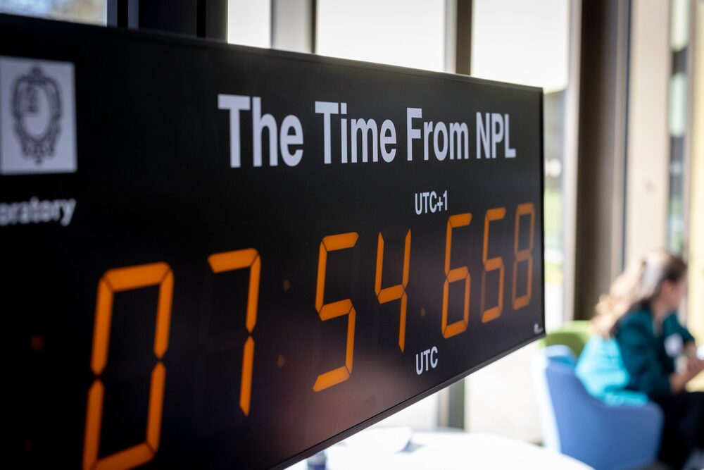
    For the past 30 years, NPL has been operating the UK’s national time scale, UTC (NPL), and for the past eight years it has been disseminating NPLTime, an end-to-end fibre-based timing service that has been supporting the finance sector with regulatory compliance.

    The partnership between NPL and Vodafone will develop a telecom version of the NPLTime service that meets stringent ITU standards for signal accuracy, stability, resilience and traceability. More specifically, the new service will deliver a terrestrial reference signal that is traceable to UTC (NPL) and can maintain accuracy within 40ns.

    At the end of the trial, the new service will meet the accuracy requirements of most sectors in the UK and offer the potential for telecommunications operators to extend the reach of a UK sovereign time source to other industries. Vodafone intends to replicate the same telecom timing infrastructure across all Vodafone markets.

    The partnership builds on the UK government’s efforts to increase resilience for position, navigation and time (PNT) for the UK’s digital infrastructure as well as on NPL’s role in delivering the National Timing Centre (NTC) program.

    “Our work with the National Physical Laboratory marks a significant step in reducing over reliance on GPS-based timing and strengthening the foundations of our future-ready 5G Standalone network,” said Andrea Donà, chief network officer, VodafoneThree. “By testing a terrestrial timing solution we’re helping to ensure that our £11 billion investment delivers a network that is not only faster and more reliable, but also more secure and resilient for our customers.”

  • UK scientists unite to map southwest coast seabed

    UK scientists unite to map southwest coast seabed

    The UK Centre for Seabed Mapping (UK CSM) will undertake a seabed mapping survey – CSM2026 – to explore and map the seabed along the UK’s southwest coastline.

    The research survey takes place between April 20 and May 19. It consists of two survey legs, starting in Lowestoft, Suffolk, and ending in Falmouth, Cornwall. Throughout the four-week survey, using cutting‑edge survey technology deployed from the Research Vessel Cefas Endeavour, a team of 26 scientists from across the field of maritime research began collecting vital hydrographic, geological and environmental data when they set sail from Lowestoft next week.

    The survey represents an unprecedented level of collaboration within the maritime sector. By combining skills and capabilities in a single survey, the team aim to secure data to deliver the UK government’s commitments and make advances in how the seabed is mapped, understood and managed.

    UK CSM includes more than 30 public sector organizations commited to collect and share high-quality marine data. For the coastline mapping project, the 11 involved are the Maritime and Coastguard Agency (MCA); the UK Hydrographic Office (UKHO); British Geological Survey (BGS); Centre for Environment, Fisheries and Aquaculture Science (Cefas); Department for Environment, Food & Rural Affairs (Defra), The Crown Estate; Historic England; Joint Nature Conservation Committee (JNCC); Agri-Food and Biosciences Institute, Northern Ireland (AFBI); Natural England and the Royal Navy.

    Over the course of the survey, the scientists on board will have the opportunity to work with experts from other public sector organizations, share skills, and source key seabed mapping data that supports a wide range of applications including offshore energy and infrastructure, marine ecosystem science, safety at sea, marine policy, and defense.

  • UK’s Watchkeeper drone program nears the end:  What went wrong and what’s to come

    UK’s Watchkeeper drone program nears the end: What went wrong and what’s to come

    We usually look for what’s new, with innovative drones emerging and gaining traction in commercial and military applications, but this month, news of the termination of a leading UAV program has sparked interest.

    The British Army’s Watchkeeper drone program has long been the subject of criticism over development delays, cost overruns and poor performance. Recent reports that the Watchkeeper fleet could be retired as early as 2025 — though that timeline may now slip to 2027 — have renewed scrutiny of the troubled effort. Perhaps a review of the story behind this drone adventure may be in order.

    The UK has been involved with drone operations going back into the 1960s, giving this military force deep experience and expertise in the field. Political support has enabled significant investment over time. When the Watchkeeper program was rolling in 2004-05, the US was moving toward the MQ-9 Reaper project, and military forces around the world were building their own mil-spec UAVs, mostly for surveillance to support military ground operations.

    At that time, few commercial drones existed beyond radio-controlled model aircraft flown by hobbyists. The idea was growing in China at that time for DJI and quad-copters, so these multi-use UAVs eventually emerged, and have led to a multitude of outfits elsewhere also making commercially available drones.

    When the Watchkeeper program took shape in 2004, developing a custom platform was essentially the only way for the UK to obtain a medium-altitude ISTAR intelligence, surveillance, target acquisition and reconnaissance (ISTAR) drone tailored to its requirements. The Ministry of Defence identified Israel-based Elbit Systems, which produced the Hermes 450 military drone, as a close match. The program was built around an extensively modified version of that aircraft, with the goal of bringing production to the UK

    Hermes 450 (Photo: Nehemia Gershuni-Aylho)
    Hermes 450 (Photo: Nehemia Gershuni-Aylho)
    Watchkeeper-X export version (Photo: U-tacS)
    Watchkeeper-X export version (Photo: U-tacS)

    In 2005, the U.K. Ministry of Defence awarded a £775 million contract to U-TacS, a joint venture between Thales UK and Elbit Systems, for the design, manufacture and support of 54 Watchkeeper WK-450 drones. The modifications involved making the UAV all-weather capable, including Thales integrated radar/GPS system for automated landing and take-off (Magic-ATOLS), Thales MASTER SAR/GMTI radar, dual electro-optical/IR cameras, laser designator, and tweaks to the Line-of-Sight radio system, with a satellite link option. Nevertheless, the range of the radio limits operation to within less than 100 miles of the mobile base-station, but it did provide a high-bandwidth, secure, direct, unobstructed wireless link for control and real-time video and targeting data back from the vehicle.

    Cost overruns and delays pushed the first flight to 2008 in Israel. Production of the WK-450 was then established at Thales UK, formerly Racal Electronics. The technology transfer between the two companies, separated by more than 2,000 miles, operating across different corporate cultures and exchanging proprietary material, proved more difficult and time-consuming than anticipated.

    The program delivered its first aircraft in 2014. Four drone systems flew in Afghanistan during the British troop withdrawal, logging a total of just 140 flight hours. Performance fell short of expectations, particularly the system’s all-weather capability, which proved inadequate in Afghan conditions. The U.S. military encountered similar challenges with sand contamination of helicopters and fixed-wing aircraft during early operations in Iraq and Afghanistan.

    As time rolled by, Watchkeeper found some use in Cyprus and in the UK, mostly for training, but problems continued. Between 2014 and 2022 eight vehicles crashed, and most have presumably been written off. Others have apparently experienced unplanned ‘contact with ground’ in more recent times. Faith in the now pretty old drone system has waned with the British forces — even recent political pressure to hand over the remaining fleet to Ukraine has been rebuffed by the Army — maybe too many problems with which to coach Ukraine troops. Watchkeeper is apparently now dismantled for the UK, along with the whole £1 billion investment. But not without gaining a lot of knowledge and operational experience, however an expensive lesson none the less.

    The UK has operated MQ-9A Reapers in Afghanistan, Iraq and Syria for more than 18 years, but after the Royal Air Force’s success with this US drone, these too have been retired in favor of the new MQ-9B Protector. The Protector has been customized and brought up to civilian certification standards by the manufacturer General Atomics. There have been similar sad programs with many ground, marine, and air projects around the world, but this has been such a visible and unhappy tale, it’s sad to see it end, but it’s probably a good thing so that other newer, more promising projects can get funding and become successful.

    Almost in the same breath, another UK company has already been supplying unmanned cargo aircraft to Ukrainian forces for more than three years. Windracer ULTRA is a twin-prop aircraft that can lift 330 lb for up to 620 miles, with 10 hours of endurance at a ceiling of up to 13,000ft. A newer version can reportedly travel twice as far with more payload.

    In Ukraine, the drone has been supplying front-line troop emplacements on a regular basis. The UK has been using ULTRA for surveillance and parachute drop re-supply, middle-mile parcel and cargo delivery to remote destinations, and for aerial surveys in Antarctica and elsewhere.

    So, a commercial start-up got there on its own, no direct government funding other than contracted support, and apparently no JV with another company!  So does 100% government funded development work better than setting up on your own, borrowing a bunch of cash, and doing it yourself? Mil-spec stuff is special with a limited market, so it’s unlikely that governments will ever be able to pick up finished products that fulfil all needs, but as the U.S. is proving with its bulk buy of off-the-shelf small one-way UAVs, these can meet many requirements.

  • Spirent partners with ESA to spearhead PNT resilience initiative for critical infrastructure

    Spirent partners with ESA to spearhead PNT resilience initiative for critical infrastructure

    Project establishes innovative test framework to help UK operators, providers and suppliers adopt best practice and benchmark success

    Spirent Communications, now part of Keysight Technologies, has partnered with the European Space Agency (ESA) to lead an initiative aimed at increasing the resilience of positioning, navigation and timing (PNT) systems used in critical national infrastructure. Under the initiative, Spirent and partners will deliver a comprehensive test framework to drive measurable resilience in PNT systems for users, operators and providers of critical infrastructure in the United Kingdom.

    Supported by Element 2 of ESA’s Navigation Innovation and Support Program (NAVISP), the initiative is designed to raise awareness and improve resilient PNT test and assessment by providing a pathway to assess, validate and rate PNT equipment and services used in critical national infrastructure. The 2023 UK government report The Economic Impact on the UK of a Disruption to GNSS estimates a seven-day GNSS outage could cost the UK economy £7.6 billion. Critical infrastructure is heavily dependent on satellite-based PNT systems and data.

    “For years, organizations have been wrestling with a fundamental challenge: they know PNT resilience matters, but they do not have a clear way to measure it or benchmark their progress,” explained Mark Holbrow, vice president of Engineering and Product Development at Spirent Positioning. “This new initiative changes that by building the tools and frameworks that let critical national infrastructure operators quantify resilience, track it, and improve it over time, and we’re proud that ESA has entrusted Spirent to lead this exciting three-year project.”

    The Resiliency in Critical National Infrastructure will support the UK government’s resilient PNT strategy by enabling access to rigorous, quantitative test evidence and operational insights that help evaluate and validate PNT systems across essential sectors. It will comprise three core components:

    • Spirent PNT Alliance brings together companies, academic research partners, and PNT professional and government bodies to identify, develop and cater resilience services for critical infrastructure. It will include the Royal Institute of Navigation and other strategic partners to complement their activities and help build a resilient PNT ecosystem in the UK by commercializing best practices and connecting infrastructure operators with new technologies and test approaches.
    • PNT Shopfront showcases solutions that aid the adoption of resilient PNT and help to assure regulatory compliance for critical PNT dependencies.
    • PNT Resiliency Health Check will enable independent appraisal of GNSS equipment capability against general performance, resilience and security criteria. Annual health check assessments will help organizations understand their dependencies, identify vulnerabilities, and track improvements over time, with a technical framework that scores resilience against standard benchmarks to create a pathway toward industry-wide test methodologies.

    “Intentional and malicious disruptions to GNSS are now a daily occurrence, and are pervasive in the aviation and maritime sector,” said Ramsey Faragher, director of the institute. “The Royal Institute of Navigation is focused on raising awareness to these issues and in promoting the needs for improved resilience against such disruptions, especially within Critical National Infrastructure. Our Best Practice Guidelines emphasize the criticality of thorough testing in order to verify resilience and to help protect against both existing and future attack vectors. The UK is well placed to take a lead in this area, and well placed to inspire other nations to follow suit. We are really pleased to see initiatives like these from our corporate partners, and we look forward to supporting them.”

  • UK invests in satellite timing infrastructure to strengthen national PNT resilience

    UK invests in satellite timing infrastructure to strengthen national PNT resilience

    GMV is leading the development of a secure two-way satellite time and frequency transfer system under the European Space Agency’s TOUCAN project.

    The initiative safeguards critical infrastructure by reducing reliance on GNSS and enhancing national positioning, navigation and timing (PNT) capabilities.
    Funded by the UK Space Agency through its membership in ESA’s Navigation Innovation and Support Program (NAVISP), the project is an important part of the UK Government’s Framework for Greater PNT Resilience.

    Through a competitive process, GMV was selected to enhance the UK’s national capabilities in delivering nationally assured, secure and continuous PNT services for critical infrastructure, defense and the broader economy.

    TOUCAN, the two-way satellite time and frequency transfer capability demonstration (TWSTFT), will draw on GMV’s expertise in time transfer and system-level engineering, reinforcing the company’s role in supporting the government’s PNT resilience efforts.

     TOUCAN represents a strategic milestone for GMV. It underscores our commitment to delivering cutting-edge, nationally assured, PNT solutions that are vital to the UK’s critical infrastructure and national security,” said Mark Dumville, general manager of GMV in the UK.

    eLoran support

    TOUCAN complements efforts to reestablish a UK eLoran system, which will serve as a terrestrial backup to satellite-based services. A critical goal is to ensure that this system operates independently of the more vulnerable GNSS.

    The project’s primary objective is to establish an accurate, independently verifiable TWSTFT link between the eLoran transmitter and the National Physical Laboratory (NPL), the UK’s official timekeeping authority. The new link will address GNSS-dependence within eLoran, maintaining a time traceable to UTC (NPL).

    In addition, the system will provide a TWSTFT connection to a facility that operates an R&D timescale, a secure reference that will one day be essential for synchronizing operations, maintaining communication integrity, and supporting mission-critical systems.

    “Precise and secure timing is at the heart of so much we rely on every day, from banking and transport to energy and communications,” said Paul Bate, CEO of the UK Space Agency. “This investment in UK satellite timing through TOUCAN is about more than technology; it’s about protecting the everyday services people and businesses depend on. By working with GMV, the PNT Office and ESA’s NAVIS program, we’re helping to build a stronger, more resilient space ecosystem that safeguards our security and keeps the UK at the forefront of innovation.

    GMV is delivering the design, integration and operational demonstration of the system, building on its proven track record in delivering secure national timing products and infrastructure. Project partner Viasat is supplying satellite bandwidth, as well as supporting GMV in analyzing innovative TWSTFT technology evolutions.

  • RIN report: How GNSS interference harms maritime safety

    RIN report: How GNSS interference harms maritime safety

    The UK Royal Institute of Navigation has released a special report on GNSS-interference and its impact on the maritime sector.

    Impacts of GNSS Interference on Maritime Safety is a special report by the RIN Maritime GNSS Interference Working Group on the impacts of GNSS Interference. Survey data was compiled from more than 100 sector experts and 300 vessel captains, supported by interviews with dozens of people involved in the operations and supply chain of vessels that regularly encounter GNSS interference.

    GNSS interference refers to anything that disrupts a ship’s satellite-based positioning signals, usually caused by jamming and spoofing.

    In 2025, at least two collisions and groundings were reported in mainstream media linked to GNSS interference in regions such as the Baltics, Straits of Hormuz and the Red Sea. With hundreds of vessels being affected daily, the RIN report details for the first time the scale of the problem on modern digital vessels, where GNSS jamming and spoofing present a significant cybersecurity vulnerability and urgent risks to maritime safety.

    Survey data exposes the vulnerability of critically important systems such as Global Maritime Distress and Safety Systems (GMDSS) and other SOLAS-mandated equipment that rely on satellite positioning and timing. 

    “The report has highlighted serious safety concerns and has underlined the fact that these issues are rooted in significant cybersecurity vulnerabilities, and are not just disruptions to navigation,” said Ramsey Faragher, director of the RIN. 

    Operating within regions of known GNSS interference carries serious safety-of-life and liability implications, as key systems are expected to fail or malfunction with high probability in these conditions. The report also highlights unnecessary dependencies between GNSS receivers and a range of onboard electronics — including radar, radios (VHF/MF/HF), Navtex, speed logs, ship clocks and satellite communications — many of which do not require GNSS data for their primary function, creating avoidable points of failure and compounding operational risk.

    “The issue of GNSS interference must be taken seriously. It cannot be overcome by traditional navigation techniques when GNSS receivers are ‘baked in’ to modern ships’ critical systems, including safety systems,” said Ivana-Maria Carrioni-Burnett, maritime captain and chair of the RIN Maritime Navigation Group. “These are no longer isolated incidents and pose a real risk to life: people, property and the environment. We must do more to safeguard our seas today and the shipping of tomorrow.”

    “Despite measures to improve resistance to jamming, spoofing and other harassment measures, the threat is real and growing,” said Retired Commodore James Taylor OBE and fellow of the RIN advises. “And this threat is not only to positioning and navigation; it is to every part of every transport and navigation means and to every part of national infrastructure where timing is derived from space-based timing signals.”

    The Royal Institute of Navigation will continue to work with report partners (GLA, IALA, Nautical Institute and others) and regulatory bodies to provide expert guidance to mitigate these issues, and to establish industry-wide adoption of solutions to this problem. RIN thanks National PNT Office for its support.

    Download the report for free.

  • UK identifies issues in addressing PNT resilience

    UK identifies issues in addressing PNT resilience

    The United Kingdom has issued a summary of input it requested on positioning, navigation and timing (PNT) technologies. The UK deems PNT resilience critical for the UK’s economy.

    The 2023 Government Policy Framework for Greater PNT Resilience included an action to “develop a PNT growth policy, including R&D programmes, standards and testing, to drive innovation for PNT based productivity.”

    After a call for evidence, the UK Department for Science, Innovation & Technology received 128 responses from business, industry, academics and the public. These views on opportunities and challenges for the UK’s PNT industry are gathered in a document available online.

    Key themes identified

    • A viable market exists for GNSS-independent PNT, with respondents citing applications in defense and critical infrastructure.
    • Awareness of GNSS vulnerabilities in end users and critical infrastructure sectors is low.
    • Potential opportunities in GNSS-independent PNT and other technologies include eLoran, LEO-PNT, 5G, quantum PNT, inertial systems, and applications for GNSS-denied environments.
    • Short-term challenges include funding constraints and a lack of legislation and standards.
    • Long-term challenges include scalability, lack of sovereign manufacturing capability, and insufficient planning .
    • The industry is experiencing a skills shortage, especially in engineering, with a limited talent pipeline and lack of dedicated training opportunities.

    In all, 128 responses were received from businesses (sellers and users of PNT), academics, industry bodies and the public. Respondents could select multiple sectors when describing their background; the defense sector was selected most frequently (39 responses), followed by space (35 responses), aviation and drones (28 responses), maritime (28 responses) and communications (27 responses).

    Responses will be used, along with wider research, to inform future government policy interventions to support the UK PNT sector.

  • UK Working Group discusses next steps to protect PNT

    UK Working Group discusses next steps to protect PNT

    The UK Hydrographic Office (UKHO) hosted the UK’s first cross-government geodesy, positioning, navigation and timing working group in October. Representatives from 19 government bodies shared insight on the risks, opportunities and interdependencies linked to PNT systems, including GNSS.

    On Nov. 19, the UK announced a £155M investment in PNT. The working group will continue to support collaboration and exchange knowledge as further resilience actions progress, according to the UKHO.

    GNSS supports critical activities across the UK economy. It provides accurate location and timing for communications, maritime and aviation safety, and the smooth running of power and financial networks. As threats to space-based systems grow, improving national resilience is increasingly important.

    “The UKHO’s expertise in geodesy plays a key role in helping the UK understand and protect PNT services. Our specialists provide trusted positioning and timing advice across defense and civil programs, including supporting the safety of navigation in UK waters,” the agency said.

    “It is fantastic to hear that the work with eLoran, GNSS Interference Monitoring Programme, Space Based Time Transfer and the National Timing Centre have received ongoing funding,” said Joe Pearce, senior geodesy and PNT specialist, UKHO. “This funding will assist both our data collection and the mariner. It will protect and assist future geodesy and PNT, improving resilience as these systems come increasingly under threat.”

    The UKHO also provides information on how to protect against GNSS and AIS jamming and spoofing for vessel operators.

  • Royal Navy trials quantum navigation systems with University of Sussex

    Royal Navy trials quantum navigation systems with University of Sussex

    The UK Royal Navy‘s Disruptive Capabilities and Technologies Office (DCTO) recently teamed up with scientists from the University of Sussex to test new navigation sensors developed to reduce reliance on GPS navigation.

    The ultra-sensitive quantum sensors measure tiny variations in the Earth’s magnetic field, offering a new way to pinpoint locations when satellite signals are jammed or unavailable.

    “We are excited and pleased to have supported this first sea trial with the University of Sussex and its quantum magnetometer technology,” said Commander Matt Steele, from DCTO. “We are also grateful to our colleagues in the Hydrographic Exploitation Group for providing one of its vessels and crew to provide a test platform.

    “To ensure it can resiliently operate in GNSS-denied and degraded environments, the Royal Navy continues to explore and accelerate the development of alternative means of navigation, such as this magnetic sensor, while positioning itself as a pioneer ‘quantum-enhanced navy’.”

    “GPS or GNSS signals are highly vulnerable to disruption: they can be jammed or spoofed, and they fail entirely underground, underwater, or in heavily obstructed environments,” said Tom Coussens, Research Fellow in Quantum Science and Technology at the University of Sussex. “This vulnerability has serious economic and operational consequences. While alternative systems such as inertial navigation and visual recognition exist, none simultaneously meet all critical requirements: long-term positional accuracy, weather independence, and resistance to jamming.”

    In the trials, a team from the university worked with the Royal Navy’s Hydrographic Exploitation Group who survey waters, recording details of depth, seabed objects and composition. The university used its Optically Pumped Magnetometers in open waters, with the trials taking place from His Majesty’s Naval Base Portsmouth.

    In addition to navigation, they also successfully mapped surrounding magnetic signatures, pointing to new methods for detecting vessels, undersea features, and potential hazards.

  • UK, France partner to protect GNSS for critical infrastructure

    UK, France partner to protect GNSS for critical infrastructure

    United Kingdom and French experts will work more closely to increase the resilience of both countries’ critical infrastructure to the signal jamming experienced in the war in Ukraine. The agreements are part of a suite of joint science and tech work.  

    The conflict in Ukraine has shown how new technologies — in some cases, small handheld devices — can be used to disrupt positioning, navigation and timing (PNT) services, potentially causing major disruption.

    As part of a raft of UK-France joint science and tech efforts announced July 10, researchers from both countries will work together on technologies that complement GPS, which are highly resistant to this sort of jamming.  

    For instance, the e-LORAN program, driven by the UK government, is working closely with the National Physical Laboratory and private sector companies. The system uses ground-based radio towers, which are much more challenging to block, for a reliable “backup” to GPS, so that UK infrastructure can keep running even when GPS fails.  

    The UK’s Science and Tech Secretary Peter Kyle used a joint visit to Imperial College London, with French President Emmanuel Macron, to set out how such a collaboration makes both the UK and France stronger and safer. While speaking at Imperial, Kyle pointed out the tens of millions of pounds in investment being brought into the British tech sector through UK-French trade, as well as the new jobs and growth that this partnership creates.

    These efforts will bolster the economic and national security of both countries, according to Kyle, which are foundational pillars of the Plan for Change.

    The UK and France also are launching a partnership on supercomputing. The partnership will be led by the Bristol Centre for Supercomputing, the home of Isambard-AI, and the French computing centre GENCI, who lead France’s AI Factory.  

    Closer ties between both nations’ compute power and sharing AI best practice will turbocharge the breakthroughs in AI, transforming public services and improving lives, Kyle said. These efforts build on the AI Opportunities Action Plan, the UK government’s blueprint to fuel the use of AI across the economy. It builds on the strong existing UK-France cooperation on AI. The UK’s AI Security Institute and France’s INESIA have committed to further technical workshops to deepen their collaboration on frontier AI research to support national security. 

  • Key updates in unmanned systems

    Key updates in unmanned systems

    Iran is in the process of initial field testing of a new drone aircraft carrier — the Shahid Bagheri — a converted container ship.

    Featuring an angled flight deck and ski-jump ramp, the ship seems well-equipped to launch large drones. Two additional drone-carrier vessels, the Shahid Mahdavi and Shahid Roudaki, have also been spotted during sea trials alongside this latest member of the Iranian Shahed drone-carrier fleet.

    The objective seems to enable Iran to extend its drone attack capabilities across the Gulf, which is likely to concern Israel, the United States, and their allies. Nevertheless, the drone-carrier vessels do not appear to possess advanced defense systems, nor are they accompanied by destroyers or equivalent support. As such, they may be highly vulnerable to drone attacks.


    In 2004, the UK launched the Watchkeeper drone program, led by Thales UK and Elbit Systems through their joint venture, U-TacS. The program was contracted for £700 million ($852 million), with the first flight expected in 2006.  It centered around the Elbit Hermes 450 drone with substantial modifications. The 2006 date slipped significantly as costs climbed through 2010, and authorization for military training only happened in 2014. However, the rollout for operational use was still delayed. During those initial tests, one in seven drones crashed in circumstances often associated with bad weather — not good for a drone designed and intended for all-weather operations. The trials were moved to locations with better weather conditions.

    Initially featuring limited surveillance and target acquisition capabilities, the Watchkeeper WK450 drone has been enhanced with upgrades that include synthetic aperture radar and ground-moving target indication, in addition to its original electro-optical/infrared sensor.

    Photo:
    Watchkeeper flight in April 2013. (Photo: UK MOD)

    The drone was used for English Channel patrol and for some uncontested airspace surveillance and targeting missions in Afghanistan. It was most recently fielded in NATO exercises in Estonia, flying in different weather conditions to verify airspace deconfliction and interoperability with Estonian air traffic control.

    Unfortunately, program delays, which have sometimes been associated with over 1000 additional UK requirements during the development cycle, difficulties in training, cost growth from the original £700 to an ultimate program cost of £1.35 billion ($1.64 billion), along with obsolescence brought on by the years of delays — these have all now doomed the Watchkeeper drone program to retirement, which the UK recently announced.

    Watchkeeper drones were eventually priced at $5.2 million each for a quantity of 45 to 54, for a task which today’s drones, costing maybe $30 thousand, are much more capable. A fate also perhaps brought on by the fantastic rate of evolution for today’s commercial drones versus the well-trodden, somewhat lengthy path of mil-spec development programs.


    The US Air Force has established an advanced technology test area at Eglin Air Force Base (AFB) — the Autonomy, Data and AI Experimentation Proving Ground. Near Earth Autonomy (NEA) recently worked with Eglin to demonstrate the capabilities of its Griff 135 multicopter drone and its autonomous avoidance capability.

    NEA has developed avoidance and autonomous navigation capability, which allows its drones to fly beyond visual lines of sight by knowing their location with respect to the environment around them. With optical and electronic sensors, the drone builds a point-cloud image of its surroundings on a separate computer from that which manages its autonomous behavior. The two systems interact to provide autonomous flight, including obstacle avoidance, take-off and landing, and, in several cases, the delivery of special cargo, such as blood and medical samples.

    In the case of the Eglin tests, the objective was for the Griff 135 to interact with a Service-Malory TRV-150 cargo drone operated by the 413th Flight Test Squadron. Now, we have a four-rotor cargo drone capable of carrying 150 lb of cargo and an eight-foot quadcopter capable of destroying each other in a potential collision. First, they are independent; one is manually operated, and the other has an autonomous capability. But who knows if it can see, detect, and avoid another fast-moving drone in the same airspace? So, the flight test had the two crossing paths to verify, detect, and avoid by NEA drone. Two flight sessions and the Griff-135 did a good job seeing, computing and executing multiple avoidance maneuvers.

    Photo:
    NAE UAV. (Photo: NAE)

    NAE was awarded a NASA Small Business Innovation Research grant for its autonomous aircraft inspection technology. Before a flight departs, one of the crew members inspects the aircraft, checking flight controls, lift surfaces, and tires for any damage or issues that could impact the upcoming flight or need maintenance later. Engineering personnel also conduct visual inspections, though perhaps not for every flight, to frequently verify the aircraft’s integrity.

    NAE has collaborated with NASA and Boeing to create autonomous software that allows their drone to conduct a thorough visual inspection of aircraft. The FAA mandates an inspection card outlining the requirements and the specific path around the aircraft for inspections. NAE has integrated these requirements into its drone, resulting in an automated inspection process that captures a high volume of detailed photographs from every part of the aircraft. This automated system completes inspections in approximately 30 minutes, in contrast to manual inspections, which can take up to four hours. The system is reportedly progressing toward the commercialization stage.

  • Royal Navy demonstrates quantum-sensing technology for alternative PNT

    Royal Navy demonstrates quantum-sensing technology for alternative PNT

    The Royal Navy has successfully tested a new quantum sensing technology designed for underwater detection. Conducted off the coast of Plymouth aboard HMS Magpie, the trials aimed to evaluate the effectiveness of this quantum-sensing system in identifying submerged objects.

    The technology leverages ultra-cold atoms to measure subtle variations in the Earth’s magnetic field, which indicate underwater objects. This method allows for the detection of items that traditional sonar systems might miss, enhancing the precision of underwater surveys.

    During the tests, the system identified various targets, including a concrete block weighing one ton, and demonstrated sensitivity sufficient enough to detect objects as small as a soccer ball.

    This project is part of a broader collaboration involving the Royal Navy, the Defense Science and Technology Laboratory (Dstl) and industry partners. It reflects ongoing efforts to integrate advanced technologies into naval operations, aligning with the UK’s strategic focus on quantum technologies.

    Future plans include further development and miniaturization of the quantum sensing system to enable its deployment on various naval platforms, such as ships and submarines, as well as autonomous underwater vehicles. The successful trials indicate that this technology could significantly improve the Royal Navy’s capabilities in maritime security and underwater exploration.