The UK Ministry of Defence will construct a new anti-jamming test facility at Boscombe Down in Wiltshire, England. This facility is designed to safeguard military equipment from threats posed by GPS jamming. A £20 million ($26 million) contract has been awarded to the defense technology firm QinetiQ, which will create one of Europe’s largest anechoic chambers, set to be operational by 2026.
This facility, referred to as a “silent hangar,” will accommodate large military assets such as Protector UAVs, Chinook helicopters and F-35 fighter jets, allowing for comprehensive testing against electronic warfare threats. Maria Eagle, the minister for defense procurement and industry, said that this facility will help eliminate vulnerabilities in military systems, thereby enhancing national security and better protecting armed forces during global deployments.
The hangar will be engineered to minimize radio-frequency wave leakage, ensuring that testing does not interfere with local emergency services and air traffic control. Additionally, according to the UK Ministry of Defence, the project is expected to generate 20 new jobs in the Boscombe Down area and will support broader applications beyond defense, benefiting various sectors of government and industry.
AUKUS, the trilateral security partnership between Australia, the United Kingdom and the United States, deployed autonomous and artificial intelligence (AI)-enabled sensing systems during the Resilient and Autonomous Artificial Intelligence Technology (RAAIT) trials, showcasing advancements in their Pillar II advanced capabilities initiative.
The trials took place at multinational Project Convergence exercises hosted by the United States Army. Military personnel from the three AUKUS nations tested autonomous and AI-enabled sensing capabilities in a multi-domain battlespace—land, maritime, air, and cyber—that minimized the time between sensing enemy targets, deciding how to respond, and responding to the threat.
Once integrated into national platforms, these new sensing systems are designed to provide more reliable data, which can enable commanders to make optimal decisions and allow service members to respond more quickly to kinetic threats.
During the RAAIT exercise, a sophisticated plug-in for the Tactical Assault Kit (TAK) demonstrated impressive capabilities in enhancing military operations. This map-based software application allowed a UK RedKite UAV to dynamically detect opposing force locations by making real-time adjustments based on collected data. Simultaneously, a second UAV provided high-resolution imagery for confirmation. The integrated system seamlessly transmitted this critical information to the Tactical Operations Center (TOC), where a designated “AI officer” provided essential human oversight. Upon verification, the officer authorized an Australian XT-8 UAV to execute a simulated strike. The success of this TAK plug-in has prompted the U.S. Air Force Research Laboratory (AFRL) to plan its wider distribution, showcasing the potential for enhanced interoperability among AUKUS partners.
“It used to be that each nation used its own datasets to develop separate models and deploy those models on their own platforms. Under RAAIT, we’ve matured the AI pipeline, focusing on interchangeability and interoperability, which allows for any combinations of datasets, models, algorithms and platforms to be used across all three nations,” said Dr. Kimberly Sablon, the Principal Director of Trusted Artificial Intelligence and Autonomy in the Office of the Under Secretary of Defense for Research and Engineering.
Lessons learned at the RAAIT trials will be used for future training events. The AUKUS Artificial Intelligence and Autonomy (AIA) Working Group hopes to use these findings to develop an AIA ecosystem that will one day enable the three partner nations to share data for operational success in contested environments.
In October 2023, the United Kingdom’s government announced a 10-point “policy framework” to greatly increase the nation’s resilience to disruption of vital positioning, navigation and timing (PNT) services.
Two months later, Vladimir Putin began regularly jamming and spoofing GPS for aircraft and ships across a broad swath of the Baltic and northern Europe. It was the world’s first instance of such extensive activity in the absence of armed combat.
Properly executed, Britain’s policy framework will position it as a global leader in sovereign and resilient PNT. It will also provide ample new business opportunities for British businesses to fill this growing need.
The product of years of effort under both Coalition and Conservative governments, the PNT policy framework addresses challenges that have been extensively documented and studied.
The nation’s over-reliance on space- based PNT has long been recognized. Its National Risk Register listed solar activity as a threat to PNT in 2012. When, despite extensive lobbying by the UK, the rest of Europe shut down its Loran transmitters in 2015 to prevent competition with Galileo, Britain kept its single transmitter on air as a national precise time reference. In 2018 a “Blackett Report” documented the nation’s over-dependence, estimated the consequences of service outages and made a series of recommendations. A 2021 economic report further estimated the scale of the problem.
All this well before Russia’s demonstrations of the fragility of GNSS with its attacks on Ukraine and recent aggression in the Baltic.
Yet action on Britain’s way forward was repeatedly deferred.
The sticking point seems to have been deciding upon the mechanics of how the government would deal with the invisible PNT utility, which is a capability essential to every government department and every sector of the economy and society. Should it be in the Department for Transport? Perhaps in Business and Trade or Defence? Some suggested the Cabinet Office should lead addressing the PNT challenge.
The final decision was a cross- government office hosted by the Department for Science, Innovation and Technology. The office includes members from the Ministry of Defence and is tasked with leading and coordinating a whole-of-government approach.
Moving Forward
It is easy to be skeptical about the success of this new enterprise. Regardless of the nation, government policy frameworks, strategies and the like often can be a way for politicians and bureaucrats to create the impression of action without having to ever really do anything. Documents are often published and then go on a shelf, never to be seen again.
That does not seem to be the case here, though.
The very first action item in the PNT policy framework is to “[e]stablish a National PNT Office …to improve resilience and drive growth with responsibility for PNT policy, coordination, and delivery.”
While several of the 10 items begin with “develop a proposal for…,” the projects are both considered and specific, such as a timing system “of last resort” for the Ministry of Defence and the expansion of eLoran.
Britain’s integrated governance and system-of-systems approach to PNT can make the nation virtually immune to the kinds of disruptions and infrastructure challenges being seen in the Baltic and conflict zones around the world.
Achieving that goal will involve the development of new user equipment, systems to prioritize and integrate different PNT sources, new interfaces for various infrastructures, improvements to existing technologies (e.g., an encrypted component for eLoran to make it even more secure and reliable), and new policies for responsible PNT use in critical applications.
When complete, the UK will have the sovereign and resilient PNT it needs to support national, homeland and economic security.
Global Leadership and Profit
Yet Great Britain is not the only nation over-dependent on fragile PNT signals from space provided by others. Most of the world is in the same situation.
By actively promoting and sharing its developing expertise and tech stack, the UK will become a global thought leader and technology provider for sovereign and resilient PNT. A capability that will be in greater and greater demand as malicious actors, both large and small, continue to exploit the weaknesses of satellite-based navigation and timing.
Yet, to realize these benefits, the UK must act swiftly and seize the moment.
At present there is a leadership vacuum in this field. While China has its own extremely robust and integrated PNT system based on a combination of clocks, fiber, terrestrial broadcast eLoran, and space, it does not seem eager to export that to others. China may prefer to woo nations into dependence on its BeiDou satellite PNT system, rather than enabling others’ sovereignty.
Additionally, while entrepreneurial South Korea has implemented its own space-based, eLoran and fiber PNT, it is unclear how integrated the various sources are. We have also seen no evidence that they have plans to share, or sell, their success to others.
As disruptions to GPS and other GNSS continue to increase around the globe, so, too, do calls for and moves toward solutions that include alternatives.
Last year the European Union issued a tender for an integrated GNSS/eLoran receiver. Türkiye has implemented its own local terrestrial PNT systems in several port and urban areas. India envisions expanding its regional navigation satellite system to cover the globe.
Britain has the plans, capability, and resources to become the world leader in this essential and growing technology sector — and the government is working with the Royal Institute of Navigation and other learned bodies to make it a reality.
Yet its window of opportunity may already be closing.
Rather than regarding its PNT policy framework as a routine item of work, we hope the UK government seizes this opportunity for international leadership and reaps all the inherent diplomatic, security and economic benefits.
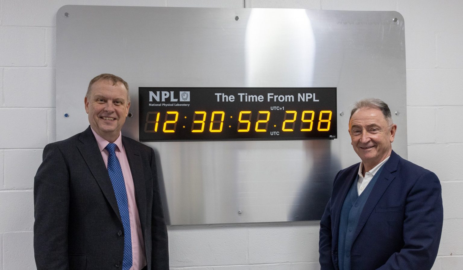
Peter Thompson, Ph.D., CEO of NPL, left, with Jim McDonald, professor at the University of Strathclyde. (Image: NPL)
The National Physical Laboratory (NPL) has marked the inauguration of the first of three innovation nodes designed to enhance the United Kingdom’s capabilities in the development of time-critical technologies. The initiative is aimed at sectors such as transport, telecommunications, fintech and quantum with the application of accurate and precise timing.
In a collaborative effort between NPL and host organizations, including the University of Strathclyde, the University of Surrey and Cranfield University, the Innovation Nodes stand as a cornerstone of NPL’s National Timing Centre Programme. It represents the UK’s nationally distributed time infrastructure and offers secure, reliable, resilient and highly accurate time and frequency data. This infrastructure is crucial for the development of new technologies in time-critical 5G and 6G applications, next-generation automated factories and connected autonomous vehicles.
Throughout the development phase, the node sites at the Universities of Strathclyde, Surrey and Cranfield have hosted feasibility and demonstrator projects funded by Innovate UK, the United Kingdom’s innovation agency. These projects have benefited from technical consultancy and access to high-accuracy timing signals, which encourage the development of new products and services. These initiatives were created as an effort to establish an evidence base for redistributing positioning, navigation and timing (PNT) data to air and ground-based autonomous systems within a smart city infrastructure. This will ensure the safety, reliability and security of autonomous transport.
NPL welcomes collaboration with industry and academia to leverage the Innovation Nodes for access to traceable and high-accuracy timing signals and promises to stimulate further innovation and development in critical sectors.
Professor Paul Griffin of Strathclyde’s Department of Physics pointed out the vulnerabilities of GNSS to jamming and spoofing, underscoring the NTC’s mission to provide robust timing for the UK independent of GNSS. The initiative includes the use of atomic clocks at Anthorn in Cumbria, aligning with UTC through the NPL Time Over eLoran (NTOL) project, led by Chronos Technology. This project demonstrates the transmission of NPL’s timebase via eLORAN and its decoding by Strathclyde’s Power Networks Demonstration Center (PNDC), which is a significant advancement in securing the country’s timing infrastructure against potential threats.
A plane carrying British Defense Secretary Grant Shapps had its satellite signal jammed as it flew near Russian territory, the government reported on March 14.
The government said that the Royal Air Force jet carrying Shapps, officials and journalists “temporarily experienced GPS jamming when they flew close to Kaliningrad” on a flight from Poland to the UK.
The Times of London, whose reporter was onboard, said that for about 30 minutes mobile phones could not connect to the internet and the aircraft was forced to use alternative methods to determine its location.
Kaliningrad is a Russian enclave bordered by Poland and Lithuania, home to the Russian Navy’s Baltic Fleet. Prime Minister Rishi Sunak’s spokesman, Dave Pares, said “the jamming didn’t threaten the safety of the aircraft at any point.” He added that it is not unusual for aircraft to experience electronic jamming near Kaliningrad.
Representatives from organizations involved in the UK Sovereign Satellite Based Augmentation System. (Image: Viasat)
Viasat, a global communications company, has successfully demonstrated the UK Satellite-Based Augmentation System (UK SBAS) during a recent test flight. This demonstration, conducted as part of an ongoing trial funded by the Department for Transport through the European Space Agency (ESA), showcased the potential of UK SBAS to provide accurate GPS data to improve safety and operational efficiency.
“The trial on a sovereign UK SBAS is all about delivering trust. Trust for pilots in their tracking systems to stay safe in challenging conditions. Trust for the aviation industry more broadly so it can rely on data to operate more efficiently,” said Todd McDonnell, president, international government, Viasat.
The test flight, carried out from Cranfield Airport using the National Flying Laboratory Centre’s Saab 340B aircraft, demonstrated the capabilities of a UK-based SBAS to deliver more precise and reliable navigation data. With the UK no longer part of the EU’s European Geostationary Navigation Overlay Service (EGNOS), the trial aims to pave the way for a complementary UK SBAS, specifically designed for critical safety-of-life navigation services across air, land and sea.
UK SBAS operates by merging ground monitoring data with satellite connectivity, which offers positioning accuracy down to a few centimeters. The system aims to significantly enhance safety in aviation by providing pilots with confidence in their onboard instruments, particularly during challenging weather conditions where visibility may be limited.
The successful aviation test marks a crucial step in further trials across various transport applications, including rail, unmanned aerial vehicles, and autonomous road vehicles, said Viasat.
Fully funded by the government through ESA’s Navigation Innovation and Support Program (NAVISP) program, the trial aligns with broader efforts to deliver high-accuracy, high-integrity positioning services to boost efficiency and innovation across the transport network.
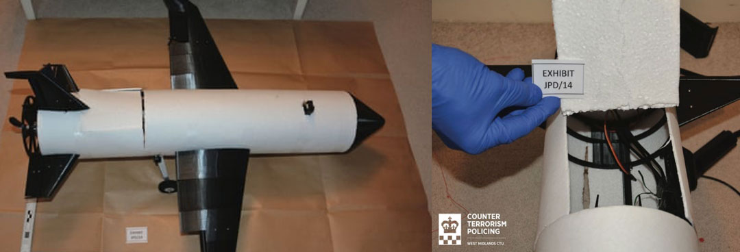
A UK judge just jailed a student for building a UAV. How could that be? Well, the 3D-printed UAV built by a guy in his room at home was only part of the story. It turns out that his jailing was perhaps more related to his connection to the Islamic State of Iraq and Syria (ISIS), and his apparent intent to use this UAV loaded with explosives or a chemical weapon to attack ISIS enemies.
3D-printed drone seized by anti-terror officers and rear access panel (Image: West Midlands CTU/PA)
The experts who analyzed the vehicle stated that it was only partially built and appeared somewhat ‘primitive’ in its construction. It would seem that an explosive charge or chemical weapon would need to be located with its fusing circuitry at the front end of the UAV, and maybe the enclosure was rather an access panel to aid the build process.
It is unclear whether the protruding black item towards the front of the UAV is either a GNSS or communications antenna. This antenna would normally be placed on the upper skin and relatively close to the autopilot or comms radio. It is possible that there is a communications/control signal antenna at the top of the vertical stabilizer. Rudimentary landing gear can be seen aft of the control surfaces of the wing, but the rear propulsion does not appear adequate for the size of the vehicle. Not a bad attempt to create an amateur UAV, but a pretty bad idea for the guy involved to intend it to be a kamikaze, one-way drone for ISIS — he received a 20-year sentence.
Both Russia and Ukraine continue to churn out new models of one-way UAVs, which they enthusiastically hurl at one another. Russia unveiled a new swarm drone known as ‘Product 53’ which apparently has the ability to seek and identify targets autonomously.
With a payload of only 3-5 kg it cannot inflict severe damage on major targets, but the plan is apparently to bombard an area with large numbers of Product 53 controlled as a swarm.
So, Russia’s latest software-driven, sophisticated kamikaze UAV is a far cry from the primitive, partially constructed, 3D-printed UAV which lead a UK court to jail its constructor. Much more was obviously made of his encrypted online contacts with ISIS and his intent to inflict potential death and destruction on behalf of a terrorist group.
On a far brighter note, a Defense Advanced Research Projects Agency (DARPA) project known as Control of Revolutionary Aircraft with Novel Effectors (CRANE), which first went out to industry for proposals back in 2021, has now moved into Phase 3 build and manufacture following a successful Phase 2 Critical Design Review (CDR).
Aurora Flight Sciences, a Boeing Company subsidiary, has been authorized to begin building a 7000 lb X-wing manned/unmanned aircraft. The aircraft is intended to prove out a design for aerodynamic control without the use of moving surfaces.
Illustration of proposed X-Wing aircraft (Image: DARPA)
Elevators, flaps, slats and rudders on conventional modern aircraft require significant internal hydraulics and/or cabling and actuators throughout the airframe, which add to the complexity, and potential failure modes, aerodynamic drag and weight. Most current UAVs emulate these flight control systems and use external control surfaces.
The DARPA X-Wing aircraft may use compressed air jets or even electrical discharges emitted at critical actuation points along its outer surface to ‘gently push’ the aircraft from its existing path through the airstream, which allows the remote pilot to maneuver the aircraft. Known as Active Flow Control (AFC) this technology has been prototyped to one extent or another in recent years, but this DARPA/Aurora project aims to prove the concept.
For the demonstration aircraft, normal moving control surfaces will be installed and retained. The aircraft will initially be flown using these standard airflow controls to form a baseline for how the aircraft performs. The control surfaces will then be locked down and the aircraft will be flown using AFC, and the performance will be compared to the standard controls baseline.
Understandably, the earlier phases of the project likely worked through the required control systems for the unique X-wing configuration. Aurora may have been well positioned to provide such flight control systems, autopilot and software from its store of Guidance, Navigation, and Control (GNC) technology — the basis for the operation of autonomous air vehicles.
Building illicit UAVs intended for terrorism may not be one of the best academic projects to undertake when you’re an ISIS supporter; Russia and Ukraine appear to be in a race to mass produce ever more sophisticated UAVs; and DARPA/Aurora appear to be headed to a relatively heavy prototype air vehicle demonstrating not only X-Wing technology, but also active flight control. Overall, there is a variety of news on UAVs in various configurations and applications.
Antenova, a UK-based manufacturer of IoT (Internet of Things) antennas and GNSS modules, has released the Admotus antenna, the latest addition to its product line of ceramic antennas.
The Admotus is a surface-mount ceramic antenna designed for connectivity on L1 GNSS signals on all constellations, including GPS-L1 at 1575.42 MHz; GLONASS L1, 1602MHz; Galileo L1, 1575.42 MHz; BeiDou (B1); and QZSS. The compact antenna offers comparable performance to a small patch antenna on a small ground plane.
The ceramic antenna has an ultra-low profile measuring a mere 1.0 x 0.5 x 0.5mm, requires 7.0 x 15mm clearance area and offers improved performance on small PCB sizes.
It offers a peak gain of 0.9dBi with an average gain of –2.6dB and offers maximum return loss of –11.5dB and a maximum VSWR 1.8:1. A companion evaluation PCB is also available for internal analysis.
The Admotus ceramic antenna is suitable for all GNSS positioning applications in the L1 band (1559 – 1609 MHz) such as wearable devices for fitness and medical monitoring, small portable tracking devices used to track keys, pets, bikes, UAVs, agricultural robotics and telematics devices.
IBM, a global technology provider, has released its latest geospatial artificial intelligence (AI) initiative to address climate change. These efforts involve collaborations across various regions and uses advanced AI models designed for geospatial applications.
Central to these initiatives is IBM’s geospatial foundation model, developed jointly with NASA. These models aim to generate environmental insights and solutions related to climate change. Unlike traditional AI models, these use a vast amount of climate-relevant data to accelerate the analysis of various environmental aspects that are affected by climate change.
“AI foundation models utilizing geospatial data can be a game-changer, allowing us to better understand and address climate-related events with unprecedented speed and efficiency,” said Alessandro Curioni, IBM fellow and vice president of Accelerated Discovery.
Analyzing urban heat islands in UAE
IBM and the Mohamed Bin Zayed University of Artificial Intelligence (MBZUAI) have partnered to map urban heat islands in Abu Dhabi using a fine-tuned version of IBM’s geospatial foundation model. The goal of the project is to understand the impact of local landscapes on temperature anomalies, the company said. The initial results show a decrease in heat island effects, which can provide valuable insights for future urban design strategies.
Reforestation and water sustainability in Kenya
In partnership with Kenya’s Special Envoy for Climate Change, Ali Mohamed, IBM is supporting the National Tree Growing and Restoration Campaign. The initiative aims to plant 15 billion trees by 2032, particularly in critical water tower areas affected by deforestation. IBM’s geospatial model powers a digital platform to track tree planting activities, aiding local efforts in restoring forests and measuring carbon sequestration impact.
Elevating climate resiliency in the UK
In collaboration with the Science and Technology Facilities Council (STFC) and Royal HaskoningDHV, IBM is developing AI-driven tools for climate risk assessment in the UK. These tools will focus on assessing weather impacts on aviation operations, the company said. Additionally, the TreesAI research project aims to map areas suitable for tree planting to mitigate surface water flooding and offer urban developers a digital planning platform.
IBM extends collaboration with NASA for weather forecasting
IBM and NASA have partnered to develop an AI foundation model dedicated to weather and climate applications. The collaboration aims to enhance the accuracy and speed of weather forecasting, predict wildfire conditions and understand meteorological phenomena. IBM researchers will work closely with NASA to train and validate this model, IBM said.
Point One Navigation has integrated Ordnance Survey base stations into the Polaris Network, which is designed to improve accuracy, precision, reliability and interoperability in the UK. The solutions aim to aid in applications such as advanced driver assistance (ADAS), robotics, mapping and more.
Polaris is a real time kinematic (RTK) corrections network that offers cm-level accurate GNSS positioning. Polaris’ global RTK network now includes the entire United States, EU, Australia, Canada and the UK.
Existing Polaris customers can utilize the UK integration immediately, at no additional cost.
This technology is complemented by the company’s FusionEngine software, which further integrates inertial measurement, wheel odometry and additional sensors to achieve the desired level of precision, even in the absence of satellite signals.
Polaris supports all major GNSS constellations and has a dense global network of base stations, which offers improved precision acquisition time in more places, the company says. The network supports all modern navigation signals across all mobile networks.
According to Point One, it is the first localization service with a modern GraphQL-based API, which aims to improve the integration of Polaris RTK into developer-built applications. It can be used by software developers to integrate RTK into demanding applications, including industrial autonomy, precision agriculture, logistics and delivery, robots and ADAS.
It will support State Space Representation (SSR) corrections delivered by L-band satellites in early 2024, the company says, which will allow for operations to continue in the absence of cellular networks or in bandwidth constrained applications.
BAE Systems’ digital GPS anti-jam receiver (DIGAR) has entered the next phase of the Phase 4 Enhancements (P4E) capability program for the Eurofighter Typhoon.
DIGAR is designed to enhance the Typhoon’s ability to withstand GPS signal jamming, spoofing, and radio frequency (RF) interference, ensuring optimal mission execution in challenging RF environments.
The receiver uses advanced antenna electronics, high-performance signal processing and digital beamforming for improved GPS signal reception and jamming immunity, which aim to increase the level of GPS jamming protection. These capabilities are critical for combat aircraft as they maneuver through a contested battlespace.
This upgrade, coupled with BAE Systems’ GEMVII-6 airborne digital GPS receiver, reinforces the Eurofighter Typhoon’s role as a component in air security for the UK and its international allies.
In addition to Typhoon, DIGAR is also installed on the F-16, F-15, and other special-purpose aircraft in the United States such as air interdiction and force protection platforms, intelligence, surveillance or reconnaissance aircraft and UAVs.
The United Kingdom’s Minister for Science, Research, Innovation announced in Parliament today a 10 point “policy framework” for advancing positioning, navigation, and timing (PNT).
The announcement addressed improvements to both PNT technology and policy.
Six technology efforts were listed:
“National Timing Centre: develop a proposal for a National Timing Centre (NTC) to provide resilient, terrestrial, sovereign, and high-quality timing for the UK (UTC(NPL)), including sovereign components and optical clocks.” This project has been underway for some time and is being executed by the UK’s National Physical Laboratory. The announcement said another £14 million had been identified and was being allocated to the project.
“MOD Time: develop a proposal for ‘MOD Time’ creating deeper resilience through a system of last resort and use NTC provided timing to support MOD.”
“eLORAN: develop a proposal for a resilient, terrestrial, and sovereign Enhanced Long-Range Navigation (eLORAN) system to provide backup position and navigation.” In May, the UK’s spectrum office, Ofcom, sought interest from industry in obtaining eLoran broadcast licenses. The U.S. Department of Transportation issued a similar request for information this month.
“UK SBAS: develop a proposal for a UK Precise Point Positioning Satellite-Based Augmentation System (SBAS-PPP) to replace the UK’s use of the European Geostationary Navigation Overlay Service (EGNOS), monitor GNSS and enable GNSS-dependent high accuracy position for autonomous and precision uses.” Since Brexit, the UK has not been a part of the EU’s Galileo enterprise. This SBAS decision comes after the UK government researched and rejected the idea of establishing its own GNSS.
“Next Generation PNT: deploy existing R&D funding into a UK Quantum Navigator and investigate possible options for a UK sovereign regional satellite system.” Britain has made development of quantum capabilities, including PNT, a particular national focus.
“Infrastructure Resilience: rollout resilient GNSS receiver chips, develop holdover clocks, and consider options for legislation on CNI sectors to require minimum resilient PNT.” The U.S. Executive Order 13905 points in a similar direction as this idea for legislation, which is a good segway to the announcement’s policy provisions.
Four organizational and policy initiatives included in today’s statement in Parliament:
“National PNT Office: establish a National PNT Office in the Department of Science, Innovation and Technology to improve resilience and drive growth with responsibility for PNT policy, coordination, and delivery.” Last year the Resilient Navigation and Timing Foundation reported a cross-government office had been established by the UK that included representation from the Ministry of Defence. That office was within the Department for Business, Energy & Industrial Strategy (BEIS). Since then, BEIS has been split into two departments, one of which is Science, Innovation, and Technology.
“PNT Crisis Plan: retain and update a cross-government PNT crisis plan to be activated if GNSS-provided PNT is lost and identify and implement short term mitigations.” Similar plans exist in the United States. The absence of an interference detection and monitoring system, though, has helped stymie U.S. government efforts to respond quickly and effectively.
“PNT Skills: explore options for centers for doctoral training in timing and PNT and review PNT skills, education, and training for longterm sovereign PNT capability.” A similar need has been identified by the U.S. President’s National Space-based PNT Advisory Board.
“Growth Policy: develop a PNT growth policy, including R&D programs, standards and testing, to drive innovation for PNT based productivity.” The U.S. PNT R&D Plan is a similar effort.
Also mentioned in the statement to parliament are two new PNT documents published today by the UK Space Agency. The first is a summary of technical concepts developed under the Space Based PNT Programme. The second is an updated report on the economic impact to the UK of a disruption to GNSS.