A roundup of recent products in the GNSS and inertial positioning industry from the September 2018 issue of GPS World magazine.
OEM
Reference receiver
For real-time networks (RTN)
Photo: Trimble
The Trimble Alloy GNSS reference receiver is designed for continuously operating reference stations (CORS). It offers 672 channels and constellation tracking of GPS, GLONASS, BeiDou, Galileo, QZSS, IRNSS and SBAS for robust and reliable reference data. With an IP68 rating for protection against dust and moisture, the Alloy performs in rugged environments to meet the demands of professionals in earth science, surveying, construction, mapping and agriculture. The Alloy allows RTN owners and operators to track and log all current and planned GNSS and deliver absolute position monitoring, as well as centimeter-level accuracy in real time with Trimble RTX precise point positioning technology. Featuring a four-line OLED screen, the receiver displays key information without the need to scroll through multiple menus. Other features include dual hot-swappable batteries, multiple power inputs and serial ports, Wi-Fi connectivity and remote access options.
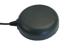
The TW7875 magnetic-mount GNSS antenna is designed for precision dual-frequency positioning. It is capable of receiving GPS L1/L5, GLONASS G1, BeiDou B1, Galileo E1/E5a and NavIC L5. It employs Tallysman’s Accutenna technology, which provides superior multipath signal rejection due to its low axial ratio across the full bandwidth. It also provides a linear phase response and tight phase-center variation. It is designed for precision agriculture, autonomous vehicles and other precision applications. The TW7875 is housed in a magnetic-mount IP67-rated housing, but can also be mounted with screws or adhesive tape. The embedded version, Model TW3875, has a wide selection of connectors and custom cable lengths, and can be custom tuned by Tallysman to ensure optimum performance within the customer’s enclosure.
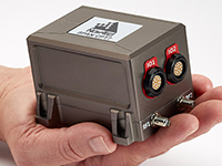
The SPAN CPT7 provides tightly coupled GNSS+INS navigation technology in a rugged, compact unit. Commercially exportable and designed for integration into a wide variety of applications, it delivers assured positioning anywhere. SPAN technology tightly couples GNSS and inertial navigation system (INS) measurements. The system enables continuous, robust positioning and fast reacquisition in challenging navigation environments where GNSS signals may be unreliable or unavailable for short periods. Dual antennas deliver instant alignment. NovAtel’s OEM7 Interference Toolkit (ITK) provides interference detection and mitigation, with the spectrum analysis function allowing integrators to identify interference within the GNSS frequency bands and implement digital filters to eliminate the problem.
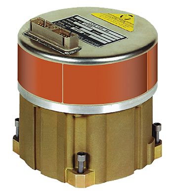
The commercial-off-the-shelf (COTS) LN-200C is a compact and lightweight six-degrees-of-freedom inertial measurement unit (IMU) that can be used for instrument stabilization, motion compensation and navigation in commercial, aerospace and industrial applications. Based on fiber-optic gyro (FOG) technology, the LN-200C IMU’s hermetic seal and lack of moving parts help to ensure low noise and extended operational life. The LN-200C can serve as a drop-in replacement for applications that don’t require the full operational range of the original LN-200 and that can benefit from the expedited licensing and global ease of use offered by the LN-200C.
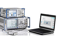
Global Certification Forum (GCF) protocol conformance tests available
Photo: Rohde & Schwarz
The Rohde & Schwarz CMW500 wideband radio communication tester and SMBV100A GNSS simulator have been expanded to support Global Certification Forum (GCF) protocol conformance tests for C-V2X device certification. Utilizing the Qualcomm 9150 C-V2X chipset from Qualcomm Technologies, the R&S CMW500 acting as an LTE network simulator allows automakers to test C-V2X direct communications (PC5) according to GCF Work Item 281. The new R&S CMW-KK550 test package includes the 3GPP Protocol Conformance tests from LTE-V2V GCF Work Item 281 and LTE-V2X GCF Work Item 282. The R&S CMW-KU514 C-V2X software package on the R&S CMW500 is used to verify data transmission and reception over the PC5 interface in ideal, faded and congested channel conditions. Together, both packages enable Rohde & Schwarz to support C-V2X device testing through all protocol layers.
The Multimax FV family is available in a range of configurations, supporting multi-constellation GNSS. The antennas also support up to dual MIMO LTE (including Band 14 for the FirstNet public safety network), 3×3 MIMO Wi-Fi or 2×2 MIMO Wi-Fi. With a small footprint and a strong, bolt-mount aluminum base, the Multimax FV family provides protection against natural hazards threatening vehicles, including vibration, ice, salt, car washes and tree sweeps. The high-gain antennas deliver a large cellular footprint alongside high-rejection GNSS technology (GPS, GLONASS, Galileo and BeiDou).
For Beyond Visual Line-of-Sight (BVLOS) flight operations
Arctic UAV has adopted Kongsberg Geospatial’s IRIS UAS Airspace Awareness application for BVLOS operations within Canada’s Arctic. IRIS provides simultaneous monitoring of multiple drones. It offers real-time calculation of aircraft separation and communications line-of-sight, real-time visualization of track and weather data.
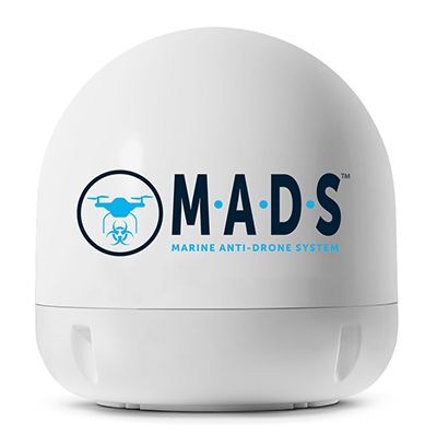
M.A.D.S detects and identifies commercial drones within a 5+ kilometer range, providing GPS positioning of both drone and pilot together with the drone’s speed and heading. Once a drone threat is established, the system enables a 500-meter electronic exclusion zone to be created around the yacht. Should the drone approach this exclusion zone, its control/video signal is blocked, initiating a fail-safe mode and forcing a landing or return to operator.
Operates on the Wave Relay mobile ad hoc network (MANET)
The Auto-Tracking Antenna System is a portable ground-to-air antenna for tracking aircraft, including drones. Defense customers can use it for better airborne communications relay and full-motion video camera/sensor data transmission. It can be assembled and deployed in less than 15 minutes.
Version 6 of Virtual Surveyor drone surveying software offers a faster, more efficient workflow and better user experience in a more stable platform than previous versions. Along with new capabilities is an improved licensing system and an extended free application. The software generates an interactive onscreen environment through orthophotos and digital surface models generated from a UAV, where the surveyor selects survey points and breaklines to define the topography. It enables land surveyors to complement traditional fieldwork with UAV imagery to generate highly accurate topographic products.
Foresights is a risk management and geospatial analytics platform designed to help clients manage forestry assets quickly, effectively and accurately. Foresights identifies areas of new or potential risk, and delivers operations tracking and forest damage management services. It combines satellite imagery, topography maps, soil maps, meteorological data and near real-time ground input from operational teams to deliver optimized insights. It can detect damage as small as 0.1 hectare (0.25 acre) from pests, disease and drought.
EOS Platform provides a powerful toolset for geospatial analysts — offering search, analysis, storing and visualization of large amounts of geospatial data. Image data obtained from LandViewer or uploaded from a user’s computer is stored in cloud-based EOS Storage and is instantly available for remote-sensing analysis or image processing. EOS Processing offers 16 workflows that run online, including raster tools, remote sensing analytics, photogrammetry and proprietary feature extraction algorithms designed by EOS engineers and data scientists to address the main challenges of agriculture, forestry, oil, gas, retail, city planning, defense and other industries.
The Esri book GIS for Surface Water: Using the National Hydrography Dataset by Jeff Simley details how to use geographic information system (GIS) technology to visualize and analyze data sets. Simley is an award-winning cartographer and the former lead of the hydrography program at the United States Geological Survey (USGS). The book examines the complexities of surface water systems and shows readers how to use the Esri ArcGIS software with government water data sets to better study and manage the United States’ vast water system.
EOMAP has opened a commercial online store for global shallow-water bathymetry derived from satellite data. At the store, EOStore Bathymetry, customers can search for and request high-quality data. Satellite-derived bathymetry (SDB) is a valuable tool for the surveying, planning and management of coastal and offshore sites. SDB can provide shallow-water bathymetric data worldwide without the need for a physical presence in the area of interest. EOMAP developed the bathymetry store in response to industry feedback. EOStore Bathymetry offers different horizontal spatial resolutions of the bathymetric grid of 2 to 15 meters, making the data suitable for surveying as well as planning and modeling purposes.
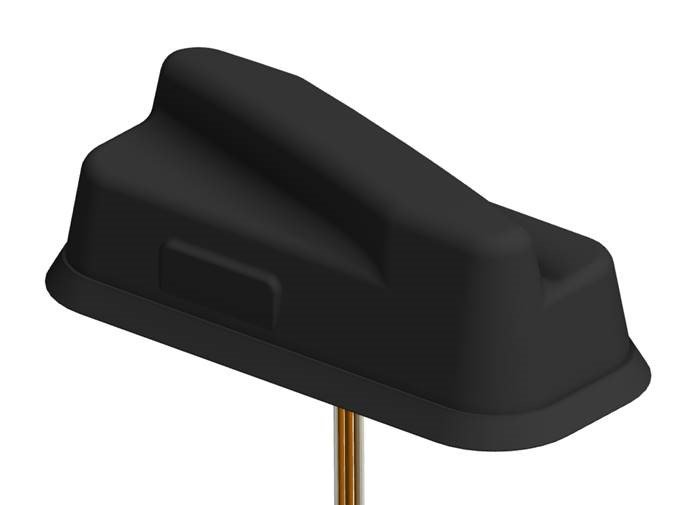
PCTEL Inc. has announced the next generation of its Trooper antenna, the company’s flagship multi-band platform for public safety fleets.
The new Trooper II provides optimal wireless communications performance through the antenna’s 4-port 4G LTE connections and 4×4 802.11ac Wi-Fi MIMO capability, the company said. It also incorporates PCTEL’s newest high rejection multi-GNSS technology for high precision tracking and asset management.
The Trooper II antenna. (Photo: PCTEL)
“The Trooper II antenna enhances PCTEL’s successful Trooper platform, with expanded multi-band RF and GNSS capability in a robust, aerodynamic housing,” said Rishi Bharadwaj, senior vice president and general manager of PCTEL’s Connected Solutions group. “Its slender new design with a single cable exit accommodates installation restrictions often encountered on modern public safety vehicles.”
“Our Trooper antennas have been broadly deployed on public safety fleets, notably in support of the leading FirstNet public safety broadband network systems. The Trooper II is also ideal for many Industrial IoT deployments,” Bharadwaj added.
The rugged Trooper II (part #GL9X1AX-TRB) features PCTEL’s new proprietary high rejection multi-band technology, which supports GPS L1, GLONASS and Galileo for high precision tracking.
In addition to public safety applications, the antenna is suitable for tracking and communications support for industrial internet of things (IoT) and other fleet management applications, including farming tractors for precision agriculture, utility service fleets and railway positive train control systems.
PCTEL will display the Trooper II antenna Aug. 6-7 at APCO 2018, Booth 1719, along with its portfolio of antennas for the public safety industry and grid testing solution for in-building public safety networks.
The Trooper II antenna is available for pre-order now. First shipments are expected in early fall.
Intelligent vehicles and smart devices could gain more accurate location awareness by fusing GNSS and Wi-Fi signals. A test for this is the focus of an Innovate UK project led by Spirent Communications and involving the Warwick Manufacturing Group (WMG) at the University of Warwick.
The £694k Enhanced Assured Location Simulator Leveraging Wi-Fi and GNSS Sensor Fusion (ELWAG) project will seek to develop and test the pioneering hybrid Wi-Fi and GNSS location system in a cost-effective, repeatable and safe environment so that manufacturers can verify its performance.
International Manufacturing Centre at WMG. (Photo: WMG)
Researchers at WMG, led by Matthew Higgins, will play a significant role in the project. They will take physical layer measurements of both Wi-Fi and GNSS signals in autonomous vehicle scenarios in and around the University of Warwick campus and the local urban road network.
The measurements will then assist in Spirent’s development of an RF propagation model that will overlay RF effects on its Wi-Fi Access Point simulator.
WMG researchers will then perform RF validation and verification activities around the developed model, to provide a level of assurance on its performance.
“The safety and functional assurance of future autonomous vehicles will be one of the many critical paths to large consumer adoption,” said Higgins, who is an associate professor in the intelligent vehicles group at WMG. “Through this project, we will contribute towards providing innovative solutions to the challenges of using sensor fusion in this testing context.”
“This is a highly technical project, which will require a holistic understanding of the signal propagation characteristics between satellites, infrastructure and vehicles. The results will impact future autonomous testing methodologies,” said Erik Kampert, senior research fellow at WMG.
The ELWAG project will run for 18 months, and also involves Chronos Technology.
Project background. Many devices currently rely on a singular location technology (typically GPS), which is one type of the wider eco system of GNSS. These systems, whilst becoming more capable, still suffer at times from the user’s environment — typically in urban areas where buildings and other cityscape features interfere with the signal.
The urban environment is, however, where most users need to know their location to the highest level of accuracy, due to increasing population or device density. Wi-Fi signals exist almost universally within dense urban areas, so there is a possibility of fusing these signals with the GNSS signals to identify one’s location very accurately.
“Currently Wi-Fi access point plus GNSS simulation can only be achieved in an ad hoc manner and does not allow for the testing of moving vehicles, multipath effects, insertion of data errors, spoofing and above all controlled, repeatable testing,” said Mark Holbrow, director of engineering and product development at Spirent’s positioning business unit.
“In the autonomous vehicle sector location accuracy can vary by up to 5 meters, which is unacceptable from a safety perspective. Bringing that accuracy down to 30 centimeters through sensor fusion will have substantial implications for autonomous navigation.”
Self-aware smart devices. The need for smart devices to have a highly accurate self-awareness of their own location, and the location of other smart devices around is becoming increasingly important.
In applications such as autonomous vehicles and transport systems, accurate location awareness is an obvious operational requirement for their safe operation in and around other vehicles, pedestrians or infrastructure.
In the personal devices space, smartwatches, phones and health monitoring and exercise aids are all striving to be able to make a judgment of the user’s state based upon location.
In the emergency and security services space, knowing the location of people and objects is also increasingly important as to target response capabilities effectively.
Airgain Inc., a provider of advanced antenna technologies used to enable high-performance wireless networking, has released its Ultramax MIMO 9-in-1 antenna, which can receive multiple GNSS signals.
Designed for public safety fleet management, it provides high rejection GNSS technology with coverage for multiple satellite systems including GPS, GLONASS, Galileo and BeiDou.
The new Ultramax MIMO 9-in-1 antenna will help improve public safety and fleet solutions with enhanced Wi-Fi capability, the company said. It includes 6 x 6 MIMO Wi-Fi, dual LTE and multi-GNSS technology antennas in a single enclosure.
MIMO — multiple input multiple output — is used within LTE to provide better signal performance and higher data rates. With integrated 6×6 Wi-Fi antennas, the antenna provides support for full high-definition (HD) streaming video and other high bandwidth applications.
The antenna is the first in an Airgain series designed to support state-of-the-art communications technology in fleet routers, including the Cradlepoint IBR1700.
The Ultramax MIMO 9-in-1 antenna is equipped with nine ports, supporting tri-band Wi-Fi, LTE/MIMO (including Band 14 for FirstNet) and GNSS. With a single compact footprint, the antenna avoids multiple mounting and cable entry points.
“Technology advances in routers, including enhanced Wi-Fi and expanded MIMO LTE, require enabling antenna technology to deliver an optimized end user experience,” said Reed Pangborn, vice president of channel sales for North America. “We designed a new antenna to support the fleet management applications required in today’s evolving mobile environment. The Ultramax MIMO 9-in-1 antenna demonstrates our commitment to providing leading antenna solutions for our mobility customers covering a wide range of vehicles, including police, fire, ambulance and other fleet assets.”
The Ultramax MIMO 9-in-1 antenna complements Cradlepoint’s IBR1700 and supports all six of its Wi-Fi ports.
Airgain will unveil the new antenna at the Cradlepoint Global Partner Summit in Scottsdale, Arizona, April 11-12. The Ultramax MIMO 9-in-1 antenna will be available to order starting in June.
Telit’s two latest modules are aimed at the European internet of things (IoT) market.
Modules WE866E4-P and ME910C1-E2 are designed to meet European specifications requirements, providing the ability to bring advanced IoT applications to market such as smart buildings, smart energy, industrial applications, medical devices and others.
“Our modules were designed with the European market in mind, eliminating the guesswork associated with what standard to use for IoT projects in the region,” said Yossi Moscovitz, Telit president of products and solutions. “We are providing the industry the ability to digitally transform by creating new opportunities for our customers to achieve innovation. We’re pleased to be a key part of enabling the promise of Smart IoT that we are seeing during this week’s conference.”
The WE866E4-P is a fully integrated dual-band, dual-mode combo Wi-Fi (802.11 a,b,g,n) and Bluetooth Low Energy (BLE) 5.0 module, with an small footprint (285 sq. mm) that provides a cost-effective way for manufacturers to add wireless connectivity to the products. It has an integrated tri-core system-on-chip with dedicated CPUs for IoT applications, Wi-Fi and BLE.
The module is self-contained with full Wi-Fi, BLE and TCP/IP networking stacks along with a complete suite of security features such as secured boot, Flash encryption, copy protection, HTTPS and WPA/WPA2 personal and enterprise security modes.
The ME910C1-E2 is a member of Telit’s flagship xE910 module family delivering 4G radio access technology in the 28.2 x 28.2 x 2.2 mm family form factor. This module increases the addressable market for LTE technology to include a broad range of new applications and use cases best served with lower maximum data rate, ultra-low power, reduced complexity and cost, and is capable of Cat M1, NB-IoT and 2G fallback. Examples of use are smart meters, industrial sensors, health-care monitors, home automation, asset tracker and other low-data-rate IoT devices.
For more information please visit Telit during this week’s Smart IoT Conference in London at Stand T2865.
Integrations of MEMS sensors with signal conditioning and radio communications form “motes” with extremely low-cost and low-power requirements and miniaturized form factor. Now standard features in modern mobile devices, MEMS accelerometers and gyros can be combined with absolute positioning technologies, such as GNSS or other wireless technologies, for user localization.
Navigation has been revolutionized by micro-electro-mechanical systems (MEMS) sensor development, offering new capabilities for wireless positioning technologies and their integration into modern smartphones.
These new technologies range from simple IrDA using infrared light for short-range, point-to-point communications, to wireless personal area network (WPAN) for short range, point-to multi-point communications, such as Bluetooth and ZigBee, to mid-range, multi-hop wireless local area network (WLAN, also known as wireless fidelity or Wi-Fi), to long-distance cellular phone systems, such as GSM/GPRS and CDMA.
With these technologies, navigation itself has become much broader than just providing a solution to location-based services (LBS) questions, such as “Where am I?” or “How to get from start point to destination?”
It has moved into new areas such as games, geolocation, mobile mapping, virtual reality, tracking, health monitoring and context awareness.
MEMS sensors are now essential components of modern smartphones and tablets. Miniaturized devices and structures produced with micro-fabrication techniques, their physical dimensions range from less than 1 micrometer (μm, a millionth of a meter) to several millimeters (mm).
The types of MEMS devices vary from relatively simple structures having no moving elements to complex electromechanical systems with multiple moving elements under the control of integrated microelectronics.
Apart from size reduction, MEMS technology offers other benefits such as batch production and cost reduction, power (voltage) reduction, ruggedization and design flexibility, within limits.
Wireless sensor technology allows MEMS sensors to be integrated with signal-conditioning and radio units to form “motes” with extremely low cost, small size and low power requirements.
New miniaturized sensors and actuators based on MEMS are available on the market or in the development stage.
Today’s smartphone sensors can include MEMS-based accelerometers, microphones, gyroscopes, temperature and humidity sensors, light sensors, proximity and touch sensors, image sensors, magnetometers, barometric pressure sensors and capacitive fingerprint sensors, all integrated to wireless sensor nodes.
These sensors were not initially intended for navigation. For instance, accelerometers are used primarily for applications such as switching the display from landscape to portrait as well as gaming.
These embedded sensors, however, are natural candidates for sensing user context. Because of their locating capabilities, people are getting used to the location-enabled life.
MEMS accelerometers and gyros, for instance, can be employed for localization in combination with absolute positioning technologies, such as GNSS or other wireless technologies.
WIRELESS OPTIONS IN SMARTPHONES
Various wireless standards have been established. Among them, the standards for Wi-Fi, IEEE 802.11b and wireless PAN, IEEE 802.15.1 (Bluetooth) and IEEE 802.15.4 (ZigBee) are used more widely for measurement and automation applications.
All these standards use the instrumentation, scientific and medical (ISM) radio bands, including the sub-GHz bands of 902–928 MHz (US), 868–870 MHz (Europe), 433.05–434.79 MHz (US and Europe) and 314–316 MHz (Japan) and the GHz bands of 2.4000-2.4835 GHz (worldwide acceptable).
In general, a lower frequency allows a longer transmission range and a stronger capability to penetrate through walls and glass.
However, due to the fact that radio waves with lower frequencies are more easily absorbed by materials, such as water and trees, and that radio waves with higher frequencies are easier to scatter, effective transmission distance for signals carried by a high-frequency radio wave may not necessarily be shorter than that of a lower frequency carrier at the same power rating.
The 2.4-GHz band has a wider bandwidth that allows more channels and frequency hopping and permits compact antennas.
Wireless Fidelity. Wi-Fi (IEEE 802.11) is a flexible data communication protocol implemented to extend or substitute for a wired local area network, such as Ethernet. The bandwidth of 802.11b is 11 Mbits and it operates at 2.4 GHz frequency.
Originally a technology for short-range wireless data communication, it is typically deployed as an ad-hoc network in a hot-spot. Wireless networks are built by attaching an access point (AP) to the edge of a wired network.
Clients communicate with the AP using a wireless network adapter similar to an Ethernet adapter. Beacon frames are transmitted in IEEE 802.11 Wi-Fi for network identification, broadcasting network capabilities, synchronization and other control and management purposes.
Timers of all terminals are synchronized to the AP clock by the timestamp information of the beacon frames. The IEEE 802.11 MAC (Media Access Control) protocol utilizes carrier sensing contention based on energy detection or signal quality.
RSSs and MAC addresses of the APs are location-dependent information that can be adopted for positioning. For localization of a mobile device, either cell-based solutions or (tri)lateration and location fingerprinting are commonly employed.
Bluetooth. A wireless protocol for short-range communication, Bluetooth (IEEE 802.15.1) uses the 2.4-Hz, 915-MHz and 868-MHz ISM radio bands to communicate at 1 Mbit between up to eight devices. It is mainly designed to maximize the ad-hoc networking functionality (Wang et al., 2006).
Compared to Wi-Fi, the gross bit rate is lower (1 Mbps), and the range is shorter (typically around 10 m). On the other hand, Bluetooth is a “lighter” standard, highly ubiquitous (embedded in most phones) and supports several other networking services in addition to IP. For positioning either tags (small size transceivers) or Bluetooth low energy (BLE) iBeacons are common.
Each tag has a unique ID that can be used for localization. iBeacon is a low-energy protocol developed by Apple; compatible hardware transmitters, typically so-called beacons, broadcast their identifier to nearby portable electronic devices.
The technology enables smartphones, tablets and other devices to perform actions when in close proximity to an iBeacon whereby a universally unique identifier picked up by a compatible app or operating system is transmitted.
The identifier and several bytes sent with it can be used to determine the device’s physical location, track customers, or trigger an LBS action on the device such as a check-in on social media or a push notification.
One application is distributing messages at a specific point of interest — for example, a store, a bus stop, a room or a more specific location like a piece of furniture or a vending machine. This is similar to previously used geopush technology based on GNSS, but with a much reduced impact on battery life and much extended precision.
Another application is an indoor positioning system, which helps smartphones determine their approximate location or context. With the help of an iBeacon, a smartphone’s software can approximately find its relative location to an iBeacon.
iBeacon differs from some other LBS technologies as the broadcasting device (beacon) is only a one-way transmitter to the receiving smartphone, and necessitates a specific app installed on the device to interact with the beacons.
This ensures that only the installed app (not the iBeacon transmitter) can track users, potentially against their will, as they passively walk around the transmitters. Localization is based on proximity sensing and cell-based solutions.
ZigBee. ZigBee is an IEEE 802.15.4-based specification for a suite of high-level communication protocols used to create personal area networks with small, low-power digital radios.
ZigBee operates in the ISM radio bands: 2.4 GHz in most jurisdictions worldwide, 784 MHz in China, 868 MHz in Europe and 915 MHz in the U.S. and Australia. Data rates vary from 20 kbit/s (868-MHz band) to 250 kbit/s (2.4-GHz band).
It adds network, security and application software and is intended to be simpler and less expensive than other WPANs such as Bluetooth or Wi-Fi.
Owing to its low power consumption and simple networking configuration, ZigBee is best suited for intermittent data transmissions from a sensor or input device.
Applications include wireless light switches, electrical meters with in-home displays, traffic management systems and other consumer and industrial equipment that requires short-range low-rate wireless data transfer.
Distances are limited to 10–100 m line-of-sight, depending on power output and environmental characteristics. ZigBee localization techniques usually use measurement of signal strength (RSS-based positioning) in conjunction with (tri)lateration and fingerprinting.
COMPARING STANDARDS
Table 1 compares the three wireless standards most suitable for a wireless sensor network. The standards also address the network issues for wireless sensors. Three types of networks (star, hybrid and mesh) have been developed and standardized.
TABLE 1. Comparison of Wi-Fi, Bluetooth and ZigBee.
Bluetooth uses star networks, composed of piconets and scatternets. Each piconet connects one master node with up to seven slave nodes, whereas each scatternet connects multiple piconets, to form an ad-hoc network. ZigBee uses hybrid star networks of multiple master nodes with routing capabilities to connect slave nodes, which have no routing capability.
The most efficient networking technology uses peer-to-peer mesh networks, which allow all the nodes in the network to have routing capability. Mesh networks allow autonomous nodes to self-assemble into the network and allow sensor information to propagate across the network with high reliability and over an extended range.
They also allow time synchronization and low power consumption for the “listeners” in the network, thus extending battery life. When a large number of wireless sensors need to be networked, several levels of networking may be combined.
For example, an IEEE 802.11 (Wi-Fi) mesh network comprised of high-end nodes, such as gateway units, can be overlaid on a ZigBee sensor network to maintain a high level of network performance.
A remote application server (RAS) can also be deployed in the field close to a localized sensor network to manage the network, to collect localized data, to host web-based applications, to remotely access the cellular network via a GSM/GPRS or a CDMA-based modem and, in turn, to access the internet and remote users.
ESTIMATION METHODS
The three most common position estimation methods are cell-based positioning (cell-of-origin, CoO), (tri) lateration and location fingerprinting, regarding achievable positioning accuracies as well as their advantages and disadvantages.
They provide different level of accuracies ranging from dm up to tens of m. Compared to (tri)lateration and fingerprinting, the principle of operation of CoO is the most straightforward and simplest. Disadvantages range from the requirement of a large number of devices or receivers as well as their performance in dynamic environments.
All these techniques provide absolute localization capabilities. Their disadvantage is that position fixes are lost if no coverage or signal availability is available.
Thus, combination with other technologies to bridge loss of lock of wireless signals (for example, no GNSS reception) is required. In smartphones, motion sensors exists that can be employed for inertial navigation (IN). In this article, these sensors are also referred to as inertial sensors.
In the simplest case, a position solution can be obtained from the relative measurements of the inertial sensors via dead reckoning (DR). The accelerometers, for instance, can be used by a pedestrian to count steps while walking and the gyroscope and magnetometer can provide the direction of movement.
These sensors have therefore substantially won on importance for navigation solutions.
MEMS LOCATION SENSORS
For many navigation applications, improved accuracy and performance is not necessarily the most important issue, but meeting performance at reduced cost and size is.
In particular, small navigation sensor size allows the introduction of guidance, navigation and control into applications previously considered out of reach. In this context, the small size, extreme ruggedness and potential for very low-cost and weight means of MEMS gyros and accelerometers have been, and will be, able to utilize inertial guidance systems — a situation that was unthinkable before MEMS.
The reduction in size of the sensing elements, however, creates challenges for attaining good performance. In general, the performance of MEMS inertial measurement units (IMUs) continues to be limited by gyro performance, which is typically around 10 to 30 deg/h, rather than by accelerometer performance, which has demonstrated tens of micro-g or better.
MEMS has struggled to reach high-accuracy tactical-grade quality.
MEMS Accelerometors. MEMS accelerometers are either pendulous/displacement mass type or resonator type. The former use closed-loop capacitive sensing and electrostatic forcing while the latter are based on resonance operation.
Both can detect acceleration in two primary ways: either displacement of a hinged or flexure-supported proof mass under acceleration, producing a change in a capacitive or piezoelectric readout, or frequency change of a vibrating element caused by a change in its tension induced by a change of loading from a seismic-proof mass.
Pendulous types can meet a wide performance range from 1 mg for tactical systems down to 25 μg. Resonant accelerometers or VBAs can reach higher performance down to 1 μg.
MEMS-Based Gyroscopes. For MEMS INS, attaining suitable gyro performance is more difficult to achieve than accelerometer performance. Fundamentally, MEMS gyros fall into four major areas: vibrating beams, vibrating plates, ring resonators and dithered accelerometers.
Gyroscopes are usually built as hybrid solutions, with sensor and electronics as two separate chips. The operational principle for all vibratory gyroscopes is based on the utilization of the Coriolis force.
If a mass is vibrated sinusoidally in a plane, and that plane is rotated at some angular rate Ω, then the Coriolis force causes the mass to vibrate sinusoidally perpendicular to the frame with amplitude proportional to the angular rate Ω.
Measurement of the Coriolis-induced motion provides knowledge of the angular rate Ω. This rate measurement is the underlying principle of all quartz and silicon micro-machined.
These gyroscopes are usually designed as an electronically driven resonator, which are often fabricated out of a single piece of quartz or silicon. The output is demodulated, amplified and digitized. Their extremely small size, combined with the strength of silicon, makes them ideal for very high-acceleration applications.
For purely surface micro-mechanical gyroscopes, given their small sizes and capacitances, monolithic integration is an option to be considered not so much for cost as for performance.
Combined IMUs. Further interest in all-accelerometer systems, which are also referred to as gyro-free, arises because high-performing small gyroscopes are very difficult to produce. Two approaches are typically used. In the first, the Coriolis effect is utilized.
Typically, three opposing pairs of monolithic MEMS accelerometers are dithered on a vibrating structure (or rotated). This approach allows the detection of the angular rate Ω. In the second, the accelerometers are placed in fixed locations and used to measure angular acceleration.
In both approaches, the accelerometers also measure linear acceleration, enabling a full navigation solution. In the direct approach, however, the need to make one more integration step makes it more vulnerable to bias variations and noise, so the output errors grow by an order of magnitude faster over time than when using a conventional IMU.
However, these devices only provide tactical-grade performance, and are most useful in GNSS-aided applications. The concept of a navigation-grade all-accelerometer IMU requires accelerometers with accuracies on the order of nano-g’s or better, and with large separation distances.
Use of all-accelerometer navigation for GNSS-unavailable environments will likely require augmentation with other absolute positioning techniques. Further sensor size reductions are underway through the combination of two in-plane (x- and y-axis) and one out-of- plane (z-axis) sensors on one chip. These multi-axes gyroscopes and accelerometer chips produce IMUs as small as 0.2 cm3.
Barometric Sensors. Barometric pressure sensors embedded in smartphones and other mobile devices demand small size, low cost and high-accuracy performance. The key element of a pressure sensor is a diaphragm containing piezoresistors which can be formed by ion implantation or in-diffusion.
Applied pressure deflects the diaphragm and thereby changes the resistance of the piezoresistors. By arranging the piezoresistors in a Wheatstone bridge, an output signal voltage can be generated. The measurement sensitivity of the pressure sensor is determined by the strain at the bottom plane of the diaphragm, whereby larger strain leads to higher sensitivity.
These altimeters are increasingly used in smartphones and other navigation systems. They can enable altitude determination of the user, for example, to determine the correct floor in a multi-storey building.
Pedestrian Dead Reckoning (PDR). The MEMS accelerometers embedded in the mobile device can be used to estimate the distance traveled from the accelerations made while walking, and magnetometers and gyroscopes to obtain user heading. Starting from a known position, determined by GNSS or other absolute positioning technique, the current position of the user can then be dead-reckoned using observations of the inertial sensors.
DR techniques differ from other localization techniques because the position is always calculated relative to the previously calculated position and no correlation with the real position can be made. PDR can give the best available information on position; however, it is subject to significant cumulative errors, i.e., either compounding, multiplicatively or exponentially, due to many factors as both velocity and direction must be accurately known at all instants for position to be determined accurately.
The accuracy of PDR can be increased significantly by using other, more reliable methods — GNSS or another absolute positioning technique such as Wi-Fi — the combination with inertial sensors produces more reliable and accurate navigation.
Altitude Determination. For navigation, determination of the altitude of the user can be of great importance, for example in determining the correct floor in a multi-storey building. Barometric pressure sensors can provide this data, augmenting the inertial sensors that can usually only provide reliable 2D localization.
Furthermore, if only three GNSS satellites are visible, providing a 2D positioning solution, pressure sensors can aid 3D localization.
Altitude determination with a barometric pressure sensor can be performed relatively from a given start height — for example, obtained from GNSS outside the building or from a known height point in the indoor environment.
As the user walks inside the building and up stairs or elevator to other floors, differences in air pressure can be calculated using a simple relationship between the pressure changes and height differences.
For conversion of the air pressure in a height difference, the mean value of the temperature at both stations is also required; MEMS infrared temperature sensors are increasingly found in smartphones to provide this.
Activity Detection. Low-cost inertial and motion sensors provide a new platform for dynamic activity pattern inference. Human activity recognition aims to recognize the motion of a person from a series of observations of the user’s body and environment.
A single biaxial accelerometer can classify six activities: walking, running, sitting, walking upstairs, walking downstairs and standing.
Until recently, sensors on the body have been used for activity detection, and until recently only a few studies have used a smartphone to collect data for activity recognition.
Smartphone accelerometers recognize acceleration in three axes as shown in Figure 1. Different motion sequences can thereby be ascertained.
Figure 1. Smartphone coordinate frame (left) and global horizontal coordinate system (right).
If a smartphone is held horizontally in the hand during a forward motion, then an acceleration in the y-axis is induced. When working with accelerations, two approaches can be applied to measure the linear displacement: integration of the accelerations or step detection combined with step size estimate.
In the first case, the distance traveled can be theoretically calculated by integrating the accelerations once for velocity, twice for distance.
Due to the double integration, however, any error in the signal will propagate rapidly, so the drift on the received signals from the accelerometer makes it impossible to use integration for walks of more than a few seconds.
The Zero Velocity Update (ZUPT) technique, where the velocity is reset to zero between every consecutive step when the foot is stationary for a small amount of time, can overcome this. Any error produced during one step has no influence on following steps. ZUPT can only be used when the accelerometer is placed on the foot, taking advantage of the stationary period between footsteps.
In the latter case, the distance traveled is obtained from step counts by processing the fluctuating vertical accelerations, which cross zero twice with every step. When the number of steps and the step size are acquired, the distance can be calculated by multiplication.
Figure 2 shows the recorded acceleration of a walking person in the z-axis, with significant maxima and minima that enable step-counting. Correction for the gravity effect on the x-, y- and z-axes of the smartphone’s local coordinate system is key to the correct determination of accelerometer-derived distance traveled. The MEMS-based three-axis accelerometer allows the device to detect the force applied along the three axes in order to accomplish specific functions based on predefined configurations.
Figure 2 . Typical recording of accelerometer sensor data in z-axis of a walking user.
The mobile device can be oriented in such that one of the axes is aligned in the direction of movement or heading (for example, y-axis), the positive x-axis is pointing rightward and the positive z-axis is upward (compare Figure 1). When the y-axis is horizontal, the gravity effect will be fully reflected on the z-axis.
However, a cell phone will most likely be placed by a user into a pocket or bag. Therefore, most existing step detection algorithms cannot be used directly — adjustments have to be made to take into account the orientation of the accelerometers. Because a phone can be placed with any side up or down, the accelerations are observed to determine which axis is the most vertical one.
The accelerations of the axis that is pointing directly to the center of the Earth has a value of 1 g due to gravity. So if the smartphone is lying flat on a table, with the display side up, then the z-axis of the accelerometer would theoretically have a value of 1,000 mg.
If the phone is put crooked (not along one of the axes) in someone’s pocket, the values will be lower than 1,000 mg. So to detect which accelerometer has the most vertical axis, the absolute average of the last 30 samples, or 1.2 seconds, of all three axes of the accelerometers of which the absolute value is closest to 1 g, is the most vertical axis and the accelerometer to use.
SYSTEM COMPARISON
Table 2 compares the most commonly used location sensors and systems in mobile devices classified depending on their positioning capability — absolute or relative — and on their type. A meaningful combination in form of a hybrid solution will produce the best performance for localization of a mobile smartphone user.
TABLE 2. Specifications of the most commonly used location sensors and systems in mobile devices.
Combining MEMS, Wireless. For the majority of indoor navigation systems, the combination of MEMS sensors and wireless options provides the optimal solution. MEMS sensors can provide relative positioning information, with an unbounded accumulation of location errors over time. Wireless systems provide an absolute position in either a local or global coordinate frame, independent of previous estimates without integrating measurements over time. The combination of these two technologies takes advantages of the strengths of both, producing a more robust position solution.
CONCLUSIONS
The increasing ubiquity of location-aware devices has pushed the need for robust GNSS-like positioning capabilities in difficult environments.
No single sensor or technique can meet the positioning requirements for the increasing number of safety- and liability-critical mass-market applications.
Integration is one approach to improving performance level, but a significant step change in high-performance positioning in GNSS-difficult environments, higher performance level are required from MEMS and wireless technologies.
ALLISON KEALY is a professor of geospatial science at Royal Melbourne Institute of Technolgy University, Australia. She holds a Ph.D. in GPS and geodesy from the University of Newcastle upon Tyne, UK. He is co-chair of FIG Working Group 5.5. Ubiquitous Positioning and vice president of the International Association of Geodesy (IAG) Commission 4: Positioning and Applications.
GÜNTHER RETSCHER is associate professor in geodesy and geoinformation at the Vienna University of Technology, with a Ph.D. in applied geodesy. He is co-chair of IAG Sub-Commission 4.1 on Emerging Positioning Technologies and GNSS Augmentation and of the IAG/Fig Working Group on Multi-Sensor Systems.
Taoglas has launched Axiom, a reference design for a low-profile, compact multiple-antenna solution for the next generation of connected cars. Taoglas is a provider of GNSS, automotive and Internet of Things products.
The reference design will help automobile manufacturers overcome one of the biggest challenges of the connected car: where and how to place the multitude of antennas needed for maximum performance.
As many as 18 antennas are needed to power the next-generation connected car, including
multiple cellular antennas for network connectivity;
Wi-Fi for hotspot connectivity;
GNSS for navigation, emergency call systems and other location-based technologies;
satellite radio;
AM/FM antennas;
radar antennas for object detection;
Bluetooth antennas for smartphones and other devices, and
dedicated short-range communications (DSRC) antennas for vehicle-to-vehicle/infrastructure applications.
Locating these antennas in a vehicle in close proximity to each other and additional electronics systems while minimizing interference and maximizing performance is extremely challenging from a design and RF performance perspective.
Manufacturers also need to take into consideration both ease of installation and assembly, and antenna size to determine how they would best work with the vehicle’s aesthetics. Taoglas has worked with the automotive industry for more than a decade, providing antenna solutions to many of the major tier 1 automobile OEMs across the globe.
The Axiom reference design incorporates Taoglas’ wealth of knowledge and expertise gained over the years into a roadmap to help automobile manufacturers more quickly advance antenna configurations that work for their particular make and model.
“Getting that many antennas to work efficiently in a small space at a competitive cost is the number one challenge for the RF teams of automobile manufacturers,” said Dermot O’Shea, co-CEO of Taoglas. “While every car manufacturer will require a slightly different solution, having a multi-antenna reference design to work from allows them to see what they can do in terms of placement and size, and how that impacts performance — all without waiting months for a custom solution to test. They can take the prototype and test it in the field to prove out concepts. Using Taoglas’ Axiom reference design allows them move more quickly to market with solutions that work. We can also work with Tier 1 OEMs to integrate the elements of the Axiom antenna reference design quickly and efficiently directly onto the board of their telematic control units, achieving highest radiated power and sensitivity, while minimizing project time, cost and size, all in one single package.”
Taoglas’ Axiom reference design has integrated nine antennas, including:
LTE Antennas: Four LTE antennas, each operating from 698 MHz to 6 GHz to fully cover LTE worldwide application bands.
Wi-Fi Antennas: Two Wi-Fi elements, supporting both 2.4 GHz and 5.8 GHz bands for Wireless Local Area Network.
GNSS Antenna: An active GNSS element to support GPS, GLONASS and BeiDou navigation systems. L1/L2 options available.
SDARS Antenna: One SDARS element to support satellite radio applications.
DSRC Antenna: One DSRC element, which supports V2V/V2X dedicated short range communication.
Taoglas’ advantage is its ability to integrate all of the antennas required for the connected car in a confined space and maintain maximum performance. The Axiom reference design uses a compact PCB all with SMT-mounted components, and also incorporates a unique board-to-board connector option, allowing the antennas and electronics systems to coexist in a single space inside the vehicle, with no RF cables or additional connectors required.
The Axiom reference design also helps auto manufacturers simplify manufacturing and assembly, with surface-mount solutions that feature the temperature and vibration resistance with the quality standards that manufacturers require. Installation is clipping the PCB into the telematics board.
Fathom, a Bluetooth real-time location system (RTLS) asset tracking company, has signed an agreement with Gimbal, a manufacturer for enterprise-grade mobile engagement and location intelligence.
The partnership presents customers with the combined strengths of each company: Gimbal’s reliable beacons and over-the-air security and Fathom’s high-accuracy indoor location platform, the companies said in a joint press release.
The agreement includes joint marketing and sales referrals to common prospective enterprise customers. It also enables Fathom to distribute Gimbal beacons and leverage Gimbal Secure Mode functionality.
“With Fathom to monitor and locate their beacons, both existing and new Gimbal deployments will enjoy the best each company offers,” said Fathom CEO Guylain Roy-MacHabée. “We are building a partner ecosystem with the best global beacon vendors and we are proud to work with Gimbal. Fathom’s asset tracking customers can now purchase Gimbal beacons directly from us, including the popular coin-sized Gimbal S10 — an ideal form factor that enables exciting and secure asset tracking scenarios.”
Fathom offers next-generation indoor location technology, utilizing Bluetooth to enhance asset tracking systems. Fathom complements asset tracking systems by providing greater coverage than RFID, greater accuracy than Wi-Fi and at a lower cost than other real-time location systems like ultra-wideband (UWB).
“Fathom’s location expertise and ability to accurately locate beacons indoors without the need for a mobile app is a natural fit for the asset tracking market,” said Brian Dunphy, general manager for Gimbal’s enterprise business. “We are delighted to be working with Fathom to expand the reach of each other’s products in the marketplace.”
Gimbal harnesses the power of location and proximity to drive value and create personalized experiences for customers, using location-specific events, geofences and beacons to access deep data analytics via a sophisticated location management platform.
Times have changed, and the technology landscape is much, much different today than it was as recently as ten years ago when GPS was the driving-force technology for geospatial users and geospatial equipment, and the exclusive concern of many companies in the industry. In that era, their challenges were to design the best performing receiver in terms of accuracy, size, weight, ruggedness and so on.
Now, GPS technology has been commoditized in mobile devices (the GNSS chip in your smartphone costs about $1.50), and high-precision GNSS is heading in that direction. It’s hard to make a living designing “GPS boxes.”
Sure, GPS is still a core technology offered in most hardware products that geospatial professionals use, but it’s not the centerpiece. It’s all about system solutions, of which software (and hardware besides GPS) is a major component.
As just one example of this overall industry trend, let’s look at how the message of system solutions was abundantly clear last week at the Trimble Dimensions User Conference in Las Vegas. This event reportedly drew 4,400 attendees from more than 80 countries.
More than 4.400 attended Trimble Dimensions at the Venetian Hotel.
Virtual/Augmented(AR/VR) Reality
The Trimble Dimensions general plenary discussion didn’t feature the latest GNSS technology. In fact, there was barely a mention of GNSS. Nonetheless, the cool factor was present, with the highlight being a live demonstration of virtually reality using Microsoft HoloLens goggles and Trimble SketchUp software.
Over the years I’ve written quite a bit about augmented and virtual reality. This technology has a bright future for locating hidden assets (think underground and inside wall infrastructure) and visualizing design ideas. For this technology to work, it’s not just about having a set of goggles. One needs software and an accurate geo-database.
During the plenary, architect Greg Lynn demonstrated the value of virtual reality technology by “displaying” a building concept on an empty table on the stage. Lynn and a colleague donned HoloLens goggles while a camera was set up with HoloLens goggles to display what they were “seeing” through the HoloLens.
AR/VR reality are a step closer to being a practical technology to deploy in the field. In a way, AR/VR technology seems to be taking the same path as tablet computers. Tablet computers existed way before the iPad was introduced. They were expensive, and history is littered with failed tablet computer ventures, just like Google Glass failed in the AR/VR world.
I remember paying ~$2,500 for a Fujitsu Stylistic tablet about 10 years ago for my work. Like the Stylistic, HoloLens isn’t cheap. It’s $3,000 for a development kit and $5,000 for the commercial version. It’s not priced for the average consumer, but the attraction is undeniable and due to the price tag; industrial markets will pick it up before the consumer market will.
It might take a Steve Jobs-like push to punch it through the finish line, but it’s just a matter of time before AR/VR technology is commonplace.
Solutions
Hardware isn’t sticky. Software is. Even better, hardware and software bundled tightly together is the sweet spot. Dimensions showed how, more and more, geospatial technique is geared around solutions, not boxes.
Trimble partner solutions area at Trimble Dimensions 2016.Trimble solutions area at Trimble Dimensions 2016.
One case in point: I took a 45-minute ride from the Venetian Hotel on the Vegas Strip to the outdoor demonstration site in the desert east of Las Vegas.
The demonstration site was a playground for heavy equipment utilizing Trimble hardware and software — from tractors to scrapers to bulldozers and paving machines. It’s difficult to imagine the scale of the outdoor demonstration site, so following are a few images.
Demonstration site facing south with the Las Vegas Strip to the southwest.
I caught a ride in a fully autonomous tractor that was outfitted with guidance technology (GNSS using RTX satellite correction service), collision avoidance sensor and display console. It repeatedly stayed within the track defined by the orange cones you see in the above image.
What good is autonomous guidance without collision avoidance? A sensor on the front of the tractor senses objects and either avoids them, slows down or stops. Trimble says they are working on perfecting the turns at the end of each line where traditionally a driver had to take control. This is a difficult task when the tractor is pulling an implement such as a planter or sprayer.
In the not-too-distant future, tractors will be completely hands-free from start to finish.
Wi-Fi radio.
Back inside the Venetian Hotel, I saw this little beast. No, it’s not a funky GNSS antenna. It’s an industrial Wi-Fi radio. Yes, Trimble owns some pretty cool outdoor Wi-Fi technology vis-à-vis Fidelity Comtech, a company that Trimble acquired in 2015.
I’ve set up outdoor Wi-Fi infrastructure before in relatively benign environments (think agriculture), but I didn’t use anything like this. This equipment is built to propagate outdoor, long-range Wi-Fi connectivity in nasty, noisy environments like shipping terminals and construction sites. It can reshape the antenna pattern on the fly in microseconds, and shape the beam width/range to cover a specific geographic area.
GNSS Gear
Even though I’ve been talking about how this isn’t a just a GPS or GNSS environment anymore, I can’t leave without investigating the latest GNSS gear.
Check this out.
Trimble Catalyst software GNSS receiver.
In the past, I’ve written about GNSS software receivers. They exist, but require some serious computing power. Well, some smartphones have powerful CPUs, such as the Samsung Galaxy 6 and 7. Trimble has developed a software GNSS receiver called the Trimble Catalyst that uses the CPU of a Samsung smartphone as the GNSS receiver…dual frequency. The antenna on the range pole is just an antenna, albeit an L1/L2 antenna. Using an RTK network, Trimble says it can deliver centimeter accuracy. Wow.
To be fair, it’s got some significant limitations such as it only uses GPS and Galileo, only runs on certain Android devices (it will likely never run on iOS devices), and eats up the smartphone battery. And although Trimble said it shares resources in a friendly manner, I must think that a rogue app or update might cause things to slow down. Although it won’t behave as snappy as RTK on an R10 and won’t recover as quickly from obstructions like trees, terrain and buildings, it most certainly could bring high-precision GNSS to a wide-array of previously non-RTK users.
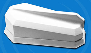
Taoglas, a provider of IoT (Internet of Things) and M2M (Machine to Machine) antenna solutions, has launched a new series of high-performance LTE + GNSS or Wi-Fi antennas. The announcement was made at CTIA Super Mobility, held Sept. 7-9 in Las Vegas.
The Taoglas Guardian X 11-in-1 antenna.
The Guardian series includes 4, 5, 6 and even 11-in-1 antenna options for 4G LTE cellular applications that also require GNSS or Wi-Fi or satellite options.
“Drilling holes in assets and doing long coaxial cable runs is a thing of the past for many IoT applications, particularly in the transportation industry,” said Dermot O’Shea, joint CEO at Taoglas. “Most vehicles and assets are no longer made from metal, but of a carbon fiber or composite material. This means the antenna does not need to be outside the asset but can be mounted internally.”
One example is in the trucking industry, where antennas are mounted under the roof and above the headliner, eliminating the need for holes to be drilled. “This saves huge amounts of time and cost for the installation as well as increasing device performance due to the cable runs being shorter,” O’Shea said. “It also decreases the likelihood of antenna damage due to impact or vandalism.”
The Guardian series antennas are delivered in a gloss-finished, compact square-shaped enclosure (146 x 134 x 20 mm). In the series are these options:
MA931 – 6 in 1 (2 x Cellular, 3 x Wi-Fi, 1 x GNSS)
MA930 – 6 in 1 (2 x Cellular, 2 x Wi-Fi, 1 x GNSS, 1 x Satellite)
MA950 – 5 in 1 (2 x Cellular, 2 x Wi-Fi, 1 x GNSS)
MA961 – 4 in 1 (2 x Cellular, 2 x Wi-Fi)
Also, an extension to the line is the Guardian X series, with the first product being MA4000, an 11-in-1 antenna (six cellular, four Wi-Fi, one GNSS).
The Guardian X dimensions are 540 x 183.1 x 35.4 millimeters. Despite its small size, the MA4000 antenna eliminates the requirement for multiple holes to be drilled in a valuable asset. The enclosure material is flame retardant, as is the CFD-200-FR low-loss cable. This means the antenna is compliant for airline, bus and rail passenger applications and complies with UNECE regulation R 118.
Let’s look through the other end of the telescope this month. The satellites are nattering along, lining up in orderly fashion at the rocket pad, extending their solar arms smoothly in space once they arrive on orbit. The constellations accrue and new signals inch closer to maturity.
The only blips on the horizon come from Ligado’s terrestrial impulse and a looming gap in GPS ground control. Just possibly, the latter might coincide with activation of the full European constellation and Galileo could come to the rescue of suitably equipped users who hunger for greater accuracy. This has been Galileo’s raison d’etre for two decades now, and it may actually be on the cusp of coming true.
At any rate, back to the telescope’s other end. What might that be? Facebook.
“When you think back to the beginning of online advertising, this is what advertisers have been waiting for.” That is Facebook’s director of monetization product marketing — an actual job title, and a powerful one in time to come.
All this — what advertisers have been waiting for — is made possible by GPS. Soon, by all GNSS. And by your smartphone.
From a GNSS Design & Test point of view, this means we are about to see some real money come available for constellations. Fast-multiplying applications of position, navigation and timing data have always shaped GNSS evolution, to some degree. Making this latest development different by a degree of magnitude is its potential to alter the way GNSS policy is shaped and the way GNSS funding is provided.
Facebook will soon roll out a new Store Visits metric for business clients: location data and purchases correlated to Facebook ad performance. Partnerships with point-of-sale systems like Square and Marketo will “prove” (let’s use that word loosely for now) who bought what after seeing Facebook ads.
The way the company tells it, “While people use mobile in 45 percent of all shopping journeys, more than 90% of sales still happen in brick-and-mortar businesses.”
Even if you don’t buy something, Facebook will know that you — assuming, and this is a big jump, that you are a Facebook user — visited a store by aligning GPS, beacon, Wi-Fi and other radio-frequency signals and cell-tower locations with brick-and-mortar coordinates. You may not be a Facebook user, but I’ll bet one of your loved ones is.
With the new feature, instead of having to (gasp!) leave Facebook to visit an unfamiliar website for a store locator, users can view the address, hours, phone number and estimated travel time without exiting the social network.
I know people who rarely or never leave Facebook. Do you? This is a plus for them.
Facebook, one of the new corporate mega-giants, duels with Google, Apple and Microsoft over various pieces of digital turf. One of the most hotly contested treasures — the Holy Grail, in marketing execs’ terms — is the capture and use of user data. It is getting more than a little bit creepy.
To date, the even-bigger giant that is advertising has used metrics such as ad views and clicks to measure effectiveness: how much an ad actually inspires purchase or response to other calls to action. I know this because I use these metrics, or someone in my organization does. Such metrics are now deemed “flimsy” by the standards of aligning GPS, beacon, Wi-Fi data and so on as outlined above.
Facebook is not alone in exploring the fertile ground. Google recently launched ads that show maps of nearby locations, and the others surely do not lag far behind. For the moment, these massive integrators aggregate and anonymize the data to protect privacy, but that’s not to guarantee they would always do so. Currently, there’s no specific opt-out other than turning off location services for the app on the user’s device, which people might be reluctant to do if it degrades other app functionality.
Let’s shield our eyes from the dark side for the moment, and consider what this means for GNSS.
We, you and I, those of us in the PNT industry, have known for some time how integral to critical infrastructure GPS is and GNSS soon will be. But the vast public does not. And lawmakers, bless their little hearts, largely do not either. That will change when the desperate craving of large companies to reach billions of buyers enters the PNT arena.
We can envision mega-marketing bolstered by alliance with the transportation industry, both ground and air, as driverless vehicles and drones become more commonplace. With powerful lobbying interests behind it, GPS might finally get some respect, and other systems around the world with it. Modernization might proceed more smoothly and quickly, without funding hiccups and capability gaps. That’s the bright side of all this.
It reminds me of nothing so much as an old rock’n’roll song. In “Top of the Pops,” the Kinks sang:
Now my agent called me on the telephone He said, son your record’s just got to number 1 And you know what this means?