New products include a low-profile GPS module, a new-gen dual-frequency GNSS module and a super-mini IoT tracker
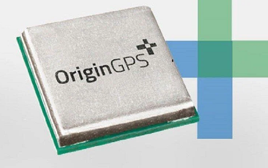
Photo: OriginGPS
OriginGPS will showcase new GPS and GNSS modules and a tiny tracker at Embedded World, Nuremberg, June 21-23, and at Electronica, Munich, Nov. 15-18.
Among products exhibited are:
the 7 x 7 mm ORG4572-MK05 GNSS module with a 10-Hz update rate
the new generation dual-frequency L1+L5 ORG4600, which provides centimeter-level accuracy with RTKLIB and NMEA with raw data in parallel
a low-profile GPS antenna module, the ORG1511-MK05
a new waterproof super-mini tracker measuring 4.9 x 2.7 x 1.4 cm and equipped with magnetic charging
high-performance solutions for a myriad of industries, from fish finders and oil and gas monitors to cargo tracking and gun control.
OriginGPS specializes in miniature GNSS modules and cellular internet of things (IoT) systems. Its high-performance solutions are suitable for every type of device designed to monitor and track valuable assets, whether stationary, in motion or both.
OriginGPS today offers a broad range of high-efficiency solutions, including traditional miniature GNSS modules and cellular IoT systems and devices to dramatically shorten time to market.
“When we realized that the component shortage was here to stay a while, we revisited our roadmap and added two GNSS modules, the ORG1510-MK05 and the ORG4572-MKO5,”said Amir Benyamini, vice president of research and development, OriginGPS. “These new models are based on available chipsets and boast a lead time of just 12 weeks. We also offer a similar lead time for our dual-frequency module.”
Advanced GNSS digital receiver IP core developer seeks to add expertise to global engineering team with the establishment of new subsidiary oneNav Finland Oy
Silicon Valley, California-based technology company oneNav is opening its first European office in Tampere, Finland.
oneNav Finland Oy will be led by Florean Curticapean, director of position engineering. He has more than two decades of professional experience in GNSS and mobile communications.
oneNav is developing a next-generation GNSS receiver for smartphones, wearables and tracking and augmented reality (AR) devices. The oneNav pureL5 GNSS solution was built from the ground up to fully leverage the modernized E5/L5/B2 signaling band deployed on multiple constellations including GPS, Galileo and BeiDou.
The new E5/L5/B2 signal has considerable benefit over the legacy L1 signal that has been used since the 1980s, according to oneNav. E5/L5/B2 enables higher precision and better multipath mitigation, improves coverage and reliability, and is a unified signal, ensuring global interoperability.
The oneNav pureL5 system utilizes machine learning and artificial intelligence to improve its solution by removing reflected signal errors that most commonly cause GNSS inaccuracy in deep urban environments.
Devices powered by oneNav’s technology will produce high accuracy in challenging signal conditions while benefiting from reduced component bulk and complexity, oneNav said.
“Talent is the key to attract such investments, but this does not appear overnight or by accident. Our businesses are benefitting from many years of research and education at Tampere University, more specifically in the Electrical Engineering Unit, in fields such as GNSS, system-on-chip, network-on-chip, embedded processor architecture, software-defined radio and more,” said Oliver Hussey, senior business advisor for the Tampere subsidiary.
Tampere is the host of the ICL-GNSS Conference, welcoming a global audience to address the latest research on wireless and satellite-based positioning techniques to provide reliable and accurate position information with low latency.
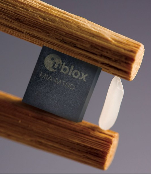
U-blox has announced its smallest GNSS module series to date, the u-blox MIA-M10.
Built on the ultra-low-power u-blox M10 GNSS platform, MIA-M10 offers a power-efficient solution for size-constrained battery-powered asset tracking devices. The module targets an expanding market for people, pet and livestock trackers, as well as industrial sensors and consumer goods.
The 4.5 x 4.5-mm form factor of the M1A-M10 allows developers to design more attractive and comfortable solutions, further driving the adoption of positioning technology in consumer and industrial solutions. The module offers ultra-low power consumption without compromising GNSS performance, the company said. Moreover, its power-save modes can double the battery life by optimally balancing position accuracy and power consumption.
Like all u-blox M10 modules, the MIA-M10 concurrently receives four GNSS constellations (GPS, Galileo, BeiDou and GLONASS) for maximum satellite signal availability. Combined with its superior RF sensitivity, the module offers robust positioning performance for solutions with small antennas as well as for devices operating in weak signal environments such as deep urban canyons.
Support for u-blox AssistNow assisted GNSS service, which delivers orbital data via the internet, cuts the time it takes the MIA-M10 to determine its initial position at startup, allowing it to immediately track satellites without having to wait for slow satellite data downloads to complete. And applications requiring extra-long power autonomy can use u-blox’s CloudLocate service, which extends the life of internet-of-things applications by offloading power-hungry position calculation to the cloud.
The chip-sized, ready-to-use GNSS module requires no external components, reducing engineering and testing efforts, saving costs and resources, and speeding time to market.
Two Variants
MIA-M10 is available in two product variants.
The MIA-M10Q is for a growing market of highly size-constrained battery-powered tracking devices, wearable devices and highly dynamic applications such as small drones, cameras, bike computers and battery-powered sensors.
The MIA-M10C targets customers requiring more flexibility to combine the module with an active or custom antenna circuit.
The MIA-M10 will be on display at the Sensors Converge and Embedded Technologies trade show in San Jose, California, at booth 1228. First samples will be available in July.
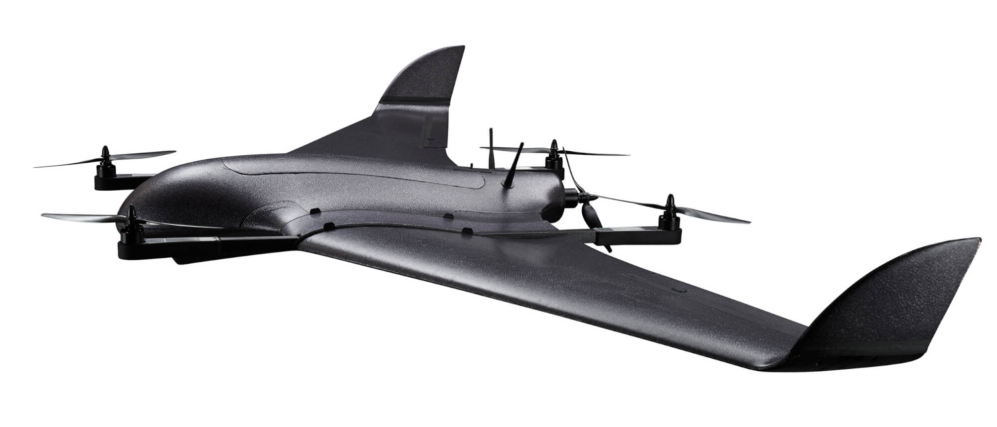
DeltaQuad has successfully integrated an advanced GPS anti-jamming system into its unmanned aerial vehicle (UAV). The DeltaQuad drone equipped with the system was flown in autonomous mode close to an active military jamming system.
Even while being hit directly by a military-grade GPS jamming platform, the system maintained a solid GPS lock and the vehicle managed to autonomously resume its mission without interruption.
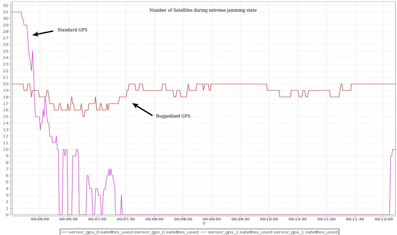
For testing purposes, a ruggedized GPS-based navigation system was installed with the standard GPS-based navigation system. As the vehicle came in range of the GPS jamming system, the standard solution quickly lost all positional awareness, while the ruggedized system maintained a number of satellite locks, even while flying directly over the jammer at close range.
Test results. (Image: Deltaquad)
In addition to the ruggedized GPS solution, the DeltaQuad UAV is equipped to maintain live aerial intelligence, even in tough environments. The transmission system on the DeltaQuad uses frequency hopping spread spectrum (FHSS) techniques to mitigate attempts to disrupt the communication links, and also uses redundant video and communication links.
The DeltaQuad is an industrial-grade vertical takeoff and landing (VTOL) fixed-wing UAV that performs fully autonomous surveillance missions. The platform offers a live video stream from a surveillance sensor for real-time reconnaissance missions.
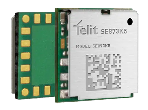
Telit has released the SE873K5 multi-constellation GNSS receiver in the L1 band. The SE873K5 simultaneously tracks and navigates all four GNSS constellations — GPS, Galileo, GLONASS and BeiDou — providing GNSS information over a UART, I2C or SPI interface serial port using the NMEA protocol.
Based on the AG3335 system-in-package from Airoha, the SE873K5 is the latest addition to Telit’s SE873 family of modules and the natural migration path from SE873 and SE873Q5.
The module is a 7mm x 7mm x 2.25mm QFN-like semiconductor package with embedded SPI flash, RTC and TCXO. With its compact size, the latest generation chipset and the advanced power modes, the SE873K5 has the benefits of low cost, small form factor and good electrical and thermal performance — suitable for wearables, fleet tracking, drones and more.
The SE873K5 low-power processing core delivers customizable power-saving modes. It optimizes current draw at module wake-up by supporting both local- and server-based assisted GNSS (A-GNSS) for improved time to first fix, while satellite-based augmentation system (SBAS) corrections from WAAS, EGNOS, MSAS or GAGAN increase positioning accuracy.
The internal flash memory allows firmware updates and customization, as well as ephemeris predictions storage.
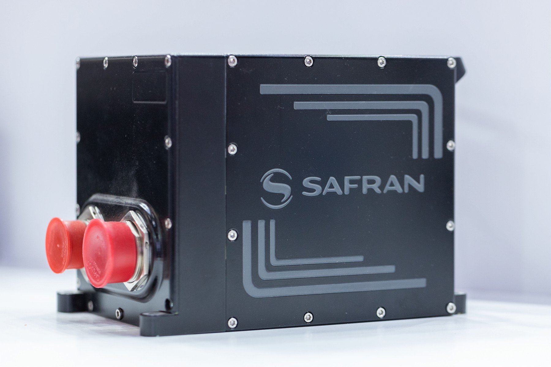
Airbus Helicopters has selected Safran Electronics & Defense to supply its SkyNaute navigation systems to equip future H160M helicopters, developed as part of the France’s joint light helicopter program. The contract follows a December 2021 order from the French Ministry of the Armed Forces for 169 Guépard helicopters.
SkyNaute is an ultra-compact hybrid GNSS/inertial navigation system based on Safran’s patented technology — the hemispherical resonator gyroscope crystal. It offers virtually unlimited service life, a robust design for severe environments and ultra-high reliability, Safran said.
With its combination of high integrity and precision, the SkyNaute navigation system guarantees a high level of performance, even when GNSS signals are absent or jammed. It will enable H160M crews to perform their missions in challenging theaters of operations, the company said.
Customizable system provides robust positioning without added site infrastructure for IHI Corp.
Photo: Trimble
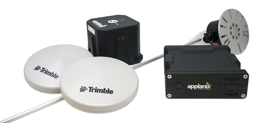
Trimble has announced the first deployment of its map-based localization system for land-based autonomous vehicle applications.
IHI Corp., a heavy industry manufacturer based in Japan, will retrofit its existing container and haulage trucks with a customized Applanix POS LV system as part of its broader autonomy capabilities for the transport of goods around industrial facilities.
Map-based localization provides precise positioning and orientation estimation, augmenting GNSS/inertial data, which is critical for safe and efficient autonomous vehicle operations. The ability to provide IHI Corp. a full workflow and real-time data ensures seamless integration into IHI’s truck design.
The custom-built, locally supported system leverages Trimble’s engineering capabilities and technology to provide reliable performance across a variety of challenging environments, the company said. Using this system, IHI Corp. can provide robust positioning for its autonomous fleet without additional site infrastructure, lowering capital expenditure costs and improving scalability.
Tailoring POS LV to work within IHI’s unique specifications and existing autonomous platform, the map-based localization system couples an inertial navigation system (INS) with simultaneous localization and mapping-based (SLAM) capabilities, and works with several types of sensors, including lidar. POS LV provides an accurate base map using post-processed data and localizes vehicle positioning in real time, enabling the reliable and safe autonomous operation of industrial vehicles.
IHI continually enhances its work environments, while also compensating for varying labor scenarios and personnel shortages. This makes the need to automate transportation critical to operations. The complexities of the evolving industrial manufacturing environment require solutions that can be tailored to a customer’s specific application requirements.
By partnering with Trimble, IHI can develop a retrofit system that addresses two major challenges — affordability and reliability — within the autonomous operation of large-scale industrial equipment.
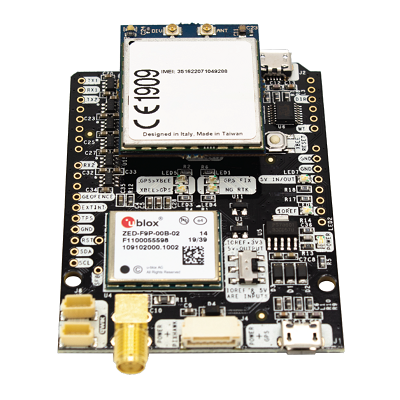
ArduSimple has announced the availability of a range of GNSS starter kits for anyone in Europe or the United States who is interested in testing or integrating high-precision centimeter accuracy for a service or product proof of concept (PoC).
Building a PoC for increasingly common applications such as autonomous vehicles, where high levels of positioning accuracy are required, is often a complex process. Finding compatible antennas that are tuned correctly, CPUs, modems that connect to GSM, sourcing a global SIM, finding a suitable real-time kinematic correction engine that works in multiple regions, and mounting it all on a board is a lengthy and costly process, according to ArduSimple.
To solve this issue, ArduSimple pulled together the components and services required into a range of starter kits that work out of the box. The simpleSSR Starter Kit works anywhere in Europe and the United States that has a 4G signal.
“Bringing together the components, high-precision accuracy and connectivity in Europe and the United States in one simple out-of-the-box solution will significantly speed up the process of PoC projects,” said Marc Castillo, senior consultant at ArduSimple. “We’ve reduced the complexity, enabling engineers to focus on the feasibility of their projects.”
The kit includes:
1 simpleRTK2B-F9P V3 board
1 u-blox ANN-MB-00 Antenna for GNSS Dual Band with cable (IP67)
4G radio module with NTRIP client including RTK-SSR engine (XBee socket compatible)
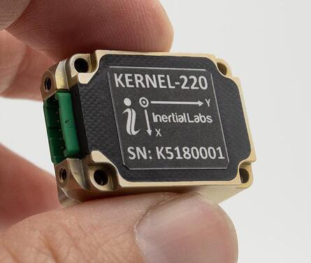
Inertial Labs has announced new versions of its Kernel inertial measurement units (IMUs).
The Kernel 110, 120, 210 and 220 are a set of compact, self-contained, strapdown industrial-grade (100 series) and tactical-grade (200 series) IMUs that measure linear acceleration and angular rates with three-axis micro-electromechanical (MEMS) accelerometers and three-axis MEMS gyroscopes.
Fully calibrated, temperature compensated, mathematically aligned to an orthogonal coordinate system, the Kernel 210 and 220 contain 1 deg/hr bias in-run stability gyroscopes and 0.005 mg bias in-run stability accelerometers.
The new Kernel 110 and 120 IMUs will be superseding the existing Kernel 100 IMU. The Kernel 210 and 220 are miniaturized versions of the company’s IMU-P (Professional) tactical unit.
The Kernel series of inertial measurement units are a fully integrated inertial solution that combines the newest MEMS sensors technology. This seamless integration allows Inertial Labs to provide an inertial system with high performance while maintaining a high-value price point. With its compact design and low power consumption, the Kernel IMUs easily integrate in a wide range of higher order systems while consuming very little space and power.
With continuous Built-in Test (BIT), configurable communications protocols, electromagnetic interference (EMI) protection, and flexible input power requirements, the Kernel 110, 120, 210 and 220 are built to be used in a wide variety of environments and integrated system applications. Units have been thoroughly tested to perform in large variations in temperature, high vibration, and shock.
Designed to be used in air, marine and land environments, the Kernel series can be integrated into motion reference units (MRU), attitude and heading reference systems (AHRS) and GPS-aided inertial navigation systems (INS). As a result, Kernel IMUs are suitable for a wide variety of applications such as autonomous vehicles, antenna and line-of-sight stabilizations systems, as well as buoy or boat motion monitoring.
“The new Kernel IMUs represent the innovative approach at Inertial Labs,” said Jamie Marraccini, president and CEO of Inertial Labs. “The high performance and the flexibility to integrate into different systems and applications is what we have striven to provide to our clients with the new Kernel IMU release.”
Tall buildings block GNSS signals, making satellite navigation in urban canyons very challenging. (Photo: RoschetzkyIstockPhoto/iStock/Getty Images Plus/Getty Images)
GPS positioning for navigation and mapping is challenging in urban environments, where GPS signals often are blocked by tall buildings. The following three papers — to be presented at the Institute of Navigation (ION) GNSS+ conference Sept. 19–23, 2022 — explore ways to solve that problem. The full papers will be available at www.ion.org/publications/browse.cfm following the conference.
ALGORITHMS FOR URBAN MAPPING
In this work, the authors use an urban environment model incorporating visibility predictions and remote-sensing techniques, which they tested in a sensor-equipped vehicle in Denver. They use an interacting multiple model (IMM) filter that uses extended Kalman filters to build and verify a map of the signal environment in an urban-canyon setting. The techniques will give ground-vehicle operations the ability to plan for blocked and delayed signals for global path planning.
Zeller, Emma; Strandjord, Kirsten, University of Minnesota; and Wang, Pai, Shanghai Jiao Tong University; “Algorithms for Mapping the Urban Signal Environment for Navigation of Ground Vehicle Operations.”
ADDING VISUAL TO GNSS/INS
GNSS real-time kinematic (GNSS-RTK) positioning is a key technology for surveying and mapping applications. To extend the capability of GNSS in difficult environments, a tight coupling between GNSS-RTK and an inertial navigation system (INS) can greatly improve the results. If the time spent in a GNSS outage is too long or if the kinematic of the survey is too weak, the GNSS/INS solution can be compromised with high navigation errors, ultimately making it impossible to align the heading angle at initialization.
This paper presents an innovative solution to overcome GNSS/INS limitations, minimizing system complexity by using a tightly coupled GNSS/INS solution with a monocular visual inertial SLAM system. This solution is capable of initialization in a few seconds and is very reliable in the long term. This vision/INS/GNSS coupling increases the overall RTK fix rate and broadens the availability of high-precision navigation solutions under challenging conditions.
Bénet, Pierre; Saussay, Brice; Saidani, Mourad; and Guinamard, Alexis; SBG Systems; “Tightly Coupled Inertial Visual GNSS Solution: Application to LIDAR Mapping in Harsh and Denied GNSS Conditions.”
USING 3D BUILDING MODELS
To solve the urban-navigation challenge, the authors propose using a 3D building model to assist GNSS positioning. This type of algorithm is named the 3D building model aided GNSS (3DMA GNSS). It can predict measurement errors and the visibility of the satellites, as line-of-sight or non-line-of-sight. The solution is then derived from the likelihood of the observed and predicted measurements over candidate locations.
The authors propose an innovative method for evaluating the reliability of building models based on the awareness of sky visibility in a specific geographic context. Sky visibility estimation is improved with use of a support vector machine regression and considering low-Earth-orbit (LEO) constellations. The real-time sky visibility could present the update of the surrounding buildings, whereas the predicted sky visibility based on the existing building models remains unchanged. Making use of this inconsistency, the authors could identify areas with the updated building. Additionally, the impacts of the building update monitoring on the 3DMA GNSS are evaluated in an urban canyon.
Xu, Hao-Sheng and Hsu, Li-Ta; Department of Aeronautical and Aviation Engineering, The Hong Kong Polytechnic University; “Urban Buildings Update Monitoring Based on Sky Visibility Estimation using GNSS and LEO.”
A roundup of recent products in the GNSS and inertial positioning industry from the June 2022 issue of GPS World magazine.
SURVEYING & MAPPING
Base/Rover
For survey-grade GNSS accuracy anywhere
Photo: Bad Elf
A base/rover feature built upon the Flex GNSS receiver brings affordable centimeter-level accuracy to surveyors and geospatial professionals working anywhere in the world. The solution consists of two Flex GNSS receivers and two UHF radios, allowing customers to perform high-accuracy field data collection in areas where traditional real-time kinematic (RTK) corrections or cellular coverage is not available. Existing Flex customers can upgrade by adding Flex radio kits (pictured). The Bad Elf Flex enables data collection either as a standalone receiver or paired with apps on iOS or Android phones and tablets.
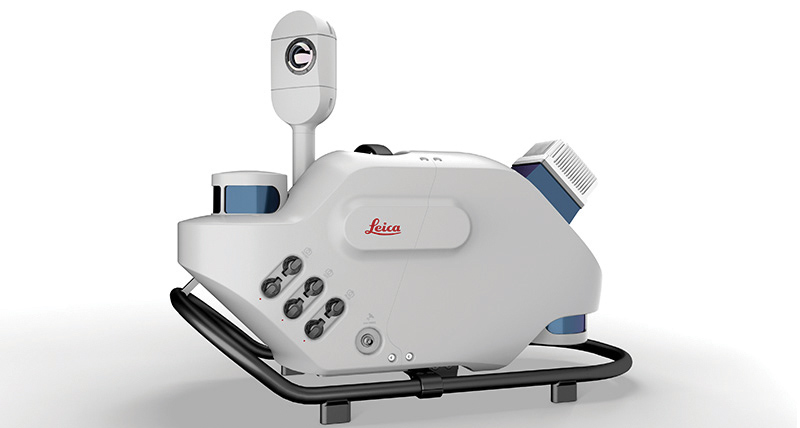
The Leica Pegasus TRK reality-capture mobile-mapping system features artificial intelligence (AI), autonomous workflows and intuitive interfaces. To comply with privacy regulations, its AI can identify and blur identifiers, such as people and vehicles, in real time. Features include advanced dynamic laser scanning and an expandable imagery system for recording, measuring and visualizing. It enables long-range mobile mapping for asset management, road construction, rail, critical infrastructure, utilities and more. The system also can create high-definition basemaps for autonomous vehicles.
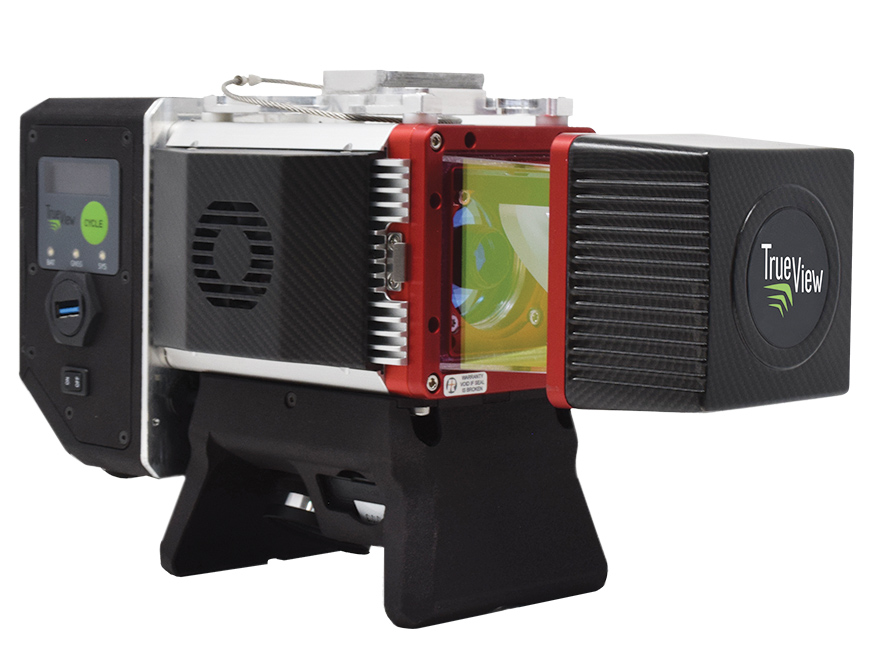
The True View 645/650 is the latest 3D Imaging System (3DIS) from GeoCue. Combined with the True View EVO data-processing software suite, it includes the full post-processing software workflow and directly integrates with Applanix POSPac. EVO supports the creation of project deliverables including ground classified point clouds, surface models, contours, digital elevation models (DEMs), volumetric analysis and wire extraction. The system delivers colorized lidar deliverables with accuracy better than 3 cm root-mean-square-error (RMSE) for the True View 645, and better than 2 cm for the True View 650.
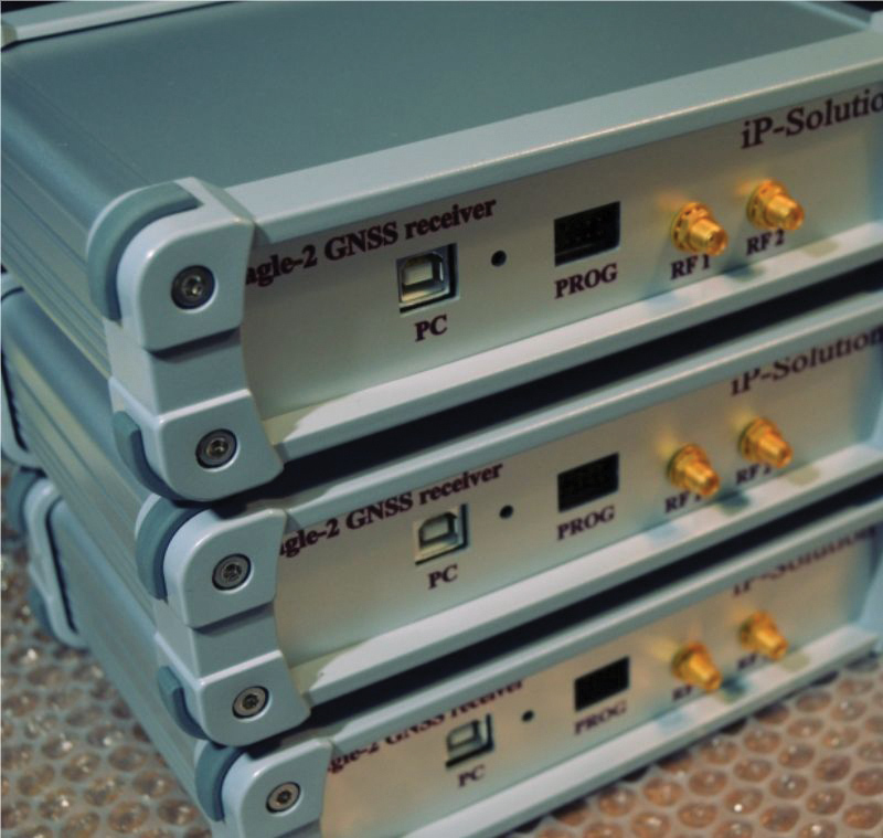
The Eagle-2 works with software-defined receivers in real time or records GNSS signals for post-processing. For post-processing, Eagle-2 supports most third-party receivers, such as MATLAB and C/C++ receivers. The front end allows a user to work with two perfectly synchronized channels connected to two antennas. The Eagle-2 supports GPS, Galileo, GLONASS , BeiDou, QZSS and SBAS.
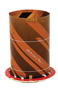
The housed HC885XF and embedded HC885EXF dual-band eXtended Filtering (XF) antennas receive GPS/QZSS L1/L5, GLONASS G1/G3, Galileo E1/ E5a/b, BeiDou B1/B2/B2a and L-band corrections services. They have been tuned to provide optimal support for the entire L1/G1/E1/B1/L-band correction and L5/G3/E5/B2 bands. The housed version, HC885XF, weighs ~42 g and is enclosed in a robust, military-grade IP67 plastic enclosure. The embedded version, HC885EXF, weighs ~8 g and is easily mounted with an embedded helical mounting ring.
Sets performance benchmarks for harsh environments
Photo: Analog Devices
The AD9213S-CSH is a highly integrated RF analog-to-digital converter that handles 12-bit, 10.25-giga-samples per second. It is the company’s fastest ADC available for the space environment. The AD9213-CSH enables the next generation of software-defined systems for satellite communications, radar and remote sensing. The high sample rate and integrated post-processing enable further performance gains for narrow-band applications.
Skyward has published a free ebook, Adding Drones to the Enterprise, to provide guidance on establishing a corporate drone program. According to Skyward, the most efficient and effective drone programs are the lowest risk and most compliant. Topics covered include how to present the business value of a drone operation to corporate executives; how risk managers can optimize the workflow to ensure maximum safety; best practices for risk mitigation and regulatory compliance; tips for collaborating with legal and compliance teams on a general operating manual; and how to provide full transparency to corporate stakeholders.
DJI’s all-in-one solution for professional drone operators includes the DJI Matrice 30 (M30) drone integrated with DJI FlightHub 2 fleet-management cloud software and DJI Dock for autonomous docking and recharging. The integrated solution is suitable for Enterprise drone users such as public safety agencies, infrastructure inspectors and energy operators. The M30 model is designed for rugged professional uses, while the fact that it fits in a backpack makes transportation and setup fast. The DJI Dock is an autonomous takeoff, landing and charging station allowing fully automatic, programmed flights with the DJI M30 Series (Dock Version). After setup, the fully charged M30 drone can take off from the dock through FlightHub 2 programmed automatic missions anywhere within a seven-kilometer radius.
The AlphaAir 1400 (AA1400) and AlphaAir 2400 (AA2400) lidar systems are lightweight, compact airborne scanners easily installed on various UAV platforms or small survey aircraft and helicopters. They are adapted to high-density point-corridor mapping applications, day or night, under leaf-on and leaf-off conditions or with dense vegetation to provide reliable results. Combined with industrial-grade GNSS receivers and high-precision inertial measurement units (IMUs), the AA1400 and AA2400 provide 2 cm to 5 cm survey-grade accuracy. They also integrate Riegl VUX lidars with waveform-lidar technology, allowing echo digitization and online waveform processing.
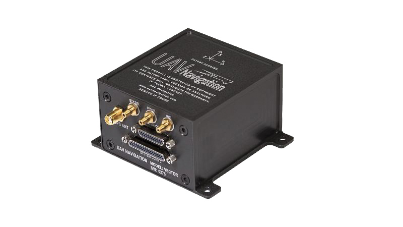
The VECTOR-600 is a robust, dependable autopilot with built-in physical and logical redundancy, allowing it to survive all individual sensor failures while maintaining accurate estimates of attitude and position. It works for fixed-wing, rotary-wing and vertical-take-off-and-landing UAVs. It provides exceptional performance in GNSS-denied environments and when there is a jamming threat. The VECTOR-600 features high quality components and an electromagnetic-resistant design tested to MIL-STD 461.
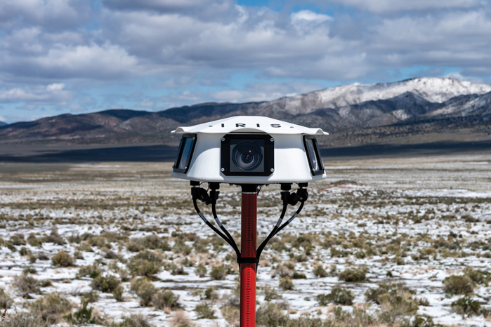
Casia G is a ground-based detect-and-avoid surveillance solution that provides 360° optical detection with alerts. It enables operators to avoid both cooperative and non-cooperative aircraft for safe beyond-visual-line-of-sight (BVLOS) flight. Casia G creates a perimeter of monitored airspace for UAVs to perform work safely, without additional payload. It is suitable for operations in fixed or temporary locations, supporting drone-in-the-box operations and augmenting or replacing human visual observers. Casia G sees the entire sky, with uniform probability and resolution, 10 times per second, covering a majority of small UAS use cases.
ION is now accepting abstracts for the co-located 2023 International Technical Meeting (ITM) and Precise Time and Time Interval (PTTI) Systems and Applications Meeting. The co-located conferences will take place January 23-26, 2023 at the Hyatt Regency Long Beach, in Long Beach, California.
ION strongly encourages authors to present in-person in Long Beach. Authors will be given the option at the point of abstract submission to submit for “in-person presentation with video presentation for remote viewers” or “virtual presentation only.”
The Precise Time and Time Interval Systems and Applications (PTTI) meeting is an annual conference sponsored by ION with a technical program designed to disseminate and coordinate PTTI information at the user level, review present and future PTTI requirements, inform government and industry engineers, technicians, and managers of precise time and frequency technology and its problems, and provide an opportunity for an active exchange of new technology associated with PTTI.
ION’s winter meeting, the International Technical Meeting (ITM), is a more intimate conference with a technical program related to positioning, navigation and timing and includes the ION Fellows and Annual Awards presentations.