GPS World, a business-to-business (B2B) media brand, was honored with a 2021 Azbee Award of Excellence from the American Society of Business Publication Editors (ASBPE). GPS World is published by North Coast Media, based in Cleveland, Ohio. Other NCM brands taking home awards were Pest Management Professional and Golfdom.
GPS World received a regional bronze award for its online and social media coverage of how COVID-19 affected the GPS and GNSS industry throughout 2020. Our COVID-19 coverage can be seen here.
Azbee Awards recognize the exceptional work of print and digital media in the professional publications industry. One of the most competitive award programs for trade media, the Azbees highlight editorial and design excellence in magazines, and digital and social media. More than 800 entries were submitted for this year’s Azbee Awards.
“Year in and year out, our print and digital media are selected as content and design leaders,” said Kevin Stoltman, NCM president and CEO. “This is great news for our marketing partners. Our brands continue to be the most trusted in their respective industries because our print and digital content, and highly engaged audiences of qualified buyers, are unparalleled.”
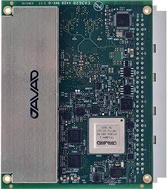
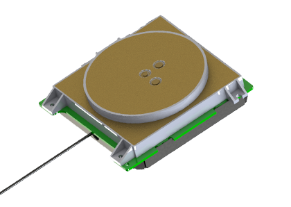
Javad GNSS has launched its TRE-3S GNSS OEM board. It measures 100 x 80 mm, weighs 87 g and tracks 874 channels with all-in-view satellite tracking. At the heart of the board is the company’s new Triumph-3 chip.
The board also includes numerous features to protect against interference and improve the signal output. These features include spectrum data output, spoofing detection, advanced multipath reduction, in-band interference rejection, GLONASS .2-mm dynamic calibration, heading determination, attitude determination and fast acquisition channels.
The TRE-3S receives:
GPS L1/L2/L2C/L5
Galileo E1/E5A/E5B/AltBoc/E6
GLONASS L1/L2/L3
BeiDou B1/B1C/B2/B3
QZSS L1/L2/L5/L6 (L61/L62)
SBAS L1/L5
The board has a 20-Hz update and real-time kinematic (RTK) rate for real-time positioning and raw data (code and carrier).
Optional features include tracking QZSS L6 (LEX) and IRNSS L5/S-band, and a data update rate and RTK rate of 100 Hz. Finally, a conformal coating can be provided.
Javad GNSS is offering a special in which customers who purchase the board can receive a second board and an evaluation kit for free. This way, customers can use one board for system integration in the field, and the other with the evaluation kit in the office or lab for testing and development.
For full specifications of the TRE-3S, see this page.
BAE Systems Inc. has received a $325.5 million contract from the Defense Logistics Agency for advanced military code (M-code) GPS modules that will provide reliable and secure positioning, navigation and timing data with anti-jamming and anti-spoofing capabilities.
The modules will help warfighters conduct operations in contested electronic warfare environments.
“Our state-of-the-art GPS technology works with the advanced military M-code signal to provide reliable information to the warfighters who depend on it,” said Greg Wild, director of Navigation and Sensor Systems at BAE Systems. “This contract will ensure the availability of M-code module inventory to build advanced, next-generation GPS receivers.”
Under the multi-year contract, BAE Systems will deliver Modernized GPS User Equipment (MGUE) Increment 1 Common GPS Modules (CGMs) compatible with the advanced M-code signal to support the U.S. Department of Defense and international allies through 2030.
BAE Systems will manufacture the modules, manage their inventory on behalf of the Defense Logistics Agency, and use them to build military-grade GPS receivers for ground and precision-guided munitions.
BAE Systems’ portfolio of M-code GPS receivers provides flexible, efficient, and reliable navigation and guidance solutions for airborne systems, precision munitions, handheld receivers, and embedded applications.
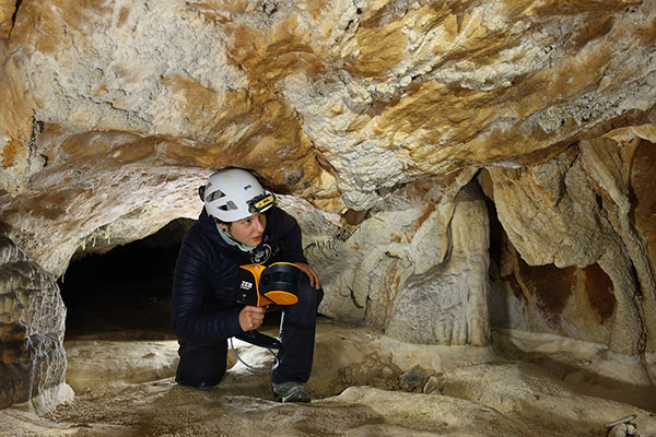
The versatility of the ZEB Horizon device enabled the Deep Time team to map the complex and challenging environment. (Photo: GeoSLAM)
Geospatial 3D mapping specialist GeoSLAM provided the technology to scan one of Europe’s largest caves as a part of the Deep Time isolation study.
For 40 days, 15 participants set up camp in the Lombrives cave in southwestern France with no clocks or sunlight, and zero contact with the outside world. Conducted by the Human Adaptation Institute, the experiment aimed to explore the links between the human brain and time, in order to gain insight into the limits of human adaptability to isolation.
Throughout the mission, the “deeptimers” organized tasks to complete within the cave setting to help structure their days. Their first task was to conduct a recce of the location.
GeoSLAM technology was called upon to conduct a digital scan of the 3-km Lombrives cave — a cave system consisting of both narrow passages and expansive chambers up to 70 meters in height, formed more than 125 million years ago.
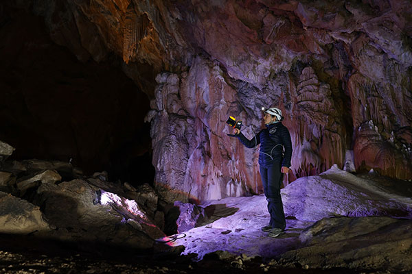
The handheld ZEB Horizon is put to the test by a Deep Time participant. (Photo: GeoSLAM)
The team used the lightweight ZEB Horizon device, which harnesses GeoSLAM’s unique SLAM (simultaneous localization and mapping) algorithm, putting to the test the device’s 100-m range capabilities. Its versatility and walk-and-scan method of data collection allowed the team the flexibility to crouch, crawl and scan the depths and narrow canals of the cave, including 90-m deep wells.
Traditional tripod-based systems used for digital mapping rely heavily on GPS to collect accurate data. SLAM technology however, overcomes this limitation by cutting out GPS altogether, enabling scans to be carried out in complex and enclosed spaces, including underground.
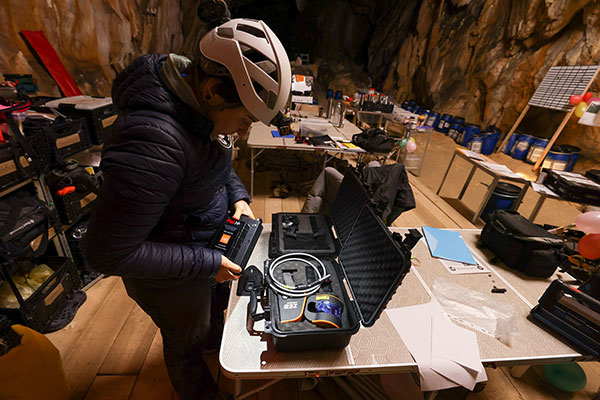
A Deep Time participant sets up GeoSLAM’s ZEB Horizon scanner. (Photo: GeoSLAM)
With low light levels, an ambient temperature of 10 degrees and humidity levels of 100 percent, the physical and psychological impacts the team experienced were documented on camera.
“We are thrilled to have been associated with the Human Adaption Institute on such an exciting and historic project,” said Tomas Blaha, GeoSLAM channel manager for Europe. “The handheld capabilities of the ZEB Horizon device provided easy-to-use technology for the members of the team with no professional surveying experience. The study tested the limits of human endurance in a challenging environment, and the same can be said of the technology to survey the Lombrives cave. Using traditional static and GPS-based scanners would have been impossible for this project, so we are delighted that the ZEB Horizon’s adaptability and ruggedness played its part in an historic piece of research.”
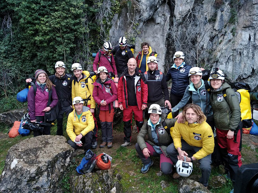
The 15 participants stand outside the Lombrives cave, France. (Photo: GeoSLAM)
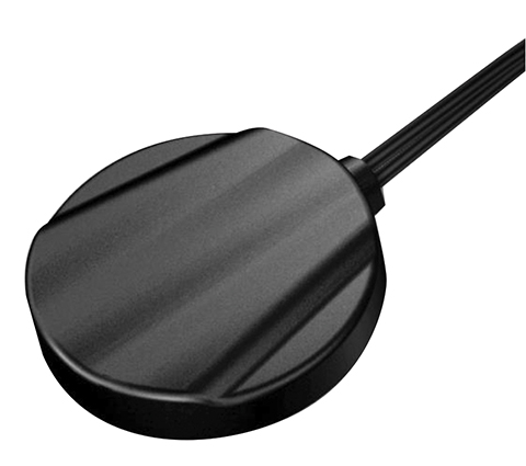
The M9708CWT-UFL from Maxtena is an active multi-frequency, high-accuracy, GNSS antenna for the L1/L2/L5 GPS, Galileo, Beidou and GLONASS bands. The antenna is designed for applications requiring greater accuracy than L1-only antennas can provide.
The antenna’s excellent radiation pattern, exceptional out-of-band rejection, minimal group delay variation, and low noise figure ensures optimal performance of GNSS systems, according to Maxtena.
The M9708CWT-UFL is designed for applications requiring minimal integration effort or for retrofitting existing products. The antenna is mounted on the inside of the application’s housing, allowing it to be hidden. The antenna element is custom tuned to the enclosure.
Features of the M9708CWT-UFL:
Low profile design
Concurrent GNSS reception on:
L1: GPS, GLONASS, Galileo, Beidou
L2: GPS L2C, Galileo E5B, and GLONASS L3OC
L5: GPS L5, Galileo E5A
Small form factor
GIS, RTK and other high-accuracy GNSS applications
Low power consumption
Minimal phase-center variation over azimuth and elevation
The European Commission and the European Space Agency (ESA) have selected Orolia to provide the core GNSS simulation engine for the Galileo Second Generation (G2G) RF Constellation Simulator (G2G RFCS).
While the first launched Galileo satellites are reaching the end of their theoretical operational life, the G2G initiative includes the preparation of a future generation of Galileo global infrastructure, from satellites to ground segments, to maintain current services as well as provide improved performance and Required Navigation Performance (RNP) features to all users.
In this context, Orolia has been selected to participate in the G2G RFCS activity, which will support G2G signals evolution requirements.
The primary objective of the G2G RFCS initiative is to design, develop, manufacture and test an enhanced radio-frequency constellation simulator dedicated to Galileo engineering and experiments. This simulation technology will enable scientists and industries to verify, demonstrate and validate the future G2G configuration.
To meet these requirements, Orolia will provide the core GNSS simulation engine based on its Skydel software technology, within a custom hardware configuration, to simulate all Galileo signals including Open Service (OS) and Public Regulated Service (PRS). Orolia’s GNSS simulators offer the high-end performance level and flexibility required to configure this new testing infrastructure in a software-defined solution.
“With this project, Orolia demonstrates the Skydel platform’s exceptional flexibility to meet critical application requirements and serve as the core engine to design the next generation of GNSS signals,” said Orolia CEO Jean-Yves Courtois. “We are very proud to work with ESA, GMV and Tecnobit to help develop the next generation European Galileo constellation.”
The Earth Archive Initiative is an unprecedented scientific effort to create a digital twin of the entire surface of the Earth – and everything on it.
By scanning the planet’s land surface with very high-resolution lidar, the Earth Archive will create a true three-dimensional digital twin of our world — an open source, digital record of the Earth that will reflect the landscape exactly as it was at the time of scanning.
The geospatial data captured will serve as the baseline for understanding and exploring our world.
A virtual conference, billed as the “Chapter I : The Amazon,” takes place June 15-16, and will provide updates on the unique project from academics, non-government organizations, technology providers and the public. Registration is free.
The Amazon Basin is the first region chosen for scanning and the focus of the conference. “While our scope is the entire planet, we’ve tasked ourselves with first scanning areas that are not only most susceptible to change, but also deep in value for understanding our past,” a project spokesperson explained.
“The 2021 inaugural Earth Archive Congress is centered on our initial campaign to scan the entire Amazon Basin. The Amazon rainforest plays a monumental role in the Earth’s climate, has an incredibly rich Indigenous history, and boasts a remarkable level of ecological diversity — but is vanishing before our eyes.
“With the ability to digitally preserve landscapes at any moment in time, very high resolution lidar can enhance archaeological, anthropological, and conservation studies and provide needed information to help advance sustainable development, as well as provide us with more groundbreaking revelations of the Amazon’s astounding past.”
Registration at the Earth Archive Virtual Congress is complimentary.
UAV Navigation has developed a flight-control solution specifically for vertical-take-off-and-landing (VTOL) fixed-wing drones.
Interest in using VTOL platforms has grown in the past few years, according to the company. A hybrid between fixed-wing and rotary-wing platforms, VTOLs provide operators with versatility.
The company’s fixed- and rotary-wing development teams worked together on the flight-control solution. Technological capabilities from other solutions — referenced navigation or the development of missions in environments without GNSS signals and under threat of jamming attack — have been incorporated in an organic way to facilitate a complete and reliable system.
The hardware developed by UAV Navigation has the MIL-STD-810F and MIL-STD 461F certification, proving the system has been tested by an independent body that certifies its extraordinary behavior in adverse conditions.
“Our extensive experience with fixed-wing and rotary-wing platforms allows us to know the strengths and challenges that these platforms face as a mission is performed,” said Miguel Ángel de Frutos, CTO of UAV Navigation. “Taking this as a starting point, we have managed to develop a specific solution for VTOL platforms that not only has the same technological capabilities as our existing solutions, but also enables missions to be carried out with the highest possible security.”
One of the main challenges with VTOL platforms is the transition from vertical to horizontal flight and vice versa. UAV Navigation’s solution facilitates and automates this critical moment as much as possible, while optimizing battery use. A series of safety and emergency procedures allow the aircraft to always reach a safe landing zone and overcome possible errors in the engine.
An adaptable VTOL software architecture allows users to customize and configure the solution through the ground control station.
Partnership with AnsuR Technologies
UAV Navigation is partnering with AnsuR Technologies to enable streaming high-definition (HD) video from small UAVs carrying a 200-kbps satcom terminal.
With the partnership, the Asmira software solution fro AnsuR provides the ability to optimize sending video and images for satellite communications. Asmira, together with the Cobham Aviator UAV 200 and the antenna pointing solution Polar-300, provided by UAV Navigation, can deliver cost-effective high quality video transmission for small satellite platforms.
Integrated into the platform’s onboard network, UAV Navigation’s Polar AHRS delivers the attitude and steering information of the platform so the Cobham device can establish contact with the satellite.
The Polar AHRS, a device designed to meet the demanding needs of the aeronautical sector, includes all the necessary sensors in a compact device to provide precise information to the servos in a gimbal or an antenna, enabling its control. Once a stable satellite link is established, the Asmira software delivers HD-quality video at rates down to 100 kbps and can support SD quality below 50kbps.
The partnership enables good-quality streaming for long-range surveillance, infrastructure monitoring and search-and-rescue missions where videos are critical.
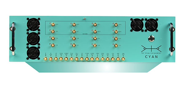
Per Vices Corp. has launched an upgraded version of its high-performance software-defined radio (SDR) platform Cyan EC (extended channel).
Cyan EC enables up to 64 digital signal processing (DSP) channels across 16 physical SMA ports. This extension allows Cyan EC users to break up the one large bandwidth physical chain into multiple digital channels, allowing the radio platform to do the multiplexing.
By providing additional digital chains, which are coherently superimposed into a single physical channel, the computational complexity required to address wide bandwidths is further reduced, and allows for processing over multiple cores on a single host system or across multiple host systems concurrently.
“We are excited that customers have already used and integrated our platform into their products,” said Victor Wollesen, CEO of Per Vices Corp “The additional processing capability provided by this option allows our customers to improve performance and implement more advanced applications using existing computational resources. I believe Cyan EC is the highest channel count software-defined radio commercially available.”
The Cyan EC product option enables engineers and system integrators to realize the benefits of both the high-bandwidth SDR and having more independent channels to ease the complexity associated with processing the high amount of data by breaking it up into separate channels. This further helps to achieve better spurious-free dynamic range (SFDR), sensitivity and signal-to-noise ratio (SNR) while continuing to offer a high throughput SDR solution.
Cyan EC benefits engineers and integrators across different markets including GNSS/GPS, radar systems, magnetic resonance imaging (MRI) receivers and exciters, and spectrum monitoring, as well as test and measurement.
A Top Canadian Defense Company
Image: Canadian Defence Review
Per Vices Corp. has been named one of the Top Defence Companies in Canada for 2021 by Canadian Defence Review, a defense and military magazine. A new inclusion to the list for 2021, Per Vices specializes in software-defined radio (SDR) solutions that are integrated into radar, GNSS/GPS, satellite, aerospace and communications systems.
The company is growing and expanding its operations and product line to satisfy the stringent and advanced requirements of its clients and their applications.
“We are incredibly honoured to be added to this list,” said Brandon Malatest, COO, Per Vices Corp. “This shows recognition and support for high performance manufacturers and companies that are bringing innovative solutions to the table, both within Canada and internationally. We offer the best software defined radio solutions commercially available and work closely with our customers to solve challenges for mission critical applications.”
The 100 companies, which must have manufacturing, R&D or service operations in Canada, are evaluated by Canadian Defence Review editorial staff and independent advisors. They are ranked on factors such as economic impact to the country, research and development initiatives, innovation, contribution to the nation’s security, and contract wins. The list is used to showcase Canadian technological innovation and its defence industry.
A roundup of recent products in the GNSS and inertial positioning industry from the May 2021 issue of GPS World magazine.
OEM
GNSS/LTE Antenna
Low profile for covert installations
Photo: Maxtena
The MEA-GNSS-LTE-MM is a two-in-one low-profile antenna solution that combines GNSS and LTE antennas in one. It is suitable for asset tracking as well as industrial and internet of things (IoT) applications. The antenna offers an ultra-low profile rugged IP67-rated design with a magnet mounting and customizable cables and connector options. The small size makes it a desirable solution for covert installations.
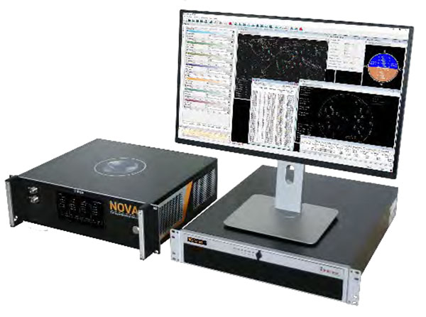
The NCS Nova GNSS simulator now fully supports the simulation of Galileo Open Service (OS) signal improvements based on the new Galileo OS SIS ICD V2.0. The NCS Nova GNSS simulator is a high-end, powerful and easy-to-use satellite navigation testing and R&D device, the company said. It is fully capable of multi-constellation and multi-frequency simulations for a wide range of GNSS applications. It provides multiple GNSS frequencies in one box. A key enhancement to the NCS Nova GNSS simulator is comprehensive support of new Galileo OS signal message improvements on E1B. By enabling real-time simulation of the Galileo OS message improvements, the NCS Nova GNSS Simulator expands the user’s Galileo signal capability.
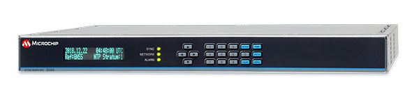
The SyncServer S600 Series network time server and instrument is now integrated with BlueSky technology signal-anomaly detection software. With the upgrade, the SyncServer S600 Series now provides GPS jamming and spoofing detection and protection, in combination with local radio-frequency data-logging and analysis. The Stratum 1 instrument continuously monitors local GPS constellation health and examines GPS and local RF signal integrity to assure validity. If an anomaly is detected, the solution sends an alarm and, if necessary, the SyncServer instrument can be shifted to alternative time sources or an internal oscillator. This protects ongoing timing outputs while ensuring only minimal, predictable timing degradation to vital network and business operations in applications ranging from banking and stock trading to electric utilities and aerospace and defense.
Microchip Technology, microchip.com
L1+L5 receiver
Provides fast updates, multipath resistance
Photo: Telit
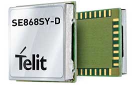
The SE868SY-D is a multi-frequency, high-precision GNSS receiver module for applications that require high accuracy, fast updates, multi-constellation support and multipath resistance. At 11 x 11 mm, the SE868SY-D accommodates ultra-compact devices and internet of things (IoT) trackers. Available now, the high-precision SE868SY-D module is Telit’s first multi-frequency, multi-constellation GNSS receiver module, featuring an ultra-sensitive -167 dBm (tracking) RF front end. By using both the L1 and L5 bands, the SE868SY-D supplies a higher location accuracy than single-frequency devices, even in high-multipath environments such as urban canyons.
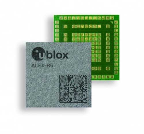
The ALEX-R5 miniature cellular module integrates low-power wide-area connectivity and GNSS technology into an ultra-small system-in-package (SiP) form factor. It is based on the secure UBX-R5 LTE-M/NB-IoT chipset platform with out-of-the-box Secure Cloud functionality and the u‑blox M8 GNSS chip for location accuracy. It has a 14 × 14-mm footprint and 23-dBm cellular transmission power, enabling devices to operate effectively in all signal conditions. A dedicated GNSS antenna interface enables independent, simultaneous operation of the u‑blox M8 GNSS chip. The ALEX-R5 is suitable for wearables and connected medical devices.
The TSC5 is a rugged, lightweight field data controller for land construction and surveying. Its backlit alphanumeric keypad is usable while wearing gloves. The battery provides all-day power on a single charge, with an optional external battery nearly doubling the power for extended use. It has a lightweight, ergonomic design and is suitable for rugged environments, with resistance to shock, dust and water. Running on the Android 10 operating system, the TSC5 is fully integrated with Trimble Access 2021 Field Software and Siteworks Software as well as Trimble Forensics Capture. The EM100 Empower module provides GNSS connectivity.
INSITE is a comprehensive cloud-based platform that enables users to more efficiently manage geospatial data, from acquisition to delivery. With applications designed for electric utilities, telecommunications and governments, INSITE provides tools to support the entire geospatial data lifecycle — project tracking, data collection and delivery, quality control, on-demand reporting, analytics and enterprise integration. INSITE enables users to import, search, analyze, manage, integrate and export all types of geospatial data and multimedia. As a cloud-based platform, INSITE improves speed and efficiency, minimizes storage expenses and supports greater collaboration.
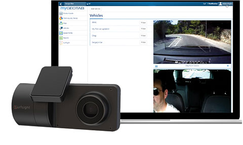
The Surfsight AI-12 camera solution is designed to help improve fleet safety through its continuous recording and advanced machine vision (MV) and artificial intelligence (AI) technology. Offered by Lytx, it integrates with Geotab’s telematics platform to provide fleets with insight into driver behavior through a combination of MV+AI, sensors, and live video streaming. The Surfsight AI-12 provides distracted driving detection, audio and visual alerts and the ability to connect auxiliary cameras. Its MV+AI technology can help identify risky driving behaviors including smoking, eating and drinking, handheld device use, unbelted driver and distracted driver. When connected with Geotab’s GO9 device, it can also capture video evidence of sudden acceleration, sharp turns and harsh braking. Through access to these insights, fleet managers can help prevent avoidable accidents and reduce the likelihood of driver or pedestrian injury, insurance claims, maintenance costs and downtime.
Suitable for rolling stock, automotive and heavy-duty applications
Photo: Eurotech
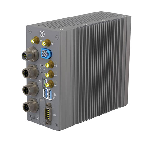
The BoltGPU 10-31 is a GPU-accelerated subsystem for machine vision and artificial intelligence (AI) applications at the edge and on vehicles. The BoltGPU 10-31 provides multi-constellation GNSS with untethered dead reckoning for geolocation. A factory option for high-precision real-time kinematic (RTK) GNSS is available. It also has Wi-Fi 6, Bluetooth 5.1 and option for LTE cellular. It is powered by NVIDIA Jetson Xavier NX and combines a 6-core, high-performance ARM CPU with a 384-core GPU and 48 Tensor Cores, offering power efficiency and accelerated computing. The rugged, fanless unit allows for simultaneous execution of neural models and the processing of multiple high-resolution, high-frame-rate sensors, even in harsh environments.
High-frequency change management for map platforms
Screenshot: Carmera
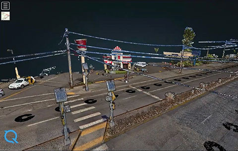
Carmera’s Change-as-a-Service (CaaS) uses consumer-grade cameras from its fleet partners and customer vehicles to detect and log changes, reducing the cost of map maintenance. With a network of commercial fleet–mounted visual probes, it overcomes the problem of GPS canyons in urban areas using a blended algorithm to localize its auto-based probes with pinpoint accuracy. CaaS is designed to be an add-on to existing map systems (both HD and SD), and will identify, analyze and localize both road inventory changes and traffic-impacting events, such as construction. A live sandbox has launched in the San Francisco-Silicon Valley area for companies to test the CaaS technology on real urban and suburban streets.
Parkopedia is designed to address challenges in navigating indoor parking facilities: system blackouts, finding a vehicle within large parking facilities, and locating services such as EV charging stations. Parkopedia provides indoor maps based on high-definition 3D models of indoor parking facilities for in-vehicle navigation. Parkopedia technology can also be used for automated valet parking. Its proprietary SLAM system integrates lidar, IMU, GNSS and high-resolution imagery.
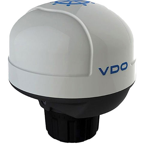
The Acqualink NavSensor can be used with any multifunction N2K-networked multifunction display. Its GPS receiver module provides position, speed and vector data, and UTC time. The inertial sensor delivers pitch and roll data. An integrated fluxgate compass with a +/- 40° tilt angle delivers course heading and the information needed by a networked autopilot to stay on course. Built-in barometer and air temperature sensors offer indicators of impending weather changes. The radome has an IPX6 extended protection rating. It is powered by the NMEA network and operates between –4° and 158° F.
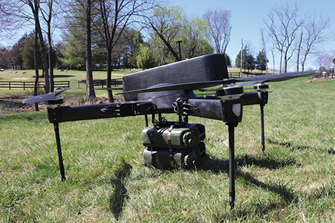
The Periscope tactical-grade UAV provides efficiencies in flight time, endurance and payload capacity. Designed for military and other federal government customers, the high-performance UAVs accomplish mission-critical tasks with speeds of up to 100 mph. They are optimized for specific mission requirements including tactical resupply, remote communications, and enhanced C4ISR. In September, Periscope Aviation won a contract to deliver prototype Tactical Resupply Unmanned Aircraft Systems (TRUAS), which the U.S. Marine Corps will field test at Yuma Proving Grounds this year. The UAVs will fly 60–90 pounds of cargo to locations 10–20 kilometers away, delivering supplies such as food, water, fuel and ammunition to marines on the front line.
The Fixar 007 is a vertical takeoff and landing commercial drone with primary application in the mapping and surveying, monitoring, mining, oil and gas, energy and agricultural sectors. The intuitive approach to working with its ground control station simplifies use (flight preparation is estimated to take only 5 minutes). With inertial orientation, the Fixar 007 can work stably under magnetic anomalies and in the event of satellite loss. A wide range of modifications is available. The Fixar 007 uses a closed, specially designed hardware and software system that guarantees security of information. The applications and UAV use a special communication protocol that eliminates control interception.
Skycopter is a ready-to-fly UAV designed to work in extreme conditions and tight spaces. The drone is enclosed and protected by an external ultra-light and ultra-resistant cage to ensure safety and avoid damage to inspected structures and to the airframe itself. The Skycopter‘s tiltable camera can record 1920 x 1080 video at 60 FPS while sending latency-free images to the ground in 5.8 GHz for first-person view on a display or (optional) high-definition goggles. It uses an ultra-bright LED system for applications in complete darkness. The Skyloc real-time location and monitoring system provides control and tracking with high accuracy in indoor scenarios or where GPS is not available.
“Seen & Heard” is a monthly feature of GPS World magazine, traveling the world to capture interesting and unusual news stories involving the GNSS/PNT industry.
Photo: U.S. Navy
Drones buzz warships
Several drones swarmed Navy destroyers off the California coast in July 2019, and it remains unclear who was behind the nighttime flights, according to a report on the website The Drive, quoting ship logs. As many as six drones flew around the warships at a time in often low-visibility conditions over a number of days, with the drones flashing lights and prompting security precautions onboard. The drone flights took place near San Clemente Island, home to sensitive military facilities: a Navy SEAL training site, the Navy’s ship-to-shore live firing range and an airfield. The drone flights prompted inquiries from investigators and intelligence officers in the Navy and the FBI, and are receiving high-level attention.
Blast shakes ionosphere
A 2020 explosion in Beirut, Lebanon, caused a southward-bound, high-velocity atmospheric wave that rivaled ones generated by volcanic eruptions, according to researchers at Hokkaido University in Japan. On Aug. 4, 2020, more than 2,750 tons of unsafely stored ammonium nitrate exploded, killing 200 people and leaving a 140-meter-diameter crater in its wake. To estimate variation in total electron content, the researchers collected RINEX GNSS data from 15 CORS stations in Israel and Palestine. The ionospheric disturbance was detected by differential delays of microwave signals of two carrier frequencies from GNSS satellites. The blast is considered one of the most powerful non-nuclear, manmade explosions in human history. Their findings are published in the Feb. 2, 2021, issue of Scientific Reports.
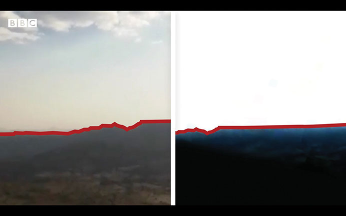
Screenshot: BBC video
3D modeling aids investigation
Amnesty International used 3D modeling, satellite imagery and geotagged video to reveal a suspected war crime in Ethiopia’s civil war, according to the BBC and CNN. With a communications blackout in place, activists and journalists turned to mapping technology and satellite imagery to determine the location of a video provided by a whistleblower within the Ethiopian Army. A forensic frame-by-frame analysis of the footage revealed the extra-judicial execution of at least 15 young men taken from a village in Tigray by Ethiopian Army soldiers in early March.
Photo: Murata Manufacturing
Traffic counts
In April, Murata Manufacturing began providing data from a traffic counter system that maps traffic volume with lidar technology. Murata uses lidar instead of cameras, because the technology can adapt to changing conditions, including rain and darkness. Data collected also classifies vehicle types, enabling strategic advertising and use as reference data for city planning, such as for the construction of shopping malls in locations with significant traffic levels. The service is expected to expand to Thailand and Malaysia.
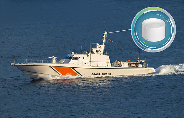
The GAJT-410MS provides anti-jamming to marine vessels. (Image: NovAtel)
Hexagon | NovAtel has released the GAJT-410MS in response to the increase of interference and jamming in marine environments worldwide. The GAJT-410MS is the company’s latest addition to its proven GPS Anti-Jam Technology (GAJT) for the commercial and defense marine markets.
The low size, weight and power (SWaP) variant protects civil and military operations from interference and jamming, with jammer direction-finding capabilities for enhanced situational awareness in the marine environment.
The GAJT-410MS provides dynamic protection on both GPS L1 and L2 bands, as well as Galileo E1, QZSS L1 and L2 and SBAS L1 to combat intentional and unintentional interference. If a vessel experiences jamming, the device’s direction-finding capabilities provide improved situation awareness of their RF environment to identify and locate the source of the jamming signals.
The commercial off-the-shelf, non-ITAR solution is easy to install or retrofit onto existing fleets, enabling assured PNT for continuous operations, cybersecurity and safe navigation at sea, NovAtel said.
Interference, both benign and malicious, is a challenge facing civilian and military operations. Commercial marine applications like shipping, tankers and bulk carriers are under threat from interference targeting their navigation and cybersecurity. Without assured positioning, these vessels can drift off-course and place the vessel, crew and cargo at risk.
Nearshore marine applications like survey, construction and piloting also require reliable positioning for uninterrupted operations in crowded waterways and RF environments. Interference mitigation and jammer direction-finding for advanced situation awareness ensure users acquire assured positioning, navigating and timing (PNT) while identifying and limiting risk from interference sources.
“Assured navigation and cybersecurity defenses are growing priorities for marine users as global threats from interference and jamming increase,” said David Russell, marine segment portfolio manager for Hexagon’s Autonomy & Positioning division. “The GAJT-410MS is an anti-jam solution protecting vessels from interference and jamming disruptions to ensure continuous operations wherever your application takes you. With GAJT, your position, navigation and timing are protected and assured.”
The GAJT-410MS is the latest iteration of proven, high-performance anti-jam products from NovAtel. It includes flexible mounting options, jammer presence and direction-finding capabilities for advanced situation awareness.