Blog

  • Surveying and geospatial data: the perfect couple

    Surveying and geospatial data: the perfect couple

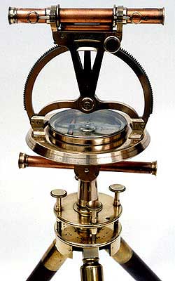
    1800s theodolite. (Photo: ngs.noaa.gov)
    1800s theodolite. (Photo: ngs.noaa.gov)

    Everywhere we look, data is being collected, reviewed, analyzed and stored. It used to be that data was a static piece of information, like a piece of paper in a filing cabinet. Millions of pieces of data being created yet almost all of it never to be used again. The computer and electronic storage began a revolution of how we warehouse this information but that was only the beginning. Technology has turned data into a living, breathing beast few understand yet it controls most of our lives in various ways.

    Mapping of the earth has not always been about establishing boundaries and parcels; many of the early maps and plats were created to depict the topography of our world. While there are some indications that Middle East maps depicted parcels, the first examples of topographic maps were created during the Roman Empire era of 300 A.D. It is common knowledge that the Romans utilized primitive yet cunning engineering for roads, buildings, and waterways but it was the initial topography that was mapped that allowed them to design those forward-thinking infrastructure components. Because of the lack of sophistication in the measuring methods and data collection, these topographic maps covered small areas and often crude because of the materials available. Considering what they were working with, it is still incredible what they were able to map, design and build.

    Measuring devices and methods of data collection expanded over the centuries like most occupations and professions. By the 16th and 17th century, mathematics has been introduced at a wider scale through many educational facilities. Another profession, geographers, also advanced with the evolution of measuring devices and mapping techniques. It was during this period that we began to see a crossover with surveyors with geographers to create topographic maps with greater accuracy and precision through triangulation.

    In the 18th and 19th century, instruments became more sophisticated to assist in the determination of elevations and more accurate angle measurements. The concept of triangulation flourished during this period and significant mapping was made for most of the civilized world. The early 1800s saw the westward push of expansion in the United States and Thomas Jefferson, U.S. president and former surveyor, led the charge to map the existing states and divide the west into sectional land for sale to settlers.

    Besides the establishment of the Public Land Survey System, surveyors also provided topographic information for map of all sizes for future development planning. The late 1800s brought a large amount of topographic mapping information to paper through efforts by the U.S. Geological Society to map the entire United States. This information has been called the first land database; although crude in overall nature compared to today’s standards, it contained an enormous amount of topographic information.

    These surveys continued well into the early 20th century until a revolutionary invention coupled with a current technology merged: the use of a mounted camera taking aerial photographs from an airplane. Geographers and photogrammetrists were able to use surveying data to assist with scaling orthometric photographs to create aerial images of thousands of acres of land. These aerial photos became the base layer for determining topographic features and contouring, covering much more land than ever before. Additional innovations included advancements in stereo plotting and photogrammetric techniques to further create high sophisticated topographic maps for the era. This type of mapping was the gold standard for decades depicting existing condition and topographic features for most of the world until the early 1970s and the computerized data revolution.

    Computers take over the world (literally)

    1960s mainframe computer (Photo: NASA)
    1960s mainframe computer (Photo: NASA)

    While mainframe computers became more universally used in the 1960s, their use was contained to governmental agencies and large corporations. As the physical size of the computer reduced, the computing capacity increased, programming became easier to complete, and more applications were created to perform a variety of tasks. One of the biggest advancements for the era was electronic storage and analyzation of data through programming. Relational databases became a hot ticket for large datasets; geographic data was the perfect fit for this type of application. Modern mapping was on its way forward at warp speed.

    Topographic mapping was not lost in this shuffle. The survey itself is based upon data points located on the face of the earth so each point is just another chunk of information within the database. Programming continued to advance and soon methods previous completed by manual methods over long periods of time were completed in a fraction of previous efforts without fail.

    This effort was also joined with advancements in graphical technology to display this data on a computer video screen instead of lines of green text and numbers. Vector-based graphics, together with enormous point databases, helped create large topographical and geographical maps for many uses. During the same time the US put a man on the moon, mapping and platting of topographic information was also out of this world.

    The turn of the century brings big changes

    For the next decade, there were small advances in technology for topographic surveys and data points, but most were in presentation of data and increases in computing power. Pen plotters and smaller yet more powerful computers were becoming affordable to smaller companies, but it was still a large investment to get into the computerized data game for a surveyor. By the mid-1980s, electronic data collection with a total station was becoming the norm, but only meant collecting more points in a more efficient timeframe. The computing component did get faster but is still producing the same information of static data points.
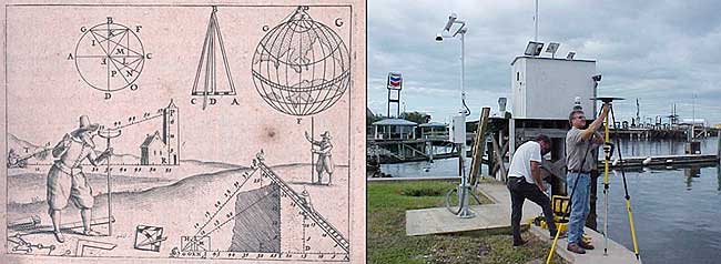
    Ancient techniques and new technologies (Image: ngs.noaa.gov)
    Ancient techniques and new technologies (Image: ngs.noaa.gov)

    The mid-1980s also brought us a shiny new object: GPS technology. By the end of the 1990s, we were able to get out of our vehicle, start the receiver and collect geolocated points in minutes rather than hours. The big takeaway from this advancement is the geolocation component of the data point. Now everything can be related to one big dataset of topographical points. By creating a database with all our project data collected in the same georeferenced datums (horizontal & vertical), we can create digital models that replicate existing conditions.

    We can also add another big advancement in data collection: remote sensing technology. From laser and lidar scanners, photogrammetry, SLAM technology and ground penetrating radar, the innovations to collect data at locations we can “see” through sensing are now a reality. Another significant improvement with this technology is the amount of data points remote sensing can collect, both in timing and spacing. We are now talking small scanning projects that consist of billions of points within the site point cloud. We are fortunate that our computing power and storage capabilities has increased exponentially along with the remote sensing. (Remember doing a “regen” on your CAD file and having time to get a cup of coffee?)

    Lots of data — now what?

    Data is powerful, especially when it is harnessed in a robust system that can analyze and model for future use. Yes, this condition also applies to the surveying world, even though you may not be thinking about it now. We can use this data to create a virtual world that mimics the one we live in; the difference is that we exist in ours yet model and manipulate the digital version in our computer system. The technology is now available, and we can make a replica of our current world; however, why would we want to do that? There are lots of reasons to use technology and data to make sophisticated topographic maps (because that is what they are) for recording the world around us.

    One of the big differences now is that we have much more information about the data points we collect within our topographic maps. Sure, many surveyors will say that their data has not changed or evolved during their careers, but they would be wrong. Unless they are still manually writing it all down for hand plotting… (Hello! The 1960s called, and they want their field book back!) Every electronically collected point has attributes associated with the data.

    These attributes, while they may be simple, contain important information about the datapoint it represents. Horizontal location? Check. Vertical elevation? Check. Assigned point number? Probably. Field code? Most likely. But it also has one other important component: time. We now know exactly when that point was collected. Why is that important?

    Because, like a lot of instances, things change. Something collected today might not be there tomorrow. Time is just as important as the physical location and the type of point it represents.

    Gather these points together, throw them in one big model and you have yourself a graphical database that can be analyzed, reviewed, and used for planning and design. It may be hard to visualize with just simple survey data using GNSS and/or a total station, but couple it with a scanner or photogrammetry, you have a powerful hunk of data for which to work.

    Why is this workflow and modeling procedure important enough to dedicate an entire column about surveying and GNSS to? Because it used to be far in the future, but the need and availability to use it is now here in front of us. Surveying and GNSS are an important part of this effort to create three dimensional models. By using survey-grade data in conjunction with point clouds collected from remote sensing equipment, we can replicate the world around us in real time.

    Yes, Virginia, there is a name for the modeling process…

    At Intergeo 2019, Bentley Systems will be focusing on digital construction, digital cities, reality modeling and civil design. (Photo: iStock.com/alexsl)
    Photo: iStock.com/alexsl

    The name for the proposed modeling of this dataset is a digital twin. It represents a digital representation of a physical object or system. NASA famously used the concept for their space program to simulate situations and procedures of many different types of events. The concept has grown with the technology to graphically create almost anything through digitalization and computer modeling. Once the model is created, both actual and proposed data points can be included to represent the existing and future opportunities.

    The idea of a digital twin is not new; technology, however, has pumped more life into its existence by leaps and bounds with computing power and data storage capability. I remember, early in my career, going into an architect’s office and seeing the scale model mockup of a new development or building. The streets in the model were perfect, there were no drainage issues, and it was a neat as a pin. Fast forward to the construction of the development and field changes were at every turn. A digital twin will allow for better planning, more thorough design and creating more cost-effective development. Many large cities have started compiling data and building their digital twin, including New York, Singapore, Boston, and Rotterdam. Engineering and planning for new and replacement facilities is very expensive yet analysts predict that having a digital twin to work will save a significant amount of money and time.

    As a surveyor, what’s in it for me?

    Software capability for the surveyor is already here. Companies, such as Hexagon, Trimble, Topcon and Esri to name a few, have been developing their software to accommodate this concept for many years. Still, lots of surveyors do not know about it. And we should. Many of us live in places where the infrastructure is well past its useful life period and should have been replaced long ago. By starting now with survey-grade data to be put into a real-time model, we can help our governmental agencies and their consultants to move towards a digital twin that will ultimately save money and possibly lives.

    What this means for the surveyor is to further embrace technology and include remote sensing into your operation. If you have not started at least looking into UAVs and photogrammetry, you are already behind. Many aerial operations are making the next leap into mounting a LiDAR unit on their UAV to gain even more capability. Early adopters of laser scanners were probably second guessing their decision during the 2008 Depression but if they stayed with it, it will be a big payoff in the long run. The next leap will be into handheld scanning devices, including ones using SLAM (simultaneous localization and mapping) technology for locating interior and close-up improvements. These technologies will cost a significant amount of time and money to implement but municipalities, engineers and architects are going to be clamoring for the data any day now.

    When it comes to surveying and mapping of existing facilities, the surveyor and technology makes a great team. Do not let point clouds, remote sensing, or terabytes of data scare you away from providing badly needed information to help assemble your local digital twin. In the long run, it will pay off for all who take on the challenge of building it.


  • KVH inertial sensor integrates photonic chip technology

    KVH inertial sensor integrates photonic chip technology

    New patented PIC Inside technology is designed to enhance inertial sensor performance and reliability for the growing autonomous market

    Photo: KVH
    Photo: KVH

    KVH Industries has launched the P-1775 inertial measurement unit (IMU), featuring KVH’s new PIC Inside photonic integrated chip (PIC) technology.

    KVH has been developing and testing the technology for more than three years and is now incorporating it into existing product lines. The first units have started shipping.

    One of the first customers has integrated the P-1775 IMU into its next-generation rocket launch vehicle.

    KVH’s PIC Inside technology features an integrated planar optical chip that replaces individual fiber-optic components to simplify production while maintaining or improving accuracy and performance.

    The PIC Inside product is designed to deliver 20 times higher accuracy than less expensive MEMS inertial measurement units, uses modular designs for ease of integration, and has outstanding repeatability unit-to-unit.

    “I applaud the tremendous effort by our incredible engineers in developing this groundbreaking technology and I am thrilled that we have begun to incorporate PIC Inside technology into our existing products, a process that we expect to continue throughout the year,” said Martin Kits van Heyningen, KVH CEO.

    The PIC technology will be added to KVH’s inertial sensor product line for use across a broad range of applications from navigation to stabilization and pointing. KVH’s fiber-optic gyros (FOGs) and FOG-based products are particularly well-suited for the large and growing autonomous market. This market includes applications on land, sea and air, such as drones, people movers, trucks, and mining and construction equipment.

    Autonomous applications rely on high-quality inertial sensors to deliver an extremely accurate navigation solution, delivering the performance required in critical metrics such as angle random walk (ARW) and bias instability.

    Next-generation driverless cars, which require centimeter-level precision for safety, are the ideal application for KVH’s inertial products, KVH said. Employing the PIC design allows for a lower cost and scalable solution due to the elimination of various fiber components and a reduction of labor.

    In 2019, KVH delivered its first product prototypes containing PIC technology to automotive customers and presented the science behind the technology to an audience of engineers at an inertial sensor conference, describing the extensive development, testing, and benefits of the new technology.

    KVH is a leading innovator for assured navigation and autonomous accuracy using high-performance sensors and integrated inertial systems. KVH’s widely fielded TACNAV systems are in use by the U.S. Army and Marine Corps as well as many allied militaries around the world. KVH’s FOGs and FOG-based IMUs are in use today in a wide variety of applications ranging from optical, antenna and sensor stabilization systems to mobile mapping solutions and autonomous platforms and cars.

  • Septentrio launches mosaic-T GNSS receiver

    Septentrio launches mosaic-T GNSS receiver

    Septentrio's mosaic-T is built specifically for resilient and precise time and frequency synchronization under challenging conditions. (Photo: Septentrio)
    Septentrio’s mosaic-T is built specifically for resilient and precise time and frequency synchronization under challenging conditions. (Photo: Septentrio)

    Septentrio has launched the mosaic-T GPS/GNSS receiver module, built specifically for resilient and precise time and frequency synchronization under challenging conditions.

    According to the company, its multi-frequency, multi-constellation GNSS technology — together with AIM+ Advanced Interference Mitigation algorithms — allows mosaic-T to achieve maximal availability even in the presence of GNSS jamming or spoofing. This compact surface-mount module is designed for automated assembly and high-volume production.

    “We are excited to expand our mosaic GNSS module family with mosaic-T, which will provide critical infrastructure and mission-critical PNT applications with accurate, reliable and resilient timing solutions,” said Francois Freulon, head of product management at Septentrio.

    Septentrio mosaic-T delivers timing with nanosecond-level accuracy and has additional inputs for an external high-accuracy clock, the company added.

    Septentrio, headquartered in Leuven, Belgium, designs and manufactures multi-frequency multi-constellation GPS/GNSS positioning technology for demanding applications.

  • NOAA report supports GNSS-RO for weather and space forecasts

    NOAA report supports GNSS-RO for weather and space forecasts

    Image: NOAA
    Image: NOAA

    On June 26, the U.S. National Oceanic and Atmospheric Administration (NOAA) released the summary of the results of Commercial Weather Data Pilot (CWDP) Round 2. View the summary here.

    In Round 2, NOAA evaluated GNSS radio occultation data from two U.S. commercial space companies: GeoOptics and Spire. NOAA concludes that, based on the results of CWDP Round 2, the commercial sector is able to provide radio occultation data that can support NOAA’s operational products and services.

    “As a result, NOAA is proceeding with plans to acquire commercial RO data for operational use,” the summary states.

    According to GeoOptics, the report highlights the unique qualities of its commercial GNSS-RO data and its ability to improve weather and space weather forecasts around the world.

    “As today’s report demonstrates, commercial satellite data will enable NOAA to make significant improvements in forecasting worldwide within the consistent budget limitations under which it operates,” said GeoOptics CEO Conrad Lautenbacher.

    NOAA anticipates release of a request for proposals soon for operational purchase of commercial radio occultation data, continuing an acquisition process that began in April with NOAA’s release of a draft Statement of Work.

    NOAA has requested $15 million in FY 2021 to support Commercial Data Purchase. The FY 2021 Budget also requests $8 million for CWDP to investigate new commercial technologies beyond radio occultation.

    By moving into this next phase of engagement with U.S. industry, NOAA is leveraging commercial space sector capabilities to support its operational products and services and to continue to improve its weather forecasting capabilities. NOAA plans to implement additional rounds of the CWDP to evaluate commercial capabilities beyond radio occultation data for potential operational use.

  • SMC and SpaceX launch third GPS III satellite

    SMC and SpaceX launch third GPS III satellite

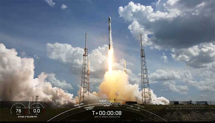
    Update (U.S. Space Force news release): The U.S. Space Force and its mission partners successfully launched the third GPS III satellite at 4:10 p.m. EDT June 30 from Space Launch Complex 40 at Cape Canaveral Air Force Station, Florida. The Lockheed Martin-built satellite was carried to orbit aboard a Space Exploration Technologies Corporation (SpaceX) Falcon 9 Launch Vehicle.

    “Our team is committed to achieving excellence and reaching the Gold Standard of position, navigation, and timing. GPS III satellites will pioneer innovation and I look forward to seeing new technologies developed for the United States Space Force,” said Cordell DeLaPena, program executive officer for SMC’s Space Production Corps. “At SMC, we are proud to deliver our third GPS III satellite and will continue to operate at a high caliber.”

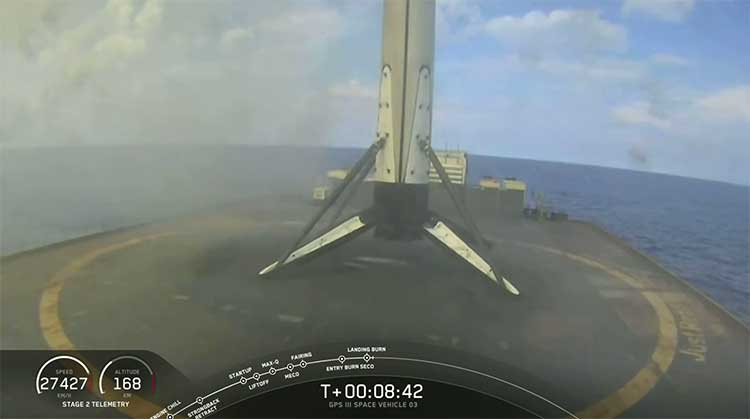
    The first-stage booster of SpaceX’s Falcon 9 Launch Vehicle was successfully recovered approximately 20 minutes after liftoff by the company’s autonomous spaceport drone ship in the predicted landing area. This launch marks the first NSSL mission where a launch provider has attempted to recovered flight hardware.

    “The successful GPS III SV03 launch and recovery serves as another step in our journey with industry partners to create innovative, flexible, and affordable services to meet NSSL mission objectives and propel U.S. dominance in space.” said Col. Robert Bongiovi, Launch Enterprise director. “I’m proud of my team’s 81st successful National Security Space Launch and look forward to our additional National Security Space missions with SpaceX.”

    GPS III’s SV03 separated from its upper stage approximately 88 minutes after launch. Engineers and operators at Lockheed Martin’s Waterton facility will now begin on-orbit checkout and tests which are estimated to complete in two weeks. Operational use is expected to begin as early as August 2020.

    “The GPS III program continues to build on its successes by delivering advanced capabilities for the United States Space Force, and maintaining the “gold standard” for position, navigation and timing.” said Col. Edward Byrne, Medium Earth Orbit Space Systems Division chief.


    UPDATE: The SpaceX Falcon 9 successfully launched the third GPS III satellite at 4:10 ET. The reusable Stage 1 successfully returned and landed on its launchpad less than nine minutes after launch.

    Screenshot: SpaceX live feed of launch
    Screenshot: SpaceX live feed of launch
    SpaceX live feed show Stage 1 returning to landing pad at sea. (Screenshot: Space X)
    SpaceX live feed show Stage 1 returning to landing pad at sea. (Screenshot: Space X)

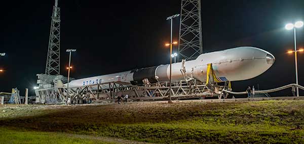
    The U.S. Space Force’s newest Global Positioning System (GPS) III satellite, Space Vehicle 03 (SV03), rolled out to Cape Canaveral’s Space Launch Complex-40 launch pad a during the overnight hours on June 27 and 28, ready for launch June 30 at 3:55 p.m. Eastern time.

    The Lockheed Martin-built GPS III SV03 is scheduled to launch aboard a SpaceX Falcon 9 rocket. GPS III SV03 will be the third USSF mission launch, the second National Security Space launch (NSSL) mission to be launched on a SpaceX Falcon 9 rocket, and the first NSSL mission where a launch service provider will be attempting to recover the booster.

    The launch window opens at 3:55 p.m. EDT and will remain open for 15 minutes. A live-feed will begin 20 minutes prior to the launch, concluding approximately 45 minutes afterward. A simulcast of the broadcast can be viewed at www.spacex.com.

    “The NSSL program’s number one priority is to achieve mission success on each and every National Security Space launch,” said Col. Robert Bongiovi, Launch Enterprise director. “We also strive to procure affordable launch services that maintain assured access to space for the Nation. Our goal with GPS III SV03 was to maintain our mission assurance record, while exploring unique cost saving opportunities like recovering a booster to deliver the capabilities our warfighters demand.”

    “The GPS III program brings a new standard of excellence for the entire space community. Our production team and contract partners have developed an indispensable tool that is available to military and civil users around the world.” said Cordell DeLaPena, program executive officer for SMC’s Space Production Corps. “Our team will continue to advance the launch campaign for the remaining space vehicles and I anticipate the successful launch of SV03 on the Falcon 9.”

    Originally scheduled to launch on April 29, the GPS III-3 mission took a 60-day tactical pause in order to implement new health and safety measures to protect launch and operations crew during the ongoing COVID-19 pandemic. This pause allowed SMC to design and implement these measures in collaboration with contractor and launch provider partners as well as medical professionals. The tactical pause resulted in no impact to the readiness and availability of the GPS constellation, which remains in strong health. There were minimal impacts to cost and schedule due to the pause.

    GPS III SV03 will be launched to augment the current GPS constellation comprised of 31 operational spacecraft. GPS satellites operate in Medium Earth Orbit (MEO) at an altitude of approximately 20,200 km (12,550 miles) in six orbital planes. Each satellite circles the earth twice per day.

    GPS is the premier space-based provider of positioning, navigation, and timing services for more than four billion users worldwide. This latest generation of GPS satellite boasts a 15-year design life — 25 percent longer than the last generation of GPS satellites on-orbit. GPS III brings new capabilities to users such as the new L1C civilian signal, which opens the window for future interoperability with international satellite navigation systems.

    “Our space systems division is filled with exceptional, highly talented team members focused on delivering the next generation of GPS satellites. They are extremely motivated and resourceful, and had to overcome numerous challenges imposed by the COVID-19 pandemic to successfully get us into a position where we can safely launch. I couldn’t have asked for a better team,” said Col. Edward Byrne, MEO Space Systems Division chief. “SV03 is set to join the first two GPS III satellites as we continue our journey to modernize the constellation.”

    GPS III satellite signals are more accurate and more powerful than previous generations, providing improved performance for civilian and military users. SV03 will add another military code (M-Code) capable satellite as the team continues to modernize the GPS fleet. M-Code will provide more accurate military signals with improved anti-jamming capabilities for the warfighter. Full M-Code capability is set to rollout with the GPS OCX Block 2 ground segment.

    GPS III SV 03 rolls to Cape Canaveral’s Space Launch Complex-40 launch pad in preparation for its June 30 launch aboard a Falcon 9. (Photo courtesy of SpaceX via USAF)
    GPS III SV 03 rolls to Cape Canaveral’s Space Launch Complex-40 launch pad in preparation for its June 30 launch aboard a Falcon 9. (Photo courtesy of SpaceX via USAF)

  • Esri ArcGIS Field Maps beta supports Eos Arrow GNSS

    Esri ArcGIS Field Maps beta supports Eos Arrow GNSS

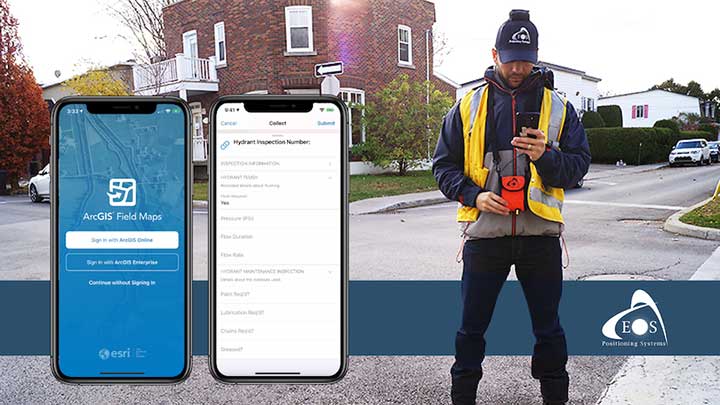
    A new Esri mobile app, ArcGIS Field Maps, will be released in its first beta in July, with the final version expected to be released in September.

    According to Esri, Field Maps will combine the following capabilities into a single app:

    • Simple map viewing and markup
    • High-accuracy field data collection and inspection
    • Battery-optimized location tracking
    • Work planning and task management
    • Turn-by-turn navigation

    Field Maps also will include a new web app, integrated with ArcGIS, that can be used to configure and deploy maps optimized for your mobile workforce needs, create and assign tasks to mobile workers, and create and share views of worker locations.

    Arrow support included

    The inaugural beta includes support for Arrow GNSS receivers’ high-accuracy locations, elevations and metadata, according to Eos Positioning.

    ArcGIS Field Maps will provide the combined functionality of five Esri mobile apps: ArcGIS Collector, ArcGIS Explorer, ArcGIS Tracker, ArcGIS Workforce and ArcGIS Navigator.

    In the first beta version, users will be able to perform markups, work with read-only maps, and work with MMPKs, including  high-accuracy GPS locations and metadata from Arrow GNSS receivers.

    Photo: Eos Positioning
    Photo: Eos Positioning

    Customers who have been wanting to take advantage of high-accuracy GNSS data in apps such as Explorer and Tracker will now be able to with the beta release. Customers who would like to have field crews able to access read-only maps with high-accuracy, for instance (such as during utility locates), this is now a possibility. In addition, crews can take advantage of high-accuracy GPS tracks while tracking.

    ArcGIS Field Maps will also support the two formerly Collector-exclusive Eos solutions Eos Locate and Eos Laser Mapping.

    Eos Locate. This high-accuracy underground mapping solution will be available in ArcGIS Field Maps right away in the first beta release. A single fieldworker will be able to perform real-time, high-accuracy mapping of underground assets using the same workflow he or she had previously used with Collector and Arrow GNSS.

    Eos Laser Mapping. Similarly, laser offsets with Arrow GNSS receivers and LTI laser rangefinders will be available in the first beta of ArcGIS Field Maps. Learn more about laser offsets, including the three workflows for using them, here:

    “We are incredibly excited for the new opportunities ArcGIS Field Maps brings to expand our partnership with Esri,” Eos CTO Jean-Yves Lauture said. “Now our joint customers will be able to use the Arrow GNSS receivers with Field Maps to access high-accuracy location when simply viewing and marking up maps and when logging location tracks.”

    Eos Positioning told its customers, “We encourage all Eos customers currently using Collector, Tracker and/or Explorer to join the beta. Meanwhile, Collector, Tracker and Explorer are planned to continue working as usual, according to the roadmap Esri has outlined.”

  • New DJI map tracks drone-assisted rescues worldwide

    New DJI map tracks drone-assisted rescues worldwide

    Global reference includes more than 400 people rescued by drones to date

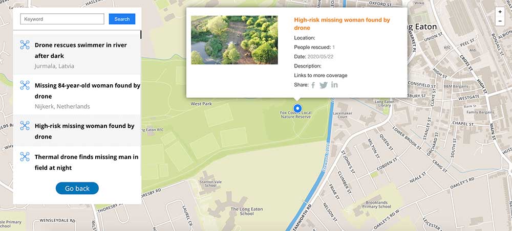
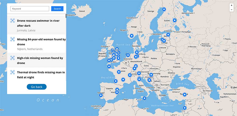
    DJI has launched an online reference to track events around the world when a drone helped rescue someone from peril. The Drone Rescue Map shows how more than 400 people around the world have been helped by drones in more than 200 emergencies, and will be continually updated as new rescues occur.

    The DJI Drone Rescue Map has been compiled from news stories and social media posts from authoritative sources such as police departments, fire departments and volunteer rescue squads.

    Each entry on the map includes the location and date of the incident, a brief description, a link to the original story or post, and an easy way to share those incidents online. To make the map as definitive as possible, DJI encourages public safety agencies to share additional drone rescues so they can be included.

    Once a week on average

    The map includes rescues recorded in 27 countries across five continents, and shows how drone technology has moved from an experimental concept to standard public safety equipment.

    The first drone rescue was recorded in Canada in 2013, the next one was more than a year later, and early examples of drone rescues were as likely to be performed by helpful bystanders as by professionals.

    Today, drone rescues are reported about once a week on average, and public safety agencies routinely share those success stories on social media.

    Screenshot: DJI Drone Rescue Map
    Screenshot: DJI Drone Rescue Map

    “The DJI Drone Rescue Map is now the best global reference for how effective drones are in emergencies, and allows the world to see the tremendous impact drones have had in finding lost people, shortening searches, reducing risks to rescuers and saving lives,” said Romeo Durscher, DJI senior director of public safety integration. “Public safety workers already know how drones are revolutionizing their work, and now the rest of the world can see their amazing stories in one place. The DJI Drone Rescue Map honors the incredible rescues they’ve made, and will allow everyone to see how drones help save people in the future.”

    Types of rescues

    The map includes instances of drones:

    • finding people lost in forests, fields and mountains, often in darkness using thermal imaging cameras
    • dropping life preservers to people struggling in water
    • locating boaters stranded on remote waterways
    • helping rescue people who were at risk of harming themselves.

    The map does not include incidents when a drone is simply used as part of a larger search process; instead, a drone must have directly located, assisted or rescued a person in peril.

    Many of these incidents illustrate how drones can find missing people more quickly than a traditional ground-based search, allowing victims to be brought to safety faster, more easily and with less risk and burden for their rescuers.

    In some of the incidents on the DJI Drone Rescue Map, the drone helped accelerate a rescue and allow first responders to operate more efficiently.

    In other incidents, the drone clearly made the difference between life and death.

    Volunteer rescue

    “I know how important drones are for people in distress, because a drone saved my life,” said Jason Mabee, a Maryland man who was injured and near death last year in a local park when he was found by a volunteer drone pilot. “My family and I are eternally grateful that a total stranger was able to use his drone to find me. It’s comforting to know that drones are helping so many other people around the world too, and I hope the DJI Drone Rescue Map demonstrates just why drones are so important in emergencies.”

    “Drones have changed the game for finding and saving people lost in difficult conditions, and twice last year drones made the difference for us in finding and saving stranded hikers in dangerous terrain at night,” said Kyle Nordfors, Drone Team Coordinator for Weber County Search and Rescue in Utah. “Drones helped make these rescues possible while reducing risk and strain on our volunteer rescue force. We’re excited to see our successful efforts represented on the DJI Drone Rescue Map, and we hope it shows people all over the world how important drones are for saving lives and protecting the rescuers.”

    Screenshot: DJI Drone Rescue Map
    Screenshot: DJI Drone Rescue Map

    Rapid increase in rescues

    DJI has previously released two detailed reports on how drones have been used to rescue people from peril around the world. The first, in 2017, counted 59 people rescued by drones, and the second saw the global total rise to 124 by 2018.

    PC Tom Shainberg, senior drone pilot of the Alliance Drone Team for the Devon & Cornwall and Dorset police forces in England, said, “The Alliance Drone Team is proud to be a leader in adapting drone technology for police incidents, and we’re glad to see our successful drone rescues — such as finding a vulnerable man huddled near the edge of a cliff — being shared wider, along with similar accomplishments from other public safety agencies from around the world via the Drone Rescue Map.”

    “Hundreds of examples now make clear that making drones widely accessible, with low barriers to entry and subject to a progressive set of operational regulations, leads inevitably to saving more lives around the world,” said Brendan Schulman, DJI Vice President of Policy & Legal Affairs. “The DJI Drone Rescue Map is a powerful resource for policymakers to understand the impact drones have on protecting vulnerable people in their own communities, and the detrimental consequences of policies that would restrict or discourage the use of drones, or increase the cost of using them. Regions with less favorable operating rules for drones appear to have substantially fewer reports of drone rescues.”

    Seeking submissions

    DJI monitors global news coverage, drone-related social media, and other sources to find new examples of drone rescues, but understands that many similar incidents may not yet be recorded on the map.

    Anyone who knows of a drone-involved rescue not included on the DJI Drone Rescue Map can submit it through a form at the bottom of the map page.

    These submissions will be reviewed for publication on the map, so DJI asks anyone submitting information about a rescue to respect the privacy rights and expectations of the persons involved, and to not share any confidential or sensitive information about agency operations.

  • GPS World welcomes new EAB members

    GPS World welcomes new EAB members

    GPS World magazine is excited to announce two additions to our Editorial Advisory Board.

    Mitch Narins
    Mitch Narins

    Mitch Narins is the principal consultant and owner of Strategic Synergies LLC, a technical and management consulting firm that he formed after retiring following over four decades of U.S. government service. He worked at the Federal Communications Commission as an acquisition engineer for the Field Operation Bureau; supported the U.S. Navy and U.S. Marine Corps as branch chief for Data Terminal Systems and Electronic Warfare Systems; and served more than 26 years at the Federal Aviation Administration as a program manager, systems engineer, and finally as the chief systems engineer for navigation.

    At the FAA, he was integrated into all aspects of aviation sector position, navigation and time systems engineering, standards development, and enterprise architecture efforts in support of the National Airspace System and the Next Generation Air Transportation System (NextGen).

    Narins is a recognized position, navigation, and timing (PNT) expert, who has published numerous articles and delivered many papers at conferences and seminars worldwide. He is a Certified Information Systems Security Professional (CISSP), a Fellow of the Royal Institute of Navigation, an active member of the Institute of Navigation (ION), and a member of RTCA, RTCM, and SAE Standards Committees. He is a recipient of ION’s Norman P. Hays Award and the International Loran Association’s President’s Award and Medal of Merit.

    Stuart Riley
    Stuart Riley

    Stuart Riley is vice president of GNSS technology responsible for GNSS signal processing and products for several Trimble business areas. In this role, he is responsible for the core GNSS technology from signal reception through to the measurement engine that is used in all Trimble GNSS precision products. He oversees GNSS product development for Trimble’s GNSS Real-time Networks, Geospatial, Heavy Civil Construction and InTech OEM Divisions.

    Beginning his career at Trimble in 1995, Stuart has worked on GNSS receiver development in various engineering roles, in addition to holding several management roles. He holds several patents filed and pending in the field of GNSS and is often a guest speaker at international conferences.

    His research interests include improving GNSS performance in harsh environments, and taking measurements from additional sensors along with optimizing the GNSS receiver architecture, especially for the newer GNSS signals BeiDou, Galileo, IRNSS, QZSS and next-generation GPS and GLONASS signals.

    Riley has an electronic engineering Ph.D. in the field of GNSS from the University of Leeds in England. After he graduated, he was a research fellow at the university on a European Space Agency-funded project to develop a prototype GNSS receiver for space applications.

  • Altitude Angel, Inmarsat offer air traffic management for UAVs

    Altitude Angel, Inmarsat offer air traffic management for UAVs

    Logos: Altitude Angel, Inmarsat

    Altitude Angel and Inmarsat are collaborating to develop and deliver advanced flight tracking and management capability for UAVs.

    According to the companies, they will build on Altitude Angel’s GuardianUTM platform to jointly develop a “pop-up UTM” capability that can be deployed anywhere it is required to manage beyond visual line of sight UAV flights, without the need for ground-based communications infrastructure. By utilizing Inmarsat’s global network of satellites and leveraging its experience in air traffic management communications, Altitude Angel’s pop-up UTM can be accessed rapidly and deployed worldwide, the companies added.

    The pop-up UTM will be developed initially to address the unmanned traffic management needs of blue light emergency services and first responders who need aerial surveillance rapidly with little notice. The companies plan to release a commercial, industry-focused product soon after. Through this technology, emergency services will be able to remotely manage UAVs, increasing their range of safe operations in mixed airspace of manned and unmanned vehicles.

    “The ability to almost instantly ‘pop-up’ safe, secure and fully operational UTM platforms in any environment, at any time, will give first responders, blue light services and aid organizations a valuable tool that could save countless lives,” said Phil Binks, head of air traffic management at Altitude Angel. “Altitude Angel and Inmarsat, in developing ‘pop-up UTM,’ will be able to bring connectivity, clarity and automated air traffic control services for UAVs in even the most challenging of circumstances.”

    Altitude Angel is an aviation technology company delivering solutions which enable the safer integration and use of fully automated drones into airspace. Inmarsat is a British satellite telecommunications company, offering global mobile services.

  • How companies are using alternative PNT

    How companies are using alternative PNT

    Not just supporting players, alternative positioning, navigation and timing (PNT) systems strengthen, augment and — when needed — replace GNSS. We explore how companies are using alternative PNT, and talk with John Fischer of Orolia and Alexis Guinamard of SBG Systems about their companies’ latest developments.

    Since the 1990s, GPS has provided the United States military with a substantial tactical edge. Civilian GPS applications are now deeply embedded in every aspect of our lives. The U.S. Department of Transportation recently reaffirmed that GPS’ positioning, navigation, and timing (PNT) services are critical to the safe and efficient use of the national transportation system, and a Feb. 12 presidential executive order declared that satellite-based PNT services “have become a largely invisible utility for technology and infrastructure.”

    It has long been equally well known, however, that GPS is vulnerable to accidental and intentional interference (the latter known as jamming), spoofing, and degradation or denial of signals. Additionally, GPS satellites are increasingly vulnerable to damage or destruction by space debris or intentional attack. The executive order mentioned above declared it U.S. policy “to ensure that disruption or manipulation of PNT services does not undermine the reliable and efficient functioning of [the country’s] critical infrastructure.”

    Protecting PNT requires not just strengthening GPS, but also developing alternative sources of PNT data and ways to integrate them into the myriad systems that currently rely on GPS.

    The National Timing Resilience and Security Act of 2018 (passed by the U.S. Senate as part of that year’s Coast Guard authorization act), called for “a complement to and backup for” the GPS timing component “to ensure the availability of uncorrupted and non-degraded timing signals for military and civilian users in the event that GPS timing signals are corrupted, degraded, unreliable or otherwise unavailable.” It mandated the procurement of a wireless, terrestrial system that would provide wide-area coverage and be synchronized with UTC, resilient and extremely difficult to disrupt or degrade, able to penetrate underground and inside buildings, and capable of deployment to remote locations.

    A report released on April 8 by the Department of Homeland Security (DHS), however, recommends “that responsibility for mitigating temporary GPS outages be the responsibility of the individual user and not the responsibility of the federal government.” It points out that research by one of DHS’ agencies “shows that users can mitigate short-term GPS disruptions (e.g., inability to read a GPS signal) with various strategies, ranging from using local backup capabilities to delaying operations until GPS is restored.” The report then focuses on “mitigation against long-term or permanent disruption or loss of GPS PNT capabilities.” It determines that the PNT functions in critical infrastructure “are so diverse that no single PNT system, including GPS, can fulfill all user requirements and applications” and notes that maximum resilience is found in diversity of solutions. Therefore, it recommends that the federal government “encourage adoption of multiple PNT sources [to expand] the availability of PNT services based on market drivers.”

    In the interviews below, I discussed these challenges with John Fischer, vice president of Advanced R&D at Orolia, and Alexis Guinamard, chief technical officer of SBG Systems.

    How Orolia is taking resilient PNT to the next level
    Software joins hardware at SBG Systems for alternative PNT


    Check out how these companies are using alternative PNT to strengthen, augment and — when needed — replace GNSS.

    Parker LORD launches all-in-one RTK system
    NovAtel SPAN prepares for road ahead
    OxTS board set ready for system integrators
    NASA’s Orion travels with Honeywell, Lockheed Martin
    SimINERTIAL designed for GPS/INS testing
    Inertial Labs releases 2-axis, 3-axis gyroscopes


    Featured image: NovAtel

  • SimINERTIAL designed for GPS/INS testing

    SimINERTIAL designed for GPS/INS testing

    Photo: Spirent
    Photo: Spirent

    Testing the full operational performance of GPS/inertial systems usually requires expensive and time-consuming field testing on an appropriate moving vehicle platform. Spirent’s SimINERTIAL system emulates inertial sensor outputs while simultaneously simulating GPS RF signals. This enables controlled, repeatable testing of integrated GPS and inertial units, reducing the need for field trials.

    SimINERTIAL is housed in a PC platform equipped with the appropriate data interface card. The simulated motion data is streamed from Spirent’s state-of-the art SimGEN application via Ethernet to SimINERTIAL, which translates this simulated motion data into representative real-time data streams at the data rate and with the data format appropriate to the unit being tested.

    SimINERTIAL is equipped with fully user-configurable sensor error modeling and supports a range of popular inertial formats. SimINERTIAL architecture is also available in configurations to support transfer alignment and multiple sensor architectures. SimINERTIAL solutions can also be equipped to deliver a barometric altitude output via a MIL-STD-1553B card installed in the SimINERTIAL controller PC.

  • NASA’s Orion travels with Honeywell, Lockheed Martin

    NASA’s Orion travels with Honeywell, Lockheed Martin

    Honeywell, under a contract with Lockheed Martin, will supply guidance and navigation systems for NASA’s upcoming Artemis missions, which will fly humans to the moon for the first time since 1972.

    The companies are supplying key components to NASA’s Orion spacecraft fleet for the Artemis missions. Components include the barometric altimeter, the inertial measurement system, and the GPS receiver.

    Honeywell will provide 14 product types for Artemis missions III through V, including both hardware and software solutions, to support NASA’s lunar missions. NASA awarded Lockheed Martin a long-term, multibillion-dollar production contract for the Orion spacecraft, aimed to meet the space agency’s anticipated needs into the 2030s.

    Working in collaboration with the Orion team over the next decade, Honeywell will support Lockheed Martin and its partners through the development and production of essential guidance and navigation systems, command data handling, and display and control products. The focus of the missions is to conduct science and learn lessons that will help take humans to Mars.

    Honeywell will supply the following types of technology for the Artemis missions:

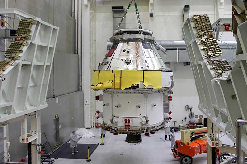
    First Orion Spacecraft: In this March 30 photo, Orion I is moved to the Final Assembly and Systems Test cell at Kennedy Space Center. The spacecraft returned from Ohio after a successful series of environmental tests at Glenn Research Center’s Plum Brook Station. (Photo: NASA)
    First Orion Spacecraft: In this March 30 photo, Orion I is moved to the Final Assembly and Systems Test cell at Kennedy Space Center. The spacecraft returned from Ohio after a successful series of environmental tests at Glenn Research Center’s Plum Brook Station. (Photo: NASA)

    Guidance and Navigation Systems. Key navigation and guidance solutions, including the barometric altimeter, which tracks the altitude of the Orion capsule in Earth’s atmosphere, as well as the inertial measurement system (INS) and GPS receiver, which track the position and movements of the capsule.

    Command Data Handling. Several data-handling products, including the vehicle management computer, which acts as the central computing platform supporting flight and vehicle control, as well as spacecraft communication functions.

    Displays and Controls. Three display units and struts, seven control panels, and two hand controllers used inside the spacecraft to help astronauts in the Orion capsule monitor and control the vehicle.

    Core Flight Software. Includes the integrated modular avionics software, a key system responsible for supporting maintenance functions sharing flight data information.

    The contract to supply key components of the Orion crew module and service module is being managed and performed out of Honeywell’s facility in Clearwater, Florida. Work is also being conducted at the company’s facilities in Glendale, Arizona, and Puerto Rico.

    Honeywell was part of NASA’s previous crewed space missions, including those that took humans to the moon.


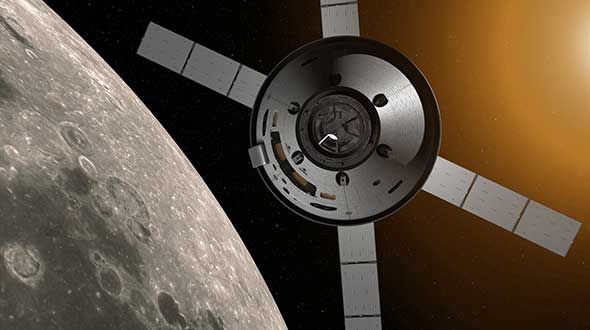
    Featured image: Artist’s concept: NASA