Blog

  • U.S. Air Force’s 2 SOPS performs first GPS III maneuver

    U.S. Air Force’s 2 SOPS performs first GPS III maneuver

    By Airman 1st Class Jonathan Whitely, 50th Space Wing Public Affairs

    News from Schriever Air Force Base

    The 2nd Space Operations Squadron performed the first station keeping maneuver on a GPS III satellite to Satellite Vehicle Number 75 on May 14 at the Schriever Air Force Base in Colorado.

    The maneuver set a new standard for how GPS maneuvers should be conducted for the squadron that provides precision, navigation and timing signals to billions of users around the world.

    A station keeping maneuver is performed to keep vehicles in their node (or parking spots in orbit) and involves burning the satellite’s thrusters and changing the vehicles speed at a particular point in its orbit. This causes the orbit to change, in turn, keeping the vehicle in the ideal position to provide coverage.

    “All operational GPS vehicles are assigned nodes, when all nodes are filled with healthy vehicles there is good global GPS coverage,” said 1st Lt. Michael Gallagher, GPS subsystems analyst. “When new vehicles are launched they typically aren’t launched directly into their final node. This means that the 2 SOPS analysis flight must perform a re-phase maneuver to put a vehicle in its node.”

    The maneuver required GPS III’s signal to be turned off. Turning off the navigation signal while performing the maneuver prevents users from receiving inaccuracies generated by a change in satellite velocity.

    “This was a new process that we could learn from as it was the first station keeping [maneuver] performed for the newest generation of GPS satellites,” said Senior Airman Harrison Sherwood, 2 SOPS satellite systems operator, who sent the commands to the satellite during the maneuver. “[Since] this was the first [maneuver] of the newest generation satellites, it was a bit of a guinea pig for future maneuvers.”
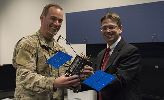
    Johnathon Caldwell, Lockheed Martin Space vice president of navigation systems, right, presents Lt. Col. Stephen Toth, 2nd Space Operations Squadron commander, with a GPS III model satellite as a token of appreciation for the 2nd SOPS critical mission in space at Schriever Air Force Base, Colorado, July 29, 2019. The squadron performed its first station keeping maneuver on a GPS III satellite May 14, 2020, at Schriever AFB. (Photo: U.S. Air Force/1st Class Jonathan Whitely)
    Johnathon Caldwell, Lockheed Martin Space vice president of navigation systems, right, presents Lt. Col. Stephen Toth, 2nd Space Operations Squadron commander, with a GPS III model satellite as a token of appreciation for the 2nd SOPS critical mission in space at Schriever Air Force Base, Colorado, July 29, 2019. The squadron performed its first station keeping maneuver on a GPS III satellite May 14, 2020, at Schriever AFB. (Photo: U.S. Air Force/1st Class Jonathan Whitely)

    However, the unit was able to complete the maneuver flawlessly. The maneuver was completed in a special mission area and there were no changes to the normal operations floor.

    “This maneuver had no effect on the rest of the [GPS satellite] constellation,” Gallagher said. “SVN-45 was in the node SVN-75 was being placed into, so there was no decrease in GPS signal quality as a result of this maneuver.”

    This procedure was also the first of its kind to be performed with the 2nd SOPS Architecture Evolution Plan, which all active satellites in the program are operated. Since GPS III vehicles are fully integrated into the program with this maneuver, all maintenance is conducted through AEP.

    “Station keeping maneuvers are essential to satellite operations and must be done for regular maintenance,” said 2nd Lt. Tyler Gorman, 2nd SOPS navigation payload engineer. “This activity helped validate a nominal maintenance activity for a new generation of vehicles.”

    The unit plans to continue to use this new method and program for future GPS satellites that are being launched and need to be re-phased into their operation slots. The next satellite that will need a station maneuver performed is SVN-76, which is scheduled to launch in the next few months.

    “GPS maintenance requires a coordinated effort to ensure our worldwide service is preserved,” Gorman said. “That means careful planning and execution from our analysts in 2 SOPS, our satellite system operator and the operational support from Lockheed Martin and the Aerospace Corporation.”

  • Kaarta launches Stencil Pro mobile mapping system with GNSS alignment

    Kaarta launches Stencil Pro mobile mapping system with GNSS alignment

    SLAM-based mobile mapping with integrated 360° color is a rugged, geo-enabled, high-density and versatile workhorse

    Photo: Kaarta
    Photo: Kaarta

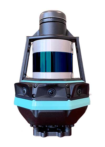
    Kaarta, an innovator of real-time mobile 3D reality capture, has announced beta testing on Stencil Pro, a versatile professional-grade mobile mapping platform with dimensional and visual fidelity.

    According to a Kaarta press release, “Whether on the road or on a job site, in a warehouse or an office, an underground mine or in the woods, along a utility corridor or a railway, the multipurpose Stencil Pro mobile mapping system is ready to take on the most challenging environments with impressive speed, providing accurate and visually stunning results.”

    An all-in-one system to scan, process and view captured data in real time, Stencil Pro offers panoramic high-definition 4K imagery and colorized point clouds. With robust surround-view perception in a wide range of light conditions, Stencil Pro is optimized for both indoor and outdoor performance.

    Featuring a 32-line high-density, low-noise lidar with a range of 120 meters (nearly 400 feet) and a data rate of 600,000 points per second, Stencil Pro produces a highly accurate 3D model in minutes.

    With an IP65 rating, Stencil Pro is safeguarded against adverse elements such as dirt, dust, fog and rain, making it the ideal tool for infrastructure mapping, mining, forestry, earthworks, construction and other harsh environments. Stencil Pro’s rugged and versatile design is adaptable to many environments, capturing data amidst poor weather, dusty work environments, and below-ground cavities or when mounted on vehicles, locomotives, ATVs and other platforms.

    Like all Kaarta systems, Stencil Pro’s simultaneous localization and mapping (SLAM) capabilities means it operates in GNSS-denied areas such as indoor, underground, under canopy, or in urban canyons. However, it is also fully geo-enabled for the many applications such as street, corridor and rail mapping where the addition of a GNSS signal is highly beneficial.

    Stencil Pro integrates the Trimble BD-990 receiver, AV-28 antenna and a range of other third-party GNSS antennas. It supports positioning accuracy enhancements through live RTK/NTRIP processing as well as PPK corrections based on data provided by the NOAA CORS network or a user-supplied base station.

    GNSS positioning data is used to align and geo-register data, providing global accuracy and further enhancing the fidelity of large area scans and long, linear scan paths. With the ruggedized design, enhanced power capabilities, as well as the option of incorporating the industry-leading SLAM accuracy in addition to – or independent of – geopositioning, Stencil Pro has the scale of traditional mobile mappers for a fraction of the investment.

    The onboard GNSS and color cameras are fully integrated into real-time capture, allowing for optimization of collected data as well as flexibility in output. The advantage of absolute positioning and accuracy coupled with 360 degree imaging technologies produces a true color, rich and robust point cloud when needed. If a colorized point cloud is not required, or GNSS is not available, reliance on other sensors is seamless.

    “Billions of dollars of commercial real estate transactions, construction projects, infrastructure maintenance and natural resource management decisions rely on understanding existing conditions data,” said Kevin Dowling, Kaarta CEO. “Obtaining up-to-date data for these environments is laborious, time consuming and expensive with current methods. Even in the most challenging scenarios, Stencil Pro rapidly provides the answers needed for managers to make informed decisions.”

    Stencil Pro is powered by either 100-240 VAC input (or 12V with an inverter) or using its two hot-swappable batteries which last for up to 3 hours of scanning. Stencil Pro’s intuitive user interface makes data capture and processing simple. The user experience includes one-button scanning, real-time scan monitoring and streamlined post-processing options for maximizing data clarity and usability. Remote operation with a touchscreen monitor allows for mounting Stencil Pro on a multitude of transports. When hand-carried, scan status can be started and stopped with the press of a button.

    Stencil Pro is built on Kaarta Engine, Kaarta’s patent-pending approach to solving the SLAM problem. Kaarta’s unparalleled expertise in localization – a result of its deep robotics roots – delivers definitively lower drift error than alternative SLAM systems by an order of magnitude. Kaarta’s proven technology, quality, and accuracy is trusted by AEC, geospatial, natural resource management and autonomous mobile robot professionals worldwide.

    Limited quantities of Stencil Pro will be available to ship in June. Those interested in being considered for early access to discuss a specific application, schedule a demonstration or review sample data sets can apply for the Stencil Pro Early Access Program.

  • Launchpad: GNSS antennas, gyroscopes, lidars

    Launchpad: GNSS antennas, gyroscopes, lidars

    A roundup of recent products in the GNSS and inertial positioning industry from the June 2020 issue of GPS World magazine.


    OEM

    GPS Tester

    Compact antenna testing for mobile deployments

    Photo: Zonu
    Photo: Zonu

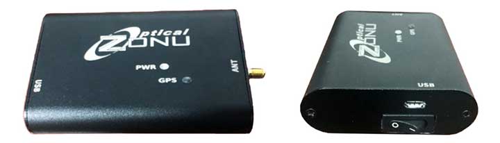
    The ZonuSkyShot is designed for quick testing during the critical installation phase of an antenna at a new site build or small-cell integration. The compact tester is designed for integrating a Zeno GPS solution, but works as a neutral testing device. SkyShot is a compact GPS receiver that detects the presence of a GPS signal, indicated on the top-panel LED. The receiver can be accessed via the USB port on the base unit, allowing the user to see the available satellites by using the app provided with the system and available at the Optical Zonu website. The receiver can simultaneously track up to 16 satellites while searching for new ones. Because of this, a problem can be found and mitigated when a GPS antenna is installed, rather than when hardware is being integrated further down the line. Close-out of projects can be indicated with screenshots of satellite visibility via the micro-USB port to a laptop.

    Optical Zonu, opticalzonu.com

    Police antenna

    Seamless installation on leading 2020 police sport utility vehicles

    Photo: PCTEL
    Photo: PCTEL

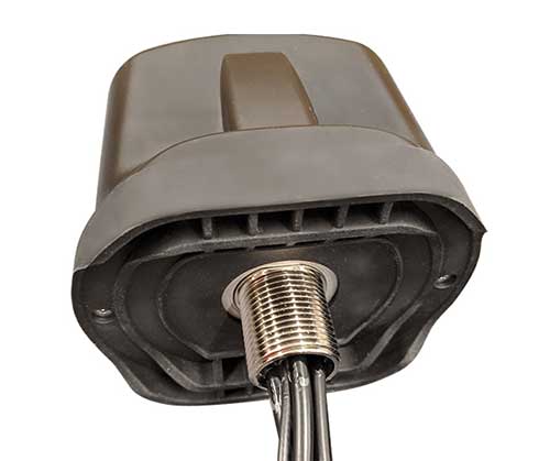
    The Trooper TRP-20INT antenna platform supports the high-speed requirements of complex RF communication systems used for critical communications in FirstNet public safety and intelligent transportation systems. The antennas feature two 5G elements compatible with cellular routers supporting 600-MHz to 6-GHz frequencies. PCTEL’s proprietary high-rejection multi-GNSS technology is included for high-precision tracking and asset management.

    PCTEL, pctel.com

    Anti-jam unit

    Mitigates RF interference

    Photo: Quantum Reversal
    Photo: Quantum Reversal

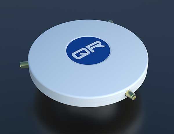
    The QR-100 L1/L2 GPS anti-jamming unit mitigates RF interference or jamming signals using a spatial domain of an antenna array reception pattern. Three passive antennas of the customer’s choice can be connected to the QR-100 unit using built-in SMA connectors. The unit default configuration (no jamming signal present) has a 120-degree phase gradient between antenna elements to maximize the reception of GPS right-hand circularly polarized (RHCP) signals. This feature allows the unit to be connected to either RHCP-type antennas or linearly polarized antennas. The default configuration of the unit is designed to connect to passive GPS antennas.

    Quantum Reversal, quantumreversal.com

    Gyroscopes

    Two and three Axis for use in harsh environments.

    Photo: Inertial Labs
    Photo: Inertial Labs

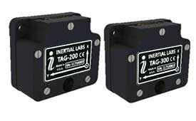
    Inertial Labs’ TAG-200 two-axis and TAG-300 three-axis gyroscopes are developed for electro-optical systems, gimbals, line-of-sight, and pan-and-tilt platforms for stabilization and pointing applications. TAG-200 and TAG-300 use advanced-performance, tactical-grade MEMS sensitive elements to accomplish complex tasks requiring accurate stabilization of assorted platforms. The gyroscopes, designed for use in harsh environments, can withstand extreme shock and vibration in accordance with MIL-STD-810 ground mobile use. They are fully digitized, include built-in test functions and have no moving parts. The gyroscopes include low noise, low latency, wide bandwidth, high data rate, low bias drift, low VRE, high MTBF and are ITAR-free. They are factory calibrated over the operational temperature range and are quality assurance and quality compliance tested and supplied with individual calibration and acceptance test certificates.

    Inertial Labs, inertiallabs.com


    SURVEYING & MAPPING

    Grade Control

    Version 2 of software adds features

    Photo: Trimble
    Photo: Trimble

    Earthworks Grade Control Platform version 2.0 features improvements to enable faster return on investment, increase productivity and decrease training time for operators. Horizontal Steering Control for dozers automatically controls the machine to follow any horizontal alignment such as a back of a curb, breakline, roadway centerline or bottom of slope, without operator assistance. Augmented reality for excavators enables users to understand 3D models, cut/fill information, slope data and other bench points and reference points on the in-cab display in context, without the need to interpret complex 2D plans or stakes. A new mastless motor grader configuration gives operators an improved range of blade motion, allowing for machine control in applications where it previously was not possible. Integrated Trimble Loadrite Payload Management displays grade control and accurate payload data on one screen, increasing mass haul productivity and efficiency by preventing underloading, and improving safety by avoiding overloading. Trimble Earthworks is also now available for compact grading attachments with dual GNSS, single GNSS and total station guidance options. The Earthworks Assistant App provides access to Earthworks learning material and documentation, allowing for a shorter learning curve and less downtime for operators.

    Trimble, trimble.com

    Tilt function

    New feature for automatic excavator

    Photo: Topcon
    Photo: Topcon

    The addition of advanced tilt and rotation functionality allows Automatic Excavator operators to easily swivel or tilt the bucket with automatic boom control for faster and more efficient excavation. If excavator operators are in situations such as at the top of the slope, grading a long incline and not totally perpendicularly lined up, the added feature makes it easier to position the cutting edge of the bucket to the surface. Operators can excavate more quickly, moving the excavator fewer times with less wear and tear on the chassis. It is also beneficial when navigating around manholes, trenches and tight spaces.

    Topcon, topcon.com


    TRANSPORTATION

    Lidar sensors

    For L3/L4 autonomous driving

    Photo: Livox
    Photo: Livox

    The Horizon is a high-performance lidar sensor built for Level 3 and Level 4 autonomous driving. It has a long-distance detection range of up to 260 meters, high-density point clouds, and is so small it can be embedded easily into vehicles. The Tele-15 has achieved a reliable detection range of up to 500 meters, offering improved safety for high-speed autonomous vehicles. Both the Horizon and Tele-15 high-performance lidar sensors feature a new scanning method that offers improved sensing performance at a low cost.

    Livox Technology, www.livoxtech.com

    INS module

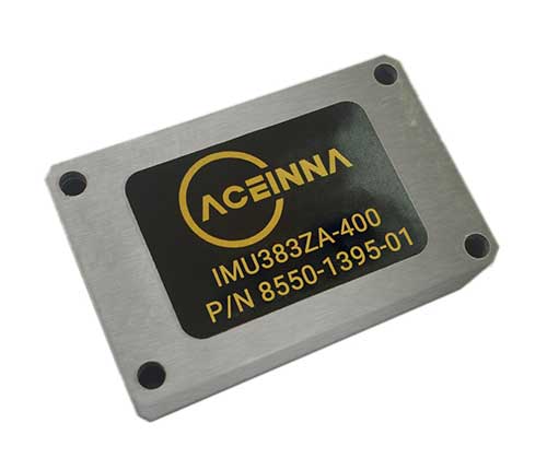
    1.3°/hr automotive IMU sensor

    Photo: Aceinna
    Photo: Aceinna

    The IMU383ZA is a high-accuracy, triple-redundant inertial measurement unit (IMU) for guidance and navigation solutions in autonomous machines and vehicles. It integrates triple-redundant, 3-axis micro-electromechanical system (MEMS) accelerometer and gyroscope sensors. The IMU383ZA is pin-compatible with the IMU381ZA and offers high performance of 1.3 deg/hr, 0.08 deg/root-hr. The miniature module is factory-calibrated over the –40° C to +85° C industrial temperature range to provide consistent performance through extreme operating environments for a wide variety of applications.

    Aceinna, aceinna.com

  • CHC Navigation introduces AT661 GNSS geodetic antenna

    CHC Navigation introduces AT661 GNSS geodetic antenna

    Cost-effective, high-performance antenna designed for GNSS networks and monitoring applications

    Photo: CHC Navigation
    Photo: CHC Navigation

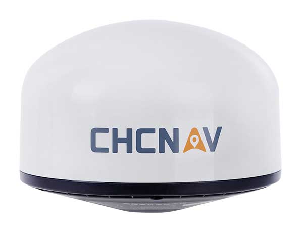
    CHC Navigation has released the AT661 geodetic antenna for GNSS networks or monitoring applications. The AT GNSS antenna series is the result of years of expertise in GNSS technologies. The compact geodetic GNSS antenna offers performances rivaling those of high-cost and bulky conventional GNSS choke ring antennas, according to CHC Navigation.

    The AT661’s supports all current and future GNSS signals, including GPS, GLONASS, BeiDou, Galileo, QZSS, IRNSS, SBAS and L-band. The antenna features both high-gain LNA and wide beamwidth to provide excellent flexibility in applications requiring low-elevation satellite reception and high availability of GNSS signals, especially in obstructed situations.

    “By further integrating the design and manufacture of GNSS antennas, CHC Navigation is broadening its presence as a global provider of GNSS solutions.” said George Zhao, CEO of CHC Navigation. “Mastering the entire GNSS positioning and navigation value chain allows us to deliver the performance our customers demand at the price they expect.”

    The accuracy of the antenna’s phase center reaches the millimeter level with extremely high stability and repeatability to ensure perfect processing of GNSS data regardless of the length of the baselines.

    Built to last, the AT661 withstands all types of weather, including high and low temperature fluctuations, and is protected by a waterproof radome.

  • Kolmostar JEDI-200 GNSS module ready to sample

    Kolmostar JEDI-200 GNSS module ready to sample

    Photo: Kolmostar
    Photo: Kolmostar

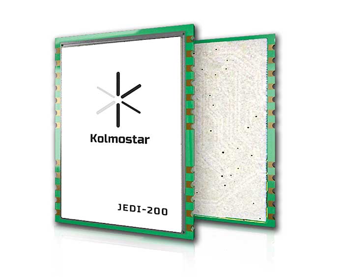
    Kolmostar’s ultra-low power, instant cold boot GNSS module JEDI-200 is now ready to sample. Specially designed for IoT applications such as pet and personal object tracking, livestock tracking, fixed and nomadic logistics, infrastructure tracking and shared economy, JEDI-200’s reduced level of power consumption and optimized efficiency with LPWAN solve IoT endpoint deployment’s pain-point of needing frequent recharges or a large battery.

    JEDI-200 specification highlights include:

    • Industry lowest energy consumption of 25 mJ/position fix
    • Shortest cold-boot TTFF of one second
    • 5.0 meter CEP positioning accuracy
    • Supports GPS and BeiDou constellations
    • 50 Byte/12-hour compressed ephemeris (EPH) for speedy download, enabling A-GPS via LPWAN while significantly reducing EPH download power consumption overhead
    • High-performance cloud computing for minimum end device power consumption and seamless integration with customers’ backend data analytics platforms and dashboard applications
    • Integrated SAW filter, stand-alone LNA and TCXO
    • 12mm x 16mm industry-proven standard form factor for easy wireless connectivity integration

    Purchase a JEDI-200 EVK here.


    Sponsored content provided by Kolmostar

  • Javad GNSS discusses jamming and spoofing technology at Intergeo 2019

    At Intergeo 2019, Javad GNSS President and CEO Javad Ashjaee shares how to identify and block spoofers using Javad GNSS technology.

  • Javad Ashjaee, founder of Javad GNSS, succumbs to coronavirus

    Javad Ashjaee, founder of Javad GNSS, succumbs to coronavirus

    Javad Ashjaee (Photo: Javad GNSS)
    Javad Ashjaee (Photo: Javad GNSS)

    Javad Ashjaee, founder of Javad GNSS, has died in Moscow, Russia. He died on May 30 after a three-week fight with COVID-19.

    The news was first reported by a family member on social media. Ashjaee was born in 1949.

    “It is with heavy hearts that we share the news of the passing of our founder Javad Ashjaee, a GPS/GNSS pioneer and visionary, on the morning of May 30, 2020, due to COVID-19 in Moscow, Russia,” reports a statement on the JAVAD GNSS website.

    The website continues, “Over the course of 37 years, Javad made an incredible and far-reaching impact in the GNSS community. He pioneered the world’s most advanced GNSS technology through a multi-national effort that combined GPS and GLONASS and established more than a quarter century of partnership between Silicon Valley and Moscow. He was always proud of this ‘success story of cooperation.’ Javad was a true industry disrupter long before the term and concept became popular. His whole way of doing business was challenging and disrupting to the status quo.”

    Read more about Ashjaee in his own words on the Javad GNSS website, where he describes the founding of his company:

    “In 1998 I founded Javad Positioning Systems (JPS) and introduced Legacy, Odyssey and Regency products, followed by HiPer. It was a 76-channel geodetic receiver. Other companies later copied HiPer. Today, many of GNSS receivers look like it. I sold JPS to Topcon, who changed its name to Topcon Positioning System and is a very successful company.

    “In 2007, after my obligations to Topcon ended and according to the provisions of our agreement, I founded Javad GNSS and introduced Triumph products. These were 216-channel receivers, integrated with several communication channels. We also introduced their Alpha, Delta, and Sigma versions. We were again the first to offer European Galileo and Japanese QZSS tracking in mass production. Triumph technology has been shown to have the best signal quality and best multipath reduction capabilities against all others tested by the German Aerospace. We also introduced GLONASS inter-channel (group/carrier delay) calibration to 0.2 millimeter which made GLONASS FDMA as good as GPS CDMA. Javad GNSS is growing fast and gaining market share.”


    Articles, insight provided by Ashjaee to GPS World

    June 2011, p. 60, “How GPS and GLONASS Got Together — and Other Recent Events
    December 2012, p. 30, “Dealing with Interference: A Proactive Approach for More Efficient Spectrum Use
    January 2018, p. 8, “What is the biggest challenge facing designers of multi-constellation GNSS receivers today?
    February 2019, p. 40, “The Key to Accuracy for High-Precision Applications


    More on Ashjaee throughout the years


    A word from Ashjaee’s nephew

    Ashjaee’s nephew Sol Adibnejad provided this biography on his uncle via social media:

    Javad was born in 1949 in Qom, Iran. After finishing his bachelor’s degree in electronic physics from the University of Teheran in Iran, he left Iran in 1972 to continue his education at the University of Iowa and got his graduate degrees, a doctorate in 1976. He went back to his native country Iran to teach at the university. He became the chairman of the Department of Computer Engineering at the Aryamehr University of Technology where he founded and managed a UNIVAC-100 computer centre. There, he created the first Iranian microprocessor lab. In 1978 he created one of the earliest student online and interactive registration systems in the world. In a few years and after the 1978 revolution and the political turmoil, things happened and he had to flee the country in 1981.

    He went straight back to the U.S. and started the next chapter of his journey in life which led to the pioneering of GPS. He spent the rest of his life designing and manufacturing of many generations of his GPS and JPS products at JAVAD GNSS, JAVAD ArWest and JAVAD EMS in the Silicon Valley. Javad Ashjaee is listed as the primary inventor in 102 granted patents, the last one in April 2020.

    Products: http://javad.com/jgnss/javad/news/pr20111228.html
    Inventions: https://patents.justia.com/inventor/javad-ashjaee
    Early life: http://archive.amerisurv.com/PDF/Professional_Surveyor_Magazine_Javad_Interview.pdf

    Below is his post on Facebook.

  • US Air Force grants Honeywell GPS/INS contract

    Honeywell logo

    Honeywell has been granted a four-year, $99 million contract to help the U.S. Air Force for the embedded GPS and inertial navigation systems (INS) modernization program (EGI-M). Honeywell will provide engineering, manufacturing and development services to the EGI-M program under the sole-source contract, according to the Department of Defense.

    Work will be performed in Clearwater, Florida, through April 19, 2024.

    The contract is the result of a sole-source acquisition and only one offer was received. The Air Force Life Cycle Management Center, Position, Navigation & Timing Contracting Branch, Robins Air Force Base, Georgia, is the contracting activity (FA8576-20-C-0001).

  • COSMIC-1 mission for GPS radio occultation comes to an end

    COSMIC-1 mission for GPS radio occultation comes to an end

    Image: NOAA
    Image: NOAA

    The COSMIC-1 program ended on May 1, when the last of six tiny satellites were decommissioned. The satellites were launched 14 years ago, and outlived their planned lifespan by 12 years.

    COSMIC — the Constellation Observing System for Meteorology, Ionosphere  and Climate (COSMIC) mission — uses GPS signals to provide a wealth of accurate atmospheric data and improve weather forecasts, according to Laura Snider, University Corporation for Atmospheric Research (UCAR), which ran the COSMIC program.

    Meanwhile, the COSMIC-2 program (FORMOSAT-7 in Taiwan) continues. Its six satellites were launched on June 25, 2019, into low-inclination orbits. The mission was launched by NOAA as the agency’s first operational GNSS radio occultation mission.

    COSMIC-1 demonstrated the value of GNSS radio occultation (GNSS-RO) to derive vertical atmospheric profiles of temperature, humidity and pressure by measuring the degree to which GPS signals bend as they travel through Earth’s atmosphere.

    Weather centers used the high-quality, accurate data to improve forecasts; the data was also used by researchers.

    “Throughout its lifetime, COSMIC-1 made an astounding 7 million vertical atmospheric profiles available to the operational forecast centers and research community,” writes Snider. “These data demonstrably boosted forecast accuracy and were referenced in more than 550 peer-reviewed scientific publications. In all, more than 5,000 users from over 100 countries have accessed COSMIC data.

    COSMIC-1 was primarily funded by the National Space Organization in Taiwan, where the mission is called FORMOSAT-3. The leading U.S. sponsor on the project was the National Science Foundation. Other U.S. partners included NASA, the National Oceanic and Atmospheric Administration (NOAA), the Air Force and the Office of Naval Research.

    UCAR also led the GPS/MET GPS radio occultation mission in the mid-1990s.

  • NovAtel delivers OEM driver built on Robot Operating System

    NovAtel delivers OEM driver built on Robot Operating System

    Hexagon | NovAtel has released its first purpose-built driver, powered by Robot Operating System (ROS), to support its OEM7 family of GNSS receivers.

    The driver, developed by NovAtel engineers, provides an optimized interface enabling users to accelerate autonomous development projects by quickly incorporating NovAtel OEM7 receivers into custom applications.

    The driver is available for immediate download through the new NovAtel GitHub repository or as a ROS Binary Package for direct installation.

    With the release of a NovAtel-developed OEM7 driver built on ROS, developers can now confidently access the critical data needed to build autonomy algorithms for academic investigations, ride-share programs, and other applications.

    Data from numerous sensors can be combined to help move projects into higher levels of autonomy faster without the need to adapt community-developed drivers. Tested using the Hexagon | AutonomouStuff platform, the driver ensures that the data received accurately reflects the output provided by the receiver, while also giving users the ability to record raw data for post-processing.

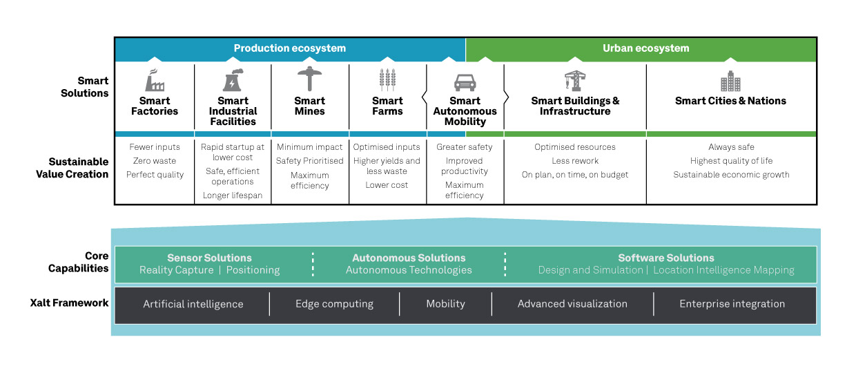
    “We are excited to introduce our first purpose-built driver powered by ROS to the GitHub community. Its development is a result of collaboration between NovAtel and AutonomouStuff in support of Hexagon’s Smart Autonomous Mobility (SAM) initiative, unveiled at CES 2020 in Las Vegas,” said Miguel Amor, chief marketing officer, Hexagon’s Autonomy & Positioning division. “The SAM portfolio is a comprehensive solutions platform that brings together all the necessary sensors, software and services to make autonomous driving possible.”

    The new driver is available for download on the NovAtel GitHub repository.

    ROS is a trademark of Open Robotics.

    Hexagon's Smart Solutions portfolio. (Image: Hexagon)
    Hexagon’s Smart Solutions portfolio. (Image: Hexagon)
  • ASPRS Annual Conference at Geo Week 2020 to go virtual because of COVID-19

    ASPRS Annual Conference at Geo Week 2020 to go virtual because of COVID-19

    Logo: ASPRS

    The American Society for Photogrammetry and Remote Sensing (ASPRS): The Imaging and Geospatial Information Society has withdrawn its ASPRS 2020 Annual Conference Virtual Technical Program from the Geo Week 2020 face-to-face event and will be going virtual because of COVID-19.

    Geo Week 2020 is currently scheduled to take place July 27-29 at the McCormick Center in Chicago.

    According to ASPRS, all presenters originally accepted for the March event in Washington, D.C., will have the opportunity to share their work in the ASPRS 2020 Annual Conference Virtual Technical Program, a series of online technical sessions taking place June 22-26.

    Because the ASPRS 2020 Annual Conference Virtual Technical Program is being hosted, organized and managed by ASPRS alone, there will be a new, separate registration process and fee for all presenters and attendees. Existing Geo Week 2020 conference registrations are not transferable to this new ASPRS event, ASPRS said. Registrants may contact [email protected] if they wish to request a refund for all or part of their Geo Week 2020 registration or transfer their 2020 registration to Geo Week 2021.

    Those who register for the ASPRS 2020 Annual Conference Virtual Technical Program will be given access to all of the online technical sessions, as well as live webinars and on-demand recordings, ASPRS said. The full program will e published on the conference website on June 8.

  • Dewberry selected for NOAA shoreline mapping contract

    Dewberry selected for NOAA shoreline mapping contract

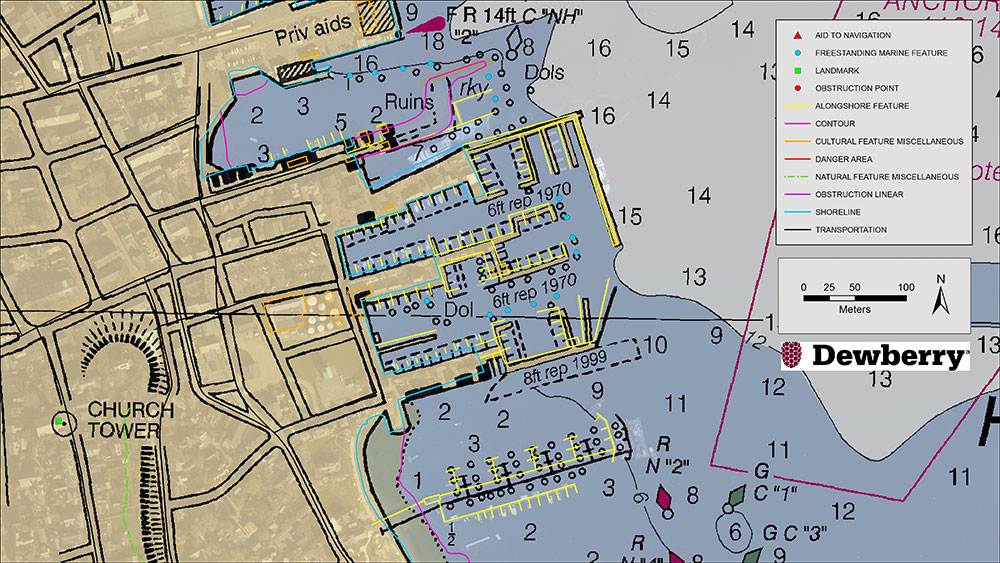
    Existing NOAA nautical chart of Nantucket Harbor, Mass., overlaid with revised shoreline features collected by Dewberry. Image courtesy of Dewberry. (Image: Dewberry/NOAA)
    Existing NOAA nautical chart of Nantucket Harbor, Mass., overlaid with revised shoreline features collected by Dewberry. Image courtesy of Dewberry. (Image: Dewberry/NOAA)

    Dewberry has been selected by the National Oceanic and Atmospheric Administration (NOAA) for the agency’s Shoreline Mapping Services contract. The five-year, indefinite delivery/indefinite quantity (IDIQ) contract has a ceiling of $40 million and will enable Dewberry and its partners to work with NOAA’s National Geodetic Survey to develop new technologies and initiatives to protect the nation’s coasts.

    This is Dewberry’s second consecutive shoreline mapping services contract for NOAA. Over the past five years, the firm completed 30 task orders across the nation, including research studies to analyze bathymetric point tracing, derive bathymetry from satellite data, and apply INSAR data to analyze subsidence.

    Task orders also included shoreline mapping in Alaska; creating topobathymetric lidar and shoreline products from NOAA-acquired data in Connecticut, Puerto Rico, the Chesapeake Bay, Florida and Maryland; acquiring and processing topobathymetric lidar data in Puerto Rico, the U.S. Virgin Islands, Texas and Massachusetts; and developing topobathymetric elevation and shoreline mapping datasets along the Atlantic seaboard from Myrtle Beach, South Carolina, to Long Island, New York.

    “We are excited to continue to support and partner with NOAA to update the national shoreline, nautical charts, and provide high-resolution topography and bathymetric data to enhance the National Coastal Mapping Program,” said Amar Nayegandhi, CP, CMS, GISP, Dewberry’s senior vice president and senior project manager for the contract. “We always strive to find the most appropriate technology and solutions for NOAA and its numerous stakeholders. The task orders we received under the previous contract are a testament to the breadth of geospatial, scientific, and technology services we offer to NOAA.”

    Dewberry also conducted special initiatives such as supporting the GRAV-D program to assist in developing the new gravimetric geoid model for 2022 and the 3D Nation Requirements and Benefits Study in collaboration with NOAA and the U.S. Geological Survey (USGS).

    The 3D Nation Study documents topographic, coastal, and bathymetric 3D elevation data requirements and benefits across a multitude of geographies, helping to establish a baseline understanding of national business uses, needs and associated benefits for 3D elevation data.