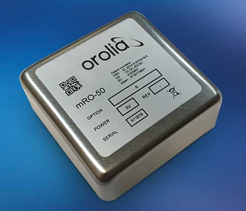
Orolia has introduced a low SWaP-C miniaturized rubidium oscillator, the Spectratime mRO-50, designed to meet the latest commercial, military and aerospace requirements where time stability and power consumption are critical. The oscillator is low SWaP-C — size, weight, power and cost.
The Spectratime mRO-50 provides a one-day holdover below 1 µs and a retrace below 1 x 10⁻¹⁰ in a form factor sized 50.8 x 50.8 x 19.5 millimeters. It takes up only 51 cc of volume — about one-third of volume compared to standard rubidiums — and consumes only 0.45 W of power.
he Spectratime mRO-50 miniaturized rubidium oscillator provides accurate frequency and precise time synchronization to mobile applications, such as military radio-pack systems in GNSS-denied environments. Its operating temperature of -10°C to 60°C (military version extends to -40°C to 75°C) is also suitable for UAVs and underwater applications.
Orolia is a leader in space-based atomic clocks and high-end crystal, rubidium, hydrogen maser and integrated GPS/GNSS clocks. The company also provides testing instruments for space missions that rely on high precision atomic clock technology.
Orolia’s Atomic Clocks team received the 2019 PTTI Distinguished Service Award in January for advancing the state of the art in high-stability atomic clocks and producing the only space-based passive H-maser in the world, operating on all Galileo satellites. Spectratime mRO-50 is the latest technology solution from this award-winning team.
“Through Orolia’s continuous commitment to innovation, we are proud to offer our customers more precise PNT data in a cutting-edge, lightweight form factor for mobile missions,” said Orolia’s Atomic Clocks Product Line Director, Jean-Charles Chen.
Bentley Systems has acquired NoteVault, a voice-based field automation provider for construction management. This acquisition expands Bentley’s Synchro digital construction environment with mobile field applications to track and manage labor, materials and equipment.
According to Bentley Systems, these comprehensive offerings further extend the value of digital twins across construction management, enabling projects to combine immersive 4D models of the construction progress with detailed up-to-date reports on resource expenditures.
NoteVault’s SaaS solution is deployed via mobile devices, offering natural language automated speech-to-text, augmented with automated machine learning, and human transcription to ensure accuracy. Because NoteVault has been engineered specifically for construction site mobile field reporting, it recognizes construction-specific language for accurate transcription, and enables automated translation so non-native English speakers can submit daily reports more easily using their native language.
With NoteVault on their mobile devices, construction professionals can help synchronize status reporting effortlessly while saving time and money, reducing the risk of contractual disputes, Bentley Systems added.
“Digital twins continue to transform the way projects are delivered and operated,” said Dustin Parkman, vice president, project delivery, Bentley Systems. “Inherent in every digital twin is a stream of continuously updated data, and for construction, automating the semantic interpretation of field reports can now be one of the richest sources of live project information. With the addition of NoteVault’s market-leading resource tracking capabilities, the Synchro 4D construction environment delivers the most comprehensive construction digital twin solution available. We are excited to continue advancing the scope of construction digital twins.”
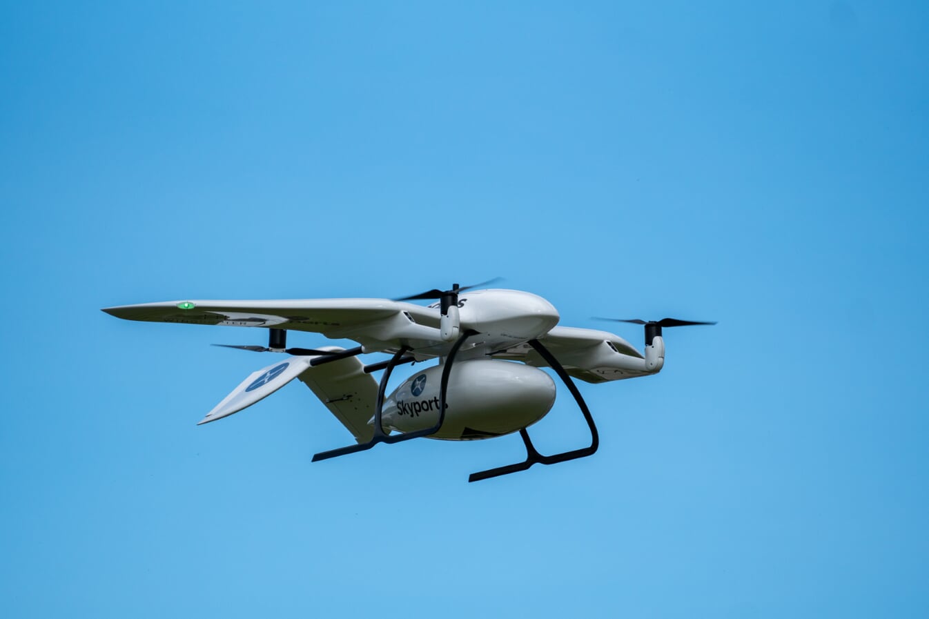
Skyports’ delivery drone, manufactured by Wingcopter, takes flight. (Photo: Wingcopter)
Skyports and Thales are partnering to conduct a drone delivery trial for the National Health Service (NHS) to support the United Kingdom’s COVID-19 response.
The trial, being conducted in Scotland, aims to prove the feasibility of delivering urgent medical cargo, such as COVID-19 test kits and Personal Protective Equipment (PPE), between remote medical facilities by delivery drone. The trial is backed by Argyll and Bute Health and Social Care Partnership (HSCP) — the integrated partnership of NHS Highland and Argyll and Bute Council directed by the local Integration Joint Board.
U.K. drone delivery provider Skyports will conduct the trial and operate the flights using delivery drones supplied by unmanned aircraft-maker Wingcopter, because of its proven capability through numerous delivery operations around the world. The trial flights will be planned through Thales’ drone operations management platform, SOARIZON, which offers digital tools to maintain compliant and safe drone flying operations.
Based at Lorn and Islands Hospital in Oban, the trial will consist of two-way flights between the hospital and Mull and Iona Community Hospital in Craignure 10 miles (16km) away on the Isle of Mull.
As COVID-19 testing rapidly gathers pace in the U.K., the proposed delivery service will help to ensure that isolated communities have access to tests, delivered in a fast and efficient way. Currently, the majority of medical supplies and specimens are transported between the laboratory at Lorn and Islands Hospital, surrounding general practitioners’ surgeries and other healthcare settings by sea and road, a long and complicated journey.
The service would cut delivery times from up to six hours one way by ground transport and ferry, to 15 minutes for on-demand delivery by drone. The speed would contribute to keeping front line medical and delivery personnel safe.
Answering the call from government and Argyll and Bute HSCP, in response to the COVID-19 crisis, the trial is the result of rapid mobilization from industry as well as the Civil Aviation Authority (CAA), local government, NHS Scotland and the U.K. Department for Transport (DFT). Argyll and Bute HSCP has been at the forefront of exploring with Skyports the use of unmanned aircraft technology, building on preliminary work with the Scottish government on the possibility of drone use by the public-sector emergency services in Scotland.
The two-week trial represents a crucial milestone for unmanned aviation in the U.K. Under current rules, drones must always be flown within visual line of sight of the remote pilot. To undertake these more extended flights (beyond visual line of sight, or BVLOS), the project team has been in close consultation with the CAA.
Through this trial, the alliance aims to prove the long-term, sustainable viability of such services; bringing together regulation, government and industry to unlock the transformational potential of drones for society when used in a safe, secure and controlled way.f this new service.”
Thales and Skyports are also working together within the CAA Regulatory Sandbox programme, exploring how regulatory approvals can be granted for more widespread BVLOS drone operations in the U.K.
Once the trial has been successfully completed, the team will continue to work closely with the CAA and the NHS to make services available in Scotland and across the U.K. to provide access to this innovative technology to a wide range of organisations, in particular a number of other NHS Boards and Trusts.
Driven by COVID-19, the uptick in adoption supports collaboration among remote workers as businesses adapt.
The Trimble Connect cloud-based collaboration platform has surpassed 10 million users. In response to COVID-19, distributed working has intensified the need for teams to share information and collaborate remotely, leading 1.2 million users to join Trimble Connect in March and April alone.
To date, Trimble Connect has hosted more than 80,000 design and construction projects, making it possible for people to collaborate and work together from anywhere in the world.
Photo: Trimble
Trimble Connect is an open collaboration platform for design and construction that connects project stakeholders with the data they need to inform decisions and improve team efficiency. Project stakeholders can share, review, coordinate and comment on data-rich constructible models, schedules and critical project information in real time — reducing costly miscommunication and improving coordination to keep projects on time and on budget.
In addition to adding new users, the activity on Trimble Connect has shown a considerable increase in collaboration for businesses in the architecture, engineering and construction (AEC) industry.
The number of invitations to collaborate on projects increased 58% in April over the previous month, indicating that users are adjusting to new remote and distributed working dynamics and enabling teams to stay resilient, despite interruptions to their traditional daily routines.
“This is an exciting milestone for Trimble Connect,” said Ray Bagley, business area director for Trimble Connect. “Businesses in the AEC industry need an open, common data environment that allows project stakeholders to unlock the real value of building information modeling (BIM), civil construction and geospatial data. The increased adoption of Trimble Connect in recent months shows us that businesses need reliable, open collaboration more than ever before.”
Trimble Connect’s open API enables data-flow to and from a variety of applications and allows users to customize workflows by integrating with existing enterprise solutions. Users can access project files stored on Trimble Connect directly through a wide range of solutions, including Tekla Structures software, Trimble Access field software, Trimble FieldLink layout software, SketchUP 3D modeling software and ProjectSight construction management software as well as third-party applications.
In 2018 the first-ever European Radionavigation Plan said “It is recognized that [..] GNSS should not be the sole source of PNT information. Alternative PNT systems, not necessarily using radio frequencies, should thus be put in place where the criticality of the application requires it.”
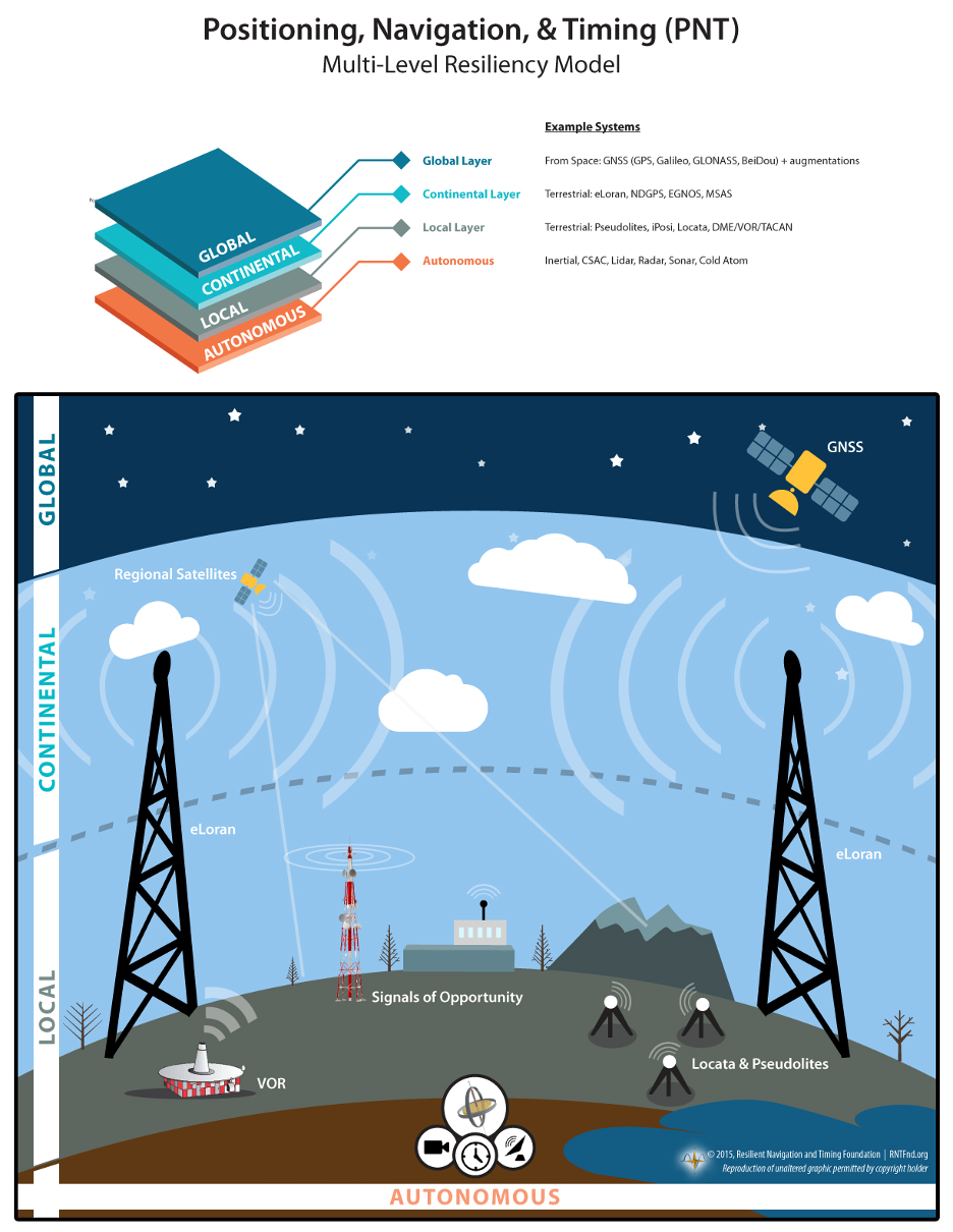
Graphic from MarRINav report showing system of systems approach to PNT resilience and reliability. (Image: Resilient Navigation and Timing Foundation)
In 2019 the European Space Agency (ESA) published a permanent open call for proposals for positioning, navigation, and timing studies and systems, including those that had nothing to do with space.
“Maritime navigation and port operations are critical for almost every nation,” said Jonathan Turner, one of the MarRINav project team. “As an island nation with a strong maritime heritage, we in the United Kingdom perhaps have an even greater appreciation of this.” Turner is co-founder of the blue economy solutions company NLA International, which led a team of eight organizations cooperating on the project.
While MarRINav focused its analysis on the United Kingdom, the intent was to provide information, and an analysis framework, that could also be used by other nations.
Maritime is one of sectors most dependent upon GNSS, according to the project reports, and a sector with great awareness of GNSS vulnerabilities and their consequences. MarRINav concludes that integrity and resilience are two of the most important parameters for maritime navigation.
Maritime is also one of the sectors most ready to integrate space and terrestrial navigation systems, according to the report’s authors. The International Maritime Organization has already introduced a performance standard for a multi-system receiver, or MSR, that will incorporate a wide variety of navigation signals.
Despite the distractions of Brexit over the last four years, the United Kingdom has been particularly focused on its vulnerability to GNSS outages.
In February of this year the UK government announced it was establishing a virtual National Timing Centre to protect the nation from the risk of GNSS failure, and in March the final MarRINav report was published.
Among the project’s findings are that:
The United Kingdom needs a comprehensive maritime PNT architecture with multiple, diverse sources to ensure continuity of maritime operations
Such a “hybrid solution” could benefit other sectors, especially if non-maritime needs were considered early in the design
New PNT systems should be terrestrial and sovereign
Establishing such a system for the UK has a very positive benefit to cost ratio
Important aspects of the new architecture are E-GNSS (Galileo and EGNOS), Enhanced Loran (eLoran) and the Ranging Mode (R-Mode) of the VHF Data Exchange System (VDES), and complemented by the development of a specific Maritime Receiver Autonomous Integrity Monitoring (M-RAIM) algorithm.
LOCATA or a similar local positioning system should be implemented at UK ports to provide a backup for container operations.
Satelles Satellite Time and Location may have potential, but its utility has yet to be demonstrated for maritime.
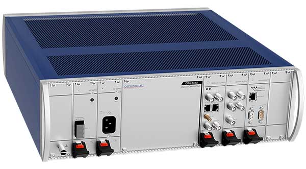
ADVA has launched a ePRC optical cesium atomic clock solution to protect synchronization networks during GNSS disruptions. The OSA 3350 ePRC+ offers vital backup for mission-critical infrastructures that depend on satellite-based timing, such as mobile networks and power utilities.
The Oscilloquartz OSA 3350 ePRC+ provides high stability and long life, as well as built-in support for Simple Network Management Protocol (SNMP) . It also meets stringent performance demands as well as the cost points needed for mobile networks transitioning to 5G.
Featuring an all-digital design, the OSA 3350 ePRC+ leverages optical-pumping techniques. It greatly improves performance by providing an extremely stable frequency source.
When used with enhanced primary reference time clocks (ePRTCs), the OSA 3350 ePRC+ delivers holdover for 14 days with an accumulated error of up to 35 nanoseconds. This far exceeds the ITU-T ePRC G.811.1 standard that requires an accumulated error under 70 nanoseconds.
The OSA 3350 ePRC+ also delivers optimum stability for more than 10 years, much longer than the lifespan of high-performance magnetic cesium clocks.
With a fully modular design, the optical cesium solution features a wide range of telecom synchronization output interfaces and supports modern and secured management capabilities with SNMP. It is RoHS-compliant and is fully integrated into ADVA’s Ensemble management and control software suite for operational simplicity and ease of use.
The 2020 Intergeo trade show will be hosted both in-person and virtually, said Intergeo organizer Christoph Hinte. The theme of the 2020 event will be “Geoinformation for a smarter world.”
“The hygiene and social distancing concept is currently being coordinated,” Hinte said. “In addition to the live event, this year is the first time we will also offer a virtual twin. Both the conference and the fair will be replicated. By hosting the fair in a virtual format, we expect to attract the same number of visitors as in previous years, if not more.”
Hinte made this announcement at the Intergeo Roundtable, an annual mid-year event for experts to discuss the latest industry trends.
During the roundtable, attendees discussed the latest industry trends. One trend mentioned in particular is the advancement of digitalization because of the COVID-19 pandemic. Trimble’s Janos Faust noticed that attitudes towards digitalization changed overnight after the breakout of the coronavirus pandemic, with people taking the digital transformation more seriously. Hexagon’s Michael Mudra also pointed out that anyone with round-the-clock access to automatically recorded, up-to-date and networked data that is evaluated using AI now has a clear advantage. Finally, Autodesk’s Ralf Mosler pointed out that companies are rapidly moving away from traditional work models and turning to technologies that completely reconnect BIM and GIS workflows.
Attendees also emphasized how the geo-IT industry can make a significant contribution to the climate crisis and current lack of resources. With regard to fleet management, up to 20% less fuel is being used and in Germany alone, precision farming methods are resulting in efficiency gains of 30%, Intergeo said in a press release. Whether it’s greater energy efficiency, enhanced energy utilization or even the simulation of different building methods, attendees agreed the industry is having a noticeable societal impact in both raw materials extraction and construction planning, Intergeo added.
Through the ION Online Job Board, ION corporate members can post job listings for free. For a limited time, non-ION corporate members can also post job listings for free. The job postings will expire automatically after 14, 30 or 60 days, depending on which expiration date the job poster chooses.
“To meet the burgeoning demand for a targeted talent pool specific to the PNT community, the new ION Online Job Board will help connect qualified job seekers with exciting and diverse employment opportunities for this niche audience, and in turn will help our corporate members continue to build talented teams to better ensure the success of their business,” said Lisa Beaty, executive director at ION.
The The Institute of Navigation is a not-for-profit professional organization dedicated to advancing the PNT industry.
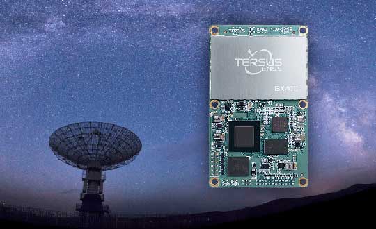
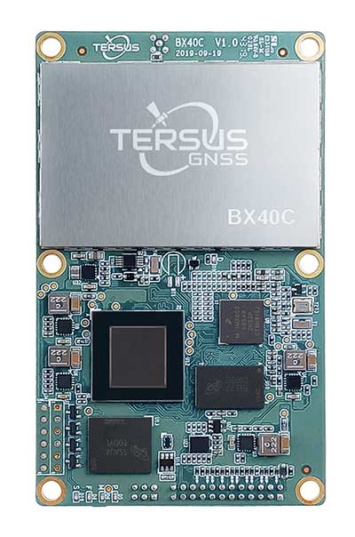
Tersus GNSS Inc. has released the BX40C RTK board to support its series of GNSS boards and provide highly accurate and fast positioning services.
Powered by the company’s new ExtremeRTK GNSS technology, the BX40C board can support multi-constellation and multi-frequency all-in-view satellite tracking.
The Tersus BX40C is a compact GNSS real-time kinematic (RTK) board with full constellation tracking for providing centimeter-level accuracy positioning. It can be integrated with autopilots and inertial navigation units to meet various developing requirements. It is suitable for high-precision positioning, navigation and mapping.
“Tersus has been proud of its BX-series RTK boards, and today we added a new member to the series by launching the new BX40C board,” said Xiaohua Wen, founder and CEO of Tersus GNSS. “The BX40C is with enhanced positioning accuracy and constellation tracking, even in harsh environments, the BX40C board can still control deviation within 3-centimeter in surveying and mapping applications. It supports 576 channels and can achieve centimeter-level position accuracy easily. We are excited to see how BX40C strengthens our product portfolio and technology competence to make a great effort in this industry.”
The BX40C board supports multiple constellations and frequencies to improve the continuity and reliability of the RTK solution — even in harsh environments. In-built 4GB memory makes data collection easy, the company said. It is compatible with other GNSS boards in the market via flexible interfaces, smart hardware design and commonly used log/command formats.
This column will address why users will be required to perform GNSS occupations when submitting a leveling project to the National Geodetic Survey (NGS) after 2022. It will highlight a section of NGS Blueprint for 2022, Part 3, “Working in the Modernized NSRS,” that discusses the process of performing leveling projects after 2022. My October 2017 column briefly discussed NGS’ preliminary plans for incorporating geodetic leveling data into the North American-Pacific Geopotential Datum of 2022 (NAPGD2022) to establish orthometric heights consistent with GNSS-derived NAPGD2022 orthometric heights. It emphasized that after NAPGD2022 is established, the primary means for deriving orthometric heights on monuments will be using GNSS observations combined with the geoid model.
As a side note, NGS just released NOAA Technical Report NOS NGS 72–GEOID18, a report that provides a comprehensive explanation of the data and methods used to create the latest NGS hybrid geoid model. My February 2020 column provided an analysis of the differences between the latest published hybrid Geoid18 values provided on NGS’ Datasheet and the computed geoid height value using the published NAD 83 (2011) ellipsoid height and NAVD 88 orthometric height.
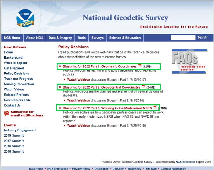
In support of the modernization of the National Spatial Reference System (NSRS), NGS has published three documents denoted as Blueprints for 2022 that describe the modernization of the NSRS (see the box titled “NSRS Modernization NGS Blueprint Documents”).
There are several sections in NGS Blueprint for 2022, Part 3, “Working in the Modernized NSRS,” that discuss the process of performing leveling projects after 2022. Something that will be new after 2022 is that NGS will require users to perform GNSS occupations in order to incorporate their leveling results into the new modernized NSRS.
NGS realizes that in the immediate future GNSS will not replace geodetic leveling for determining the most accurate local orthometric height differences. NGS’ plans include preparing a new leveling manual that will explicitly explain how to work in the modernized NSRS. Some of the new surveying procedures are described in Section 2.10 of Blueprint part 3. In section 2.10, NGS states that there will be substantial changes in how they process and serve up survey data, and that there will be some new ways of executing surveys. This column will focus on sections “2.10.2 Leveling” and “2.11.5 Leveling on Passive Marks” that discuss the new procedures for executing leveling surveys in the modernized NSRS. One major change is that leveling surveys will require Global Navigation Satellite System (GNSS) occupations to ensure orthometric heights computed in leveling surveys are up-to-date and are connected to the NSRS through the NOAA CORS Network. After the modernization of the NSRS in 2022, the NOAA CORS Network will be the primary access to the NSRS. This means leveling and classical surveys will require GNSS surveys to be part of the project. NGS’ plans include creating an OPUS option for processing all types of surveys. Users will be able, within OPUS, to adjust their projects using any mix of CORS data and passive control. Saying that, these same projects, on submission, will be deconstructed at NGS and reduced to the raw observations, then adjusted solely to the NOAA CORS Network to determine Final Discrete coordinates every GPS Month. The GPS Month concept may be new to some users. Blueprint Part 3 describes the concept in section “2.11.3 GNSS on Passive Marks.” The basic concept of a GPS Month is that it is four consecutive GPS weeks, with the first week in the GPS month having a GPS week number that is a multiple of four (see box titled “Definition of a GPS Month”).
Definition of a GPS Month
GPS month: Four consecutive GPS weeks, with the first week in the GPS month having a GPS week number that is a multiple of 4.
In this fashion, NGS defines:
GPS month 0 = GPS weeks 0, 1, 2, and 3 (1/6/1980 through 2/2/1980)
GPS month 1 = GPS weeks 4, 5, 6, and 7 (2/3/1980 through 3/1/1980)
GPS month 2 = GPS weeks 8, 9, 10, and 11 (3/2/1980 through 3/29/1980)
…
GPS month 513 = GPS weeks 2052, 2053, 2054, and 2055 (5/5/2019 through 6/1/2019)
etc.
So, what does this really mean to the user when performing a leveling project in 2022? For a leveling project to be processed using NGS software and/or submitted to NGS for inclusion into the NSRS database, the user must follow specific rules.
The following is from Blueprint, Part 3, section “2.10.2 Leveling:”
“As GNSS occupations are required for geodetic leveling, the rules for how many and how frequently will be:
For a leveling project to be processed using NGS software and/or submitted to NGS for inclusion into the NSRS database, its field observations should not span more than one year. Longer projects should be broken into sub-projects of less than one year.
A minimum of three “primary control marks” must be in the level network for every project.
More primary control marks should be added so there is never more than a 30-kilometer linear distance between marks in the entire network.
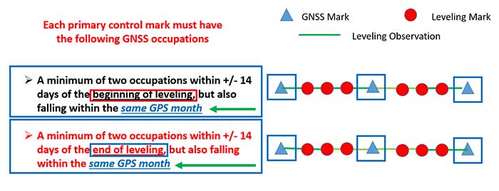
Each primary control mark must have the following GNSS occupations (details on using GNSS occupations to work in the NSRS will be found in the update to NGS 58):
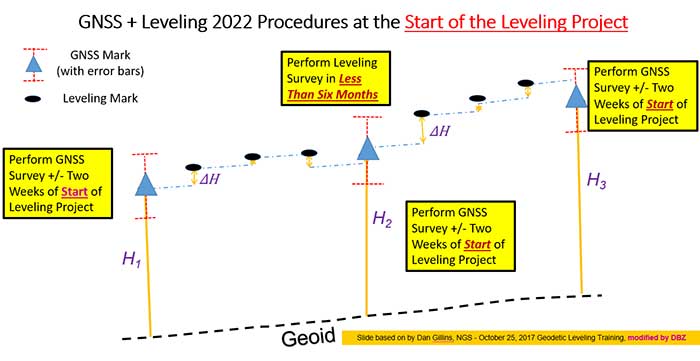
A minimum of two occupations within +/- 14 days of the beginning of leveling, but also falling within the same GPS month and whose local start times are separated by between 3 and 21 hours.
It is preferable, but not required, that all occupations on any primary control mark occur within the same GPS month as those of all other primary control marks.
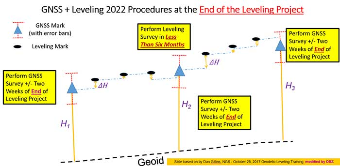
A minimum of two occupations within +/- 14 days of the end of leveling, but also falling within the same GPS month and whose local start times are separated by between 3 and 21 hours.
It is preferable, but not required, that all occupations on any primary control mark occur within the same GPS month as those of all other primary control marks.
All projects exceeding six months must have a third set of GNSS occupations on all primary control marks some time near the middle of the project, without a rigorous rule as to when. They must follow the “minimum of two occupations” rule as per above, and each mark’s occupation is required to fall in the same GPS month, with a preference that all primary control marks are occupied in the same GPS month.”
The box titled “GNSS Procedures for Leveling Projects” highlights the GNSS rules that need to be adhered to when performing leveling projects in 2022.
GNSS procedures for leveling projects
For the Immediate Years Following 2022, NGS Will Require That all Leveling Projects Turned in Have GNSS on Primary Control
Minimum of 3 Points with a Maximum Spacing of 30 km
At Least Two Occupations of Each GNSS Primary Control:
+/- 14 days of Beginning of Leveling
Within the Same GPS Month
+/- 14 days of Ending of Leveling
Within the Same GPS Month
Diagram: David B. Zilkoski
The boxes titled “GNSS + Leveling 2022 Procedures at the Start of the Leveling Project” and “GNSS + Leveling 2022 Procedures at the End of the Leveling Project” provide conceptual diagrams that illustrate what this means to a typical leveling project.
Diagram based on information from Dan Gillins, NGS, and modified by David B. ZilkoskiDiagram based on information from Dan Gillins, NGS, and modified by David B. Zilkoski
So, why is NGS requiring users to perform GNSS observations in support of leveling project. Leveling is a differential measurement technique; it generates relative height differences not absolute heights. In NGS’ modernized, time-dependent 2022 NSRS, the absolute height will be provided by up-to-date GNSS data; and the accurate relative height differences between leveling marks will be provided by the leveling data. (See box titled “Why NGS Requires GNSS Occupations on Primary Marks.”)
Why NGS requires GNSS occupations on primary marks
The Connection to NAPGD2022 is Obtained Through GNSS and a High-Accuracy Geoid Model
Network Accuracy
The Accuracy of the Height Differences are Provided Through the Leveling Data
Local Accuracy
Combining the leveling and GNSS increases the redundancy in a survey network
NGS is developing models and tools to facilitate the incorporation of leveling survey data and adjustment results into the new modernized NSRS in 2022. Blueprint, Part 3, section “2.13.3 OPUS for Leveling,” describes NGS plans to support leveling surveys through the use of the OPUS web tool. The box titled “OPUS for Leveling” outlines how NGS will modify the OPUS web tool to support leveling surveys.
OPUS for leveling
Support for leveling surveys will follow many of the best aspects of OPUS
Uploading and processing digital data files
Using a web-based graphical interface
Submitting data to NGS
Leveling is a differential measurement technique
It generates relative height differences not absolute heights
For users who need absolute heights in the NSRS
OPUS will support a mix of GNSS and leveling in a single project
NOTE: NGS will require a GNSS survey to be performed at specific times before and after leveling surveys in order for the data to be submitted for inclusion in the modernized NSRS after 2022.
NOTE: Leveling surveys longer than one year must be broken up into multiple projects. Leveling surveys between 6 and 12 months in duration require a third, intermediary GNSS data collection.
This column highlighted that in the modernized NSRS the only way to get “into the datum” will be through a GNSS survey. It noted that leveling projects generate relative height differences not absolute heights. In NGS’ new modernized, time-dependent NSRS, the absolute height will be provided by up-to-date GNSS data; and the relative height differences between leveling marks will be provided by the leveling data. A major requirement will be that users must collect GNSS data both at the beginning and at the end of a leveling survey project. Leveling survey projects that take longer than one year to complete must be broken up into multiple projects. NGS is developing model and tools to facilitate incorporating all types of survey data into the new NSRS. I would encourage all readers to read NGS’ Blueprint for 2022 documents to obtain a better understanding of the new, modernized NSRS.
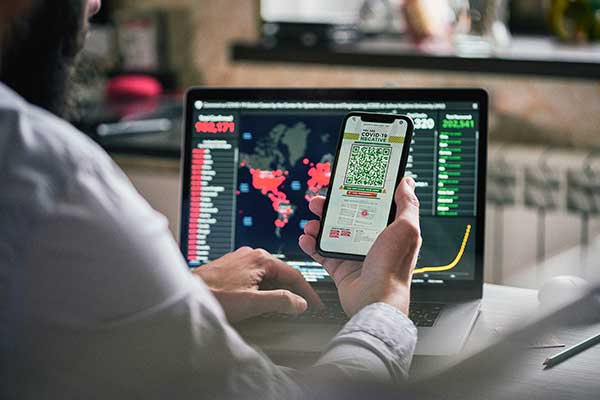
Contact tracing can help stem the spread of the COVID-19 pandemic. It involves tracking the movement and interactions of infected individuals to identify others at risk.
National and regional responses to the COVID-19 pandemic have included containment through quarantine and restriction of movement. When properly implemented, these solutions limit spread of the contagion to prevent it from overwhelming healthcare and emergency management systems.
According to the World Health Organization, the Centers for Disease Control and Prevention, and virtually all medical professionals, any effective strategy to return the world to normal requires three components: testing, contact tracing and isolation.
While testing to find the people who are infected is the absolute top priority, contact tracing is vital for stopping a disease from spreading out of control. It involves tracking the movement and interactions of infected individuals to identify others at risk. Any positive test without contact tracing is bad public health — it misses an opportunity to reduce the spread of the virus.
While the concept of contact tracing has just entered popular consciousness, it has been a standard public health tool for a century. For example, in the 1930s, Great Britain used it to contain the incidence of sexually transmitted infections. In the 1960s and 1970s, South American, African and Asian countries used it to eradicate smallpox. Additional diseases for which contact tracing is performed include tuberculosis, measles, HIV, Ebola, bloodborne infections, serious bacterial infections and novel infections.
What Is Contact Tracing?
The World Health Organization describes three basic steps:
Contact identification. Those who have been in contact with someone who has been confirmed to be infected are identified, by asking about their activities and those of the people around them.
Contact listing. All persons who have had contact with the infected person are informed of their status and told to receive early care if they develop symptoms.
Follow-up. Contacts are monitored for symptoms and tested for signs of infection.
In some cases, quarantine or isolation is required for high-risk contacts.
The enormous dimensions of the current pandemic, however, challenge traditional models of contact tracing, which are very resource intensive. In search of a technological assist, several Asian countries already have been taking advantage of the functionalities of smartphones to scale up contact tracing to match the pandemic’s rate of growth, such as the Trace Together app built by the Singapore government. Companies and organizations around the world are following suit, including Britain’s National Health Service, a pan-European initiative, and an unprecedented joint venture by Apple and Google.
Automating Contact Tracing
A study published on March 31 in Science concluded that “viral spread is too fast to be contained by manual contact tracing but could be controlled if this process [were] faster, more efficient and happened at scale.” A contact-tracing app that memorizes close contacts and immediately notifies users if they have had contact with infected individuals, prompting them to self-isolate, could control the pandemic without need for mass quarantines if enough people used it, the study argues.
Privacy versus Protection. A similar app has been deployed in China, where people are required to use it to be allowed to move beyond their neighborhood, enter public spaces, or use public transport. A central database collects data on each user’s movement and coronavirus diagnosis, artificial intelligence analyzes these data, then the app displays a red, amber or green code that determines the user’s freedom of movement. This app has been credited with significantly helping China suppress the pandemic, but has been criticized for its disregard for data protection and privacy.
Relying on fundamental epidemiological principles and common smartphone functionality, the Science study authors designed a simple algorithm to replace manual contact tracing. “Coronavirus diagnoses are communicated to the server, enabling recommendation of risk-stratified quarantine and physical distancing measures in those now known to be possible contacts, while preserving the anonymity of the infected individual.” Symptomatic individuals could use the app to request testing, and everyone could use it to access COVID-19-related health services, information and instructions, or even to request deliveries of food or medicine during self-isolation.
Public trust in the app and how the gathered data are used would be critical to its success. The study’s authors lay out a series of requirements for its ethical implementation, then point out that “the algorithmic approach we propose avoids the need for coercive surveillance, since the system can have very large impacts and achieve sustained epidemic suppression, even with partial uptake.”
The authors of a similar article in the journal JMIR mHealth and uHealth write that a contact-tracing system can limit any central coordination to notifying users who have been in contact with an infected person. Their core idea is that it does not matter where someone contacts an infected person, only that they were in close enough contact to risk infection. Particularly sensitive location data, such as GPS or phone cell data, “is actually neither necessary nor useful.” No one learns who the user is because the app is not linked to an identity, and it neither records nor stores location data.
The authors argue their proposed app is the most effective epidemiologically because it would determine which people were in close proximity, and it would receive user cooperation. “Only if people trust a system — because it does not spy on them — will the system find broad support in the population.”
GPS, Bluetooth or Both?
Technologically, the concepts of location and proximity are embodied in two standard smartphone components: GPS receivers and Bluetooth transceivers. GPS-derived location data makes it possible to map and analyze the movements of individuals and of large numbers of people; for example, it is how we know that many in this country have begun relaxing social distancing rules ahead of the lifting of legal mandates. Bluetooth’s use of low energy, generally a drawback, becomes an advantage here because it can tell us whether two or more people have been within 1.5 to 2 meters of an infected person for at least 10 to 15 minutes — when the risk of infection is highest. This knowledge can enable newly infected, pre-symptomatic people to self-isolate and not infect others.
Numerous companies are developing and proposing smartphone-based contact tracing apps.
Vesedia Mobile Technologies proposes that people who test positive to COVID-19 be asked to provide information about public places they visited in the preceding days and at what times, using their phone location history for verification. The information would be anonymized by healthcare officials, and entered into a database that would be publicly accessible via a website and mobile app.
Ramesh Raskar. (Photo: MIT/John Werner)
Intersections. The COVID Safe Paths phone app and the Safe Places browser tool for contact tracers were created by Ramesh Raskar and other researchers at the MIT Media Lab. If a user tests positive and consents, his or her data is uploaded, redacted by healthcare authorities to remove any personally identifiable information, and downloaded by the app.
The app then performs “intersections” — it identifies and notifies people with whom the infected person has crossed paths. By clicking on intersections, users can display their timeline for the past 14 days, in a calendar view, which tells them how many intersections have occurred each day.
The app also provides news reports from authorized local news channels, based on each user’s position or if they tap the URL for their local healthcare authority, said Abhishek Singh, the program’s tech lead, who is helping with the app’s development.
“We are also building an interoperable architecture,” Singh said. “Because there are many contact tracing apps already in the wild, we want to make sure that they have some common standards and guidelines that enable them to utilize data from other apps securely and through consent.” More than 1,200 people are voluntarily contributing to the project. “It is being led by the open-source community, and all our source code is out there and anybody can contribute,” Singh said.
Safe Places is helping health authorities by making the data and insights visible, enabling them to make the right decisions such as targeting resources to areas that need them most, helping them impose restrictions such as lockdowns, or reopen the economy. “The economy will not reopen in a single burst, but step by step.” Singh said. “A dashboard that allows them to monitor where the infection is spreading and where it has been contained helps them decide where to take which steps.”
The GPS Advantage. The uptake required for GPS-enabled contact tracing to be successful is generally lower than for Bluetooth-based contact tracing, Singh argues, citing an Oxford University simulation. “With GPS, you do not need people to have the app already downloaded for it to be effective,” he points out. A person who tests positive for the virus can use the Safe Place web tool to manually create a GPS trail and help healthy people. This is one of the biggest advantages of GPS compared to Bluetooth, because the latter requires exchanging information directly through the hardware, which cannot be done after the fact.
Because the app is open source, any government can deploy it using its own IT infrastructure. However, a government that wants to adopt Safe Paths must sign a letter that commits it to complying with privacy and ethical guidelines. Preventing authoritarian governments and nosy employers from requiring people to use this app and reveal their data requires stringent guidelines as to how it is deployed and who can access the data, Singh said.
Apple and Google Join Forces
Apple and Google have joined in an unprecedented alliance to develop a system for notifying people who have been near others who have tested positive for COVID-19. Eight out of 10 people in the United States own smartphones, and the two companies’ operating systems run more than 99% of them. Apps built directly into iOS and Android, especially if interoperable, could dramatically increase the reach of public health authorities (the only organizations that would receive the data). To avoid fragmentation and encourage wider adoption, Apple and Google will allow only one app per country to use their system, but will allow U.S. states to use it and support countries that opt for a state or regional approach.
The system will use Bluetooth signals from phones to detect encounters rather than GPS location data. It will not run ads, will require users to opt-in, be decentralized, and use randomized IDs not tied to a user’s actual identity to communicate potential contacts with individuals with a confirmed positive COVID-19 diagnosis.
With GPS, you do not need people to have the app already downloaded for it to be effective.
API Coming. On May 20, Apple and Google released an API to developers. Next, they will issue a system update to build in contact tracing at the OS level. Should a user’s phone notify them of a possible contact, they will be prompted to download and install a public health app from their local health authority to obtain trusted instructions.
Developers of coronavirus-related apps for several U.S. states have argued that GPS location data is vital to identify infection hotspots and track outbreaks. However, for various technical reasons, workarounds designed to bypass the decision by Apple and Google and collect GPS data in connection with their contact tracing system would work poorly.
Ethical and Equity Concerns
“The work that we are doing for COVID-19 is pretty similar to work that we do on a routine basis with other reportable communicable diseases,” said Lisa Ferguson, nursing supervisor for Communicable Disease Investigations and Case Management for Multnomah County, Oregon, which includes the city of Portland. Most commonly, her unit is notified of illnesses by the state database, which receives electronic lab reports. “We assign that as a case to somebody on our team, and they call the person, interview them, ask some questions about their illness, their symptoms and where they could have possibly been exposed,” Ferguson explained. “Then, they talk about who that person might have exposed and where they were from two days before they became sick up until the time of the interview or the time that their symptoms were resolved.”
The Multnomah County, Oregon, Disease Detection Team. (Photo: Multnomah County, Oregon)
How could technology — such as smartphone location data — best help Ferguson’s team conduct contact tracing for COVID-19? “In the public health world, we are not used to having access to technology in that way,” she said. “We need to have some ethical discussions before we are prepared to utilize something like a technology that can track people.” Also, unlike tracking measles, which requires knowing whether someone was in an airspace and who was there after them, “We do not automatically consider someone to have been exposed if they were in the same airspace as someone who tested positive.”
If the privacy concerns could be adequately addressed, receiving a list of all the people who were less than six feet away for at least 10 minutes from someone who had tested positive could help her team scale up, Ferguson said. Her team would then reach out to those people, using such language as “You may have been exposed,” and “Please watch yourself closely.”
Ferguson’s team always has “equity concerns,” fearing they might under-identify groups that do not have access to the technology. “It is a supplemental tool, but it certainly would not replace the work that we are doing,” she said.
Help Wanted
Safely reopening the United States will require a new workforce of at least 100,000 contact tracers, according to a report from the Johns Hopkins Center for Health Security and other experts. Any technological assist to contact tracing does not diminish this need. For example, smartphone alerts can help filter out those at low or no risk so that human tracers can focus on genuine cases, people at higher risk, or those who are harder to contact.
Two out of 10 people in the United States do not own a smartphone, and only 42% of those above the age of 65 — who suffer 80% of the deaths from COVID-19 — do, according to a 2017 Pew Research Center poll. Hardly any homeless people own a smartphone. Among those most vulnerable to the pandemic are immigrants who do not speak English and are fearful of efforts to collect their personal information, strengthening the need for this to be done in person by trusted community members.
Finally, even if Google and Apple’s automated service is widely adopted and works well, it will require many thousands of health workers to conduct tests and follow-ups.
Brazilian geoscience services company OceanPact Geociências has chosen deep-water positioning technology from Sonardyne Brasil Ltda. to support its geophysical, geotechnical and environmental research operations across the region.
Ranger 2 ultra-short baseline (USBL) systems have been installed on board OceanPact’s research vessel Seward Johnson and RSV Austral Abrolhos to precisely track the location of underwater equipment and sensor packages deployed from the ships, including seabed corers, towed sensors and data loggers. Both vessels are currently on hire to Brazilian oil major Petrobras.
Ranger 2 USBL is a popular choice for conducting research at sea as operations can start as soon as a vessel arrives on location. This helps maximise valuable ship time. It has the capability to track multiple underwater targets simultaneously to beyond 11 kilometers, works in shallow or deep water and is able to remotely configure and communicate with compatible instruments. This operational flexibility was a key factor in OceanPact’s investment decision.
“This order from OceanPact further embeds Ranger 2’s reputation in the region. For those wanting accuracy and versatility, it’s proven itself time and again while also meeting the toughest specifications from oil and gas, science and survey companies,” Andre Moura, sales and applications manager at Sonardyne Brasil Ltda.