Blog

  • CMC Electronics and ÉTS launch major research chair in resilient aviation navigation

    CMC Electronics and ÉTS launch major research chair in resilient aviation navigation

    A five-year research and development program has been launched to enhance GNSS navigation for aviation, encompassing security, integrity and spoofing resilience.

    CMC Electronics is partnerinng with École de Technologie Supérieure (ÉTS) in Quebec, Canada, to create the CMC Electronics Industrial Research Chair in Resilient GNSS Navigation. The five-year chair, valued at more than $6 million, unites CMC’s avionics expertise, led by John Studenny, internationally recognized GNSS navigation expert and standards contributor, with ÉTS’s renowned LASSENA laboratory under René Jr. Landry, an expert in aerospace navigation and cybersecurity.

    The chair will tackle critical threats to GNSS navigation for aviation, including jamming and spoofing. CMC and ETS aim to develop spoofing-resilient GNSS receivers capable of real-time detection, mitigation and total recovery from spoofing attacks, setting a benchmark in aviation safety and integrity.

    Research focus areas

    The chair’s work spans several integrated areas that target key GNSS security challenges:

    • integration of spoofing detection algorithms
    • spoofing resilience grading and stress testing frameworks
    • recovery mechanisms and certification benchmarking
    • advanced integrity algorithms (ARAIM)
    • sensor fusion and authentication technologies for spoofing mitigation
    • end-to-end spoofing-resilient GNSS prototype
    • next-generation inertial sensors with built-in integrity

    Together, these areas aim to produce operational, spoofing-resilient GNSS systems suitable for aviation environments.

    Broader impact and strategic alignment

    The chair will train more than 65 highly qualified personnel (HQPs) and promote equity, diversity and inclusion in engineering. It supports initiatives to increase women’s representation and aligns with ÉTS’s strategic research fields in aerospace, cybersecurity, sensors and intelligent autonomous systems.

    CMC Electronics is co-leading the research program and industrial deployment, ensuring that the outcomes are fast-tracked toward secure, export-ready GNSS solutions. Safran Trusted 4D contributes specialized expertise, and Jaunt Air Mobility provides operational insights for flight testing and system integration.

  • Maxar Intelligence rebrands to Vantor, unveils AI-powered platform

    Maxar Intelligence rebrands to Vantor, unveils AI-powered platform

    Vantor has rebranded from Maxar Intelligence. The newly named company also unveiled Tensorglobe, an AI-powered spatial intelligence platform.

    The rebrand represents the culmination of the company’s multi-year journey to productize its core operational technology and transform from a satellite imagery provider into an end-to-end spatial intelligence company.

    According to the company, the name Vantor speaks to how the company unlocks a real-time competitive advantage by delivering total clarity for missions across the space, air and ground domains, ending the era of disconnected sensor platforms. “Vantor is solving the most critical challenges across the defense and commercial sectors, including the urgent need for more advanced battlespace systems and the push to unleash autonomy across every industry,” the company said in a press release.

    The company addresses these challenges with multi-domain spatial intelligence solutions that integrate sensor data across satellites, drones and ground-based assets to improve decision-making and drive autonomous operations at scale. Over the past six months, Vantor has launched several AI-enabled solutions, including:

    • Raptor: A software suite that integrates Vantor’s 3D terrain data with a drone’s native camera to ensure that autonomous platforms can navigate effectively and extract target ground coordinates accurately in the absence of GPS.
    • Sentry: A global-scale persistent site monitoring solution that can identify operational threats across hundreds of areas at once by integrating automated collection planning across multiple satellite constellations, including sovereign assets, with AI-driven data fusion and analytics.
    • Tensorglobe: An end-to-end platform that empowers organizations to build their own spatial intelligence system. Tensorglobe fuses sensor data from space, air and ground to create a living 3D globe, automating the intelligence cycle to keep this unified foundation up to date.

    Vantor has partnered with innovators across the defense and commercial sectors to jointly build integrated intelligence solutions. For instance, Vantor is delivering the foundational spatial intelligence for Anduril’s next-generation mixed reality combat system designed for the U.S. Army’s Soldier Borne Mission Command Architecture (SBMC-A) program. The company has also signed partnerships with Saab and Taiwan’s AIDC to integrate Raptor into mission-ready systems designed for contested environments.

  • Topcon launches Geomatics division ahead of Intergeo

    Topcon launches Geomatics division ahead of Intergeo

    Topcon Positioning Systems has created of a dedicated business structure focused on delivering high-precision technology, software and services for geomatics. The new organization consolidates and expands Topcon’s portfolio of surveying, geospatial and GIS solutions, while opening new pathways into emerging markets.

    The specialized division is an addition to the company structure, which includes established divisions dedicated to construction and agriculture.

    “Geomatics is entering a new era,” said Ivan Di Federico, president and CEO of Topcon Positioning Systems. “It is no longer only about collecting points and producing maps. Today, it is about capturing massive amounts of geospatial data, connecting multiple data streams, and delivering insight with the speed and simplicity our customers demand. Topcon’s role is to reduce the gap between field capture and business decisions. By elevating geomatics into its own global business group, we are signaling that this discipline is vital — not just for traditional professionals, but for every sector where spatial intelligence drives efficiency and growth.”

    Photo:
    Neil Vancans will lead the new Geomatics Sales Unit of Topcon. (Photo: Topcon)

    Neil Vancans, an experienced leader in the surveying and geospatial industries, has joined the company as the head of its new Geomatics Sales Unit. He brings decades of experience in senior leadership roles at companies including Leica Geosystems, Thales Navigation, Septentrio, and Altus Positioning Systems.

    “Topcon has the precision technology, the global resources, and the vision to reshape what users can expect from geomatics,” Vancans said. “The demand for accurate, reliable positioning is expanding rapidly, and our goal is to turn raw data into usable, actionable intelligence. That means creating value for customers, empowering dealers and partners, and ensuring that geomatics solutions accelerate digital transformation.”

    Topcon geomatics solutions — including the expanding Capture Reality portfolio — will be showcased at Intergeo 2025 in Germany, Oct. 7-9.

    For more on Topcon’s focus on precision, watch the video “Since Precision Exists.”

  • Thank you for registering

    Thank you for registering for the upcoming webinar, “Building a Layered Future: Resilient GNSS Alternatives That Complement, Not Compete, with GPS” sponsored by NextNav.

    A link to the live event will be sent to you two hours before the event. Your personalized event URL will be automatically generated by the ON24 system. To ensure receipt of the email, please whitelist this email address by adding it to your contacts: [email protected].

    This presentation will begin at 2 p.m. EDT on Thursday, October 23. A recording will also be sent to you the following day so you can watch it on-demand.

    Audience members may arrive 15 minutes prior to live time. If you have any questions, please contact event producer Halle Reid at [email protected].

  • Redefining high-precision GNSS – meet Accutenna 4

    Redefining high-precision GNSS – meet Accutenna 4

    The Accutenna 4 features:

    • Low-profile 4-feed composite patch
    • Full GNSS + L-Band coverage
    • Superior interference mitigation (XF)
    • Housed and embedded models available
    • Lightweight, rugged industrial design

    Click here to learn more.

  • Waypoint post-processing software

    Waypoint post-processing software

    Waypoint software is an industry-leading, professional post-processing portfolio trusted by the companies building maps for the world. Waypoint software leverages Global Navigation Satellite Systems (GNSS) and inertial navigation systems (INS) data to generate a source of truth for post-mission trajectories and mapping. 

    Built on Hexagon | NovAtel’s decades-long legacy in post-processing algorithm development, Waypoint software refines GNSS-only or GNSS+INS data by processing forward and reverse in time, then combining and smoothing the results to maximise accuracy and signal availability for applications across land, air and sea. 

    Click here to learn more.  

  • Are you ready for NSRS modernization? What the upcoming changes mean for your geospatial data

    Are you ready for NSRS modernization? What the upcoming changes mean for your geospatial data

    In my August 2025 GPS World newsletter column, I highlighted that a colleague reminded me that the National Geodetic Survey’s (NGS) new National Spatial Reference System (NSRS) is more than a technical upgrade. It offers a prime opportunity to review and improve current processes and workflows, examine existing products and considerations, and plan strategically for future needs. By auditing geospatial data dependencies now, NSRS users can assess how transitioning to the new datum will affect workflows, datasets and operational decision-making.

    Several organizations have formed working groups to address the new NSRS. The National Society of Surveyors (NSPS) has released a story map to inform the professional surveying community and is developing guidance and case studies. The American Association for Geodetic Surveyor (AAGS) is collaborating with NSPS. The American Society of Photogrammetry and Remote Sensing (ASPRS) has prepared materials available on its website. Additionally, under the leadership of Gary Thompson, the North Carolina Geodetic Survey established the North Carolina 2022 Reference Frame Working Group. The group’s goal is to address issues related to the implementation of the datum change in 2026. It includes representatives from North Carolina agencies involved in producing or using geospatial products and services.

    Agencies Involved in the NC 2022 Reference Frame Working Group
    NC Geodetic SurveyNC DOT HydraulicsNC State Mapping Advisory Committee
    NC Geographic Information Coordinating Council (GICC)NC State, Land Records ManagementNC Geodetic Survey Advisory Committee
    NC Center for Geographic Information & AnalysisNC GICC Local Government CommitteeNC Society of Surveyors
    NC DOT State Location & SurveysNC State Mapping Advisory CommitteeDuke Energy
    NC DOT Photogrammetry UnitNC GICC Local Government CommitteeU.S. National Geodetic Survey

    The organizations participating in the NC RFWG are assessing how changes in the new NSRS may impact their geospatial workflows and evaluating their reliance on NGS products and services. Proactive self-assessment is essential because NGS cannot customize support for each entity’s unique needs and processes. By identifying potential challenges and opportunities early, organizations can adapt smoothly and maintain operational efficiency during the transition. The following were the key action items from the last NC RFWG meeting:

    • Create an information sheet to help local governments prepare for the data change
    • encourage agencies to consult their software vendors on support measures for the new datums
    • establish a rule for when to use the U.S. Survey Foot versus the International Foot
    • review current data files to ensure their metadata includes datum and unit information.

    Many participants of the North Carolina working group expressed interest in understanding how much the coordinates will shift with the new NSRS. While NGS’s website offers diagrams that provide a high-level overview of coordinate and product changes, many users sought more detailed information specific to North Carolina. To address this, I used NGS’s Multi-Year CORS Solution 3 (MYCS3) update of the NOAA CORS Network to ITRF2020, epoch 2020.0, to estimate the changes between the current NSRS — NAD 83 2011 (epoch 2010.0) — and the upcoming NSRS in North Carolina, such as NATRF2022 at epoch 2020.0. This approach offers a more detailed view of the magnitude of shifts in local regions. The figure titled “Approximate Differences Between NATRF2022 (Epoch 2020.0) and NAD 83 2011 (Epoch 2010.0) in NC” illustrates the approximate horizontal coordinate differences between the current NSRS and the future NSRS based on NCN CORS data. (Note that these units are in feet.) For additional information on MYCS3 and regional changes across the United States, refer to my August 2025 GPS World column.

    Approximate differences between NATRF2022 (Epoch 2020.0) and NAD 83 2011 (Epoch 2010.0) in North Carolina. Horizontal change in feet. (Credit: Dave Zilkoski)
    Approximate differences between NATRF2022 (Epoch 2020.0) and NAD 83 2011 (Epoch 2010.0) in North Carolina. Horizontal change in feet. (Credit: Dave Zilkoski)

    Differences in orthometric heights between the new NAPGD2022 and the current NAVD 88 are significant for anyone working with FEMA flood maps or preparing flood insurance elevation certificates. I used ITRF2020, epoch 2020.0, ellipsoid heights from NOAA CORS stations along with Geoid2022 values to estimate the NAPGD2022 orthometric heights at the CORS sites. As depicted in the plot, the height differences between NAPGD2022 and NAVD 88 across North Carolina range from about 0.5 feet in the southeastern region to over a foot in the northern and western regions. (Note that the units are in feet.)

    Approximate differences between NAPGD2022 and NAVD 88 in North Carolina. Orthometric height change in feet. (Credit: Dave Zilkoski)
    Approximate differences between NAPGD2022 and NAVD 88 in North Carolina. Orthometric height change in feet. (Credit: Dave Zilkoski)

    This type of information should be shared with managers of real-time GNSS networks(RTN). RTN operators could then establish a parallel beta system to enable users to understand how the new NSRS may affect their products and services. (Note: The North Carolina Geodetic Survey, which manages the NC CORS/RTN system, is considering running a pilot parallel RTN based on the new NSRS.) This data can be valuable for RTN users to assess how coordinate changes might influence their workflows. For example, it can help determine how the shifts in coordinates will affect agricultural activities such as planting, fertilizing and harvesting. Will farmers need to remap their fields, or will a transformation be sufficient?

    Fostering collaboration with stakeholders and constituents will help users better understand how the NSRS modernization impacts their products and services. Developing strategies to align geospatial data management with regulatory requirements and operational objectives will also facilitate a smoother implementation process. NGS is partnering with federal agencies and professional societies to create a self-assessment guide that helps organizations evaluate how the NSRS update affects their geospatial missions. As previously mentioned, the North Carolina 2022 Reference Frame Working Group is working with state and local agencies, as well as surveyors, to proactively address key questions and challenges. This collaboration aims to improve communication with NGS and determine whether their products and services need to be reprocessed, re-surveyed or transformed to suit the new standards.

    Each organization has its own unique geospatial requirements and a thorough understanding of its mission and needs. This is an ideal opportunity to develop a centralized plan for evaluating and managing geospatial workflows during the transition to the modernized NSRS. Challenges include aligning legacy datasets with new reference standards while ensuring data integrity. Organizations should assess the accuracy of their data in relation to the NSRS and document any necessary updates in metadata. By creating a well-structured plan that balances operational constraints, legal compliance and practical considerations, organizations can prioritize accuracy, efficiency and alignment with the updated NSRS.

    To assist others in preparing for the new NSRS, Dana J. Caccamise II, NGS regional geodetic advisor, has developed guidance materials that have been shared with federal agencies — including the FGDC and their team leaders — and professional organizations such as NSPS, ASPRS and AAGS. See the boxes titled “Questions to Guide a Self-Assessment of Your Operation and Products” and “List of NGS Products and Services — Are your workflows dependent on one or more NGS products.” The goal is to help these agencies become ready to implement the new NSRS once it is officially adopted by NGS.

    Questions to Guide a Self-Assessment of Your Operation and Products
    Are you generating or using geospatial data (or doing both)?
    – If so, your workflows are likely dependent on geodetic control tied to one or more NGS products. The upcoming NSRS update will affect these dependencies. (See “List of NGS Products and Services.”)
    Do you know if your mission, project, or datasets depend on NGS products?
    – Identifying whether and how your entity relies on NGS products is a critical first step in assessing potential impacts.
    What are your accuracy, precision, and shelf-life requirements for geospatial data?
    – Understanding your mission’s specific data requirements ensures you can evaluate whether NSRS modernization will meet your operational needs without unnecessary adjustments. This should include plans to accommodate greater accuracy in the future.
    Do you know how your entity accesses and utilizes geospatial data?
    – Are you obtaining it directly from NGS or indirectly through third-party vendors (e.g., RTN systems, GIS platforms, GNSS companies)?
    – Have you considered how updates to NGS products may impact the tools or services you rely on from these vendors?
    – Many entities rely on geodetic control without realizing it. NGS’s foundational data and frameworks are often invisible and seamlessly embedded within the tools and services offered by third-party vendors, such as GIS platforms, survey equipment, and software providers. These vendors, in turn, depend heavily on NGS products like the NSRS to ensure their tools are accurate and functional. Understanding this indirect reliance is crucial for preparing your workflows and ensuring continuity as the NSRS is modernized.
    Where does your entity fit in with the geodetic workflow?
    – Does your entity create integral products (e.g., GNSS data, lidar data) on which other products depend?
    – Does it produce derivative products (e.g., DTM, Topographic Map, Flood Insurance Rate Map (FIRM) and Flood Insurance Study (FIS) Report)?
    – Evaluating these dependencies will help you determine the scope of NSRS modernization impacts.
    What are your project requirements for data accuracy and longevity?
    – Assess whether your data accuracy thresholds and long-term usability align with the modernized NSRS.
    Have you evaluated workflows and identified potential impacts in areas affected by significant ground movement (e.g., regions with tectonic shifts, vertical land motion, and, most notably, subsidence)
    – Identifying potential risk or disruption areas can guide prioritization and help mitigate impacts on critical operations.

    List of NGS Products and Services

    Are your workflows dependent on one or more NGS products

    Products and ServicesExamples
    Geodetic Control Data– Datasheets
    – State Plane CoordinatesSurvey
    – MarksSurvey Data
    National Spatial Reference System (NSRS) Datasets– Horizontal (Geometric) reference frames
    – Vertical (Orthometric / Physical) datums
    – Geoid Models
    NSRS Tools and ResourcesNGS Geodetic Tool Kit
    – NGS PC Software such as ADJUST
    – User-Contributed Software
    – VDatum to convert elevation data
    – Other NSRS Resources such as transformation tools
    GNSS Data and SolutionsOPUS (Online Positioning User Service)
    – CORS (Continuously Operating Reference Stations)
    – Satellite Orbits
    Gravity Data– Gravity for the Redefinition of the American Vertical Datum (GRAV-D)
    – Deflection of the Vertical (DoV)
    Coastal Mapping Products– Topobathy lidar Data
    – Shoreline Mapping Products
    Aerial Imagery and Remote Sensing– NOAA Remote Sensing Division Products such as Emergency response imagery (e.g., hurricane damage)
    Analytical tools– Least squares analysis tool
    – Antenna Calibrations
    GIS and Visualization Tools– Geospatial Data such as Shapefiles and KML files for GIS applications
    – Web Services
    Educational and Reference Materials– Documentation such as NGS technical reports
    – Presentations and Posters
    – User support such as NGS Information Center and Regional Geodetic advisors
    Historical Data Archives– Legacy Products such as Older geodetic survey records and Superseded geoid models and transformation tools
    Standards and Procedures, best practices, data formats– Standards and Procedures such as NOAA Technical Memorandum NOS NGS 92
    – Data Formats such as GVX (Real-time or post-processed GNSS vectors)

    To support the increased awareness of the modernization of the NSRS, under the auspices of the Federal Geodetic Control Subcommittee, NGS will host a meeting with federal geospatial agencies on Oct. 15, 2025, to discuss the NSRS modernization. The primary objectives of this meeting are to:

    • Increase awareness of the NSRS modernization rollout schedule and engagement strategy, including self-assessment and interaction between official departmental working groups.
    • Within other departments, connect decision-makers to those who accomplish NSRS modernization tasks and designate points of contact to interface with NGS capacity building efforts.
    • Share experiences and strategies among federal agencies concerning NSRS modernization self-assessment and preparation.
    • Gather questions, discuss anticipated challenges and identify opportunities to support each other through this transition.

    It is my understanding that this meeting is open to the public (virtually) for listening and observation. See below for more information on the meeting.


    Federal Geodetic Control Subcommittee Meeting

    • Date: Wednesday, October 15, 2025
    • Time: 1:00 PM – 4:00 PM ET
    Photo:

    I recommend that NSRS users consult guidance from NGS and engage with professional societies that have established working groups to analyze the impact of the new NSRS on geospatial products and services. Getting involved now will help ensure you are prepared when NGS officially adopts the updated NSRS. As Dru Smith, NGS NSRS modernization manager, explained in his webinar titled “NSRS Modernization — Big Steps Forward and What Comes Next” on Aug. 14, 2025, once the initial set of products and services of the modernized NSRS is “official,” the new NSRS becomes “The NSRS,” and its implementation then begins.

    Are you prepared to implement the new NSRS once NGS officially adopts it? Do you have the necessary tools and resources in place to support a smooth transition? This newsletter highlighted several actions that users can take now to ensure they are ready to implement the new NSRS when it becomes official.

  • Korea testing gridded VRS for better GNSS accuracy

    Korea testing gridded VRS for better GNSS accuracy

    South Korea has launched a test operation of a new GPS-based positioning service, reports the Korea Herald. The Gridded Virtual Reference Station (G-VRS) works without an internet connection to provide real-time location data with centimeter-level accuracy.

    The G-VRS will complement the current VRS system for users in remote areas with unstable internet connections — islands, mountains or fast-moving vehicles.

    GNSS control points have been installed across the country, including four on Jeju Island and one in Gageodo, an island off the southwestern coast. The state plans to install additional points on four islands, including Ulleungdo, about 120 kilometers off Korea’s eastern coast, to operate 103 control points in total by the end of this year.

  • Tackling NavWar and PNT Threats

    Tackling NavWar and PNT Threats

    With Safran Federal Systems

    GNSS simulation has evolved well beyond accuracy testing. It now covers full-spectrum NavWar and PNT validation. Today’s simulators are expected to generate real-time GNSS, LEO signals, inertial measurement units (IMU), alternative navigation sources, jamming and spoofing — all from a single system.

    “The number of signals continues to grow with the rise of multi-PNT sources and advanced threat capabilities,” said Jaemin Powell, senior product manager, NavWar & Simulation at Safran Federal Systems. “Our customers are preparing for GPS-denied operations, validating NavWar responses and ensuring resiliency in contested domains.”

    Powell noted that Safran Federal developed BroadSim Genesis to enable simultaneous streaming of L1, L2, L5 and L6 GNSS and LEO signals with integrated jamming and spoofing — all within a compact 4U platform.

    The company’s strategy is built on a software-defined architecture, allowing for rapid adoption to evolving threats and mission requirements, Powell said. Safran Federal collaborates closely with government stakeholders and defense primes to stay up-to-date with new requirements and incorporate real-world threat vectors, such as spoofing and jamming. The BroadSim platform supports software upgrades for every feature, from adding constellations and LEO signals to enabling hardware-in-the-loop (HIL) support or integrating additional PNT resources.

    While defense and aerospace continue to serve as core markets, rising demand also is coming from space companies, LEO-PNT developers, and advanced electronic warfare laboratories now relying on Safran simulators.

    “These users value the scalability, fidelity and flexibility of our simulation solutions, especially in environments with high dynamics,” Powell said. “They are looking beyond traditional GNSS, and we address that need with a simplified, all-in-one platform.

    Large-Scale Simulation 

    “Large-scale simulation is technically demanding,” Powell added. “Generating thousands of signals across multiple bands with ultra-low latency and 1000 Hz update rates pushes both hardware and software boundaries.”

    Maintaining the intuitive Skydel interface while adapting to evolving NavWar requirements remains a top priority for the company. For example, Safran Federal introduced real-time automated calibration for BroadSim Wavefront, which executes before every scenario. This allows users to power up and immediately begin testing, eliminating recalibration and setup delays.

    “Simulation is more than just signal generation. It is about enabling operational confidence,” Powell said. 

    “Our platform gives users the ability to stress test systems, visualize behavior in real time and adapt quickly without relying on range time or live sky testing…We are enabling teams to meet their toughest NavWar and PNT challenges with confidence and flexibility. If you have demanding requirements, we are ready to deliver a solution that is intuitive, capable and built for the future.” 

  • Frankfurt welcomes INTERGEO 2025 as geospatial tech tackles global challenges

    Frankfurt welcomes INTERGEO 2025 as geospatial tech tackles global challenges

    Geoinformation has evolved from a specialist tool to an essential resource for government, business and civilian use. Whether captured from space or drones, analyzed through artificial intelligence (AI) or 3D visualizations, geographic data now, more than ever, drives critical decisions across industries.

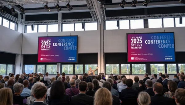
    INTERGEO 2025 exemplifies this transformation. From Oct. 7-9, the Frankfurt Exhibition Center will host the world’s leading conference and trade show for geodesy, geoinformation and land management, featuring more than 500 international exhibitors ranging from innovative startups to industry giants.

    Three-Day Conference Program Features 100 Sessions
    The INTERGEO Conference will present approximately 100 presentations and sessions over three days, drawing speakers from space agencies, United Nations organizations, government ministries and international technology companies.

    Key topics include AI-powered remote sensing, urban digital twins, open data strategies, Earth observation for climate and crisis management and building information modeling (BIM) integration for infrastructure lifecycle management.

    Keynote presentations such as “Earth Observation and Artificial Intelligence” and “Cartography for the Future” will provide forward-looking insights, while panel discussions on digital sovereignty and standardization will address strategic frameworks. Each session demonstrates how geoinformation serves as the critical foundation for climate adaptation, disaster preparedness, urban development and infrastructure protection.

    Opening Day Features Space Technology Focus

    DVW President Prof. Rudolf Staiger will open INTERGEO on Tuesday, Oct. 7, followed by a keynote from Johann Dietrich Wörner, space coordinator for the state of Hesse. His presentation, “Earth Observation and Artificial Intelligence,” will explore how AI transforms massive Earth observation datasets into actionable insights for climate, agriculture and urban planning projects.

    Prof. Serena Coetzee of UNU-FLORES will deliver the German Cartography Congress keynote on Wednesday, Oct. 8, addressing cartography’s evolution amid growing geodata volumes and governance challenges.

    Thursday morning’s panel discussion, “Digital Transformation – Perspectives, Trends and Theses,” will examine the need for reorienting geoinformation management to foster innovation and collaboration.

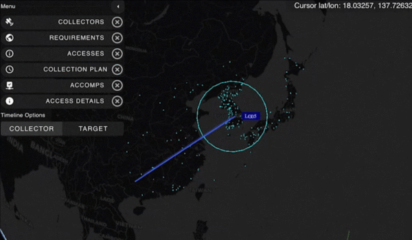
    Revolutionizing Geospatial Data Analysis

    AI is accelerating the transformation of raw data into actionable insights, fundamentally changing how professionals work with geoinformation. The session “AI-Based Analysis of Remote Sensing Data for Updating the ATKIS Basic DLM” demonstrates practical applications in public administration.

    The Hessian Administration for Soil Management and Geoinformation uses AI methods to automatically detect landscape changes, significantly improving the quality and timeliness of digital landscape models.

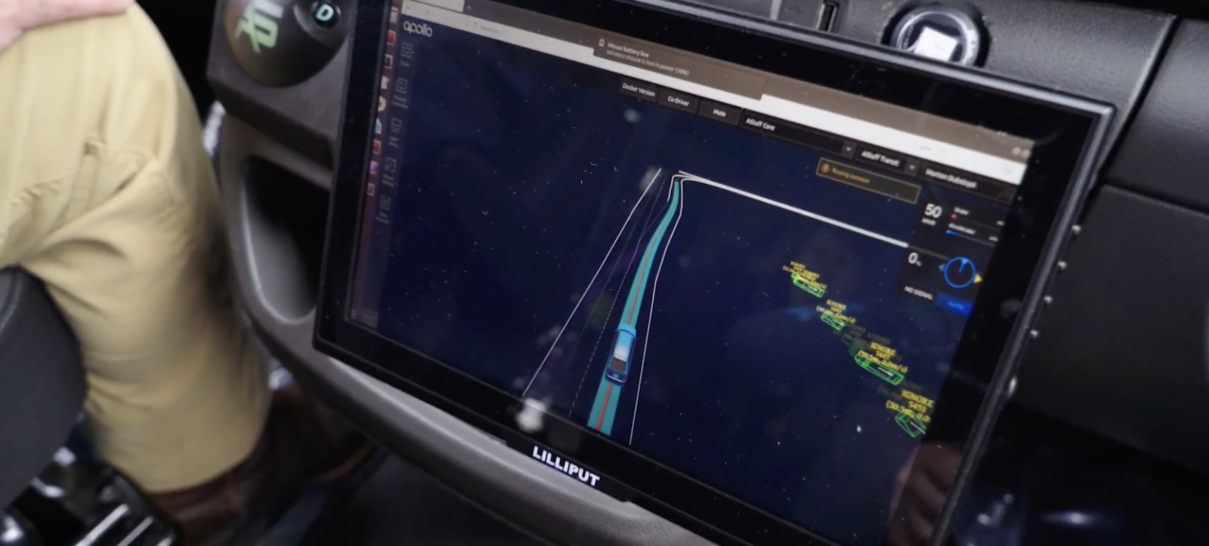
    Urban digital twins are rapidly advancing from static models to powerful operational platforms. The session “From Data to Insights: Visualization Technologies for Next-Generation Digital Twins” will showcase how modern visualization makes complex systems accessible and accelerates planning processes.

    The research project “DigitalCities4Us” illustrates practical applications, using high-resolution 3D data to enable barrier-free urban planning and improve accessibility for people with mobility restrictions.

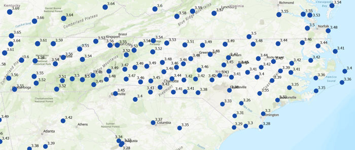
    Additional sessions will examine implementation across administrative levels. “The Digital Twin NRW: A Practical Report” presents a statewide geospatial data infrastructure that is freely accessible and continuously developed. The city of Zurich will demonstrate its transition from traditional geospatial data infrastructures to multifunctional twin platforms.

    Geodata infrastructures, open data and data spaces form the backbone of digital transformation and serve as key prerequisites for digital sovereignty. Multiple sessions will emphasize the importance of stable, future-ready geodata infrastructure.

    Standardization receives particular attention through presentations like “Three Perspectives, One Goal: Digital Sovereignty through Open Standards in BIM and GIS” and the position paper “Official Geodata as a Basis for Digital Processes in Planning, Construction and Operation.” These sessions demonstrate how uniform standards for data exchange between geographic information systems and building information modeling can accelerate planning, construction and operational processes.

    The position paper represents a joint initiative of buildingSMART Germany, the Working Committee of the Surveying Authorities and the Federal Association of Publicly Appointed Surveyors.

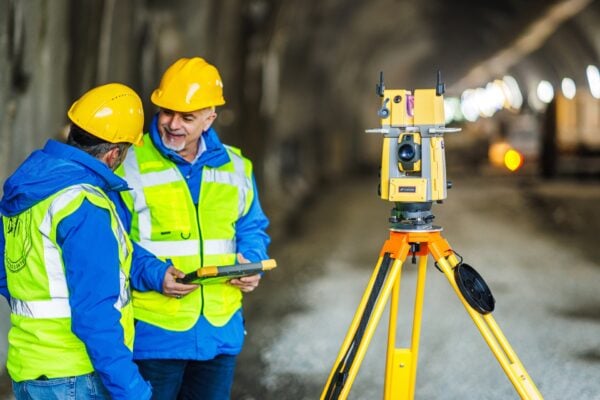
    Critical infrastructures require precise, reliable data to minimize risks. The presentation “Regional and Effective Flood Protection in the State Capital of Düsseldorf” demonstrates how geoportals and flood forecasting tools prevent flooding and strengthen urban infrastructure resilience.

    Bringing Innovation to the Exhibition Floor

    Registration is now open at the INTERGEO website. The INTERGEO 2025 team looks forward to welcoming attendees to the Frankfurt Exhibition Center from Oct. 7-9.

  • Spain’s defence minister’s aircraft latest to report GPS interference

    Spain’s defence minister’s aircraft latest to report GPS interference

    An A330 airplane carrying Spanish Defence Minister Margarita Robles experienced GPS interference while flying over Kalingrad, Russia, reports EU Today. The news outlet cites Spanish newspaper El Mundo as its source.

    Robles was flying to in an aircraft belonging to the Spanish Air and Space Force. It was is “subjected to an attempt to throw it off course using GPS” over Kaliningrad as Robles was travelling to the Šiauliai air base in Lithuania on Sept. 24.

    The pilot said incidents attempting to disorient pilots have been common for both commercial and military flights over Kaliningrad. Becausee this was a military craft, the plane was receiving instructions from a military satellite and the attempt failed.

    Reports of GNSS interference have increased across the Baltic and adjacent regions since 2022, the beginning of Russia’s war with Ukraine. 

  • Taoglas expands comet antenna series with models engineered for metal enclosures

    Taoglas expands comet antenna series with models engineered for metal enclosures

    Taoglas has expanded of its Comet Series with the MA58x family of compact, discrete, screw- or through-hole mount puck antennas.

    Metal structures or flat surfaces, such as cabinets, can affect antenna performance and change the electrical groundplane. The Comet MA58x series is specifically engineered to maintain stable, high-efficiency operation in these challenging conditions.

    Conventional LTE antennas rely on their RF cable to achieve low-band efficiency, particularly when the cable itself is routed inside a metal enclosure, turning it into an unintended radiator. The MA58x design removes this dependency, enabling efficient radiation and delivering at least 20% better performance than comparable alternatives.

    With a footprint of 101 x 101 mm and low profile of 20 mm, the antennas deliver reliable multi-antenna connectivity across GNSS constellations including GPS, GLONASS, Galileo, and BeiDou, as well as 5G/4G MIMO and Wi-Fi 6/7. Advanced RF design enables consistent gain and efficiency across global cellular frequencies from 600 MHz to 6 GHz and Wi-Fi bands up to 7.125 GHz, while also supporting legacy 2.4/5.8 GHz Wi-Fi and Bluetooth for maximum compatibility. These levels of performance are rarely achieved in antennas of this size, and even more so when installed on metallic structures.

    The rugged, weather-resistant housing is molded in Acrylonitrile Styrene Acrylate (ASA) for long-term outdoor durability, and the IP67-rated enclosure with a screw/stud mount provides a permanent installation option that ensures secure, reliable operation in vibration-prone and harsh conditions such as fleet vehicles, heavy equipment, and industrial automation.

    The new antennas are available in multiple configurations and in either black or white enclosures. Custom cable lengths and connector options are also offered, making integration more flexible for OEMs and system designers. The MA58x series is suited to gateways and routers, public safety systems, point-of-sale terminals, digital signage, smart home automation, robotics and industrial automation. The Comet Series also offers a magnetic mount MA32x variant to address different deployment needs.

    Further details on the design principles that deliver these performance gains are available in a Taoglas white paper.