Blog

  • Four Galileo Satellites Now at ESTEC

    Four Galileo Satellites Now at ESTEC

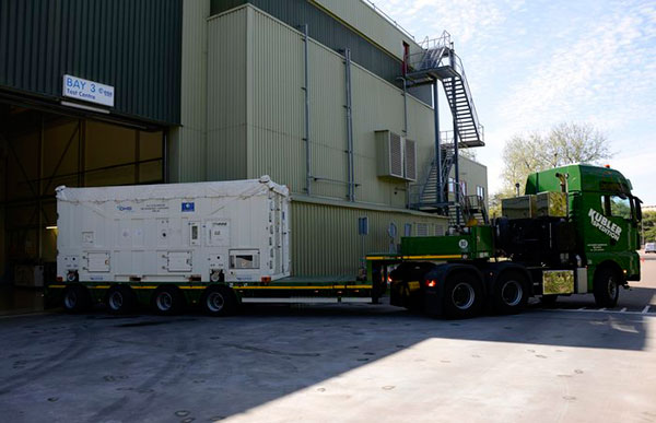
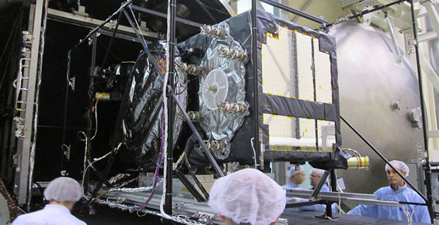
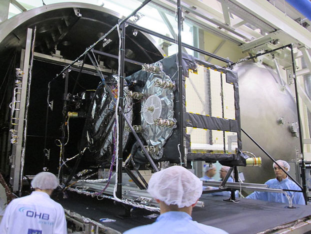
    chamber. Weeks of testing simulated the airlessness and temperature extremes of orbital space, taking place at the ESTEC Test Centre in Noordwijk, the Netherlands during May 2015. (Photo: ESA)
    Weeks of testing simulated the airlessness and temperature extremes of orbital space, taking place at the ESTEC Test Centre in Noordwijk, the Netherlands during May 2015. (Photo: ESA)

    News by the European Space Agency

    Europe’s latest Galileo was unboxed at ESA’s technical centre in the Netherlands in May, bringing the total number of satellites at the site to four.

    ESTEC in Noordwijk is the largest satellite test facility in Europe, with all the equipment needed to simulate every aspect of the launch and space environment under a single roof. It is an essential stop on the way to space for Europe’s Galileo satellites, built by OHB in Bremen, Germany, with navigation payloads from Surrey Satellite Technology Ltd. in Guildford, UK.

    The 12th Galileo arrived by lorry from Bremen on May 13, in a custom-built environmentally controlled container. The satellite will begin with a thermal vacuum test in a 4.5-meter-diameter stainless steel chamber, subjected to about five weeks of hard vacuum and the temperature extremes of space.

    Galileo-11 recently completed the same trial before moving on to final system testing, including a compatibility run with the ground network.

    Meanwhile, the ninth and tenth satellites are in storage at ESTEC, having passed their own checks. They will be flown to Europe’s Spaceport in French Guiana in late July for launch by Soyuz in September, which will bring the total in orbit into double figures.

    The 12th Galileo satellite, FOC FM-08, arrived at the ESTEC Test Centre on May 13. It was transported by lorry from Bremen in a protective air-conditioned container.
    The 12th Galileo satellite, FOC FM-08, arrived at the ESTEC Test Centre on May 13. It was transported by lorry from Bremen in a protective air-conditioned container.

    The first four Galileos, launched in 2011 and 2012, were in-orbit validation satellites, built by prime contractor Airbus Defence & Space. They confirmed that the overall system worked as planned, while also serving as the foundation of the full constellation to follow.

    The follow-up Full Operational Capability satellites are now being launched regularly to increase the size of the constellation to the point where early Galileo services can begin next year.

    European Partners. Galileo is a collaboration between ESA and the European Commission (EC). The validation phase was co-funded by ESA and the EC, while the full operational phase is funded by the EC. Under a delegation agreement, ESA acts as design and procurement agent on behalf of the commission.

  • USGS Hosts National Maps Webinar for Web and Mobile

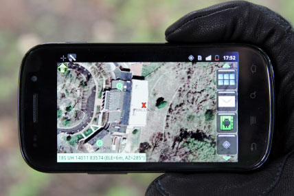
    Screenshot of a mobile mapping service integrating USGS topographic data; hiking and biking trails south of Golden, Colo. Imagery with road and contour data overlaid via AlpineQuest.
    Screenshot of a mobile mapping service integrating USGS topographic data; hiking and biking trails south of Golden, Colo. Imagery with road and contour data overlaid via AlpineQuest.

    Are you a developer, firm, or organization using mobile or web applications to enable your users? The United States Geological Survey (USGS) has publicly available geospatial services and data to help your application development and enhancement.

    The USGS’ National Geospatial Technical Operations Center (NGTOC) will be hosting a 30-minute webinar on “Using The National Map services to enable your web and mobile mapping efforts” on June 16 at 9 a.m. MT.

    Screen shot of a mobile mapping service integrating USGS topographic data; hiking and biking trails south of Golden, Colo. Trail data in KML/GPX overlaid via AlpineQuest.
    Screenshot of a mobile mapping service integrating USGS topographic data; hiking and biking trails south of Golden, Colo. Trail data in KML/GPX overlaid via AlpineQuest.

    This webinar will feature a brief overview of services, data and products that are publicly available, a quick overview on how AlpineQuest, a leading private firm, is leveraging this public data to benefit their users, and a Question & Answer session with a USGS developer to help you get the most out of the national geospatial services.

    “This is an opportunity from NGTOC to bring developers and users together for some demonstrations and starting some dialogue,” said Brian Fox, the NGTOC Systems Development Branch Chief.  “The webinar format allows us to improve awareness of USGS geospatial services and develop a better understanding of what users and developers need to make our data and services more available and usable.” 

    To access the webinar, you’ll need to activate Cisco WebEx and call into the conference number (toll free) 855-547-8255 and use the security code: 98212385.  The webinar will display through WebEx.

    Use this system diagnosis to ensure that you have the appropriate players installed for this WebEx enabled webinar.

    The session will be recorded and closed caption option is available.

    Click here to find out more about this and other NGOC webinar conferences. 

  • USGS Hosts National Maps Webinar for Web and Mobile

    Screenshot of a mobile mapping service integrating USGS topographic data; hiking and biking trails south of Golden, Colo. Imagery with road and contour data overlaid via AlpineQuest.
    Screenshot of a mobile mapping service integrating USGS topographic data; hiking and biking trails south of Golden, Colo. Imagery with road and contour data overlaid via AlpineQuest.

    Are you a developer, firm, or organization using mobile or web applications to enable your users? The United States Geological Survey (USGS) has publicly available geospatial services and data to help your application development and enhancement.

    The USGS’ National Geospatial Technical Operations Center (NGTOC) will be hosting a 30-minute webinar on “Using The National Map services to enable your web and mobile mapping efforts” on June 16 at 9 a.m. MT.

    Screen shot of a mobile mapping service integrating USGS topographic data; hiking and biking trails south of Golden, Colo. Trail data in KML/GPX overlaid via AlpineQuest.
    Screenshot of a mobile mapping service integrating USGS topographic data; hiking and biking trails south of Golden, Colo. Trail data in KML/GPX overlaid via AlpineQuest.

    This webinar will feature a brief overview of services, data and products that are publicly available, a quick overview on how AlpineQuest, a leading private firm, is leveraging this public data to benefit their users, and a Question & Answer session with a USGS developer to help you get the most out of the national geospatial services.

    “This is an opportunity from NGTOC to bring developers and users together for some demonstrations and starting some dialogue,” said Brian Fox, the NGTOC Systems Development Branch Chief.  “The webinar format allows us to improve awareness of USGS geospatial services and develop a better understanding of what users and developers need to make our data and services more available and usable.” 

    To access the webinar, you’ll need to activate Cisco WebEx and call into the conference number (toll free) 855-547-8255 and use the security code: 98212385.  The webinar will display through WebEx.

    Use this system diagnosis to ensure that you have the appropriate players installed for this WebEx enabled webinar.

    The session will be recorded and closed caption option is available.

    Click here to find out more about this and other NGOC webinar conferences. 

  • OriginGPS Unveils Multi-GNSS Module with Antenna for Wearables

    OriginGPS Unveils Multi-GNSS Module with Antenna for Wearables

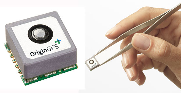
    The Multi Micro Hornet by OriginGPS was designed small with wearables in mind.
    The Multi Micro Hornet by OriginGPS was designed small with wearables in mind.

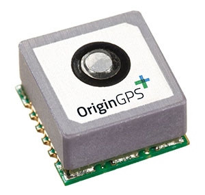
    OriginGPS has launched the Multi Micro Hornet, a tiny fully integrated multiple constellation antenna module. The innovative architecture packs functionality and high-quality components in a small space to improve wearables’ fashion and function, the company said.

    “A recent study by the European Global Navigation Satellite Systems Agency (GSA) showed that multi-constellation is becoming a standard feature in today’s user equipment,” said Gal Jacobi, CEO of OriginGPS. “Developers of wearables need modules with these features in the smallest size possible to be competitive in a market the GSA predicts will reach 14 million by 2023.”

    GPS World reported on the GSA market report in its April issue, and held a webinar on the report on April 16, which can be viewed for free.

    The Multi Micro Hornet is designed for devices that require a small form factor, low power consumption, and high sensitivity. In keeping with the company’s “Mini + Mighty” corporate mantra, OriginGPS has reduced the total volume in size by over 68 percent of other GNSS antenna modules without sacrificing performance, the company claims.

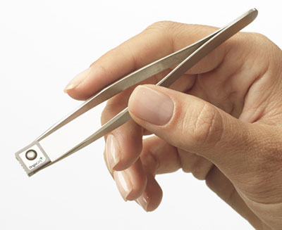
    The Multi Micro Hornet by OriginGPS.
    The Multi Micro Hornet by OriginGPS.

    The Multi Micro Hornet has features that will improve the navigation experience of wearables and other Internet of Things devices, including:

    • Small size, high performance: Despite its miniature outline of 10 x 10 mm and height of 5.9 mm, the Multi Micro Hornet module offers superior sensitivity and outstanding performance, achieving rapid Time To First Fix (TTFF) of less than one second, accuracy within as little as one meter, and sensitivity at -165 dBm by tracking both GPS and GLONASS constellations simultaneously.
    • High sensitivity and noise immunity: The Multi Micro Hornet continues to leverage OriginGPS’ patented and proprietary Noise Free Zone NFZ technology to ensure high sensitivity and noise immunity even under marginal signal conditions.
    • Reduced power consumption without compromising connectivity: It detects changes in context, temperature, and satellite signals to achieve a state of near continuous availability. By opportunistically updating its internal fine time, frequency and satellite ephemeris data, the Multi Micro Hornet is able to stay connected while consuming mere microwatts of battery power.
    • An intelligent design that shortens time to market: The Hornet family of GPS / GNSS antenna modules integrates a GNSS receiver and patch antenna in a single module. As a cornerstone of the OriginGPS portfolio, the Multi Micro Hornet’s pin-to-pin compatibility with the Micro and Nano Hornet modules ensures a seamless migration from GPS to GNSS and gives developers the ability to create new product offerings in the shortest time to market while minimizing costly design risks. Developers can connect it to a power source on a single layer PCB and be off and running.

    Additionally, the Multi Micro Hornet module combines OriginGPS’ proprietary low-profile GPS+GLONASS antenna with a dual-stage LNA, RF LDO, SAW filter, TCXO, RTC crystal and RF shield with SiRFstarV GNSS system on chip.

  • The Internet of Everything: It’s All in the Timing

    40th Annual NIST Time and Frequency Metrology Seminar

    There were four of us, mature males who all remember having a crush on Annette Funicello, were seated around a table avidly discussing deviant behavior with a sometimes rapt mixed-gender audience. The four of us, loudly discussing deviant, and only occasionally aberrant behavior, were doctors: David Allan the world renowned creator of Allan Deviation or variance fame, Judah Levine, world renowned nuclear physicist and Father Time of NIST (National Institute of Standards and Technology), Neil Ashby, former chair and currently Professor Emeritus of Physics at UC Boulder, also from NIST, along with yours truly representing GPS World magazine and the Institute for Defense Analyses. Our ever-changing audience was composed of the 40+ members from around the globe attending the 40th Annual NIST Time and Frequency (T&F) Metrology Seminar, held June 2-5 in stunningly beautiful Boulder, Colo.

    Of course, the numerous deviant behaviors under discussion had more to do with the sometimes-fickle performance of various atomic reference systems than they did anatomy. And we were speaking loudly because that is what most men of our age do. Dr. David Allan frequently threw in quotes and anecdotes from his recently published book on time, It’s About Time, about which you will read more later.

    The NIST T&F Metrology Seminar is truly one of a kind, easily the best in the world for time and frequency metrology. I have been fortunate enough to attend numerous times. I can truly say I have never found it repetitive or boring. There are so many exciting discoveries concerning time, which David Allan staunchly maintains is a purely human construct, and how time applies to our everyday lives, especially to GPS — all PNT systems actually — that it is impossible not to be constantly fascinated.

    NIST Mission

    NIST Boulder is all about research and development for timing standards, which is a benign way of saying NIST SMEs (subject matter experts) are the world’s foremost authorities on time and metrology. To wit, NIST has produced no less than four Nobel Prize winners in metrology, the last being awarded in 2012. The atmosphere at NIST and the University of Colorado Boulder campus is such that you can’t help but feel certain there are more Nobel Prizes for NIST on the horizon.

    David Howe (Ph.D.), my NIST host and group leader of the Time and Frequency Metrology Division, explained that his organization, which sponsors the seminar, is an operating unit of the Physical Measurement Laboratory of the National Institute of Standards and Technology (NIST), an agency of the U.S. Department of Commerce. The NIST T&F Division is located in Boulder at the NIST Boulder Laboratories, just across from the street from the University of Colorado. Many of the NIST researchers are also University of Colorado professors, adjuncts or graduate students.

    The NIST mission includes:

    • Maintaining the primary frequency standard for the United States
    • Developing and operating standards of time and frequency
    • Coordinating United States time and frequency standards with other world standards
    • Providing time and frequency services for United States clientele
    • Performing research in support of improved standards and services

    Precise time and frequency information is required by electric power companies, radio and television stations, telephone companies, air traffic control systems, participants in space exploration, computer networks, scientists monitoring data of all kinds, and navigators of many types. These users need to compare their own timing equipment to a reliable, internationally recognized standard. NIST provides this standard for the United States.

    Of course one of the largest distribution networks for timing data is through the Global Positioning System (GPS), which provides this data globally to more than 4+ billion users and millions of timing systems everyday, numerous times per day. The number of times GPS time is utilized per day is almost impossible to calculate, but most certainly resides in the trillions.

    The NIST Time and Frequency distribution system delivers NIST Internet time over the Internet at the rate of 8 billion requests per day from servers at 25 locations across the United States.

    The frequency stability provided by classic Cesium and Rubidium atomic reference systems onboard GPS payloads have historically been on the order of 1 x 10-14. While this is the stability provided by the GPS IIF rubidium clocks, currently the rubidium clocks being prepared for GPS III are achieving frequency stability on the order of 1 x 10-15 under laboratory conditions, an order of magnitude better than the current on-orbit clocks.

    This is actually an amazing feat. For those of you who don’t deal in scientific notation on a daily basis, this means — since it is on a logarithmic scale — that the frequency stability of GPS III’s atomic clocks have the potential to be 10 times as stable as the IIF clocks, which are currently the most stable and accurate GPS clocks on orbit to date.

    Where atomic reference systems are concerned, we routinely speak of frequency stability and not clock accuracy. It is the stability over measured epochs, short and long, that matters most. Indeed, it is the oft-misunderstood frequency stability uncertainty expressed as delta f/f = 1 x 10-16 that produces the clock accuracy to within one standard (SI) second in three hundred (yes, 300) million years — a statistic that is obviously not directly observable, but reasonably predictable. Hence, as Judah Levine often says, where stability is concerned you are an historian, but where accuracy is concerned you are a prophet. NIST defines an SI second as the duration of 9,192,631,770 cycles of the cesium hyperfine transition.

    Tom O’Brian, the current chief of the NIST Time and Frequency Division, explained that this level of precision is equivalent to measuring the distance from the Earth to the Sun, a distance of 150 million kilometers, to the uncertainty of 15 microns or 1/10 the thickness of a human hair. While that is impressive, the best is yet to come. NIST is currently working on research-grade optical clocks, which we could reasonably expect to see on orbit one day in future GPS payloads, with an optical frequency stability equivalent to delta f/f = 2 x 10-18 or accuracy equal to 1 second in 15 billion years. Again this is the equivalent of measuring the distance from the Earth to the Sun to an uncertainty of 0.3 micron or the size of a virus.

    So What?

    Many of you may be asking why, as a GPS user, or merely as a user of technology, you should care about accurate and stable time reference systems. Marc Weiss, a long-time acquaintance and noted researcher at NIST (now in semi-retirement), very eloquently put his thoughts about time in an introduction to a recent timing white paper*, which has been slightly edited for length, current trends and readability. [Ed. So as to not be accused of putting words or opinions in the authors’ mouths, we have provided a reference for the unedited paper at the end of the referenced section]. Marc and several other metrology luminaries express their feelings concerning the future of time and why we should all care:

    We stand at the advent of a revolutionary new economy fueled by the global Internet of Everything (IOE). The IOE is a combination of traditional telecom systems with a growing need for wireless technology, and the emerging Internet of Things (IOT) including Machine-to-Machine (M2M) technology. Several current technology providers predict there will be a trillion global endpoints connected to the Internet by 2022, with $14.4 trillion in value at stake.

    One fundamental enabler of this revolution is a marriage of timing signals and data that breaks through existing barriers. Currently, optimal use of data in computing and networking is anathema to optimal use of timing signals. Computer hardware, software and networking all isolate timing processes, allowing the data to be processed with maximum efficiency due in part to asynchrony. Yet, the coordination of processes, the time stamping of events, latency measurements and optimal use of precious spectrum are all enabled by ever more accurate and stable timing.

    Timing is critical for the future development of and improvements to several high-value applications. For example, in smart transportation systems the exchange of information between vehicles, highways, and civil authorities depends on a robust ubiquitous timing system to ensure the rapid, accurate synchronization and provenance of data. Similar requirements are found in the operation of power grids, especially now that wind farms, solar arrays and the like require different control strategies, which are a critical part of the system. Modern medical applications such as tele-surgery and real time integrative online medical conferences, as well as applications in financial systems are all important examples that require accurate and stable timing signals and may well affect us all.

    There are three different types of timing signals for dependable synchronization: frequency, phase, and time. Frequency can be supplied by an individual clock, such as a commercial (atomic) Cesium or Rubidium standard, though practicality drives the use of local oscillators that require calibration and active reference signals. [Ed. Many of these local reference systems and oscillators are routinely updated by GPS signals.] By contrast, phase and time synchronization always require the transport of timing signals plus data. Timing signals are physical, they occur on the physical layer of networks. Indeed the IoT has many devices and applications that require frequency, time and/or phase synchronization. Frequency, time and phase all need to cross layers, boundaries, and networks from their sources in accurate clocks. Requirements for these transfer systems include parameters that create different, perhaps orthogonal, demands on systems. Accuracy, stability, integrity and even non-repudiability requirements are realized with varying demands on different systems….

    To facilitate the massive growth of the IoE, data processing and networking require new designs at fundamental levels, allowing integration with precise and verifiable time, frequency and phase signals.

    Timing performance is fundamentally dependent upon an underlying oscillator, or ensemble of oscillators and the clocks constructed based on these oscillators.

    However, it is apparent to us that many of the researchers and developers of the various time aware systems operate independently of each other. They attend different conferences, read different literature, and in general do not interact sufficiently to achieve the breakthroughs needed. In our minds this calls for a dedicated and collaborative “across the stack” research collaboration focused on two or three comprehensive challenge problems.

    * Time-Aware Applications, Computers, and Communication Systems (TAACCS), A White Paper, Feb. 15, 2015. Available from http://nvlpubs.nist.gov/nistpubs/TechnicalNotes/NIST.TN.1867.pdf

    Fortunately, this is what researchers, scientists, analysts and metrology experts do at NIST and what we learned about during the T&F Metrology Seminar. The bottom line is many perturbations affect timing signals from atomic reference systems and even local quartz oscillators (clocks). The more these perturbations are understood, the easier they are mitigated and the more stable and accurate our timing signals will be and the faster technology — PNT (position, navigation and timing), clock and otherwise — advances.

    For many traditional timing applications and developing “post-timing” applications, stability is more important than accuracy; just as for most advanced technology applications, frequency is more important than time of day.

    NIST clearly states its Time and Frequency Metrology Group has the world’s most advanced measurement and calibration facilities for characterizing noise components in oscillators and frequency synthesizers. NIST engages in numerous research and development activities to determine the cause of various types of noise for the purpose of isolating and reducing it, leading to improved components, instruments, techniques and results that are often critical in modern applications. In other words, you have to thoroughly understand a clock issue before you can begin to mitigate issues affecting it. NIST, a synecdoche for understanding time, does that better than any other metrology laboratory in the world today when it comes to atomic reference systems.

    What Is Time and Why Does It Matter?

    Accurate timing and synchronization are a crucial part of the world’s critical national infrastructure and of modern technology in general, especially the timing signals from GPS satellites, which are used by billions of users continuously every day — although most users remain unaware of the importance and impact that accurate and stable timing has on their everyday lives.

    Tom O’Brian reminded us that even St. Augustine of Hippo wondered about time. In circa 400 he wrote:

    “What then is time? If no one asks me, I know.
    If someone asks me to explain, I know not.”

    Then, just 1500 years later in 1930, Albert Einstein had this to say about time:

    “Space and time are modes by which we think, not conditions under which we live.”

    Therefore, I agree with David Allan when he posits that time is a human invention with which only humans struggle. Be that as it may, it is still a condition we live under, and when you consider all the forces, minute to infinite, that affect atomic reference systems and clocks in general, it is amazing our clocks function as well as they do.

    Consider that atomic clocks, and even quartz clocks to some extent, are affected by the following elemental and environmental forces and more in the laboratory:

    • Motion
    • Acceleration
    • Gravity – Earth, Moon and planetary
    • Changes in elevation
    • ~23 different types of noise
    • Temperature
    • Magnetic fields
    • Earth’s Poles
    • Tides
    • Light (including lasers)
    • Electricity
    • General and Special Relativity
    • Radiation

    The United States Air Force then takes these delicate clocks, atomic (Rubidium and Cesium) as well as quartz VCXOs and OXOs, and launches them (with violent maneuvers) into space in a Medium Earth Orbit that regularly intersects the Van Allen radiation belt. Once on orbit, the clocks routinely experience every one of the listed forces and more on both a regular and changing basis. Of course, we expect the GPS clocks to operate at the same standards and with the same stability and accuracy they displayed in the laboratory. Not asking much are we?

    The amazing fact is that thanks to the dedicated scientists and physicists at NIST and other timing laboratories, the clocks work as advertised and continue to do so sometimes for more than 20 years. The current GPS III Rubidium clocks being tested and aged at NRL (Naval Research Laboratory) and other locations around the U.S .are posited to be the first 30-year Rubidium standards with nominal frequency stability of 1 x 10-15. This should provide GPS with another nanosecond of timing accuracy and another 12 inches of positioning accuracy. There will be three of these extremely stable Rubidium clocks on board each GPS III satellite — no Cesium clocks for this family of satellites. Horologists around the world are hoping it is truly a 30-year tube and that only one Rubidium will be required. Only time will tell.

    Little Known Factoid (LKF): The first family of GPS satellites on orbit made use of a General and Special Relativity switch that could be set in one of three positions: neutral, plus or minus, depending on whether the universe was relatively static, expanding or shrinking in size. Guess where the switch was set initially and (hint, hint) it could be changed via software from the ground. Drop me a line @ [email protected] and let me know what you think — posit or know, as the case may be.

    Thanks

    My thanks to David Howe, Judah Levine, Neil Ashby, David Allan (Ph.D.s all) and Danielle Lirette, who made my visit to NIST such a wonderful experience.

    It’s About Time

    Earlier I mentioned physicist David Allan’s wonderful book, published in 2014. It’s About Time: Science Harmonized with Religion. Allan is about science harmonized with religion and where we are in God’s time. I am halfway through the 402-page tour de force on time, and it is a fascinating read. It is a 50-year biography and history of atomic reference systems, since the first atomic clock only came about in 1949. You’ll be amazed how that happened. Based on what I have read so far, I highly recommend this scientific tome, which is very readable and understandable even for the lay reader. I promise a full review in a future column.

    Until then, Happy Navigating! I hope to see many of you at ION JNC (Institute of Navigation Joint Navigation Conference) in Orlando, Fla., June 21-26. There will be a classified day on Thursday, June 25 and a Warfighters Panel as well. Hope you can join us. Remember, GPS is brought to you courtesy of the United States Air Force.
  • Cold Assets: GeoDecisions Platform Used to Track Icebergs

    Cold Assets: GeoDecisions Platform Used to Track Icebergs

    This photo shows drifting icebergs from the Amundsen during research expedition. (Photo: courtesy of Greg McCullough, University of Manitoba)
    This photo shows drifting icebergs from the Amundsen during research expedition. (Photo: courtesy of Greg McCullough, University of Manitoba)

    A Canadian expedition team used GeoDecisionsGeoILS platform to help track icebergs during a voyage to better understand how icebergs drift. An intelligent location server using the Esri ArcGIS platform, GeoILS enables users to monitor and locate assets and facilitate quick and coordinated responses.

    GeoDecisions, an information technology company specializing in geospatial solutions, partnered with Solara Remote Data Delivery Incorporated, Canada’s Carleton University and Esri during the project.

    Led by University of Manitoba Scientist David Barber, the crew of Canadian Coast Guard Icebreaker Amundsen sailed off the coast of Newfoundland and Labrador to research ice hazard mitigation, the effects of climate change, and polar region technology requirements. GeoILS location intelligence helped crew members visualize, analyze, and leverage project-pertinent data.

    “During the expedition, researchers and scientists used GeoILS to assess drifting through sensor monitors attached to the icebergs,” said Brian Smith, vice president of commercial solutions with GeoDecisions. “In addition to reporting and notifications, GeoILS provided the project team with maps that were tailored by selecting desired iceberg information and the geographic area of interest based on user-defined criteria.”

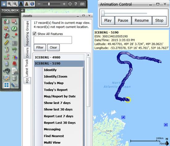
    Above is a representative snapshot of GeoILS’ features and range of functionality used during the Canadian iceberg expedition.
    Above is a representative snapshot of GeoILS’ features
    and range of functionality used during the
    Canadian iceberg expedition.

    GeoDecisions’ data portal was used with Iridium Solara tracking devices during the iceberg research project. “We are excited to provide tools to scientists who are gaining critical insights into the behavior of icebergs and global climate change,” said Tom Tessier, president of Solara Remote Data Delivery Incorporated.

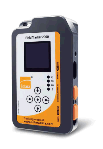
    Solara Field Tracker 2000.
    Solara Field Tracker 2000.

    “GeoILS and the satellite tracking beacons worked very well during this project,” added Derek Mueller, assistant professor and physical geography program supervisor with Carleton University. “Thanks to our partners’ efforts, we now have a great new suite of tools for examining our data.”

  • Blink: Researchers Demonstrate Nanosecond Accuracy for Wireless Networks

    Researchers experimentally demonstrate the first wireless network synchronized with accuracy of a billionth of a second.

    A new timing protocol, dubbed “Blink,” would allow for timing greater than that provided by GPS satellites. According to researchers, the protocol would allow for wireless transmission over longer distances with less energy — while improve the overall efficiency of wireless networks.

    Such an enhanced timing technology could result in applications like coordinated signal jamming of enemy military receivers; extremely precise localization; coordinated navigation, tracking, and operation of UAVs; convoys of autonomous vehicles; and distributed beam forming.

    At the 2015 IEEE International Conference on Communications, being held June 8-12 in London, Andreas Molisch, professor of Electrical Engineering at the University of Southern California’s Viterbi School of Engineering, presented the paper, “Experimental Demonstration of Nanosecond-Accuracy Wireless Network Synchronization.”

    Molisch co-authored the paper with Marcelo Segura and S. Niranjayan, former post-doctoral students at USC, and Hossein Hashemi, also professor of Electrical Engineering at USC Viterbi.

    In the paper, the researchers experimentally demonstrate the first wireless network synchronized with nanosecond accuracy.

    Segura, Niranjayan, Hashemi and Molisch have developed a prototype, consisting of four nodes that synchronize to each other with an accuracy of approximately three nanoseconds. They also introduced a scalable protocol, which they call the “Blink” algorithm, that extends the same accuracy of the current small-size prototype (in this case, four wireless devices) to hundreds or even thousands of wireless devices.

    “Previous research has addressed precision synchronization, but, in the publically available literature, nanosecond accuracy was achieved only by connecting devices via cables, and only between few wireless devices. Even though GPS is widely used and is considered very precise, it does not easily provide this level of accuracy, and cannot be used in many indoor settings,” Hashemi said.

    Instead of requiring a precision of minutes, wireless devices have to make their clocks match within very small fractions of a second. This “clock synchronization” is needed for a large range of purposes — from increasing cellphone coverage, to increasing data speed rates, to enabling precision localization in places where GPS is not available. Some of these activities require synchronization within “only” a millionth of a second, a requirement that has been achieved by a variety of methods.

    One nanosecond, a billionth of a second, is how long it takes light to travel over one foot through the air. It is at this focused level that researchers have competed to develop solutions to push synchronization to a billionth of a second, or what is known as “nanosecond accuracy.”

    Synchronizing a whole network of wireless devices to such accuracy would enable a host of new possible applications, from precise localization to energy-efficient transmission for “Internet of things” sensor networks. However, it is remarkably hard to achieve such a level of synchronization, especially when the clocks in the devices are low-cost and not very precise.

    While this work has considerable applications for the military, it also has indications for other instances in which increased precision is necessary such as communication among a group of driverless cars to share location information.  Other possible applications include helping a person with limited sight navigate an indoor physical space, or providing a map for robots employed in the home or in industrial settings.

    The research was supported primarily by the Office of Naval Research and the Ming Hsieh Institute at USC.

  • Device Tracks Soldiers’ Movements without GPS

    Device Tracks Soldiers’ Movements without GPS

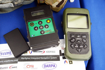
    The Warfighter Integrated Navigation System, center, uses inertial systems to determine a Soldier's location in the absence of a GPS signal. On the left, a smaller version of WINS. On the right, the Defense Advanced GPS Receiver, which soldiers use now for position, navigation, and timing. All three devices were on display at the DOD Lab Day, May 14, at the Pentagon. (Photo: U.S. Army/C. Todd Lopez)
    The Warfighter Integrated Navigation System, center, uses inertial systems to determine a Soldier’s location in the absence of a GPS signal. On the left, a smaller version of WINS. On the right, the Defense Advanced GPS Receiver, which soldiers use now for position, navigation, and timing. All three devices were on display at the DOD Lab Day, May 14, at the Pentagon. (Photo: U.S. Army/C. Todd Lopez)

    When GPS satellites can’t be seen due to dense jungle canopy, or they are blocked due to enemy interference, soldiers will still be able to track their location digitally using the Warfighter Integrated Navigation System (WINS), a device now under development at the Communications Electronics Research Development and Engineering Center (CERDEC).

    During the U.S. Department of Defense Lab Day held May 14 at the Pentagon, CERDEC researcher Osie A. David explained how the technology behind WINS will one day be transitioned to an Army program manager to bring assured navigational capability to soldiers.

    The WINS is a device small enough to carry in a soldier’s cargo pocket, about half the size of a pack of cigarettes.

    “It’s got a number of inertial sensors, such as a pedometer and an accelerometer, things you will find on your cell phone but of a higher quality,” he said. “Even if the enemy is denying you GPS or the terrain is, you can still get known location on here so it will show up on your Nett Warrior device or your command and control system.” The Nett Warrior is an integrated dismounted situational awareness and mission command system for use by leaders during combat operations, using advanced navigation and information sharing capabilities to allow for faster and more accurate decisions during the tactical fight.

    The Nett Warrior
    The Nett Warrior

    Those inertial sensors will calculate an offset from the last-known location using footsteps taken, speed, acceleration and time, for instance. The device even has way to measure altitude. “It’s got a pressure reader so it knows if you are on the third floor or first floor of a building,” David said.

    The WINS isn’t perfect. As time goes by without a new GPS signal, its estimate of current location will degrade. But the device provides for the user an estimate of its own miscalculation. “After a time, it’ll show you a circle radius for the error range,” he said. “It’s still better than having no GPS at all.”

    David said knowing location is everything in combat, and the WINS, or a follow-on system that uses technology from WINS, will make sure that soldiers have that no matter what happens to GPS.

    “Say we go to Southeast Asia and I’m in the middle of the jungle. There are not a lot of good landmarks. I’m navigating around and I lose the GPS because with the triple-canopy jungle, the GPS can’t penetrate that. I don’t know where I am on the map, so I’m in a bad situation. If I want to know exactly where I am so I can call for reinforcements or resupply, WINS is going to give me my location on a map, no matter where I am.”

    David said CERDEC is still working on issues like where soldiers should wear the device. He also said that he expects the engineering specifications for WINS to be transferred to Program Executive Office, Intelligence and Electronic Warfare & Sensors by 2017. It will be inside an Army program manager’s office, not an Army lab, that WINS or the technology it contains will be made available to soldiers.

    The Soldier Power Manager sits on top of a conformal battery. Allowing multiple devices to be connected to a battery, it reports battery usage, power remaining,  and power usage by connected devices. (Photo: U.S. Army/C. Todd Lopez)
    The Soldier Power Manager sits on top of a conformal battery. Allowing multiple devices to be connected to a battery, it reports battery usage, power remaining, and power usage by connected devices. (Photo: U.S. Army/C. Todd Lopez)

    David also had with him a device he called the Soldier Power Manager. The power manager was connected to a “conformal battery,” which was also developed at CERDEC in conjunction with industry. The conformal battery is flexible and slips easily into a soldier’s tactical vest without being uncomfortable due to stiffness. It wraps around a soldier’s torso.

    The power manager allows multiple devices to connect to a battery, and provides a display saying how much power is left in the battery, what devices are connected to the battery, and how much power each device is using.

    “It lets you know how much energy is left and what is plugged in,” David said. He said one advancement the lab has made on the system is to transfer the user interface to a Nett Warrior device, so soldiers can see it on that screen.

    “It lets you see the total power left on the device and how much energy each device is pulling, so you can make a decision about what device to pull — when energy gets low — to make sure you have enough power to meet mission needs. We have sort of integrated the energy component with the information to make better choices in the battlefield in terms of operational energy.”

  • Esri President Looking for a Few Good Images

    Esri President Jack Dangermond is asking for geospatial professionals to provide illustrations for his opening presentation at the 2015 Esri User Conference in July.

    “Each year, the Plenary Session provides an inspiring overview of the state of geospatial technology today, and one of the best ways to illustrate that is by sharing examples of your work,” Dangermond writes in an email. “I invite you to submit up to three images for us to consider including in the presentation.”

    Dangermond said he is interested in:

    • Maps that helped make a decision
    • Maps that helped with collaboration
    • Maps that helped communicate
    • High-quality cartographic displays
    • 3D visualizations
      • Built environment
      • Nature landscapes
      • Cartography (statistics)
    • Maps that illustrate spatial analysis, modeling, and science
    • Web maps

    Image submissions must be received by Friday, June 12, via Esri’s online portal.

    Send any questions to [email protected].

  • LizardTech Extends Global Reach with Partnerships

    LizardTech, a provider of software solutions for managing and distributing geospatial content, has expanded its global presence with several new business partnerships and product purchases during the first half of 2015.

    During the last six months, national governments, energy organizations and infrastructure owners and operators have all bought LizardTech software in countries such as Canada, Sweden, Norway, Germany, United Kingdom, Spain, South Africa, Saudi Arabia, Turkey, Oman, Australia and the Philippines.

    New partnerships established this year include EMi Grup in Turkey, Beijing Space Eye Innovation Technology Co. in China, Esri Muscat in Oman, and the Cuminas Corporation in Japan. Additionally, Sani International of Canada re-committed to LizardTech product distribution in Canada and the Caribbean. LizardTech’s international relationships outside of the Americas are managed by the geospatial sales and marketing agency, Quarry One Eleven, based in Guildford, UK.

    “We are delighted with the progress we have made in promoting LizardTech’s remarkable MrSID-based software throughout the European, African and Middle Eastern market places and beyond into Asia Pacific,” said Quarry One Eleven Founder Alistair Maclenan. “LizardTech is a great client that understands the power of marketing and in-region representation. Their support has been a huge factor in the partnership and sales successes we have seen for their image compression, preparation and distribution products.”

    “We have had an exciting first half of the year which illustrates that our products are in demand all over the world,” said Jeff Young, who directs Global Business Development at LizardTech. “These sales validate the sustainability of LizardTech over the last 23 years through partnerships in multiple continents. We take pride in our customer’s loyalty and continued commitment to our MrSID image compression format.”

  • Harris, exactEarth Form Alliance for Global Maritime Tracking

    exactEarth Ltd. and Harris Corporation have formed an alliance to provide a new level of Satellite Automatic Identification System (AIS) data service that will deliver real-time global coverage for maritime vessel tracking. The new service will leverage the persistent global coverage and real-time connectivity of the Iridium NEXT constellation through the implementation of 58 hosted payloads covering the Maritime VHF frequency band.

    Harris is a space, geospatial and remote sensing company, and exactEarth is a provider of AIS data services.

    Compatibility testing of the hosted payload with the Iridium satellites has been completed. The first launch is scheduled for early 2016, with the completed constellation expected in 2017. The new service will provide customers with the fastest, most accurate vessel information available. With revisit times and latency under one minute, the service expansion represents a leap forward in the ability for both Harris and exactEarth to offer global ship tracking and maritime information solutions, the companies said in a statement.

    The alliance leverages exactEarth’s proven and patented signal de-collision detection technology and Harris’ expertise in satellite hosted payloads, advanced radio frequency technology and antenna solutions. Harris becomes the exclusive provider to the US government of AIS products and services produced under the alliance, including exactEarth’s exactAIS product portfolio, while exactEarth continues to serve all other global markets.

    “This alliance will expand our IntelliEarth family of innovative solutions, which leverage Harris’ world-class remote sensing capabilities to help customers around the globe make smarter operational and business decisions,” said Bill Gattle, vice president and general manager, National Programs, Harris Government Communications Systems. “Harris is committed to exploring new technologies and partnering with world-leading organizations to provide our customers with the greatest value.” 

    “As the recognized Satellite AIS industry leader, this announcement further strengthens our commitment to provide best-in-class maritime intelligence solutions to our customers worldwide,” said Peter Mabson, Ppresident of exactEarth.  “We are thrilled to be able to offer the shortest revisit times and lowest latency for developing true maritime domain awareness. This partnership with Harris will allow us to significantly expand the range of advanced value-added services and information solutions that we can bring to the global maritime market.”

  • FOIF GNSS Receivers Aid with Australian Pipeline Survey

    Photo: FOIF GNSS Receivers

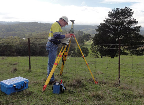
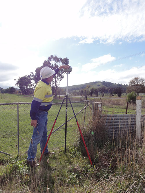
    Three years ago, engineering survey company G & C Sadlier Design was engaged to perform a route selection and centerline pegging survey for a gas pipeline duplication between Somerton in Victoria and Young in New South Wales, Australia. To accomplish the work, G & C Sadlier Design turned to FOIF GNSS receivers.

    So far, about 225 kilometers have been surveyed and constructed, with 306 kilometers still to be surveyed, designed and built, according to surveyor Greg Sadlier. The current focus is a 100-kilometer section in Victoria and a 70-kilometer section in New South Wales. Recently completed are two linear static control surveys over 80 kilometers in Northern Victoria and 70 kilometers at the end of the project near Young in New South Wales.

    Photo: FOIF GNSS Receivers

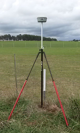
    “These surveys have been done using a FOIF F60 Base GNSS receiver and two FOIF A30 Rover receivers. (Two one-man survey crews are used),” Sadlier said. The procedure is to set up the F60 base over a point with known coordinates and elevation, approximately in the center of the alignment to be surveyed.

    The base was set first, to record 1-second data to the datacard over the duration of the survey. One surveyor started the base, and surveyed forward to the end of the alignment, and the other rover crew started at the beginning of the alignment and surveyed towards the base. The rovers were also set to record 1 second data to the datacard.

    “The control points were 0.75-m steel star pickets driven flush with the ground surface, and witnessed with a galvanized 1.5-m steel star picket,” Sadlier explained. “Each rover point was surveyed for 20 minutes plus 1 minute per kilometer of the distance to the base. That is, a point that is 35 Km from the base will be occupied for 55 minutes or 3300 epochs. With the control points at easy accessed positions, usually roads crossing the alignment, at intervals of about 8 kilometres mean that the survey of 80 Km is completed in one day.

    Photo: FOIF GNSS Receivers “We have found the FOIF GNSS receivers are very easy to use, and the epoch readout on screen is very reassuring that the data is being stored, and easily confirms that the correct amount has been stored. The data is easily downloaded from the card and converted to Rinex format with FOIF RnxTransform. The data was post processed by a third party.”

    The control survey results were adjusted (Helmert adjustment) onto check Permanent Marks at both ends. “This made a rotation of 0°00’00.001” and a shift of 0.007 meters E and 0.005 meter N. An elevation difference of .035 meters was manually adjusted out over the 80 kilometers,” Sadlier said.

    “We are now using the control survey while surveying the route selection and features survey,” Sadlier said. “We have two RTK base locations at the 25-kilometer mark and 52-kilometer marks, and using our VHF radio solution have coverage over the entire job with a 10-kilometer overlap in the center.

    “We have found that RTK observed control readings of 180 epochs return residuals of less than 010 meters for both coordinate and elevation for all the static control points. Very impressive results considering the length of the survey,” Sadlier said.

    The engineering firm has yet to process the New South Wales data, but expects the same or better, Sadlier said, as the overall length is a little less and the surveyed control points were in more open country with less tree cover.