Blog

  • The World of GNSS: What’s Next?

    As the world of GNSS moves forward and begins to absorb the new signals which are coming on line, it might be helpful to consider where we are going with all this. Maybe its time to ask ourselves to hold on a second — where is this all leading and what do we actually need? Let’s take a quick look at where we’ve been with GPS and GLONASS and what’s in store for these systems and what the impact might be for us users. Then if we consider the changes coming with Galileo, COMPASS, QZSS and the augmentation and regional system around the world, how can we as consumers cope with what’s coming and what impact will these things have on us? And what direction should manufacturers take to accommodate and lead consumers?


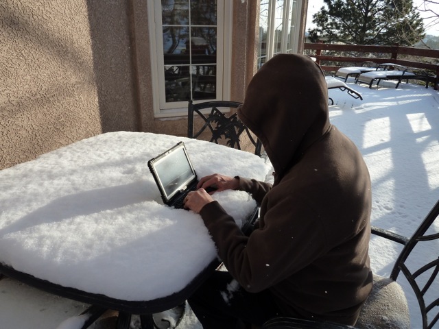
    When GPS first became operational, at least the surveyors breathed a sigh of relief and recognized that their work had become easier. No need to get out of bed in the middle of the night to catch a better configuration of satellites, which would only be around for two or three hours in the early hours of the morning. Now we had 24/7 coverage; while DOPs would ebb and flow a little, we still had pretty good position measurements just about any time.

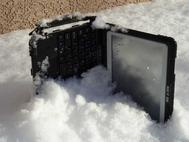
    Then the Russians also grew GLONASS into an operational system and we had the luxury of two constellations to work with; that is, if we could find dual-function receivers with high enough precision. Sure enough, a couple of manufacturers began to sell GPS/GLONASS receivers and we had virtually doubled the number of visible satellites in the sky, which allowed us to work when we wanted. And RTK using two constellations seemed like precision heaven!

    Unfortunately GLONASS decayed, and designers and researchers worked a lot harder to extract the maximum they could get out of GPS alone. But now GLONASS is back, and even though we have some individual satellite idiosyncrasies to manage, and frequency diversity complexity means we have quite an overhead in RF bandwidth and added interference rejection — well, getting twice the number of satellites is worth it. And most manufacturers have come up with later generations of dual-function receivers that have very good, if not excellent, performance.

    Novatel . Credit: Tony Murfin
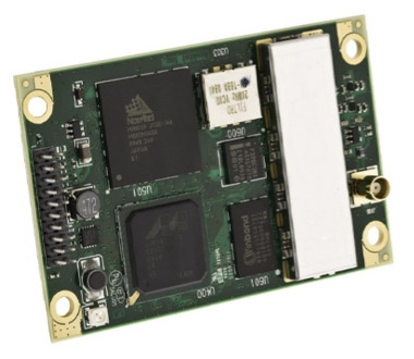
    NovAtel OEMV-1G GPS/GLONASS receiver.     

    Ashtech . Credit: Tony Murfin
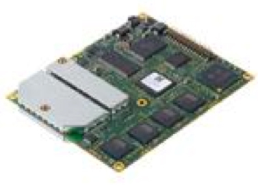
    Ashtech MB 500GPS/GLONASS receiver.

    Septentrio .  Credit: Tony Murfin
    Septentrio AsterRx-m GPS/GLONASS receiver.

    So what’s next? Should manufacturers wait for Galileo to get a usable constellation before they start trying to persuade customers that they need a new receiver that can get even better performance than the dual-function GPS/GLONASS receivers a number of users just bought? Or are these receivers just good enough? What about COMPASS?

    And those customers in Asia who can even see one or more COMPASS GEOs and/or “wobbly-GEO” satellites, and who might have the prospect of receiving added QZSS signals, or even IRNSS regional signal spill-over into their geographic areas — what should manufacturers provide to those customers? And what happens when COMPASS becomes truly global?

    Poem-fig .  Credit: Tony Murfin
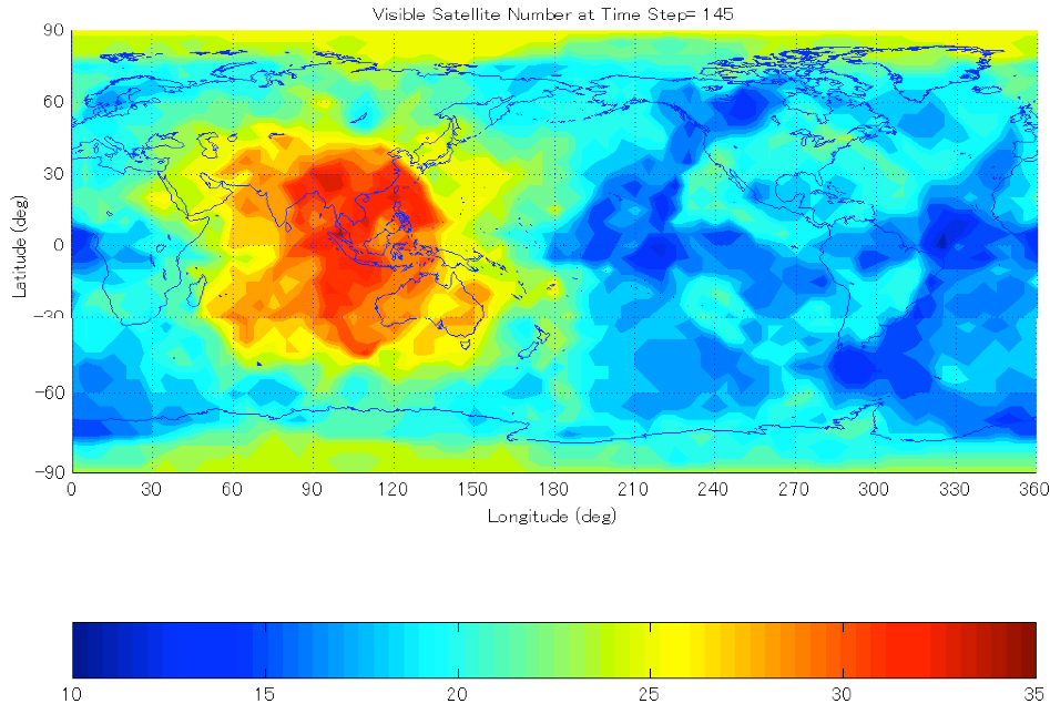
    Asian multi-constellation illustration, courtesy of Hiroaki Tateshita – JAXA (Click to enlarge).

    Well, it all depends on what the customer wants, right? That might apply for iPhones and their clones, for high fashion clothes, or for 60-inch plasma TVs, or the huge choice in high-performance cars — but GNSS seems a little different. “Accuracy is addictive,” someone said — well, higher performance GNSS receivers do create their own demand in the marketplace, and if you have something that is better, people seem to be prepared to pay for it.

    And there was a phase, which we might actually still be in, where all the manufacturers claimed that they had Galileo, and receivers were already upgradable so you could get what’s coming when you bought your next-generation receivers. Buy the latest receivers and be ready for when there are enough satellites to also get Galileo. Not sure that worked as a sales strategy, because what’s hot now are GPS/GLONASS receivers, which work better than anything else we’ve had before.

    Could be Galileo didn’t come on line when we expected it, so manufacturers backed off the “buy now, upgrade later” strategy. But Galileo is now “around,” and in the coming couple of years, we might just have enough SVs to make the investment worth making in a receiver with Galileo capability. But do you buy Galileo now, or will COMPASS get there first? And in Asia, wouldn’t it be more useful to use a few COMPASS extra SVs now?

    This is exactly the same dilemma that the GNSS developers, designers and manufacturers now face. Admittedly the Galileo Open Service ICD is available and contains sufficient detail, which is more than you can say for the somewhat skimpy COMPASS ICD. And developers are now building Digital Signal Processing (DSP) ASICs which have “generic” reconfigurable channels — but RF front-end hardware and signal processing software are commodities that require serious R&D effort. And these generic DSP channels and their associated software decoding algorithms may not be generic enough for all the things that you may discover in the more esoteric Binary Offset Carrier BOC (x,y) or Multiplexed BOC (x,y) modulation schemes which have still to come on line.

    And what schemes might be hidden deep inside the COMPASS signal structure when we get to see more details — what modulation might we find on other frequency signals?

    You can download the Japanese QZSS ICD from the JAXA website, but as the disclaimer says, the data transmitted from the QZS-1 satellite ’is provided without any warranty, including but not limited to accuracy, usefulness, Positioning Signal continuity, and fitness for a particular purpose of use of the Signals.’ I seem to remember similar disclaimers in the released Galileo ICD. The phrase “including but not limited to” is great legal terminology that basically says you are on your own if you should be so bold as to make a receiver using the information provided in the ICD — basically anything could happen to you, including maybe even being zapped by Martian death rays… The legal guys can caveat just about anything! But I couldn’t find any disclaimers in the released draft COMPASS ICD — it’s just missing essential stuff like the navigation messages.

    So, as a manufacturer, you need to balance the real desire you have to sell so many receivers that you control the entire GNSS marketplace, with the knowledge that if you use compatibility with the new constellations as your sales gimmick, there may be some risks. As consumers, we need to be aware that although these new constellations will be great to have to improve GNSS performance, the data to which manufacturers currently have access to make receivers that include Galileo, COMPASS, QZSS or even other developing augmentation or regional systems, this data is still somewhat preliminary — which means it could change — or assumptions have to be made to fill the gaps. So manufacturers have to be very smart, and use flexible hardware design approaches which allow them to update receivers through future software changes. This might not always be the most optimum approach for signal processing, which may be more efficient when optimized and implemented in silicon; tuning on mature/stable signals might eliminate or simplify components and high-powered processors might run a little less intensely with software work-arounds.

    So, as usual it’s a compromise — if you want to have the early implementation to gain a competitive advantage for your application, you may get ahead and win market share, but just be aware that more efficient, possibly less costly offerings may be available later, and then you’ll have to buy that too to keep up.

    The analogy could be — go ahead and buy that hybrid gas/electric car now because you want to save the environment. But be aware that there is a huge amount of research ongoing into how to make lighter, more efficient and more compact vehicle batteries, and there will be even more fuel-efficient vehicles in the future — its just how soon will they be available? And should you wait to get more benefits? Most people want better stuff now — so GNSS manufactures will offer more GNSS for your buck, even though right now the advantages are somewhat limited. And when we’ve waited and we know if Galileo or COMPASS is the way to go, its not outside the realms of possibility that we may have to ultimately replace what we buy today. That’s the price of progress.

    In the meantime, GPS/GLONASS receivers are very good and getting better as manufacturers refine and improve things. So as far as multi-constellation receivers go — we already have ‘em.

    Tony Murfin
    GNSS Aerospace

  • NTIA Thumbs Down LightSquared; FCC Concurs

    “We conclude that LightSquared’s proposed mobile broadband network will impact GPS services and that there is no practical way to mitigate the potential interference at this time.” These words from Lawrence Strickling (right), U.S. assistant secretary for communications and information and head of the National Telecommunications and Information Administration (NTIA), appear to signal the end of LightSquared’s run.

    Strickling’s letter to Federal Communications Commission (FCC) chairman Julius Genachowski appeared in public on February 14. Later that same day, FCC spokesperson Tammy Sun released a statement from that agency that “the Commission will not lift the prohibition on LightSquared,” and that it plans to “vacate the Conditional Waiver Order, and suspend indefinitely LightSquared’s Ancillary Terrestrial Component authority.”

    Together, the NTIA and the FCC share responsibility for controlling U.S. radio spectrum use and making band allocations. The FCC supposedly has final authority in these matters, although the NTIA, representing government interests, may swing the bigger cat in the room. LightSquared’s inability to satisfy the requirements of the Federal Aviation Administration (FAA), coupled with unremitting frowning and glowering from the Department of Defense, may have been the deciding factors — more so than the uproar among most GPS manufacturers. The FAA and the U.S. military, two key government entities with widely fielded GPS equipment and applications, constituted the backbone that the NTIA finally showed, although the military has been, with one notable exception, silent on the issue, and indeed is not mentioned in the NTIA letter.

    Strickling’s eight-page NTIA letter recaps the background of our story, with a July 6, 2011 early climax: “The test results demonstrated that LightSquared’s then-panned deployment of terrestrial operations posed a significant potential for harmful interference to GPS services.” He continues with the history of the further NTIA testing of cellular GPS receivers, joint continued analysis by FAA and LightSquared of impact on aviation receivers, and testing of general/personal navigation GPS receivers by the Executive Steering Group of the Interagency National Executive Committee for Space-Based Positioning, Navigation, and Timing (EXCOM).

    Strickling quotes a January 13 letter to him from Ashton Carter, U.S. deputy secretary for defense, and John Porcari, deputy secretary for transportation:

    “It is the unanimous conclusion of the test findings by the EXCOM agencies that both LighSquared’s original and modified plans for its proposed mobile network would cause harmful interference to many GPS receivers. Additionally, an analysis by the FAA has concluded that the LighSquared proposals are not compatible with severl GPS-dependent aircraft safety-of-flight systems. Based upon this testing and analysis, there appear to be no practical solutions or mitigations that would permit the LightSquared broadband service, as prosposed, to operate in the next few months or years without significantly interfering with GPS. As a result, no additional testing is warranted at this time.”

    But wait, we’re not done yet. Strickling calls for GPS receiver standards to be developed, citing the EXCOM’s decision that “federal agencies will move forward this year to develop and establish new GPS spectrum interference standards that will help inform future proposals for non-space commercial uses in the bands adjacent to the GPS signals.”

    The FCC, in its concurrence statement to the NTIA letter, actually begins by reciting the mantras of “economic growth, job creation, and to promote competition . . . freeing up spectrum for mobile broadband,” and only graduallyl works its way around to its decision. This signals an ongoing, solid commitment to make further sallies in this area.

  • Higher Accuracy Geospatial Data is a Double-Edged Sword

    There’s no doubt that geospatial data collected today is more accurate than it was five years ago and will be more accurate five years from now than it is today. A couple of items had me thinking (once again) about the challenge that higher accuracy geospatial is posing and is going to pose in the future.

    The first was an interview I did with Dale Lutz this week. Dale is the vice president of software development and co-founder of Safe Software. Dale is a great person to talk to about trends in geospatial data because Safe Software produces geospatial data conversion software tools. Essentially, the company’s software allows users to seamlessly merge geospatial data sets from different sources. For example, a user may have a requirement to merge data sets from AutoCAD, Esri, and Smallworld along with lidar data. Doing so manually can be a terribly laborious task. Not only does the user have to deal with different data formats, but also data of varying accuracy and unknown sources.

    “One thing that is an ongoing issue, we see a lot of files that frankly don’t have the right coordinate systems in them or it’s missing, so then that relies on users to know,” said Lutz. “That kind of lack of metadata is going to pose a challenge for people as time goes on because folks aren’t going to remember and the file is going to get passed around. They are not going to know which datum it was collected with and they may not get exactly the correct answer.”

    Dale succinctly summarizes the problem. After 20+ years in the geospatial industry, working in many places in the world, and teaching numerous workshops, matching spatial data is the #1 problem people ask me about. It’s fascinating to watch how diligent people are in acquiring the best data collection devices and collecting the most accurate data in the field, only to see it be diluted as it is integrated into a GIS or passed around without the metadata being communicated.

    I’m guilty of it as much as anyone. On many mapping projects, I integrate data from several different data sources. Many times the data is a free download from the web with no metadata provided and no technical support. If I’m able to reach someone to ask a detailed question about the data, 90% of the time they will make their best guess as to the datum used and when the data was collected. Was it in the original NAD83 horizontal datum? HARN? NSRS 2007? And even, ugh, NAD27? The difference can be more than a meter or much greater. It doesn’t take much of an error to negate the value of the expensive high-precision GPS receiver you spent thousands of dollars to acquire.

    Dale knows all too well. “When we used to deal with a MicroStation file that was accurate to a meter, we didn’t lose too much sleep, but now it’s more of an issue.”

    Not only are horizontal datums an issue, vertical accuracy is a challenge of a different kind.

    “It’s really doing a good job with the Z (elevation) that is the challenge we are working on. That’s been a big focus for us,” said Lutz.

    Another item about geospatial data accuracy I ran into this week was a thread on an Autodesk discussion forum. It was an entertaining thread about parcel maps and how they don’t reconcile nicely.

    The original poster summarizes the problem:

    “I am trying to draw a parcel map in AutoCAD, using the distance and bearing info that was added by to the original hand-made drawing by the surveyor. The parcels don’t quite close perfectly… Does anyone know what the acceptable tolerances are for parcels of say 1 acre and under, 1-5 acres, and 5-20 acre sites? Will it ever close EXACTLY, or am I a dreamer?? WOuld you send the surveyor back out to take new measurements if, lets say, he was off by .3″? Or a foot? Or 4 feet on a huge parcel? I am new @ this and just getting started. Thanks!”

    An obviously well-informed poster responded:

    “That is one major open-ended question…
    There are all kinds of things that come into play.  Some of it is the age of the original plat.  There are many places around our country where we have plats created in the 1700’s, using the proverbial “one-eyed goat and a rope”. Those surveys could have major errors, when compared to what we can achieve with today’s technology. But there’s a whole string of law that decides how all of that gets resolved, and it favors the “original survey” whenever possible. But above that, it favors any monuments that are found and recovered. Those typically hold precedence, even if they disagree with the legal record.
    There are also standards that you may need to live to now, in our current age, especially if you’re doing something like an ALTA (Land Title) Survey.  You have to make sure to perform within the standards set by the law. With today’s technology, this is often relatively easy, but you still may run into issues when dealing with older neighborhoods, laid out in past times when measurements were not as exact, and especially when original monumentation can’t be found…  It can get worse; sometimes you find inconsistent monumentation, and have to try to sort through different surveys, figuring out which monuments were set when…  It can become quite a puzzle.
    Learning all of this stuff is what becoming a professional land surveyor is about. And it takes years to do that. So there’s no real way to explain it all in a forum post.”
    Finally, in one sentence the same poster summarizes the colliding worlds of digital cartography, one of the newest digital technologies, and land surveying, one of the oldest professions.
    “A jig-saw puzzle made by blind men with dull saws. As I sometimes describe it.”
    Thanks, and see you next week.
    Follow me on Twitter at http://twitter.com/GPSGIS_Eric
  • Bringing Visualization to Transportation Research Board Meeting

    By Art Kalinski

    Two weeks ago I gave a presentation, at the Transportation Research Board (TRB) annual meeting. This is one of those mega-meetings attended by almost anyone involved in the transportation related professions. TRB is part of the National Research Council jointly administered by the National Academy of Sciences, the National Academy of Engineering, and the Institute of Medicine. TRB’s active members include more than 7,000 engineers, scientists, and other transportation researchers. The program is supported by state transportation departments and federal agencies including the U.S. Department of Transportation.

    The TRB annual meeting is huge — 11,000 attendees spread out among eight D.C. area hotels in four main venues. TRB is involved in every possible aspect of transportation: public transportation including highways, mass transit, aviation and marine, and freight movement by rail, water and pipelines. With more than 4,000 presentations, it reminded me a lot of the ESRI Users Conference — absolutely impossible to see and hear it all.

    The presentations ran the gamut from political and financial, engineering and construction to advanced research into safety, human factors, energy and the environment. As you would expect there were many presentations that were Greek to me, as I’m sure some of the geospatial ones were Greek to other attendees. There were a lot of engineering/construction-related sessions. A significant number of advanced research presentations dealt with statistical analysis of factors related to highway safety, including a heavy emphasis on the mind-eye interaction. Even the poster sessions were tough to comprehend, with a lot of statistical analysis covering human factors related to safe highways. Although I had calculus and calculus-based statistical courses, it hurts my head to see a lot of integral signs in a poster. The learning curve to understand the work is just too tough in a “drive-by” viewing.

    Several sessions dealt with FAA GIS and the NextGen air control system in particular. See the column on Airport GIS for more details and to understand where we are headed in aviation. The GIS-related presentations were concentrated in a track under the broader concept of Virtual Design and Construction (VDC). These sessions were organized by Lance Parve, MSCE of the Wisconsin DOT, Charles Hixon of Bergmann Associates and Kevin Gilson of Parsons Brinckerhoff. They did an exceptional job of tying together visualization, GIS, CAD and BIM with a focus on interoperability in final construction.


    My attendance was prompted by a presentation I did in August at the once-every-5-year TRB Visualization Symposium. The conference committee invited three presenters out of 120 to speak at the TRB Annual Meeting, so I was pleased to be one of the three. I spoke about the benefits of oblique imagery and related 3D models for planning, public safety and public involvement meetings.

    I wrapped up my presentation by highlighting the superb example of a 3D web application for public involvement visualization built by Fairfax County under the leadership of Tom Conry.

    Visit the Fairfax County visualization website to experience this interactive site first hand.


    Combining GIS and GPS technology, David Brown of Delcan explained how his firm kept track of quality control inspection results using Trimble GeoXT GIS GPS Data Collectors. His team of inspectors recorded each inspection point and inspection results in a GIS. The collection and creation of the GIS database was accomplished quickly and efficiently using the GeoXTs to capture the location and inspection values in one step. They also used cameras to record problems and bar codes/readers to speed data entry. At left is a GIS plot of all the data points. The GIS analysis tools helped identify clusters of poor samples that signaled the start of quality issuesso they could be corrected early in the construction process.

    There were sessions on LiDAR point cloud captures and converters to 3D models. A very impressive example was TopoDOT by Certainty 3D is a MicroStation application for extracting topography and digital models from point clouds. The system tool suite extracts ground topography quickly and accurately from airborne, mobile or terrestrial point clouds and calibrated images. It then extracts breaklines, elevations, cross-sections, and other DTM componentsaccording to project requirements.

    Not surprising is that the common thread was a path to BIM models. Civil engineers have adopted BIM models aggressively and all this technology has led to VDC (Virtual Design and Construction) a technology wave that is revolutionizing the construction industry. In March 2011, I wrote about how even Granite Counter Tops were being measured, digitized and the digital design models fed directly into the digital controlled stone cutting machines to fabricate the tops quickly and accurately. The same kind of process is revolutionizing civil engineering.

    Back in the Paleozoic era, when I was in college, I worked part time in a machine shop. Traditional machining was done by moving rotating cutting tool across metal blanks to create objects described in mechanical drawings.The machinist did this by manually turning operating wheels that adjusted the cutting tool to fabricate the part according to the design blueprint. Early automation at that time, called Numerical Control, used digitally controlled motors to move the same cutting tools according to predefined paths to make the same parts. There was considerable time spent manually programming the machines to do the jobs. Current technology, just like the granite cutting system, goes directly from the digital design to fabrication of the finished product.

    The same process is being done on a mega scale with bulldozers and other heavy earth-moving machines. You may remember that a number of years ago farmers started using aerial CIR imagery to map soil and water conditions of their land. They then used GPS to do precision farming by metering the optimal distribution of fertilizer based on mapped water content and the location of their tractor relative to the GIS data. The same kind of GPS machine control has been perfected by companies like Trimble and John Deere.

    On the right is a bulldozer that is accomplishing its work no differently than a machine shop milling machine or precision farming tractor. There are GPS receivers mounted on each end of the dozer’s blade. The operator in the cab can be guided by the CAD image or turn over steering and blade depth control to the automated system. There is no longer a need to place wood marker stakes and constantly survey the progress of the excavation. The bull dozer operator is clearing the land at double speed guided by GPS and a GIS/CAD/BIM 3D model.

    It’s strange seeing this kind of automation and precision in heavy earth moving equipment, but this type of technology is making inroads into all phases of construction. So next time you pass a major construction site, see how many GPS receivers you can spot and appreciate the GIS link.

  • Government and Fleet Markets Find Steady Growth

    It’s not a market that will help users find friends or places to eat, but it seems to be one that keeps movin’ along. The government and enterprise market for location-based services seems to be steady, if not growing, as evidenced by nearly 9,000 attendees at the recent Transportation Research Board Annual Meeting in Washington, D.C. Topics included the 20th Anniversary of the government’s intelligent transportation systems program.


    WASHINGTON, D.C. — Standing out among the thousands of college professors, scientists and engineers were a core of companies who have made inroads into intelligent transportation systems and other government markets here at the Transportation Research Board Annual Meeting, held January 22-26.

    Such companies as TomTom have tried to harness the government market for the past few years with real-time traffic information. The traffic information companies contend that the government market will be big for policy makers, who need detailed support tools to make money-saving decisions for local traffic management programs.

    At TRB, TomTom announced a partnership with Delcan Corp. to provide historical traffic data for the Strategic Highway Research Program 2 (SHRP 2). The program is managed by the TRB.

    “We’ve been using our real-time traffic information, and our historic products, to work with them on traffic management and planning,” said Nick Cohn, TomTom senior business development manager.

    By using GPS-based measurements from the TomTom historical traffic database, Delcan and its partners will develop models for travel time reliability analysis and research as part of the program, the company said. TomTom says its traffic database, which uses traffic measurements, costs less money and is time-saving — compared to survey methods.

    Last year at TRB, TomTom announced a partnership with PTV where the company was able to deliver TomTom traffic content, via TomTom Traffic Stats, to its customers in the transportation sector.

    20th Anniversary of ITS Well Attended

    An introspective session at TRB was the Intelligent Transportation Systems 20th Anniversary, which was attended by industry veterans who were around when the first U.S. Transportation Department directives calling for ITS were issued. Most of the panel members agreed that when ITS was being thrown around as something that may replace Cold War contracting dollars with new markets, no one really tried to predict how technology would shape autos and communication.

    While panel members agreed that EZ-Pass was one of the big ITS accomplishments over the last 20 years, some acknowledged that GPS and the Internet and cell-phone development were never really focused on (as at least two weren’t even developed). They agreed that the automotive industry took over the market, not the government.

    “Fortunes were made — and lost. Mostly lost,” said Mort Downey, former DOT deputy secretary. Downey said the big deal in getting ITS off the ground was President Clinton’s decision to turn off GPS’ selective availability.

    Michael Noblitt of IBM’s Global Business Services remembers that the telematics market really was developed by aftermarket manufacturers. “It was an exciting time. Privacy was traded for convenience and service. Consumers now see [telematics] as valuable,” he said.

    Rich Schuman of Inrix, who was the second employee of the entity now know as ITS America, presented a timeline of technology events and tied them to intelligent transportation initiatives. “It’s a chaotic world — don’t try to find it. Focus on business incentives and leave technology to the bigger market,” he said.

    Industry old-timers remember that the ITS America and ITS World Congress meetings were the only places to get market information in the 1990s because of auto manufacturers and the two largest digital map makers at the time, Navteq and Tele Atlas/Etak, were the major players. Both meetings have seen a resurgence in the number of auto makers and traffic companies exhibiting to compete for their share of the government market.

    ALK Doing Well in European App Stores

    At TRB, LBS Insider caught up with Alain Kornhauser, ALK Technologies founder, who talked about his role in the company and what markets have been good for them in the past year. ALK has been in several publications as having the iPhone and Andriod “top app” for its CoPilot Live, which is doing well in Europe, Kornhauser said.

    “We’ve done well in respect to app stores. We also participated in the recent Iowa Caucuses when we offered directions to candidates for all 94 of the state’s counties,” he said.

    Kornhauser said that Barry Glick, former MapQuest executive who was hired last year as CEO, runs the company’s day-to-day operations. In December, ALK established a new group, Enterprise Solutions, which combined its PC MILER, CoPilot Truck and CoPilot Live Professional product lines plus supporting map data, software tools and professional services. The Enterprise Solutions Group is led by Michael Kornhauser, senior vice president and Alain’s son, who reports directly to Glick.

    While competing against free navigation applications, publications are saying that CoPilot Live has a niche because it has a friendlier interface and better directions to gas stations, restaurants and other points of interest.

    Industry pioneer Kornhauser, who was involved in autonomous vehicle testing, said that ITS was a success because of the private industry, without government impact or influence. “They didn’t stand in the way,” he said.

    Kornhauser, a long-time Princeton University professor and head of its transportation program, said he likes being an entrepreneur. “I also like the [location] space,” he said.

    In other LBS news:

    • Join us for GPS World magazine’s LBS Market in 2012 webinar, “LBS 2012 — Show Me the Money,” on Feb. 22 at 10 a.m. Pacific Standard Time. Speakers will include several industry executives. Register for free.
    • Audiovox Electronics Corp launched its Car Connection and Care Connection products, both of which Audiovox considers LBS-capable, that will use Sprint’s Nationwide Network in the U.S.A. Car Connection is a new plug-in on-board diagnostic (OBDII) device that will allow consumers to monitor, manage and maintain not only their own but other family drivers’ habits. Care Connection is a wearable personal tracking system that features two-way voice communication to locate children, teen drivers and aging parents.
    • Persistent Systems purchased Openwave’s Mobile Location-Based business, to offer what its says will be the first enterprise carrier-based LBS. The company says the big market opportunity is that businesses want asset tracking, geo sensing and couponing.


  • Rugged GPS-Enabled Windows Laptops

    I brushed the snow from the XRW keyboard and in my mind I could hear the neighbors whispering, “Call the men in white coats, there he goes again.” And actually there may be reason for concern, as I am sitting on my deck during a lull in a major blizzard and typing on a laptop computer half buried in snow. But not just any computer.

    I am composing the beginning of this month’s column, the words you are reading now, on the Algiz XRW built in the non-tropical Swedish paradise known as Lidköping (which must mean something like “coping by the frozen lake”), and brought to you by the folks at Handheld US. Of course, I know — or certainly hope — my neighbors are not really calling anyone to come take me away to a little padded room because for them my once-strange behavior should by now be almost commonplace. Like swallows returning to Capistrano, when it snows in the Rockies I can be found on my deck with several new devices: dropping them in snow banks and freezing pools of water, and generally putting them through their paces. Where I live in the Rockies, we are eligible for snow 12 months out of the year, so this is not an uncommon occurrence. There are lots of opportunities for testing supposedly rugged devices.

    Unfortunately, only about one in ten survive this tortuous treatment, and those are the ones you read about in this column. Remember, my rules of engagement (ROE) are that I only review top-notch products that our warfighters and first responders can use. I never pen a negative review unless it is a comparison evaluation where one of the products is clearly inferior. These inferior products, the ones I don’t write about, are returned to the manufacturers in various states of disrepair. Frankly, I am amazed and disturbed by the huge number of substandard and sometimes just poorly conceived “rugged” laptops on the market. Fortunately, the XRW is not one of them. Indeed, as a rugged GPS-enabled Windows laptop, it rises above the herd of less capable machines and demonstrates that a great device can be produced with just a little, or in the case of the XRW, a lot of planning and forethought, and be genuinely useful to our warfighters and first responders.

    Photo: Don Jewell
    The XRW being put through its paces during a lull in a Colorado Blizzard.

    Why Test?

    I decided to test several rugged laptops during our latest blizzard. A full 20 percent of my warfighter correspondence indicates that there are just some warfighting computer tasks more suited to a rugged laptop than a rugged handheld device.

    One of the greatest weaknesses and strengths of current military user equipment (MUE), and be assured it is only one of many, is that the mission planning software requires a separate Windows computer to fully plan missions and download numerous waypoints. The only upside is that, certainly speaking generically, it is usually more convenient and more comfortable to make changes on a laptop versus a rugged handheld. The problem comes with the restriction that this is the only way to make major mission changes to your government-furnished PNT (position, navigation and timing) device. If the mission changes in the field, which happens more often than not, about 90 percent of the time according to warfighters, then you need a rugged laptop in the field to update or change the mission coordinates that are input into the extremely outdated government-furnished GPS device. So for the warfighter, since a laptop is required to make changes, it makes sense to use a rugged laptop or notebook computer to do the updating in the field. Having said that, and considering that in Afghanistan there are really no front lines, everyone is in the field in some respect, I suspect the perceived need is actually very real. Employing a rugged laptop or notebook that actually has an excellent inherent GPS capability adds a layer of familiarity and comfort as well as necessity; consequently and for good reason, many of our warfighters feel strongly that they need a rugged laptop, so a search and subsequent blizzard testing commenced.

    Photo: Don Jewell
    Handheld US produces several mil-spec rugged
    devices. We have put many of them through
    their paces over the last several years.

    The Algiz XRW, henceforth referred to as the XRW, passed all the mil-spec tests with flying colors, but there was one test event that provided a result I have never before encountered — the first time I dropped the XRW into a snow bank from about five feet up, it hit a hidden rock and the keyboard popped off. I was surprised and a bit disappointed, until I realized this was a design feature, not a fault. The keyboard is connected via an electrical connection that does not alter the imperviousness of the laptop case, ensuring the XRW is immune to water and dust. I simply reinserted the keyboard; it popped back in place very easily, and it has been functioning perfectly ever since.

    Photo: Don Jewell
    There really is a keyboard underneath all that snow and the XRW is running applications
    as it gets cold soaked for further mil-spec testing
    .

    The XRW is truly a rugged laptop with a keyboard that can take everything you can throw at it. As you can see in several of the pictures, the keyboard is covered in fresh snow while I allowed the XRW to cold soak and repel moisture for over an hour with no ill effects. Everything still functions perfectly. And I must admit the XRW keyboard has a nice feel, almost as good as the Apple keyboard I use daily, and that from me is high praise indeed, as I freely admit that I am enamored with the touch and feel of Apple keyboards.

    Photo: Don Jewell

    Photo: Don Jewell
    The XRW running applications while embedded in fresh Colorado snow. Note the leather
    strap on the left side of the XRW that can be used as a handhold or as an attachment point
    for a lanyard, a warfighter requirement.

    The XRW is probably more correctly called an ultra-rugged notebook, but most notebooks don’t have touchscreen capabilities. Whether you choose to call it a laptop or notebook, it is extremely rugged. Its size and capabilities make it very well suited for use by warfighters and first responders, as you can see by reviewing the following specifications that include very stringent MIL-STD (military standard) specifications:

    Algiz XRW Specifications
    Size 260mm x 178 mm x 40 mm (10.2″ x 7.0″ x 1.6″)
    Weight 1.5 kg (3.3 lb)
    Environment Operating: -20 °C to 55 °C (-4 °F to 131 °F) MIL-STD-810G, Method 501.5

    Procedure II, MIL-STD-810G, Method 502.5, Procedure I, II, III

    Storage: -40 °C to 55 °C (-40 °F to 131 °F) MIL-STD-810G, Method 501.5

    Procedure II, MIL-STD-810G, Method 502.5, Procedure I, II, III

    Drop: 26 drops from 1.22 m (4 ft) MIL-STD-810G, Method 516.6, Procedure IV

    Vibration: MIL-STD-810G, Method 514.6 Procedures I & II, General minimum

    integrity and the more rigorous loose cargo test

    Sand & dust: IP65, MIL-STD-810G

    Water: IP65, MIL-STD-810G

    Humidity: MIL-STD-810F, Method 507.5, 90% RH temp cycle 0 °C/70 °C

    Altitude: 4572 m (15.000 ft) at 22 °C (73 °F)

    Processor Intel ATOM Z550 2.0 GHz/US15W chipset
    Memory/Disk 2GB RAM/64 GB solid state hard drive
    Operating system Microsoft Windows 7 Ultimate
    Screen 10.1″ touchscreen 1366×768 resolution LED high brightness, MaxView

    Technology

    Keyboard/keypad Keyboard with touch pad. English, French, Spanish, Italian, German,

    Nordic languages. Keyboard illuminated by 2 LEDs.

    Battery 1 x Battery, 4800mAh, 57.6Wh, 8 hours
    Connections 2 x USB 2.0 port

    1 x 9-pin serial RS-232 port

    1 X RJ45 for Ethernet 10/100/1000 LAN

    1 x DC power input

    1 x SD Slot

    1 x VGA

    Docking Connector (Contact Pin Type)

    Dual Speaker/Mic

    Microphone input jack

    Headset Jack

    Receiver (Audio In)

    Communication Audio: Speaker /MIC

    Bluetooth: PAN: Bluetooth v.2.0 + EDR

    Cellular (WWAN): HSDPA/3G, Gobi 2000 ready

    Wireless LAN: Wireless LAN 802.11b/g/n, WiMax option

    Optional WiMax

    Navigation u-blox GPS, WAAS/EGNOS capable
    Camera 2 Megapixel camera with auto focus
    Options Kensington lock, Vehicle cradle, USB office dock,

    carrying equipment, vehicle charger, screen protectors


    Warfighter Requirements

    At just over three pounds, the XRW is easy to hold and has a side strap with a leather Velcro cover that is easily adaptable to attaching to a warfighter via a lanyard. This allows the warfighter to instantly drop the XRW and bring his or her weapon to bear without ever worrying about the rugged notebook hitting the ground. I tested this scenario several times and the side strap held up well. The computer was no worse for wear, mainly because it is rugged and has a 64-GB solid-state drive — in other words, no moving parts. The lanyard and instant-drop capability is fast becoming a requirement or “must have” among our warfighters, and the XRW meets the requirement handily.

    Another warfighter requirement, especially in the mountains of Afghanistan, is that the MaxView Technology 10.1-inch touchscreen be usable by a warfighter wearing gloves or using a stylus, a pencil eraser or a bare finger. The XRW’s touchscreen responds well to all these input devices. Therefore with the XRW, whatever comes to hand or the hand itself works for inputting data or selecting applications.

    The screen is readable in all lighting conditions, including bright sunlight and sunlight reflected off snow, which can be blinding. Alternatively, the light level of the screen can be lowered to the point that it is only visible to those in a very small radius. The XRW also employs what I like to call a tactical “instant off” capability. Just touch one button and the screen doesn’t just fade-to-black — it goes black instantly, a handy and potentially life-saving feature for our warfighters.

    GPS

    The XRW’s GPS capabilities are best displayed using an onboard program named U-Center developed by ublox in Switzerland. The display provides more information than the average warfighter would ever want to know about their GPS position and the satellites responsible. A built-in data recorder and viewer can be automatically programmed to reconstruct GNSS environments displaying the number of satellites available by PRN (pseudorandom noise) codes, satellites used (in several graphical formats) and the PDOP or Positional Dilution of Precision (3D) and HDOP or Horizontal Dilution of Precision during any given moment.

    The U-Center also displays velocity of the user or, more correctly, the XRW unit, altitude, time, date, coordinates, compass heading, whether you are in 2D or 3D mode, and the last time to first fix (TTFF) when the GPS capability was last initialized on the XRW. Your position and the sub-point position of the GPS satellites utilized is displayed on a global map for geospatial situational awareness. I used Google Maps indoors with the 3D function and the display was crisp and clear. The ublox GPS chipset is sensitive enough to use indoors, where on average I received seven satellites for 5-meter navigation data with the FAA’s (Federal Aviation Administration) WAAS (wide area augmentation system) enabled. EGNOS or the European Geostationary Navigation Overlay Service is also available. This is excellent performance for indoors.

    Outdoors, there were always 10-12 satellites available, at 7000+ feet with an approximate 15-degree masking angle toward the Rocky Mountains. The XRW’s GPS accuracy was consistently below three meters and half the time better than two meters. Combine this with the 3G and Wi-Fi communications capabilities, and unless you are geocaching this is excellent performance and certainly acceptable for our warfighters and first responders. Note: I employed Skype using a military tactical headset with a small adapter and it worked flawlessly. With the headset attached, the very capable internal speakers are disengaged.

    Philosophy

    Try Skyping with the current MUE; no, don’t bother because it doesn’t work. Please note that when I question the status quo and indeed the legitimacy of the current MUE program for our warfighters, it is for good reason. The U.S. Army last year spent $450M on supplying our warfighters with decades-old proprietary equipment that has a user interface from the early ’70s. At the same time the Army is now instigating a program to provide warfighters with very capable Android phones, while setting up what can only be described as an Android apps store for military users, programmers and developers. The U.S. Air Force has several special programs in place that take advantage of the unique capabilities of the iPhone and iPad. The DoD and Services routinely support waivers for specialized GPS/PNT equipment that fills a requirements void. So while the military response to new technology can only be described as bipolar in nature, it is important that our warfighters and first responders have access to the best equipment available, hence the periodic equipment reviews in this column. The Algiz XRW is certainly a piece of equipment that fills one of the equipment voids for our warfighters and first responders.

    eXtreme Road Warrior 

    The XRW or eXtreme Road Warrior performs all the functions of your normal office laptop running Windows 7 Ultimate. I found the screen to be clearly viewable from all angles, even when the unit was unfolded to an almost flat aspect, in all lighting conditions, and the touchscreen to be very intuitive. There were times when touching the screen to enable a function or application seemed much more intuitive than using a mouse. While I agree with Steve Jobs concerning the use of a stylus, that “once a stylus is required you have lost the battle,” in fact there are times with the XRW when the mouse works best, times the stylus works best, and then sometimes your digits are the best tools. The beauty of the XRW is that all three options work when enabled, and it makes using this great little machine very intuitive.

    I put the Algiz XRW through the ringer for over two months, and this is another machine that is going to be tough to send back. Do you have any idea how much it costs to FedEx a package to Sweden?!

    Bottom Line

    The bottom line is the Algiz XRW is the perfect solution for those warfighters and first responders that need a rugged touchscreen netbook capable of doing double duty in the office and in the field.

    As the folks in Lidköping, Sweden, home of the Algiz XRW would say, it is lagom.

    Until next time, happy navigating.


  • Inside the Head of the Body Politic

    In the exciting run-up to Election ’12, we conducted a straw poll of selected voters, giving everyone a chance to see what the electorate thinks about the state of things, and its outlook on the future. This is y’all talking, now: a barely scientific subset of the GPS/GNSS community, the audience at last week’s webinar, “The Challenges of Global Navigation.” The poll results are hardly surprising, but illuminating nonetheless.

    Question One. The greatest challenge to realizing new technical capabilities is:

    A.   staying ahead of the competition.  4.3% voted for this one.
    B.   funding.  34%
    C.   meeting expectations of the consumer (user).  34%
    D.   establishing standards.  8.5%
    E.   overcoming opposition (policy, privacy, regulations, etc..).   19.1%

    Few surprises here. The biggest problems are always getting hands on the money to make a product, and then getting someone to buy the product.  The latter, of course, by making the product enough of a value proposition for the discerning prospect to buy.

    Question Two. The predominate source of technical vision/innovation is:
    A.     Governments.   1.7%
    B.     Industry on its own.   53.3%
    C.     Industry responding to government requirements.   28.3%
    D.     Academia.   16.7%

    Most of you out there believe you know what you are doing and are best left to yourselves to do it. Good on ya.

    By the way, all the questions here were devised by Doug Taggart, president of Overlook Systems Technologies, Inc., and moderator of the plenary session at the Institute of Navigation’s (ION’s) International Technical Meeting. The ION ITM plenary took place three hours before our webinar, and audience members voted on these same questions. We then adjourned to a hotel room at the conference site and essentially re-presented a portion of the webinar content, interspersed with the polling questions.

    The full 60-minute webinar, with presentations by Jules McNeff, VP Strategy and Programs, Overlook Systems Technologies, Inc., and Chuck Schue, president and CEO of UrsaNav, is available for download and replay at env-gpsworld-integration.kinsta.cloud/webinar (scroll down).

    Question Three. Successful innovation is most dependent on:
    A.     technology revolution.   11.5%
    B.     technology evolution.   39.3%
    C.     market demand.   34.4%
    D.      project management.   6.6%
    E.      funding.   8.2%

    The free-market Keynesians out there are exceeded (in numbers) only by the techno visionaries, who believe that technology itself is a live organism, evolving and developing under its own impetus (perhaps aided or driven in part by market demand). Unless I’m putting words into someone’s mouth.

    Question Four. Should innovative military capabilities be made available for civil/commercial exploitation?
    A.      Yes, always.  The commercial spin-off value is far greater.  31.3%
    B.      Sometimes.  When military capability is not compromised.   68.7%
    C.      No.  Military capabilities are for military use only.  Every advantage must be protected.   0%

    “Sometimes” is always a safe answer. But a coalition of free-marketers and techno visionaries made a surprisingly strong showing, garnering nearly one-third of the votes on an unequivocal up-down issue. This pushback should not be ignored by those in power.

    Question Five. GPS will continue to be the world’s space-based PNT “Gold Standard”:
    A.    for the next 20 years.   50%
    B.    until Europe’s Galileo system is declared operational.   20.8%
    C.    until China’s Compass system is declared operational.   14.6%
    D.    until Glonass incorporates L1C.   8.3%
    E.    it is not the Gold Standard today.   6.2%

    At first glance, one might find few worries here for those who design new products with GPS uppermost or even solely in mind. On the other hand, if you combine the four non-GPS gold standard answers, you get a separate but equal body politic.

    Mind you, the other 50% are not saying that any other system will surpass GPS and become a new gold standard. The question does not ask that. But it does leave the door open for anyone to conclude that there may not be a gold standard at all at some point in the future — that all or at least a plurality of systems will be equally capable, or that an interoperable, interchangeable GNSS will surpass any single system component.

    Question Six. From a user perspective, what is the most concerning aspect of having access to PNT information derived from GNSS?
    A.    It is susceptible to interference.   58%
    B.    Without augmentation, it does not meet my needs.   26%
    C.    It is overshadowing the need for complementary systems that do not have similar shortcomings.   8%
    D.    No concerns.   8%

    Interference is on nearly everyone’s mind. In fact, those who voted the B or C ticket can also be inferred to be driven by interference concerns, they are just taking their concern a step further by envisioning a solution. Chuck Shue’s webinar presentation (see above link) on e-Loran should be of interest to everyone here except the bottom 8.

    Question Seven. Regarding GNSS systems, which is more important to design and field first?
    A.      The Space segment (satellites).   21.4%
    B.      The Ground Control Segment.   23.2%
    C.      The User Equipment.   1.8%
    D.      All are equally important, and should be fielded simultaneously.   53.6%

    I feel this result is of little use to anyone except the U.S. Air Force, the European Space Agency, Roscosmos, and the China National Space Administration. And I’m pretty sure they all knew it already.

    Question Eight. How does a country gain and maintain GNSS superiority?
    A.      Create technological advantage (better mouse trap).   25%
    B.      Create political/policy advantage (better playing field).   11.5%
    C.      Create fiscal advantage (better funding).   36.5%
    D.      Create public/private partnerships (better risk mitigation).   26.9%

    A majority, but not a thumping one, opts for money.  Another safe vote in almost any circumstance.

    David Last, another panel speaker at the morning’s plenary, made a cogent comment when this question was presented. He could understand, he said, how a country might want to gain and maintain military superiority. That’s a question of survival. But GNSS superiority? In this age of interoperability, surely that’s beside the point.

    Well, we’ve tossed our chaff into the wind to see which way it blows. Now we must all put our heads down and our shoulders to the wheel, pushing on to Election ’12, coming up  November 4.

    But there’s an earlier Election ’12 that takes place September 20: the return showdown between the Satellite Party and the Signal Party. The Reds and the Blues. They last contested, you may or may not remember, in the previous election year, 2008; Put to a Vote, GPS World’s Leadership Dinner — held during ION-GNSS 2008 in Savannah, Georgia — convoked a lively debate: Would the community gain more from new signals, or from more satellites? A made-up scenario that elicited important insights.

    The Satellite Party has been in power since its ’08 victory. Are you better off now than you were four years ago? We will return to the hustings in Nashville during ION-GNSS, as again GPS World hosts GNSS Election ’12.

    Given the current tenor of debates around the country and around the world, I have a feeling we’ll be hearing from the Occupy GPS movement as well as the two frontrunners.

  • Ariane 5 to Launch Galileo Constellation

    Jean-Yves Le Gall, chairman and CEO of Arianespace, and Didier Faivre, director of the Galileo Program and Navigation-related Activities at the European Space Agency (ESA), signed an agreement February 2 in London to launch satellites in Europe’s Galileo satellite positioning system by Ariane 5 launchers.

    This agreement provides for the possibility of using Ariane 5 launchers in 2014 and 2015 to complete the deployment of the Galileo constellation. Arianespace will have launched the 26 satellites in this constellation using a combination of Soyuz launch vehicles (two satellites per launch), and Ariane 5 launchers (four satellites per launch). The contract for adapting the Ariane 5 launcher to enable simultaneous launch of four Galileo satellites was also signed today by the European Space Agency and EADS-Astrium.

    The Galileo satellite launch contract is managed by ESA on behalf of the European Commission. The contract signing ceremony was also attended by David Willets, U.K. Minister of State for Universities and Science, and Antonio Tajani, Vice President of the European Commission.

    These satellites, built by the team of OHB Technology of Germany and Surrey Satellite Technology, Ltd. of the United Kingdom, will be placed in a circular orbit at an altitude of 23,000 kilometers by Soyuz and Ariane 5 launchers operating from the Guiana Space Center in French Guiana.

    Arianespace and its subsidiary Starsem have already orbited the Giove-A and Giove-B in-orbit validation satellites, thus securing the frequencies allocated to the Galileo constellation. On October 21, 2011, Arianespace launched the first two satellites in the constellation — built by Astrium during the IOV (In Orbit Validation) phase — using a Soyuz launcher at the Guiana Space Center.

    With both Ariane 5 and Soyuz, Arianespace offers the best solution for launching the entire Galileo constellation, thus guaranteeing independent access to space for Europe, Arianspace said.

  • Ohio University Team Wins Second ION Autonomous Snow Plow Competition

    IMG_6300
    Photo: Ohio University

    An Ohio University team won the Institute of Navigation (ION) Satellite Division’s second annual ION Autonomous Snowplow Competition. The competition was held January 26-29, at Rice Park in downtown Saint Paul, Minnesota, in conjunction with the 126th Saint Paul Winter Carnival.

    Sponsored by The Institute of Navigation Satellite Division and held in cooperation with the ION North Star Section, the ION Annual Autonomous Snowplow Competition is a national event open to college and university students, as well as the general public, that challenges teams to design, build, and operate a fully autonomous snowplow using state of the art navigation and control technologies to rapidly, accurately and safely clear a designated path of snow.

    Six teams participated during the four-day competition, each using unique vehicle design approaches.

    Teams included students, partners from private industry and faculty advisors from Dunwoody College of Technology; Miami University (Ohio); Ohio University; The University of Michigan, Dearborn; and The University of Minnesota.

    Teams were judged based upon their cumulative scores earned throughout the competition phases: 75% of the total score was based upon the plowing competition; and 25% of the total score was based upon the presentations and pre-event report.

    First place was awarded to Ohio University students Samantha Craig, Ryan Kollar, Kuangmin Li and Pengfei Duan with support from faculty advisors Frank van Graas, Woulter Pelgrum and Maarten Uijt de Haag. The first place prize included $3,000 and a golden snow globe trophy.

    Second place was awarded to Miami University students Chad Sobota, Mark Carroll, Robert Cole, Mark Stratis, with support from student advisors Steve Taylor, Ryan Wolfarth and Harrison Bourne and faculty advisors Jade Morton, Peter Jamieson and Janet Burge. The second place prize included $2,000 and a silver snow globe trophy.

    Third place was awarded to the University of Michigan (Dearborn) students Angelo Bertani, Zach DeGeorge, Mark Lawrence, Doris Kotori, Alf Williams, with support from student advisors Benjamin Craig,  Jhonatan Ferrer,  and faculty advisor Narasimhamurthi Natarajan. The third place prize included $1,000 and a bronze snow globe trophy.

    In addition, the first place team, Ohio University, will be invited to display their winning snowplow during ION GNSS 2012 Conference September 17-21, 2012 in Nashville, Tennessee.

    Sponsors of the second annual ION Autonomous Snowplow Competition included Lockheed Martin Corporation, ASTER Labs, Inc, Honeywell, Inc., Alliant Techsystems Inc., U.S. Bancorp, Hitching Post Motorsports, Space Exploration Technologies Corp., and The Toro Company.

    The Third Annual ION Autonomous Snowplow Competition will be held in January 2013 at the Saint Paul Carnival, St. Paul, Minnesota.

    The First Place team from Ohio University. Photo: Ohio University
    The First Place team from Ohio University. Photo: Ohio University


  • SSTL-OHB System Consortium to Build Eight More Galileo FOC Satellites

    European Commission Vice President Antonio Tajani announced in London that the consortium led by OHB System AG and Surrey Satellite Technology Ltd. (SSTL) will build a further eight satellites for the European Union’s Galileo satellite navigation program under the supervision of the European Space Agency.

    The new contract will see SSTL continuing its role as payload prime, assembling, integrating and testing the navigation payloads in the UK, whilst OHB System, as the prime contractor, builds the eight satellite platforms and executes the final integration of all the satellites in Germany. The SSTL-OHB partnership is already building fourteen satellites for the Galileo program and will draw on its heritage and experience to produce the additional satellites to demanding schedules.  

    Matt Perkins, SSTL Group CEO commented “SSTL has played a key role in the development of the Galileo program for nine years and we have the commitment, experience and track record to deliver this substantial contract.  We are delighted to have been selected with our partner, OHB, to continue to play our part in building Europe’s operational navigation system.”

    SSTL is assembling the Galileo program payloads at its recently opened purpose-built Kepler technical facility in Guildford, UK. Under the contract, SSTL is fully responsible for the construction and test of the navigation payloads. SSTL will manufacture the electrical harnesses and the electronics to interface the navigation payload with the satellite platform. The remaining payload equipment will be externally procured by SSTL from European and other suppliers. SSTL's payload solution is based on European-sourced atomic clocks, navigation signal generators, high power travelling wave tube amplifiers and antennas and will provide all of Galileo’s services.

    Galileo is Europe’s own Global Navigation Satellite System (GNSS), providing real-time positioning, navigation and timing services with unrivalled accuracy and integrity. It will be interoperable with the American GPS system and Russia’s GLONASS system.

    The Full Operational Capability phase of the Galileo program is managed and fully funded by the European Union. The Commission and ESA have signed a delegation agreement by which ESA acts as design and procurement agent on behalf of the Commission. The views expressed in this Press Release can in no way be taken to reflect the official opinion of the European Union and/or ESA. “Galileo” is a trademark subject to OHIM application number 002742237 by EU and ESA.

  • A Comparison of Lidar and Camera-Based Lane Detection Systems

    By Jordan Britt, David Bevly, and Christopher Rose

    Nearly half of all highway fatalities occur from unintended lane departures, which comprise approximately 20,000 deaths annually in the United States.  Studies have shown great promise in reducing unintended lane departures by alerting the driver when they are drifting out of the lane. At the core of these systems is a lane detection method typically based around the use of a vision sensor, such as a lidar (light detection and ranging) or a camera, which attempts to detect the lane markings and determine the position of the vehicle in the lane. Lidar-based lane detection attempts to detect the lane markings based on an increase in reflectivity of the lane markings when compared to the road surface reflectivity. Cameras, however, attempt to detect lane markings by detecting the edges of the lane markings in the image. This project seeks to compare two different lane detection techniques-one using a lidar and the other using a camera. Specifically, this project will analyze the two sensors’ ability to detect lane markings in varying weather scenarios, assess which sensor is best suited for lane detection, and determine scenarios where a camera or a lidar is better suited so that some optimal blending of the two sensors can improve the estimate of the position of the vehicle over a single sensor.

    Lidar-based lane detection

    The specific lidar-based lane detection algorithm for this project is based on fitting an ideal lane model to actual road data, where the ideal lane model is updated with each lidar scan to reflect the current road conditions. Ideally, a lane takes on a profile similar to the 100-averaged lidar reflectivity scans seen in Figure 1 with the corresponding segment.
    Figure 1. Lidar reflectivity scan with corresponding lane markings.

    Note that this profile has a relatively constant area bordered by peaks in the data, where the peaks represent the lane markings and the constant area represents the surface of the road.  An ideal lane model is generated with each lidar scan to mimic this averaged data, where averaging the reflectivity directly in front of the vehicle generates the constant portion and increasing the average road surface reflectivity by 75 percent mimics the lane markings.  This model is then stretched over a range of some minimum expected lane width to some maximum expected lane width, and the minimum RMSE between the ideal lane and the lidar data is assumed to be the area where the lane resides. For additional information on this method, see Britt, Rose & Levy, September 2011.

    Camera-based lane detection

    The camera-based method for this project was built in-house and uses line extraction techniques from the image to detect lane markings and calculate a lateral distance from a second-order polynomial model for the lane marking in image space. A threshold is chosen from the histogram of the image to compensate for differences in lighting, weather, or other non-ideal scenarios for extracting the lane markings. The thresholding operation converts the image into a binary image, which is followed by Canny edge detection. The Hough transform is then used to extract the lines from the image, fill in holes in the lane marking edges, and exclude erroneous edges. Using the slope of the lines, the lines are divided into left or right lane markings. Two criteria based on the assumption that the lane markings do not move significantly within the image from frame to frame are used to further exclude non-lane marking lines in the image. The first test checks that the slope of the line is within a threshold of the slope of the near region of the last frame’s second-order polynomial model. The second test uses boundary lines from the last frame’s second-order polynomial to exclude lines that are not near the current estimate of the polynomial. second-order polynomial interpolation is used on the selected lines’ midpoint and endpoints to determine the coefficients of the polynomial model, and a Kalman filter is used to filter the model to decrease the effect of erroneous polynomial coefficient estimates. Finally, the lateral distance is calculated using the polynomial model on the lowest measurable row of the image (for greater resolution) and a real-distance-to-pixel factor. For more information on this camera-based method, see Britt, et al.


    Figure 2. Camera-based lane detection (green-detected lanes,blue-extracted lane lines, red-rejected lines).

    Testing

    Testing was performed at the NCAT (National Center for Asphalt Technology) in Opelika, Alabama, as seen in Figure 3.  This test track is very representative of highway driving and consists of two lanes bordered by solid lane markings and divided by dashed lane markings.  The 1.7-mile track is divided into 200-foot segments of differing types of asphalt with some areas of missing lane markings and other areas where the lanes are additionally divided by patches of different types and colors of asphalt.


    Figure 3. NCAT Test Facility in Opelika, Alabama.

    A precision survey of each lane marking of the test track as well as precise vehicle positions using RTK GPS were used in order to have a highly accurate measurement of the ability of the lidar and camera to determine the position of the vehicle in the lane. Testing occurred only on the straights, and the performance was analyzed on the ability of the lidar and camera to determine the position of the lane using metrics of mean absolute error (MAE), mean square error (MSE), standard deviation of error (σ­error), and detection rate. The specific scenarios analyzed included varying speeds, varying lighting conditions (noon and dusk/ dawn), rain, and oncoming traffic. Table 1 summarizes the results for these scenarios. For additional results, please see [8].

    Scenario

    MAE(m)

    MSE(m)

    σ­error (m)

    %Det

    Lidar

    Noon Weaving

    0.1818

    0.1108

    0.3076

    98

    Camera

    Noon Weaving

    0.1077

    0.0511

    0.2246

    80

    Lidar

    Dusk 45mph

    0.0967

    0.0176

    0.1245

    100

    Camera

    Dusk 45mph

    0.2021

    0.0592

    0.2433

    57

    Lidar

    Medium Rain

    0.1046

    0.0177

    0.1314

    65

    Camera

    Medium Rain

    0.0885

    0.0101

    0.0635

    91

    Lidar

    Low Beam, Night

    0.0966

    0.0159

    0.1215

    99

    Camera

    Low Beam, Night

    0.1182

    0.0185

    0.0762

    84

    Table 1. Lidar and camera results for various environments.

    Additional testing on the effects of oncoming traffic at night was examined by parking a vehicle on the test track at a known location with the headlights on. Figure 4 shows the lateral error with respect to closing distance where a positive closing distance indicates driving at the parked vehicle, and a negative closing distance indicates driving away from the vehicle. Note that the camera does not report a solution at -200 m, which is due to track conditions and not the parked vehicle.


    Figure 4. Error vs. Closing Distance.

    Based on these findings it would appear that the camera provided slightly more accurate measurements than the lidar while having a decrease in detection rate. Additionally the camera performed well in the rain where the lidar experienced decreased detection rates.

    References

    Frank S. Barickman. Lane departure warning system research and test development. Transportation Research Center Inc., (07-0495), 2007.

    J. Kibbel, W. Justus, and K. Furstenberg. using multilayer laserscanner. In Proc. Lane estimation and departure warning Proc. IEEE Intelligent Transportation Systems, pages 607 611, September 13 15, 2005.

    P. Lindner, E. Richter, G. Wanielik, K. Takagi, and A. Isogai. Multi-channel lidar processing for lane detection and estimation. In Proc. 12th International IEEE Conference on Intelligent Transportation Systems ITSC ’09, pages 1 6, October 4 7, 2009.

    K. Dietmayer, N. Kämpchen, K. Fürstenberg, J. Kibbel, W. Justus, and R. Schulz. Advanced Microsystems for Automotive Applications 2005. Heidelberg, 2005.

    C. R. Jung and C. R. Kelber, “A lane departure warning system based on a linear-parabolic lane model,” in Proc. IEEE Intelligent Vehicles Symp, 2004, pp. 891–895.

    C. Jung and C. Kelber, “A lane departure warning system using lateral offset with uncalibrated camera,” in Intelligent Transportation Systems, 2005. Proceedings. 2005 IEEE, sept. 2005, pp. 102 – 107.

    A. Takahashi and Y. Ninomiya, “Model-based lane recognition,” in Proc. IEEE Intelligent Vehicles Symp., 1996, pp. 201–206.

    Jordan Britt, C. Rose, & D. Bevly, “A Comparative Study of Lidar and Camera-based Lane Departure Warning Systems,” Proceedings of ION GNSS 2011, Portland, OR, September 2011.

  • SSTL-OHB System Consortium to Build Eight More Galileo FOC Satellites

    European Commission Vice President Antonio Tajani announced in London that the consortium led by OHB System AG and Surrey Satellite Technology Ltd. (SSTL) will build a further eight satellites for the European Union’s Galileo satellite navigation program under the supervision of the European Space Agency.

    The new contract will see SSTL continuing its role as payload prime, assembling, integrating and testing the navigation payloads in the UK, whilst OHB System, as the prime contractor, builds the eight satellite platforms and executes the final integration of all the satellites in Germany. The SSTL-OHB partnership is already building fourteen satellites for the Galileo program and will draw on its heritage and experience to produce the additional satellites to demanding schedules.

    Matt Perkins, SSTL Group CEO commented “SSTL has played a key role in the development of the Galileo program for nine years and we have the commitment, experience and track record to deliver this substantial contract.  We are delighted to have been selected with our partner, OHB, to continue to play our part in building Europe’s operational navigation system.”

    SSTL is assembling the Galileo program payloads at its recently opened purpose-built Kepler technical facility in Guildford, UK. Under the contract, SSTL is fully responsible for the construction and test of the navigation payloads. SSTL will manufacture the electrical harnesses and the electronics to interface the navigation payload with the satellite platform. The remaining payload equipment will be externally procured by SSTL from European and other suppliers. SSTL’s payload solution is based on European-sourced atomic clocks, navigation signal generators, high power travelling wave tube amplifiers and antennas and will provide all of Galileo’s services.

    Galileo is Europe’s own Global Navigation Satellite System (GNSS), providing real-time positioning, navigation and timing services with unrivalled accuracy and integrity. It will be interoperable with the American GPS system and Russia’s GLONASS system.

    The Full Operational Capability phase of the Galileo program is managed and fully funded by the European Union. The Commission and ESA have signed a delegation agreement by which ESA acts as design and procurement agent on behalf of the Commission. The views expressed in this Press Release can in no way be taken to reflect the official opinion of the European Union and/or ESA. “Galileo” is a trademark subject to OHIM application number 002742237 by EU and ESA.