Safran Electronics & Defense has acquired Syntony GNSS, a simulator and receiver company founded in 2015 in Toulouse, France. The acquisition is intended to strengthen Safron’s resilient PNT innovations.
Under the agreement, signed Feb. 13, Safran will take 100% of Syntony’s share capital, subject to customary regulatory approvals. Financial terms were not disclosed.
A European leader in GNSS solutions for underground environments, Syntony has developed unique expertise to ensure reliable positioning in contexts where satellite signals are unavailable.
Syntony’s technology addresses a major challenge of satellite navigation systems: the vulnerability of GNSS signals to physical obstacles, jamming and interference. To tackle this, Syntony has developed several critical technologies, including:
Controlled reception pattern antennas (CRPAs) that make GNSS receivers less sensitive to jamming and spoofing — essential for flight safety and the protection of sensitive infrastructure.
Software-defined radio (SDR), a digital radio that can change function (switching from FM to Wi-Fi or GPS) through a simple software update without changing hardware, allowing it to adapt to threats or to changes in received or transmitted signals. It offers compactness and scalability, particularly suited to embedded systems and the requirements of modern operational environments.
In addition, Syntony develops GNSS receivers for next-generation satellites, particularly for low Earth orbit (LEO) constellations, further strengthening Safran Electronics & Defense’s offering in the space-based PNT and New Space sectors.
Syntony employs nearly 70 people across Toulouse and Paris.
For Safran Electronics & Defense, this acquisition makes it possible to offer more comprehensive equipment that is also more compact and energy-efficient, while remaining adaptable to the constant evolution of signals. These gains in weight and power consumption are essential for future civilian and military platforms (drones and counter-drone systems, missiles, aircraft and low-orbit satellites).
Syntony GNSS, the SDMIS of Lyon and CS-Group have released a demonstration video of the SubWAVE system, filmed at La Mine Bleue near Angers. The video highlights how GNSS signal emulation enables real-time tracking of first responders and victims in GPS-denied environments such as tunnels and mines. This advance allows for precise localization of responders and 112 emergency calls, while significantly enhancing tactical situational awareness during rescue operations.
Emergencies that occur underground — in tunnels, mines, or parking garages — present a critical challenge to first responders: the inability to rely on GNSS signals. Satellite navigation systems cannot penetrate dense materials like concrete or rock, often leaving firefighters and rescue teams without essential positioning data. This lack of visibility can delay victim care and increase risks for responders who are already operating in complex, unfamiliar environments.
The SDMIS of Lyon, noted for its expertise in deep confined-space operations, recognized this operational barrier. In partnership with Syntony GNSS and CS-Group, they produced a demonstration of the SubWAVE system at La Mine Bleue, a tourist site near Angers, aiming to show how real-time GNSS signal emulation can improve safety and efficiency in underground rescue missions.
Central to this development is SubWAVE, a solution created by Syntony GNSS. Unlike GPS repeaters, which only retransmit surface signals underground, SubWAVE generates realistic GNSS signals in real time, including altitude data adapted to different underground layers. These signals are fully compatible with standard GNSS-enabled devices, ranging from professional radios to everyday smartphones. SubWAVE broadcasts these signals through antennas or existing underground radio infrastructure, ensuring a smooth transition between surface and subterranean environments. As a result, responders can be continuously tracked without requiring specialized equipment or recalibration.
The demonstration video clearly illustrates the system’s effectiveness. Firefighters equipped with radios or using the Réseau Radio du Futur (RRF) were tracked in real time, enabling commanding officers to coordinate operations with new levels of reliability.
With GNSS coverage and responder localization now possible underground, a wide range of advancements are within reach. It becomes feasible to locate victims or lone workers, even without active signal transmission, by utilizing GNSS capabilities in mobile phones. Guidance and alert systems can be integrated into helmets or masks for first responders, and artificial intelligence can help map and analyze intervention zones, anticipate hazards, and enhance situational awareness. The technology also allows for interoperability between fire, police and EMS services through shared geolocation data, and may expand precise localization capabilities to complex indoor environments such as shopping malls or high-rise buildings where GPS is often unreliable.
These improvements represent more than mere technical upgrades. They mark a fundamental shift in how emergency services can operate in GNSS-denied zones. By embedding intelligence and connectivity throughout the emergency response chain, SubWAVE aims to redefine standards of safety and coordination in some of the most challenging rescue scenarios.
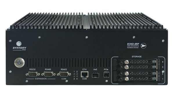
Syntony GNSS has introduced the Echo 4RP, the latest addition to its Echo series of GNSS record and playback systems. This new model builds on the capabilities of the Echo R&P, offering advanced features designed to address the evolving needs of GNSS testing and development.
The Echo 4RP expands its frequency range to include L, S, and C bands, surpassing the previous model’s coverage of 1100 MHz to 2550 MHz. This broader spectrum supports both current and emerging GNSS and non-GNSS signals, making it adaptable for diverse testing scenarios.
The system now supports up to four RF channels for simultaneous recording and playback, an increase from three in the earlier version. This enhancement enables complex testing setups, including multi-antenna configurations and Controlled Radiation Pattern Antenna (CRPA) applications, with precise phase synchronization.
The Echo 4RP delivers high-quality signal fidelity with options for 16-bit I&Q sampling at 93.75 MHz per channel or 8-bit I&Q sampling at 187.5 MHz per channel across all four channels simultaneously. These options provide flexibility to meet specific testing requirements.
Weighing less than 10 kilograms, the Echo 4RP combines portability with performance, making it suitable for both laboratory and field environments. Its compact design simplifies deployment without sacrificing functionality.
The system includes up to 32 terabytes of internal storage with a swappable SSD design, allowing extended recording sessions and efficient data handling.
The Echo 4RP is designed for a wide range of GNSS testing applications:
CRPA testing: Phase synchronization across all channels supports anti-jamming and anti-spoofing technologies for enhanced signal integrity.
GNSS spectrum analysis: C-band coverage allows exploration of new GNSS signals and services, aiding research into next-generation navigation technologies.
The European Space Agency (ESA) has selected Syntony GNSS to supply user demonstration receivers for its low-Earth orbit positioning, navigation and timing (LEO-PNT) project.
Led by Thales Alenia Space and funded by ESA, the first European LEO-PNT project aims to enhance PNT services from LEO. This initiative is expected to improve the accuracy and reliability of navigation systems, serving a wide range of applications, from critical emergency services to everyday technologies.
Syntony will provide its ground receivers, compatible with the new LEO/PNT signals, as well as with GPS and Galileo systems. These receivers will initially assess the performance of signals from the constellation, which will start with fewer than 10 satellites. There will be 100 to 600 satellites when the constellation is complete, according to Syntony.
Although the receivers may not always be able to calculate position, velocity, and time (PVT) due to the lack of available satellites, they will be essential in evaluating signal performance when at least four satellites are visible. This allows for PVT calculations and performance comparisons with existing GNSS systems.
Syntony’s software-defined radio (SDR) receivers enable real-time adjustments to the receiver settings to evaluate the constellation’s performance. This can be achieved without any hardware changes, as the LEO-PNT constellation uses frequencies similar to those used by the medium-Earth orbit (MEO) GNSS systems.
Syntony’s Constellator GNSS Simulator will be updated to incorporate the constellation’s signals as soon as they are available. This process is similar to how the signals from Xona Space Systems’ PULSAR constellation were integrated as early as 2022.
Syntony GNSS has partnered with Keysight Technologies, an RF testing solutions manufacturer, to advance GNSS testing and simulation capabilities.
The collaboration centers on Keysight’s VXG advanced signal generator, which can generate thousands of simultaneous signals across all GNSS constellations and bands. It features time and phase synchronization for high fidelity and accuracy in simulation scenarios. This feature is particularly crucial for testing GNSS receivers under various conditions to ensure optimal performance in real-world scenarios.
The Syntony GNSS Simulator Constellator can mimic the complex dynamics of GNSS signals, providing a platform for testing and validating GNSS receivers. When combined with Keysight’s VXG, it serves as a comprehensive testing solution for all GNSS signals and scenarios.
The partnership aims to improve Controlled Reception Pattern Antenna (CRPA) testing. CRPA is pivotal in enhancing the resilience of GNSS receivers against interference and jamming to offer reliable operation even in adverse conditions. The combined solution from Syntony GNSS and Keysight offers a platform for testing CRPA systems to ensure they meet the stringent requirements of modern applications.
Telecommunications, among other sectors, relies heavily on precise timing information, typically derived from GNSS signals. The threat of jamming attacks, which can disrupt GPS time synchronization, poses a significant risk, potentially crippling communications and other dependent systems. The testing solutions emerging from this partnership provide a toolset for infrastructure managers to evaluate and enhance the resilience of their systems against such threats.
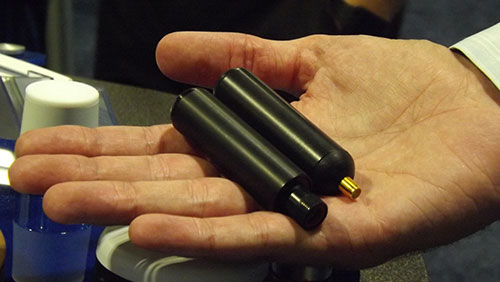
Syntony GNSS has released CERBER, a GNSS receiver embedded in a CRPA solution.
A classic CRPA system consists of embedded GNSS antennas and antijamming treatments. However, CERBER relies on the tight integration of a CRPA treatment (with a 4-array antenna) and the embedded GNSS receiver.
The estimation of GNSS direction of arrival (DoA) is enabled and allows the receiver to check whether those DoA estimations are compatible with GNSS constellations or originate from very few directions. Therefore, users will be able to detect and locate spoofing devices or receivers instantly.
The receivers are also able to constantly recalibrate the chains of reception based on the DoA and GNSS signals.
CERBER’s embedded approach also enables a 6dB power gain in satellites’ directions, the continuity of GNSS signals’ phase when the space-time adaptive processing (STAP) filter is updated, the absence of additional noise that a GNSS receiver would imply with the re-generation and re-digitalization of RF signals and an improved rejection performance when compared to a classic CRPA + independent GNSS receiver solution.
This technology is designed for the protection and the surveillance of civil critical infrastructures, including Galileo’s and EGNOS’ ground segments, airports or any infrastructure requiring precise and resilient GNSS timing.
Syntony GNSS has doubled the SDR L1C/A equivalent signals of its multi-GNSS simulation solution, Constellator.
With Constellator’s computation power doubled from 660 L1C/A equivalent signals to 1200, users can simulate a complex RF environment for GNSS testing with a powerful and high-fidelity machine, the company said. Additionally, users can now test equipment with multiple traditional GNSS constellations and new ones to come, such as Xona’s PULSAR.
As a result of doubled computation, massive new constellations can be simulated. When fully deployed, the Xona constellation will count hundreds of satellites on multiple bands, in complex RF environments including specific atmospheric parameters, jamming, spoofing and multipath. It also introduces the controlled reception pattern antenna (CRPA) testing capacities of the device, when the demand is increasing for resilient multi-GNSS and low-Earth orbit (LEO) position, navigation and timing (PNT) solutions.
Syntony said it was the first PNT services provider to integrate all Xona demo signals into Constellator, in 2022. However, to offer a full testing solution, Syntony also developed a Xona-enabled GNSS receiver.
Syntony GNSS and Xona Space Systems have partnered to integrate the low-Earth-orbit (LEO) position, navigation and timing (PNT) constellation from Xona into GNSS simulators and receiver solutions from Syntony.
This partnership is part of Syntony’s and Xona’s strategy to offer users PNT solutions.
“The demand for advanced and resilient PNT services is skyrocketing,” Brian Manning, CEO of Xona Space Systems, said. “We are building an entire ecosystem from the ground up to address this demand. Having a full Rx-Tx solution available for all Xona signals is one of the keys to rapidly develop this LEO PNT ecosystem.”
Syntony GNSS was the first PNT services provider to integrate all of the Xona demo signals into its multi-GNSS simulation solution, Constellator, in 2022. However, to offer a full testing solution, Syntony has also developed a Xona-enabled GNSS receiver.
The CAST-5000 produces a coherent wavefront of GPS RF signals to provide repeatable testing in the laboratory environment or anechoic chamber. The basic system generates four independent, coherent simulations that reference a single point and is configurable to support up to eight elements for CRPA testing. With an intercard carrier-phase error of less than 1 millimeter, the CAST-5000 is extremely accurate.
The system generates a wavefront of GPS when its GPS RF generator cards are operated in a ganged configuration. Each generator card provides a set of GPS satellites coherent with the overall configuration. Several RF generator cards may be utilized together, ensuring phase coherence among the bank of signal generator cards. The CRPA antenna, antenna electronics and the GPS receiver can be tested as a unit with or without radiating signals.
The CAST-8000 is a new simulator that merges the CAST-5000 CRPA tester with a CAST-3000 EGI tester. The CAST-5000/8000 has the ability to be “ganged” together with additional CAST simulators to provide multiple vehicle and/or multiple antenna test configurations.
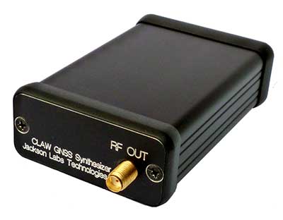
The 18-channel miniature full-constellation CLAW GPS Simulator is a fully self-contained, low size, weight, power and cost (SWaP-C) miniature GPS simulator. It is very popular in manufacturing environments as well as R&D applications that require consistent and repeatable local GNSS signals at low price points.The CLAW simulator does not require external computers for processing and control — it works fully self-contained by simply applying power, and storing location/time/date data in internal non-volatile (NV) memory, or by storing complex vector data to simulate highly dynamic scenarios. The CLAW also can be used to transcode NMEA or SCPI position/velocity/time (PVT) data into GPS RF signals. JLT offers an easy to use, highly configurable and cost-free SimCon Windows application program that is downloadable from the JLT website.
The SimConapplication allows random scenario generation and is thus usable to simulate leap-second events, week 1023 rollover events, or any other GPS live-sky scenarios including highly complex yet easy-to-create dynamic vector simulations. For authorized U.S. government users, a version that does not have altitude and velocity limitations is popular for low-Earth-orbit (LEO) simulations. Multipath simulation allows use of the entire 18-channel simulator capability. The unit can be field-upgraded with an easy to use in-field software upgrade feature. The CLAW is also very useful in GNSS receiver sensitivity testing for R&D or mass-production assembly lines as it allows accurate control of RF output power ranging from –100 dBm to less than –130 dBm with 0.1-dB resolution and typically better than 1-dB accuracy over the controllable power range.
The CLAW GPS Simulator also has a built-in RF signal generator with sweep, CW and random noise functions that are useful in simulating GNSS jamming scenarios, as well as GPS spoofing scenarios. The simulator comes in an FCC-certified metal desktop enclosure with numerous accessories.
The Orolia family of GNSS simulators offers a wide breadth and depth of tools for those responsible for mission-critical positioning, navigation and timing (PNT) applications. The simulation tools enable users to test a variety of scenarios, from simple to complex. Orolia’s simulators are feature-rich and easy to use, offering a way to harden GPS/GNSS-based systems without the limitations of testing from live-sky signals. Orolia’s approach allows users to buy only what they need today and upgrade later.
ESSENTIAL
Photo: Orolia
GSG 5/6. An essential scenario-based simulator used for testing a variety of smart applications such as drones, the internet of things (IoT), connected cars, cellular and more. GSG 5/6 offers ease-of-use with an out-of-the-box configuration and comprehensive set of pre-defined scenarios, plus the ability to create scenarios. It can simulate all constellations, all frequencies, and movements/trajectories anywhere on or above Earth. This enables a multitude of test solutions covering accuracies and sensitivities due to environmental conditions, technology factors and other events. Application packages are available for real-time kinematic (RTK), eCall, high-velocity, jamming and sensors.
ADVANCED
Skydel Software Engine. The software behind Orolia’s high-end GNSS simulators: GSG-8, BroadSim, BroadSim Anechoic and BroadSim Wavefront. All share the same software-defined benefits and interoperability. In addition to Orolia’s turn-key systems, Skydel can run on the user’s own commercial off-the-shelf (COTS) hardware. It is suitable to test and validate GNSS systems for a variety of applications, with advanced signal customization and configurable outputs. Users can create advanced scenarios with multiple parameters and variables: antenna patterns, orbits, multipath, hardware-in-the-loop (HIL) and more. The easy-to-use API configures all aspects, available in Python, C#, C++ and LabVIEW. User interactions can be recorded and exported as executable Python script — a learning tool that drastically reduces the automation learning curve.
Photo: Orolia
GSG-8. An advanced software-defined GNSS simulator supporting multiple constellations, frequencies and hundreds of signals all-in-view. With a 1000-Hz iteration rate, high dynamics and real-time synchronization, GSG-8 delivers ultra-high performance and flexibility. It is designed for space trajectories, custom PNT signals, HIL and more. Advanced jamming and spoofing options allow users to create benign and threat scenarios required for critical applications. Complex objects such as Differential GNSS (RTK), multi-antenna vehicles, attitude measurements and sophisticated GNSS receivers can be tested. A comprehensive software development kit (SDK) allows users to incorporate encrypted or proprietary signals. Powered by the Skydel Simulation Engine.
Photo: Orolia
BroadSim. Available through Orolia Defense & Security, BroadSim was designed to meet the demand of NAVWAR testing. BroadSim supports high dynamics, advanced jamming and spoofing simulation tools, and encrypted military codes including Y-code, M-AES and M-MNSA. BroadSim uses a custom Linux operating system for security and better performance. BroadSim excels in NAVWAR applications due to its four independent RF outputs, a wide dynamic range with up to 0 dBm transmit power, and integrated jamming and spoofing scenario creation. BroadSim’s ease-of-use and functionality to configure multiple vehicles allows any user to seamlessly test the performance and vulnerability of their system without requiring a high level of expertise. Powered by the Skydel Simulation Engine.
Photo: Orolia
BroadSim Anechoic. Available through Orolia Defense & Security, BroadSim Anechoic enables users to accurately simulate over-the-air (OTA) GNSS environments in their anechoic chamber. Designed from the ground up for the user, by users, the system has 32 individual RF outputs enabling it to drive 16 dual-frequency antennas. The automation of antenna mapping, time delay and power loss calibration cuts set-up time from days to minutes. Easily verify signals with a built-in spectrum analyzer. The 48-dB transmit chain amplifier and 80-dB transmit chain dial attenuator allow for complete signal control and high dynamic range. Powered by the Skydel Simulation Engine.
Photo: Orolia
BroadSim Wavefront. Available through Orolia Defense & Security, BroadSim Wavefront enables fully featured testing of controlled reception pattern antenna (CRPA) and multi-element antenna electronic systems. Scaled upon the same easy-to-use software-defined platform and interface, it supports 4-16 antenna elements with integrated high dynamics and a phase coherence of 1° σ. Users can simultaneously simulate multiple spoofers, jammers, repeaters and alternate PNT sensors with just a few clicks. The Wavefront makes no compromise between the number of signals and the iteration rate, which remains at 1,000 Hz. It is designed to help engineers deliver results and make decisions, and can be calibrated in a matter of minutes. Powered by the Skydel Simulation Engine.
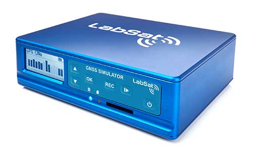
The LabSat 3 Wideband is a compact yet powerful multi-constellation and multi-frequency GNSS testing solution.
The easy-to-use, one-touch record and replay function provides an efficient way to test and develop GNSS-based technology without the cost and limitations of live-sky signals.
With simple-to-install upgrade options available, customers can invest with the confidence that its capabilities can grow alongside their future requirements.
LabSat 3 Wideband can record and replay up to three different channels at 56-MHz bandwidth across all major constellations and signals including:
GPS: L1/L2/L5
GLONASS: L1/L2/L3
BeiDou: B1/B2/B3
QZSS: L1/L2/L5
Galileo: E1/E1a/E5a/E5b/E6
L-band correction services including SBAS and IRNSS
2x CAN, RS232 and digital inputs tightly synchronized with GNSS data
Future signal launches are also supported, including L2C, L5 and L1C
LabSat 3 Wideband has a removable SSD (up to 7TB) and a two-hour runtime provided by an internal battery. It is lightweight and portable, making it ideal for field testing in any environment.
SatGen Signal Simulation Software
SatGen software allows users to quickly create bespoke, accurate scenarios with their own time, location and trajectory, that can be replayed via a LabSat GNSS Simulator.
The latest version of SatGen can be used to create a single scenario containing all the upper and lower L-Band signals for GPS, Galileo, GLONASS and BeiDou.
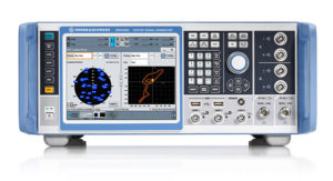
Precision-sensitive applications such as autonomous driving, control of unmanned aerial vehicles (UAV), or positioning of aircraft during landing procedures in coordination with ground-based augmentation systems (GBAS) require that modern GNSS receivers undergo detailed tests before implementation.
Rohde & Schwarz signal generators like the R&S SMW200A and the R&S SMBV100B offer a unique approach to generating complex and highly realistic scenarios for testing of GNSS receivers that are able to work with diverse navigational systems such as GPS, GLONASS, Galileo, BeiDou and QZSS/SBAS signals. Both simulators can emulate them all for testing.
R&S SMW200A. The R&S SMW200A GNSS simulator (pictured above) can be used to produce complex interference scenarios with multiple interferers — all generated within the instrument itself. It can emulate up to 144 GNSS channels and can be equipped with up to four RF outputs. With its ability to simulate multi-constellation, multi-frequency, multi-antenna and multi-vehicle scenarios, the R&S SMW200A is able to cover a variety of high-end GNSS applications.
R&S SMBV100B. The R&S SMBV100B supports the same navigational systems, with access to 60 GNSS channels and one RF output, with the same ability to configure realistic scenarios including obscuration, multipath and atmospheric effects, as well as the specific characteristics of the antenna and the simulated vehicle. An integrated noise and CW interference generator also can be added.
Since the devices do not require an external PC for scenario configuration, all the tests can be created quickly through the user-friendly GUI. Due to all-encompassing instrument options available, both simulators can be set up to fit unique user requirements.
For testing GNSS receivers under controlled and repeatable conditions, the R&S SMW200A and the R&S SMBV100B provide extensive and cost-effective solutions. The platforms are ready to adapt to future requirements and testing of newly implemented GNSS signals.
GSS9000, SimMNSA, CRPA test system, anechoic chamber testing, mid-range testing
Photo: Spirent Federal
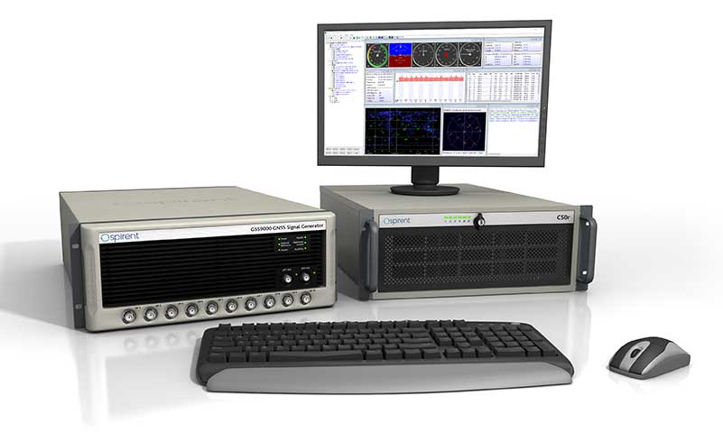
Spirent Federal provides GPS/GNSS test equipment that covers all applications, including research and development, integration/verification and production testing.
GSS9000. The enhanced GSS9000 Multi-Frequency, Multi-GNSS RF Constellation Simulator is Spirent’s most comprehensive simulation solution. It can simulate signals from all GNSS and regional navigation systems and has a system iteration rate (SIR) of 1000 Hz (1 ms), enabling higher dynamic simulations with more accuracy and fidelity. The GSS9000 supports restricted/classified signals. Users can evaluate the resilience of navigation systems to interference and spoofing attacks, and have the flexibility to reconfigure constellations, channels, and frequencies between test runs or test cases.
SimMNSA. The first fully approved MNSA M-code simulator. Authorized users of the GSS9000 series of simulators will be able to utilize the advanced capabilities of SimMNSA to create more robust solutions for their customers. SimMNSA has been granted Security Approval by the Global Positioning System Directorate.
CRPA Test System. Spirent’s Controlled Reception Pattern Antenna (CRPA) Test System generates both GNSS and interference signals. Users can control multiple antenna elements. Null-steering and space/time adaptive CRPA testing are both supported by this comprehensive approach.
Anechoic Chamber Testing. Spirent’s GSS9790 Multi-Output, Multi-GNSS RF Constellation Wave-Front Simulator System is a development of the GSS9000. The GSS9790 is a unique solution providing the core element for GNSS applications that require a test system that can be used in both conducted (lab) and radiated (chamber) conditions.
Mid-Range Solutions. Spirent also offers solutions that cater to intermediate GPS/GNSS testing needs. The GSS7000 multi-constellation simulator provides an easy-to-use solution for GNSS testing that can grow with users’ requirements. The GSS6450 RF record and playback system enables replay of a real-world GNSS/GPS test repeatedly in the lab.
High-end GNSS simulation solutions for R&D, integration and production testing
Photo: Syntony GNSS
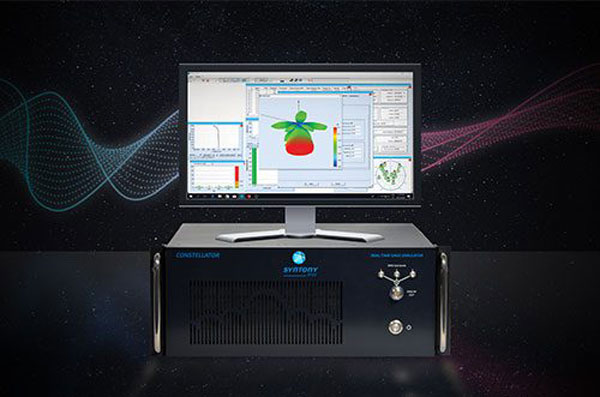
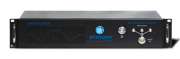
Constellator. Syntony’s GNSS simulator Constellator supports all constellation signals available and provides a high level of service in different ranges. It covers, in a single unit, a wide spectrum of use cases from entry-level with L1C/A up to very demanding configurations such as multi-frequencies and 400 channels management.
Extensively used in aeronautics, space and defense industries, Constellator answers complex requirements:
Standalone mode (on the ground and in space)
Multi-frequencies
All constellations and their signals, including NavIC/IRNSS
Hardware in-the-loop (HIL) mode with zero-effective latency and 1000-Hz update rate
All typical synchronization interfaces
Particularly in the space industry, Constellator implements the advanced models (Earth gravity, drag, 3D ionospheric models, side lobes, etc.) needed to achieve accurate simulations for all kinds of orbits (from LEO to GEO and SSTO). Combined with other Syntony GNSS simulation products (interference generator, Recorder & Player Echo, GBAS simulator, etc.), Constellator can be used to tackle challenging use cases such as jamming, spoofing, multipath, and multiple antennas testing. Constellator is based on a software-defined radio (SDR), making it hardware-ready for future constellations, signals and codes. It is easily upgradeable and versatile.
GNSS Recorder & Player. Syntony’s Echo is an ultra-high-fidelity GNSS recording and playback solution. It is designed to capture real-life signals and environments, for instance from airplanes, and then replayed for R&D or production tests. Echo offers:
3 RF channels of 100-MHz bandwidth each (for the whole set of GNSS signals from all constellations)
16-bit resolution (I&Q)
from 7 to more than 1,000 hours of record/replay capabilities depending on configuration
Echo-R can also record complex and very long realistic scenarios from a simulator; Echo-P can replay them with very high fidelity for long-run or production tests. Please ask Chief Sales Officer Francois Goudenove for distributor contacts in the U.S., Europe, India, China, South Korea and Japan.
“Prepare for Tomorrow: Find Vulnerabilities Today” was the title of our wide-ranging webinar in July that focused on GNSS signal simulation for jamming and spoofing scenarios. We did not have time to address all the questions posed by the audience, so we return to them here.
Q: While testing receivers, realistic scenarios for jamming and spoofing are very important. What is the typical approach to set the number of interference sources, their type and main signal parameters?
Two different approaches are common, those involving the use of an anechoic chamber and those which are lab-based. Each approach has its limitations and merits. Each approach must address the number of significant interferers, their signal powers and the waveforms of the interference signals. Each must also consider the geometric arrangement of these interferers relative to the antenna under test and relative to the simulated constellations under test.
Changes in signal phase, signal Doppler and signal power are as important for the interference signals as they for the wanted GNSS signals. These changes are caused by the simulated motion of the vehicle and potentially the motion of the interferers. These changes should also include the impact of terrain surrounding the vehicle and the interferers, and also the gain and phase patterns of the receive antenna on the vehicle and the transmit antennas on the interferers. Some interferers might be discounted from the significant set due to their signals being masked from the vehicle by the terrain or antenna patterns or by them being too far from the vehicle to have an impact. These interference signals may become significant as the scenario progresses due to vehicle or interferer motion.
Simulator graphical user interface. (Image: Spirent Federal Systems)
Q: In GNSS navigation systems for commercial applications, what emphasis of design effort should be on anti-jamming/anti-spoofing over improving the navigation accuracy?
Commercial applications is a broad area, so it will depend on the particular application as to whether it needs more accuracy or more resiliency against AJ/AS, but in general, the accuracy of GNSS is fairly mature. Standard GNSS offers accuracies on the order of ~1 meter. Centimeter accuracy can be achieved with differential or real-time kinematic (RTK). Multi-constellation use can increase availability in areas with limited sky view such as urban canyons. Multi-frequency can aid in the reduction of multipath and improve accuracy. If the application needs accuracy, these features are readily available.
However, integrity and resiliency are growing needs in commercial applications, especially ones that are in critical operations. Much more can be done to detect jamming and spoofing than what is in standards GNSS receivers today. In our systems, we include an additional software layer called BroadShield, which monitors internal state variables of the receiver, and will alarm on detection. Additional sensors combined with the GNSS receiver such as an inertial measurement unit (IMU), magnetometer, odometer, or even the much stronger Satellite Time and Location (STL) signal offer augmentation during periods of GNSS denial, or in the case of spoofing, authentication of the navigation solution.
While both jamming and spoofing are intentional attacks, they are highly different in their set-up and serve very different purposes. Due to their simplicity, most jamming attacks can be mitigated thanks to adaptive filtering or pulse blanking. On the other hand, spoofing is a malicious attack, highly complicated, and requires knowledge of the GNSS signal structure as well as precise timing and positioning.
The question is thus whether one should emphasize navigation accuracy over the ability to output a position (jamming case) or the possibility to output a completely erroneous position (spoofing case). The answer lies, obviously, in the end application and the coupling of GNSS receivers with other systems. High-precision non-life-critical applications should emphasize navigation accuracy while implementing simple jammer filtering strategies. Life-critical applications, being often coupled with other systems, should ensure the reliability of the solution even if that means being unable to compute a position due potential threats.
Q: Do you have GPS/inertial navigation system (INS) test capabilities?
The CAST-3000 EGI integration system produces GPS RF signals commensurate with simulated IMU sensor data to provide repeatable testing in the integration laboratory for a wide range of military and government applications.
CAST GNSS/INS simulators generate high-fidelity signals required for emulating the legacy GPS signals as well as those used by next-generation navigation technologies. This is because our sole business focus is supplying GNSS simulators, GNSS/INS test equipment, and GNSS/INS support services to government and military avionics laboratories, prime contractors, and GNSS receiver manufacturers. For 35 years we have provided off-the-shelf products to both the government and U.S. major defense contractors.
CAST EGI integration tools are used by Northrop Grumman and Honeywell and are now also being used in integration laboratories worldwide. Our equipment supports system integration in major weapons platform labs and development at major military contractor labs. CAST simulators produce high-quality, accurate signals that are used in government, military and commercial labs around the globe.
Our NCS TITAN GNSS simulator is able to emulate the presence of IMUs and micro electro-mechanical systems (MEMS) sensors with the optional available real-time IMU/Sensor Emulation Package (SEP). The SEP upgrades the TITAN to support the simulation of inertial sensors, which nowadays are implemented as MEMS, among others, and of other common aiding sensors. To obtain more accurate positioning for location-based services and navigation, GNSS chipset and receiver manufacturers as well as system integrators combine more and more GNSS navigation with such sensor fusion or signals of opportunity.
The optional SEP enables controlled and progressive testing of sensor-fusion algorithms when used with NCS Control Center operating software. This software supplies the SEP with an internally- or externally-generated center-of-gravity (CoG) trajectory for the device under test.
The various sensor models to be emulated by the SEP run within the Control Center software. The device under test (vehicle) input trajectory at the CoG passes through the sensor model, which in turn generates the appropriate sensor output, by taking into account the corresponding error model for each sensor defined.
We have added the capability to emulate INS/IMU data in addition to GNSS signals to our Constellator simulator, to offer to the customers a complete testing platform. Constellator can simulate up to six gyrometers and six accelerometers. The attitude of each sensor is defined with respect to the vehicle axes. Deterministic errors can be configured to simulate the axis misalignment and scale factors, and biases can be defined in order to simulate realistic sensors. Stochastic error models are also available such as random walk or Gauss-Markov models for each sensor (gyrometer or accelerometer) to improve the sensor emulation fidelity.
Q: Do you have detailed scenarios for jamming and spoofing in timing use of GNSS receivers, that is, involving time synchronization for telecommunications companies?
The simulated jammer’s signal specification must be very flexible in order to faithfully simulate real-world jamming events. For example, the jammer’s spectral shape should be flexible enough to simulate a Blue Force electronic attack (BFEA) on a GNSS receiver.
Also, the simulator should be able to simulate dynamic scenarios by varying the power of the jammers as a function of their trajectories and as a function of different antenna patterns.
Sometimes when testing receivers, the simulated jammers should replicate pre-recorded waveforms from real world. The ability to play back the pre-recorded IQ-baseband signal in conjunction with GNSS signals is another powerful feature of a simulator. Simulation of spoofing attacks on a GNSS timing receiver is only possible when the GNSS simulator provides fine-grained control of transmitted signal. This includes controlling the offsets on the pseudoranges with additive ramps, as well as individual signal power levels at very precise points in time.
Also, the GNSS simulator must be able to synchronize itself with the live sky’s GNSS signal. Another way to achieve realistic spoofing is to use two simulators controlled independently (that is, full control on constellation, navigation message, propagation time offset, power and so on).
FIGURE 1. Real-world jamming simulation must take into account key factors such as varying jammer power, as a function of their trajectories and antenna patterns. (Image: Skydel)
Q: Please discuss how to simulate a smart spoofer that would generate a replica of a constellation (or all constellations) and then produces two full RF transissions: one that is the true signal, and a strong spoofed signal that pulls the receiver to a false location. Can you simulate the two full multi-band RF ensemble?
Two artificial synchronized scenarios could be created using SatGen signal generator software that can reproduce the GNSS signals from a number of constellations. The user could create two separate signal streams, both starting at exactly the same position and time and using the same constellations, chosen by the user.
The second scenario could then be set to diverge away in position from the first scenario, while staying perfectly synchronized in time. The signal-to-noise ratio of each scenario could be adjusted independently of each other to simulate a spoofing situation where the spoofing signal is much stronger than the real signal. A file containing this twin scenario can be replayed using a LabSat Wideband with two separate RF outputs, each synchronously replaying the two different scenarios. This would closely simulate the actions of a smart spoofer, but in a completely repeatable, and controllable manner.
This could be accomplished by either combining the output of two of our CLAW GPS simulators, or by combining the output of a single CLAW simulator with live-sky signals using passive industry-standard splitters/combiners. The CLAW is able to receive a custom ephemeris download in RINEX format to match either the spoofed live-sky constellation, or to generate a synthesized constellation in the case where two CLAW simulators are being used.
The simulator has a wide RF power adjustment range of over 45-dB, allowing the spoofing signal to be gradually introduced to the primary GPS constellation RF signal. This spoofing simulation could be accomplished with better than 0.5 meter peak-to-peak positioning accuracy and better than 5-ns real-mean-squared (rms) typical UTC (GPS) offset unit-to-unit, allowing the victim receiver to be pulled off of its true (live-sky) position with very high accuracy. Typically, GPS receivers are spoofed easily as long as the UTC timing synchronization is 500-ns or better between the live-sky and spoofed signals.
Timing synchronization to the spoofed victim GPS signal to within nanoseconds is achievable through the external 1PPS reference input, the simulator accepting a position, navigation and timing (PNT) fix in real time via its NMEA serial and 1PPS inputs. This allows capturing a moving victim receiver by estimating its momentary position, then ramping up the spoofer power, and then presenting the victim receiver with alternate position information as required (see Figures 2 and 3).
High position and timing accuracy between the spoofed and live-sky signal is important to prevent and mitigate spoofing detection via UTC phase or position jumps that could happen when the receiver gradually or quickly switches over to the spoofed satellite signals.
FIGURE 2. Spoofing attack on a GPS receiver using a CLAW simulator to spoof a live-sky antenna signal. Initially the spoofer was phase- and frequency-synchronized to UTC(GPS), then spoofer RF power is ramped up, and once the victim GPS receiver is captured, a frequency offset is added to UTC(Spoofer), which pulls the system off-phase. (Figure: Jackson Labs)
FIGURE 3. Simulating a spoofing attack on a timing application where the spoofer does not know the exact victim antenna location with certainty. The resulting antenna position offset error (50 meters in this simulation) still allows the victim receiver to be captured, and then causes a time error as satellites move in and out of view even with the spoofer being synchronized to UTC(GPS) at all times. This error is clearly visible in the resulting UTC(Spoofer) output from the victim receiver equipment. (Figure: Jackson Labs)
Q: We want to correctly model and simulate effectiveness of various anti-jamming (AJ) and anti-spoofing (AS) solutions to make informed decisions about which AJ/AS solution is most effective for a specific mission and interference scenario. How can you help?
Live-sky testing on a jamming/spoofing range provides a wealth of data, and reassurance that the system under test does work as intended. Record and playback systems (RPS) under live-sky conditions can allow further evaluation back in the lab, after the live-sky tests are complete. Performance parameters of the RPS may degrade the validity of the signal when played back; signal bandwidth and bit-depth are absolutely key, for example. Recordings that use too few bits will degrade the dynamic range of the recorded signals, so significant care should be taken when selecting an RPS.
Either way, under live-sky or with recorded live-sky, you get what you get. It is extremely difficult to predict what the test parameters actually are. It is perilous to attempt to alter the test parameters after the event. Lab-based or anechoic chamber-based systems have their limitations, but they are repeatable, predictable and tweakable. Again, performance parameters of the simulation system play a key role in the validity of the testing. The ability to calibrate the simulation system to give a repeatable, predictable performance is as important as the realism of the simulation. Carrier-phase accuracy/repeatability among antenna elements and signal timing accuracy are important parameters when evaluating AJ and AS systems.
Q: We had a receiver where the time stamp for any location report would drift off progressively, up to an hour off of the known true location. What might contribute to this? We do not believe this was an intentional threat, but an artifact of nearby electronics or other system conditions. It actually occurred on a pivot irrigation arm in motion, with substantial vibration. The receiver was electrically isolated. The results were repeatable on the pivot arm, but not on our vibration table.
Interesting problem with no obvious answer. Even the worst oscillator will take many months to drift off by up to an hour with no GNSS, even under horrible vibration conditions, so this is an unlikely cause. Is it drift or a jump in error? Nearby electrical noise could cause GNSS denial (jamming), but not erroneous data. That requires spoofing. If you have no reason to believe that it is intentional, that makes spoofing unlikely, but still possible. Is a GNSS repeater or a record/playback GNSS tester operating in the area? These are spoofers, even if they are unintentional.
If this is a precision agriculture application, then an RTK reference station transmitting erroneous data could be the cause. What time-stamping format is used: local time or UTC? An unlikely but possible scenario is the unit is changing time zones so local time jumps an hour. Is there a processor/software app between your output and the actual GNSS receiver? This could introduce errors. What is the position output indicated when the time drift occurs? The best way to diagnose this is to record the time and position output as log files using a laptop PC connected to the serial data.
Q: Do your simulators work as well for testing handheld, consumer-grade GPS? Please discuss the differences in testing techniques or approaches for high-precision vs. mass-market receivers?
We have a range of simulators suitable for all levels of GNSS testing. If you don’t need the high fidelity and wide bandwidth of the LabSat Wideband, then the entry level LabSat 3 will also work with any GNSS device including handheld consumer-grade products.
To fully explore the performance of high-precision receivers, including multipath effects and P-code reception, a wider bandwidth and a greater number of bits would be required to capture and replay all of the available signals. For these applications, we recommend a bandwidth of 56 MHz and at least 4 bits of resolution.
For testing of consumer-grade, handheld devices with simpler RF front ends, we recommend a much reduced bandwidth of around 9 MHz and only 2 bits of resolution. This smaller bandwidth and fidelity will easily reproduce the majority of real-world conditions, and the resulting data files will be much easier to handle.
FIGURE 4. Simulator graphical user interface. (Image: Racelogic)
Q: How many GNSS signals can a software-defined radio produce?
The theoretical limits of a software-defined radio (SDR) are based on four distinct characteristics of the SDR: the digital-to-analog converter’s (DAC’s) bit resolution, the maximum sampling rate, the bandwidth and the number of RF outputs. With most SDRs, available bandwidth is defined by the sampling rate.
With a 16-bit DAC, there is enough dynamic range to generate up to 50 GNSS signals and hundreds of multipath echos (with more than 60 dB of range to accommodate different signal power levels) per RF output.
For example, with a sampling rate of 50 MSps, a 40-MHz wide signal — combining GNSS constellation signals such as GPS L1 C/A, Galileo E1, GLONASS G1 — can be generated. Nowadays, SDRs can have two or more RF outputs and are able to operate with sample rates of 100 MSps or higher. By distributing the GNSS signals across different RF outputs, the entire GNSS spectrum can be covered at a relatively low cost in terms of hardware.
A handful of SDRs can easily be synchronized to form multiple RF output systems. In such cases, the complete range of GNSS signals for all visible satellites can be generated at the same time.
Q: In a dual-frequency receiver would it be possible to still use L1 spoofed/jammed with L2 clean to get an accurate position? Is it possible to do a combination between the two signals in order to save the spoofed/jammed L1?
In principal, it is still possible to use L1 spoofed/jammed with L2 clean in a dual-frequency receiver to get an accurate position. Such receivers are available as off-the-shelf products. These receivers use a special algorithm to detect if a GNSS frequency band is spoofed/jammed and automatically switch over to the clean frequency band. However, this principle can only be applied if the entire GNSS spectrum is not completely jammed. Whether a dual-frequency receiver can still use L1 spoofed/jammed with L2 clean to get an accurate position is therefore finally basically dependent on the overall bandwidth of the interferer/jammer.
With IFEN’s TITAN simulator, it is possible to easily create the corresponding simulation scenarios for the real-time simulation of realistic test scenarios to test the robustness of GNSS receivers against interference/jamming and also spoofing. In doing so, various static and dynamic interference/jamming sources are supported by the simulator’s software.
It is possible to achieve a PNT solution using L2 signals only. This requires reception and decoding of either the military L2 P(Y) signal, or reception of the new but still pre-operational L2C commercial signal. Codeless or semi-codeless commercial L1/L2 receivers rely on tracking the carrier phase on L2 to be able to mitigate effects such as solar flares and ionospheric errors; however, they are not capable of generating a PNT solution with L2-only reception as would be the case under this spoofing/jamming scenario.
P(Y) signal reception on L2 typically requires reception of the coarse acquisition (C/A) signal on L1 prior to tracking P(Y) unless the receiver has its own internal (atomic) time-base synchronized to UTC to the sub-microsecond level.
On-Demand Webinars
Simulation against Jamming and Spoofing: With cyber attacks on the rise, it is more critical now than ever to thoroughly test GPS and GNSS systems against jamming and spoofing.
Back again in Portland, Oregon, the 2016 Institute of Navigation’s ION GNSS+ conference was a great opportunity for the GNSS community to catch up on what’s been cooking in the industry, and of course who’s been doing what in the research community.
The attendees eagerly took to a wide range of technical paper presentation sessions, and from time to time came to take a look at what industry had to offer on the exhibit floor. Lots of engaging research reports, from work undertaken over the last year by academia, again drew a significant number of attendees from around the world.
On the other hand, industry continued the trend to go to trade shows in application sectors and pull back somewhat from ION GNSS+ as a place to look for product sales. So the number of companies on the ION show floor remained around the same or maybe a little less than in the previous few years. Nevertheless, the quality of the companies exhibiting remained high and there were some interesting newcomers.
A number of major GNSS receiver manufactures have pulled back from ION, so there were only two established U.S. companies and two new U.S. entrants at the show. On the other hand, GNSS simulation companies were at ION in force — eight all told, or twice as many as the receiver manufacturers present who have been their historic customers. But the trend in GNSS simulation now appears to be to move down stream towards the needs of integrators and systems outfits — in segments such as automotive, UAV and agriculture — with lower cost, very capable simulators.
Receiver makers roll out new tech
As a consequence, the NovAtel and Septentrio booths got a lot of attendee traffic, while BDStar (Unicore receivers and Harxon antennas) and ComNav also had a number of visitors to their booths. As usual, NavTech, who represent almost all the manufacturers, also had a busy exhibit.
OEM7600 dual-frequency receiver.
NovAtel chose to launch its OEM-7 series of GNSS receivers and a newly designed VEXXIS high-precision antenna at ION GNSS+, which is a somewhat refreshing return to the ION GNSS+ launch platform we used to see in the past. A new highly integrated ASIC at the heart of this receiver now provides, amongst other features, 555 channels, L-band support, inertial SPAN capability and an intriguing “Interference Toolbox”. The toolbox enables integrators to localize interference effects over a wide band — especially helpful for densely packed electronics, which you might expect in a UAV, for instance.
Interference Toolbox Screenshot.
Septentrio didn’t have a whole lot of new product announcements, but as usual the company has been working hard at improving existing capabilities on its receivers. The AsteRx4 receiver that uses a new ASIC has been available for a while, but it too boasts 544 channels — perhaps too many to actually be used in practice — robust heading, centimeter-level RTK and decimeter-level PPP (with TerraStar and Veripos corrections) with dual L-band channels, and an improved suite of advanced interference mitigation (AIM+) capabilities. This helps detection and removal of the effects of “chirp jamming” from low-power “cigarette-lighter” jammers — using signal analysis and adjustment of adaptive notch filters.
Septentrio did announce a new PolaRx5TR packaged time-and-frequency transfer receiver and a contract with the Jet Propulsion Laboratory (JPL) for reference stations and timing. A report by UNAVCO also found its way into my inbox, which related comparative testing of the PolaRx5 and other manufacturers’ receivers in connection with a UNAVCO RFP – Septentrio did O.K. and was selected as a preferred vendor, which no doubt influenced the JPL award and added to an already good first half year for the company.
The Septentrio PolaRX5TR.
BDStar had a range of GPS, GLONASS, Beidou receivers from its subsidiary Unicorecomm, along with an impressive selection of antennas from Harxon, another of its Chinese subsidiaries. Both product lines have done very well in the Chinese market, and BDStar would like to sell more in North America.
ComNav also displayed a similar range of GNSS receivers and antennas, with new versions of both since last year, and a strong desire to break through into the US market.
Simulators a big presence
Simulator companies at ION included the more established Spirent, Spectracom, CAST, IFEN and Rohde & Schwarz — we could even now consider RaceLogic/LabSat as a record-and-playback fixture in the market. But in the wings and making lots of waves at the show were Syntony from France and Skydel from Montreal, Canada.
Spirent brought its usual large-scale GNSS simulators to ION, but also featured an interference detection and software analysis suite, a 16-bit high-fidelity record/playback unit, along with a new multi-frequency simulator aimed at downstream integrators. The GSS200D Detector finds interference effects and is able to relate them to the threats in the environment around a receiver. The object is to help debug an installation by finding internal interferers. The analysis tools can also help differentiate between regular equipment interference and potential external jammers.
Spirent’s new GSS200D detector.
Spirent also displayed a record/playback unit that has 16-bit playback capability, enabling a user to record and review a particular interference event, and then feed their new commercial simulator in order to replicate the interference. So a passing isolated jamming event can be analyzed in detail. Multiple reruns are possible to confirm the effect on the target system, and following equipment modifications, prove that the problem has indeed been neutralized.
Spirent analysis tools.
RaceLogic introduced its new wideband LabSat 3 record/playback system for GPS L1, GLONASS L1, Galileo E1, BeiDou B1, QZSS and SBAS. Recording live signals for any or all of these signals then allows later playback of a canned sample for equipment debugging on the bench. The LabSat product line has been around for some time, and this addition increases the debug capability for downstream users at an affordable price in a very portable format. When used with the RaceLogic SatGen software system, the user has access to a powerful toolset for testing new GNSS devices.
LabSat 3 and SatGen test set-up.
Spectrcom displayed its multi-frequency, multi-constellation simulator and also featured a GNSS vulnerability test system for interference detection and system debugging. The company’s approach requires two simulators, both synchronized by an atomic clock, allowing a PC-based Test Scenario Control to generate reproducible interference effects for debugging.
CAST Navigation is already moving downstream quite quickly with its CAST-SGX handheld GNSS simulator. With a touchscreen display, this simplified L1 GPS simulator (with P-code option) is ideal for test-bench debugging.
Rohde & Schwarz had its usual array of high-end test equipment, with a test set-up aimed at demonstrating testing of a Wi-Fi indoor location application on a smartphone.
IFEN showed up with a completely re-engineered simulator with huge frequency/channel capacity. The Titan GNSS Simulator houses up to 8 RFSIM modules, each of which carries 32 configurable satellite signals. A fully configured Titan chassis can therefore provide 256 channels of GPS L1/L2/L5, GLONASS G1/G2/G3, Galileo E1/E5/E6, Beidou B1/B2/B3, IRNSS L5 and S-band, QZSS L1/L2/L5/LEX and all current L1/L5 SBAS signals. Titan also has up to four independent RF outputs.
IFEN Titan GNSS Simulator.
Skydel is one of the newcomers in GNSS simulation, but has made significant inroads first appearing last year at ION. Skydel now boasts a full-up, reconfigurable GPS, GLONASS, Galileo, Beidou “software” simulator which the company claims to sell at a 1/3 the price of a conventional hardware simulator. And during the year, Skydel teamed up with Talen-X in Ohio, who have embedded Skydel software-defined in a U.S.-sourced GPS/GLONASS/Galileo/Beidou simulator that can include GPS P/Y and M-code.
Broadsim from Talen-X powered by Skydel.
Syntony rises high by going under (the ground)
The noise in simulation at ION was, however, created by Syntony from Toulouse in France. Syntony recently won a 15-simulator order from OneWeb — the outfit that plans to launch a 640 internet connectivity satellite constellation through 2020. With funding secured from Virgin Group and Qualcomm in 2015, initial satellite build is underway at Airbus Defence and Space, launch services are contracted with Arianespace to provide 21 multi-sat launches on Soyuz beginning in 2017 with optional launch service with Virgin Galactic. So Syntony is likely going to be able to build, deliver and be paid for its 15 simulators, which will be used for testing GPS capability that is integrated into each comms satellite.
Syntony’s simulator is also software-defined and is reconfigurable. The software-defined heart of this system comes from a Syntony GPS/Galileo receiver, and a version of this receiver has now been sold for use in the Airbus Adeline re-usable space module. This receiver is a “multi-antenna receiver” in order to avoid signal or tracking loss while switching between antennas during the Safran launcher rotation. The catch here is that Syntony must develop this receiver to Airbus critical airborne software=qualification standards — no mean feat! Syntony is also providing a version of its Constellator simulator for testing this multi-antenna input receiver.
An ECHO record/playback system is also available, which includes high-fidelity 16-bit RF outputs.
Finally, Syntony was able to capture a proof-of-concept location infrastructure project for Stockholm, Sweden’s, underground metro. The metro stations are pretty deep underground, as they have been dug under the sea in and around Stockholm, and no one had been able to come up with a system that would enable emergency 911 calls with associated essential localized position information to be carried from within the stations. Syntony was able to provide a GPS-like signal infrastructure at the stations which is compatible with GPS-enabled smartphones. It worked well, and Syntony verified that there was no radiation of the signal outside any of the entrances to the test station — so no GPS interference. It actually worked so well that Syntony got the contract to equip all 50 metro stations in Stockholm, and the Syntony is now working to spread its system around the metros of all major cities, worldwide.
Defining the Galileo PRS signal…
Then I came across Fraunhofer towards the end of the show, and their posters about a Galileo PRS (Public Regulated Service) receiver. Now, we know that there has been significant discussion between the different security services of countries across the European Union, and its taken a lot of time to get to a definition of the PRS signal and who has access. So it wasn’t surprising that there was no hardware on the Fraunhofer booth; what’s surprising is that there was any mention of such a receiver being available and telling attendees at a conference in the U.S. that it’s available.
I talked to a couple of people at their booth, and indeed there is such a receiver, but they really couldn’t tell me anything about it because telling is strictly verboten! Another strange anomaly of the Galileo program — the participants seem to want to let the U.S. know that they have the capability for a special access service, and a receiver is available to work with it, but they can’t tell us anything about it. I guess the idea may be to rattle the cage of the U.S. P-code/M-code guys, and let them know Galileo has caught up at last… But Fraunhofer has an idea of how to make things available to, well, err …. to somebody. They have a concept to have cellphone users who want PRS to connect with their cloud receiver, and they will decode and provide PRS position back over the internet. That solves the whole security thing…. OK, that should do it.
Where inertial stands
I also made the rounds of the inertial and inertial/GPS guys at the show, and there were quite a few. From NorthropGrumman and Systron Donner and their mil-spec high-end FOG and RLG and Quartz MEMS tube-shaped inertial units — could they be for shells or missiles? — to Silicon Sensing’s MEMS accels and gyros and their move out of automotive and towards high-precision performance, to Sensonor’s high-performance commercial MEMS/GNSS units, there were actually only a few of the inertial-aiding outfits present. Yet everything we hear is that for anything that moves, we really should use integrated inertial/GNSS, and UAVs especially want lots of that! So this part of the business looks to be quite healthy too…
Now another ION GNSS+ conference has come and gone — and I was reminded that maybe I’ve actually been to 95 percent of the ION September conferences over the last 30 years. And as I write, the last of the late Friday paper sessions are crawling to a close.
ION still remains a good place to come and learn, a place to meet industry colleagues and a place to see a little of what industry is up to. Definitely worth the trip, and don’t forget your business cards next year.
The Averna RP-6100 Multi-Channel RF Record & Playback for RF application testing allows users to tecord real-world signals such as GNSS, HD Radio, LTE and Wi-Fi — plus impairments — to significantly advance projects and harden product designs. Skydel Solutions’ GNSS simulator is an entirely software driven innovative and cost-effective simulator that works with the RP-6100, enabling users to test corner cases and future events with a real-time GNSS solution.
PCTEL’s GPS/GLONASS high-performance asset tracking and synchronization helix antennas are now available commercially. The antennas capture the frequencies needed for GPS, Galileo and GLONASS satellite reception. This cross-compatibility allows global OEMs to use one standard platform to serve both European and U.S. markets.
PCTEL uses its proprietary filtering design to allow wideband coverage while achieving superior out-of-band rejection. With an IP67 rating, the small form-factor helix antennas will withstand harsh environments.
AsteRx-U and AsteRx-U Marine multi-constellation dual-antenna receivers incorporate the latest GNSS tracking and positioning algorithms and interference mitigation. Machine-control users in the agricultural, construction, marine and mining industries benefit from a complete system with integrated UHF radio, Wi-Fi, USB, Bluetooth and cellular connectivity and a spectrum analyzer. All configurations can be done via the on-board web interface.
The AsteRx-U has decimeter- and centimeter-level RTK positioning including TerraStar. The AsteRx-U Marine also supports Veripos PPP augmentation services.
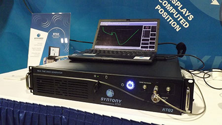
The RTG2 is a GNSS constellation simulator that generates realistic GNSS RF signals, taking into account current and future GNSS constellations. RTG2 is able to entirely simulate one or many constellations (GPS, Galileo, etc.) including satellite-based augmentation systems such as WAAS and EGNOS.
The generator is entirely configurable (troposphere and ionosphere effects, simulated receiver trajectory, etc.) through a user-friendly interface accessible on a separate PC through Ethernet. RTG2 is highly flexible and scalable, offering hardware and software upgrades for capability extensions.
Telit’s Jupiter SE873 GNSS receiver with flash memory.
GNSS Receiver with Flash Memory
The Jupiter SE873 GNSS receiver is a complete multi-constellation position, velocity and time engine that delivers versatile performance in harsh environments. The 7 x 7 x 1.85 mm module has serial quad I/O flash memory, an integrated low noise amplifier, SAW filter, TXCO and real-time clock. The Jupiter SE873 supports Assisted GPS (both autonomous and server-based) plus SBAS, which improve time-to-first-fix and position accuracy. AGPS data is stored in flash memory and is available even after all power has been removed and then restored. This is especially important for battery-operated equipment.
The SE873 supports the entire GNSS spectrum: GPS, GLONASS and BeiDou, and it is Galileo ready. It delivers simultaneous low-power tracking of GPS and GLONASS or GPS and BeiDou.