Tag: Xona Space Systems

  • Murata and Xona Space sign MOU on LEO satnav for industrial applications

    Murata and Xona Space sign MOU on LEO satnav for industrial applications

    Murata Manufacturing Co. Ltd. and Xona Space Systems have signed a memorandum of understanding to improve the accuracy and reliability of satellite PNT technologies.

    The companies will explore the potential to provide optimal products and solutions by combining Murata’s long-standing expertise in high-frequency and wireless communications, sensors, timing devices and module design with Xona’s advanced low-Earth-orbit (LEO)-based positioning and timing synchronization technologies.

    Benefit of LEO satellites

    Because LEO satellites orbit closer to Earth, they can deliver stronger signals to the ground, which improves signal reception in city centers and indoor environments. Their higher orbital speed compared with GNSS enables observation data in a shorter period of time, which enhances performance in urban areas via accelerated convergence times and reduction in multipath errors.

    Against this backdrop, technologies that combine satellites in different orbital layers, including LEO, are attracting attention as an approach to complement and strengthen the accuracy and reliability of PNT, with growing interest in their adoption for higher precision and enhanced resilience.

    The role of Pulsar

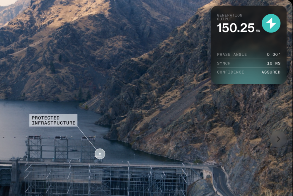
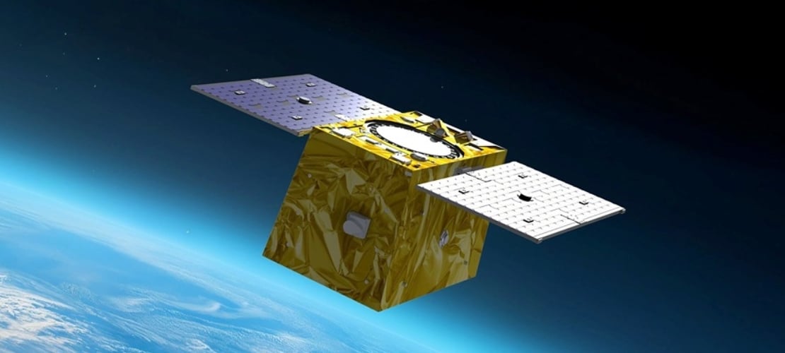
    Xona offers Pulsar, a PNT service based on a satellite network composed of a constellation of dedicated LEO satellites with significantly stronger signals than traditional GNSS systems. Pulsar is compatible with GNSS, enabling these enhanced capabilities to be integrated with typical GNSS user equipment in a way that complements and improves existing systems.

    As a purpose-built modern PNT service, Pulsar aims to achieve centimeter-level positioning accuracy, greater performance in urban areas, and enhanced resilience against jamming and spoofing.

    Previous venture and latest MOU

    Murata has previously invested in Xona through Wonderstone Ventures, Murata’s corporate venture capital arm. This initiative represents part of an ongoing collaboration built upon the existing relationship between the two companies.

    Based on this MOU, the two companies will explore the potential to provide optimal products and solutions by combining Murata’s long-standing expertise in high-frequency and wireless communications, sensors, timing devices, and module design with Xona’s advanced LEO-based PNT positioning and timing synchronization technologies, with the goal of realizing highly accurate and highly reliable positioning and timing synchronization.

    Looking ahead, the companies will evaluate potential applications in data centers and financial institutions that require highly accurate timing synchronization to support 5G/6G communications, as well as in off-road industries such as construction and agricultural machinery, where positioning needs are high in environments where GNSS is difficult to use.

    Through these efforts, the companies aim to enhance performance and create new solutions across various sectors.

  • Rohde & Schwarz enables Xona Pulsar signal simulation for next-generation navigation devices

    Rohde & Schwarz enables Xona Pulsar signal simulation for next-generation navigation devices

    New test capability supports device manufacturers preparing for Xona’s commercial LEO navigation constellation.

    Rohde & Schwarz is providing signal simulation capabilities supporting Pulsar, the next-generation satellite navigation service developed by Xona.

    The new functionality enables manufacturers to test Pulsar capabilities in production settings using Rohde & Schwarz signal generators, providing an accessible pathway for validating and scaling devices with next-generation positioning, navigation and timing (PNT).

    As demand grows for more precise and resilient navigation technology, the industry is preparing for a new generation of satellite signals. Xona’s Pulsar constellation, operating in low Earth orbit (LEO), is designed to complement existing GNSS infrastructure such as GPS by delivering stronger signals, improved accuracy, and enhanced resilience against threats and interference.

    The capability will be available as a new software option for the R&S SMBV100B and R&S SMW200A vector signal generators, allowing engineers and manufacturers to test receiver compatibility with Pulsar signals as the new constellation enters scaled deployment. By adding Pulsar simulation to its test portfolio, Rohde & Schwarz enables device developers and manufacturers to begin validating compatibility with the emerging service.

    “Navigation technology is entering a period of rapid evolution,” said Matt Hammond, North America satellite technology manager, Rohde & Schwarz. “By adding Pulsar signal simulation to our signal generator portfolio, Rohde & Schwarz is preparing our customers for the next evolution of satellite navigation. Our goal is to provide the scalable test infrastructure needed to bring these innovations from development into deployment.”

    “Pulsar is designed to upgrade the global navigation infrastructure while remaining compatible with GNSS devices already in use today,” said Bryan Chan, co-founder and VP of strategy at Xona Space Systems. “Test and measurement solutions play an important role in enabling device manufacturers to evaluate compatibility as new signals become available. Rohde & Schwarz brings deep expertise in precision signal generation that helps make this possible.”

    The R&S SMBV100B and R&S SMW200A vector signal generator will soon join Pulsar’s verified ecosystem program recognizing devices and testing solutions validated for compatibility with Pulsar signals. Rohde & Schwarz will showcase its navigation test solutions at Space Symposium 2026, taking place April 13-16 in Colorado Springs.

  • Topcon secures early access to Xona’s Pulsar satellite navigation service

    Topcon secures early access to Xona’s Pulsar satellite navigation service

    Topcon Positioning Systems has signed a commercial agreement with Xona to secure early-adopter access to Pulsar, Xona’s low Earth orbit (LEO) satellite navigation constellation. This agreement positions Topcon among Xona’s first commercial customers preparing to integrate Pulsar into future high-precision positioning workflows. 

    “The letter of agreement reinforces Topcon’s long-standing commitment to innovation and customer-driven technology leadership,” said Ron Oberlander, head of the Topcon Geomatics Platform. “It lays the groundwork for a new era of high-precision performance possibilities as LEO satellites come online. By proactively adopting next-generation navigation infrastructure, we strengthen our commitment to provide reliable, resilient, and future-proof solutions for our customers.”

    “Topcon understands where accuracy, continuity and confidence matter most for operators in the field,” said Bryan Chan, co-founder and VP of Strategy at Xona. “By adding a modern navigation layer into Topcon’s offerings, Pulsar will strengthen signal performance and resiliency in even the most challenging environments, ensuring Topcon customers can operate with greater confidence wherever their work takes them.”

  • Furuno and Xona Space Systems sign MoU to develop innovative LEO PNT solutions

    Furuno and Xona Space Systems sign MoU to develop innovative LEO PNT solutions

    Furuno Electric and Xona Space Systems have signed a Memorandum of Understanding (MoU) to collaborate on solutions using Xona Pulsar, a low-Earth-orbit positioning, navigation and timing (LEO PNT) service for next-generation satellite navigation.

    Through the agreement, both companies will leverage their respective technological expertise and business strengths to explore opportunities for delivering advanced and promising LEO PNT solutions.

    Furuno has been actively pursuing LEO PNT as a promising technology capable of complementing or even substituting for GNSS.

    LEO PNT refers to systems that use a satellite constellation of 200 to 400 satellites deployed in low Earth orbit at an altitude of 500 km to 2,000 km. The LEO constellation is designed for PNT rather than non-terrestrial networks to provide global positioning and timing services similar to GNSS, but with significantly better performance.

    Xona is a pioneer in LEO PNT technology and offers a commercial service called Pulsar, which uses a dedicated LEO PNT constellation of 258 satellites. Compared to conventional GNSS, this service enhances resiliency and improves the accuracy of positioning and timing — the proximity of LEO satellites to Earth makes their signal power about 100 times stronger.

    Pulsar adopts a signal architecture similar to GNSS for compatibility, making it easy to integrate into existing GNSS products. Integrating Xona Pulsar into Furuno’s products will provide an alternative to GNSS while significantly boosting performance by complementing existing GNSS services.

    Furuno’s Pulsar-enabled timing solutions allow users to maintain accurate synchronization even when GNSS is degraded due to unexpected failures, including jamming and spoofing, the companies said.

  • QinetiQ and Xona increase resilience of GPS using new satellites

    QinetiQ and Xona increase resilience of GPS using new satellites

    QinetiQ and Xona Space Systems have demonstrated how GPS navigation can be bolstered by using low Earth orbit (LEO) satellites, in the first UK tests of Xona’s new satellite navigation system, Pulsar.

    This marks a major milestone in the development of next-generation positioning, navigation and timing (PNT) capabilities, increasing resilience against jamming and spoofing, as well as improving GPS availability in congested or challenged environments.

    In the tests, QinetiQ’s Q40 multi-constellation GNSS receiver acquired and tracked signals from Xona’s first production-class satellite, Pulsar-0. The tests demonstrated that, by supplementing GNSS with LEO satellite signals like the Pulsar X1, enhanced resilience in contested or poor-signal environments can be achieved.

    The Q40 GNSS receiver. (Photo: Qinetiq)

    A recent software upgrade to QinetiQ’s Q40 was developed under the European Space Agencies’ Navigation Innovation and Support Program (NAVISP) in the GNSS Receiver with Advanced Pulsar Enhancement (GRAPE) project.

    GRAPE is a collaboration between QinetiQ and Xona, supported by the UK Space Agency and European Space Agency. Its goal is to explore how new LEO-based signals can be integrated with existing GNSS, to enhance the accuracy and resilience of navigation services for defense, critical infrastructure and future autonomous applications.

    “For the first time, we have demonstrated how signals from new LEO satellites can be used alongside existing GNSS to give users stronger, more resilient timing and position information,” said Chris Walker, Managing director, Mission Systems Division, QinetiQ. “This is a huge step in increasing the protection of our defence, critical infrastructure and future autonomous systems against interference.”

  • Xona secures first customers to modernize precision timekeeping

    Xona secures first customers to modernize precision timekeeping

    Xona has reached three new commercial agreements with precision timing innovators Hoptroff, Fibrolan and Timebeat, marking its official entry into the precision timekeeping and synchronization market. These partnerships seek to enable end users to leverage Xona’s Pulsar satellites to provide independent, secure, and resilient timing infrastructure amid mounting global complexity and risk.

    Satellite navigation provides far more than positioning — it’s the world’s most accurate source of globally synchronized time signals underpinning nearly every critical system, including:

    • Emergency response coordination
    • Real-time power grid balancing
    • Transportation network resilience
    • Fair and trustworthy global financial trading
    • 5G network synchronization
    • Data center efficiency and security

    As infrastructure becomes more connected and distributed, timing is the backbone of data governance— determining who holds critical data, when it was held and for how long. A single second lost or spoofed can erode trust across every facet of daily life.

    Broadcasting nanosecond-level accurate time from low-Earth orbit, Pulsar provides a new alternative to vulnerable GNSS-based systems. With built-in authentication, secure signals, and up to 100x received  power of legacy GNSS, Pulsar ensures reliable reception even in low-rise buildings and urban environments — all without requiring specialized hardware, according to the company.

    “This is an important milestone — proof that next-generation satellite technology is no longer just promising innovation, but solving real, urgent problems today.” said Jay Wakenshaw, COO of Xona. “Seeing market leaders like Hoptroff, Fibrolan, and TimeBeat adopt Pulsar validates that there’s a genuine need and significant demand for what we’re bringing to market.”

    Pulsar testing and demonstrations in real-world environments will continue through this year and into early next year, with active field deployments planned from late 2026.

    “Our customers in critical national infrastructure rely on precision timing to keep their operations secure, compliant, and efficient.” said Tim Richards, CEO of Hoptroff. “The low-Earth orbit Ssatellite system provided by Xona will add additional redundancy to our global timing network, and complements our existing terrestrial timing infrastructure which is essential for next gen applications particularly in these uncertain times.”

    “We’re always seeking innovative alternatives to GNSS — because the future of timing depends on it.” said Shamir Stein, CEO of Fibrolan. “Pulsar is exactly the kind of breakthrough our industry needs: a powerful, dependable solution that will allow us to continue delivering simple, robust, and hassle-free timing to our partners and customers.”

  • Xona Pulsar satellites to leverage Astroscale tech for resilient and secure navigation

    Xona Pulsar satellites to leverage Astroscale tech for resilient and secure navigation

    Astroscale of the UK will provide Xona Space Systems with next-generation docking plates for integration into Xona’s growing constellation of low Earth orbit (LEO) satellites. The collaboration supports two critical goals: building a resilient positioning, navigation and timing (PNT) infrastructure and keeping Earth’s orbit safe and sustainable.

    Xona is developing Pulsar, an advanced PNT satellite infrastructure based in LEO. Pulsar operates alongside legacy systems like GPS, delivering stronger signals, centimeter-level precision, and built-in protection against interference including jamming and spoofing. As threats to global navigation escalate, a more resilient and secure PNT architecture has become essential for national security, critical infrastructure and connected devices around the world.

    “Resilient PNT is a national and economic priority,” said Giorgio Taylor, Director of Business Development, Xona UK & Europe. “Pulsar delivers stronger, faster, and more secure navigational intelligence designed for the threats we face today. Our work with Astroscale reinforces our belief that space infrastructure should evolve to continue meeting user needs, not remain frozen in time.”

    Astroscale will provide docking plates for Xona’s future Pulsar satellites as the company scales to launch its full constellation, allowing for future in-orbit servicing, upgrades or safe deorbiting. This supports a more flexible and responsive satellite architecture and helps prevent space debris. These are both key parts of responsible space operations.

  • Xona satellite begins tests for commercial LEO navigation

    Xona satellite begins tests for commercial LEO navigation

    Xona Space Systems’ Pulsar-0 satellite, the company’s first production-class asset for a commercial navigation constellation, is now operational and undergoing in-orbit testing. Launched in March 2024 on SpaceX’s Transporter-10 mission, Pulsar-0 is designed to assess the performance of Xona’s Pulsar architecture, which aims to provide high-accuracy, resilient positioning, navigation and timing (PNT) services from low-Earth orbit (LEO).

    According to Xona, Pulsar-0 is transmitting LEO-based PNT signals using a payload built to support signal authentication and increased resilience against interference — capabilities that have become more important as concerns about vulnerabilities in traditional GNSS systems grow. The system’s encrypted and authenticated signals are intended to mitigate risks from jamming and spoofing, and deliver stronger, more reliable service in environments where legacy GPS may be degraded.

    Xona’s Pulsar constellation is being developed as a commercial complement to GNSS, offering centimeter-level accuracy and greater resistance to interference through modernized signal design and LEO deployment. The company reports that its initial signal waveforms are already being used by select government and commercial partners for prototyping and validation.

    Pulsar-0’s technical objectives include:

    • High-precision GNSS corrections: Real-time correction data from LEO, targeting position accuracy within 10 cm.
    • Signal authentication: Cryptographically verifiable signals to reduce the risk of spoofing.
    • Jamming resistance: A signal strength up to 100 times greater than GPS, enhancing reliability in contested or congested radio frequency environments.
    • Stronger signals: Stronger signals designed to perform in obstructed locations, such as indoors or in dense urban areas.

    The Pulsar-0 mission is primarily focused on validating Xona’s core technology and enabling live sky testing with early partners, paving the way for future launches and eventual commercial operations. The company aims to launch a constellation of hundreds of satellites to provide persistent, redundant PNT coverage for sectors including defense, logistics, mining and autonomous systems.

    Further details on Pulsar-0’s performance are expected as data collection and testing continue throughout the year.

  • Xona Space Systems, Trimble to deliver advanced navigation services

    Xona Space Systems, Trimble to deliver advanced navigation services

    Xona Space Systems and Trimble have collaborated to integrate Trimble correction services with Xona’s PULSAR high-performance navigation service.

    Initial satellite launches are expected in late 2026 with service starting in 2027 through the PULSAR satellite network, enabling secure, high-precision positioning for applications ranging from geospatial to low-power mass mobile and IoT. In support of this new and developing collaboration, Xona has received an investment from Trimble Ventures.

    Xona PULSAR, powered by Xona’s planned network of small satellites in low-Earth orbit (LEO), is being developed to deliver robust and secure high-precision positioning and navigation services directly to current GNSS hardware. The PULSAR service, which will include high precision correction services through this collaboration, has the potential to provide scalable, cost-effective solutions for industries with demanding positioning and navigation requirements, such as civil construction, surveying and mapping, and automotive and IoT applications. Xona’s signals are also expected to enable operations inside low-rise buildings, as well as improve resistance to jamming and interference compared to current GNSS capabilities.

    Precision positioning solutions from LEO constellations are intended to provide new enhanced capabilities along with high levels of uptime to meet the rapidly evolving needs of industries around the world. Including Trimble correction services with Xona PULSAR is expected to enhance the reliability of Trimble correction services delivery, which is crucial for users in areas without reliable cell coverage, limited sky visibility environments, including high-latitude regions and other challenging geographies.

  • Astranis advances resilient GPS technology for US Space Force

    Astranis advances resilient GPS technology for US Space Force

    Astranis has completed a critical demonstration for the U.S. Space Force’s Resilient GPS (R-GPS) program, showcasing its ability to transmit core GPS waveforms using software-defined radio hardware. Conducted ahead of schedule and within budget, the demonstration highlights Astranis’ ability to adapt its flight-heritage high-orbit satellite hardware to meet new resilience requirements for the Space Force.

    The test took place at Astranis’ headquarters in San Francisco, California, using a flight-like software-defined radio and positioning, navigation and timing algorithms provided by Xona Space Systems, a partner and subcontractor for the R-GPS program. Astranis transmitted a GPS Course Acquisition (C/A) navigation signal through its resilient GPS payload and demonstrated signal acquisition and recovery of Legacy Navigation messages with an off-the-shelf GPS receiver. According to Astranis, this validated that its resilient GPS design, Nexus, complies with GPS specifications “out of the box,” ensuring compatibility with existing user equipment without requiring costly upgrades.

    Astranis was selected in September 2024 as one of four contractors to design next-generation resilient GPS satellites under the Space Force’s initiative. The company received its Authority to Proceed on Sept. 19, 2024, and has since exceeded program objectives ahead of schedule. The R-GPS program aims to augment the existing GPS constellation with smaller, cost-effective satellites to enhance resilience against threats such as jamming or spoofing.

    Astranis is advancing its satellite design in preparation for the Space Force’s goal of launching the first eight R-GPS satellites by 2028. The company’s approach leverages its MicroGEO satellite design and software-defined radio technology to deliver resilient capabilities while maintaining compatibility with legacy equipment.

  • US Air Force to test Xona LEO GPS alternative

    US Air Force to test Xona LEO GPS alternative

    The Air Force Research Laboratory awarded Xona Space Systems a contract to demonstrate and refine its commercial positioning, navigation and timing (PNT) solutions for Department of Defense (DOD) missions. The agreement, facilitated through the Space Technology Advanced Research — Fast-tracking Innovative Software and Hardware (STAR-FISH) program, increases Xona’s total contracted commitments to more than $20 million.

    Under the contract, Xona will evaluate its PULSAR satellite navigation service across commercial user devices in scenarios where GPS/GNSS signals may be denied or challenged. Testing will focus on assessing resistance to jamming and spoofing, reducing multipath interference and implementing secure key distribution protocols. The initiative aims to expedite the development of advanced alternative PNT capabilities in commercial off-the-shelf equipment, aligning with DOD requirements for rapid deployment.

    Xona has collaborated with GPS/GNSS hardware providers QinetiQ, StarNav and Locus Lock to integrate PULSAR-enabled devices. These partners will participate in performance demonstrations as part of the multi-year effort, which includes leveraging Xona’s simulation tools and plans to utilize the first PULSAR satellite scheduled for launch in June 2025.

  • Xona Space Systems, QASCOM advance resilient PNT

    Xona Space Systems, QASCOM advance resilient PNT

    Xona Space Systems has partnered with QASCOM to integrate Xona PULSAR into QASCOM’s GNSS software-defined radio (SDR), the QN400-P. The integration is designed to strengthen positioning, navigation and timing (PNT) resiliency in the face of persistent threats.

    The partnership seeks to deliver security, jamming and spoofing resistance and next-gen accuracy for industries such as UAV navigation and defense.


    The QN400-P receiver offers multi-frequency, multi-constellation GNSS capabilities, including GPS and Galileo. Additionally, it includes measures for the mitigation of jamming and spoofing and is compatible with low-Earth orbit (LEO) PNT services, such as Xona’s PULSAR.

    The demand for more robust, secure and accurate navigation is increasing across various industries, including agriculture, construction and autonomous systems. The integration of Xona and QASCOM technologies aims to deliver solutions for these sectors, as well as for other relevant applications and use cases.