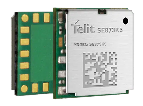
Telit has released the SE873K5 multi-constellation GNSS receiver in the L1 band. The SE873K5 simultaneously tracks and navigates all four GNSS constellations — GPS, Galileo, GLONASS and BeiDou — providing GNSS information over a UART, I2C or SPI interface serial port using the NMEA protocol.
Based on the AG3335 system-in-package from Airoha, the SE873K5 is the latest addition to Telit’s SE873 family of modules and the natural migration path from SE873 and SE873Q5.
The module is a 7mm x 7mm x 2.25mm QFN-like semiconductor package with embedded SPI flash, RTC and TCXO. With its compact size, the latest generation chipset and the advanced power modes, the SE873K5 has the benefits of low cost, small form factor and good electrical and thermal performance — suitable for wearables, fleet tracking, drones and more.
The SE873K5 low-power processing core delivers customizable power-saving modes. It optimizes current draw at module wake-up by supporting both local- and server-based assisted GNSS (A-GNSS) for improved time to first fix, while satellite-based augmentation system (SBAS) corrections from WAAS, EGNOS, MSAS or GAGAN increase positioning accuracy.
The internal flash memory allows firmware updates and customization, as well as ephemeris predictions storage.
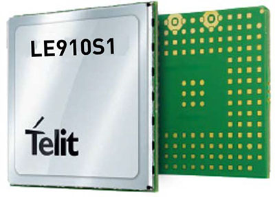
Telit, a global enabler of the internet of things (IoT), has launched the LE910S1-ELG, a new LTE Cat 1 module designed for IoT applications in Latin America (LATAM) that need a combination of performance, affordability, voice support and 2G fallback in a compact form factor.
With an embedded GNSS receiver, the cost-optimized LE910S1-ELG is suitable for tracking applications such as fleet management, stolen-vehicle tracking and recovery, and other mobile IoT applications that need to maintain a reliable connection when moving around in a country, region or multiple regions.
The LE910S1-ELG is the latest member of Telit’s flagship xE910 module family, whose unified form factor and electrical and programming interfaces spanning 2G, 3G and 4G products enables developers to implement a “design once, use anywhere” strategy. The module supports LTE Cat 1 with single-antenna reception, providing downlink speeds of up to 10 Mbps and uplink speeds up to 5 Mbps. Its streamlined configuration, compared to LTE Cat 1 devices with two antennas, helps significantly reduce cost and complexity.
Supporting 2G fallback, the LE910S1-ELG is suitable for applications that require full mobility throughout the LATAM regions, including areas that have not upgraded to 4G yet. It also supports both circuit-switched voice and VoLTE for those applications that require making phone calls, such as healthcare mobile personal emergency response systems (mPERS), connected elevators, alarm systems and more. The power-saving embedded GNSS receiver enables the use of GNSS positioning even when the cellular modem is switched off.
“The LE910S1-ELG is a great option for migrating customers that use legacy 2G and 3G modules in Latin America, especially where nationwide LTE-M and NB-IoT coverage does not yet exist,” said Marco Stracuzzi, head of product marketing, Telit. “Our all-in-one cellular and GNSS module covers all LATAM 4G and 2G bands, as well as mainstream bands used in Europe and Asia, which makes it well-suited particularly for high-performance tracking across intercontinental deployments.”
The LE910S1-ELG is sampling now, and will be commercially available during the first quarter of 2022.
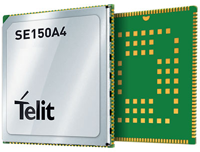
Telit has launched the SE150A4 system-on-module series with an embedded multi-constellation GNSS (GPS, BeiDou, GLONASS and Galileo) receiver for high-performance positioning and navigation.
The SE150A4 module is designed for retail and point-of-service (POS) devices, home automation and security, law enforcement and other applications that need high data rates, advanced human-machine interfaces and edge-computing functionality. It features the Android OS and the Qualcomm QCM2150, and is designed to serve internet of things (IoT) device makers and customers.
With LTE Category 4 for maximum data rates of up to 150 Mbps downlink and 50 Mbps uplink, the SE150A4 series is designed for bandwidth-intensive applications such as live, high-definition (1080p/30 fps) video from law enforcement cameras, home security systems and robots. Along with GNSS, Wi-Fi (802.11a/b/g/n) and Bluetooth Low Energy (BLE) 4.2 provide additional connection flexibility.
The SE150A4 series provides native support for integrated peripherals such as high-resolution touch displays, advanced cameras, sensors and audio interfaces, as well as SDIO 3.0, USB 2.0, UART, SPI and I2C digital interfaces. Android OS gives device OEMs, systems designers and other users access to a vast developer community and broad selection of tools and ready-to-use software components.
The modules are available in two versions.
The SE150A4-NA for North America supports 13 LTE bands, including Band 14 for AT&T FirstNet Band and Bands 66 and 71 for T-Mobile, as well as 3G fallback.
The SE150A4-EU for Europe and the rest of the world supports Band 28 and nine additional LTE bands, as well as 2G/3G fallback.
At 40.5 x 40.5 mm, the LCC +LGA form factor allows easy integration in portable, wearable and handheld devices, including mobile point-of-sale terminals, medical monitors, industrial PDAs and telematics cameras. The modules are also suitable for fixed applications such as smart-home gateways and alarm systems.
A roundup of recent products in the GNSS and inertial positioning industry from the May 2021 issue of GPS World magazine.
OEM
GNSS/LTE Antenna
Low profile for covert installations
Photo: Maxtena
The MEA-GNSS-LTE-MM is a two-in-one low-profile antenna solution that combines GNSS and LTE antennas in one. It is suitable for asset tracking as well as industrial and internet of things (IoT) applications. The antenna offers an ultra-low profile rugged IP67-rated design with a magnet mounting and customizable cables and connector options. The small size makes it a desirable solution for covert installations.
The NCS Nova GNSS simulator now fully supports the simulation of Galileo Open Service (OS) signal improvements based on the new Galileo OS SIS ICD V2.0. The NCS Nova GNSS simulator is a high-end, powerful and easy-to-use satellite navigation testing and R&D device, the company said. It is fully capable of multi-constellation and multi-frequency simulations for a wide range of GNSS applications. It provides multiple GNSS frequencies in one box. A key enhancement to the NCS Nova GNSS simulator is comprehensive support of new Galileo OS signal message improvements on E1B. By enabling real-time simulation of the Galileo OS message improvements, the NCS Nova GNSS Simulator expands the user’s Galileo signal capability.
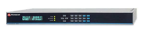
The SyncServer S600 Series network time server and instrument is now integrated with BlueSky technology signal-anomaly detection software. With the upgrade, the SyncServer S600 Series now provides GPS jamming and spoofing detection and protection, in combination with local radio-frequency data-logging and analysis. The Stratum 1 instrument continuously monitors local GPS constellation health and examines GPS and local RF signal integrity to assure validity. If an anomaly is detected, the solution sends an alarm and, if necessary, the SyncServer instrument can be shifted to alternative time sources or an internal oscillator. This protects ongoing timing outputs while ensuring only minimal, predictable timing degradation to vital network and business operations in applications ranging from banking and stock trading to electric utilities and aerospace and defense.
Microchip Technology, microchip.com
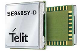
L1+L5 receiver
Provides fast updates, multipath resistance
Photo: Telit
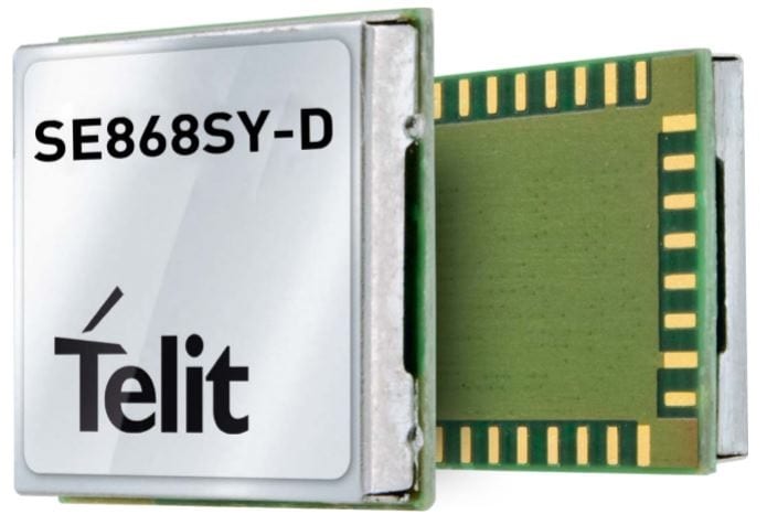
The SE868SY-D is a multi-frequency, high-precision GNSS receiver module for applications that require high accuracy, fast updates, multi-constellation support and multipath resistance. At 11 x 11 mm, the SE868SY-D accommodates ultra-compact devices and internet of things (IoT) trackers. Available now, the high-precision SE868SY-D module is Telit’s first multi-frequency, multi-constellation GNSS receiver module, featuring an ultra-sensitive -167 dBm (tracking) RF front end. By using both the L1 and L5 bands, the SE868SY-D supplies a higher location accuracy than single-frequency devices, even in high-multipath environments such as urban canyons.
The ALEX-R5 miniature cellular module integrates low-power wide-area connectivity and GNSS technology into an ultra-small system-in-package (SiP) form factor. It is based on the secure UBX-R5 LTE-M/NB-IoT chipset platform with out-of-the-box Secure Cloud functionality and the u‑blox M8 GNSS chip for location accuracy. It has a 14 × 14-mm footprint and 23-dBm cellular transmission power, enabling devices to operate effectively in all signal conditions. A dedicated GNSS antenna interface enables independent, simultaneous operation of the u‑blox M8 GNSS chip. The ALEX-R5 is suitable for wearables and connected medical devices.
The TSC5 is a rugged, lightweight field data controller for land construction and surveying. Its backlit alphanumeric keypad is usable while wearing gloves. The battery provides all-day power on a single charge, with an optional external battery nearly doubling the power for extended use. It has a lightweight, ergonomic design and is suitable for rugged environments, with resistance to shock, dust and water. Running on the Android 10 operating system, the TSC5 is fully integrated with Trimble Access 2021 Field Software and Siteworks Software as well as Trimble Forensics Capture. The EM100 Empower module provides GNSS connectivity.
INSITE is a comprehensive cloud-based platform that enables users to more efficiently manage geospatial data, from acquisition to delivery. With applications designed for electric utilities, telecommunications and governments, INSITE provides tools to support the entire geospatial data lifecycle — project tracking, data collection and delivery, quality control, on-demand reporting, analytics and enterprise integration. INSITE enables users to import, search, analyze, manage, integrate and export all types of geospatial data and multimedia. As a cloud-based platform, INSITE improves speed and efficiency, minimizes storage expenses and supports greater collaboration.
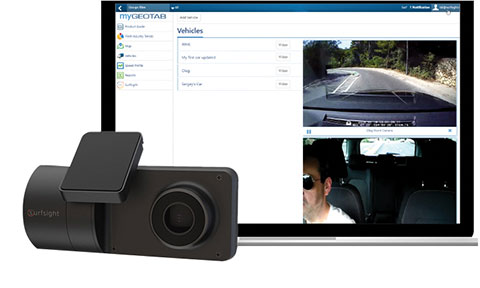
The Surfsight AI-12 camera solution is designed to help improve fleet safety through its continuous recording and advanced machine vision (MV) and artificial intelligence (AI) technology. Offered by Lytx, it integrates with Geotab’s telematics platform to provide fleets with insight into driver behavior through a combination of MV+AI, sensors, and live video streaming. The Surfsight AI-12 provides distracted driving detection, audio and visual alerts and the ability to connect auxiliary cameras. Its MV+AI technology can help identify risky driving behaviors including smoking, eating and drinking, handheld device use, unbelted driver and distracted driver. When connected with Geotab’s GO9 device, it can also capture video evidence of sudden acceleration, sharp turns and harsh braking. Through access to these insights, fleet managers can help prevent avoidable accidents and reduce the likelihood of driver or pedestrian injury, insurance claims, maintenance costs and downtime.
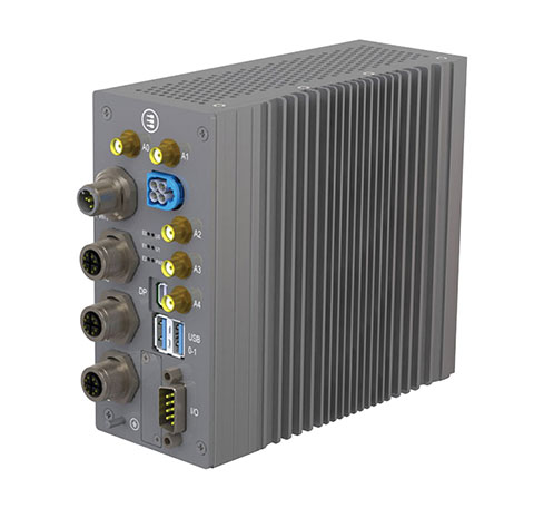
Suitable for rolling stock, automotive and heavy-duty applications
Photo: Eurotech
The BoltGPU 10-31 is a GPU-accelerated subsystem for machine vision and artificial intelligence (AI) applications at the edge and on vehicles. The BoltGPU 10-31 provides multi-constellation GNSS with untethered dead reckoning for geolocation. A factory option for high-precision real-time kinematic (RTK) GNSS is available. It also has Wi-Fi 6, Bluetooth 5.1 and option for LTE cellular. It is powered by NVIDIA Jetson Xavier NX and combines a 6-core, high-performance ARM CPU with a 384-core GPU and 48 Tensor Cores, offering power efficiency and accelerated computing. The rugged, fanless unit allows for simultaneous execution of neural models and the processing of multiple high-resolution, high-frame-rate sensors, even in harsh environments.
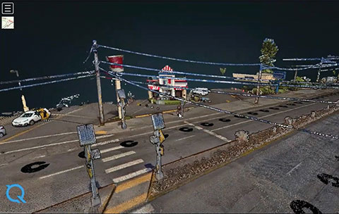
High-frequency change management for map platforms
Screenshot: Carmera
Carmera’s Change-as-a-Service (CaaS) uses consumer-grade cameras from its fleet partners and customer vehicles to detect and log changes, reducing the cost of map maintenance. With a network of commercial fleet–mounted visual probes, it overcomes the problem of GPS canyons in urban areas using a blended algorithm to localize its auto-based probes with pinpoint accuracy. CaaS is designed to be an add-on to existing map systems (both HD and SD), and will identify, analyze and localize both road inventory changes and traffic-impacting events, such as construction. A live sandbox has launched in the San Francisco-Silicon Valley area for companies to test the CaaS technology on real urban and suburban streets.
Parkopedia is designed to address challenges in navigating indoor parking facilities: system blackouts, finding a vehicle within large parking facilities, and locating services such as EV charging stations. Parkopedia provides indoor maps based on high-definition 3D models of indoor parking facilities for in-vehicle navigation. Parkopedia technology can also be used for automated valet parking. Its proprietary SLAM system integrates lidar, IMU, GNSS and high-resolution imagery.
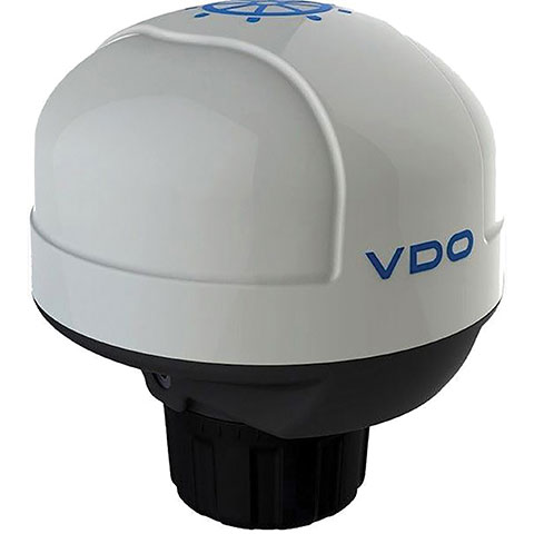
The Acqualink NavSensor can be used with any multifunction N2K-networked multifunction display. Its GPS receiver module provides position, speed and vector data, and UTC time. The inertial sensor delivers pitch and roll data. An integrated fluxgate compass with a +/- 40° tilt angle delivers course heading and the information needed by a networked autopilot to stay on course. Built-in barometer and air temperature sensors offer indicators of impending weather changes. The radome has an IPX6 extended protection rating. It is powered by the NMEA network and operates between –4° and 158° F.
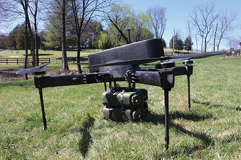
The Periscope tactical-grade UAV provides efficiencies in flight time, endurance and payload capacity. Designed for military and other federal government customers, the high-performance UAVs accomplish mission-critical tasks with speeds of up to 100 mph. They are optimized for specific mission requirements including tactical resupply, remote communications, and enhanced C4ISR. In September, Periscope Aviation won a contract to deliver prototype Tactical Resupply Unmanned Aircraft Systems (TRUAS), which the U.S. Marine Corps will field test at Yuma Proving Grounds this year. The UAVs will fly 60–90 pounds of cargo to locations 10–20 kilometers away, delivering supplies such as food, water, fuel and ammunition to marines on the front line.
The Fixar 007 is a vertical takeoff and landing commercial drone with primary application in the mapping and surveying, monitoring, mining, oil and gas, energy and agricultural sectors. The intuitive approach to working with its ground control station simplifies use (flight preparation is estimated to take only 5 minutes). With inertial orientation, the Fixar 007 can work stably under magnetic anomalies and in the event of satellite loss. A wide range of modifications is available. The Fixar 007 uses a closed, specially designed hardware and software system that guarantees security of information. The applications and UAV use a special communication protocol that eliminates control interception.
Skycopter is a ready-to-fly UAV designed to work in extreme conditions and tight spaces. The drone is enclosed and protected by an external ultra-light and ultra-resistant cage to ensure safety and avoid damage to inspected structures and to the airframe itself. The Skycopter‘s tiltable camera can record 1920 x 1080 video at 60 FPS while sending latency-free images to the ground in 5.8 GHz for first-person view on a display or (optional) high-definition goggles. It uses an ultra-bright LED system for applications in complete darkness. The Skyloc real-time location and monitoring system provides control and tracking with high accuracy in indoor scenarios or where GPS is not available.
Telit has launched the SE868SY-D multi-frequency, high-precision GNSS receiver module for applications that require high accuracy, fast updates, multi-constellation support and multipath resistance.
At 11 x 11 mm, the SE868SY-D accommodates ultra-compact devices and IoT trackers.
Available now, the high-precision SE868SY-D module is Telit’s first multi-frequency, multi-constellation GNSS receiver module, featuring an ultra-sensitive -167 dBm (tracking) RF front end. By using both the L1 and L5 bands, the SE868SY-D supplies a significantly higher location accuracy than single-frequency devices — even in high-multipath environments such as urban canyons, Telit said.
This sub-1-meter precision is a major reason ABI Research expects more than 1 billion multi-frequency GNSS devices to ship annually by 2023.
The SE868SY-D is the first product from a new strategic collaboration between Sony and Telit, and features Sony’s next-generation CXD5610 GNSS receiver large-scale integrated circuit (LSI).
The Telit SE868SY-D is designed for battery-powered applications such as IoT trackers and wearables. With less than 45 mW in L1+L5 tracking mode, the module has low power consumption, despite using both L1 and L5 bands.
For high-dynamic applications, the SE868SY-D a high update rate of up to 25 Hz. Its high-accuracy, one-pulse-per-second signal also makes the module suitable for timing applications.
“With the new SE868SY-D, Telit is uniquely prepared to meet the burgeoning global demand for multi-frequency, multi-constellation GNSS receivers for IoT trackers, wearables and more,” said Eric Lagorce, Telit business development director. “The SE868SY-D also perfectly complements Telit’s two decades of GNSS expertise and its broad portfolio, and highlights the potential of our strategic collaboration with Sony.”
The Telit SE868SY-D provides pin-to-pin compatibility for applications based on Telit’s legacy GPS module JF2 and GNSS module SE868V3.
Telit has introduced a new positioning module aimed at India. The SL869T3-I combines GPS with India’s NavIC (IRNSS) navigation system and the country’s satellite-based augmentation system (SBAS), known as GAGAN.
The SL869T3-I module enables the creation of high-performance position reporting and navigation solutions. It complies with Automotive Industry Standard 140 (AIS-140) — an Indian government mandate that requires the use of NavIC for vehicle location tracking devices in all public transportation vehicles, effective April 2019.
The SL869T3-I is a 16 x 12.2-millimeter module with an LLC package. It is provided with a single RF input for L1 and L5 bands. It also contains Flash memory, a low noise amplifier (LNA) and SAW filters. The RF front end is specifically designed to comply with sensitivity specifications contained in AIS-140 standard.
“The new SL869T3-I is among the first IoT GNSS positioning receiver modules to deliver IRNSS/NavIC L5 coverage compliant with the Indian government’s AIS-140 regulation,” said Manish Watwani, EVP global product management, Telit. “This new addition to the Telit family of products results from more than 20 years’ experience in GNSS applications.”
For more information, visit booth C3.227 at Electronica, Nov. 13-16 in Munich, Germany.
Telit GE310-GNSS IoT Module fills European demand for GSM/GPRS compact form factors, and is part of Telit’s migration-support program that helps customers leverage 2G’s low cost and broad coverage while preparing for 4G and 5G.
The GE310-GNSS module. (Image: Telit)
Telit has released the GE310-GNSS, an internet of things (IoT) module with GSM/GPRS, multi-constellation satellite positioning and Bluetooth functionality in a 270-millimeter-squared form factor.
The GE310-GNSS enables original equipment manufacturers (OEMs) and system integrators in application areas such as asset management, utilities and telematics, meet strong demand for low-cost, highly compact devices without tradeoffs in performance, reliability and functionality, particularly in regional markets such as Europe, where 2G is forecast to remain in strong growth in number of IoT connections for many years.
The GE310-GNSS features a miniature form factor packaged in an LGA 94-round-pad format. It is designed to meet the robust demand in Europe, Latin America and other regional markets for compact devices such as health and wellness monitors, smart residential and commercial thermostats, commercial fleets and IoT-connected grid equipment for smart utilities.
With support for Europe’s Galileo as well as other satellite positioning constellations, the GE310-GNSS is suitable for IoT applications that require location awareness throughout Europe and the rest of the world. The module’s Bluetooth 4.0 capability makes it easy for OEMs to add connectivity to proximal area network devices, Telit said.
The GE310-GNSS is part of Telit’s future-proofing program, which helps customers leverage 2G’s low cost and gapless European coverage immediately while retaining absolute control of when they switch to a compatible 4G module in the Telit family lineup.
The lineup includes multiple roadmap paths to upgrade to 4G and later to 5G based on the customer business strategies and specific market conditions.
Research firm ABI Research estimated in its “ABI IoT Market Tracker – Worldwide – October 2018” that 2G cellular IoT connections will continue to grow in Europe from 100 million in 2018, reaching a peak of 148 million connected devices in 2022 before slowly dropping to about 89 million in 2026.
“The GE310-GNSS is the newest in our lineup of updated 2G modules for markets like Europe and Latin America which still show a sustained pull for over half a decade,” said Yossi Moscovitz, president products and solutions, Telit. “This svelte module combines proven, reliable 2G connectivity with the latest satellite positioning and Bluetooth technologies, all backed by Telit’s decades-enduring migration-support program. Telit has helped thousands of customers through cellular generational transitions and is now helping 2G customers in Europe, Latin America and other regions develop business-enhancing roadmaps to 4G and 5G.”
For more information about the GE310-GNSS and other Telit IoT solutions, visit booth A.b80 at European Utility Week, Nov. 6-8 in Vienna, Austria.
A roundup of recent products in the GNSS and inertial positioning industry from the August 2018 issue of GPS World magazine.
OEM
IP Solution
With multi-constellation GNSS for internet of things (IOT) devices
The Dragonfly NB2 is a highly integrated and modular IP (internet protocol) solution optimized for Cat-NB2 (3GPP Release 14 eNB-IoT) that can seamlessly be incorporated into chips and modules by the multitude of companies looking to address the large and fast-growing cellular IoT space. GNSS hardware package. For customers developing NB-IoT products that also require GNSS capabilities, Ceva-Dragonfly NB2 includes a new power-optimized GNSS hardware package, with GNSS RF receiver and multi-constellation digital front-end. The GNSS package speeds up both acquisition and tracking tasks by up to 8 times compared to Ceva-Dragonfly NB1, enabling a host of popular NB-IoT use cases, including people, livestock and asset tracking and geofencing.
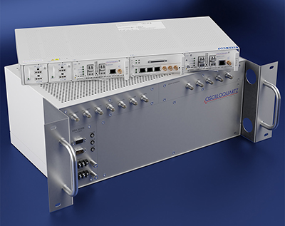
Provides timing accuracy and stability when GNSS signal is lost
Photo: Oscilloquartz
Oscilloquartz has launched its enhanced primary reference time clock (ePRTC) system to enable a high level of timing accuracy and stability, even when the GNSS signal is lost. The system provides a timing source for mission-critical transport systems, such as utility networks, government infrastructure and radio access networks, and provides the strict synchronization needed for LTE-A and 5G applications. Featuring the OSA 3230B ePRC atomic cesium clock connected to an Oscilloquartz clock combiner and grandmaster, the new solution offers the extremely stable frequency of a cesium clock with the UTC-traceable signal provided by GNSS. When combined with the OSA 5430, the OSA ePRTC system provides full hardware redundancy and multiple fan-out options including PTP over 10 Gbit/s.
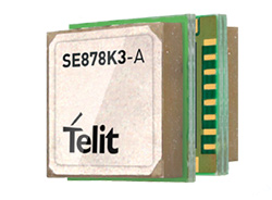
The SE878Kx-A series of GPS and GNSS integrated antenna receiver modules offer high performance, maximum reliability and low power consumption for consumer and business applications. The SE878K3-A and SE878K7-A are compatible with GPS, GLONASS, Beidou and Galileo and also enable device vendors to develop quickly and cost-effectively location-based IoT solutions for use in virtually any country worldwide. The SE878Kx-A series supports dual internal-external antennas to ensure connectivity when one is broken or compromised, along with a SAW filter to maximize jamming immunity. The modules are designed for mission-critical applications and other use cases where reliability is key, such as alarms, stolen cars or high-end asset tracking. The series also provides seamless integration with Telit’s cellular modules, including eCall/ERA-GLONASS compliant solutions.
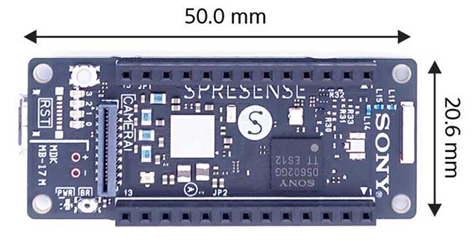
The Spresence main and extension boards are designed for internet of things (IoT) applications. The main board uses a multi-CPU structure equipped with Sony’s GNSS receiver (GPS+GLONASS) and high-resolution audio codec. A variety of systems for applications such as drones and other IoT devices can be built by combining the boards and developing the relevant applications. The boards’ software and hardware is available via open platform, allowing for a wide range of developmental possibilities. The main board can be used to control a drone using GPS positioning and a high-performance processor, voice-controlled smart speakers and low-power consumption sensing cameras. It also can be combined with sensors for use in systems that detect errors in production lines on the factory floor.
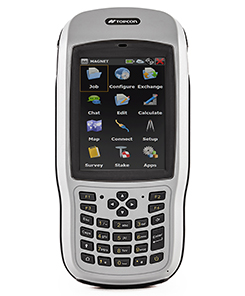
Designed for geopositioning, construction and mapping
Photo: Topcon
The T-18 handheld controller has a 3.7-inch sunlight-readable display, a 1-GHz processor and 1 GB of internal storage. For field data collection using Topcon’s MAGNET software, the T-18 offers a durable ergonomic solution with fast processing, excellent connectivity and a long (10-hour) battery life. It has a 3.5G cellular modem for connectivity with Topcon MAGNET solutions for sending and receiving data to the cloud company account. The modem also can be used for real-time kinematic (RTK) correction services. Other features include Bluetooth and an IP65 rating for dust and water protection in demanding job-site conditions.
The SXblue ToolBox is an Android application for SXblue GNSS receivers, enabling users to view and analyze the position data and metadata related to its location. The user can send commands that enable or disable some features, including systems in use, mask angle or differential angle, and constellation in use, including GPS, GLONASS, Galileo, BeiDou and SBAS. The SXblue ToolBox is also an NTRIP client capable of connecting to a NTRIP server for real-time kinematic (RTK) corrections, allowing the receiver to issue very accurate location information. The application can record, save and transfer raw data from the GNSS receiver, allowing post-processing on computers for surveying and geomatics professionals.The toolbox has been developed with special consideration for modern mobile devices and attention to user and dealer feedback. It includes a series of configurable audible and visual alarms for determining the thresholds of the information provided by the SXblue GNSS receiver.
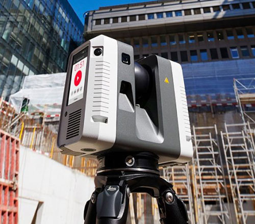
The Leica RTC360 laser scanner is equipped with edge computing technology to enable fast and accurate creation of 3D models in the field. It combines high-performance laser scanning, edge computing and mobile app technologies to preregister captured scans quickly and accurately. With the push of a button, two million points per second of high dynamic range imagery can be captured to create a full-dome scan in under two minutes. It features a visual inertial system that automatically tracks movements between setup positions. The scans captured can be combined and preregistered on a mobile device, where they can be viewed and augmented with information tags.
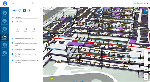
Location technology allows users to see rooms, gates and offices
Screenshot: Esri
ArcGIS Indoors is designed to enable interactive indoor mapping of corporate facilities, retail and commercial locations, airports, hospitals, event venues, universities and more. The solution applies the latest location technology to allow users to see and share where assets, rooms, departure gates and offices are located. It uses data streams, real-time processing and location intelligence tools to help businesses and other organizations understand how to better coordinate space and other resources with their facilities and campuses. Insights from sensor networks deliver real-time information to managers and executives through interactive dashboards, while visitors and employees can find useful information about the buildings they occupy. The solution also allows users to quickly access and explore critical business information, such as the location and status of fire extinguishers and their last inspection dates.
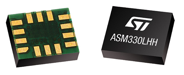
Meets demands for continuous, accurate vehicle location
The ASM330LHH module. (Photo: STMicroelectronics)
The automotive-grade ASM330LHH six-axis inertial sensor is designed for super-high-resolution motion tracking in advanced vehicle navigation and telematics applications. It lets advanced dead-reckoning algorithms calculate precise position from sensor data if satellite signals are blocked, such as in urban canyons, tunnels, covered roadways, parking garages or dense forests. Its advanced, low-noise, temperature-stable design enables dependable telematics services such as e-tolling, tele-diagnostics and e-Call assistance. Precision inertial data in six axes also meets the needs of advanced automated-driving systems. Automotive component manufacturer Magneti Marelli has selected the ASM330LHH for advanced telematics systems, to be fitted as original equipment by global automotive groups in upcoming vehicle ranges.
Esri and Waze smart cities partnership grows. (Image: Esri)
The free crowdsourced traffic and navigation app Waze is now fully supported by ArcGIS Online, where its live feed of mapped traffic alerts and other information, such as accidents, congestion and street damage, can be used in applications in minutes. Waze Live Alerts, available in ArcGIS Marketplace, is free to members of the Waze Connected Citizens Program. The program, a two-way sharing of publicly available traffic and road condition information, offers governments a stream of data, constantly updated in real time. This enables personnel to make data-driven infrastructure decisions and improves the efficiency of incident response.
Traffic engineers can use the data to analyze problems on the road and create targeted solutions.
Open-source platform for autonomous delivery and other iot
The AGL platform provides Mercedes-Benz Vans with the ability to create autonomous delivery robots. (Image: Daimler)
Automotive Grade Linux (AGL) is a collaborative cross-industry effort to develop an open platform for the connected car. Mercedes-Benz vans are using AGL as a foundation for a new onboard operating system for its commercial vehicles. The Mercedes-Benz “adVANce” initiative focuses on connectivity and internet of things (IoT) applications, innovative hardware solutions, new on-demand mobility and rental concepts, and fleet management solutions. The AGL platform provides Mercedes-Benz Vans with the flexibility to rapidly create tailored solutions for customers, including adding and connecting any kind of IoT component to the vehicle, such as sensors, automation controls and actuators. The new AGL-based operating system will debut on various Mercedes-Benz Vans prototype projects later this year.
eCyber is an integrated hardware-software product that protects vehicles against ransomware and other cyber-attacks. It can be installed in a vehicle by authorized parties, such as vehicle importers and fleet managers, in the aftermarket stage after the vehicle has left the factory, as well as by the OEM itself during manufacture. eCyber, a combined hardware and software solution in a compact box, is installed between the vehicle’s external communications device and the vehicle’s CAN (Controller Area Network) bus. It provides a secure gateway for outside communications to the CAN bus, allowing only communications with predefined parameters and values to go through. It blocks any unrecognized communications to and from the CAN bus, so no malicious digital communications can disrupt vehicle function.
Engineered for UAV-imaging missions, the iXM 100MP is a high-productivity metric camera with a range of high-resolution lenses. It is ready for integration with various UAV platforms, including Phase One’s DJI Matrice 600 Pro. The camera incorporates a medium-format sensor with backside-illumination technology, enabling high light sensitivity and extended dynamic range. Phase One also offers four new RSM lenses — with focal lengths ranging from 35mm to 150mm — to fit the new sensor’s 3.76 μm pixel size and 33 x 44 mm frame size. The lenses are available with either fixed-focus or motorized-focus functionality. The fixed-focus 35mm and 80mm lenses are especially suitable for surveying applications.
For quick approval of flights over controlled airspace
Screenshot: Skyward
Commercial drone operators in California and Hawaii — as well as a few areas in Nevada, Utah and Arizona — can get quickly authorized to fly in controlled airspace using the LAANC (Low Altitude Airspace Notification Capability) platform. Skyward is an FAA-approved airspace vendor. With Skyward, pilots with a Part 107 license can get permission to fly in regulated airspace in seconds compared to manual authorizations that can take months. This makes it significantly easier for businesses of all sizes, particularly in the construction and warehousing industries, to manage a fleet of drones to access valuable, cost-saving data. Skyward’s LAANC expansion includes airspace in the busy metro areas of Los Angeles, the Bay Area, San Diego, Las Vegas and more than 50 smaller air markets.
Telit, a global enable of the internet of things (IoT), has debuted its SE878Kx-A series of GPS and GNSS integrated antenna receiver modules for consumer and business applications. According to the company, these modules provide high performance, maximum reliability and low power consumption.
In addition, the SE878K3-A and SE878K7-A are compatible with GPS, GLONASS, Beidou and Galileo and also enable device vendors to develop quickly and cost-effectively location-based IoT solutions for use in virtually any country worldwide, Telit said.
The SE878Kx-A series supports dual internal-external antennas to ensure connectivity when one is broken or compromised, along with a SAW filter to maximize jamming immunity. According to Telit, these features make the modules ideal for mission-critical applications and other use cases where reliability is key, such as alarms, stolen cars or high-end asset tracking.
The SE878Kx-A series also provides seamless integration with Telit’s cellular modules, including eCall/ERA-GLONASS compliant solutions.
“The new SE878Kx-A series is the latest example of Telit’s leadership in providing GNSS solutions for applications that demand the highest reliability and performance,” said Yossi Moscovitz, Telit president of products and solutions. “Just as important, the modules give IoT designers maximum flexibility, faster development cycles, easier integration and the ability to develop once and deploy worldwide.”
Telit’s two latest modules are aimed at the European internet of things (IoT) market.
Modules WE866E4-P and ME910C1-E2 are designed to meet European specifications requirements, providing the ability to bring advanced IoT applications to market such as smart buildings, smart energy, industrial applications, medical devices and others.
“Our modules were designed with the European market in mind, eliminating the guesswork associated with what standard to use for IoT projects in the region,” said Yossi Moscovitz, Telit president of products and solutions. “We are providing the industry the ability to digitally transform by creating new opportunities for our customers to achieve innovation. We’re pleased to be a key part of enabling the promise of Smart IoT that we are seeing during this week’s conference.”
The WE866E4-P is a fully integrated dual-band, dual-mode combo Wi-Fi (802.11 a,b,g,n) and Bluetooth Low Energy (BLE) 5.0 module, with an small footprint (285 sq. mm) that provides a cost-effective way for manufacturers to add wireless connectivity to the products. It has an integrated tri-core system-on-chip with dedicated CPUs for IoT applications, Wi-Fi and BLE.
The module is self-contained with full Wi-Fi, BLE and TCP/IP networking stacks along with a complete suite of security features such as secured boot, Flash encryption, copy protection, HTTPS and WPA/WPA2 personal and enterprise security modes.
The ME910C1-E2 is a member of Telit’s flagship xE910 module family delivering 4G radio access technology in the 28.2 x 28.2 x 2.2 mm family form factor. This module increases the addressable market for LTE technology to include a broad range of new applications and use cases best served with lower maximum data rate, ultra-low power, reduced complexity and cost, and is capable of Cat M1, NB-IoT and 2G fallback. Examples of use are smart meters, industrial sensors, health-care monitors, home automation, asset tracker and other low-data-rate IoT devices.
For more information please visit Telit during this week’s Smart IoT Conference in London at Stand T2865.
Positioning on a micro-scale is the task of a new sensor that reports on range of motion (ROM) achieved in stretching exercises and other post-operative activities by at-home patients after discharge from hospital. Telit, a company active in sensors for the Internet of Things (IoT), announced that U.K.-based 270 Vision Limited has selected Telit’s BlueMod+SR Bluetooth module for its BPMpro Mark 2 sensor for remote, precision measurement of patient ROM.
The BPS (Body Performance Measurement) wearable sensor is a medical device that measures patient ROM before and during rehabilitation. Post-surgery, patients are discharged to be remotely monitored at home as they undertake their daily routine using a BPMpro sensor. The captured sensor output displays on a patient tablet running BPMpathway software and streams live to the clinician, who can use this data to assess the patient’s progress. With the patient recovery data collected by BPMpathway, clinicians can tailor an orthopedic patient’s post-operative support to meet their individual needs, without having to wait for a face-to-face consultation.
The BlueMod+SR module is a very small form factor dual-mode Bluetooth 4.0 module (17 x 10 x 2.6 mm). Range in line of sight is about 100 meters. Dual mode means it supports classic Bluetooth basic rate (BR) and enhanced data rate (EDR) operations as well as Bluetooth low energy (LE).
New app promises better-than-GPS urban guiding
Attention, GPS World readers living in or visiting Central London, Mountain View, California or San Francisco. Public beta of a new app (iOS only) will take you by the hand — er, phone — and lead you around the fair city; those cities only, at present. More intriguing, it claims to deliver “better than GPS accuracy.”
This augmented reality (AR) navigation employs an AR-native framework, Apple’s ARKit. Blippar touts its AR City app for something it calls “urban visual positioning…which localizes users with higher accuracy than GPS, thanks to computer vision.” The app uses visual inertial odometry, interpreting movement seen through the camera, to minimize position errors, that is, in a sense, to correct GPS.
Holding the phone in front of one’s face in tourist fashion, the user receives nearby points of interest based on what he or she can actually see. The app feature three layers of information:
AR Basic Navigation. A visualization of walking routes through augmented reality.
Enhanced Map Content. Overlays of information and content related to user location in AR — for example, streets and points of interest.
Urban Visual Positioning. Recognition, positioning and directional information via computer vision.
AR basic navigation, available everywhere that is supported by Apple Maps, visualizes routes with arrows shown in augmented reality. AR basic navigation uses GPS to estimate the absolute position of the user, and visual inertial odometry (VIO) to track their local movement. Blippar integrates GPS and VIO by building on the ARCL library, which uses Apple’s ARKit for VIO and Core Location for GPS.
GPS alone doesn’t give a high enough level of accuracy when looking at the map and has an average error rate of 16 m in cities, according to Blippar, which claims its urban visual positioning provides more than twice its accuracy.
Mower-maker Husqvarna has installed a wireless sensor device co-developed by Telit and Wireless System Integration (WSI) in its city robotic mower pilot program. Cities are using the Husqvarna mowers to collect data about the environment, the quality of air, water, and levels of light and sound, while maintaining the cities’ green spaces, saving time and money, reducing emission and noise pollution.
A Husqvarna robotic mower patrols a lawn along Prince’s Street in Edinburgh, Scotland. Equipped with a GPS-enabled Telit module, it gathers real-time sensor data on the city’s green space environmental conditions.
In parks in seven cities — Edinburgh and London in the United Kingdom, Gothenburg and Stockholm in Sweden, Almere and Leeuwarden in the Netherlands and San Francisco in the United States — mowers autonomously cut the grass daily and collect real-time data on UV radiation, air quality, ambient noise, luminosity and vibration.
The sensor box, designed by Telit, is mounted on top of the mower, uses the robot’s main battery for power supply, and recharges whenever the robot returns to its base. The sensor box transmits the data using Telit’s HE910-G cellular module which includes a GPS L1 receiver with reported 3-meter accuracy to acquire mower position.
Telit HE910 cellular module has GPS option.
Geofencing is enabled for the mower as well as location-based alarms to disable it should it be moved without authorization. To ensure public safety, sensors detect any nearby objects, including people and animals, causing machines to turn away.
Telit’s global Internet-of-Things (IoT) connectivity data plans and platform seamlessly connect, manage and deliver the environmental data in a ready-to-use format.
Environmental Gains. One of the biggest roadblocks to reach the United Nations Sustainable Development Goals is the lack of data. Cities need better environmental data to improve health and create cities people want to live in. The project measures the environmental gains and potential time savings of mowing public lawns with robotic mowers. The test will measure the reduction of noise pollution as well as direct emissions when replacing petrol-powered products with battery driven robotics.
In cooperation with Husqvarna, Quantified Planet, an organization that links innovation to science, receives the data and publishes it for citizens to review. The cities can then analyze the environmental data sent by the robots and implement programs to improve the health of its citizens, based on these insights.
“This new data can provide insights and innovation on how to develop and improve sustainable open green spaces which impact the citizens living nearby,” said Maja Brisvall, CEO, Quantified Planet.
“The need for green spaces is growing more and more in urban areas. The pilot program affords the possibility to increase sustainability and productivity in professional landscaping for urban areas,” said Pavel Hajman, president of the Husqvarna division.
“Cities are using IoT to become more sustainable and efficient,” added Yosi Fait, Interim CEO, Telit. “Through this collaboration we have been demonstrating again our sensor-to-cloud capabilities, cutting our customers’ time to market through our integrated lines of products and services as well through our professional services team’s significant IoT knowhow.”