Tag: warfighter

  • L3Harris M-code receiver deliveries surpass 100,000 units

    L3Harris M-code receiver deliveries surpass 100,000 units

    Modernized GPS is strengthening operational assurance and signaling a new era of assured positioning, navigation and timing (PNT) for U.S. and allied forces

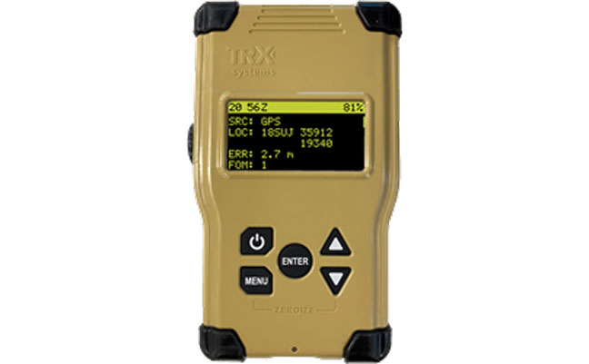
    L3 Harris has reached a milestone with the delivery of the 100,000th next-generation military-code (M-code) GPS receiver to the United States and allied partners through the Modernized GPS User Equipment (MGUE) Increment 1 program.

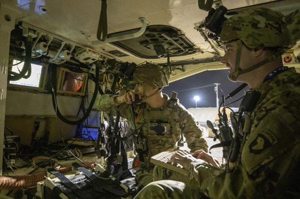
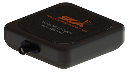
    M-code receivers are designed to deliver secure, jam-resistant PNT capabilities that are essential as military operations grow more distributed, joint and technologically complex. Unlike legacy systems, M-code-enabled receivers provide enhanced security features and increased resistance to interference, allowing forces to maintain trusted GPS access when signals may otherwise be degraded or denied.

    “As the global threat environment continues to evolve, secure and resilient PNT has never been more critical to ensuring operational advantage,” said Quinlan Lyte, president, Advanced Effects, Missile Solutions, L3Harris. “Reaching this delivery milestone reflects our team’s sustained commitment to equipping the warfighter with reliable technology designed to perform in the most contested environments.”

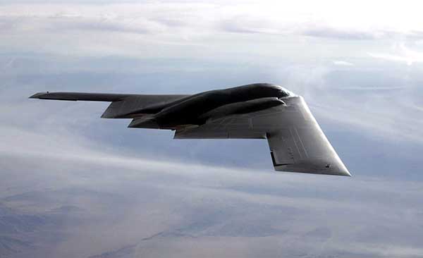
    Beyond the milestone itself, the scale of fielded MGUE Increment 1 receivers underscores a broader shift toward modernized, mission-ready GPS capability across U.S. and allied platforms. From air and ground systems to maritime and joint operations, M-code technology is helping commanders operate with greater confidence in environments where GPS reliability can no longer be assumed.

    Onto the next phase

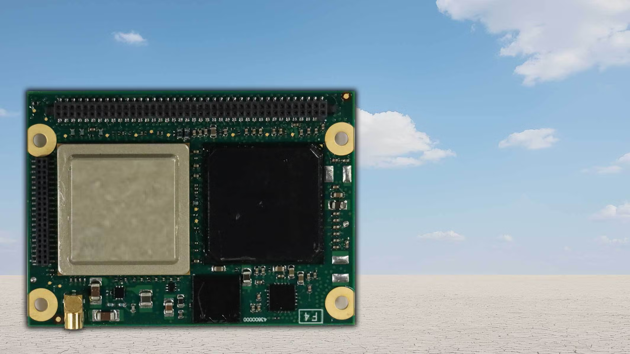
    L3Harris is building on the momentum from MGUE Increment 1 as the company advances the next phase of GPS modernization through MGUE Increment 2. Ongoing development includes a new M-code-enabled application-specific integrated circuit and the TruTrak-M Type II receiver, technologies designed to further improve size, weight, power and cost efficiencies while maintaining robust security and performance. These advancements will enable greater integration and flexibility, as well as broader adoption across future platforms.

  • Safe Pro unveils new algorithms for GPS-denied drone operations for U.S. Army

    Safe Pro unveils new algorithms for GPS-denied drone operations for U.S. Army

    The latest generation of Safe Pro’s AI technology will be presented at U.S. Army exercise at Fort Hood, Texas

    Safe Pro Group, a developer of artificial intelligence (AI)-enabled defense and security solutions,  has deployed upgraded AI algorithms to its patented Safe Pro Object Threat Detection (SPOTD) technology for drone operations in GPS-denied environments.

    The newly enhanced SPOTD capabilities will be prominently featured at the upcoming U.S. Army 2026 Concept Focused Warfighter Experiment (CFWE) technology demonstration taking place at Fort Hood, Texas.

    Operating on the Amazon Web Services (AWS) Cloud or at the Edge, SPOTD is Safe Pro’s patented rapid battlefield image analysis platform designed to identify and map small explosive threats such as landmines and ambush drones detected in videos collected from virtually any drone.

    The ability for SPOTD to rapidly detect threats and create 2D/3D models from drones flying in GPS-denied environments was developed after real-world exercises in Ukraine at the request of end users. The integration of these new algorithms further enhances the value of SPOTD as a situational awareness tool for use in a wide array of military reconnaissance and planning operations.

    SPOTD enhancements include:

    • Ability to process any drone video data: Turning video clips into 2D and 3D models with AI-trained explosive threat detections
    • Enhanced operational robustness: Operating capability in GPS and GPS/GNSS denied environments
    • Terrain modeling: Threat and terrain mapping in support of unmanned ground vehicles (UGVs) route planning
    • Rapid mapping-only mode: Mapping for intelligence, surveillance and reconnaissance (ISR) and missions that do not require AI-powered threat detections
    • Accelerated processing: Up to 10x reduction in processing time powered by Safe Pro’s proprietary geospatial AI algorithms.

    Powering the company’s SPOTD technology is Safe Pro’s unique real-world datasets, which include high-resolution drone imagery and GPS-tagged geospatial data encompassing more than 2.2 million drone images analyzed to date, and 41,400+ threats identified across 11,400 hectares (28,000+ acres).

  • Editorial Advisory Board Q&A: Improving the GPS program

    What works well and what needs improvement in the GPS program regarding technology, policy, or management?


    Jules McNeff
    Jules McNeff

    “GPS technology and operational performance continue to set the standard for GNSS, but necessary modernization is late to need, and becoming later by the day. This reflects what I see as loss of focus on ‘Job 1’ (delivering effective GPS service to the Joint Force) and a diminution in the sense of ‘GPS uniqueness and exceptionalism’ in its management as it was fragmented within the old SMC and is no longer the ‘shiny new object’ within the evolving Space Force. Even so, its value to its global user base, and particularly to U.S. and allied militaries, is stronger than ever and it remains the cornerstone among diverse complements within the Department of Defense PNT Enterprise. It is incumbent on the DOD to ensure the GPS services our warfighters will depend on can sustain that vital role.”

    — Jules McNeff
    Overlook Systems Technologies


    Ellen Hall
    Ellen Hall

    What works well? There is good focus on the areas that need development: M-code, CRPA, resiliency. What needs improvement? More thorough and timely sharing of information by the government with industry. — Ellen Hall, Spirent Federal Systems


    Mitch Narins
    Mitch Narins

    The ‘GPS program’ has set the standard for all other GNSS efforts, but there are always lessons to be learned. I have full confidence that USSF leadership is well equipped to deal with both the technology and management aspects of the program. As for policy, which supports military and civil uses worldwide, there is a clear distinction, based on mission areas and acceptable risk. However, risks to civil users have increased as GPS PNT services permeate all civil critical infrastructure systems. Therefore, system improvements directed at civil user PNT resilience should be given a higher priority and funded through appropriate civil channels. I encourage a policy to enable more resilient PNT services from space — and to consider that by looking both ‘up’ and ‘down’ for PNT services, unfortunate ‘situations’ might be avoided.
    — Mitch Narins,
    Strategic Synergies


    Bernard Gruber
    Bernard Gruber

    “One of the most consistent and enduring enablers of the GPS program is national policy. NSPD-39 re-baselined requirements buttressed by GPS being provided to the world for free, that it must be sustained and have an ever-present focus on performance improvement and robustness. Accordingly, NSPD-7 acknowledges an ever-changing world with a nod to cybersecurity, augmentations and direction to “improve NAVWAR capabilities to deny hostile use of United States Government space-based PNT services, without unduly disrupting civil and commercial access to civil PNT services.”
    — Bernard Gruber,
    Northrop Grumman

  • APNT/Space team aims to advance navigation capabilities

    APNT/Space team aims to advance navigation capabilities

    APNT/Space modernization gives U.S. Army a clearer view of multi-domain battlefield

    U.S. Army soldiers experiment with new assured PNTT/space equipment during the 2021 PNT Assessment Exercise at White Sands Missile Range, New Mexico. (Photo: U.S. Army/Austin Thomas, Army Futures Command)
    U.S. Army soldiers experiment with new assured PNTT/space equipment during the 2021 PNT Assessment Exercise at White Sands Missile Range, New Mexico. (Photo: U.S. Army/Austin Thomas, Army Futures Command)

    News from U.S. Army Futures Command

    The Assured Positioning, Navigation and Timing/Space Cross-Functional Team — APNT/Space CFT — takes a multi-dimensional approach to understanding and preparing for future warfare.

    The team — based at Redstone Arsenal, Alabama — is dedicated to advancing the Army’s tactical and navigational capabilities and ensuring tomorrow’s soldiers  have the modern situational tools they need to maneuver with the utmost accuracy, safety and skill.

    The CFT is making significant progress toward this goal by leveraging iterative developments, remaining open to new technologies and committing to continuously evolving PNT equipment and systems to meet changing threats and needs.

    “Our cross-functional team will continue to assess and strengthen the future of our operational environments, emerging threats and technologies to ensure our Army is prepared for 2030 and beyond. We will continue to support the requirement development and delivery of trusted solutions to the soldier,” said Michael C. Monteleone III, director of the APNT/Space CFT, reiterating the team’s focus on nimbly and steadfastly enabling the success of future warfighters.

    According to Army planners, the likelihood of future operations spanning diverse domains — air, land, sea, space, cyberspace and the electromagnetic spectrum — means soldiers will need more flexible and far-ranging resources to inform their movements and operations.

    To facilitate this, the APNT/Space CFT conducts rigorous field experimentation and prototype assessment and drafts detailed requirements for state-of-the-art materiel solutions, which the Army can then further develop and employ to improve information gathering and data precision without disrupting or adding extra burden to soldier operations.

    Experimentation for APNT/Space happens on the ground and in the air, including along the electromagnetic spectrum — sometimes referred to as the “invisible battlefield” — and in the low Earth orbit of space.

    Within these frequently interwoven domains, the APNT/Space CFT investigates alternative GPS capabilities and other navigation resources already in use, while also evaluating how to best integrate new anti-jamming functions, electronic support, inertial navigation systems and vision-based navigation platforms.

    The CFT coordinates regularly with industry, joint partners and other government agencies to identify and explore solutions that are modular, scalable and an excellent fit for multiple platforms, as well as the upgrades and adjustments that occur to equipment and systems over time.

    Modern PNT tools being developed and fielded include mounted, dismounted and alternative navigation systems, situational awareness devices, and next-generation sensors that allow for optimum flexibility and performance against threats.

    Within the realm of space, the CFT is shaping a strategy to provide survivable, responsive and resilient intelligence, surveillance and reconnaissance and communications capabilities in low Earth orbit, complete with the ability to share information rapidly and securely with tactical commanders on the ground.

    The team’s experts are also focused on understanding and preparing for the future of navigation warfare, or NAVWAR, which will require sophisticated offensive and defensive systems to produce tactical advantages and enable overmatch. To encourage synchronization of efforts on this front, the CFT is working closely with Army partners to draft an overarching NAVWAR strategy that aligns with U.S. Department of Defense NAVWAR plans but is also tailored to unique Army needs.

    By studying and preparing for multi-domain operations and experimenting with the newest technologies available, the APNT/Space CFT is playing an integral role in helping the Army to equip soldiers with more mobile, scalable and interoperable navigation devices, in turn strengthening the agility of the future force.

  • Registration open for JNC 2022

    Registration open for JNC 2022

    JNC Logo

    Registration for the Institute of Navigation’s (ION) Joint Navigation Conference (JNC) 2022 is open and the technical conference program is now available online.

    The JNC, sponsored by the Military Division of the Institute of Navigation (ION), will be held June 6–9 at the Town and Country Hotel in San Diego, California. JNC 2022 is a Federal Employees and Contractors U.S.-only conference. Advance visit requests and approvals are required for all attendees.

    The event focuses on technical advances in PNT with emphasis on joint development, test and support of affordable PNT systems, logistics and integration. From an operational perspective the conference will focus on advances in battlefield applications of GPS; critical strengths and weaknesses of field navigation devices; warfighter PNT requirements and solutions; and navigation warfare.

    The theme of the 2022 conference will be Enhancing Dominance and Resilience for Warfighting and Homeland Security PNT. The technical program includes six panel discussions on Rapid Agile Development and PNT Technology Transition; MGUE Integration; National Critical Infrastructure Threat; Future Space-based Sources of PNT; Situational Awareness; and the Warfighter Panel.

    To view the JNC 2022 technical program and register for the event, visit ion.org/jnc.


  • US Army selects TRX Systems to provide DAPS PNT system

    US Army selects TRX Systems to provide DAPS PNT system

    The TRX DAPS solution will allow warfighters to better target, move and communicate in operational environments where GPS is degraded or denied.

    TRX DAPS Dismounted A-PNT Device. (Photo: TRX Systems)
    TRX DAPS Dismounted A-PNT device. (Photo: TRX Systems)

    TRX Systems, developer of NEON GPS-denied location solutions, has been selected by the U.S. Army to provide a next-generation Dismounted Assured Positioning, Navigation and Timing (PNT) System (DAPS).

    The TRX DAPS solution employs a lightweight soldier-worn device that enables dismounted warfighters to successfully conduct operations when operating in GPS challenged, degraded or denied environments.

    Military equipment can be the subject of enemy electronic attacks, potentially resulting in a loss of location awareness that can put army missions at increased risk. The TRX DAPS solution alerts the users when their position isn’t reliable and then leverages multiple sensors and timing sources to provide the best soldier position possible within the GPS-degraded operational environment.

    The solution — designed to replace the Defense Advanced GPS Receiver (DAGR) — supports both a standalone configuration and integration with the Nett Warrior ensemble. It combines inputs from small, body-worn sensors and other sources to provide assured PNT while meeting the size, weight and power (SWaP) needs of dismounted soldiers already physically burdened with heavy equipment loads.

    TRX Systems has delivered GPS-denied location technology to thousands of military, public safety  and security users worldwide.

    “Maintaining assured PNT is paramount to the situational awareness of U.S. warfighters in the many conflict zones around the world,” said Carol Politi, president and CEO of TRX Systems. “When initial units are fielded in mid-2022, the TRX DAPS solution will deliver a balance of the highest possible level of integrated PNT capabilities with the smallest package that can be fielded for dismounted warfighters.”

  • Hexagon | NovAtel enhances performance of GAJT-710

    Hexagon | NovAtel enhances performance of GAJT-710

    Photo: Hexagon | NovAtel
    Photo: Hexagon | NovAtel

    Hexagon | NovAtel has updated its GPS Anti-Jam Technology (GAJT) portfolio with the new GAJT-710 product line, which features several enhancements over the previous generation.

    The GAJT-710 product line is the next evolution of NovAtel’s battle-proven anti-jam technology for land and marine platforms. The new jammer direction-finding capability of GAJT enables situational awareness and a new silent mode feature reduces its thermal signature. These improvements, including enhanced GNSS tracking performance, are achieved while maintaining the same form and fit of the previous generation product.

    GAJT units are deployed worldwide, providing anti-jam protection on land, at sea and in the air. Across these environments, GAJT protects GNSS navigation and precise timing receivers from the growing threats of intentional jamming and unintentional interference. GAJT reliably provides APNT for allied forces no matter the scenario.

    “NovAtel has proven itself as a leader for assured PNT through our GAJT portfolio,” said Steve Duncombe, executive vice president of aerospace and defense at Hexagon’s Autonomy & Positioning division. “The new GAJT-710 builds on that success by providing new features combined with existing mission-proven technology to continue providing evolutionary APNT capabilities for the warfighter, national infrastructure and other mission-critical applications.”

    NovAtel’s commitment to APNT is central to its product design approach. Deep GNSS expertise and lean manufacturing capabilities enable the delivery of high-performance products like the GAJT-710 in large volumes with minimal production and delivery times, the company said.

    The GAJT-710 product line is available for land vehicles, marine vessels, positioning networks and timing infrastructure.

  • TRX Systems delivers NAVWAR threat mapping for foot soldiers

    TRX Systems delivers NAVWAR threat mapping for foot soldiers

    Image: TDK/U.S. Army
    Image: TDK/U.S. Army

    Electronic Warfare Kit enables dismounted soldiers to detect, map and mitigate the impact of navigational warfare (NAVWAR) attacks

    TRX Systems, developer of NEON GPS-denied location solutions, has delivered the TRX Systems Dismount Electronic Warfare (EW) Kit prototype to the U.S. Army.

    Developed for U.S. Army Rapid Capabilities and Critical Technologies Office (RCCTO), the TRX EW Kit is designed to extend EW and signal intelligence for the dismounted warfighter.

    The kit adds powerful new capabilities to the company’s NEON Personnel Tracker-MIL solution, expanding the integration between its NEON Location Service and ATAK application to better equip dismounted personnel for detection and mapping of jamming and spoofing attacks.

    New NEON functionality includes:

    • Robust Interference Detection. Rapidly detects and geo-references NAVWAR threats including GPS jamming, repeating and spoofing.
    • NAVWAR Threat Mapping. Increases situational awareness by geo-referencing and mapping detected threats through integration with ATAK and EW platforms.
    • Reliable Dismount Location Data. Mitigates the impact of NAVWAR attacks by eliminating erroneous GPS inputs while continuing to deliver reliable location data to dismounted users.
    • Integration with NAVWAR Devices. Integrates threat data from Orolia Defense & Security BroadSense Nano and other devices already carried by warfighters to provide a fused NAVWAR threat indication.

    The NEON Personnel Tracker Military (PT-MIL) uses a suite of patented algorithms that fuse GNSS, an inertial sensor, ultra-wideband (UWB) and other inputs to deliver reliable position data to dismounted personnel operating in the presence of compromised or intentionally denied GNSS signals.

    With the new EW Kit functionality, warfighters will receive real-time situational awareness into jamming or spoofing threats at their immediate location and from other dismount personnel sharing data over the TAK network.

    The EW Kit is integrated via soldier plug-ins, enabling threats discovered and mapped by dismounts to be fused into the overall NAVWAR threat picture.

    “In today’s conflict zones, it’s becoming increasingly easy for adversaries to launch electronic attacks against GNSS systems using low-cost jammers built with readily available commercial technology,” said Carol Politi, president and CEO of TRX Systems. “The EW Kit developed in the RCCTO program provides dismount soldiers with clear insight into their NAVWAR environment by rapidly detecting and characterizing these NAVWAR attacks, and it mitigates the impact by eliminating compromised data from their position solution.”

  • Registration open for ION Joint Navigation Conference 2021

    Registration open for ION Joint Navigation Conference 2021

    Logo: ION JNCThe Institute of Navigation (ION) announces that registration for the Joint Navigation Conference (JNC) is now open.

    The JNC, sponsored by the Military Division of the Institute of Navigation, will be held Aug. 24-26 (FEDCON U.S. ONLY) at the Northern Kentucky Convention Center in Covington, Kentucky (Greater Cincinnati, Ohio).

    The Classified Sessions (Secret U.S. ONLY) will be held Aug. 27, at the Air Force Institute of Technology on Wright-Patterson Air Force Base, Ohio. Visit requests and approvals are required for all session attendees.

    View the JNC 2021 program and register at ion.org/jnc.

    JNC 2021 is the largest U.S. military positioning, navigation and timing (PNT) conference of the year, with joint service and government participation.

    Four new panel sessions have been introduced to this year’s technical program, which will host leaders and decision makers as they discuss and debate

    • MGUE Integration
    • Rapid Agile Development and Manufacturing
    • the National Critical Infrastructure Threat
    • Combatant Command Joint Urgent Operation Need (Secret, U.S. Only).

    The technical program will focus on enhancing dominance and resilience for warfighting and homeland security PNT, and will include keynote addresses from:

    • William B. Nelson, director, Assured Positioning Navigation &Timing (APNT) Cross Functional Team (CFT), U.S. Army Futures Command
    • Ray Chartier, Jr., Safety of Navigation Mission manager, National Geospatial Intelligence Agency
    • General David D. Thompson, vice xhief of Space Operations, United States Space Force
    • Bradford Parkinson, Stanford Center for PNT

    Attendance Restricted for JNC Technical Sessions

    Conference attendance for both FEDCON (U.S. ONLY) (Aug. 24-26) and Classified Sessions (U.S. ONLY) (Aug. 27) will be screened by the Joint Navigation Warfare Center. Visit requests and approvals are required for all technical participants.

    The exhibit hall is open to any registered conference attendee or exhibiting company representative, and all materials shall be designated DISTRO A/Publicly Releasable After Review.

    Government-issued photo ID will be required to access all conference events.

    If you have questions, contact the Institute of Navigation at [email protected] or by calling +1-703-366-2723.

  • Southwest Antennas releases rugged GPS/GLONASS antenna

    Southwest Antennas releases rugged GPS/GLONASS antenna

    Southwest Antennas has introduced a high-performance GPS and GLONASS active L1/L2 patch antenna for high-accuracy location service, timing and navigation applications.

    Part #1065-042 covers both the L1 and L2 bands, supporting military, commercial and industrial applications. For military users, the antenna supports the GPS P/Y code with +/-20-MHz bandwidth, allowing for increased accuracy, jam resistance and encryption for authorized military applications.

    Photo: Southwest Antennas
    Photo: Southwest Antennas

    The antenna’s built-in low-noise amplifier (LNA) and filters give it a total system active gain of +28 dB and out-of-band rejection of >50 dB (+50 MHz / -35 MHz of L1, +35 MHz / -45 MHz of L2). The specifications allow the antenna to operate in contested and congested radio frequency (RF) environments.

    “Our goal is to empower radio operators who require high-accuracy GNSS solutions with more choices for deployment and mounting,” said Benjamin Culver, president and co-owner of Southwest Antennas. “Adding onto our existing line of GPS antennas and gooseneck mounting options, users now have more freedom of choice in antenna placement to help overcome reception issues in challenging environments.”

    The low-profile radome allows the antenna to be easily tucked into pockets or modular lightweight load-carrying equipment (MOLLE) pouches and mounted on body armor, vests, rucksacks or other tactical gear. The custom black chrome SMA(f) RF connector ensures the antenna is waterproof, while allowing users to fully customize antenna placement on their gear and select their own cable type and length to suit their preference for mounting location away from their receiver.

    For additional flexibility in mounting locations, part #1065-042 features a magnetic mount integrated flush into the antenna’s radome, allowing it to be secured and removed quickly from any ferromagnetic surface. This extends the antenna’s operational capabilities through the ability to remotely locate the antenna away from the attached radio system to enhance satellite acquisition speed and signal strength when operating in environments with poor sky views.

    Applications include:

    • SAASM GPS, GLONASS, GNSS receivers, and other precision navigation receivers
    • Manpack and handheld radios, dismounted soldier-level communications
    • Small form-factor radios
    • Low-profile vehicle mounts and unmanned ground vehicles
    • Unattended/intelligent munitions systems
    • Aviators, combat search-and-rescue radios
    • IED recognition and destruction jamming systems
    • Law enforcement and first responders
    • Precision surveying receivers
    • Asset tracking
    • Precision timing applications
    • LBS and M2M applications
    • Oil and gas industries
  • Raytheon Intelligence & Space delivers 3,000th GPS receiver

    Raytheon Intelligence & Space delivers 3,000th GPS receiver

    Raytheon Intelligence & Space, a Raytheon Technologies business, delivered its 3,000th MAGR 2000-S24 GPS system to the U.S. Air Force. The MAGR2K is a secure, resilient GPS receiver that allows the warfighter to navigate the battlespace with protection against interference and jamming.

    The MAGR2K is an upgrade to the legacy miniaturized airborne GPS receivers and is in service aboard 20 types of fixed-wing and rotary-wing platforms from Department of Defense and Foreign Military Sales customers.

    “In the battlespace, disruptions to navigation are not an option,” said Eric Ditmars, vice president of Secure Sensor Solutions at RI&S. “Our MAGR2K GPS receivers enhance GPS acquisition and performance ensuring military forces reliable and assured GPS data they can act on. Delivery of the 3,000th unit is a significant milestone for our team.”

    Raytheon Intelligence & Space continues to upgrade the MAGR2K technology to stay current with the evolving battlespace. Development is underway for the MAGR-2K-M, which uses the company’s M-code technology.

    The first production readiness units are undergoing platform integration on the U.S. Air Force’s B-2 platform.

    B-2 Spirit multi-role bomber capable of delivering both conventional and nuclear munitions. In December 2017, the Air Force completed a series of successful flight tests of M-code GPS using a Raytheon Company receiver on board a B-2 Spirit at Edwards Air Force Base, California. (Photo: U.S. Air Force/Bobby Garcia)
    B-2 Spirit multi-role bomber capable of delivering both conventional and nuclear munitions. In December 2017, the Air Force completed a series of successful flight tests of M-code GPS using a Raytheon Company receiver on board a B-2 Spirit at Edwards Air Force Base, California. (Photo: U.S. Air Force/Bobby Garcia)

  • New US Army PNT office welcomes industry on GPS-denied solutions

    New US Army PNT office welcomes industry on GPS-denied solutions

    The U.S. Army is opening a new office and laboratory to develop agile position, navigation and timing solutions to reduce soldiers’ dependence on GPS, according to reports in C4ISRNET and Defense News.

    The new PNT modernization product office will focus on developing and deploying solutions that keep soldiers operating in areas where the GPS signal has been denied, degraded or spoofed. The office will open Oct. 8, and will use an open-systems architecture.

    The new office will also host an Open Innovation Lab, a space where commercial entities can work with the Army to develop PNT solutions. Within lab, the Army has set aside space for the CMOSS (C4ISR/EW Modular Open Suite of Standards) Lab and the Network Cross-Functional Team’s Orion Forge at Aberdeen Proving Ground in Maryland.

    The lab will be physically separated from the more classified areas of the site to encourage engagement with industry. Technologies to be explored include radio frequency systems, GPS, alt-nav, chip-scale atomic clocks, other timing technologies and celestial navigation.

    According to the reports, the technologies will be fielded fast, with new solutions every five years. This is in contrast to the usual method of a decade spent developing technologies meant to last 20 years so that soldiers can always combat adversaries’ capabilities.

    Andradige Silva, electronics engineer for the C5ISR Center's Intelligence and Information Warfare Directorate, and Maj. Doug Williams, assistant product manager for the Joint Battle Command-Platform, access the C4ISR/Electronic Warfare Modular Open Suite of Standards (CMOSS). (Photo: U.S. Army)
    Andradige Silva, electronics engineer for the C5ISR Center’s Intelligence and Information Warfare Directorate, and Maj. Doug Williams, assistant product manager for the Joint Battle Command-Platform, access the C4ISR/Electronic Warfare Modular Open Suite of Standards (CMOSS). (Photo: U.S. Army)