Author: Allison Kral

  • Hexagon acquires Tacticaware for 3D security surveillance capabilities

    Hexagon acquires Tacticaware for 3D security surveillance capabilities

    Logo: HexagonHexagon AB has acquired Tacticaware, which provides lidar-based 3D surveillance software to monitor and protect critical infrastructure and buildings.

    Tacticaware’s flagship solution, Accur8vision, is a volumetric detection security system offering 3D surveillance. Unlike conventional systems that typically only monitor perimeters, Accur8vision delivers situational awareness of an intruder’s exact location, size, speed and movement trajectory — all of which can be visualized within a 3D digital reality of the area under surveillance, Tacticaware said.

    “Hexagon has long been a leader in sensor and 3D visualization technology,” said Hexagon President and CEO Ola Rollén. “Our award-winning 3D surveillance solution, Leica BLK247, fuses lidar, video and thermal imaging with edge computing and intelligent algorithms to instantly detect and report physical changes within an environment. Together with the BLK247 and HxGN OnCall, our comprehensive portfolio of next-generation public safety solutions, Hexagon can now offer those working to make our world a safer place a fully integrated end-to-end security surveillance solution for 24-hour, full visibility of critical infrastructure and spaces to call-taking, dispatch, incident planning and response and more.”

  • Cohda Wireless launches advanced C-V2X software development kit

    Cohda Wireless launches advanced C-V2X software development kit

    Cohda Wireless has released an updated version of its C-V2X software development kit (SDK). According to the company, the SDK now features an extensive range of useful applications and tools, as well as a virtual simulation tool. The virtual simulation tool allows users to test their applications before real-life deployment, through high-quality, simulated drives that provide full playback capabilities for actual drive tests.

    The Cohda C-V2X SDK is a self-contained virtual machine that allows anyone with previous embedded Linux experience to quickly compile and run C-V2X applications in conjunction with C-V2X development platforms, such as those featuring the Qualcomm 9150 C-V2X chipset solution, the company said.

    The SDK includes source code for red light warning and road side alert to demonstrate the various APIs and enable quick application development. It also features binaries for forward collision warning, emergency electronic brake light, curve speed warning, RoadWorks warning, blind spot warning, hazard location warning for China, abnormal vehicle warning for China, speed limit warning for China, red light violation warning for China and green light optimal speed advisor for China. It includes tester control interfaces for performing conformance tests, as well.

    “The functional benefits of this SDK, especially the vsim component, have significant tangible value in the C-V2X ecosystem,” said Fabien Cure, chief engineer at Cohda Wireless.

    As they are radio agnostic, Cohda’s V2X solutions support C-V2X and dedicated short-range communication.


    Feature image: Cohda Wireless

  • Spectra Geospatial, Aplitop partner on tunneling survey solution

    Spectra Geospatial, Aplitop partner on tunneling survey solution

    Image: Spectra Geospatial
    Image: Spectra Geospatial

    Spectra Geospatial is partnering with Aplitop for a comprehensive tunnel survey solution designed to increase productivity for survey service providers.

    According to the companies, the collaboration provides surveyors and geospatial professionals with a complete hardware and software solution for performing efficient tunnel construction surveys.

    Through the partnership, the Spectra Focus 35 robotic total station will be integrated with the workflows of the Aplitop TcpTUNNEL, running on the ST10 or Ranger 7 data collector. This will enable surveyors to perform excavation control, automated survey and stakeout of tunnel cross-sections, the companies said.

    In the office, data and designs can be transferred seamlessly between TcpTUNNEL CAD, a plug-in for several CAD platforms, and TcpTUNNEL field software.

    The Spectra Geospatial and Aplitop solution provides a full featured workflow for tunnel constructions surveys including definition of project design elements; tunnel drill and blast setout and reporting on the difference; automated data collection; accurate stake-out-of-key design features and anchor belts; and graphical reporting of the differences between design and survey data.

    “Collaborating with Aplitop enables Spectra Geospatial to provide customers with a world-class tunneling solution to increase productivity working in underground environments,” said Olivier Casabianca, vice president at Spectra Geospatial. “The combination improves the tunnel construction process by providing customers with increased confidence in the field and streamlining final deliverable creation in the office.”

  • BAE Systems acquires Collins Aerospace military GPS business

    BAE Systems acquires Collins Aerospace military GPS business

    Logo: BAE SystemsBAE Systems has completed the $1.9 billion acquisition of Collins Aerospace‘s military GPS business from Raytheon Technologies Corp. BAE also purchased Raytheon’s airborne tactical radio business for $275 million.

    In January, BAE Systems announced its intent to buy the Collins Aerospace Military GPS division. In April, Raytheon finalized its merger with United Technologies Corp. (UTC) to officially form Raytheon Technologies Corp. The U.S. Department of Justice approved the Raytheon/UTC merger in March, but only on the condition the companies divest UTC’s military GPS and large space-based optical systems businesses, as well as Raytheon’s military airborne radios business.

    Collins Aerospace’s military GPS business will be integrated into BAE Systems’ Electronic Systems sector.

    “This partnership will enable us to build on our market leadership and bring new discriminating capabilities to our customers, including the U.S. Department of Defense and its allies,” said Greg Wild, director of Military GPS. “We’re excited to be joining the BAE Systems family. They appreciate our legacy of innovation and will provide opportunities for continued business growth and success.”

    Based in Cedar Rapids and Coralville, Iowa, the military GPS business has a workforce of approximately 700 employees. The business designs and produces advanced, hardened and secure GPS products with a range of form factors, including products designed for space-constrained and harsh environments.

  • NGS releases modernized National Spatial Reference System updates

    NGS releases modernized National Spatial Reference System updates

    The National Geodetic Survey (NGS) recently announced two new items related to the modernized National Spatial Reference System (NSRS). First, it announced that there will be a delayed release of the modernized National Spatial Reference System (NSRS). See the box titled “Updates notices from NGS Homepage” for the link to the notice.

    Updates notices from NGS Homepage

    Image: National Geodetic Survey
    Image: National Geodetic Survey

    The box titled “Delayed Release of the Modernized NSRS” provides a summary of the notice. The announcement stated they are performing a thorough review of all tasks and will provide regular updates on their progress. What this means is that the modernized NSRS will not be completed by 2022. Even if it’s delayed a couple of years, it’s never too early to obtain an understanding of the new, modernized NSRS, and start preparing for the transition to the new NSRS.

    Delayed Release of the Modernized NSRS

    (https://www.ngs.noaa.gov/datums/newdatums/delayed-release.shtml)

    NOAA’s National Geodetic Survey (NGS) is announcing a delay in the release of the modernized National Spatial Reference System (NSRS).

    In 2007, NGS began planning for the modernized NSRS, acquiring its first airborne gravimeter, creating and initiating the Gravity for the Redefinition of the American Vertical Datum (GRAV-D) project and by 2008 had codified its modernization plans into a Ten Year Plan. At that time, the target completion date was 2018. By 2013, that date seemed unlikely, due to both the broadening of the GRAV-D coverage area and the experience of five years of operational planning and execution.

    In 2013, NGS revised its 2008 Plan, and targeted 2022 as the date of the release of the modernized NSRS. This date was reinforced with a 2018 Strategic Plan revision. By 2017, confidence in hitting the 2022 target was high enough to reach final agreement with Canada and Mexico on a naming convention for certain components, to include “2022” in their names.

    Since 2017, operational, workforce, and other issues have arisen and compounded, causing NGS to recently re-evaluate whether a successful roll-out by 2022 is possible. The most significant impacts have been in workforce hiring and retention, and in meeting GRAV-D data collection milestones, which underpin the NSRS modernization efforts.

    NGS is currently conducting a comprehensive analysis of ongoing projects, programs and resources required to complete NSRS modernization and will continue to provide regular updates on our progress. To get the latest news on NSRS modernization and track our progress, subscribe to NGS News or visit our “New Datums” web pages.

    The second important announcement by NGS was that two Federal Register Notices related to the modernized NSRS were published on July 24. See the box titled “NGS News.”

    Image: National Geodetic Survey
    Image: National Geodetic Survey

    The first Federal notice was titled “Upcoming Changes to the National Spatial Reference System.” See the box titled “Federal Register Notice titled Upcoming Changes to the National Spatial Reference System” for the summary. This announcement provides a statement about the new, modernized NSRS and that it’s going to be published between 2022 and 2025. The information about the modernized NSRS shouldn’t be new to anyone that’s been reading my newsletters, but the Federal Notice makes it official and NGS provides dates of when the modernization will be rolled out.

    Federal Register Notice titled “Upcoming Changes to the National Spatial Reference System”

    (https://www.govinfo.gov/content/pkg/FR-2020-07-24/pdf/2020-16068.pdf)

    Image: Federal Register
    Image: Federal Register

    The second Federal Notice was titled “Consideration of Potential Age Limiting Observations To Be Used To Compute 2020.00 Reference Epoch Coordinates in the National Spatial Reference System.” This is a very important notice that users of NGS published coordinates should read and understand. NGS is considering imposing data age limits that will be part of the new, modernized NSRS. See the box titled “Imposing Age Limits of Data in 2022” for a summary of the Federal Register Notice announcement.

    Imposing Age Limits of Data in 2022

    (https://www.federalregister.gov/d/2020-16084)

    Image: Federal Register
    Image: Federal Register

    My last column highlighted that in the modernized NSRS the only way to get “into the datum” will be through a GNSS survey. It noted that leveling projects generate relative height differences not absolute heights. It emphasized that in the new modernized, time-dependent NSRS, the absolute height will be provided by up-to-date GNSS data; and the relative height differences between leveling marks will be provided by the leveling data. Many of my previous newsletters have explained different aspects of the new NSRS and how it may affect the surveying and mapping community products and services. As the Federal Register Notice implied, at this moment, NGS expects large uncertainties in the vertical component of the Intra-Frame Velocity Model (IFVM) which will translate into the GNSS-derived height Limiting the age of data will help to reduce the amount of uncertainty in the vertical component based on older data. Saying that, this could have an impact on users that rely on coordinates established using data acquired prior to 2010. NGS is requesting that users take new GNSS observations on all stations of interest that haven’t been occupied since the year 2010. The supplementary information in the Federal Register notice contains some very important statements. I have highlighted several statements in the box titled “Supplementary Information from Imposing Age Limits of Data in 2022.”

    NGS hasn’t decided on the date of the age limit but the notice states that “For instance, it is unlikely that such an age-limit will be fewer than 10 years.” This is why NGS recommends the following “that users take new GNSS observations on geodetic control marks of interest that have not been surveyed since January 1, 2010, and asks the users to submit the observations to NGS before December 31, 2021.” Another important item in the supplemental information section is that NGS is enhancing the OPUS-Projects tool to include real-time kinematic and real-time network (RTK/RTN) observations. This should help to facilitate users submitting data on marks of interest so that they will have 2020.0 Reference Epoch Coordinates (REC).

    Supplementary Information from Imposing Age Limits of Data in 2022

    (https://www.federalregister.gov/d/2020-16084)

    SUPPLEMENTARY INFORMATION:
    In 2017, the National Geodetic Survey (NGS) announced its plans to estimate RECs on a five-year cycle in NOAA Technical Report NOS NGS 67, 2019, starting with the first reference epoch at 2020.00, as part of the modernization of the NSRS. In the Technical Report, the exact observations to be used for this estimation were listed as “To Be Determined.” NGS is considering imposing age limits upon the observations that will be used, particularly because of expected uncertainties in the vertical component of the IFVM. These age limits cannot be determined until additional well-structured, data-driven experiments are conducted. Such experiments are expected to occur during the 2020 reference epoch adjustment projects (geometric, orthometric, and gravimetric), which are scheduled for calendar year 2022.

    However, since the cut-off for new observations to enter those adjustment projects is December 31, 2021, any decision to age-limit input observations will come too late for submissions to impact the 2020 RECs. While the cut-off for age-limited observations is unknown, certain assumptions are safe to make. For instance, it is unlikely that such an age-limit will be fewer than 10 years. Older observations may be used in the estimation of 2020 RECs, but this cannot be guaranteed. As such, NGS requests that users take new GNSS observations on geodetic control marks of interest that have not been surveyed since January 1, 2010, and asks the users to submit the observations to NGS before December 31, 2021. Users may either (a) submit existing unsubmitted observations through the OPUS-Share tool or (b) conduct new GNSS observations and submit the data to NGS via the OPUS-Share tool.

    In order to increase the submission of GNSS observations on marks, NGS is prioritizing the finalization of an expanded OPUS-Projects tool, which will allow real-time kinematic and real time network (RTK/RTN) observations to be submitted, rather than the standard four-hour observations required in OPUS-Share. Initial roll-out of this new tool is expected to occur during calendar year 2020.

    This action is designed to increase both the number and the coordinate accuracy of geodetic control points, which in the modernized NSRS will have an estimated 2020.00 REC. Historically, NGS has combined data across multiple decades to estimate geodetic coordinates, yet such efforts have not fully accounted for the lack of information about vertical motion of geodetic control points throughout the years. Since height information is critical to the understanding of floods, failure to compute heights accurately can have negative impacts on property and lives. NGS views periodic re-surveys of geodetic control points, rather than the estimation of coordinates from observations that are years (or even decades) old, as the most effective way to maintain accurate and up-to-date knowledge of geodetic coordinates, including heights. As such, this announcement provides users of the NSRS with advance notice that geodetic control points of interest to them should be re-surveyed for the most accurate representation of geodetic coordinates, including heights.

    NGS has scheduled a webinar for August 27, 2020, to discuss the delayed release of the modernized NSRS. See the box titled “Webinar on Delayed Release of the Modernized NSRS” for the announcement and web link to register for the webinar. I would encourage all users of the NSRS to register for this webinar.

    Webinar on Delayed Release of the Modernized NSRS

    (https://geodesy.noaa.gov/web/science_edu/webinar_series/delayed-release-nsrs.shtml?utm_medium=email&utm_source=GovDelivery)

    Image: National Geodetic Survey
    Image: National Geodetic Survey

    Many users are probably wondering if the delay in the new, modernized NSRS will change the dates of other deadlines. The FAQs webpage addresses some of these questions. I have highlighted a few FAQs in the box titled “Questions from NGS FAQ Website.”

    Questions from NGS FAQ Website

    (https://www.ngs.noaa.gov/datums/newdatums/FAQNewDatums.shtml)

    How will the delay affect the GPS on Benchmarks Phase II deadlines?

    The deadline for submittal of GPSonBM data for the 2022 Transformation tool will remain December 31, 2021

    If SPCS2022 zone designs are completed before other parts of NSRS modernization, will SPCS2022 be released sooner?

    No. SPCS2022 is explicitly defined with respect the four 2022 terrestrial reference frames (not NAD 83), and SPCS2022 will be released along with the roll-out of those frames. If the frames are rolled out prior to other parts of the NSRS modernization, the frames will be accompanied by SPCS2022 (see the previous FAQ about phased roll-outs).
    However, complete definitions of all SPCS2022 zones will be made available as soon as they are finalized. NGS expects that to occur by the end of 2021. Providing zone definitions early will give software vendors, database administrators, and others ample time to adopt and test them in their systems. Doing so will ensure SPCS2022 is available for immediate use upon roll-out of the 2022 terrestrial reference frames.

    My projected height change seems to return me to NGVD 29 heights. Is this a coincidence?
    This is coincidental. It so happens that, in some areas of the country the actual orthometric height in a region happens to be numerically closer to NGVD 29 than NAVD 88. NGVD 29 itself has biases and tilts which make it as inappropriate of an estimate of true orthometric heights as NAVD 88

    [NOTE: I have heard this question from many of my readers so I provided an approximate estimate of the differences between NAPGD2022 orthometric heights and NGVD 29 height values in my June 2017 Survey Scene column. See figure below labeled “Figure 2 from June 2017 Survey Scene Newsletter.”]

    Image: National Geodetic Survey
    Image: National Geodetic Survey

    Figure 2 from June 2017 Survey Scene Newsletter

    Future newsletters will address updates on the modernized NSRS as they become available to the user community.

  • InfiniDome launches GPSdome OEM Board anti-jamming solution

    InfiniDome launches GPSdome OEM Board anti-jamming solution

    The GPSdome OEM Board (Image: infiniDome)
    The GPSdome OEM Board (Image: infiniDome)

    InfiniDome has released its GPSdome OEM board, which delivers GPS signal protection for UAV/UAS, fleet management and critical infrastructure.

    According to the company, the GPSdome OEM board is designed for OEMs to fully integrate anti-jamming technology and deliver unmatched power and weight differentiation.

    The GPSdome OEM board also is offered as a PCB solution. When integrated into a GNSS receiver, GPSdome OEM board not only detects the attack, but also shields the received signals from being overpowered by jammers, the company said.

    When triggered, GPSdome OEM board sends an alert and notifies operators of the earliest possible detection of GPS/GNSS interferences. When infiniDome’s CommModule is integrated alongside GPSdome, the alert is sent to infiniCloud, infiniDome’s GPS Security Cloud, where users have access to real-time and statistical data on GPS attacks.

    According to infiniDome, the GPSdome OEM board is ideal for several applications and can be integrated into the flight controller of drones, telematics unit for fleets and inside the time server for critical infrastructure.

    “After learning from multiple customers that system size, weight and power limitations are getting more stringent, we addressed these market requirements with the smallest, lightest solution which will have minimal negative impact on system performance,” said Omer Sharar, CEO at infiniDome. “Our matchbook-sized GPSdome OEM board integrates into the flight controller of drones, the telematics unit for fleets, and inside the time server for critical infrastructure where it delivers signal protection for continuous operation of these mission-critical assets.”

    For users seeking to retrofit their existing larger drones and realize quick time-to-market, infiniDome also offers the solution in an IP-67 housing. The GPSdome OEM board is compatible with any GNSS receiver on the market and compatible with any off-the-shelf GNSS antennas with minor integration efforts, infiniDome added.

  • Drone payloads to become vital in supplying medicines, test results in COVID-19 pandemic

    Drone payloads to become vital in supplying medicines, test results in COVID-19 pandemic

    As the world goes in quarantine and social-distancing has become a necessity with COVID-19 pandemic, various measures have been taken to fulfill basic needs of humans. The medical sector is facing a lot of troubles as the number of cases has been increasing day by day and keeping up with the enough supply of necessary equipment and medicines is becoming difficult. Among various measures taken by hospitals and government, utilizing drone payloads for supplying medicines, transferring tests and specimens, and spreading disinfectants has become a new way to facilitate operations. From India to Canada and the U.S., the governments and tech firms have been developing drones that can carry loads and travel up to certain distance to speed up medical and healthcare processes. The market for drone payload is gaining momentum. According to the report published by Allied Market Research, the global drone payload market is expected to generate $7.01 billion by 2022. Following are some of the activities taking place across the world.

    On the verge of COVID-19 outbreak, various measures have been taken by governments to control the spread and eliminate completely. Among the measures taken by various governments is disinfecting the cities. Bengaluru, a city from Karnataka, India has been disinfected with the help of drones. Six hexacopter drones have been deployed. They are equipped with 15 liters of disinfectants for various localities of the city. These drones have been developed by startups Alpha drones and Multiplex. It has five kilometer range and has ability to fly for 25–30 minutes based on the payload. The pre-set speed of drones is at 6 meters per second. Nearly 10–15 meters of area is covered based on the altitude. The cetrifuger automiser pump technology is utilized for spreading the disinfectant in air and on lands. Highly crowded areas such as markets, bus stops, railway stations, and others will be covered and drones will be operated for 6–7 hours each day.

    Along with spreading disinfectants, there have been another medical uses. Urban drone stations have been utilized for logistic medical payload exchange in hospitals. The Matternet Station at Mountain View, California, is a structure that can be mounted on ground or rooftops. It is three meters in height and offers personal safety. Hospitals can utilize the stations for transferring pathology specimens, blood diagnostics, and medicines to other facilities and suppliers. It also offers fast, secure, and predictable aerial delivery.

    Each Station is equipped with its own automated aerial deconfliction system for management of drone traffic at the Station. The Station enables Matternet M2 drones to carry out a precision landing. Then the drone is locked in the particular place and executes swapping of payload and battery. There is a Matternet Cloud that directs flight directors an ability to control and track operations. Moreover, an integrated authentication system enables only authorized personnel to insert or take out payload through scanning of hospital identification badge. Then there is a tracking of payload at each touch point for maintenance of strong custody. Ideally, it can hold four boxes of payloads that are held at the controlled temperature for maintaining integrity of specimen. Andreas Raptopoulos, CEO of Matternet, outlined that the technology platform will be utilized for rapid, point-to-point, and urban medical deliveries. This way, hospital systems are able to reduce patient waiting times and carry out savings of millions of dollars each year.

    Another company has taken measures to contribute to countering the outbreak of COVID-19. Drone Delivery Canada (DDC) would bring its own drone delivery system by the mid April for delivery of blood test, blood samples, and medicines. Michael Zahra, president and CEO of DDC, outlined that it is a necessity to bring an automated and unmanned delivery system of drones to supply medical necessities to the right people at rapid pace. The company possesses the drone that can take off from the starting point, reach destination, drop the cargo and return.

    Zahra have been encouraging hospitals, communities, pharmacies, healthcare centers, and others to build a case for the support from government. He added that logistics differ in each scenario, however, the basic setup can be achieved. There is a minimum required infrastructure available at the starting point. On the other hand, there is no infrastructure at the destination point.

    Its Sparrow drone can carry nearly 10 pounds of payload in a single trip and can travel up to 30 kilometers. The company has a portfolio of two drones. First is Robin, which carries the payload of 25 pounds with a travelling distance capability of 35 kilometers. Another is Condor, which have capability to carry 400 pounds and go up to 200 kilometers. With the Special Flight Operations Certificate, the company’s drones can navigate throughout Canada without the need to outline flight plans regarding routes prior to trips. Once it obtains the permission and support from government to implement drones for medical purposes, it would implement its model and accelerate the supply in this grave situation the world has been facing.


    Get detailed COVID-19 impact analysis on the drone payload industry here.


    Pratik Kirve holds a bachelor’s degree in Electronics and Telecommunication Engineering. He is currently a senior specialist — content writer at Allied Analytics LLP. He has avid interest in writing news articles across different verticals.


    Feature photo: sarawuth702/iStock / Getty Images Plus/Getty Images

  • Benefits of commercial drones and upcoming major trends

    Benefits of commercial drones and upcoming major trends

    In many ways, 2020 would be another big year for commercial drones. The market has witnessed slow and steady growth over the years, and according to Allied Market Research, the global commercial drone market is expected to reach $10.73 million by 2022, growing at a CAGR of 26.2% from 2016 to 2022. This exponential growth is due to the high demand for cost-effective, energy-saving and eco-friendly OLED lighting coupled with growth in display and large screen backlit market. On the other hand, the outbreak of COVID-19 has reshaped every other industry and business function in the world and the commercial drone industry is no exception.

    Use of commercial drones during COVID-19 pandemic

    Even though complete ramifications of COVID-19 are not clear, some impacts of the standstill of the global economy beginning to be felt. Needless to say, the drastic changes in the drone industry are imminent and the market players would feel them over the coming years.

    Search & rescue mission

    Initially, several countries used commercial drones for search and rescue missions. Moreover, some countries used them spanning deserts and high population areas. As drones have the potential to visualize and communicate with complicated areas, the demand for them increased to supervise the dense and urban areas during the initial stages of the COVID-19 outbreak when panic was taking its root. Thanks to drone technology, officers could easily scan an area and broadcast necessary instruction if the area is infected while maintaining the safety of the officials.

    Delivery of essentials

    Since the declaration of a pandemic, the local governments have asked citizens to maintain a safe distance and limit the exposure to the virus. This greatly affected the food and package delivery systems, as it may be a potential factor of contamination. Although drone package deliveries are not used across the globe, few tests in the U.S. and the Dominican Republic have proven to effective. The use of commercial drones is encouraging as most of the commercial drones can be modified with payload drop mechanism and used for package deliveries without risking both parties. The package delivery system by drones is particularly important in areas where the presence of the virus is imminent such as hospitals that actively treat the virus.

    Disinfection of public areas

    The use of commercial drones is effective in disinfecting area. Even though more information about the virus is being discovered, the officials have declared that it can survive on hard surfaces such as chairs and buses. Thus, public places pose a huge risk of infection. To prevent further spread and disinfect public areas, some countries have deployed agriculture spraying drones filled with disinfectant instead of pesticides.

    Apart from this, the entire country of China has implemented commercial drones to perform simple temperature check processes before admitting visitors into the building. As the major symptom of the virus is fever, the use of commercial drones to spot potential patients without compromising the safety of anyone.

    Major trends in the commercial drone industry

    The increase in counter-drone solutions has almost doubled in the past year and its market is expected to grow rapidly in 2020. Urban air mobility has been a buzzword since the rise of the commercial drone market. In addition, drone deliveries have already started in the U.S., Ghana and Australia. Developing countries such as China and India have actively used drones for drugs and food delivery. In the future, the development of passenger drones will demand more funding to get certified, boosting the passenger drone market.

    The increased popularity of drones would press the government to review regulations regarding unmanned vehicles. In the next five years, commercial drones would enter in unmanned traffic management and remote identification.

    In the coming years, the adoption of aerial drones and commercial drones are likely to enter various market apart from healthcare, agriculture, and entertainment. Instead, it will grow in industries such as insurance, public safety and first responders, and mining.

    Apart from this, the advancements in imaging sensors and aerial imaging software are expected to improve artificial capabilities. Currently, the majority of the technologies applied in commercial drones include cloud-based machine learning and AI-based drones are still in the development stage. The increased adoption of drones and advancements in sensor technology and automation will open new opportunities in the coming years.

    Thanks to the early hype about commercial drones and how they hold the potential to transform industries, there will be a huge investment in the market to make such forecasts in reality. Due to the COVID-19 pandemic, the adoption of commercial drones has increased. Over the last few years, there was public distrust in the technology. However, the benefits of use of drones during pandemic have reduced some concerns about commercial drones. In addition, new governmental regulations regarding the use of unmanned vehicles clear the misunderstandings and concerns about drones with safety and privacy. However, one thing is sure, despite the tragic start of the new decade, the COVID-19 pandemic has been favorable for the commercial drone market and is expected to bring opportunities in the future.

    Get detailed COVID-19 impact analysis on the commercial drone market here.


    Swamini Kulkarni holds a medical bachelor’s degree from Pune University, and works as a content writer exploring the impact of technology on human life.


    Feature image: lakshmiprasad S/iStock / Getty Images Plus/Getty Images

  • 1Spatial becomes corporate member of DAMA UK, releases software upgrades

    1Spatial becomes corporate member of DAMA UK, releases software upgrades

    Logo: 1Spatial

    1Spatial has released a number of updates, including its membership in the Data Management Association (DAMA) UK and two software updates.

    DAMA UK membership

    1Spatial is now a member of DAMA, a global community of data management professionals organized around local membership-based chapters. The chapters are supported by DAMA International, which maintains the data management body of knowledge and the certified data management professional certification. DAMA UK is a local chapter that aims to nurture a community of data professionals in the U.K. who champion the value of data management.

    1Integrate v2.7

    1Spatial has unveiled 1Integrate v2.7, which the company says ensures compliance of data for use across the enterprise and provides automated data validation, cleaning, transformation and enhancement. It also enables users to access the quality of data to ensure it meets defined specifications and is fit for purpose.

    This release adds support for Esri feature services via a connection to the ArcGIS server, enhanced security features and the ability to define custom task labels. It’s also able to toggle groups of indexes for improved efficiency when configuring data stores, as well as provide simple integration wit lightweight directory access protocol for WEbLogic installations. It features custom task labels, updated platform support and a clearer view of available datastores if FME is not being utilized alongside 1Integrate.

    “We have focused our improvements on data access, with the ability to connect to Esri ArcGIS Server essential as many of our customers are moving to SaaS offerings,” said Sarah Gadd, 1Integrate product manager. “We have also made improvements in usability, with the new custom tasks labels making even the most complex sessions easier to read and maintain. Our platform refresh means we can deliver the latest security enhancements, and by further expanding our datastore support we can offer customers even more options for data validation and enhancement.”

    1Data Gateway v2.1

    1Spatial also has released 1Data Gateway v2.1. According to the company, 1Data Gateway is a web-based portal for spatial data validation, processing and analytics. It provides a simple and controlled way to deliver validation rules, corrections and data enhancement processes for users with no training required and can be deployed on the cloud or on-premise, the company added.

    1Data Gateway (Image: 1Spatial)
    1Data Gateway (Image: 1Spatial)

    The release includes a variety of new features, including the introduction of conformance thresholds which enable the automatic rejection of submissions, giving customers more control over validation of their data. It also includes support for 1Integrate 2.7, user interface and washboarding improvements, support for missing features and attributes, task conformance pass thresholds, improved schema mapping management, media retention policies, more granularity in user permissions and export statistics in CSV format.

    “1Data Gateway is successfully serving large governmental and private agencies, helping them to ensure the quality of incoming data from supply chains is as they would expect,” said Ricardo Cifres, 1Data Gateway product manager. “With this new release we can deliver even more flexibility and security, improving our customer’s data governance processes even further.”

  • AUVSI Xponential 2020 goes virtual

    AUVSI Xponential 2020 goes virtual

    AUVSI Xponential 2020 logo

    The Association for Unmanned Vehicle Systems International (AUVSI) has decided to convert AUVSI Xponential 2020 to a virtual event. It will still take place Oct. 5-8.

    “For decades, the unmanned systems industry has reshaped critical missions and business operations by meeting challenges head-on with innovation and resolve,” said Brian Wynne, president and CEO of AUVSI. “Our commitment to supporting the unmanned systems community remains unwavering, so amidst the current global health crisis we, too, must adapt to fulfill that mission.”

    Xponential 2020 was originally scheduled to take place May 4-7 at the Boston Convention and Exhibition Center. It was then rescheduled to take place Oct. 5-8 at the Kay Bailey Hutchison Convention Center in Dallas.

    “While we are disappointed to not be convening in person this year, the health and safety of Xponential exhibitors and attendees is our utmost priority,” Wynne said. “It may not look like the Xponential we are used to, but we look forward to offering attendees the opportunity to virtually network, learn from and collaborate with one another just as they have in years past.”

    According to AUVSI, those who have already registered for Xponential will receive an email in the coming weeks to confirm options for participation in the virtual event.


    Check out other trade shows that have been canceled, gone virtual or have been rescheduled because of COVID-19.

  • An overview of GPS/GNSS shows canceled or postponed because of COVID-19

    GPS/GNSS-related trade shows and conferences have been canceled or postponed because of the coronavirus pandemic. Below is an overview of these shows so far, starting with the most recent updates.


    AUVSI Xponential 2020: Virtual

    AUVSI Xponential 2020 logo

    The Association for Unmanned Vehicle Systems International (AUVSI) decided to convert AUVSI Xponential 2020 to a virtual event. It will still take place Oct. 5-8.

    Xponential 2020 was originally scheduled to take place May 4-7 at the Boston Convention and Exhibition Center. It was then rescheduled to take place Oct. 5-8 at the Kay Bailey Hutchison Convention Center in Dallas.

    “While we are disappointed to not be convening in person this year, the health and safety of Xponential exhibitors and attendees is our utmost priority,” Wynne said. “It may not look like the Xponential we are used to, but we look forward to offering attendees the opportunity to virtually network, learn from and collaborate with one another just as they have in years past.”


    Logo: ION JNC

    ION 2020 Joint Navigation Conference: Canceled

    The Institute of Navigation (ION) canceled its 2020 Joint Navigation Conference, which was scheduled to take place Sept. 8-11 in Covington, Kentucky/Cincinnati, Ohio.

    According to show organizers, the decision was made because of COVID-19 and the current U.S. Department of Defense and government travel restrictions that are limiting travel.

    ION JNC 2021 will be held June 7-10 at the Northern Kentucky Convention Center in Covington, Kentucky/Cincinnati, Ohio, with the classified session hosted at the Air Force Institute of Technology.


    Logo: ITSF Online

    ITSF 2020: Virtual

    The International Timing and Sync Forum (ITSF) is a time and synchronization conference and exhibition showcasing solutions for 4G/5G, finance, broadcast, automotive, smart grids, IoT, distributed datacenters, transport and defense. The 2020 event will be held virtually Nov. 3-5.

    “In the light of the current global situation, we are please to announce that ITSF 2020 will now be a fully virtual event — #ITSFOnline,” show organizers said.


    TU-Automotive: Virtual

    TU-Automotive will be held Aug. 18-20 in a virtual format.

    “After continuously reviewing the best ways to serve the Automotive community, we are thrilled to announce the launch of the Virtual edition of TU-Automotive Detroit, ADAS & Autonomous Vehicles, WardsAuto Interiors Conference and WardsAuto UX Conference,” show organizers said.

    The virtual event will feature keynotes, conference tracks, workshops, roundtables and working groups.


    Logo: Commercial UAV Expo Americas

    Commercial UAV Expos (America and Europe): Virtual

    Commercial UAV Expo Americas 2020 is going virtual, according to event organizer Diversified Communications. The event is slated to take place Sept. 15-17.

    “Due to ongoing health and safety concerns stemming from the COVID-19 pandemic, members of the commercial drone community we serve have made it clear that it would be impossible to hold the live event as originally planned. In the interests of ensuring our community still has an opportunity learn from and connect with each other, we have reimagined Commercial UAV Expo Americas as a fully virtual event taking place September 15-17, 2020,” said Lisa Murray, group director at Diversified Communications, organizer of Commercial UAV Expo Americas.

    Commercial UAV Expo Europe also will take place as a virtual event Dec. 1-3.

    “Due to ongoing concerns caused by the COVID-19 pandemic, and for the health and safety of the members of the commercial drone community we serve, we have made the decision to reimagine Commercial UAV Expo Europe as a fully virtual event this year which will take place as part of a hybrid live-virtual Amsterdam Drone Week 1-3 December, 2020,” Murray added.


    Logo: Intergeo 2020

    Intergeo 2020: Virtual

    Intergeo 2020, originally slated to take place Oct. 13-15 in Berlin, Germany, will now take place entirely virtually. Organizers announced in early June that the show would take place partially in person and partially virtually, but made the decision in early July to move the entire show to a digital platform.


    Logo: GEO Business

    GEO Business 2020: Postponed

    The venue and date have both been changed for GEO Business 2020. The show, organized by Diversified Communications U.K., will now take place May 19-20, 2021 at ExCel London. This event aims to connect those involved in the gathering, storing, processing and delivery of geospatial information.

    Read more about the conference here.


    5th annual FAA UAS Symposium: Virtual conference

    Logo: FAA UAS SymposiumThe Federal Aviation Administration (FAA) and the Association for Unmanned Vehicle Systems International (AUVSI) will host the 5th annual FAA UAS Symposium virtually, rather than in-person in Baltimore. The event will take place June 16-18.

    The FAA and AUVSI also will be hosting a series of virtual events that will address the content already planned for this year’s program. The fist will take place in early summer and will focus on UTM and international UAS integration. The second will take place in late summer with a focus on updates to the Integration Pilot Program and public safety operations.

    Learn more about the show here.


    AUVSI Xponential: Postponed

    AUVSI Xponential 2020 logoThe AUVSI Xponential trade show, originally scheduled to take place May 4-7 in Boston, has been rescheduled to take place Oct. 5-8 in Dallas.

    Because of the rescheduled conference, AUVSI will be hosting Xponential Virtual Sessions, a week-long webinar series, May 4-8. Find out how you can participate here.

    Read more about the conference here.


    Logo: Trimble Dimensions 2020

    Trimble Dimensions 2020: Canceled

    Trimble Dimensions 2020, which was scheduled to take place Nov. 2-4 at the Gaylord Opryland Resort and Convention Center in Nashville, Tennessee, has been canceled.

    “Unfortunately, the overwhelming concerns and ongoing impact of COVID-19 inhibit our ability to deliver a conference that meets the high standards of safety and excellence our attendees expect and deserve,” Trimble said in a press release.

    Read more about the show here.


    Logo: IAC 2020

    International Astronautical Congress 2020: Virtual conference

    The 71st International Astronautical Congress (IAC): The CyberSpace Edition will take place virtually Oct. 12-14. The show, originally scheduled to take place in Dubai, brings together stakeholders from space agencies and institutions around the world to exchange information and ideas, share developments and advancements, and swap insights and rising trends.

    According to show organizers, the IAC is a one-of-a-kind assemblage, unmatched in scale and in scope, unequalled in its reach and its attendance.

    Read more about the virtual conference here.


    Esri User Conference: Virtual conference

    Logo: Esri

    The Esri User Conference, which typically takes place every July in San Diego, will be held virtually July 13-15. The plenary session, technical workshops and Esri Showcase will be virtual, featuring demonstrations and live discussions during the conference.

    Read more about the virtual conference here.


    AIxSPACE: Postponed

    AIxSPACE will now be taking place Nov. 2 in Montreal, Québec, Canada. According to show organizers, AIxSPACE brings together stakeholders in space and artificial intelligence industries to allow everyone to obtain concrete information on these markets and connect with potential business partners.

    Read more about the conference here.


    ENC logo

    European Navigation Conference: Postponed

    The European Navigation Conference has been rescheduled to take place Nov. 22-25 at the Maritim Hotel & Internationales Congress Center in Dresden, Germany. The conference, hosted by the German Society for Positioning and Navigation, brings together scientists, engineers and international experts to discuss new ideas, latest research results, future developments and new applications.

    Read more about the conference here.


    Connected & Autonomous Vehicles Conference: Postponed

    The Connected & Autonomous Vehicles Conference has been postponed and will now be taking place Aug. 10-13 at the San Jose Convention Center in California. The conference aims to highlight the latest automotive industry developments, as well as allow participants to engage with experts and form strategic alliances.

    Read more about the conference here.


    Logo: ION

    ION Joint Navigation Conference: Postponed

    The Institute of Navigation’s (ION) Joint Navigation Conference (JNC) has been rescheduled for Sept. 8-11 at the Northern Kentucky Convention Center. JNC is a U.S. military positioning, navigation and timing conference with joint service and government participation. According to ION, the rescheduled conference will host the original program, which was scheduled to take place in June.

    Read more about the conference here.


    36th Space Symposium: Postponed

    The 36th Space Symposium will now take place Oct. 31 to Nov. 2 at The Broadmoor in Colorado Springs. According to the Space Foundation, the 36th Space Symposium will gather leaders, innovators and entrepreneurs from the civil, commercial, military, research and international sectors to share, explore and partner on efforts that will impact our lives beyond Earth and upon it.

    Read more about the conference here.


    IEEE/ION PLANS Conference: Canceled

    The IEEE/ION PLANS Conference, originally scheduled to take place April 20-23 in Portland, Oregon, was canceled.

    Read more about the cancellation here.


    Munich Satellite Navigation Summit: Canceled

    Logo: Munich Satellite Navigation Summit

    The Munich Satellite Navigation Summit, originally scheduled to take place March 16-18, was canceled.

    “In light of the current situation caused by the coronavirus as well as related travel restrictions and resulting cancellations we unfortunately are forced to cancel the Munich Satellite Navigation Summit 2020 as we are no longer able to provide a well-ordered and appropriate program,” show organizers said in a press release.

    Read more about the cancellation here.


    Logo: Mobile World Congress 2020

    Mobile World Congress: Canceled

    Mobile World Congress, which was slated to take place Feb. 24-27 in Barcelona, Spain, was canceled.

    “With due regard to the safe and healthy environment in Barcelona and the host country today, the GSMA has cancelled MWC Barcelona 2020 because the global concern regarding the coronavirus outbreak, travel concern and other circumstances, make it impossible for the GSMA to hold the event,” said GSMA CEO John Hoffman in a statement.

    Read more about the cancellation here.


    Read more of GPS World‘s coronavirus coverage here.


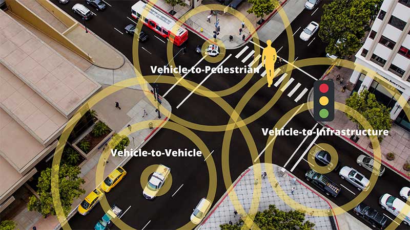
    Featured image: rclassenlayouts/iStock / Getty Images Plus/Getty Images

  • UP42 partners with Vultus for precision ag solutions

    UP42 partners with Vultus for precision ag solutions

    Photo: UP42
    Photo: UP42

    UP42 has partnered with Vultus, which specializes in precision farming technologies.

    According to UP42, its customers can now use Vultus Fertilization Zoning Maps algorithms to fine-tune crop management — with more agricultural technologies coming soon.

    Founded in 2016 in Lund, Sweden, Vultus AB provides a geospatial infrastructure for precision farming. Vultus analyzes Earth observation satellite data with advanced artificial intelligence algorithms to give farmers insights into the health of crops within small sections of their fields, enabling them to apply fertilizers variably across the field.

    “Growers reduce nitrogen-based fertilizer use by up to one third while increasing yield by three to five percent with the Vultus technology,” said Robert Schmitt, Vultus CEO. “This results in lower operating costs and significantly less environmental harm.”

    Fertilization Zoning Maps — the first in a series of proprietary algorithms Vultus brings to UP42 as a partner — shows farmers which parts of their fields need more or less fertilizer. Fertilization Zoning Maps divide fields into five zones that are classified according to the variable fertilization rate the soil requires, Vultus said.

    By partnering with Vultus, UP42 also brings precision farming technologies to the users of its geospatial developer platform and marketplace for Earth observation data and analytics. With the addition of Vultus technologies, UP42 customers can now pick and choose combinations of data and processing algorithms for their area of interest and retrieve results on a single scalable platform.

    “We’re very happy to announce a new partnership with Vultus, an emerging leader in the agritech industry,” said Sean Wiid, UP42 CEO. “Our partnership is a key step towards providing UP42 users with a simplified way of building precision agriculture solutions. We look forward to launching new capabilities and supporting the agritech industry together.”