To illustrate the fix we’re in, Logan Scott offered this analogy for out-of-band interference during the April webinar, “LightSquared and GPS: Our Story So Far.” We’re driving at night and come upon a bicylist with one of those little flashing lights. That’s the GPS signal. So far, so safe. We know the bicyclist’s position.
Then around the bend comes a truck with its headlights on high-beam, in the adjacent lane, but brights set at our eye level. That’s the LightSquared signal.
Where’s the bicyclist? Uh oh.
That is not the only light off which we are fending. Some of it we generated ourselves — with help from neighbors and children and friends and employers and, well, just about anyone with a mobile online connection.
Every time you:
download a map and driving directions to your cell phone or wireless-connected PND;
stream a movie to your cell phone (all right, so only youngersomethings of your acquaintance actually do this. They still have the eyesight for it);
while on the road, tap wirelessly into your company’s complex database of whatever kind that has been moved to “the cloud” in a cost-saving and efficiency-ramping measure;
download a Zen meditatation app to your mobile, one with scientifically designed binaural rhythms using embedded beats to induce a trance-like state through brainwave entrainment for ultimate relaxation, stress reduction, pain management, improved sleep quality, super learning, enhanced creativity, out-of-body experience, and lucid dreaming (I kid you not); or
get sports updates and video highlights direct to your phone —
Every time you do any one of these or myriad other activities on your handy pocket communications device, you, sir or madam, are contibuting to the problem that the GNSS community now struggles with.
Society has developed a ravenous appetite for huge volumes of virtual data, and we are not at all content to wait until getting home or to the office for a wired connection to access it. We want it now! On the road or sidewalk, in the coffeeshop, in the mall, in the stadium, along the running path, yea, even unto in the wilderness.
This appetite will only grow. LightSquared — mark my words, it will have plenty of company following — wants wider bandwidth to help you access online data faster. Sooner than you can say “traffic congestion,” even more data will be on offer, with even greater demand for wider bandwidth.
As one webinar attendee e-mailed (he wrote in all caps to emphasize his feelings, but they are downsized here),
“Do y’all think this has anything to do with the fact that mobile phone companies can make significantly more money streaming TV to cell phones than with GPS applications?”
Plus: GLONASS CDMA Tracked, Third Beidou-2 Launched
The second report from non‐governmental members of the LightSquared/GPS Technical Working Group (TWG) was filed with the Federal Communications Commission (FCC) on April 15. For those anxious to see actual results of interference/desensitization of GPS receivers by the proposed LightSquared terrestrial signal — or, conversely, absence of said results — the report does not contain any such hard news. It relates the set-up of TWG work sub-teams to test various categories of GPS devices and receivers.
The sub-teams have identified laboratories for testing activities, developed test plans, and identified devices, receivers, and systems to be tested. Attachments to the report include current draft test plans and the current list of devices and receiver models submitted for testing by companies.
The following sections summarize the testing laboratories and devices selected for testing by each sub-team:
aviation
cellular
general location/navigation
high precision, networks, and timing. These three sub-teams are collaborating to a large extent.
space-based receivers.
The full report also includes a “high-level description of test plan” by each sub-team.
Aviation Sub‐Team. The aviation sub‐team will rely primarily on testing, funded by the Federal Aviation Administration (FAA), that will be performed at Zeta Associates Incorporated of Fairfax, Virginia.
Additional testing is planned by the U.S. government at White Sands Missile Range and Holloman Air Force Base, both in New Mexico, for use by the National PNT Engineering Forum (NPEF) LightSquared Working Group. These results will be considered for inclusion in the TWG Final Report by the aviation sub‐team. Presumably, this group will test military receivers, under classified categorization.
The aviation receivers are representative of those in use today. Their selection was based mainly upon device availability (those already owned by the FAA Technical Center). They are: Canadian Marconi GLSSU 5024; Garmin 300XL; Garmin GNS 430W; Garmin GNS 480; Rockwell Collins GLU‐920 multimode receiver; Rockwell Collins GLU‐925 multimode receiver; Rockwell Collins GNLU‐930 multimode receiver; Symmetricomm timing card (used for an FAA automation system); WAAS NovAtel G‐II ground reference station; and Zyfer timing receiver (used for the WAAS ground network).
Cellular Sub‐Team. The cellular sub‐team is in the process of engaging PC TEST, Columbia, Maryland; CETECOM, Milpitas, California; InterTek, Lexington, Kentucky; and ETS Lindgren, Cedar Park, Texas, for device testing.
The cellular sub‐team expects to test approximately 50 different device models. The selections represent current and legacy devices and have been prioritized based on sales volumes. While it is expected that there will be some representation of data‐only devices and femtocells, the testing will focus largely on handheld devices.
Those designated for testing are: Apple iPhone 4 (GSM and CDMA); HTC A6366; HTC ADR6200; HTC ADR63002; HTC ADR63003; HTC ADR6400L; HTC Touch Pro 2; LG Lotus Elite; LG Rumor Touch; LG VN250; LG VS740; LG VX5500; LG VX5600; LG VX8300; LG VX8360; LG VX8575; LG VX9100; LG VX9200; Motorola A855; Motorola DROID X; Motorola VA76R; Motorola W755; Nokia 6650; Nokia E71x; RIM 8330C; RIM 8530; RIM 9630; RIM 9650; RIM 9800; Samsung Moment; Samsung SCH‐U310; Samsung SCH‐U350; Samsung SCH‐U450; Samsung SCH‐U640; Samsung SCH‐U750; Samsung SGHi617; Samsung SGHi917; Sierra Wireless 250 U USG 3G/4G; and Sony Ericsson W760a.
General Location/Navigation. This sub-team has chosen Alcatel/Lucent as its initial facility for testing. Twenty-six devices were selected based on nominations by manufacturers represented on the sub‐team, considering the percentage of the installed user base.
They include: Garmin Forerunner 110 and 305; Garmin ETREX‐H; Garmin Dakota 20; Garmin Oregon 550; Garmin GTU 10; BI Inc. ExacuTrack One; Garmin GPS 17X; Garmin GPSMAP 441; Hemisphere Vector MV101; GM OnStar (model TBD); Garmin GVN 54; TomTom XL335; TomTom ONE 3RD Edition; TomTom GO 2505; Garmin nűvi 2X5W, 13XX, 3XX, and 37XX; Garmin GPSMAP 496; Garmin aera 5xx; Honeywell Bendix/King AV8OR; Trimble iLM2730; Trimble TVG‐850; Trimble Placer Gold; and Hemisphere Outback S3.
High Precision-Networks-Timing. The HPN&T sub‐teams are collaborating extensively to develop joint test plans and procedures. The joint sub-teams have chosen the U.S. Navy’s NAVAIR facility for testing.
To be tested are: Hemisphere R320; Hemisphere A320; Deere iTC; Deere SF‐3000; Deere SF‐3050; Trimble MS990; Trimble MS992; Trimble AgGPS 252, AgGPS 262, AgGPS 442, and AgGPS EZguide 500; Trimble CFX 750; Trimble FMX; Trimble GeoExplorer 3000 series GeoXH and GeoXT; Trimble GeoExplorer 6000 series GeoXH and GeoXT; Trimble Juno SB; Trimble NetR9 and NetR5; Trimble R8 GNSS; Trimble 5800; Leica SR530; Leica GX1200 Classic; Leica GX1230GG; Leica GR10; Leica Uno; Leica GS15; Topcon HiPer Ga and HiPer II; Topcon GR‐3 and GR‐5; Topcon MC‐R3; Topcon NET‐G3A; Topcon TruPath/AGI‐3; NovAtel PROPAK‐G2‐Plus; NovAtel FLEXG2‐STAR; NovAtel FLEXPAK‐G2‐V1, FLEXPAK‐G2‐V2 and FLEXPAK6; NovAtel PROPAK‐V3; NovAtel DL‐V3; Septentrio PolaRx3e; and Septentrio AsteRx3.
Space‐Based Receivers. Lab testing has been conducted at the NASA Jet Propulsion Laboratory (JPL) in California. The receivers are used by NASA for space‐based missions and high-precision science applications. The TWG agreed that these would be tested at JPL by NASA, with participation by LightSquared personnel, and the results provided to the TWG; see Appendix G
The devices tested are current or representative of GPS receivers in use by NASA or planned for use in the near future for space and science applications: TriG (NASA Next‐generation Space Receiver) and IGOR (Space Receiver).
NASA/JPL also tested the following high-precision receivers and shared the results with the HPT&N sub‐team: JAVAD Delta G3T (High Precision‐IGS) and Ashtech Z12 (High Precision‐IGS).
Conclusion. For all sub-teams, analyses will consider both LightSquared’s expected transmit power of 62 dBm per channel and its maximum authorized transmit power of 72 dBm per channel.
The WG co‐chairs will update the Commission on its progress in a subsequent report on May 16.
The April 15 TWG report contains these appendices: Working Group Roster; List of Receivers and Devices; Aviation Test Procedure; Cellular Test Plan Draft; General Location/Navigation Test Plan Draft; High Precision/Networks/Timing Test Plans Draft; Space‐Based Receivers Test Process.
GLONASS CDMA: New Era’s Dawn Glimpsed from Multiple Receivers
The newest Russian satellite, launched on February 26, began transmitting its new code-division multiple-access (CDMA) signal on April 7. In a clear break from all previous GLONASS signals, which are frequency-division multiple-access (FDMA), the new signal is expressly designed to be interoperable with current and future GPS signals, and with the coming Galileo signals, all of which have a CDMA structure. Thus, a new era of GNSS, truly global navigation satellite systems, began on April 7.
JAVAD GNSS was the first company to announce that it had tracked CDMA signals of the GLONASS-K satellite in
the L3 GLONASS band. Data was logged at the company’s Moscow office on April 8 from 02:30 until 07:30 UTC. The satellite’s pseudorange (in chips) and signal-to-noise ratio (in relative numbers) are shown in Figures 1 and 2.
Figure 1. GLONASS-K’s pseudorange in chips, courtesy of JAVAD GNSS. The y-axis goes from 0 to 12,000 in increments of 2,000; the x-axis goes from 0 to 500 in increments of 100. (Click to enlarge.)Figure 2. GLONASS-K’s signal-to-noise ratio (in relative numbers), courtesy of JAVAD GNSS. The y-axis goes from 0 to 10,000 in increments of 2,000; the x-axis goes from 0 to 500 in increments of 100. (Click to enlarge.)
On April 11, the satellite’s code-minus-phase and signal-to-noise ratio were tracked (Figures 3 and 4). Data quality is quite similar to GPS, according to the company.
Figure 3. GLONASS-K satellite’s code-minus-phase data (courtesy of JAVAD GNSS). (Click to enlarge.)Figure 4. GLONASS-K satellite’s signal-to-noise ratio (courtesy of JAVAD GNSS). (Click to enlarge.)
Future GLONASS satellites of the K1 and subsequent K2 generations will broadcast CDMA signals in multiple frequency bands. GLONASS-K satellites are markedly different from their predecessors. They are lighter, use an unpressurized housing (similar to that of GPS satellites), have improved clock stability, and a longer, 10-year design life. There will be two versions: GLONASS-K1 will transmit a CDMA signal on a new L3 frequency, and GLONASS-K2 will in addition feature CDMA signals on L1 and L2 frequencies. The CDMA signal in the L3 band has a center frequency of 1202.025 MHz.
The new generations of GLONASS signals and satellites are described in detail in the April “Innovation” column of GPS World, edited by Richard Langley.
Septentrio Navigation of Leuven, Belgium, also tracked GLONASS CDMA L3 signal with its AsteRx3 receivers. Figure 5 shows the C/N0 in dB-Hz of the legacy L1-C/A signal and of the data component of the new L3 CDMA signal. The graph covers the time span starting at 20:30 (UTC) on April 10 and ending at 02:00 on April 11. Figure 6 shows the de-trended code minus phase from L1-C/A and L3 signals. Such a plot provides a glimpse of the code measurement multipath and noise, according to the company.
Figure 5. GLONASS-K1 AsteRx3 measurements; C/N0 in dB-Hz of L1-C/A and L3 CDMA (courtesy of Septentrio Navigation).Figure 6. GLONASS-K1 AsteRx3 measurements; de-trended code minus phase of L1-C/A and L3 CDMA (courtesy of Septentrio Navigation).
Topcon Positioning Systems (TPS) also released data on the new signal, stating that signals from the new satellite “provide an additional accuracy advantage over older satellites.” Figures 7 and 8 show data from the company’s Moscow office.
Figure 7. Pseudorange-phase of four signals transmitted by the new K1 satellite (courtesy of Topcon Positioning Systems). (Click to enlarge.) Figure 8. Signal-to-noise ratios of four signals transmitted by the new K1 satellite (courtesy of Topcon Positioning Systems). (Click to enlarge.)
Finally, the German Aerospace Center’s Institute of Communications and Navigation recorded the spectrum of the GLONASS CDMA signal, captured with a 25-meter dish antenna, Raisting Satellite Earth Station, near Munich.
The signal spectrum spans at least 40 MHz (Figure 9). It contains additional sidelobes not shown in the plot. The plot indicates total power of all components of the transmitted signal.
Figure 9. GLONASS CDMA signal’s power over frequency (courtesy of the German Space Agency, DLR).
Third Beidou-2 IGSO Launched
China’s BeiDou-2 (Compass) satellite launched on April 9 has attained a circularized orbit, joining two inclined geosynchronous orbit (IGSO) satellites to form a mini-constellation centered on an east longitude of about 120 degrees. While BeiDou-IGSO-3’s orbit might still be tweaked slightly, it is clear that the orbits of the three satellites are arranged so that there will always be one satellite with a high elevation angle over China, according to the CANSPACE news service operated by the University of New Brunswick.
The latest spacecraft joins four geostationary satellites, a middle-Earth orbiting vehicle, and the two other IGSO satellites now on orbit. As the first Chinese launch in 2011, the new arrival presages much activity to come. With eight now flying, six more spacecraft are scheduled to rise by 2012, completing a 14-satellite constellation to provide a regional service over eastern Asia. The regional system will consist of five geostationary or GEO, five IGSO, and four medium-Earth orbit satellites.
Long-range plans envision a 35-satellite constellation providing global service by 2020: 27 MEOs, 5 GEO satellites, and 3 IGSOs. The satellites will transmit signals on the 1195.14–1219.14 MHz, 1256.52–1280.52 MHz, 1559.05–1563.15 MHz, and 1587.69-1591.79 MHz carrier frequencies.
Compass satellites have an announced lifespan of eight years.
Three IGSO satellite tracks over China (image courtesy of CANSPACE).
First Overload Interference/Desensitization to GPS Receivers, Systems, and Networks Report to FCC
The joint working group co-led by the U.S. GPS Industry Council and Lightsquared, investigating potential problems of LightSquared/GPS interference, delivered its first monthly report on March 15 as directed by the FCC. The report (PDF) lays out a schedule for receiver selection and testing and names 34 members, two working group co-chairs, and four information facilitators of a technical working group (TWG) supervising and analyzing the assessment of GNSS receivers operating under conditions of a dense national network of high-powered cell-phone transmitters. “TWG members represent a diverse group of interested parties including equipment and chipset manufacturers, aerospace/aviation companies, wireless providers, engineering firms, public safety, and various federal agencies. Additionally, several individuals have volunteered to be advisors to the TWG,” said the report.
The TWG held its first meeting on March 3 in Arlington, Virginia, and via a conference bridge for members around the globe who were unable to attend in person. In that and subsequent teleconferences, the TWG focused on the first seven items from the Work Plan:
Establish pertinent analytical and test methodologies and assumptions underlying the test regime: definition of harmful interference, relevant information regarding terrestrial broadband network, interference analysis assumptions, and evaluation of potential test methodologies.
Select categories of receivers and receivers to be tested.
Develop operational scenarios.
Establish methodology for analyzing test results.
Derive test conditions based on the established operational scenarios.
Write test plan and procedures.
Identify and engage appropriate test facilities.
LightSquared provided technical details to the TWG regarding the equipment planned for its terrestrial broadband deployment, including the channelization plan, output power, out-of-band emission (OOBE) characteristics, and emissions mask.
The GPS community is concerned that desensitization/overload due to strong signals outside of the GPS band may cause GPS receivers to operate in a non-linear mode with reduced gain (that is, gain compression) for the desired GPS signal. Other receiver impairments may also arise as a result of the nearby strong signals.
The TWG has agreed to move forward with a combination of laboratory-based and field-based testing programs. Field testing will be performed at outdoor test locations using transmitters, filters, and antennas similar to those that LightSquared plans to deploy in its commercial operations.
Other items of interest in the report:
Definition of Harmful interference at the GPS/GNSS/Augmentations/L-Band Receiver. “The TWG members have discussed a number of receiver parameters related to the definition of harmful interference. In the FCC Rules, harmful interference is defined as ‘interference which endangers the functioning of a radionavigation service or of other safety services or seriously degrades, obstructs, or repeatedly interrupts a radiocommunication service operating in accordance with [the ITU ] Radio Regulations.’
“Harmful interference affects different types of receivers in different ways. The key factors that pertain to the functioning of GPS receivers and/or whether service is degraded, obstructed, or interrupted are accuracy (position, velocity, time), availability (ability to perform a given function), coverage (within what space can a function be performed), integrity (what is the probability that the results are correct), and continuity (what is the probability that a given function can be completed). Metrics for harmful interference are developed from an understanding of the consequential relationship between negative impacts and receiver parameters, which include effective C/N0, PVT accuracy, time to first fix, loss of lock, cycle slips, etc. The signal conditions to be taken into account are defined in the GPS Standard Positioning Service (SPS) Performance Standard, 4th Edition, Interface Specifications (ISs), GPS policy, and both the present and planned future signal environments will be considered.Environmental and field conditions in which GPS receivers operate will also be considered.
“It should be possible to assess interference impact, up to that which includes harmful interference, using metrics in terms of receiver parameters that include measurable changes in effective C/N0 as well as position accuracy, time to first fix, loss of lock, cycle slips, etc. Related to this discussion is whether there is any margin that could be budgeted for terrestrial broadband operation, and if so, what that amount could be. When considering systems guaranteed for safety-of-life operations, there may be very little or no margin.
“There is general agreement within the TWG that the device testing protocols should include changes in effective C/N0 and degradation of other key performance measures so as not to exclude data that might be relevant for the post-testing analytical phase using operational scenarios.
Overload interference/desensitization at the GPS/GNSS/Augmentations/L-band Receiver. “Desensitization/overload due to strong signals outside of the GPS band may cause the GPS receiver to operate in a non-linear mode with reduced gain (i.e., gain compression) for the desired GPS signal; there may also be other receiver impairments caused by strong signals outside the GPS band. The TWG will consider these mechanisms further after testing is underway and sufficient samples are available to adequately assess such mechanisms.”
Evaluation of Potential Test Methodologies. “The TWG has agreed to move forward with a combination of laboratory-based and field-based testing programs. Laboratory tests are repeatable, allow for the creation of a fully controlled environment and the ability to test multiple scenarios and many devices in an efficient, repetitive manner. Field tests expose devices to a real-world environment where measurements can be performed at various distances and morphologies from terrestrial broadband network sites in order to gauge the effects of distance and physical environments on terrestrial broadband signal strength and potential interference. One advantage of field testing is that it captures a complete, live test environment comprehensively and helps develop keener testing or analysis insights that modeling cannot offer. The major disadvantage or concern is that field testing uses the present environment, not the environment that might exist at some future or past time. Interference testing analysis has to consider worse-case assumptions, and not only the current test reality.
“Laboratory testing will be performed either using conducted testing, where devices are connected directly to transmission sources via 50 ohm connectors, or through radiated testing in anechoic or other radiated emissions chambers. While conducted testing is the preferred laboratory methodology, anechoic chambers will be used where conducted testing is not practical, is not recommended by the manufacturer, or where connectorized devices cannot be made available within the established test timeline.
“Field testing will be performed at outdoor test locations that will utilize transmitters, filters, and antennas similar to those that will be deployed by Lig
htSquared in its commercial operations.”
The TWG identified seven categories of receivers that it considers representative of non-military GPS user equipment operating in the United States: aviation, cellular, general location/navigation, high precison, timing, space-based receivers, and networks.
Seven sub-teams are focusing on these receiver categories. The sub-teams are responsible for determining device selection and prioritization criteria, defining operational scenarios, listing testing conditions and test plan procedures, and recommending appropriate test facilities.
Save Our GPS Coalition Forms
Representatives from a variety of industries and companies have formed the Coalition to Save Our GPS to resolve what it terms a serious threat to the national positioning, navigation, and timing service: the FCC conditional waiver to Lightsquared allowing expansion of terrestrial use of the satellite spectrum immediately neighboring that of GPS, potentially causing severe interference to millions of GPS receivers.
“GPS is essential to Americans every day — it’s in our cars, the airplanes in which we fly and the ambulances, police cars, and fire trucks that help keep us safe. It’s also used in many industrial applications and even synchronizes our wireless, computer, and utility networks,” the group stated. “LightSquared’s plans to build up to 40,000 ground stations transmitting radio signals one billion times more powerful than GPS signals as received on earth could mean 40,000 ‘dead spots’ — each miles in diameter — disrupting the vitally important services GPS provides.”
The Coalition (www.SaveOurGPS.org) includes representatives from aviation, agriculture, transportation, construction, engineering, surveying, and GPS-based equipment manufacturers and service providers.
Initial members of the coalition are the Aeronautical Repair Stations Association, Air Transport Association, Aircraft Owners and Pilots Association, American Association of State Highway and Transportation Officials, American Rental Association, Associated Equipment Distributors, Association of Equipment Manufacturers, Case New Holland, Caterpillar Inc., Edison Electric Institute, Esri, Garmin, General Aviation Manufacturers Association, Deere & Company, National Association of Manufacturers, OmniSTAR, and Trimble. More members are expected to join in the near future.
The following is from a statement issued by the coalition:
“[In] The unusual waiver granted in January to LightSquared by the FCC . . . the usual FCC process of conducting extensive testing followed by approvals was not followed. Instead, the process was approve first, then test. Additional safeguards are needed, so the coalition recommends:
“The FCC must make clear, and the NTIA must ensure, that LightSquared’s license modification is contingent on the outcome of the mandated study. The study must be comprehensive, objective, and based on correct assumptions about existing GPS uses rather than theoretical possibilities.
“The FCC should make clear that LightSquared and their investors should not proceed to make any investment in operating facilities prior to a final FCC decision (or at least make it explicit that they do so at their own risk). While this is the FCC’s established policy, it failed to make this explicit in its order.
“Further, the FCC’s, and NTIA’s, finding that ‘harmful interference concerns have been resolved’ must mean ‘resolved to the satisfaction of preexisting GPS providers and users.’ Resolution of interference has to be the obligation of LightSquared, not the extensive GPS user community of millions of citizens. LightSquared must bear the costs of preventing interference of any kind resulting from operations on LightSquared’s frequencies.
“This is a matter of critical national interest. There must be a reasonable opportunity for public comment of at least 45 days on the report produced by the working group.”
WAAS Official Again
The Federal Aviation Administration (FAA) announced on March 18 that WAAS PRN 135 has resumed normal operations. “The WAAS team recently received the final report from Lockheed Martin on the failure of Galaxy 15,” reported FAA GNSS program manager Leo Eldredge. “After a review of that report, the team determined that the satellite was ready to be returned to operations.”
The FAA said that PRN 135 is currently located at ~120°W and enroute to its final destination of 133.1°W, but is now broadcasting operational corrections that can be used by both aviation and ground users, including those in Northwest Alaska.
In April 2010, satellite operator Intelsat reported it had lost contact with PRN 135 (named Galaxy 15) and it was drifting uncontrolled. At that time, the FAA reported that it would drift out of WAAS service within a few weeks. Instead, PRN 135 remained within a usable condition/location, although drifting east, until December 2010, when it ceased operating. On December 23, Intelsat reported that the power from the Galaxy 15 battery completely drained during its loss of Earth lock and the baseband equipment command unit reset, as it was designed to do. Shortly thereafter Galaxy 15 began accepting commands, and Intelsat engineers began receiving telemetry in the operations center.
Intelsat determined that static electricity charge caused the initial failure, and has uploaded new software to prevent the event from occurring again. There are now three operational WAAS GEO satellites:
◾ PRN 133 located at 98°W.
◾ PRN 135 located at 133.1°W (currently at ~120°W); will arrive at 133.1°W on or about April 4, 2011.
◾ PRN 138 located at 107.3°W.
EGNOS SOL Operational
The European Geostationary Navigation Overlay Service (EGNOS) was declared operational for safety-of-life (SOL) services on March 2. The service consists of GPS corrected signals intended for transport applications, particularly aviation, where lives could be endangered if the performance of the navigation system is degraded.
The SOL coverage area, expected performances, and conditions of use are described in the EGNOS Safety-Of-Life Service Definition Document (SDD, see env-gpsworld-integration.kinsta.cloud/egnosSOL). The two operational EGNOS satellites — Inmarsat-3-F2/AOR-E at 15.5 degrees west longitude using PRN code 120, and Artemis at 21.5 degrees east longitude using PRN code 124 — now transmit Message Type 2, indicating that the signals are available for safety-critical purposes.
Air-navigation service providers can now publish SBAS precision approach procedures, localizer performance with vertical guidance (LPV), based on EGNOS. On March 22, EGNOS operator European Satellite Services Provider published the first EGNOS LPV approaches for use at Pau Airport, near the Pyrénées in southern France.
EGNOS improves accuracy and provides integrity to the GPS signal over most of Europe and parts of North Africa. The system uses a monitoring network of 40 ground stations to provide the corrections with 99.9 percent availability over the core service region. Accuracy is measured by GPS user equivalent range error typically about 4.2 meters after EGNOS corrections for GPS signals from satellites at a 5-degree elevation, and 2.4 meters for satellite signals arriving from a 90-degree elevation. If reliability falls below a minimum level, EGNOS users are alerted within six seconds.
Russian SBAS Satellite Passes Transponder Tests
The Luch-5A geostationary communication satellite under construction has successfully completed a cycle of transponder tests. The satellite includes a transponder for the System for Differential Correction and Monitoring (SDCM), the Russian satellite-based augmentation system. SDCM will provide integrity monitoring of
GPS and GLONASS satellites and differential corrections and analyses of GLONASS performance: real-time differential corrections with horizontal accuracy of 1–1.5 meters, vertical of 2–3 meters.
As it was in the beginning, now and always, and to the ages of ages — or at least into the conceivable near future: GPS was, is, and shall be a dual-use system.
Why, then, reading through the March 15 report of the Technical Working Group (TWG) to the FCC on LightSquared/GPS interference, do we find no mention at all of military receivers?
Presumably DoD and the GPS Directorate are both concerned and active on a separate front vis à vis the FCC, but what/how/when? Would it not be beneficial for the dual uses to present a united front in some way, or at least to collaborate to some extent? To observe, if nothing else, each other’s testing?
It turns out there are separate LightSquared/GPS Industry Council and government testing structures, the latter under under the National Space-Based PNT Systems Engineering Forum (NPEF), which will include military receiver tests. Several government members of the TWG are also members of the NPEF. The Executive Secretariat to the NPEF is also a core member of the TWG.
The two testing groups collaborate and try to be on the same page as to technical assumptions, test methodology, measures of effectiveness, and so on. They will observe and participate in each other’s tests as much as they can — with the exception of national security issues.
Testing of the military receivers is not a part of the TWG primarily because of classification. Any discussion of vulnerabilities of military equipment is generally classified at least at the Secret level.
Outside of the TWG, there have been direct meetings between LightSquared and the military officers leading the military receiver testing. The military have asked technical questions and LightSquared has answered them and provided examples of its hardware. LightSquared has flown technical experts to Colorado Springs to meet with HQ Air Force Space Command test leads.
“To the maximum extent possible,” said Anthony Russo, director of the U.S. National Coordination Office for Space-Based Positioning, Navigation, and Timing, “we’ll invite LightSquared to review test plans and make inputs on test methodology, but we do anticipate that some of the end results will be classified and therefore have to be conveyed separately to the FCC.”
“There is certainly good collaboration between the LightSquared-led TWG and the independent federal testing activities I directed under the NPEF charter. LightSquared has been extremely cooperative in supporting this,” he added.
In addition to classification issues, there are other reasons to do independent federal testing. LightSquared is focusing on the potential in-band overload issue, while the GPS community is concerned about any potential interference scenario — including out-of-band emission issues that LightSquared is not looking at.
Russo anticipates at least two reports will go to the FCC in June: “One from LightSquared where we make inputs, but have no official say on what they conclude; and one from me, based on NPEF results, submitted through the PNT EXCOM to the FCC. I expect the latter report to be at the Secret level, although we may be able to do a redacted version for LightSquared and the general public.”
Can the development and use of smart technologies actually render us dumber? Have we already lost a mental step or two, as we equip ourselves fearlessly for the future?
Marshall McLuhan, the “medium is the message” guy from back when, preached that tools numb whatever part of the body they amplify. By extrapolation, location-enabling tools render us less aware of our actual place.
It causes me some discomfort to float this topic in the standard bearer for an extremely advanced high-tech industry. Yet I also felt acute and nearly continuous discomfort while reading a book over the winter holidays; a poke here, a prick there, until I was sitting on pins and needles. I had selected the volume with an eye to finding out why my adult and near-adult children, actively engaged online, have little patience with the printed page anymore, and find books practically abhorrent.
Of course, every generation has its preferences, but this trend troubles me because it seems associated with a reluctance to truly explore, to think critically, at length, and in some depth. Also, it’s not limited to twentysomethings. I find plenty of affected folks at every age.
The book is The Shallows: What the Internet Is Doing to Our Brains, by Nicholas Carr. It provided grist galore in the online/print dichotomy — the changes in how we look for, absorb, process, and store information. And as said, it generated no little discomfort as I realized how much I, too, have changed in a decade and a half of increasing online activity, at work and in leisure.
I began to wonder, as I read, where that other game-changing modern technology, global satellite navigation, enters the picture. Sure enough, it surfaced on page 212.
A neuroscientist engaged in studying the brains of London taxi drivers found that their hippocampal area increased in gray matter volume because of the huge amount of street names and traffic-flow data they must memorize. She worries that when cabbies use GPS, that knowledge base will shrink, and possibly that area of the brain will atrophy or fail to develop.
This is perhaps a trivial example that has little to do with you and me. But consider your experience and your awareness as you follow, head down, your PND or a cell-phone screen to your next destination. Do you register the environment en route, possibly including hazard factors? Do you notice other points of interest that might enrich your experience, occasion a stop, detour, or return trip — or even constitute a better destination? Once arrived, could you find your own way there again, or have you become dependent on silicon and signals?
GNSS brings undeniable benefits in areas where it creates capabilities that did not exist before, such as measuring millimetric sway of tall buildings or changes in sea level; that is, largely in professional areas. But where it offers convenience or shortcuts in everyday life, that can be a more double-edged sword. The Internet has proved so; recall also canned, frozen, and processed pre-prepared foods, once embraced as modern timesavers. We now find they stripped essential nutrients out of our diet, undermining health and helping create an obesity epidemic.
At the opposite end of this book, my esteemed colleague Eric Gakstatter gives you his Top Five news stories of the recently passed year, from a system point of view. Spend five minutes here in this column, and I’ll toss up the Top Ten for GNSS business, as reported in this magazine.
Not the biggest money deals or revenue generators, at least not in the short term. But the most significant in terms of breaking new ground, pushing out frontiers, integrating with other technologies — the modes through which industry grows and prospers.
I’m leafing through my back copies in reverse order. This listing goes not by prominence, but by reverse chronology.
PNDs Up, Then Down By 2015. When you are doing well, rest assured that someone is gaining on you. Smartphones will gradually take over the personal nav market. Stay flexible, innovate, and be prepared to change horses in midstream.
Rockwell Delivers New MUE. While military user equipment gave this industry its start, the receivers themselves have always lagged behind product available to civil users. Still, security features in the GB-GRAM-M foreshadow what all receivers may eventually require.
Triumph V.S. from JAVAD. Supercharged with capabilities, a veritable surveyor’s arsenal, and probably a gamechanger — whether or not it makes it in the marketplace. A visionary product.
NovAtel OEMV-1DF. Almost every month, another smallest-yet consumer-grade GPS receiver emerges. But when high-precision, dual-frequency receivers grind down their footprint and power requirement, you know this is a future wave that will sweep everything along. Not the only tiny high-performance OEM receiver, mind you, just the latest.
LLC Rusnavgeoset. The joint venture between Trimble and a Russian company will help drive the commercialization of GLONASS, an aspect that system has not yet truly seen. We all talk about the second GNSS of choice, but the second commercialized GNSS is what we really want.
Smartphone Explosion. The flipside to the first story. This year’s models from Apple iPhone, Google Android, Blackberry, Windows Phone 7, and all their kin, if not built around location as Apple claimed, certainly have it as core feature. The flip of the flipside: pricing for the GPS component is cut-throat. Absolutely the worst you’ve ever seen.
GPS-Enabled USB Drive. That’s all it takes — well, download some software and buy a contract — to make a laptop location-aware.
Spirent Assisted-GLONASS Testing. One more sign that the Russian system, against betmakers’ odds, may yet become the trusty sidekick. Soon, if your mobile doesn’t have it, it’s not top-of-class.
One-Chip Receivers-Plus. Hardly breaking news, since it’s been talked about and even done, sort of, for years. TI, Broadcom, Qualcomm, CSR, and silent runners like Sony and Panasonic are all adding some communication transceiver(s) to GPS and squeezing them onto a single piece of silicon.
No News Is Big News. Actually not reported here or anywhere, because neither party wants to reveal anything, but some of the biggest deals are cut by chip manufacturers (such as STMicroelectronics, to name just one), with automobile makers around the world. Like it or not, the car/truck is the dominant mechanical paradigm of our age. And if location is in it . . .
We are indeed fortunate to be part of, and partners in, such a vital scene. Best wishes for this New Year.
Two figures for your holiday mulling here. I keep putting one and one together, and coming up with three.
The first one points to a value of $1,000 billion. Or, as we like to say, one trillion dollars. That has a nice ring to it.
The second one hovers at a lower level, around $230 billion, not nearly as melodic as the first. But if the second one creates the first one, how much magic is there in that — do you see what I’m saying?
Let me elucidate the second one first. It emerged at the European Navigation Conference, when a spokesperson for Galileo Services put forth the assertion that, currently, European industry holds a market share of around 20 percent of global GNSS hardware, software, and services, a market size he estimated at 180 billion euros, or $230 billion. Thus the first figure.
The speaker’s point was that in other high-tech sectors, European industry held a market share of 33 percent, so really, they could be doing better. But that’s beside my point, which takes, as a rough estimate — and much subject to debate, granted — that the current global market of GNSS hardware, software, and services lies in the neighborhood of $230 billion.
Returning to the first figure, it comes from a conversation with Paul Verhoef of the European Commission; a lengthy interview treats other issues, but I don’t want to let this snippet get away. He stated, based on some market research the EC has done but not yet released (you bet I’m trying), that “at the moment, 6 to 7 percent of the European Union gross domestic product (GDP) is directly dependent on the availability of GPS. This is a GDP value of around 800 billion euros; this is more than $1,000 billion.”
A cool trillion dollars of European economy directly dependent on GPS availability.
Wouldn’t it be nice if we knew the similar figure for the U.S. economy?
Let’s just assume, for the sake of argument, that it roughly equals the European number. So United States and Europe combined, two trillion dollars of GDP directly dependent on GPS availability. Throw in the rest of the world and I’ll bet you’re at three trillion dollars.
Boy, I wish I had an investment portfolio that I could throw $230 billion at, and wind up with $3 trillion at the end of the day.
What, what, what are world governments doing, pinching pennies and cutting back programs and replenishing on need and sliding to the right — when they could be feeding a roaring economic engine, a behemoth that would support and stimulate so many other industries, and their GDPs as a whole?
Come to think of it, Russia and China are pushing forward with this capitalist plan. It’s Western countries that appear ignorant of, and thus unable to learn from, their own economic history.
Paul Verhoef, the European Commission’s program manager for European Union (EU) satellite navigation programs — namely Galileo — discussed current issues at some length with GPS World, in a conversation on November 10. He addressed aspects of interoperability with GPS and prospects for further development in that area, the need for an ongoing political commitment by the EU to Galileo, the challenges of financing, the prospects for an 18-satellite constellation (which he dismisses as unrealistic), military considerations for both Galileo and GPS, and the recent uncertainty around Galileo’s Public Regulated Service.
Alan Cameron (AC): All four GNSS operators are or have been in discussions about interoperability, to varying levels. In my perception, the U.S.-E.U. agreement on GPS/Galileo interoperability appears to be the strongest, most defined, and most committed result of all these talks. Do you agree?
Paul Verhoef: I think that’s correct. We have I think seen in the process with the U.S. that first of all there has been a quite clear political commitment on both sides, at the highest levels, that interoperability was wanted. Secondly, in the implementation we’ve had a very good working relation with our U.S. colleagues in order to establish that. The advantage that I see is that we have been able at a very early stage to deliver on such an interoperability agreement, that this is clear to industry, it provides for predictability. It allows industry to monitor clearly how the two systems are evolving, and when this interoperability is actually going to be available in the marketplace, and it allows them to time their investments, their R&D, their production, and all the rest.
I’m extremely happy with that. We have moved on with U.S. colleagues to look at a whole range of other issues between the two systems, be it safety-of-life service, be it all sorts of other issues, and I think also because we jointly tie in our industries, we are transparent about the results, we provide papers, as we have recently done on SOL, we provide clarity to users worldwide. I think it is an excellent example of how this work can be done, and I’m extremely happy with it.
There is possibly still quite a lot of work ahead of us. I would say there is work forever. There are evolutions in the thinking on GPS, there are evolutions in the thinking on Galileo, we need to adapt to new situations jointly, but there is a clear endeavor between the two sides to progress with that. There are suggestions every now and then, also some of the areas we haven’t been looking into, we should look into more closely, particularly referring to our PRS service, and whether we should have some closer contacts with the U.S. on how we would, on what we do jointly on PRS and GPS use, etc. But comments made, there is quite a lot of work underway.
This doesn’t mean we aren’t doing anything with the other systems. We have with most of them very good relationships. Sometimes, like with the Russians, interoperability is a bit more complex because of the different technologies used, but the interest is there. We are with Japan pretty well advanced with the number of discussions; it is of course in a bit more limited context in relation to what the result would be for the services over Japan and the Asian region. With India, we are moving forward. As you know, with our Chinese colleagues the situation is a bit more complex. Although we have good discussions, I think there is still a bit of length to go before . . . . We come first of all with clear notions of compatibility, and interoperability is yet beyond that. So we need to take that in the order of priority, and the first priority is obviously compatibility.
AC: How does this commitment to interoperability balance with the lagging arrival of Galileo satellites, relative to the speed with which Compass is establishing a constellation? For market acceptance and worldwide use, is a well-defined and interoperative signal structure more important than a fully operating constellation?
Verhoef: That’s a good question. It’s not easy for me to predict how the markets will see that. If I judge by the way that our interoperability agreement with the U.S. has been received, one would tend to think that the market would be in favor of some predictability and some transparency in terms of the plans of the deployment schedule, and the standing, the solidity of the program in having a visibility, the capabilities of the technology, in having a timely interface specifications available, and all that sort of thing. We have done that, obviously there are currently a number of delays. My sense from what I hear from the marketplace is they are not too worried about that. They are really interested in being able to follow that.
Whether the strategy of playing for speed is going to work, I guess is still an open issue. In my view it is rather a dangerous and rather tricky situation, because there is not too much visibility on the Chinese program. It is only recently that they have started lifting a bit of the veil on it. I’m not sure from what I hear from the marketplace, whether they think they know what the system is going to do, they don’t know the specifications, they don’t know what the exact planning is. And obviously there is a bit of an issue hanging in the air there: that if compatibility and interoperability with that particular system is not in place, what is going to be the consequence?
Those agreements from China are not in place with us. It is not in place with the U.S., it is not in place with Russia, it is not in place as far as I can see it with Japan or with India. So the Chinese give a bit of an impression that they’re quite willing to go at this alone. Now I must say that over the last two years they have come into the fold of the international community a bit more, we have managed to convince them to discuss these issues with us not only bilaterally but also multi-laterally, at the providers’ forum which is taking place in the context of the International Committee on GNSS of the U.N. I think that they see that this is a good place to be. They have now offered to host a meeting of that committee in 2012, so the first indications are there that they are ready to be more of a world citizen, so to speak. But I think in order to find acceptance not only at the level of governments, but also at the level of markets, they’re going to really come forward with clarity on their intentions on compatibility and interoperability. As long as there is uncertainty about that, my sense is that the marketplace will be holding back and will want to see how this develops before they move on anything at all.
So it could be a rather risky strategy for the Chinese if they don’t seek to come to rather clear agreements with the other providers. And not only the first time, like now, but on a continuous basis. We all have evolving systems, we all want to come with the possibility of new ideas. I don’t think there is anybody really trying to stop the others, but we are going to have to work very hard to make sure our respective plans all can be granted without undue impacts on the others. This is a continuous process which is going to last, I guess, forever. We’re going to have to really work at that. We are continuing everything we can in order to progress with the colleagues in China. I’ve recently had meetings with them, a couple of weeks ago, in August, to try and really understand what their concerns are and be able to address those. We still have hope to be able to
come to a satisfactory conclusion.
AC: Other than financing, what are the most significant challenges for the Galileo programme today?
Verhoef: My sense, Alan, is that the most significant challenge for the programme is that we need to be able to give from the EU levels, at a political level, a political commitment to the system, which is solid. Meaning investments in receivers, in applications are done on the basis of a belief that the political commitment to the system, to supply the necessary minimum technical performance, that commitment is sufficiently solid, and sufficiently underpinned in order to have users worldwide say, Yes, we believe in this, and we think our own investment in this, even if it is sometimes a few thousand euros or sometimes hundreds of thousands or millions of euros is really warranted.
Of course this commitment is currently in place in the U.S., the U.S. government has been able over the years to provide a very credible goal commitment as to its performance with GPS. There are sometimes discussions on it, but by and large people do accept that the commitment of U.S. government is very credible. Obviously, we seek to establish a very similar level of credibility of commitment, because otherwise there would always be doubt as to, well, there is a problem now and what would you do in the future, and would they continue doing this, and would I finance that, and all the rest, and you would have continuous discussions, and it brings a large measure of uncertainty in the marketplace. Given the rather difficult financial times everybody goes through around the world, this is not a good way to proceed. We are really working very hard with all the political levels in Europe to try and get such a commitment to the table, and with it of course the underpinning for it.
The other challenge is, I think it is time that Galileo delivers something concrete. We’ve had many years of discussion behind us on whether the system will come, and if it will come, and how it will come, and what it will look like, and all the rest. I think that for my part, I’m very happy to see that in 2011, we plan to launch. The first four satellites are on the way; they are almost ready. About half the ground infrastructure is currently under implementation, we have every couple of months the opening of another ground station around the world. We had recently Kourou, New Caledonia, we will have next month the opening of the new ground station in Kiruna in northern Sweden. We have Oberpfafenhoffen in Germany open, we have Fucino in Italy open. With this, the system becomes a reality, and I think once the satellite launches will go across television screens in the whole world, people will see that the system is becoming a reality. And I think that is desperately needed in order to give it a sense that things are moving forward. I’m really looking forward to that. That is a piece of good progress we have achieved over the last couple of years.
AC: And now, would you like to say anything about financing?
Verhoef: Financing of any big programs, be it in the U.S. or Europe or any other part of the world, is always a challenge. Whether it is for civil programs, for military programs, for space programs, for terrestrial programs, no matter what, these sort of programs always have an issue with financing. Obviously, what we are trying to do at the moment is come to a financial engineering of the program, if you wish, in such a way that we can, from the program management point of view, take a commitment that we are normally not going over certain levels of financing, of budget use. I think this is possible to do. Obviously, then we will need our political levels, as I just said, to come to the commitment for this financing. We have at the moment in the world, but also in Europe, a particularly harsh financial crisis which means that many programs, be it in infrastructure provision, or in space, or in other areas, are under pressure.
We think that the situation with Galileo is rather solid, not only have we already invested a lot, but I think the return on investment is important. The fact that we need an independent system is clear to everybody. Just to give you some figures on that, at the moment, 6 to 7 percent of the European Union GDP is directly dependent on the availability of GPS. This is a GDP value of around 800 billion euros, this is more than 1,000 billion dollars. This is a figure where you say, well, you know, is it acceptable that we have this all dependent on a single system, and I think that the view of most is, No, this is silly, this is a risk we shouldn’t take. Therefore our own system is well worth putting in space. I think the cause for Galileo is fully accepted, and on that basis I don’t feel too concerned.
What is important is that we get a good grip on the cost of such a program. We’ve had to struggle with that a bit because we have found out — and this is known — we have found out that a number of our estimates a couple of years have been underestimated, particularly in the area of launches, which is much more expensive that we had anticipated. It is always difficult to do a good estimation for a program like this, because basically what you are buying is a machine that has not been made, at least in Europe, ever been made before. And because it is completely custom-made, it is not entirely clear during the estimates what are the costs that would be associated with it. But we are slowly coming to grips with that.
We now have a much better view of where our cost envelopes would be going, and I think this is important for the European ministries of finance. I think they are not necessarily too worried about the actual costs, as long as those costs have some form of stability in them. As soon as there is any uncertainty, of course, ministries of finance become very nervous, because then they are heading for very uncertain futures, and they don’t know how to handle any possible program reserves, and all the rest of it. That is of course a very difficult situation for them. But I think these times are now almost over, we now know, after we have the majority of the initial procurements behind us, we know pretty well what the system is going to cost, and that is a good basis to proceed.
AC: Regarding the launches in particular, I’ve seen a proposal recently to move the launches away from Ariane and to Russia. Is this politically feasible?
Verhoef: This is obviously politically very complex, in the sense that there are a couple of elements. The number one element, we have in Europe an access to space policy with a clear strategy to make sure we have our own abilities to launch. This access to space policy is built on a philosophy that we need to have our own capacity, meaning that Ariane Espace is also used for commercial purposes, but it is particularly used for governmental launches. There is obviously a price tag attached to that, and I think that is then to be seen how we handle that.
The second thing is maybe a very formal issue, but in the end I think is very important. We have taken in the WTO a commitment that others could launch governmental satellites for us, but only the basis of reciprocity, meaning that we are willing to open our markets of governmental launches for launch providers from other regions of the world, but only if they open up their own governmental markets. This until now has not happened. So, if we would give access to either Russian or U.S. launchers, to take two of a number of theoretical possibilities, it would be difficult to see that we would see competition to our own launch system, without our own launch system having access to the governmental markets in the U.S. and in Russia. I think this is a basic political fact of life, and I don’t see quite easily that this position is going to be changed.
I know there has been an expressed interest, both from a couple of Russian quarters, also from U.S. quarters, and I have been very clear to them. At the moment that the two respective governments that I mentioned open up their governmental launch market for the European launch systems to compete in, then I can accept offers from them in any bidding phases that we have. This is an issue, one can say, well you are running over cost, maybe you should go out nevertheless. This is an easy way out, but on the one hand, it would completely undermine our WTO commitment and our policy in this, so I cannot see at the political level that there is going to be a change in this. We’re going to have to see how this proceeds. There is obviously a discussion on it, because one can now see what some of the price implications possibly would be, but this is where we are. I’m not too worried about that.
It is true that we receive the launch providers, they have their ideas, they have their suggestions they offer to us. I have been careful in making sure to them they understood the context in which they do this, and I think they know what the situation is. Obviously they still try because maybe they would be able to provoke a change at the political level, but for the moment I very much doubt that that would be the case. AC: Going back to the figures of GDP percentage dependent on GNSS, if these could be published, and if the U.S. could supply the corresponding figures for the U.S. economy, and even Russia and China, this would be of mutual benefit, to furthering all GNSSs everywhere.
Verhoef: These are indeed as you mentioned very important notions and they need to be well understood. This is where I see that the cooperation with us and the U.S. government is so good, because we have realized, on both sides, exactly that. We are very happy that there is a GPS system in certain ways complementary to ours, and in other ways a backup to us, and vice versa. You see it in the recent statement of the Obama administration, where they say they would want to extend their discussions with third countries to look at how these systems work together. My sense from what I hear is that this goes well beyond compatibility and interoperability. If we together provide a real important piece of infrastructure to the world, we need to be aware of the responsibility we carry with that. AC: When you say it goes beyond compatibility and interoperability, what would you call it?
Verhoef: There have been certain very informal suggestions already over the last couple of years from the U.S. as to whether we think it would be possible at some moment in the future to optimize operations between the two systems. For example, look at maintenance and outages jointly, so there is the least impact on the user community. To see whether certain optimizations would be possible between the two systems which would help that. Maybe to even go so far as looking into what sort of backup we could play to each other, etc., etc. I can well see for example that we have a need to have access to a large amount of territories around the world for our ground segment. So does the U.S., and I hear that this discussion is coming to the fore once more. Well, we can help each other with that. The European countries have access to quite a bit of territories around the world, the U.S. has as well, and there are other territories. Maybe we can co-locate a number of facilities with some joint security and all the rest of it.
One can imagine a whole lot of things where we say, well, you know, we are helping each other to make sure that in terms of operations and overall service provision, that we have a common strategy. This doesn’t mean we are going to be fully dependent on each other. It is more the reverse. Use the respective independencies to the maximum, but by having the common strategy, optimize the full use of those infrastructures so there are the least impact on users if there are issues.
AC: I’ve heard that kind of suggestion of optimization between the two systems from Brad Parkinson. Have you heard them from some kind of official entity, a negotiating body of the U.S. government?
Verhoef: I have personally been approached at a very high level in the U.S. government about this, but very, very, very informally. As to whether we would think that, not immediately but in the future, and these would be possibilities, and would we be interested to discuss that, and all the rest. Now, for the moment, it hasn’t come to much, because we have so much else to look at which is much more urgent. But the notion that this is maybe useful in the longer term is clear. Let’s face it, the current work that we are currently doing with the U.S. colleagues on defining safety of life service, which has a single standard across the two systems and which is then respectively implemented and supported, and being a future backbone for the aviation sector, is one of these things.
If one goes further, there have been indeed also by people more on the ground, there have been suggestions, maybe we could learn from each other. I recall a visit to the GPS Wing where the colleagues there were enthusiastic, saying we have learned all sorts of good things, and maybe you want to profit from that: you get certain experiences in the future from which we would like to learn. We should keep an open mind to see that we on both sides have some channels on that, etc., etc.
This is not to say — on the contrary — that we have received formal letters with requests for all this to be put on paper and negotiated. That is not the point. I think on both sides there is awareness that these are potentials that one moment we may want to develop.
AC: You mentioned earlier the words “commitment to a minimum necessary technical performance.” Is that 18 satellites, is that 24?
Verhoef: There are a number of factors in that. The first is, I think we need to be looking at where the users are going. The users are clearly asking for high figures in terms of availability, and in terms of accuracy. Those sort of demands, which I would only expect to increase over time, I would hardly expect to see that in this particular technological world, users are going to say, no, no, we can do with less availability and less accuracy — I just don’t believe it, I don’t think that is the normal trend where you go with technology. My sense is there is always going to be pressure from users for those, which translates certainly into more satellites. At the very simplest level, it militates in favor of more satellites. This is the first element.
The second element is I see, the discussion in the U.S. where there is a commitment of the U.S. government to provide 24 satellites, and as we saw at the ION conference once more serious discussions as to whether, with over 30 satellites in orbit, how comfortable the U.S. is positioned in providing that minimum technical performance. I think one has to come to the conclusion that this is to be looked at with some care. The question is, indeed, is 24 enough, or should we go to a higher minimum in order to look at that. Or should we adjust the spare strategy in order to have a much larger margin on that. Which effectively means that you also have more satellites in orbit, presumably.
There are obviously, there is a discussion in Europe, because the 30-satellite constellation that we had defined was in part dictated by a very high-performance safety-of-life service that we had foreseen. Now that we have come to the conclusion that that particular safety-of-life service, whic
h at that time was foreseen to be much more proprietary, to give a PPP consortium a chance of better revenues — now that we have come to the conclusion that that is no longer necessary, and no longer desired by the marketplace, because the marketplace is very clearly saying, sorry guys, we are much more interested in you having an agreed standard with GPS and implementing that. There is obviously a review needed to see whether the 30-satellite constellation we had foreseen is what we’re going to do.
There is another element. If I look for the moment at the performance charts and statistics which are put in front of me by the European Space Agency and a few other space agencies in Europe, it is clear that it is probably more satellites that are necessary rather than less. There is a bit of a discussion for some reason in Europe, for some reason some people seem to think that we could do a way with 18 satellites. Well, from me you will hear a solid No.
The availability figures for an 18-satellite constellation are around 90 percent on average, which means that for an aggregate total of some six weeks a year you would not receive sufficient views, not have sufficient satellites in sight to actually determine a position. There are going to be sectors like aviation where this is completely unacceptable, and they would never invest in anything if that is what we’re going to do. So my sense is that we will always have a lot of upward pressure in terms of constellation size. Of course it needs to be offset against costs and other considerations, but I think the pressure is always going to be there. It is very premature for people to be trying to take a shortcut, to think, well, maybe we could do with less. Because in the end you would have a constellation with a technical performance which the marketplace is not interested in, and then you would have a real problem.
AC: What about factors other than the marketplace? European governments and European militaries, what is their thinking about the PRS, and about having to work with an 18-satellite constellation, either for incomplete, as you say 90 percent availability, or perhaps a reconfigured constellation that gives continuous coverage over Europe but not over the rest of the world?
Paul Verhoef: The latter, I have not heard of. Presumably if Europe, there is an interest in using satellite navigation for strategic defense capabilities as you mention, my impression is that that is only in part an interest in Europe, but that is particularly of interest outside Europe, so I think you would still look at a sort of near-worldwide requirement.
Let me say it in different words. Everything that I have heard is that our governments are interested in a fully fledged PRS service which is accessible from around the world, which is uninterrupted, and which has the highest grades of security. All of that means 18 satellites is just not going to do it, and we need more. There is then a question, coming back to the discussion on interoperability, what is it GPS and Galileo could do together? I think that it’s early days, the discussion is not really fully on the table yet. There are a number who show an interest in possibly discussing this. We will see whether this comes to a discussion and how we would do that.
My presumption is, nevertheless, even if this would be done there is on both sides of the Atlantic an interest in having a basic level of autonomy and independence, even if there is a possible combined use, and it means that under the basic conditions of autonomy and independence, that you are fully capable of using that services for governmental purposes. From that perspective, we’re going to need a fully-fledged constellation.
So I think the discussion on the constellation size is particularly introduced by those who consider that the system is maybe expensive, and one can cut costs and thereby reducing the size of the constellation is an element of cutting costs. Which obviously, in theory is true. But I think that no matter what the size of the constellation, you’ll always have a basic level of costs, of operations which is linked to manpower and basic ground installations which is going to be necessary. The procurement of a number of satellites more or less, I don’t think is going to be making that much of a difference in the overall picture.
AC: In all European discussions, the military seems to take a very quiet and very backrow seat, if even perceived to be in the room at all. This is very different in the U.S., where the GPS is financed, largely, out of the military budget and obviously administered by the military. What influence on your activities and the Galileo program does the military in Europe play, and secondly, if there was a budget shortfall, can military funds be accessed to help get Galileo going?
Verhoef: It’s a bit of a theoretical question. You know, the EU budget is made available by our 27 member states, and we get money from them. There is no tag on that money which says, “this part is coming from agriculture and this part is coming from military and this part is coming from transport, and therefore it has to be used for that.” We get a certain sum of money and on the basis of that, on the total, there is then a discussion on for what purposes it is used. So the question in Europe is not so much where it comes from, but what it is being used for.
On the national level, of course, it is a bit different, because there you have a defense ministry or a transport ministry, buying with its budget a certain thing. Well in this case, it is the European Commission buying, on behalf of the EU, on the basis of a general budget which is made available.
But let’s come back to the military. There is at the moment, number one, there is a discussion ongoing in the Council, on the basis of a proposal which we have recently made in the Parliament on the access rules to the PRS service. That means, what are the agreed rules that the member states would like to establish, who is having access, under what conditions, to PRS? It is a fully controlled service with only government-authorized users. It is clear there is an enormous amount of use foreseen , including in the defense area. I think there is a very broad level of agreement in the EU, that the normal use in terms of logistics etc. etc. of the defense establishment should be completely possible. There seems to be an increasing majority of member states that is keen to see that the PRS is made available for certain peacekeeping missions and other things. You know this is defense/military use, but in the particular context.
What is still not being discussed is would Galileo be used for purely military purposes? Let’s put a word to it, for missile delivery, or not? This is where I think the discussion is not there. There are no doubt member states that have a view on that. I think everybody is aware of the sensitivity of that particular discussion. It is not something that the Commission gets involved in, because this is an issue would need to be decided by the member states and the European Parliament. Everybody knows that there are differences of views on this.
But with that sector excluded for the moment, this means that there is a large sector of agreement for civil protection purposes, for overall logistics purposes, for peacekeeping purposes, and all sorts of other purposes — PRS should be used. There are as a result in many of our member states, very advanced works taking place on shaping this up, on finance preparations at the national level, to put authorities in place at the national level who control this use. They will in turn interact with the system in order to organize the distribution of encryption keys and all the rest. There are going to be common minimum standards which are going to be developed. In a whole lot of ministries there are groups looking at how this technology is going to be used, under what circumstances industry can be licensed to build the receivers necessary for it, how they would use it in their respective operations, etc., etc.
So what you see in addition to the expenditure at the EU level for the system itself, and for the security of the system itself, there is quite a large investment in member states to prepare themselves for the use of PRS. It is true that in some countries, the military se this as an opportunity to have much more direct involvement in advanced satellite navigation technology, which with GPS is always under license form the U.S. DoD, which has a lot of strings attached. In this case too there will be strings attached, but they will be strings which we attach ourselves to it.
One also has to say that the use of GPS for military purposes in Europe, between member states is not equal. Not all our member states have access to military GPS, which means that for example if we would have joint peacekeeping missions from EU member states, and we would do that on the basis of GPS, that a number of member states would not be able to involve themselves in that, if that is a core technology which needs to be used, because they don’t have access to it. So this is another reason why there is an increased interest to see what we would do with the situation and how it would evolve.
My sense is that this is an area where there is a lot of discussion. There is a lot of effort being put into it. PRS service is clearly one of the key services that the system is going to deliver. Our governments are by and large very upbeat about using it, they are preparing for it, and this is a good issue.
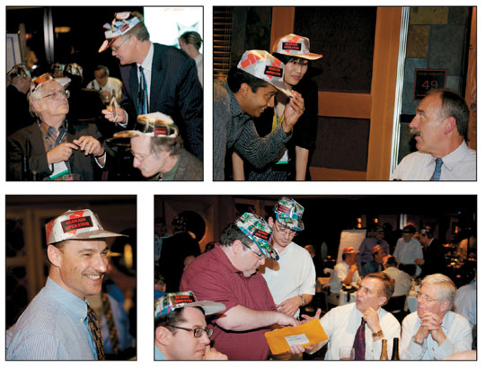
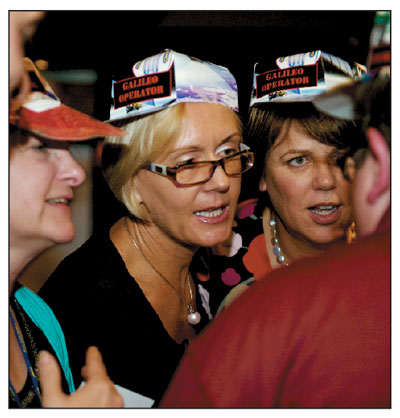
AC: In September, you participated in GPS World’s Grand Game of GNSS, playing for the purpose of the game the role of a member of the U.S. Industry group. Any lessons learned, perspectives gained?
Verhoef: First of all, Alan, it was a fantastic game. I want to congratulate you personally for having put this into the very enjoyable evening, it was certainly part of a lot of fun. It was fun to play U.S. industry, and my colleague from the State Department playing a European operator, a funny situation.
What I learned from this, if you slip into these roles, basically everybody has similar roles across the world, industry, governments, same roles. One can easily understand — whether I did learn anything particular from it, I did learn that one can have a lot of fun together.
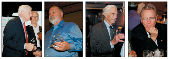
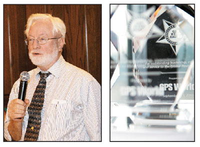
GPS World’s seventh annual Leadership Dinner, which took place during the ION-GNSS conference in Portland, Oregon, and was sponsored by Rockwell Collins, this year honored some of the surviving GPS Heroes (see May and June 2010 issues). PLUS: We invited 120 dinner guests to find out by walking a mile in someone else’s shoes, in the Grand Game of GNSS, a role-playing and negotiation exercise. Learn who won!
Recognition for the GPS Heroes
Leadership Dinner Speech by Brad Parkinson
Good evening. It is good to see you all. Particularly it is wonderful to see some of the surviving heroes of the Phase One Brotherhood who helped make GPS possible against desperate odds. We came together in 1972, and by 1978 had proven the dream. We could not fail. It is now hard to believe that it started 38 years ago.
Would the Phase One Heroes please stand and be recognized?
Engineers are usually destined to be forgotten. I wrote the two articles that many of you have seen in an attempt to remember the wonderful officers, aerospace engineers, and supporting contractors who made GPS a reality. All of you were needed.
I want to acknowledge my co-author, Steve Powers, my roommate as a midshipman back at the the Naval Academy and now a professional historian, for his help.
Unfortunately, both memory and space limited the numbers of early contributors to whom I could give credit. Alan Cameron has been extremely
helpful in publishing those articles and helping compile a list of the heroes. I would urge you to scratch your heads and add to the list of names.
And thanks to GPS World for this great dinner and gathering.
We could foresee many of the early uses of GPS. But we could not foresee hundreds of other uses. Perhaps most astonishing, the best GPS receivers now routinely resolve position in real time with accuracies better than a centimeter. This has opened up a whole new world of robotic control and tracking. It is a credit to the engineers who succeeded us and invented the techniques of real-time kinematic positioning.
The burden for maintaining and improving GPS has now been passed to yet another generation of leadership. I am particularly pleased that the JPO Director, or GPS Wing Commander, Colonel Bernie Gruber is here this evening. He is a worthy successor to the many fine program directors that GPS has had since I retired in 1978. He will have his hands full with keeping the torch lit, in particular with maintaining the size of the GPS constellation to ensure its availability for all users.
Bernie, we are very pleased to see you back with the GPS brotherhood. For those who are not aware of it, Bernie served in the user equipment area of GPS about 18 years ago. He certainly qualifies as a veteran of this program.
I propose three toasts:
To those who are now carrying the burden of GPS: the Joint Program Office, Aerospace, and the supporting contractors.
To those still alive who could not be here but who were the brotherhood of heroes who started it all, from 1972 to 1978.
Last, to those who are now dead, and gave so much to make GPS possible. The names of those that I know who are no longer with us: Mel Birnbaum, Val Denninger, Ivan Getting, Don Henderson, Gary Hahn, Ernst Jechart, Ken Schultz, Werner Weidemann, and Jack Barry.
If you know of others who have passed away, please tell me or e-mail me.
I would like to close with a paraphrase from Shakespeare: Henry V’s speech just prior to the Battle of Agincourt.
And a New Year shall ne’er go by,
From this day to the ending of the world,
When we in it, we engineers shall be
forgotten;
But we few, we band of brothers,
We shall remember that brotherhood and the sacrifices we all made.
For he that stood with me,
He that labored with us in the desperate early days of the GPS,
Shall be our brother.
Thank you all.
GPS World magazine and dinner sponsor Rockwell Collins, represented by Gary McGraw, then joined Dr. Parkinson to present small mementoes to these attending GPS Heroes:
Hugo Fruehauf, chief engineer at Rockwell International for design and development of the first GPS satellites, whose oversight was essential to producing the first GPS atomic clocks;
Gaylord Green, the first officer then-Colonel Parkinson brought onboard the new Joint Program Office, and who succeeded him as a JPO director several years later;
Ed Lassiter, who had extensive space-flight experience and led the early Aerospace contingent of engineers working on the system;
Ed Martin, who made significant contributions, collaborating on the early, important decision that the carrier, code, and data of the GPS signal would all be phase-coherent;
Brad Parkinson, first GPS JPO director;
Tom Stansell, a Transit expert who helped design the first GPS civil receivers at Magnavox;
Joe Strada, a key leader in the extensive test program, developing test environment and analysis setup;
AJ Van Dierendonck, who helped define GPS time and developed a modified Kalman filter for near-real-time orbital prediction;
Chuck Wheatley of Rockwell’s Autonetics Division, part of a team that built a space-qualified clock for the first GPS launch, February 1978.
Phil Ward, developer of Texas Instruments’ TI-140, an early commercial high-precision receiver;
Paul Weber, GPS JPO deputy program manager from the U.S. Army.
Gaylord Green, Joe Strada, and Paul Weber were among those honored for getting GPS off the ground, 1972–1978.Brad Parkinson proposes three toasts: to those now administering GPS, to those still living who launched the program but could not attend the dinner, and to those from that heroic group who have passed away.GPS pioneers Hugo Fruehauf, Brad Parkinson, and Ed Lassiter.(From left) Ed Martin, AJ Van Dierendonck, Chuck Wheatley, and Phil Ward.Tom Stansell, and the GPS Heroes glass memento.
The Grand Game of GNSS
How difficult can it be to build a satellite system, sustain an industry, or equip users? We invited 120 dinner guests to find out by walking a mile in someone else’s shoes, in the Grand Game of GNSS, a role-playing and negotiation exercise. Twelve teams represented system operators, industries, and user groups from the United States, Russia, Europe, and China. Operators and Users had money. Industries had satellites and receivers. Each wanted what the other had. For rules and results see env-gpsworld-integration.kinsta.cloud/wideawake.
• GLONASS operators Chaminda Basnayake (General Motors) and Di Qiu (Sigtem Technology) pay a call on Russian Industry captain John Betz (MITRE). • European Industry captain Sam Pullen (Stanford) checks inventory, as Sergey Karutin (Russian Institute of Space Device Engineering), Neil Gerein (NovAtel), Mike Shaw (Lockheed Martin), and Colin Beatty (Royal Institute of Navigation) mull strategy. • Scott Feairheller (U.S. Air Force) tries on another hat for size. • GLONASS operators Chaminda Basnayake (General Motors) and Di Qiu (Sigtem Technology) pay a call on Russian Industry captain John Betz (MITRE).Compass operator Anthea Coster (MIT) looks on as Galileo captain Dorota Grejner-Brzezinska (Ohio State University) and Jane Wilde (DW International) drive a hard bargain on European Industry.• (Clockwise from top left) China User Grace Gao (Stanford) puts on her business face. Captain Frank van Diggelen (Broadcom) recalls, “Grace, assisted by Sherman Lo, leapt into the fray, and was soon taking care of all the business 10 times more effectively than the rest of us together. We were left to tally the numbers, count money, and drink the wine — activities we found hard to keep up with, the speed with which Grace made things happen.” • Compass Operator Mike Whitehead (Hemisphere GPS) flashes a wad of several hundred million dollars at Russian industrialists John Lavrakas (Advanced Research) and Art Gower (Lockheed Martin), as U.S. Industry captain Matt Harris (Boeing) kibbitzes. • China Industry rep Frank Czopek (Boeing) negotiates with Russian industrialists Vince Massimi (MITRE) and Antje Tucci (University FAF Munich). • GPS Wing Commander Bernie Gruber finds a quiet moment to get the real story from (Mrs.) Ginny Parkinson.The Galileo team thinks they have won.The End of the Game. Ian Mallett (Australia Civil Aviation Safety Authority), Nunzio Gambale (Locata Corp.)
Engineers are an eager lot, by and large. They like talking about their work, openly showing information and results, testing their work against data and alternate hypotheses, getting feedback and even critique from colleagues near and far. They value an iterative, elaborative, collaborative process.
Politicians and business managers, on the other hand, tend to the dour. They would rather not show their hand, nor do they care to hear what you think of their organization’s work, citing intellectual property or national security reasons.
This is not just about last month’s abrupt withdrawal of a session’s worth of Galileo papers from the showcase rank of the European Navigation Conference (see story, page 14). It extends across governance of all GNSS, and ultimately affects the frontiers of knowledge everywhere. GLONASS has never been particularly forthcoming with technical details, while Compass has taken reticence to new heights. Or depths.
The socialist countries have not taken much heat for this practice, perhaps because it is assumed to be part of their political culture. Europe, on the other hand, surprises us a bit. It may be a sign of the changing of the times, the tightening of the GNSS space race. Once Galileo held unquestioned second place as the GNSS of choice to combine with GPS. No longer. GLONASS revives itself on practically a daily basis, and Compass goes about launching satellites with quiet regularity — although without much useful information on signal structure.
The GPS Wing of the U.S. Air Force deserves commendation for the frankness with which it has discussed recent problems. Even the Europeans admitted, “ION was a little better this year. The Americans talked about the failures they had, the problems with their ground stations and satellites.” At least one prominent U.S. government contractor, however, has moved in the opposite direction.
European system managers have grown cautious, and stress the importance of protecting intellectual property. “We were too open before.” The case of the behavior of atomic clocks, for example, comes up in discussion. “You take sx months to find a solution, and then give it away in one session. Knowledge, what you find out by trial and error, or even by accident, this is the most critical thing.”
From another quarter came this opinion: “Detailed information on tests is a clear transfer of technology. It’s not a matter of security, it’s business.”
Ironically, the Europeans have run into a stone wall of their own, after granting the level playing field that U.S. industry agitated for, in terms of access by foreign companies to Galileo contracts. A European satellite builder visited a U.S. company, on U.S. soil, prepared to solicit a bid. But the U.S. company’s compliance officer — charged with keeping all operations in line with government rules and regulations — repeatedly stood up in the meetings and told colleagues, “Stop talking about how you are doing it and just talk about what it does.”
Unable to obtain sufficient technical context to prepare a request for proposal, the European company walked away, thinking “They don’t want our business.”
The following was delivered as an invited presentation at the Civil GPS Service Interface Committee plenary session, held September 20 in Portland, Oregon.
Hi, my name is Alan, and I’m an accuracy addict.
I got my first taste of accuracy back in 2000 when I started at GPS World, and discovered the vast range of very advanced things that people were doing with the signals of the Global Positioning System.
This filled me with a great feeling of elation, expansiveness, and effectiveness. I can position anything. I can track anything. I can go anywhere, and know where I am. I can direct something else to go somewhere, and have it hit exactly on target. I can examine the minute movements of the earth, the swaying of skyscrapers, the moisture content of the atmosphere, and I can know all.
I began to feel the illusion of omnipotence — of power over all.
The more I found out about accuracy, the more I used it, the more addicted I became.
Very early, I learned that advanced practitioners, such as some of the people in this room, had developed ways of taking two GPS signals, not just one, but two signals, including one that they weren’t even entitled to use, and combining them, distilling them, refining them to produce an even more potent product: high precision.
High. I was getting pretty high. Almost as high as some of you.
Because we’re all in this together. In this room, we are all addicts. And when our supply of accuracy gets cut off, or restricted, or we learn that it might soon be diminished in some way, or even that its projected future rate of increase might not be as rapid as expected, or that it might not increase at all, it might just simply stay the same — well then, we get upset.
We want to get high precision, we want to stay high precision, and we want to get higher precision.
We may have a problem with our accuracy habit.
It’s not just us, the highly educated, highly equipped, highly advanced users, with near-lifelong histories of accuracy use. Outside this room, outside this convention center and all who gather here this week, outside our offices and labs, the great unwashed masses are getting their first taste of low-grade accuracy. With their cell phones or smart phones, maybe 50-meter, maybe 15-meter, maybe even 5-meter accuracy.
They’re liking it, that first taste. Once they learn how to exploit it, and learn that higher accuracy is possible, they’re going to demand it.
And some enterprising young engineers are going to build a high-powered LBS app that needs high accuracy, just like other new apps need broadband or WiFi or 3G or 4G. If the capability exists, someone wants to make money off it.
We may be raising a generation of monsters, who will absorb our habit into their bloodstreams and into their lifestyles.
Things might get ugly. We know they’re going to change, altering the landscape in ways we may not recognize.
I’m not talking about just the social landscape, the way accuracy users behave. Not just the user segment. I’m talking about the way accuracy is produced and administered. I’m talking about
the supply of accuracy, the supply of a substance that is in high demand and to which an increasing number of people are becoming addicted.
I’m talking about the ground control segment and the space segment.
Ultimately, I’m talking about who makes the decisions, who funds the decisions, who enacts the decisions, and who enforces the decisions about how much accuracy can and will be produced.
Today, we know, or think we know who those people are: the GPS Wing, the Air Force, the Department of Defense, the Administration of the U.S. government. We may think we know that those same people will be in charge tomorrow.
I’m not so sure. Revolutions have happened before.
I don’t mean to be U.S.-centric. The same developments are taking place, perhaps a bit lagged, in Europe and Russia and China. When the great mass of the Chinese market gets into using accuracy, gets the habit, you’re going to see some effects.
Returning to the United States, simply because it has the most known and most established of these systems, it is not inconceivable that some Tea Party-like movement, a groundswell should roll right up to Washington, into Congress, and say:
“Higher accuracy is possible. We are paying for GPS with our taxes, and we want you to spend that money producing and supplying us with a higher grade of accuracy. Don’t give us this talk of responsible stewards. We are calling the shots now. Just do it. Revise the ICD. Up the ante.
“Give me accuracy or give me death.”
Ladies and gentlemen, I have expanded, exaggerated only slightly, and perhaps exploded the old dictum that I’ve heard attributed to Charlie Trimble, I don’t know who first said it, but it bears repeating and repeating often: accuracy is addictive.
Indeed it is. I’m here to tell you.
I was asked to give you a user perspective. I’ve chosen what is today a relatively small user segment, but a very real one, and a growing one. And most important, one that augurs for the future.
Perhaps the scenario I just imagined for you exaggerates a bit. Perhaps. I am consciously trying to push further out the boundaries of our thinking.
We’ve been waiting, some of us, for a long time for the mass market to get involved in GPS. This is now happening, bit by bit. But it has not yet fully happened. When it does, great changes will come. When LBS figures out the key to making money out of location, you’ll see changes you can’t imagine today.
I started to become aware of how pervasive and how strong accuracy addiction has grown when we experienced a succession of anomalies in the GPS constellation over the last year or so: SVN-49, the last IIR-M satellite; carrier-phase anomalies detected on SVN-48; and now SVN-62, a small variance in the L5 signal on the first IIF. “The signal variation results in no more than a 5-centimeter error with a predictable periodicity of about six hours.”
In each case, GPS performed within spec, and some therefore viewed these issues as non-issues. “What seems to be lacking is context: what relevance their findings on unspecified and unrequired signal characteristics really have to do with the real-world GPS IIF mission and requirements.”
I’ve repeated here two printed quotes in the magazine; offline, the point-counterpoint discussion grew a good deal more inflamed. Passions run high when the supply and quality of accuracy appears in question.
This might seem a minor flare-up today, off in a corner of the field: specialized scientific research spatting with industry giants and their military-industrial complex benefactors.
But today’s developing applications in aviation, ground transportation, structural monitoring, machine control, infrastructure, and more use techniques such as carrier phase that are not governed, are not even mentioned in the GPS ICD.
When LBS gets figured out, and high-accuracy LBS and vehicle navigation and crash avoidance become regularly supplied commercial services, when the dependence of financial and communications infrastructure on high precision becomes fully understood and appreciated, then you’ll see some large corporate money that has become accuracy-addicted. Imagine this room in another few years, with GM, Ford, Google, Microsoft, AT&T, and Verizon attending and very interested, very much so, in aspects of user accuracy that are not currently addressed in the ICD.
This community will change. Its needs will change. Balances of power and funding will shift. Are we prepared for that? Are we prepared to be surp
rised? Or are we prepared only to be left behind by tides of change, to become obsolete?
As this issue goes to press in late August, the first Japan Aerospace Exploration Agency Quasi-Zenith Satellite System (QZSS) space
vehicle, nicknamed Michibiki, holds steady for a September 11 launch.
QZSS will use multiple satellites in inclined orbits, placed so that one satellite always appears near zenith above Japan, well known for its high-rise cities. The design provides high-accuracy satellite positioning service covering almost all of the country, including urban canyons and mountainous terrain.
QZSS Phase One will validate technological enhancement of GPS availability, performance, and application. Phase Two will demonstrate full system capability using three QZSS satellites, including Michibiki.
The satellites will generate and transmit their own signals, compatible with modernized GPS signals. QZSS also transmits GPS corrections and availability data.
Michibiki Profile. Dual-box shape with wing-type solar-array paddles; overall dimensions, 2.9 x 3.1 x 6.2 meters, paddles extending 25.3 meters; weight approximately 4,000 kilograms; altitude approximately 32,000–40,000 kilometers; inclination approximately 40 degrees;
period, 23 hours 56 minutes.
Compass. In early August, the first Beidou/Compass inclined geosynchronous orbit (IGSO) satellite achieved near-geosynchronous orbit. The mean east longitude of the sub-satellite ground point is currently 117 degrees, 19 minutes (see figure 1). This is one of the first, if not the first, satellite to use such a highly inclined circular geosynchronous orbit.
Figure 1. Left, the orbit path of three QZSS satellites will eventually keep at least one of them directly over Japan at all times. Right, the inclined geosynchronous orbit of the fifth Compass satellite, launched in July, has a similar ground track and mission goal.
Multi-GNSS Campaign. An international collaboration is poised to take advantage of a coming proliferation of satellites, led by Compass and QZSS but also including GPS, GLONASS, and Galileo, over the Asia/Pacific region. The website www.multignss.asia/campaign.html states, “The Asia and Oceania region is a unique place where the number of usable modernized navigation satellites will increase much faster than other areas in the world. We will see great improvement of PNT capability and hence there is a great opportunity to try, test, and validate new receiver hardware, algorithms, and applications in order to address user requirements.”
The web page also carries an animation of the availability of more than 100 GNSS space vehicles that will operate over the region in the next decade. An initial campaign workshop in Bangkok, Thailand, in January drew 195 participants from 18 countries. A second workshop is scheduled for November 21–22 in Melbourne, Australia.
GLONASS September. Three GLONASS-M satellites to be launched on September 2 completed pre-launch testing and mating to the upper stage of the booster rocket at Baikonur Cosmodrome. Numbered 36, 37, and 38, the satellites will constitute the Block 42 triad.
GPS III Design: Done. The Lockheed Martin team developing GPS III has successfully completed the program’s Critical Design Review (CDR) phase, two months ahead of baseline schedule. CDR completion validates the detailed GPS III design to ensure it meets warfighter and civil requirements. It culminates many rigorous assembly, subsystem, element, space vehicle and system-level CDR events, validates the overall design maturity of the GPS III space vehicle, and allows Lockheed Martin to enter production phase. Col. Bernard J. Gruber, U.S. Air Force GPS Wing Commander, certified the completion. Lockheed Martin, ITT, and General Dynamics are working under a $3 billion development and production contract for up to 12 GPS IIIA satellites. The team is on track to launch the first GPS IIIA satellite in 2014.
GPS Interface Specs. New IS-GPS-200E, IS-GPS-705A, and IS-GPS-800A documents have been posted to www.gps.gov/technical.
SVN62 Rubidium Clock. The U.S. Naval Research Laboratory issued a preliminary report on the rubidium atomic clock currently in use on the SVN62 Block IIF satellite. While documenting excellent short-term performance, the report notes anomalous fluctuations in the clock signal with distinct 12-hour and 6-hour periodicities. The exact cause has not been identified although it is speculated that the fluctuations are of thermal origin like SVN-62’s L5 phase variance detected earlier. But note that the clock signal analysis relies only on L1 and L2 measurements.
GPS IIF Got Active. The 50th Space Wing’s 2nd Space Operations Squadron formally took over command and control of the first Block IIF satellite on August 26 from the GPS Wing, and the satellite was set healthy on August 27, making 31 healthy GPS satellites on orbit.
Advisory Board Update
GPS World Editorial Advisory Board member Art Gower has been elected a Lockheed Martin Fellow, an honor recognizing pre-eminent technical individual contributors in the company, delivering mission success and vision by undertaking the most difficult technical challenges facing the company and its customers. Art started his career with IBM Federal Systems Division (now part of Lockheed Martin Integrated Systems and Global Solutions) in 1983, developing displays and performing navigation upload and command and control system engineering for the GPS control segment, and becoming chief engineer for the GPS control segment in 1990. He has spent the majority of his career working on GPS, GNSS, and SBAS systems.