Author: Eric Gakstatter

  • Sources of Public, Real-Time, High-Precision Corrections

    I probably reminisce a bit too much at times, but I can’t help but think back to the ’90s, when obtaining three-meter accuracy via post-processing took a bit of planning. You either had to operate your own GPS base station, or you had to find a publicly available one before you went to the field to make sure you had a source of base station data. Remember, back then publicly available CORS weren’t very common.

    Then, towards the late ’90s, there were enough publicly available GPS CORS in the U.S. that you could collect data in the field without knowing where the closest base station was located, but you knew GPS base stations were so prolific that you could find one close enough to use for post-processing without prior planning/coordinating.

    Then, sources of real-time GPS corrections started through the same progression. In the ’90s, if you wanted real-time corrections, you either had to operate your own GPS base station and wireless datalink or, if you were lucky you were close to a U.S. Coast Guard beacon transmitter, which were few a far between. OmniSTAR was an option, but subscription was a quite a bit more expensive back then and the equipment was bulky.

    Today, post-processing is a no brainer. You don’t even need to have to license post-processing software. Through the National Geodetic Survey’s OPUS, Austraila’s AUSPOS and Canada’s CSRS-PPP, you can collect GPS data anywhere in the world, submit it to one of these free, online processing centers, and have the answer in your email inbox in a few minutes. But, as I’ve lamented more than once over the years, post-processing is a dinosaur. Mind you, it will never go away completely, but it doesn’t belong in the typical mainstream data collection workflow. It just doesn’t make sense.

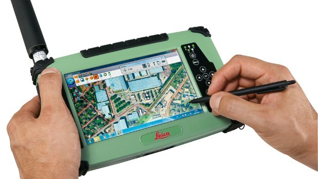
    As it was 20 years ago and as it is today, the challenge with real-time GPS/GNSS data collection is the wireless datalink. If you’ve ever worked with real-time GPS/GNSS data collection and had a unreliable wireless data link between the base and your receiver, you know what I mean. It’s exceedingly frustrating and unproductive. However, when everything is working as designed, the real-time GPS/GNSS data collection workflow is a thing of beauty.

    Sources of high-precision real-time GPS/GNSS corrections are still a rather disparate group of public and commercial services that depend heavily on geography and communications infrastructure. For example, in the U.S. there is plenty of wireless coverage (GSM, CDMA, Wi-Fi) in metro areas and along major interstate roads, but there are still vast areas of rural farmland, prairie and desert where wireless networks don’t reach, leaving the choice of either satellite-based communications or setting up your own private wireless communications (UHF/VHF/900 MHz) between a base station and your receiver.

    That said, there are more choices for real-time, high-precision GPS/GNSS corrections than ever before. In fact, just last week, the International GNSS Service (IGS) announced that it has started to offer a global real-time PPP data stream for high-precision, dual-frequency GPS receivers via NTRIP. That means anyone with a dual-frequency GPS receiver and an Internet connection can achieve sub-decimeter accuracy anywhere in the world, free of charge. How exciting is that! I think about the regions of the world like South America, Central and Southern Africa, Australia, and parts of Asia that aren’t served well by public SBAS or other free sources of high-precision GPS/GNSS corrections. This service will open up those regions to a new level of real-time, high-precision positioning. There’s one catch though; GPS/GNSS receiver designers have to implement special firmware to use the IGS RT PPP service. Some manufacturers are talking about implementing this, which would be a boon for the high-precision GNSS user community. Global IGS RT accuracy = ~10 cm.

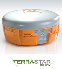
    Of course, OmniSTAR, Fugro, Starfire, Veripos have been providing real-time PPP for years  (as well as Terrastar and Trimble more recently) in their respective vertical markets (land and offshore) but it requires an annual subscription fee and specialty hardware (L-band) to receive the signal. The receiver hardware can be prohibitively expensive for some potential users, and their coverage, based on leased communications satellite footprint, isn’t dependent on local Internet connectivity. However, I will say that OmniSTAR subscription pricing is very competitive now, and that a public service like what IGS is offering has no guarantees of availability or accuracy. On the other hand, since commercial services like OmniSTAR are collecting a fee, they have an obligation to service their users. Nevertheless, public, sub-meter SBAS services like WAAS, EGNOS, MSAS, GAGAN, and SDCM are offered to non-aviation users on the same terms as IGS, and those services have worked out very well for our surveying and mapping user community.

    Other public sources of high-precision GPS/GNSS corrections are on the rise:

    RTK Networks. RTK networks continue to proliferate. In the U.S., many states offer free access to their centimeter-level statewide RTK networks. These are somewhat well-known within the surveying and agriculture community, but not as well known within the GIS community. Many countries also offer regional and country-wide RTK networks. RTK network accuracy = 1-2 cm.

    WSRNMap2011
    Washington State RTK Network
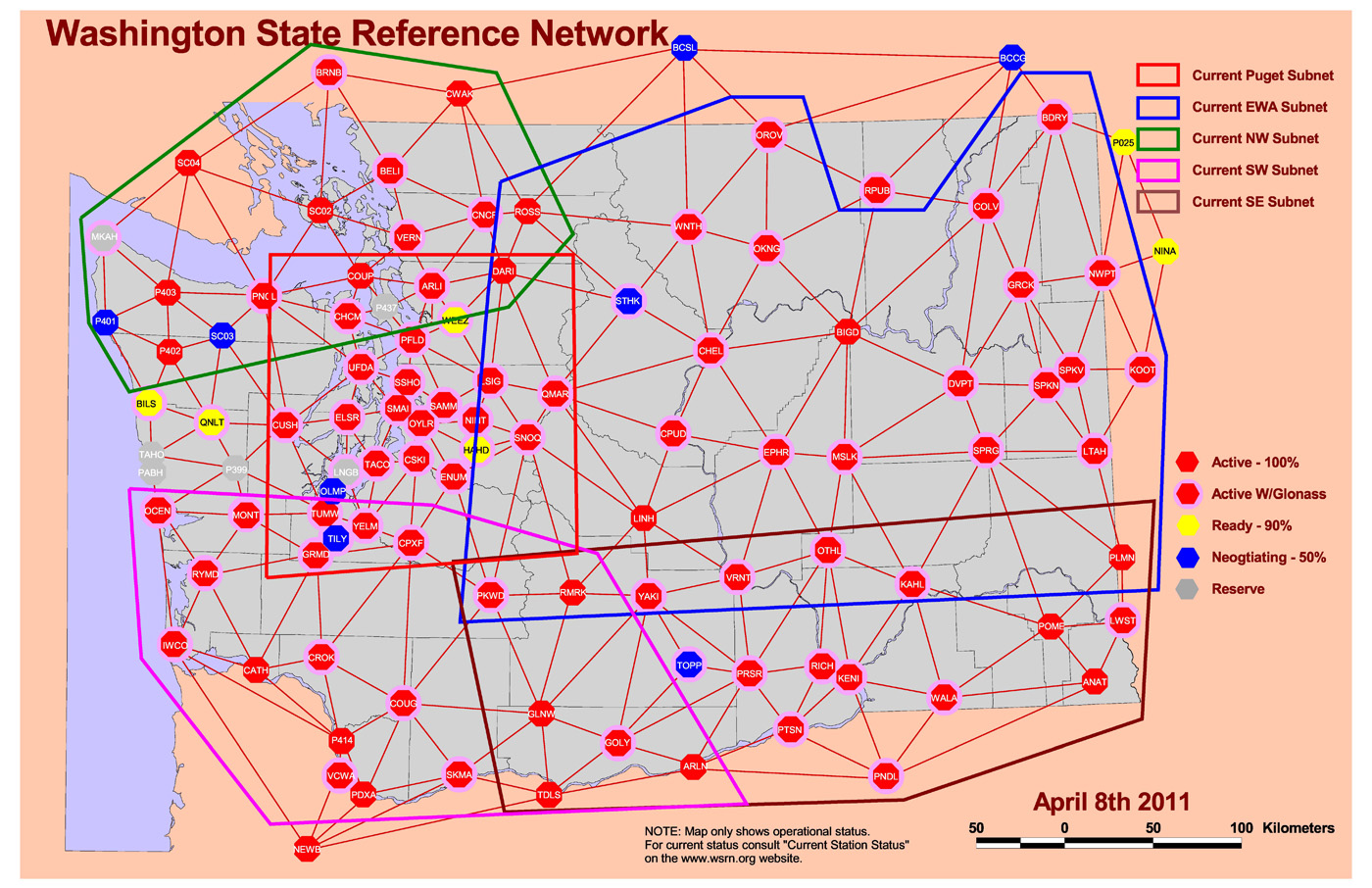
    Source: Washington State Reference Network. http://www.wsrn3.org/

    PBO real-time streaming. In the western U.S., UNAVCO’s Plate Boundary Observatory (PBO) maintains more than 1,000 GNSS base stations with many of them broadcasting RTCM3-formatted data. If you’re in California, Oregon, Washington, and the surrounding states, you should take a look at its website. The only requirement is that you have a receiver capable of handling RTCM3 data and you have Internet access in the field. You’ll also need an NTRIP client software (there are free ones available) running on your data collector (smartphone, handheld, tablet). Note that these are single baseline solutions (as opposed to the RTK network solution), so the further you are from the base station, the more error will be introduced. One caveat: be sure you understand which horizontal datum and epoch the particular PBO base station is streaming. PBO real-time streaming accuracy within 20 km = 1-2 cm.

    PBORealtime
    PBO Station Streaming Map
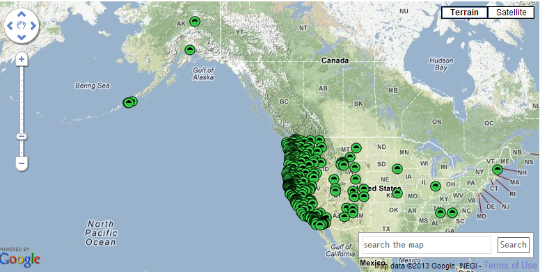
    Source: UNAVCO Plate Boundary Observatory. http://pbo.unavco.org/data/gps/realtime

    CORS Streaming. The National Geodetic Survey (NGS) is testing real-time streaming from nearly a couple of dozen CORS sites, mostly in the Eastern U.S. This is very similar to PBO real-time streaming. If you are 50-75 km from the base station, you’ll still be under 10 cm. If you’re within 20 km, you’ll be down to 1-2 cm.

    SBAS. SBAS (WAAS/EGNOS/MSAS/GAGAN/SDCM) was the first true source of public, country-wide high-precision GPS corrections. What make SBAS so easy is its ergonomics. It’s become such a standard that virtually every high-performance GPS/GNSS receiver designed today has SBAS capability built-in. You don’t need to purchase any extra hardware or software to use it. SBAS accuracy = sub-meter (with a receiver designed to optimize WAAS).

    SBAS_World_20121212_Extrapolated
    Global SBAS Coverage Map
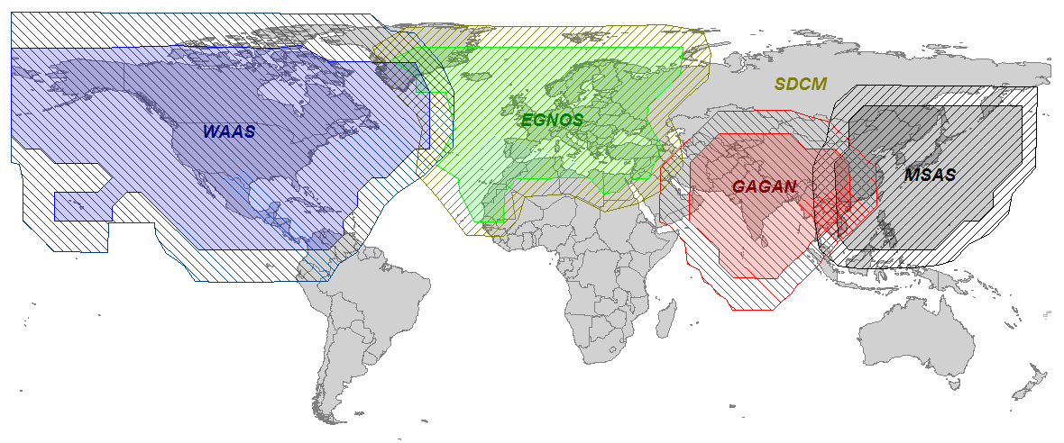
    Source: Geneq, Inc. www.sxbluegps.com

    There’s no doubt that years from now, we’ll look back and be amused at how “difficult” and expensive real-time, high-precision positioning was. Today, there are many more sources of high-precision, real-time GPS/GNSS corrections than there were ten years ago. In ten years, there may or may not be many more choices for high-precision GPS/GNSS corrections, but certainly the sources will be less complex, more ubiquitous and more convenient than they are today.

    For the latest GPS/GNSS news, follow me on Twitter by clicking here.

    Thanks, and see you next month.

  • US Geological Survey Report: What is the Economic Value of Satellite Imagery?

    Does remote-sensing information, such as that from Landsat and similar Earth-observing satellites, provide economic benefits to society, and can this value be estimated? Using satellite data for northeastern Iowa, U.S. Geological Survey scientists modeled the relations among land uses, agricultural production, and dynamic nitrate (NO3) contamination of aquifers. They demonstrated that information from such modeling can allow more efficient management of agricultural production without sacrificing groundwater quality. Just for northeastern Iowa, the value of such remote-sensing information was shown to be as much as $858 million ± $197 million per year, which corresponds to a current value of $38.1 billion ± $8.8 billion for that flow of benefits into the foreseeable future.

    fs2013-3003_Image

  • SuperGIS Server 3.1a Officially Launched Globally

    Supergeo announced that SuperGIS Server 3.1a Value Edition and Standard Edition are officially launched globally.

    SuperGIS Server 3.1a

    According to the announcement, SuperGIS Server is designed for enabling organizations to create, manage, integrate and publish the various types of GIS services. Through SuperGIS Server, spatial data and spatial images of all types as well as GIS functions can be applied as GIS services in desktop, mobile and web applications over the internet to assist enterprises in building ideal workflow and improving productivity.

    The newest SuperGIS Server 3.1a mainly adds geoprocessing service publishing functions and enhances the efficiency of map cache tools. Besides the functions in Value edition, SuperGIS Server 3.1a Standard Edition additionally provides developers with Mobile SDK to customize mobile applications which can access SuperGIS Server services and meet various requirements.


  • California’s GeoPortal to Improve Access to Valuable Geographic Information

    The California Technology Agency has launched the California GeoPortal, an interactive and user-friendly gateway to thousands of geographic data sources around the country.

    “California’s new GeoPortal organizes important geographic data and makes it more accessible and useful,” said Secretary Carlos Ramos. “This innovation increases government transparency, boosts efficiency and saves the State money.”

    According to the announcement, the California GeoPortal helps find solutions to real-world problems such as locating a new business or helping choose a new place to live. The GeoPortal gathers thousands of data sources such as demographics, environmental hazards, school information and transportation, and makes the information more accessible and useful. The GeoPortal strengthens these databases by combining information and making it customizable.

    “For the first time in our history, California is taking a statewide approach to sharing data and mapping it to provide a visual location based view for our stakeholders – both public and private industry,” said Scott Gregory, California’s Geographic Information Officer. “By making these diverse resources accessible and relevant, it becomes a very efficient and powerful decision making tool for all Californians.”

    “The GeoPortal is a groundbreaking tool enhancing collaboration and data sharing among the public and private sector,” said Carl Guardino, the Chief Executive Officer of the Silicon Valley Leadership Group. “Business will have accurate and relevant data at their fingertips, supporting their decisions to help grow California’s economy.”

    The announcement stated that California’s GeoPortal is a comprehensive catalog of thousands of data sources from federal, state, county, city, tribal and education geographic resources. Users can access the GeoPortal from the web without having to login to another system, streamlining access to government derived and developed data.

    “The ability to share geospatial data through a single public source will be a tremendous benefit to the academic institutions in California,” said Dr. Shawna Dark, Department of Geography Chair, California State University, Northridge.

    The GeoPortal is a service offering by the California Technology Agency to state and local agencies and departments at no cost. It is a tool to be leveraged by organizations to catalog and manage their geographic data resources. Organizations will be able to register their geographic data content on the GeoPortal and securely manage their information. It has a robust set of management tools that allow organizations to edit, upload and maintain geographic information. The end result is a more comprehensive and authoritative data resource for geographic data in California.

    For a video introduction to the California GeoPortal, visit here.

    The California GeoPortal is available at http://portal.gis.ca.gov/geoportal/

  • Crowd-Sourcing the Nation: Using Volunteers for Enhanced Data Collection

    The USGS announced it is expanding the involvement of volunteers to enhance data collection about structures for The National Map.

    This program, known as The National Map Corps, focuses on encouraging citizens to collect data relating to structures by both adding new features and/or correcting existing data within The National Map database. These structures can include schools, hospitals, post offices, police stations and other important public places.

    According to the announcement, collaborative pilot projects in Colorado were recently used to test the concept of crowd-sourcing. While the project is on-going, early indications point to positive results and show the success of using TNMC volunteers to enhance data sets.

    The USGS reported that over a trial period of ten months, 143 volunteers collected, improved, or deleted data on more than 6,400 structures in Colorado. The volunteers’ actions were accurate and exceeded USGS quality standards. In the Colorado pilot project the volunteer-collected data showed an improvement of approximately 25 percent in both location and attribute accuracy for existing data points. Completeness, or the extent to which all appropriate features were identified and recorded, was nearly perfect.

    The significant results of the Colorado pilot have led to a phased, nation-wide expansion of the crowd-sourcing /volunteer project. The states in the first expansion of TNMC are: Arkansas, Alaska, Colorado, Delaware, Georgia, Idaho, Maryland, Michigan, Montana, North Dakota, New Jersey, New Mexico, Ohio, Oregon, South Carolina, Utah, Washington, West Virginia

    After an evaluation of the quality and procedures of the first group of states, the second set will be made available. Ultimately, by the end of 2013, the third batch of states will complete the expansion of the program.

    “The response by volunteers in Colorado exceeded our expectations both in terms of the number of volunteers and the quality of the data they collected”, said Kari Craun, the Director of the USGS National Geospatial Technical Operations Center. “The Volunteered Geographic Information (VGI) community represents a fantastic, untapped resource to assist USGS in maintaining data that are part of The National Map.”

    While some familiarity with the area that a volunteer chooses is helpful, one doesn’t have to live near a particular place to contribute. The tools on TNMC website, along with ancillary information available on the Internet, are generally sufficient to edit a distant area.

    There have been several instances of crowd-sourced geographic information making significant contributions to research and databases in government, private sector, and non-profit organizations. The goal of the TNMC is to provide data for the nation’s primary federal mapping agency in its effort to provide accurate and authoritative spatial data via the web-based National Map.

    The citizen geographers/cartographers who participate in this program will make a significant addition to the USGS’s ability to provide accurate information to the public. Data collected by volunteers become part of TNM Structures dataset which is available to users free of charge.

    Without a network of volunteers, the desired information would not be collected this year and the existing data would not be updated. TNMC volunteers perform important work that otherwise will not be accomplished in the foreseeable future.

    Becoming a volunteer for TNMC is easy; go to the National Map Corps website to learn more and to sign up as a volunteer. If you have access to the Internet and are willing to dedicate some time to editing map data, we hope you will consider participating!

  • Esri and Geofeedia Expand Social Media with Location Analytics

    Esri and Geofeedia announced plans to extend the ArcGIS platform with Geofeedia’s social media tools. Public safety professionals will be able to advantage of these capabilities to accurately integrate, monitor, analyze, and visualize live emergency data as events unfold. Deploying assets and personnel, understanding of events on the ground, adjusting response on the fly, and post-event monitoring are all improved using social media combined with location analytics.

    “Geofeedia is an innovator in location-based social media,” says Ryan Lanclos, emergency management manager, Esri. “Both organizations recognized that understanding location provides context and value to social media. Ultimately, this improves meeting mission demands.”

    “Esri is an industry leader and provides the ideal enterprise platform to visualize and analyze real-time social media feeds from Geofeedia,” says Phil Harris, CEO of Geofeedia. “Location-based social media data layers from Geofeedia combined with Esri’s technology and vast repository of other layers give public safety officials the best combination of real-time intelligence for response efforts.”

    According to the announcement, the real-time data integration, searching and streaming will work across multiple social media platforms including Twitter, Instagram, Flickr, YouTube, and Picasa. Geo-located tweets, photos, and videos can be viewed within the context of digital imagery, street networks, topography, and community base maps. The social data can be mashed up with other information such as public safety assets, city infrastructure, utility networks, hazardous materials, demographic data, and more. Additional dynamic data including weather, automated vehicle location, GPS, and traffic video camera feeds can be combined with social and map data. In addition, people can perform historical social media analysis to identify trends and patterns.

    In addition to public safety, professionals in government, national security, healthcare, and insurance will be able to extend the ArcGIS platform by adding intelligence about social conversations. This includes social media sentiment, location, population profile, and temporal and spatial trend analysis. Adding intelligence improves security, crisis response and business continuity, event monitoring, marketing, compliance, and more.

  • CMTINC.com Introduces Cruise Angle iCMT App for iOS

    CMTINC.COM has released its Cruise Angle iCMT software application for the Apple iPad and iPhone. This app will turn the iPhone, iPod or iPad into an angle gauge for selecting sample trees for timber cruising.

    According to the announcement, when using the point sampling method for timber inventory, the forester or small woodland owner first determines a suitable Basal Area Factor (BAF) for the timber stand. Then the corresponding angle gauge is used to select the sample trees. At each sampling point, the trees are scanned through the opening of the angle gauge. Any tree that completely fills the opening is deemed a sample tree. Instead of bringing along a few angle gauges, one could just use the Cruise Angle iCMT app on the iOS device to pick the sample trees. The app will automatically compute the basal area per acre for the sample point.

    iPhoneArea    iPhone_Limiting-Distance    iPhone_OUT-Tree

    Function highlights for Cruise Angle iCMT:

    * Work with Metric and English measurement units.
    * Calibrate the gauge or enter the camera FOV angle value.
    * Change the color and transparency of the on-screen angle gauge.
    * Select from a list of commonly used BAF values.
    * Tally the sample trees for the occupied point.
    * View the Basal Area per Acre for the occupied point.
    * Check borderline trees based on limiting distance calculation.
    * Calculate the actual stem length of a leaning tree.
    * Convert between horizontal distance and slope distance.
    * Measure distances on the displayed Map.
    * Measure an area on the displayed Map.

    According to the announcement, the Node Tool in this app will let the user drop nodes precisely to delineate a line or an area to view the measurement value. One could also add the GPS location as a node for determining distance or area.

    This app is now available from the iTunes App Store.

  • RTK GNSS Receivers: A Flooded Market?

    Wow, if one counts the number of new RTK GNSS receivers introduced in the past ~six months, it’s impressive. If you’re in the market for such a GNSS receiver, this is good news for you. More competition in the product and distribution side of the equation usually means better products and better service for the consumer. While Trimble, Leica and Topcon still dominate the majority of RTK GNSS receiver sales in North America, it’s pretty clear that others are eating away at their market share, and most of the new competitors don’t even design their own RTK GNSS receivers! The high-precision user community has more choices for high-performance RTK receivers than ever before even though there are only a handful of companies capable of designing reliable RTK GNSS receivers:
    image005

    • Trimble
    • Leica/Novatel
    • Topcon/Sokkia
    • Hemisphere GNSS
    • JAVAD GNSS
    • Septentrio
    • Ashtech (owned by Trimble)
    • Navcom Technology (owned by Deere & Co.)

    Some of you may think that I should include “consumer” GNSS chipset designers like GlobalLocate/Broadcomm, SiRF/CSR, u-blox, NVS Technologies, etc. While some of the engineers at consumer GNSS chip companies clearly have the knowledge (and experience in some cases) of RTK design, none of these chipsets are integrated into commercial RTK products. Yes, I know some of you have “made RTK work” with consumer GNSS chipsets, and I think that speaks volumes about where RTK capability will end up, but it’s not quite there yet with respect to a reliable commercial implementation.

    image007Regardless of consumer GNSS chipsets, the multi-constellation, multi-frequency RTK GNSS receiver landscape is changing quickly, even before the deployment of the new L5 signal and Galileo as I’ve written about previously (Why the Price of Precision Receivers Will Drop). This is because of the proliferation of RTK GNSS receiver “boards” such as the Trimble BD series, Novatel OEM series, Hemisphere GNSS P series, and Septentrio AsteRx series. System integrators like Altus, Geneq, CHCNav, Stonex, FOIF, Carlson, etc., are scooping up these proven receiver boards and designing their own systems around them.

    There are more RTK GNSS system integrators in China than any other geographic region in the world. It makes sense because the Chinese market for RTK GNSS receivers is larger (much larger) than any other market in the world. Even though you don’t see many Chinese-made RTK GNSS receivers sold in North America (you do see them sold in Africa, Europe and South America), they sell a huge number of them within China. I would even go as far as to say that the North American market is likely considered a “leftover” market since the North American RTK GNSS receiver sales volumes are so low in comparison. In other words, North America is such a small market for RTK GNSS receivers, it’s not worth the marketing/selling effort it requires. That said, some companies, like CHCNav, are ramping up their marketing and selling efforts in North America.

    To put it in perspective, let’s take a look at some of the new RTK GNSS products (and services) introduced in the past ~6 months (in alphabetical order). I’m sure I’ve left some out because there are so many on the market, but this gives you an idea of the broad range of RTK GNSS receivers available. Again, these are products introduced just in the past ~6 months.

    Altus APS-3L

    Key benefit: Integrates Terrastar’s new 10cm real-time precise positioning service. Uses a Septentrio GNSS receiver board.

    Carlson SuperG

    Key benefit: Tablet-based RTK GNSS system capable of 1cm real-time accuracy. Uses a Novatel RTK GNSS receiver board.

    CHCNav X900+ GNSS

    Key benefit: Low-cost RTK GNSS made in China. Uses a Novatel RTK GNSS receiver board.

    FOIF A30

    Key benefit: Low-cost RTK GNSS made in China. Uses a Trimble RTK GNSS receiver board.

    Geneq SXBlue III-L

    image003Key benefit: Low-cost, palm-sized receiver integrates OmniSTAR’s G2/HP/XP 10cm service and also 1cm RTK capability. Uses a Hemisphere GNSS receiver board.

    Hemisphere A325 GNSS Smart Antenna

    Key benefit: All-purpose, low-cost RTK GNSS receiver.

    Javad J-Shield

    Key benefit: Innovative radio frequency (RF) interference visualization (onboard spectrum analyzer) and interference reporting feature.

    Leica CS25 GNSS

    Key benefit: Tablet-based RTK GNSS system capable of <10cm real-time accuracy.

    Navcom StarFire Over IP

    Key benefit: 5cm (horizontal RMS) real-time correction service delivered via IP (Internet Protocol) as an alternative to delivering via satellite communications.

    Sokkia GRX-2

    Key benefit: Low-cost, lightweight (1.00kg) RTK GNSS receiver. Same as Topcon HiPer V.

    Topcon HiPer SR

    image001Key benefit: Palm-sized, lightweight (.85kg) RTK GNSS receiver capable of surviving a two meter drop.

    Spectra Precision ProMark 700

    Key benefit: Lightweight (.65kg) RTK GNSS receiver. Uses Trimble RTK GNSS receiver board.

    Stonex S9III

    Key benefit: Lightweight (1.2kg) RTK GNSS receiver. Uses Trimble RTK GNSS receiver board.

    Terrastar Terrastar-D Satellite Correction Service

    Key benefit: World-wide, real-time 10cm (horizontal 2DRMS) GNSS correction service delivered via satellite.

    Trimble R-10

    Key benefit: Lightweight (1.12kg) RTK GNSS receiver.

    Trimble RTX

    Key benefit: World-wide, real-time 4cm GNSS correction service delivered via satellite.

    Looking at this list, there are two key trends:

    1. RTK GNSS receivers are becoming smaller. Moore’s Law, or a GNSS version of it, is definitely in effect.
    2. The price of RTK GNSS receivers is falling, as low as US$7,000 (retail price) for a full RTK GNSS receiver in North America and likely less than that in other parts of the globe.

    image009Another clear trend is the advancement of global GNSS augmentation services (OmniSTAR, StarFire, Terrastar, Trimble). RTK networks are great when you have access to them, but in many places of the world, RTK networks aren’t available or there isn’t a data link (wireless network) available to receive corrections. This has created an opportunity for satellite-based (and Internet-based) global correction services. Whereas OmniSTAR (serving the agriculture and mapping markets) and StarFire (serving primarily the agriculture market) have been long-term players in this market, Terrastar recently announced its entry into the market and Trimble (who also owns OmniSTAR) announced its new RTX service.

    The advantage of satellite-based correction services is that you can receive them virtually anywhere in the world as long as you have a clear view of the sky. The disadvantage is that the initialization time it takes to achieve the stated real-time accuracy (<10 cm) is up to one hour if you aren’t starting on a known point. The addition of GLONASS helps reduce the initialization time, but it’s still much longer convenient than RTK initialization due to the sparse network of reference GNSS receivers used.

    Furthermore, the accuracy provided by the satellite-based correction vendors isn’t as good as RTK. OmniSTAR and Terrastar advertise 10-cm (horizontal 2DRMS) real-time accuracy. StarFire advertises 5-cm (horizontal RMS, as opposed to 2DRMS values given for competing services) real-time accuracy, and Trimble RTX advertises 4-cm (horizontal 2DRMS) real-time accuracy. RTK accuracy is solid at 2-cm or less.

    Lastly, in order to access satellite-based correction services, GNSS receivers must be specifically designed (additional hardware is required), so the reality is that few receivers on the market are capable of utilizing these services. But, if you’re performing mapping work across a large geographic area where RTK networks aren’t consistently available and you don’t want the go through the pain of owning, maintaining, and setting up your own RTK base station, the satellite-based correction service is a solid solution.

    For more information on these satellite and internet-based correction services, GPS World’s Tony Murfin published a detailed article this month entitled “Look, No Base-Station! — Precise Point Positioning (PPP)“. Tony offers some detailed insight into these services.

    Nightmare on GIS Street: Accuracy, Datums, and Geospatial Data

    Changing the subject a bit, but highly related to RTK GNSS receivers, is the subject of datums and geospatial data. Last month, I wrote an article for Geospatial Solutions that is a first in what promises to be a very interesting and complex discussion. I received quite a bit of email on the article with many good points made. If you think you know how to handle horizontal datums in a GIS environment, you might want to take a look at the article and follow the thread over the next few months. You can read the article by clicking here.

    Thanks and see you next month

    Follow me on Twitter by clicking here.

  • 3D Mapping & 3D Modeling Market worth $7.7 Billion by 2018

    According to a new market research report “3D Mapping Market: Global Advancements, Business Models, Technology Roadmap, Forecasts and Analysis (2013 – 2018)“, the 3D mapping and 3D modeling market is expected to reach $7.7 billion by 2018 at a CAGR of 47.9% from 2013 to 2018.

    According to the announcement, 3D mapping technology is one of the fastest and most complete ways to build 3D-environments in the market today. 3D mapping solutions enabled the user to swiftly build three-dimensional maps of the surroundings with supreme accuracy and clarity, ready to plug into professional visualization systems. With investments towering up for 3D maps applications to be introduced to smartphones, market players such as Nokia, Samsung and other smartphone companies have indicated string interest in this market. The 3D-enabling devices like sensors, cameras, scanners, GPS components, and other acquisition devices create huge potential in this market. The improvised 3D experience on smartphones, tablets, notebooks, PCs, cars, etc. is set to revolutionize the mobile device market and other GPS-enabled device market by broadening the horizons for the users to locate things easily using any device.

    The report stated that the 3D mapping and 3D modeling total market is expected to grow from $1.1 billion in 2013 to $7.7 billion by 2018, at an estimated Compound Annual Growth Rate (CAGR) of 47.9% from 2013 to 2018. North America, the first mover in the 3D mapping and modeling market, is expected to remain as the major market by 2018. Meanwhile, we also observe the Asia Pacific (APAC) and Middle East and Africa (MEA) regions to grow at a significant rate, mainly driven by opportunities in countries such as China and India. In 2013, Europe is expected to account for about 33.1% of the global market, and is expected to grow at a CAGR of 43.2% from 2013 to 2018. APAC is estimated to be a $1.6 billion market by 2018; at a CAGR of 66.38% 2013 to 2018. The market players include Tier 1 companies such as Google, Apple, Amazon, Saab and Hover.

    The report provides an in-depth analysis of the various industry verticals such as healthcare, automotive, transport and logistics, aviation and space, building and construction, defense and public safety, retail, others. It also analyzes the emerging trends in the 3D mapping and 3D modeling market across geographies.

    The past decade witnessed a giant leap in various industries, with 3D technology being implemented in various electronic devices and other objects. The need for 3D mapping arose after an attempt to make 2D maps more advanced and look more real. This was done by introducing sensors, cameras, scanners, GPS components, and other acquisition devices to capture the real time 3D images which are created into models incorporated into maps. This type of technology is often used in modern computer programs to provide a lifelike view of a place or thing on a map.

    Portable GPS devices use 3D mapping technology to provide automated directions. These devices have small screens that display a three-dimensional view of roads and maps. This is a good tool for people who travel or go for hiking to unfamiliar areas because the device uses satellites to pinpoint its exact location. Building schematics are blueprints used for the construction of houses. 3D mapping technology is often used to create construction schematics. This tool makes it easy to draw a three-dimensional version of a house plan. These plans are typically used to get building permits and construction material before any building starts.

    The improvised 3D experience in smartphones, tablets, notebooks, PCs, cars, etc. is set to revolutionize the mobile device market and other GPS-enabled device market by broadening the horizons for the users to locate things easily using any device. This report looks at the various applications of 3D modeling and mapping applied in various business verticals. It analyzes the challenges and opportunities for 3D mapping and modeling as well as its impact in the marketplace. The report also gives insights into the global adoption trends, key market players, future scope, drivers, and restraints in the market, along with growth potential across different geographies. It also analyzes various factors that will drive and restrain the market over the next 5 years.

    Scope of the Report

    This report segments the 3D modeling and mapping market by applications, business verticals, 3D-enabled devices, 3D-enabling devices, and geographies. The market forecasts in terms of revenues for all the segments and unit shipment forecasts are provided for the 3D-enabled device segment.

    On the basis of applications:

    The market by application type in 3D mapping is classified into 3 segments:

    • 3D projection mapping,
    • Mapping and Navigation
    • Other applications (3D mobile mapping, 3D laser mapping, 3D texture mapping, 3D video mapping, etc.)

    On the basis of Business verticals:

    The 3D modeling and 3D mapping market by verticals is classified on the basis of 7 segments:

    • Healthcare
    • Automotive, Transport and Logistics (ATL)
    • Aviation and Space
    • Building and Construction
    • Defense and Public safety
    • Retail
    • Others

    On the basis of 3D devices market:

    The 3D Modeling market by 3D-enabled device unit shipments is classified on the basis of 4 segments:

    • 3D-enabled smartphones
    • 3D-enabled tablets
    • 3D-enabled notebooks
    • Other 3D-enabled devices

    We have analyzed other 3D devices (3D sensors, 3D cameras, 3D displays, GPS components) in terms of market attractiveness.

    On the basis of geographies:

    The report segments the market geographically into

    • North America
    • Latin America
    • Europe
    • Middle East & Africa (MEA)
    • Asia Pacific (APAC)

    Each section provides market data, market dynamics (drivers, restraints, trends and opportunities), key players, and competitive outlook. This report provides 100+ market tables covering all sub-segments and micro-markets. In addition, the report provides 20 company profiles representing various sub-segments.

  • Bentley Announces InspectTech Collector Software for iPad

    Bentley Systems, Inc., has announced the immediate availability of InspectTech Collector Mobile for use on the iPad. This new iWare app underscores Bentley’s commitment to providing a broad range of apps for mobile devices that increase information mobility with integrity across engineering disciplines and the infrastructure lifecycle, the company said.

    InspectTech Collector Mobile works with Bentley’s InspectTech software-as-a-service offering, which helps asset owners streamline the process of planning inspections, collecting and managing inspection data, and complying with government reporting requirements — reducing inspection times by up to 25 percent. The new app empowers inspectors of transportation and infrastructure assets — from bridges and culverts to signs, light poles, antenna towers, storm water networks, and more — to quickly and effectively collect a range of inspection information, including photos and audio, in the field on their iPads. By expediting these inspections, InspectTech Collector Mobile enhances inspector productivity and saves owner-operators time and money.

    According to the announcement, through the app users simply sign in to their InspectTech system, and anyone can try the app’s capabilities with access to sample data via Bentley’s new “Explore” trial services program. The app is available for download at no additional charge.

    InspectTech_Collector_ss3The key advantages of InspectTech Collector Mobile include:

    • enhanced inspection efficiency — A streamlined interface delivers valid fields and drop-down boxes as the inspector works through a logical and thorough collection of inspection data;
    • improved inspection quality — Inspectors enhance inspections with the ability to capture photos, audio, and video as they inspect individual assets;
    • reduced inspection costs — Inspectors need no longer travel back to the main office to upload reports, and they enjoy the efficiency associated with the use of a single inspection device that takes the place of multiple inspection tools, including paper and pen, GPS, camera, and audio recorder;
    • increased productivity and reduced errors — Inspectors create comprehensive reports, working quickly and accurately with agency-specific forms and historical asset information;
    • enhanced inspection flexibility — Like all Bentley apps, InspectTech Collector Mobile enables inspectors to work with or without an Internet connection;
    • inspection compliance — Calculations are performed based on National Bridge Inventory (NBI) and other inspection standards;
    • enhanced accuracy – InspectTech Collector Mobile rapidly pinpoints assets using GPS technology;
    • time savings — Synchronization with the organization’s home InspectTech solution via cloud services and automatic generation of high-quality reports speed inspection completion;
    • powerful support for analysis and planning — Inspection data can be provided for planning, performance monitoring, and risk-based analysis and decision making.

    “SCDOT is excited to be testing InspectTech Collector Mobile for bridge inspection data collection,” Lee Floyd, PE, State Bridge Maintenance Engineer, South Carolina Department of Transportation, said. “The Department’s Director of Maintenance Office has been pushing the use of iPads for some time now. We believe that the iPad hardware, along with its stable environment, is an excellent choice for bridge inspection applications. Our early indications are that the InspectTech Collector Mobile software from Bentley is easy to use and will improve our bridge inspection workflow.”

    “InspectTech provides a secure and managed shared source of information for the inspection, inventory, maintenance, and management of transportation physical assets,” Jeremy Shaffer, Bentley director of Transportation Asset Management, said. “It generates savings through better efficiency — from capturing and reviewing inspection data to turning needs into actionable plans – and empowers maintenance management to make the best use of asset inspection information for maintenance planning, prioritization, scheduling, and capital-project decision making. Our new InspectTech Collector Mobile further enhances the flexibility of InspectTech, advancing information mobility within inspection workflows and giving inspectors yet another way to conveniently gather their crucial asset inspection information in the field. This app will also be available to all InspectTech users as an optional data collection add-on for use with the AASHTO Pontis Bridge Management transportation asset management system – as part of the Bentley and AASHTO ongoing partnership.”

  • eSpatial Launches Free Edition of Mapping Software

    eSpatial announced the launch of a free edition of their flagship mapping software, also called eSpatial.

    According to the announcement, eSpatial mapping software lets users convert spreadsheet data into map form. This visualization provides immediate insights into market trends and challenges.

    The new free edition of eSpatial is available to anyone who signs up for an account at www.espatial.com. Once logged on, users can create maps from their existing data and then post them on websites as interactive maps.

    Sales Mapping Software

    Paid editions (including Basic, Pro and Team) of the application with greater functionality – including the ability to handle increased amounts of data, reporting and sharing options – start at $399 for an annual subscription.

    Launching the free edition of eSpatial, company CEO Philip O’Doherty said he hoped this availability of the product would increase awareness of the potential impact of sales mapping software.

    “I think this is a bold move and one that shows us to be an innovator in the mapping market,” he said. “We hope the free edition of our already-successful product will encourage businesses and organizations to think differently about their data and how they can use it to achieve new or continued success.”

  • Esri Introduces Collector for ArcGIS App for Android and iOS

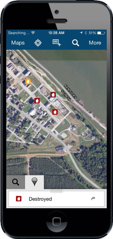
    Esri introduced Collector for ArcGIS, which allows users to capture and report spatial and/or tabular information directly from their iPhone or Android smartphone in the field.

    The Collector for ArcGIS application simplifies data collection in the field. Data can be recorded using GPS or by tapping on the map. The Collector app provides the ability to plan routes, generate directions, capture photos and video, and seamlessly integrate information back into an organization’s GIS. The app can also be configured for use with various tools to help tailor data collection workflows to users’ specific needs.

    The Collector for ArcGIS is available for download from the Apple App Store and Google Play (formerly Android Market).

    The Operations Dashboard and Collector applications are available to organizations that have either a 30-day trial or have purchased an ArcGIS Online subscription..