Author: Matteo Luccio

  • Minnesota company develops new system for mapping underground utilities

    Minnesota company develops new system for mapping underground utilities

    800Cover Story Image
    An Ellingson Companies surveyor works on an underground utility line. (Image: Ellingson Companies)

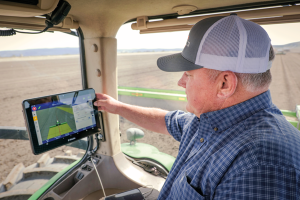
    This is part I of our III part feature story. Read more in part II, Review benefits of GNSS rover accuracy  and part III, Robotic total stations add scanning capabilities.


    The danger of hitting a buried water or gas pipe when digging for a construction project persists despite many efforts to reduce it, such as “call before you dig” phone numbers. For example, in Minnesota there were 4,000 such hits in 2019. That is one reason why it is very important to map “as built” underground utilities accurately. This must be done quickly and efficiently, before trenches are filled and without slowing progress of the project.

    Traditionally, crews have mapped the underground pipes and cables on paper. In turn, when a construction project needs to know the location of underground utilities before digging, it typically relies on someone who consults those paper maps, uses an electromagnetic utility locating tool, and marks the ground with spray paint. The construction crew then must correctly interpret those marks on the ground. In 2019, Minnesota-based utility consultancy Ellingson Companies was asked to develop a new and more efficient process.

    Capturing Data in Real Time

    By leveraging solutions from Esri and from Canadian hardware and software manufacturer Eos Positioning Systems, Ellingson Companies GIS Manager Damon Nelton developed a solution that allows his team to capture new pipe construction in real time. By streamlining documentation workflows, the new process improved field productivity and allowed Ellingson Companies to produce digital as-builts that meet the needs of its gas utility clients and improve the safety of future construction projects.

    While construction crews have been putting pipe in the ground for generations, today they are expected to produce a digital record of their work in real time — for the sake of safety and efficiency.

    Using Esri’s Utility Pipeline Data Model, Nelton created a system that enables crews to map their as-built pipe projects while also tracking components. The system improves data integrity — in other words, reduces human error — by relying on scannable 16-digit alphanumeric bar codes developed by the American Society for Testing and Materials that provide seven attributes for each conduit, including thickness, diameter, lot number and manufacturer date. To collect and store these data, Nelton set up an ArcGIS Enterprise geodatabase.

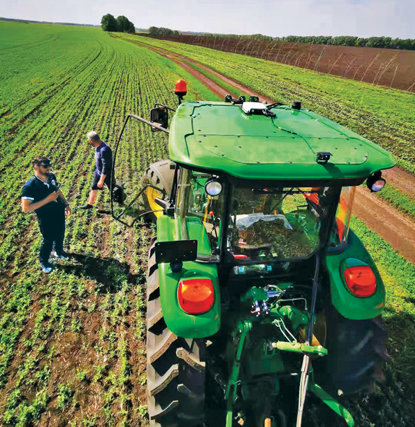
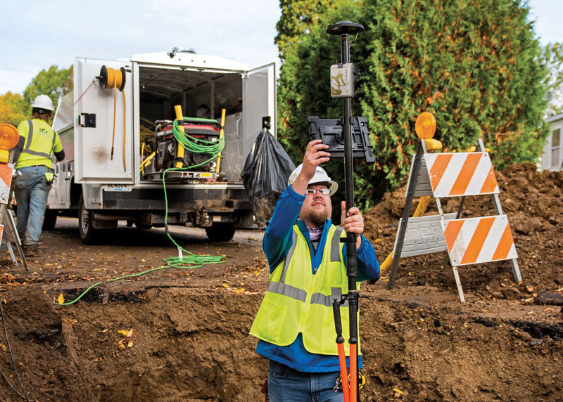
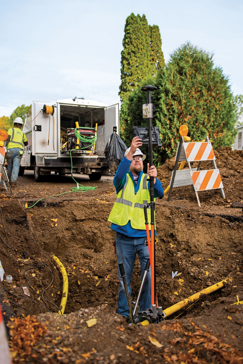
    Gas meters, which also need to be mapped, are often in locations that are hard to map directly with a GNSS receiver because line-of-sight to the satellites is obstructed by trees, roof eves, or adjacent buildings. Therefore, they must be shot with an offset. For these situations, Nelton used Eos Positioning Systems’ laser mapping solution, which enables surveyors to use lasers attached to their range poles to feed data directly into their GIS.

    No More Battleship

    Using Eos Positioning System’s Arrow Gold receiver and the MNCoors RTK network, Nelton said, his team was able to average an accuracy of 0.25 throughout a project in the city of Owatonna, Minnesota, as confirmed by spot checks with other survey equipment and with the city’s survey team.

    “Not every shot was easy, and some took multiple attempts and tricks of the trade to get them,” Nelton pointed out.

    On projects in the middle of mountains, where real-time kinematic (RTK) networks do not exist, the company has used the Atlas Service, averaging accuracies of 12 in.

    “Given the circumstances of these projects,” Nelton said, “we still consider that to be great.”

    Using the new system, foremen use a survey in ArcGIS Survey123 to input their inspection notes and other information, feeding it all from the field to the office and into layers shared between divisions. This way, the data are available in real time, not at the end of the project.

    For customers who still want a piece of paper to file in a physical folder in a filing cabinet, Nelton creates a Microsoft Word document template in their format, populates it using dynamic text with syntax in ArcGIS Pro, inserts a map, then saves the Word document as a PDF.

    “At the end of the project, we got almost 17,000 digits with no human entry other than pressing the button on the barcode scanner, which means zero data errors,” said Nelton.

    No pieces of paper with critical data on the underground utilities languish in a glove compartment or are eaten by a surveyor’s dog, and all the data is available in real time.

    Additionally, the combination of the barcode scanning workflow and the high accuracy GNSS receiver enables Nelton’s team to locate gas asset pieces that need to be replaced — for example, due to a recall by the manufacturer — “without playing battleship,” he said.

  • Who runs GPS?

    Who runs GPS?

    Who Runs GPS

    Nearly 50 years ago, in December 1973, the Defense Systems Acquisition Review Council approved the Navstar Global Positioning System for entry into Phase I of development. Since then, through its development, deployment and continuing modernization, GPS has grown into a complex program. It is operated by the Department of Defense based on legislation from Congress, executive orders from the White House, and policies established jointly with the Department of Transportation. It supports U.S. military missions as well as myriad scientific, commercial and consumer applications around the planet. Of course, the last category, with its billions of users, now dwarfs all the other ones combined.

    The GPS program, with an annual budget of nearly $2 billion and no user fees, is a gift from U.S. taxpayers to the world. It has staff in Washington, D.C.; at the Pentagon in Arlington, Virginia; at Schriever Space Force Base, Colorado; at the Space Systems Command at Los Angeles Air Force Base, California; at Cape Canaveral, Florida; at the U.S. Coast Guard Navigation Center in Alexandria, Virginia; and at GPS ground antennas in additional locations around the world. From the White House to Congress to aerospace companies, from military officers to civilian civil servants, from policy makers to engineers, from the East Coast to the West Coast to remote islands in the Pacific, Indian  and Atlantic Oceans, GPS is a vast enterprise — most of which is little known even to people in the industry and virtually unknown to the public.

    The Global Positioning System is a vast and mostly unknown enterprise. This section — the first in an occasional series of authoritative reference pieces in this magazine — aims to clarify who does what to maintain GPS as a fantastic global utility. The relevant missions of agencies or units are in italics.

    After I researched and drafted the piece, I asked the experts listed below to review it and provide corrections and additions. While grateful for their substantial feedback, I take sole responsibility for any remaining errors or omissions.

    Thank you to the following experts:

    • Harold W. Martin III, Director, Space-Based Positioning, Navigation & Timing, National Coordination Office
    • Michael J. Dunn, Capability Area Integrator for PNT, Space Systems Command, United States Space Force
    • Lt. Col. Robert O. Wray, Commander, 2nd Space Operations Squadron, United States Space Force
    • Scott R. Calhoun, Commanding Officer, Navigation Center, United States Coast Guard
    • Paul Benshoof, Technical Director, 746th Test Squadron (AFMC), Central Inertial and GPS Test Facility
    • Bernard Gruber, Senior Director, Northrop Grumman

    Please return to this page periodically to read corrections and updates to this special section. If you spot any significant inaccuracies or omissions, please bring them to my attention by writing to me at [email protected].

  • Precision Agriculture: GNSS Is Now Standard on Most Tractors

    Precision Agriculture: GNSS Is Now Standard on Most Tractors

    (Photo: CHC Navigation)
    (Image: CHC Navigation)

    The earliest article about GPS and agriculture that I found in my collection of this magazine(*) is from the July/August 1992 issue: “Using GPS in Agricultural Remote Sensing,” by Eileen M. Perry of the Remote Sensing Research Laboratory of the USDA Agricultural Research Service. Thirty years later, you cannot buy a tractor from a major manufacturer that does not come equipped with a GNSS-based guidance system, and precision agriculture routinely makes use of remote sensing data and geographic information systems (GIS). The data are collected by Earth observation satellites, manned aircraft, UAVs and sensors on farm machinery. The GIS are used to collect, manage and analyze these data and create maps for the variable-rate machines to follow when seeding, irrigating, spraying fertilizer, herbicide and pesticides, and harvesting.

    In this cover story, managers at Trimble, Tallysman Wireless, and ComNav Technology give their perspective on precision agriculture. Additionally, Gavin Schrock explains recently introduced options for tiered precise point positioning (PPP) services, using Trimble’s CenterPoint RTX as an example.

    Proponents of precision agriculture and equipment vendors have always claimed that it reduces inputs (water, seeds, fertilizer and pesticide) and environmental impacts while increasing yields and profits. However, I have never been able to find any independent, reliable and comprehensive study of precision agriculture’s return on investment. If you are aware of any, please let me know, at [email protected].

    — Matteo Luccio, Editor-in-Chief

    Check out these perspectives on precision agriculture:

    Trimble

    Tallysman Wireless

    Comnav Technology


    * I have the entire collection of GPS World’s print edition, except for the first issue, the 10 issues in the second year (1991), and the September through December 1993 issues. I would be thrilled to receive those missing issues, or facsimiles, from anybody who has them.

  • Low-Elevation-Angle Tracking Antenna Improves Field Mapping

    Low-Elevation-Angle Tracking Antenna Improves Field Mapping

    Photo:
    Tallysman antennas provide a critical link in the field for autonomous and semi-autonomous farm equipment. (Image: Kinwun/iStock/Getty Images Plus/Getty Images)

    Answers from Ken MacLeod, Product Manager, Tallysman Wireless


    How do you define precision agriculture?
    Precision agriculture includes all such modern technological advances as precise GNSS, robotics (autonomous vehicles, UAVs), sensors, and GIS that enable improved crop production by soil/field management and minimize the use of energy, seed, herbicides, pesticides and fertilizer.

    What have been the key turning points in the development of precision agriculture?
    There have been four key precision agriculture developments over the past 25 years. First, field mapping, which enables yield monitoring and the directed application of seed, fertilizer, herbicide and pesticide. Second, precision GNSS, which enables the same plus crop row offset from year to year. This offset, in turn, makes it possible to distribute the plant root system and utilize nutrients in different locations in the field, as well as to minimize soil compaction by ensuring that wheels do not travel over the same row from year to year. Third, autonomy, including UAVs and autonomous vehicles. Fourth, sensors to monitor moisture and water levels, and to identify weeds and plants.

    What are the specific requirements and challenges of precision agriculture for GNSS, and how do they differ from those of other kinds of mapping and machine control?
    Many precision agriculture applications require L-band corrections, which are typically broadcast from a geostationary satellite 35,800 km above the equator. The distance from the broadcast satellite to the user increases as the user travels either north or south of the equator. At the same time, the elevation angle decreases and at ~70° north or south of the equator the geostationary satellite will be seen at the horizon. As a result, at northern and southern latitudes, the L-band correction signal is seen at a low elevation angle and it is very weak because it has travelled a long distance. Tallysman has designed the VSS6037L antenna to receive L-band signals seen at low elevation angles.

    When did Tallysman Wireless begin to focus on precision agriculture and why?
    In September 2019, Tallysman Wireless released the VSS6037L agriculture and machine control GNSS antenna. Most GNSS/L-band antennas on the market have significantly lower gain at low elevation angles. Common GNSS antennas will provide good geostationary L-band reception from the equator to approximately 55° north or south latitude. However, as the arrival angle gets lower, a common GNSS antenna will have less gain and it will be challenged to receive the L-band signal at higher latitudes. Tallysman designed the VSS6037L specifically to provide support for all latitudes and specifically low elevation angle L-band signals received by users north or south 55° latitude.

    What are your relevant products/product lines?
    Tallysman Wireless has several GNSS antennas and smart GNSS antenna product lines that are designed for precision agriculture. The TW3972XF (triple-band plus L-band) and VSS6037L (full-band plus L-band) are ideal precision agriculture antennas. Tallysman has recently released the TW5390, which is a smart GNSS antenna that uses the u-blox F9P chipset and supports its PointPerfect L-band augmentation service.

  • Keeping on Course through RTK Outages

    Keeping on Course through RTK Outages

    For farmers, every centimeter counts. ComNav’s AG360 Pro autosteering system controls pass-to-pass accuracy within 2.5 cm. (Photo: Daniel Balakov/E+/Getty Images)
    For farmers, every centimeter counts. ComNav’s AG360 Pro autosteering system controls pass-to-pass accuracy within 2.5 cm. (Image: Daniel Balakov/E+/Getty Images)

    Answers from Simon Peng, Director, Overseas Department, ComNav Technology Ltd.


    How do you define precision agriculture?
    Precision agriculture uses new technologies to obtain as much as possible the unique characteristics of a field and input the correct amount of resources at just the right time. It is a system that needs to be implemented throughout the whole process of crop growth, including land preparation, tractor guidance, water management and weather monitoring. Tractors are used at every step, therefore it is critical to make them work consistently throughout the whole process, by using GNSS. ComNav Technology’s autosteering systems can be installed on most types of tractors. This allows farmers to grow the crops in a more autonomous and efficient pattern, which they can then save with high precision and reuse for later steps until harvest, increasing the utilization rate of land and decreasing the use of fuel, water, fertilizer and herbicides.

    What have been the key turning points in the development of precision agriculture?
    We have been in this sector since 2013. Our current solution is much easier to install and maintain and has higher accuracy and stability. The younger generation of farmers are more receptive to autonomous driving. They would like to try new things and set themselves “free” with technology.

    What are the specific requirements and challenges of precision agriculture for GNSS, and how do they differ from those of other kinds of mapping and machine control?
    The main challenges for autosteering systems include signal loss and terrain compensation. Most rural areas lack GSM coverages; therefore, in many countries using autosteering requires base stations. However, radio data links between stations far apart could be affected by obstacles, causing frequent correction outages. To compensate for this, ComNav has embedded in its GNSS module its “RTK-Keep” algorithm, which can maintain a relatively high-precision performance for autosteering during corrections outages. The system also must include various terrain compensation algorithms that identify a field’s elevation contours and provide smooth and continuous guidance even in complex terrains.

    When did ComNav begin to focus on precision agriculture and why?
    In 2013, we introduced our first high precision GNSS board. Initially, our main role was to provide it to integrators with expertise in precision agriculture. Over the years, the market began to boom in China and in 2016 we announced our first generation autosteering system for tractors. The main reason for us to focus on precision agriculture is the increasing demand from the market, which we believe will continue to grow in the foreseeable future due to the increasing demand for food from Earth’s growing population.

    What are your relevant products/product lines?
    In the past, workers in China drew lines on the land and then planted potatoes roughly along those lines, which was challenging and time consuming. It was hard for the farm owner to hire an experienced driver and guarantee the effectiveness of seeding. Now, however, ComNav Technology’s AG360 Pro autosteering system solves that problem by guiding vehicles according to set routines, including straight lines, curves, automatic turns and headline turns. Importantly, the pass-to-pass accuracy can be controlled to within 2.5 cm. The worker can finish multiple processes within only 24 hours, such as ridging, ditching, sowing, fertilizing and laying drip irrigation under mulch. Furthermore, compared to traditional manual planting, mechanized planting produces a more even sowing rate, which also establishes the foundation for the automated harvesting of potatoes. Potato production has increased by 10% per acre, land use has been reduced by more than 20%, and labor costs have been reduced significantly.

  • Positioning Services Enable Much More than Machine Guidance

    Positioning Services Enable Much More than Machine Guidance

    Photo:
    With the aid of Trimble’s correction services, the in-cab GFX-1260 display connects farmers to a wealth of knowledge about their fields and crops. (Photo: Trimble)

    Answers from Maximilian Hiltmair, Strategic Marketing Manager, Trimble Positioning Services


    How do you define precision agriculture?
    Precision agriculture is the use of technology in farming to increase yields through data and precision. Precision ag helps farmers improve yields by collecting data on all aspects of each plant to figure out exactly what it needs, when it needs it and how it will best survive. From planting, growing and cultivating to spreading, spraying and harvesting, precision agriculture allows farmers to monitor, measure and utilize data from beginning to end.

    What have been the key turning points in the development of precision agriculture?
    Accurate positioning is the enabler for all precision agriculture. RTK was one of the biggest initial developments within positioning as it allowed farmers a higher level of accuracy than had been seen previously. Precise Point Positioning (PPP) was the next big development. Our version of PPP, Trimble RTX, allows farmers the best of both worlds — RTK-level accuracy delivered via satellite, eliminating the need for base stations or sometimes unreliable radio, cell or internet signals. Though precision agriculture started with guidance, it has now made its way to implement-level, variable rate seeding and spraying and section control. ISOBUS has also been a big development in the past few years — allowing machines of all types to interact and communicate with each other, regardless of type, color and shape.

    What are the specific requirements and challenges of precision agriculture for GNSS, and how do they differ from those of other kinds of mapping and machine control?
    The challenge in GNSS is providing customers with the greatest availability in the field. While most fields are under open sky, obstacles such as trees and gullies make it more challenging. At Trimble, we provide market-leading pass-to-pass value with limited overlap for the customers at different price points. With our latest and most premium correction service, CenterPoint RTX, ease of use is also a key benefit.

    When did Trimble begin to focus on precision agriculture?
    Trimble unveiled its first agriculture receivers in 1999, signaling the start of the Trimble Agriculture division. In 2000, AgGPS Autopilot and automated steering systems were released for row crop application, further cementing Trimble’s presence in the precision agriculture community.

    What are your relevant products/product lines?
    Trimble offers technology integration that allows farmers to collect, share, and manage information across their farms, while providing improved operating efficiencies in the agricultural value chain. Trimble solutions include both hardware and software for guidance and steering, flow and application control, water management, harvest solutions, desktop and cloud-based data management, and correction services. Trimble’s CenterPoint RTX satellite-based correction service delivers GNSS positions repeatable to less than an inch. Combined with Trimble’s ProPoint GNSS technology, this service provides greater positioning availability, even in challenging environments such as tree lines, gullies and along contours where much of farming takes place.

    For applications where centimeter-level accuracy is not as high of a priority, such as broad acre applications, Trimble RangePoint RTX and ViewPoint RTX give additional correction service options. They hold equipment to 6-inch and 12-inch pass-to-pass accuracy — or about the width of a tire between passing swaths. Trimble also offers Trimble VRS Now, giving farmers instant access to RTK positioning services using a network of permanent, continuously operating reference stations.

  • Editorial Advisory Board: The “geodesy crisis” and GNSS satellites

    Editorial Advisory Board: The “geodesy crisis” and GNSS satellites

    What are your thoughts on the “geodesy crisis” and what do you propose to address it?

    Bernard Gruber
    Bernard Gruber

    “Evidence seems to be very clear that we, as a country, need geodesists and that there has been a decline in investments, training, and research in geodesy. While our decline relative to China may be shocking, it should not be surprising. U.S. industry and government relentlessly pursues STEM graduates, or those with relevant experience, but that does not meet current needs. Besides maybe surveying, it is unclear to the public what the geodesy profession is all about, why it is needed, and quite frankly, why it is an exciting career choice.”

    — Bernard Gruber
    Northrop Grumman


    Does crowding of low-Earth-orbit (LEO) space — with new satellites and space debris — pose any problems for the launch or operations of GNSS satellites in medium
    Earth orbit (MEO)?

    Ellen Hall
    Ellen Hall

    “This was a focused topic at SATELLITE 2022, where the discussion centered on the 6,000 tons of space debris circulating in LEO. Even the smallest piece of debris can be lethal to a satellite, so the key is to track and maneuver where possible. Add to that about 5,000 active satellites and plans to launch tens of thousands of additional ones into LEO over the next few years, and you have a serious problem to overcome. While there are treaties and plans for tracking and maneuvering these satellites, the debris is the real challenge.”

    — Ellen Hall 
    Spirent Federal Systems


  • First Fix: Arrivals and Departures

    First Fix: Arrivals and Departures

    Matteo Luccio
    Matteo Luccio

    As we begin 2023, GNSS development continues apace, as described in this issue’s annual “Directions” section by representatives of Galileo, GLONASS, and BeiDou. We plan to publish a similar update on the GPS program soon.

    Galileo’s user base now stands at more than 3.5 billion, and the services it provides continue to improve and expand. Beginning early this year, free precise point positioning (PPP) corrections for Galileo and GPS (single- and multi-frequency) will improve real-time user position by up to 10 times. While the discontinuation of Soyuz launch services from the Kourou Space Centre in French Guiana, due to the Russia-Ukraine conflict, delayed the two Galileo launches that had been planned for last year, 2022 was a key year for the development of Galileo Second Generation (G2G) satellites. They will provide, among other innovations, a reconfigurable fully digital navigation payload, point-to-point connection between satellites, and advanced jamming and spoofing protection mechanisms.

    On Nov. 29, 2022, Russia launched the 51st Glonass-M satellite, about 20 years after launching the first one. Currently, 13 of these satellites are operating beyond their guaranteed lifetime, with an average orbit lifetime of more than 10 years. Starting this year, the constellation will be renewed by Glonass-K and Glonass-K2 satellites, which provide CDMA signals to users.

    Currently, 45 BDS satellites are operational in orbits, including 15 BDS-2 satellites and 30 BDS-3 satellites. The constellation says that it has reached a continuity of 99.996% and an availability of 99%, with a global positioning accuracy better than 1.5 meters horizontally and 2.5 meters vertically (95% confidence).

    Tracy Cozzens, who has been a pillar of this magazine for 17 years, is retiring this month. We will miss her journalistic acumen, dedication to clarity and style, attention to detail, and wealth of institutional knowledge. We wish her a well-deserved retirement. At the same time, we welcome aboard Maddie Saines, our new managing editor, who is near the beginning of her career.

    I am pleased to announce that Rob VanBrunt has joined GPS World’s Editorial Advisory Board. In mid-December, the board of directors of Spirent Federal Systems, a provider of PNT test solutions for the U.S. government and contractors, appointed him as the company’s president/CEO-designate, a role he will assume when the onboarding process is complete.

    VanBrunt began his career at Spirent Communications in 1990 as product developer and manager, and then held posts of increasing responsibilities, moving to director and vice president roles focused on management, strategy and mergers and acquisitions. Most recently, he was executive vice president in the Office of Business Excellence. VanBrunt has a B.S. in electrical and electronics engineering from Rutgers University.

    Spirent Communications is a global provider of automated test and assurance solutions for networks, cybersecurity and positioning. In July 2001, the company formed Spirent Federal Systems as a wholly owned subsidiary and U.S. proxy company. Spirent Federal markets and sells Spirent Communications’ products in North America. It also provides value-added features and ongoing customer support.

    On Jan. 1, I lost my beloved mother, Maristella “Mimi” Luccio. She was 87.

    Matteo Luccio | Editor-in-Chief
    [email protected]

  • XenomatiX: Roadway assessment with solid-state lidar

    XenomatiX: Roadway assessment with solid-state lidar

    Multi-sensor clusters enable precise assessment of road conditions. (Photo: XenomatiX)
    Multi-sensor clusters enable precise assessment of road conditions. (Photo: XenomatiX)

    The success of higher levels of vehicular autonomy will depend on two types of roadway corridor digital twins: pre-mapped and augmented on the fly. No matter how well the corridors are pre-mapped, there will always be the need for the vehicle to be self-aware — not only of the proximity of other vehicles and pedestrians, but also of changes to fixed features. New vehicles are being provisioned with multi-sensor clusters, including GNSS, cameras, lidar, sonic and more. This provides an opportunity to more precisely assess the condition of the road surface, which affects the performance of vehicle suspension systems, tires, fuel efficiency and general wear and tear.

    “Imagine that your car navigation map system included roadway conditions,” said Karsten Bronowski, sales and business development manager for XenomatiX, “a global view where roads are color-coded based on their surface types and roughness. And all of this is mapped by systems like ours or added to the mobile systems mapping all the roads.

    “Our product actually came out of the automotive world, and we still have customers that use it as a reference system for active suspensions, for mass-spring damping systems,” Bronowski said. For these applications, the sensors were mounted facing forward for a preview mode. “We have worked with the Belgian Road Research Center and others with applications to readily provide the international roughness index.”

    XenomatiX was formed in 2013, focused on developing true solid-state lidar. “The idea was to get the motor out of lidar,” said Bronowski. “You have moving parts, you have wear and tear, the effects of vibration, problems with long-term reliability and with controlling temperature. With true solid-state lidar, you eliminate these issues.” Micro-electromechanical systems (MEMS) lidar systems still have moving, opto-mechanical components. Bronowski said that the solid-state systems feature a CMOS-based detector generating high-density point clouds in all weather conditions, and a multi-beam laser projector generating a high-resolution grid of points.

    The dual lidar sensor system gets its orientation and positioning from additional components, including GNSS and IMU. The system that Bronowski showed at Intergeo 2022 had Septentrio AsteRx-U3 GNSS/IMU units supporting dual antennas for heading. However, they are using other means to improve both relative and absolute positioning: “How we do this is one of our secrets. For one of our customers in Japan mapping local highways, we proved to have excellent compensation, even tracking precisely through a 4-kilometer-long tunnel.”

    XenomatiX has developed software to analyze data for many applications, automate feature recognition, and even validate other data. For instance, one customer in the United States is a big player in the satellite imaging sector that wants to match that data with pavement markings the XenomatiX system picks up.

    While there is a needed calibration step and the requirement to align the detector for the dedicated measurement vehicle, sensor systems such as this can be put on just about any type of vehicle — on- or off-road. The driver does not need to intervene much, and the processing is done on a standard PC or laptop. “The customer does not care about the systems, just the data that comes from it,” Bronowski said.

  • CHC Navigation: UAS use on the rise for corridor mapping

    CHC Navigation: UAS use on the rise for corridor mapping

    Tactical-grade IMUs enable UAVs to achieve the same locational accuracy as ground-based systems. (Photo: CHC Navigation)
    Tactical-grade IMUs enable UAVs to achieve the same locational accuracy as ground-based systems. (Photo: CHC Navigation)

    We often hear the anecdote about an early lidar scanner that could take a shot every few seconds, yet it held a value proposition for certain applications. As the capabilities of successive mapping and surveying systems change rapidly, so does the conventional wisdom about which are best for various applications. Transportation corridor mapping — be it for improvements design, as-built surveys, asset management or digital twinning — has always been a balancing act between precision and efficient large-scale data capture.

    “I remember 15 years ago, during my university time, the scanner was the size of a dining table,” said Andrei Gorb, segment manager for mobile mapping and unmanned aerial vehicle (UAV) systems, CHCNAV. At the top end of the mapping food chain were terrestrial scanners, targets, bore sighting, and registering point clouds mostly manually. As cumbersome and time-consuming as the legacy tools and methods were, these options still offered efficiency gains compared to conventional surveying with total stations. Then a decade ago, mobile-mapping systems began to change that paradigm. Departments of transportation found that mobile-mapping systems could meet their requirements for many design projects, and certainly for asset inventory and management. Unmanned aircraft systems (UAS) were not quite there yet.

    The tech used depended on the application. “First, there was road maintenance, to understand the road condition,” Gorb said. “Previously, UAS did not meet the high requirements: centimeter in absolute and millimeter in relative. We now have mobile-mapping solutions, from us and other suppliers, that can be in the 8-9 mm absolute accuracy range on short road surfaces.” Yet for many transportation applications, the absolute accuracy may not be as important as the relative precision. This is where years of development in UAS has made the difference.

    CHCNAV was not alone in recognizing that the gap was closing, and the company planned ahead. “Previously, UAS would fly for under an hour, and were mostly carrying cameras or early lidar, which was not suitable for highways,” Gorb said. “A few years of development, and we see it is practical to meet requirements with UAS flying between 50 and 100 meters — in Europe, many local regulations forbid flying above 120 meters anyhow.” Gorb attributes the advances to lidar sensors that UAS can carry. These sensors have become much better and less expensive. Plus, platforms like vertical-take-off-and-landing (VTOL) systems can stay in the air much longer.

    The UAS boom of the past 10 years saw the dominance of consumer-prosumer market UAV platforms becoming quite commoditized, with certain vendors gaining majority market share. CHCNAV, instead, sought to develop enterprise solutions, for both mobile and UAS systems — large-platform rotor, fixed-wing and VTOL platforms. The company offers an amalgam of hardware and software, from Riegl scanner heads on some of their mobile-mapping systems to Honeywell inertial navigation systems (INS) for some of their UAS solutions.

    Gorb echoes what we hear from many mapping practitioners, saying ground-control points are not as necessary in the densities required for legacy mobile and UAS mapping. He explained that everything from strip adjustments to processing of GNNS/IMU data has tightened both precision and accuracy. “We have a tactical-grade IMU in both our mobile mapping and UAS solutions, for a high-end trajectory,” Gorb said. “So, it means that we can get the same high-accuracy point cloud for highways from the ground and the air perspectives.”

  • Trimble: European company reduces emissions and improves deliveries

    Trimble: European company reduces emissions and improves deliveries

    Trimble Maps enables a shipping company to offer one-hour delivery windows. (Photo: Trimble)
    Trimble Maps enables a shipping company to offer one-hour delivery windows. (Photo: Trimble)

    To reduce its emissions, DPD Deutschland — a franchise of DPDgroup, one of the largest international parcel carriers in Europe — has asked Trimble Maps to help optimize its operations. DPD Deutschland’s parcel supply chain covers 80 franchise depots, 9,500 employees and more than 13,000 drivers, delivering about 2 million packages to businesses and consumers per day via a mixed fleet of vehicles, including electric ones.

    DPDgroup has a vision to become the international standard in sustainable delivery by 2030. Per parcel, it has reduced its CO2 emissions by 18.8% since 2013 and is on track to reach a 30% reduction by 2030, according to Trimble.

    One of DPD’s most popular service offerings, called Predict, allows parcel recipients to track the progress of their deliveries in real time, with an estimated one-hour delivery window and updated notifications along the way. Since 2014, Trimble Maps’ portfolio has helped calculate this one-hour delivery window and provided turn-by-turn navigation to DPD drivers, resulting in less overall travel time, more successful first-time deliveries and reduced emissions.

    DPD was the first, and still is the only, parcel carrier in Germany that provides recipients with an estimated one-hour delivery window, the company says, calculating it for every parcel. The service is made possible in part by the integration of Trimble Maps’ route optimization and mapping web services platform, known internally as DPD Maps. Recipients can reschedule deliveries as needed for future days and times, or perhaps to a convenient drop-off location. This reduces emissions created by multiple return trips.

    DPD Maps calculates an optimized route for drivers, who are then able to manually sort the stops and change the route to best fit their preferences. Once routes are locked in, Trimble’s commercial navigation application, CoPilot, provides drivers with real-time directions. Once a driver’s route is complete for the day, DPD can compare the actual route taken with the optimized route DPD Maps calculated in an easy-to-understand view that can be analyzed by the driver and the depot.

    DPD Maps allows the company to visualize, share and discuss results with different stakeholders within the organization. The solution also allows drivers to plan out their day as they see fit, while giving the back office access.

  • Orolia: Distress locator enhances aviation safety

    Orolia: Distress locator enhances aviation safety

    Airbus will install Orolia’s Ultima-DT emergency locator transmitter on its aircraft. (Photo: Airbus)
    Airbus will install Orolia’s Ultima-DT emergency locator transmitter on its aircraft. (Photo: Airbus)

    This fall, Orolia’s Ultima-DT was certified as an emergency locator transmitter with distress tracking (ELT-DT) by Cospas-Sarsat, an international humanitarian search-and-rescue system. Cospas-Sarsat uses space-based technology to detect and locate model 406 emergency beacons carried by ships, aircraft or individuals venturing into remote areas — often inaccessible by GNSS signals. The system consists of a network of satellites, ground stations, mission control centers and rescue coordination centers that work together when a 406 beacon is activated.

    I spoke about the certification with Christian Belleux, director, Aviation & Defense Beacons for Orolia.

    Matteo Luccio (ML): Has Orolia produced aviation safety products in the past?

    Christian Belleux (CB): Orolia has been supplying emergency locator transmitters for aviation since 1995 on a very large number of platforms to OEMs and airlines for use on commercial aircraft — Airbus, Boeing, Embraer and Bombardier aircraft. Orolia is also participating in industry groups creating standards (Eurocae, RTCA, ARINC) or contributing to the progress of the Cospas-Sarsat search-and-rescue satellite system as a member of the Expert Working Group.

    ML: What are the key challenges in making an aviation ELT?

    CB: With new requirements for lithium batteries and new regulations introducing distress tracking, recent times have been rich in innovation. We were granted the first ETSO certification ever for an ELT-DT and the same product, the Ultima-DT, was also the first ELT to be certified for its lithium battery.

    ML: What did Cospas-Sarsat certification of the ELT-DT entail?

    CB: The ELT-DT is a new type of beacon with a new communication protocol. The labs performing the certification tests must be approved by Cospas-Sarsat before we can apply. Then the Cospas-Sarsat organization and infrastructure must be updated to receive and consider the new ELT-DT protocol. The Cospas-Sarsat certification of our ELT-DT means that it complies with the performance requirements described in Cospas-Sarsat standards and can communicate with the infrastructure.

    ML: What is new about an ELT-DT?

    CB: The principle of an ELT-DT is to activate in flight before a crash, as opposed to a legacy ELT that is activated by the shock of a crash. This means that the aircraft and the ELT-DT can analyze the health of the aircraft and its parameters, and activate if a catastrophic event is about to occur. Once activated, the ELT-DT transmits a high-rate distress signal that makes it possible to track the aircraft until it crashes. The ELT-DT contains its own GNSS receiver that is independent the aircraft’s navigation system.

    ML: Did you cooperate closely with one or more avionics manufacturers to develop your device?

    CB: Orolia was in very close contact with Airbus, which designed the avionics components.

    ML: Do you already have contracts with airlines or aircraft manufacturers besides Airbus for the Ultima-DT?

    CB: We have several contacts with aircraft manufacturers and airlines interested in the Ultima-DT.

    ML: When will the first batch of the ELT-DT / Ultima-DT be operational?

    CB: We started flight tests months ago at Airbus and delivered production units. Airbus soon will announce its first delivery of an aircraft equipped with the Ultima-DT.