Author: GPS World Staff

  • Alstom pioneers use of Galileo to help measure location and speed of trains

    Alstom pioneers use of Galileo to help measure location and speed of trains

    Photo: Alstrom
    Photo: Alstrom

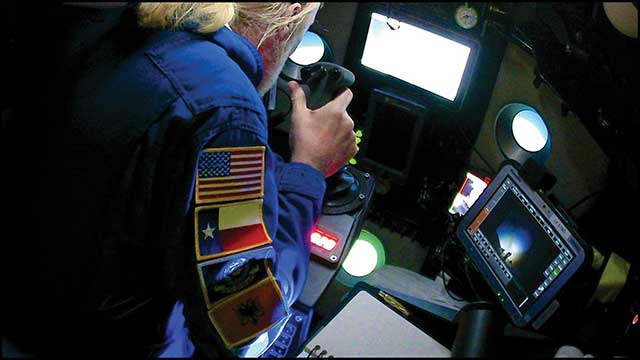
    News from the European GNSS Agency

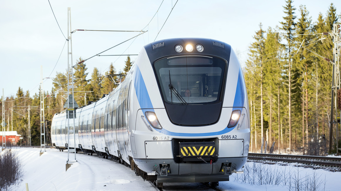
    In June, Alstom became the first railway manufacturer to integrate certified data-fusion algorithms for fail-safe train localization, using position and speed of trains based on GNSS data coming from multiple constellations, including Galileo.

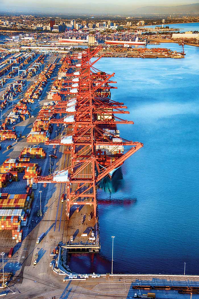
    The added value of Galileo and EGNOS in the European railway sector is widely known, especially when it comes to non-safety applications, such asset management and passenger information services.

    In recent years, however, with multi-constellation becoming the norm and multifrequency receivers being adopted rapidly, rail stakeholders view GNSS-based solutions as game-changers for the future of European Train Control System (ETCS).

    A recent example of EGNSS adoption in rail operations is the innovative odometry solution deployed by Alstom to measure the location and speed of its trains. The French rolling-stock manufacturer introduced a new sensor type, with a hybridisation of satellite information and inertial sensors. The solution is primarily using GNSS Doppler information, derived from Galileo, GPS and GLONASS constellations (configurable).

    Such use allows to improve the overall confidence in the resulting speed, along with specific algorithms to master the resulting location accuracy. The GNSS receiver is an automotive grade receiver manufactured by u-blox. The inertial measurement unit (IMU) used to supplement information in case of GNSS loss is based on enhanced micro-electromechanical systems (MEMS) technology, with temperature compensation.

    The new odometry system based on data fusion, which Alstom is currently implementing in Norway, is applicable to all types of trains and all environments, including the harshest weather conditions. It is estimated that by 2026, 450 trains will be equipped with this new feature across Norway.

    Increased safety, lower costs for rail companies

    Wheel slipping and sliding especially during demanding weather conditions can affect the odometer accuracy and the proper functioning of the different sensors involved. By incorporating Galileo signals as an extra layer of accuracy, Alstom managed to create a system that is capable of providing a more robust speed and location estimate. This space data fusion approach —certified by Belgorail — minimizes the need for the costly external radar components for localisation and speed measurement currently used.

    “Industry embedding Galileo in their solutions is the proof that we are on the right path to ensure the market uptake of the EU Space Programme technology,” said Rodrigo da Costa, GSA executive director. “This is a recognition of the capability of EGNSS to reduce the need for infrastructure and related cost, while maintaining the operational safety of ETCS.”

  • Belgian company Seafar pioneers barge automation technology

    Belgian company Seafar pioneers barge automation technology

    An autonomous freight barge moves through a lock. The barge is equipped with Septentrio GNSS positioning via Seafar navigation. (Photo: Seafar)
    An autonomous freight barge moves through a lock. The barge is equipped with Septentrio GNSS positioning via Seafar navigation. (Photo: Seafar)

    Seafar has integrated Septentrio’s AsteRx-U dual-antenna, multi-frequency, multi-constellation receivers into its autonomous vessels to provide sub-meter positioning for navigation and control.

    AsteRx-U’s robust enclosure is equipped for harsh outdoor marine environments. The dual-antenna set-up provides precise heading information along with reliable positioning. A captain in a Remote Operating Center monitors several unmanned ships simultaneously, and can take over navigation control if the need arises.

    The maritime industry is witnessing an emerging trend of navigation automation both in the open sea as well as inland. Lloyds Register predicts that the marine industry will undergo a shift toward full autonomy for seafaring as well as inland ships by 2035, a timeline similar to that of the automotive industry.

    And GNSS positioning plays a key role. Unlike open sea transport, inland barges navigate narrow waterways, passing through locks, under bridges and near urban areas. The distance between ships can be down to 1 meter in a tight lock. Septentrio’s AsteRx-U provides the accurate and continuous positioning that enables ships to navigate in ports, stay on their predetermined routes and dock at harbors. The receiver also provides Septentrio’s Advanced Interference Mitigation (AIM+) to ensure reliable positioning in the face of jamming or spoofing.

    Currently, only 6% of inland transport travels on waterways, though water transport is more energy efficient and safer than rail and road. Optimized route and fuel efficiency, increased cargo space and savings on human resources are ways automation helps inland barge owners increase their margins and gain a competitive edge.

  • MGUE Increment 2 contracts awarded to BAE, L3 and Raytheon

    MGUE Increment 2 contracts awarded to BAE, L3 and Raytheon

    The United States Space Force’s Space and Missile Systems Center awarded the Military Global Positioning System User Equipment (MGUE) Increment (Inc) 2 Miniature Serial Interface (MSI) with Next-Generation Application Specific Integrated Circuit (ASIC) to BAE Navigation & Sensor System, L3 Technologies (now L3Harris) and Raytheon Technologies.

    According to the U.S. Space Force, the three MSI contracts are valued at $552 million and will be executed as Middle Tier Acquisition rapid prototyping efforts. The first delivery is scheduled for early fiscal year 2026.

    Enhanced processing and security features associated with M-code drove the decision to develop a smaller and more powerful receiver card for handheld and dismounted applications, the U.S. Space Force said. The MSI with Next-Generation ASIC will enable Military-Code GPS receiver production, mitigating the obsolescence issue of current ASICs and providing significant security and performance improvements for GPS-enabled weapons systems. MGUE Inc 2 will be compatible with all existing and future spacecraft and ground systems, it added.

    MGUE Inc 2 enables military GPS user equipment to receive allied GNSS positioning, navigation and timing (PNT) signals to increase both the resilience and capability of military PNT equipment, and deter attacks on GPS, the U.S. Space Force said. These signals will supplement GPS-based PNT in accordance with Department of Defense policies regarding usage of allied GNSS signals, ensuring identification and mitigation of cyber risks, and compatibility with existing PNT equipment.


    Feature photo: EvgeniyShkolenko/iStock / Getty Images Plus/Getty Images

  • Unmanned survey vessel efficiently maps seabeds

    Unmanned survey vessel efficiently maps seabeds

    Sometimes hands-on data collection just isn’t good enough. In the busy Shizuoka harbor, Weichao Liu of CHC Navigation used the company’s Apache6 marine drone to take a bathymetric survey of a channel in preparation for dredging at a Shizuoka seaport. The Apache6 also collected 3D lidar data above the water’s surface.

    In May, CHC Navigation launched the 2020 Edition of the Apache6 USV (unmanned surface vessel), which combines a dual GNSS positioning and heading receiver, stable and reliable hull attitude sensors, and an inertial measurement unit (IMU). The CHCNAV GNSS/INS control box maintains high accuracy during transient GNSS outage, according to CHC Navigation, such as providing uninterrupted surveying while passing under bridges.

    Just like an aerial drone, the Apache6 has an auto return feature, and like it’s much larger manned brothers, it uses sonic radar (sonar) to avoid obstacles. Its fully autonomous survey mode is powered by CHCNAV absolute straight line technology so that the craft follows a predetermined path even in adverse current conditions.

    Besides 3D bathymetric surveys, the USV has been used for positioning of underwater objects, offshore construction, underwater archaeology and wreck salvage. It is equipped with a high-performance single-beam echosounder, and can be installed with lidar to create a combined marine and terrestrial 3D high-accuracy survey in a single pass, such as for harbor and river surveys with height clearance evaluation.

    Check out more water applications below.

    Guiding an unmanned vessel
    GNSS receivers track port movements with CORS corrections
    Amphibious excavators guided by GNSS in bay cleanup
    Construction company adopts positioning tech for marine projects
    Plug-and-play compass selected for survey package
    Resilient PNT critical to maritime advancement
    Manufacturer equips submarines with rugged tablets
    eCognition goes underwater to help conserve coral reefs
    Water utilities reduce expenses with mobile GIS
    Belgian company Seafar pioneers barge automation technology
    The shape of water: bathymetry in action


    Feature image: Weichao Liu, a member of CHC Navigation’s technical support staff, prepares to launch an Apache6 unmanned surface vessel, also known as a marine drone. (Photo: CHC Navigation)

  • Manufacturer equips submarines with rugged tablets

    Manufacturer equips submarines with rugged tablets

    Triton Submarines — famous for underwater explorations including that of the Titanic — has replaced large, outdated computers onboard with rugged tablets. Each sub is equipped with two Panasonic Toughpad FZ-G1 tablets to monitor depth, light, voltage, gases and alarms, as well as input data and run analytic software. On the surface, a Toughbook 54 is used for tracking and communication.

    Photo: Caladan Oceanic
    Photo: Caladan Oceanic

    Integrated GPS receivers simplify mapping, allowing teams to plot the location of a vessel in real time. “We use the GPS receiver inside the Toughbook 54 for positioning of the surface boat to aid in tracking of the sub,” said Patrick Lahey, president of Triton Submarines. “The GPS receiver works very well. The update rate, time to first fix, and accuracy allows the boat to have a good fix while moving, and for a quick restart during operations at sea.”

    Photo: Caladan Oceanic
    Photo: Caladan Oceanic

    Once the sub is submerged, it loses all radio communications including GPS. An underwater positioning system based on acoustics is used instead, Lahey explained. The USBL system uses a surface base station mounted on a boat and GPS to determine its location. Then, using an array of acoustic transducers, it sends a ping to the sub and the sub pings back. The surface unit then measures the travel time to each transducer to find the sub’s position.

  • eCognition goes underwater to help conserve coral reefs

    eCognition goes underwater to help conserve coral reefs

    Image: TNC and Tama Group
    Photo: TNC and Tama Group

    The Caribbean Division of The Nature Conservancy (TNC) has focused on monitoring, protecting and restoring the region’s marine environments for more than 40 years. As the plight of coral reefs has become more urgent, so too have TNC’s efforts to tackle coral conservation, and meet the demands for better maps.

    “Reef maps are an essential tool for coral resource managers, but historically these maps have had insufficient detail, been outdated or been produced for small areas,” said Steve Schill, TNC marine conservation specialist. “Not having access to accurate, large-area reef maps has limited our understanding of these ecosystems and the benefits they provide.”

    Having used Trimble’s eCognition object-based image analysis (OBIA) software for automatically classifying and mapping small reef areas, Schill believed eCognition could be the enabling, scalable approach to map the hundreds of thousands of reefs across the region.

    Schill worked with technical professionals at Earth observation company Planet and researchers at Arizona State University to select 30,000 4-meter-resolution scenes from the Dove satellite constellation. The team then created a seamless mosaic of the whole Caribbean basin. He also partnered with eCognition specialists Tama Group to develop the OBIA method to automatically classify benthic habitats.

    Image: TNC and Tama Group
    Image: TNC and Tama Group

    To map reefs, Tama Group experts integrated the Dove satellite surface reflectance and Dove-derived bathymetry into eCognition. The software first delineates land and sea areas deeper than 15 meters. Based on depth data and known topographic characteristics, it then categorizes the overall reef structure, distinguishing reef crest, fore reef, back reef, patch and fringing reef. Once it defines the five reef classes, eCognition determines seagrass classes (dense and sparse), sand types and dredged areas, and then finishes with mapping the deeper hard-bottom-with-algae classes. In total, the software automatically classifies 13 different benthic habitats.

    Using this workflow, eCognition successfully classified the shallow water benthic habitats of the entire Caribbean Basin in four months. The software exported each area as vector shapefiles, and Schill and his team downloaded them for analysis and quality control. Moving from reef to reef, they used field data to analyze the accuracy of the classifications, making manual corrections where needed.

    To date, benthic habitat maps have been produced for 23 countries and territories across the insular Caribbean. In October, the final full set of benthic habitat maps for the insular Caribbean will be available online.

  • Plug-and-play compass selected for survey package

    Plug-and-play compass selected for survey package

    Photo: Advanced Navigation
    Photo: Advanced Navigation

    Advanced Navigation’s plug-and-play GNSS Compass was selected by Nortek for its new survey package. Nortek’s scientific instruments apply the Doppler principle to underwater acoustics to measure water in motion, such as currents and waves. The instruments are used by scientists, researchers and engineers worldwide, employed in demanding environments that require state-of-the-art instrumentation that is reliable and easy to use.

    A vessel-mounted acoustic Doppler current profiler (ADCP) measures the velocity of currents beneath a moving vessel. To correct the measured values for vessel speed and direction, ADCP measurements require accurate velocity and heading information. Besides the use of bottom track within the ADCP itself, such information can be provided externally using a GNSS receiver and a non-magnetic heading source such as a gyro compass.

    Nortek’s ADCP package — Signature VM — offers operational convenience and reduced complexity. As part of the package, Advanced Navigation’s GNSS Compass provides accurate dual-antenna GNSS-based heading that is not subject to magnetic interference. Its inertial navigation system (INS) can maintain accurate heading during GNSS outages of up to 20 minutes. “By making use of today’s modern Ethernet instruments, such as the Signature ADCP and the GNSS Compass, we can guarantee nanosecond time synchronization with Ethernet PTP protocol,” said Herman Huitema, VM product manager at Nortek. “Data from the ADCP can be exactly aligned with the GNSS Compass information.”

  • Water utilities reduce expenses with mobile GIS

    Water utilities reduce expenses with mobile GIS

    GIS Manager Kenny Ratliff, Oldham County Water District, collects utility data. (Photo: Eos Positioning)
    GIS Manager Kenny Ratliff, Oldham County Water District, collects utility data. (Photo: Eos Positioning)

    Across North America, the use of high-accuracy GNSS technology has proliferated among water and wastewater service providers. Water utilities are saving time, cutting operational expenses, and definitively improving the accuracy of their asset management systems by capturing survey-grade location data.

    Oldham County Water District serves more than 8,300 residences with 369 miles of pipeline in rural Kentucky. In 2001, the utility digitized its assets for the first time. In 2016, they decided it was time to improve the assets’ accuracy. GIS Manager Kenny Ratliff deployed ArcGIS Collector, iPad 2 mobile devices, and the Arrow Gold GNSS receiver by Eos Positioning Systems. As a result, OCWD was able to more quickly arrive exactly at the location where meters were to be replaced. With the savings of time, labor and fuel, OCWD cut the cost of installing each water meter by half, from $212 to $111.

    Other water utilities are using GNSS technology to improve the office-to-field workflow, accelerate deployment of new systems, and map buried pipelines.

  • Construction company adopts positioning tech for marine projects

    Construction company adopts positioning tech for marine projects

    Photo: Vladimirovic/E+/Getty Images
    Photo: Vladimirovic/E+/Getty Images

    Offshore construction company Sulmara Subsea has exclusively used Hexagon | VERIPOS solutions since inception to achieve precise, redundant and reliable vessel positioning for a variety of marine construction projects. Projects involving the precise positioning of offshore vessels and subsea assets and vehicles such as ROVs and trenchers are vital to success — even slight errors or loss of connection in surface navigation can lead to problems and down time that can cost millions.

    “Sulmara has set out to be an industry leader in innovation and technology from the start. Key to the success of any project is the ability to achieve accurate and reliable global positioning,” said Cory Goodyear, Sulmara’s Americas business unit director. “The support from Veripos to provide not only a cost-effective but reliable service is vital to our operations.

    “2020 has seen an unprecedented decline in the oil and gas market, and a growing demand for renewable energy,” Goodyear said. “This has created an even larger demand for lower costs and increased reliability in our services. As a new-start survey company with a goal of establishing itself as a serious competitor, positioning services supported by Veripos was the obvious choice.”

    Veripos offers customers several marine receiver options for hydrographic/offshore surveying, dredging, offshore construction, seismic exploration and dynamic positioning. The LD8 ruggedized compact dual-antenna, multi-constellation receiver is best for short-term projects or where space is limited. The larger LD900 can receive Veripos services through a multi-channel L-band demodulator. The multi-constellation receiver is configurable to allow GNSS heading and inertial positioning. It has an intuitive color display for configuration and monitoring. A kit allows the receiver to be installed within vessel equipment racks.

  • Amphibious excavators guided by GNSS in bay cleanup

    Amphibious excavators guided by GNSS in bay cleanup

    Photo: Topcon
    Photo: Topcon

    Over the years, contractors involved in underwater excavation projects — dredging, pond/lake expansions, creation of boat landings, waterfront cleanups, etc. — have become some of the most ardent supporters of GNSS-based solutions. They’ve found that the ability to “see” beneath the surface with their machines has proven invaluable in improving efficiency and minimizing the risk of over/under cutting.

    The Minnesota Department of Natural Resources (DNR) led the effort to remediate a section of the St. Louis River on Duluth’s waterfront. Midwest Amphibious Equipment (MAE) tackled the huge restoration project, equipping two of its amphibious excavators with Topcon HiPer VR, an FC-5000 field controller and an X-53i system.

    MAE began digging out vast amounts of wood waste that had rested at the bottom of the river for more than a century, when sawmills lined the waterfront. By removing the wood waste and building a small island in the Grassy Point area, the DNR hopes to restore the damaged habitat.

    The murky water required a precise method of measuring the cuts as debris was removed. “The Topcon solution lets my guys know exactly where the bucket is in relation to the plan provided by the engineers,” said MAE CEO Steve Gilbertson. “There is no guesswork; it is dead-on every time, with tolerances to 1/10 of a foot — far closer than we need it to be.”

    Topcon’s SiteLink 3D provides a point-to-point communications solution. “With the click of a button I can do everything from verifying a machine’s position to sending the as-built back to the office to looking at their screen to answer a question the operator might have about the project itself,” Gilbertson said. “We’ve only scratched the surface of what can be done with SiteLink, but it’s still proving a really nice addition to our operation.”

    Less than halfway into the project, MAE had removed more than 100,000 cubic yards of material.

  • GNSS receivers track port movements with CORS corrections

    GNSS receivers track port movements with CORS corrections

    The largest seaportS on America’s West Coast are the Ports of Long Beach and Los Angeles, located next to each other in San Pedro, California. (Photo: Art Wager/E+/Getty Images)
    The largest seaportS on America’s West Coast are the Ports of Long Beach and Los Angeles, located next to each other in San Pedro, California. (Photo: Art Wager/E+/Getty Images)

    The Port of Long Beach, California, is moving up and down because it sits on fault blocks that move like pistons due to subsidence caused by oil extraction. To accurately keep track of these movements, the port’s surveyors use GNSS receivers that receive corrections from continuously operating reference stations (CORS) operated by the port and by the City of Long Beach.

    CORS corrections compensate for errors inherent in GPS — clock drift, orbit errors, signal errors and atmospheric errors.

    Monitoring Subsidence. A monitoring receiver is placed on each fault block’s anticline, said Kim Holtz, director of survey for the Port of Long Beach. Her agency has 15 stations, along the coast, and a couple in the Port of Los Angeles. They were installed originally in the 1990s, using Trimble 5700s. “We are constantly monitoring to make sure that the fault blocks are not moving too much and that they are not moving horizontally other than all together, as the plates move to the north,” Holtz said.

    Also, the Long Beach Energy Resources Department has 14 Trimble R9 base stations. While Energy Resources uses the equipment to get precise elevation differences and measure subsidence for movement of more than 0.025 feet, the port uses them mainly for horizontal measurements for construction.

    The port’s hydrographic survey boat, the pilot boats, and the dig alert crew that marks utilities for construction operations also use the receivers to tie into the CORS network. “The stations are about eight or nine years old and Energy Resources is getting ready to replace all of them with Trimble Alloy GNSS reference receivers, over a three-year period,” Holtz said.

    Digital Level Run. The port normally performs a digital level run from a tidal wave base station in San Pedro, which dates to the 1920s. “We run a level run from that and, at the same time, Energy Resources does a GPS subsidence survey, where they get elevation,” Holtz explained. “Last year, we combined the two surveys, to compare the data and see whether we could use some of their GPS data for our level run. It was very promising. We are going to do it again in November.

    “Then, if it works, we will cut our level run, which normally takes two months, down to about a week or two. We will just come off of the main benchmarks on which Energy Resources puts a GPS elevation.”

    To keep the elevations tight, more than 10 years ago Long Beach created its own geoid. “It is a hybrid of GEOID12B, and we’ve updated it a couple of times,” Holtz said.

  • Guiding an unmanned vessel

    Guiding an unmanned vessel

    U.K.-based Unmanned Survey Solutions (USS) has created a unique unmanned surface vessel called the Accession Class USV. It’s modular design offers three variable boat lengths depending on the desired application. The base boat length of 3.5 m can be extended to 4.25 m or 5 m by adding additional hull sections.

    The standard USV configuration includes sensors for meeting International Hydrographic Organization (IHO) special-order surveys. The sensors consist of an R2Sonic SONIC 2024 multibeam sonar; an SBG Apogee Navsight Inertial + GNSS solution, and a Valeport MiniSVS and Swift SVP for measuring sound velocity.

    Image: Unmanned Survey Solutions
    Image: Unmanned Survey Solutions

    The data is acquired in either Hypack or QINSy hydrographic software and used for mission planning, data acquisition, post processing and final products. Designed for operations in both nearshore and offshore environments, the autonomous platform is safer and more cost-effective than comparative manned vessels, USS said.

    Image: Unmanned Survey Solutions
    Image: Unmanned Survey Solutions

    Although the Accession USV is payload agnostic and fully customer configurable, the standard configuration can also be interfaced with a mobile lidar such as the Carlson Merlin laser scanner for mapping terrestrial structures to create a full 3D point cloud above and below the water. This is achievable because of the embedded SBG inertial navigation system (INS), which is extremely versatile for both shallow or deeper water regions as well as challenging GNSS environments such as under bridges. In such situations, the centimeter-level RTK position accuracy is greatly improved using the SBG’s Qinertia post-processing software. This PPP- and PPK-capable software offers single or virtual base-station modes and can even incorporate users’ own base-station RINEX data.

    “Not only did we want to create an autonomous vessel specifically for surveyors, but we also wanted to incorporate the latest advanced sensor technologies,” said James Williams, USS director. “It was also extremely important that the final combined solution had a low CO2 footprint and was more cost effective than similar manned vessels.”