SPH Engineering has launched a product designed to conduct bathymetric surveys of inland and coastal water.
The system — an unmanned aerial vehicle (UAV) integrated with an echo sounder — is time- and cost-efficient, the company said. It is suitable for mapping, measuring and inspecting tasks as well as environmental monitoring.
The system allows field workers to collect data with high accuracy quickly. It is easily transported, quickly deployed and twice as cost-efficient as traditional methods.
The UAV/echo sounder system can be operated in hard to reach locations, and unsafe or hazardous environments. Locations not reachable by foot or that are dangerous for a human (steep coasts, mining pits, contaminated waters, terrain obstacles, etc.) as well as waters of ponds, lakes, and canals can be reached by the drone.
“Since autumn 2018 we have been getting bathymetry-related requests,” said Lexey Dobrovolskiy, CTO of SPH Engineering. “Analyzing about 150 inquiries, we have come to the conclusion that a drone-based solution could open a new business opportunity for drone service companies to do bathymetry surveys of coastal and inland water, especially those for industrial needs.
“Compared with a standard approach using a boat or an unmanned surface vehicle, a drone could save a lot for its user,” Dobrovolskiy said. “An echo sounder itself could be integrated into a client’s drone with no need to purchase additional equipment. Moreover, it is small and easy to transport and operate. At the same time, such research method guarantees data accuracy and employee safety.”
L3Harris’ Jason Hendrix discusses the company’s latest developments, including the delivery of its GPS III payloads, at ION GNSS+ 2019, which took place Sept. 16-20 in Miami.
The new digital clinometer and attitude attribute type available in Touch GIS. (Image: Touch GIS)
Touch GIS has introduced a digital clinometer tool to assist field geologists in recording strike and dip readings.
Version 1.3 of the app also features a new “attitude” attribute type, which makes it easy to record and display these readings on the map.
“We’ve been testing these new features with a number of field geologists, and we’re excited to finally be launching it broadly,” said Joe Wilson, head of products at Touch GIS. “While Touch GIS is valuable for a wide variety of field data collection, we’ve found that it’s especially popular with geologists.”
As more and more field work is being done on mobile devices, it’s important to integrate them onto a single platform for collecting and sharing field data. Touch GIS has a mission to provide the most robust data collection featureset for mobile field mapping.
Touch GIS also features powerful file support for industry-standard types, offline mapping capabilities, and accurate drawing tools for points, lines and polygons.
Touch GIS has a free tier that allows users to explore a majority of its features. Premium subscribers can cache maps for offline use and export collected data.
According to Quectel, this paper details the challenges eMobility providers face in enabling vehicles such as eScooters and eBikes to be located in deep urban canyons. The white paper also examines why accurate location data will be vital in enabling the ride-sharing industry to comply with regulation to restrict eMobility usage on sidewalks and other areas, Quectel said.
The report also details drive test data conducted on an eScooter in San Francisco. The data demonstrates the enhanced accuracy offered by L1 and L5 plus dead reckoning capability.
Finally, the white paper discusses how the Quectel LC79D is enabling the eMobility industry to harness the fusion of different sensors in a very small footprint at low incremental cost with unparalleled accuracy, the company added.
“eMobility providers face substantial challenges when dealing with location in deep urban environments,” said Mark Murray, vice president of sales for GNSS and automotive at Quectel. “First and foremost, customers need to be able to find the vehicle and cities need to have the assurances that these eBikes and eScooters are operated in mutually agreed locations.”
GPS World is offering the latest news and updates concerning the coronavirus (COVID-19) pandemic as it affects the GNSS/PNT industry. Read a message from GPS World here.
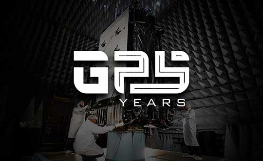
“Celebrating this anniversary gives us a moment to recognize how far we’ve come, but also to get pumped about what lies ahead for our program and our role in executing that.”
By First Lieutenant Tyler Whiting Peterson Air Force Base, Colorado
The Global Positioning System marked its 25th year of operation on April 27.
On this date in 1995, the system reached full operational capability, meaning the system met all performance requirements. U.S. Air Force Space Command formally announced the milestone three months later.
“This is a major milestone,” Gen. Thomas S. Moorman Jr., former Air Force Vice Chief of Staff, said in 1995. “GPS has become integral to our warfighters and is rapidly becoming a true utility in the civilian community.”
Initially developed for the military to meet a critical need for determining precise location on the battlefield, GPS has also become an integral part of technology affecting the lives of billions of people worldwide.
“The United States Space Force’s continuing objective for the constellation is to ensure GPS remains the Gold Standard for global space-based positioning, navigation and timing,” said Gen. Jay Raymond, USSF Chief of Space Operations, and U.S. Space Command Commander.
Image: USAF
Today, the U.S. Space Force operates the GPS satellite constellation as a global utility – always available to everyone, everywhere on Earth.
“GPS is a free for use service provided by the Space Force that enhances everyday lives around the world,” said Brig. Gen. DeAnna Burt, USSF Director of Operations and Communications. “GPS provides the highest accuracy positioning and timing data. In addition to the essential capabilities it provides for the military, GPS underpins critical financial, transportation and agricultural infrastructure. It’s always available, whether for an ATM transaction or securing a rideshare.”
Military capabilities
Its military capabilities first enhanced combat operations in 1990 and 1991 during Operations Desert Shield and Desert Storm. Allied troops relied heavily on the new GPS signal to navigate the featureless deserts in Kuwait and Iraq.
In the early 2000s, during Operations Enduring Freedom and Iraqi Freedom, GPS contribution to warfighting increased significantly. For example, the GPS constellation enabled accurate munitions, allowing the delivery of GPS-aided Joint Direct Attack Munitions with pinpoint precision and minimal collateral damage.
Today, in addition to these and other GPS-enabled warfighting capabilities, Airmen conduct resupply missions with battlefield precision airdrops to combat forces with GPS-guided, parachute-delivered equipment pallets known as “Smart Pallets.”
Continually updated
The GPS operational constellation currently has 31 satellites, and the system is continually updated and modernized, making it a resilient system to maintain the signals required for accurate positioning, navigation and timing around the world.
The first satellite of the new GPS III version, called Vespucci, was launched into space Dec. 23, 2018.
The 2nd Space Operations Squadron at Schriever Air Force Base, Colo., operates GPS. The squadron recently accepted control of the second GPS III satellite, called Magellan, on March 27.
GPS III is meeting users’ emerging needs and responding to tomorrow’s threats with improved safety, signal integrity and accuracy. GPS III satellites are more accurate, have improved anti-jamming capabilities, and have doubled the design life; when compared to previous iterations of GPS. They are also designed to incorporate new technology and changing mission needs,
“The 25th Anniversary is a huge, momentous occasion for us. We take great pride in providing this global utility to the approximately six billion users worldwide,” said Lt. Col. Stephen Toth, 2nd SOPS commander. “Celebrating this anniversary gives us a moment to recognize how far we’ve come, but also to get pumped about what lies ahead for our program and our role in executing that.”
The USGIF Awards Program annually recognizes the exceptional work of the geospatial intelligence (GEOINT) tradecraft’s brightest minds and organizations pushing the community forward.
Award winners are usually recognized at the annual GEOINT Symposium. This year’s event, scheduled for April 26-29 in Tampa, Florida, was canceled because of the COVID-19 pandemic.
“Unfortunately, you will not see the awardees recognized on the GEOINT Symposium stage this year,” said Kevin Jackson, chair of the USGIF Awards Subcommittee. “So please take a moment to read their accomplishments and join me and the USGIF in congratulating the 2020 USGIF Achievement Awardees and the runners-up.”
Award winners are nominated by their colleagues and selected by the USGIF Awards Subcommittee.
“The 2020 USGIF awardees reflect the importance and the significance of the outstanding work that occurs daily in the GEOINT community,” Jackson said. “You will see how the GEOINT community always rises to the occasion to face head on the world’s toughest problems and this year is no exception.”
Academic
James Martin Center for Nonproliferation Studies, Middlebury Institute
On Dec. 7, 2019, after denuclearization negotiations between the United States and North Korea collapsed, North Korea reversed commitments made in Singapore and resumed engine testing at its Sohae Satellite Launch Center. Using new technological opportunities offered by high-cadence moderate resolution satellite imagery and flexible high-resolution satellite image tasking provided by Planet Labs, analysts at the CNS, through the use of open-source GEOINT, detected and correctly identified preparations for the engine test 39 hours before it occurred. Announcing in advance that North Korea was preparing to violate an international nonproliferation commitment.
Community Support
NGA Expeditionary Operations Office
NGA’s Office of Expeditionary Operations provides deployed personnel and technology to support GEOINT activities of worldwide U.S. military operations, humanitarian assistance and disaster relief efforts, and other national security objectives. The team’s world-class workforce seamlessly enables trusted global GEOINT capabilities today, while developing programs and processes to meet emerging challenges. Robust partnerships with DoD and IC allies fuel innovation and expertise, helping U.S. and foreign partners build programs that anticipate their needs, expanding the GEOINT community and optimizing meaningful consequence across the GEOINT enterprise.
Government
Mark A. Skoog and Loyd R. Hook
Implementing digital terrain solutions for safer aviation has been a career-long goal for Mark Skoog and Loyd Hook. As true innovators and lifelong proponents of using digital terrain data, Skoog and Hook lead the development efforts of NASA’s award-winning Automatic Ground Collision Avoidance System (Auto GCAS), which prevents imminent collisions with the ground. Auto GCAS is the culmination of a decades-long effort to bring geospatial intelligence to aircraft safety. This work involved traveling the world, evaluating myriad digital terrain from Sweden to Hawaii. The team extensively tested the system to ensure against every category of controlled flight into terrain mishaps—and found it would have prevented every one, which resulted in ten lives saved thus far in the USAF operations.
Industry
Lockheed Martin Space GATR Team
Globally-scalable Automated Target Recognition (GATR) is an artificial intelligence system that finds objects of interest in satellite imagery on a worldwide basis. It was developed by a team of scientists and engineers from Lockheed Martin Space who combined state-of-the-art deep learning algorithms with scalable high-performance computing in a cloud-based framework to achieve high-speed global automated target recognition (ATR). Unlike other ATR systems, GATR searches extremely large geographic regions with accuracy and speed. The GATR team, led by Dr. Mark Pritt, includes Tyler Bartelmo, Gary Chern, Dr. Austen Groener, Michael Harner, Andy Lam, Stephen O’Neill, Ryan Soldin, and Steve Wozniak.
Military
RS/GIS CX, The GRiD Team
David Finnegan and the Geospatial Repository & Data Management System (GRiD) program provide the Department of Defense (DoD), intelligence community and geospatial community with a centralized repository for the storage, discovery, and dissemination of critical terrain and 3D data. Prior to the GRiD program, the National System for Geospatial Intelligence (NSG) lacked a centralized mechanism for the storage and discovery of this essential content. Historically, the data was subject to local storage, limiting visibility and resulting in retasking collection assets for previously characterized areas, putting military personnel and equipment at risk. By partnering with the National Geospatial-Intelligence Agency (NGA) and the DoD, the GRiD program is now the community standard and enterprise solution for 3D/elevation data discovery across the NSG.
USGIF, the United States Geospatial Intelligence Foundation, is dedicated to bringing together the many disciplines involved in GEOINT to exchange ideas, share best practices and promote the education and importance of a national geospatial intelligence agenda. For more on the awards program, visit the USGIF website.
Image: 4X-image iStock / Getty Images Plus / Getty Images
Nearly 4,000 waivers granted under Part 107; about 20 percent of waivers granted to organizations received by first responders
Almost four years after the Federal Aviation Administration (FAA) established rules for the commercial operation of small unmanned aircraft systems (UAS), a new report by the Association for Unmanned Vehicle Systems International (AUVSI) found that nearly 4,000 operators across all 50 states have been granted waivers to go beyond current regulations.
First responders across the country received about 20 percent of all waivers granted to organizations (398), which demonstrates growing interest and need for public safety applications enabled by UAS, including search and rescue and firefighting at night.
Effective Aug. 29, 2016, the small UAS rule, also known as Part 107, created a uniform regulatory framework for UAS. Among the rule’s requirements, UAS must fly below 400 feet above ground level (AGL), within visual line of sight and during daylight hours.
Recognizing the need for the rule to be flexible to foster innovation, the FAA created a waiver process that allows for expanded types of operations, such as nighttime or beyond line of sight operations, with the approval of the agency.
AUVSI analyzed 3,946 of these waiver documents granted by the FAA since Part 107 went into effect. While the vast majority of waivers (3,636 or 92 percent) were granted to waive the requirement for flying only during the daytime to enable nighttime operations, the FAA has also granted waivers from other sections of the regulations to permit advanced operations, including:
Flights over people (112 waivers);
Operation in certain airspace (97 waivers);
Operating multiple UAS at the same time (55 waivers);
Visual line of sight operations (to enable beyond line of sight operations) (51 waivers).
Operators in all 50 states, as well as the District of Columbia and Puerto Rico, have received waivers. California leads the way with 451 waivers granted, followed by Texas (334), Florida (272) and New York (159). About 87 percent of all waivers were granted to small businesses with fewer than 10 employees and annual revenues of less than $1 million.
“Across the country, operators have demonstrated they are eager to harness the tremendous potential of expanded UAS operations,” said Brian Wynne, president and CEO of AUVSI. “Small businesses have been able to save time and money, and first responders and public safety agencies have used UAS technology to increasingly contribute to the greater good worldwide, supporting missions from disaster relief to humanitarian aid.”
Last month, AUVSI submitted its comments on the FAA’s Notice of Proposed Rulemaking (NPRM) for Remote Identification of UAS. In the comments, AUVSI urged the FAA to proceed concurrently with rulemaking that would allow for expanded operations rather than wait for a fully implemented remote ID rule to avoid unnecessary delays. The FAA says it hopes to issue a final rule before the end of the year.
In the interim, the FAA recently announced several initiatives to improve the waiver application process in response to a review last year of the waiver framework by a task group of the Drone Advisory Committee that was chaired by Wynne.
The FAA’s plans include expediting the waiver renewal application process, particularly in instances where there hasn’t been many changes since the original application; enabling quick administrative changes to previously granted waivers; providing more responsive feedback to applications that were not approved; streamlining the applications; implementing new regulations to obviate the need for waivers; and increasing transparency and accountability to provide support for waiver applications, disapprovals, and general UAS questions.
“The waivers that have been granted so far demonstrate that operators are safely able to conduct expanded operations, such as flights over people and beyond visual line of sight,” said Wynne. “While improvements to the waiver process are needed and welcomed, we urge the FAA to move forward rapidly with rulemakings that would enable these operations widely and provide the economic and societal benefits they offer.”
The National States Geographic Information Council (NSGIC) has released a joint statement on the value of GIS in the pandemic, alongside its partners the MidAmerica GIS Consortium (MAGIC), Open Geospatial Consortium (OGC), Urban and Regional Information Systems Association (URISA), and American Association of Geographers (AAG).
Joint Statement on the Value of GIS in the Pandemic
The spread and effects of COVID-19 can be best understood considering space and time.
As governments are responding to COVID-19, more leaders are recognizing the value of “knowing the where.” The importance of knowing where the outbreak is growing, where high risk populations are, where the hospital beds and important medical resources are, and where to deploy resources is essential. “Knowing the where” informs better decision-making.
In an effort to better understand the where, governments are recognizing the value of geospatial information and technologies and are engaging geospatial professionals to help them better understand the where to help them in their decision-making and response.
Geospatial professionals bring unique analytical and visualization skills to the table that help responders and decision-makers visualize where the pandemic is spreading more quickly and can make the important decisions regarding where response and resource needs need to be focused. The value of telling the story through a map coupled with a geospatial dashboard provides a view of the event not readily seen in a table such as a spreadsheet.
Beyond visualizing existing data, we can connect data from a location perspective, which enhances the value of the data sources being integrated. Equally important in this event is data on COVID-19 cases and testing packaged and shared in a way useful to scientists.
GIS (geographic information systems) is experiencing an unprecedented level of use. Historically, GIS was deployed following a disaster to help respond and recover. Today, GIS is used as a disaster is unfolding. The COVID-19 event is an outstanding example of how effective GIS is when robust data is available. Governments are realizing the value of investing in these systems and the people who run them.
The information necessary to empower all partners already exists.
Current nationwide models and response efforts may not benefit from the details of local geographic parameters. Local or statewide models and response efforts may not fully take advantage of the data from other areas of the country. Hospitals are surveyed by both federal and state agencies, and the results of those surveys are not readily available to the hospitals working together to care for patients. Nationwide geospatial data will empower a coalition of participants with a better understanding of the spread and impacts of COVID-19 and improve mitigation actions.
The same data can be made available in different forms to empower people playing different roles in the response. Researchers — epidemiologists — will benefit from nationwide COVID-19 testing data and data describing factors impacting the spread. This data needs to be as disaggregated as permissible under HIPAA and in a form readily digestible in models.
The case data could be aggregated to the same units of geography as a wealth of existing demographic data (Census tracts), which could explain and quantify local variances in the spread. Policy makers and those in emergency management can benefit from map and tabular dashboards, harnessing the power of the where by integrating data for analytics.
The emergency response, public health and geospatial communities must come together to understand COVID-19 in the U.S. and mitigate its spread and overall impact.
By geo-enabling public health and emergency response data, we can better:
understand the spread — with COVID case data, movements of people, and symptoms
understand the impact on individuals — with data including age, disease, obesity, and medical treatments
understand how to tailor outreach — by age, language, engagement with government, and lifestyle choices
understand the needs of the healthcare industry — by facility, day, bed capacity, type of care, ventilators, and PPE
understand the impact on the local economy — by county, day, unemployment, and bankruptcies
understand the societal impacts — by census tract, domestic violence, alcohol consumption, child abuse, animal abuse, elder abuse, mental health crises, 3-1-1 calls and firearm sales
We are committed to beginning the national conversation about leveraging the best available data to better understand the spread and impacts of COVID-19.
Over the last few weeks, many organizations have transitioned their workforce to remote work environments. At the same time, the demand for geographic information systems (GIS) products and skilled GIS professionals is high.
Esri announces that all of its instructor-led courses are available in its instructor-led online classroom, which is calls “an engaging learning environment that offers convenience and interactivity.”
The company lists these features:
Instructors and course attendees use the phone, chat, and virtual whiteboards to talk and collaborate in real time.
Group breakout sessions and content reviews support peer-to-peer learning and knowledge retention.
Attendees access all Esri software needed to complete course exercises through virtual machines.
“We understand that sustaining business operations and achieving your organization’s mission remains critical,” the Esri Training Team said in an email. “As always, we’re committed to helping you build the skills needed to apply ArcGIS best practices, fuel efficiencies and make the best decisions based on data.”
Esri offers the Esri Training Pass to streamline access to its online instructor-led classes. Users can pre-purchase training days to simplify training registration and approval processes throughout the year.
In times of global crisis, the world relies on the trucking industry to transport essential items across the country. From medical supplies to restocking the shelves at local grocery stores, truck drivers play an integral role in maintaining the supply chain.
To keep these essential items moving during the COVID-19 crisis, the U.S. Department of Transportation (DOT) has suspended most of the Hours of Service (HOS) regulations for trucks that are transporting these essential goods.
Commercial truck drivers have had their driving hours extended from 11 to 14 hours depending on the goods being carried. With so much going on and so many depending on trucking and freight transportation organizations during this global crisis, fleet managers and owners need to be extremely organized to handle current and future industry needs.
With that in mind, here are a few ways in which you can keep track of your fleet during a time of heightened demand and uncertainty.
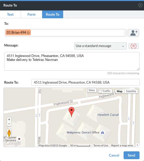
The “Route to” feature in Director. (Photo: Teletrac Navman)
Communication is key
The visibility that essential telematics technology brings can be incredibly helpful. Being able to stay in constant communication with your drivers via messaging and dedicated contact forms — as well as knowing their locations at all times — allows fleet managers to make informed decisions. With things being so hectic right now, knowing where your assets are, who is available for the next load, who is nearest to the depots, and who has encountered longer detention times is critical in a time when efficiently maintaining your fleet on the road is more important than ever.
Most likely due to shelter-in-place orders reducing the traffic overall, many of the states experiencing the highest level of COVID-19 spread are seeing a reduction in travel times for drivers. According to the American Transportation Research Institute (ATRI), freight trucks are clocking faster times overall in these areas, particularly in regularly congested areas.
That being said, because of additional route changes, border regulations and detention delays, freight is taking much longer to transport. Having access to accurate telematics and open lines of communication with drivers will be key in planning and tracking routes.
Documentation should continue
While logs are not mandatory to be kept while under the Federal Emergency Declaration, continuing to make notes and annotate the daily log with the reason for non-compliance is a good practice. This will make sure that logs are current when the Emergency Declaration is lifted. It’s a good idea to integrate a route planner or add-on the service if it isn’t included by your telematics provider to facilitate the planning of loads and tasks. With so much on the fleet manager’s plate and the additional hours drivers are logging, any opportunity for automation should be embraced.
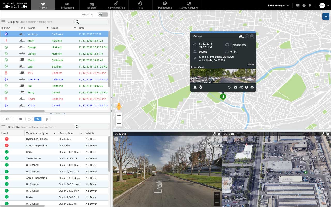
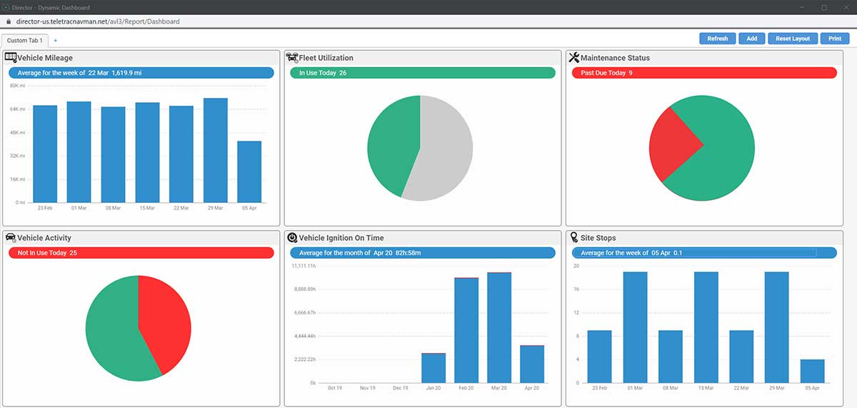
The Dynamic Dashboard of Director. (Photo: Teletrac Navman)
Driver safety
For all fleet managers, the safety of your drivers should be the top priority. DOT HOS regulations are there for a reason. The guidelines, of course, are there to make sure that drivers are not being overtaxed, reducing the possibility of accidents. Giving your team ample time to rest before taking the next load is imperative.
And while its required that drivers receive at least 10 consecutive hours off if they let their company know they need immediate rest, they may be inclined to push themselves given the current situation, feeling a responsibility to their fleet manager and the community at large.
Plus, with people practicing social distancing, it’s likely there will be an uptick in eCommerce purchases, adding additional strain to fleet capacity. A fleet tracking tool will allow managers to review driver’s time, how often they have completed a 14-hour shift, and allow for properly scheduled rest periods to avoid exhaustion and potential accidents.
Tracking rig maintenance
While drivers are putting in the extra miles, so are their rigs! Keeping track of oil changes, tire rotation and other regular maintenance items can keep your drivers and trucks safely on the road. While you may think a global crisis is not the time to stop for regular maintenance, these quick care items are much easier and more cost effective to complete than larger complications they could cause going unaddressed.
An oil change can help engines run more efficiently and reduce a fleet’s cost per mile. Taking time to examine tires could reveal a small leak or puncture which could lead to a popped tire on the road, leaving your driver stuck for hours or even cause them to lose control of the truck from the blowout. Addressing these regular maintenance items will boost efficiency and save time in the long run.
Invest in add-ons
During times of global crisis, the supply chain can change at a moment’s notice. Add-ons such as a brokerage provider integration can help keep the lines of communication open with your customers and help you keep track of where the loads are and when they will arrive. With demand high, and lives on the line while carrying freight like medical supplies, these up-to-the-moment notices can be key in providing your team and customers with the proper support.
Driving demand
There’s no doubt about it: the trucking industry is a key player in combating this global crisis. Delivering everything from medical supplies, to food to other eCommerce purchases for those in quarantine, the country is demanding quite a bit from our fleets.
By staying organized and using helpful telematics tools, fleet managers and owners will be able to meet this challenge with the knowledge they need to make smart decisions. Staying in constant communication with drivers and customers will also help manage expectations and make sure everyone is on the same page.
Marco Encinas, Senior Product Manager at Teletrac Navman, plans the product strategy and roadmap releases globally for all of Teletrac Navman’s software platforms. He gains industry insights from customers, integration partners and R&D to improve current Teletrac Navman product features and tools, and drive development of new product requirements. Before joining the Teletrac Navman team, Encinas planned product strategy and roadmap releases for both commercial and consumer product lines, developed sales training tools and product curriculum at Magellan GPS and Mitsubishi.
Enables building stakeholders to take accurate measurements based on point clouds
The latest release of the NavVis IndoorViewer 3D building visualization software features a new tool that lets building stakeholders take highly accurate measurements based on point clouds in the realistic 360° image view.
NavVis, global provider of indoor spatial intelligence technology and enterprise solutions, announces the release of NavVis IndoorViewer 2.6. This major software release includes a new measurement tool that lets users take highly accurate measurements based on point clouds in realistic browser-based digital buildings.
This release also makes additional features available to structured e57 point cloud files, including automatically generating highly detailed floor plans and routing.
NavVis IndoorViewer is a popular deliverable among building stakeholders without the technical expertise to work with point clouds and modeling software, thanks to the realistic digital buildings and intuitive interface.
One of the features that has proven to be useful among users across multiple industries is the measurement tool. It enables users to take measurements remotely on any device, saving time otherwise spent traveling to the site.
The release of version 2.6 of NavVis IndoorViewer marks a major advance in the accuracy of virtual measurement tools. The tool has been redesigned to overcome two of the biggest problems with virtual measurement tools – accuracy and usability.
On the one hand, point cloud measurements are quite accurate. But often these software tools are not accessible or even usable for a wide range of building stakeholders who lack the expertise in working with point clouds. If, on the other hand, the tool uses images or even meshes, which are much more user-friendly than point clouds, the tools are usually not reliable enough to produce accurate results.
The new measurement tool in NavVis IndoorViewer combines the best of both worlds, thanks to a patent-pending magnifying feature that appears when taking measurements in the realistic 360° view. The magnifying feature reveals the exact section of the point cloud behind the image and lets users pick the point cloud point as the basis for a measurement while benefiting from the intuitive interface of the fully immersive walkthrough.
“When redesigning the measurement tool in NavVis IndoorViewer, we wanted to make sure that a wide range of stakeholders in every industry that works with built environments could benefit from the accuracy of point clouds when taking virtual measurements,” said Georg Schroth, NavVis CTO. “We are confident that the new magnifying feature in NavVis IndoorViewer achieves our goal. Now even stakeholders that are unfamiliar with point clouds have an easy, intuitive way to take measurements based on this highly accurate real world data.”
In addition to making strides in the accuracy of remote measurements, the interface of the tool has also been fully redesigned. This includes a new slider function that lets users view the 2D floor plan and 3D walkthrough side-by-side or move from one view to the other.
The dual view provides an overview of the entire building so that users can easily locate an asset or area while also viewing the location in the realistic 360° view. The fully immersive walkthrough makes it possible to virtually move through the area being measured or inspect the asset, as if the user were on site. Measurements being taken show up in both views.
The release of NavVis IndoorViewer 2.6 also introduces new feature support for e57 point cloud files captured by static scanners. Previous NavVis IndoorViewer releases have included a popular feature that lets laser scanning professionals upload structured e57 point cloud files and automatically generate realistic, fully immersive 360° walkthroughs that can be published and shared with clients as a web-based link.
With the release of NavVis IndoorViewer 2.6, two popular features that were previously only compatible with scan data captured by NavVis hardware are now available for point clouds uploaded as structured e57 files. The first is the generation of a navigation graph, which makes it possible to turn static scans into a fully immersive indoor routing tool. The second is the automatic generation of highly detailed floor plans. Now point cloud files uploaded as structured e57 files can be turned into digital floor plans in a few clicks.