Author: GPS World Staff

  • Sierra Wireless and Maestro Wireless team up for global fleet and asset tracking

    Sierra Wireless and Maestro Wireless team up for global fleet and asset tracking

    The AirPrime HL Series module by Sierra Wireless.
    The AirPrime HL Series module by Sierra Wireless.

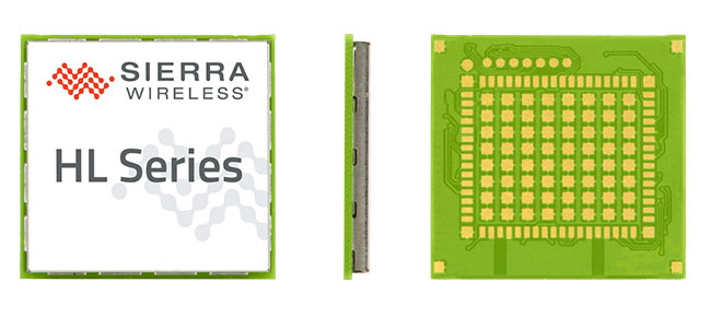
    Maestro Wireless Solutions Limited, a provider of tracking devices for Internet of Things (IoT) applications globally, has announced its first LTE Cat-1 tracker based on the AirPrime HL Series from Sierra Wireless.

    Maestro’s newest tracker, the ruggedized MT-44, provides fleet and asset tracking capabilities in harsh mobile environments using the LTE Cat-1 module with maximum data rates of 10 Mbps downlink and 5 Mbps uplink.

    The Maestro MT-40 Series is a compact range of rugged micro-trackers for the vehicle tracking market.
    The Maestro MT-40 Series is a compact range of rugged micro-trackers for the vehicle tracking market.

    “We have been integrating Sierra Wireless modules into our products for more than 15 years and we have always trusted the company to deliver on leading edge cellular technologies that improve product performance,” said Xavier Dupont, chief executive officer of Maestro. “The HL Series provides us with a single footprint for 2G and 3G global coverage and the LTE Cat-1 module is utilizing the same compact design in our newest tracker.”

    “Today, we are seeing strong interest in our LTE Cat-1 embedded modules optimized for lower bandwidth and power requirements,” said Dan Schieler, senior vice president, OEM Solutions for Sierra Wireless. “We are pleased to have Maestro deploying our latest LTE technology in their tracking devices. The HL Series Cat-1 module provides the next step in the evolution for our customers, as service providers are continuing to transition their networks to LTE technology.”

    The HL Series uses the CF3 form factor from Sierra Wireless that is footprint-compatible across product lines and network technologies, and is fully interchangeable with future versions of the modules, including LTE-M variants when they become available.

    LTE-M is a Low-Power Wide Area (LPWA) technology that will provide a highly efficient cellular option with lower radio-frequency complexity, significantly reduced power consumption (up to 10 years of service on a single AA battery), better in-building signal penetration and lower costs. Sierra Wireless is an active contributor to the LTE-M standard definition process within the 3GPP and has committed to launching compatible modules timed with network deployments, expected to begin in 2017.

    The LTE Cat-1 modules from Sierra Wireless will be commercially available in January 2016 on the HL Series.

  • Lockheed Martin conducts collaborative unmanned systems demonstration

    Lockheed Martin conducts collaborative unmanned systems demonstration

    Lockheed Martin has demonstrated its ability to integrate unmanned aircraft system (UAS) operations into the National Airspace System (NAS) using its prototype UAS Traffic Management (UTM) capabilities.

    During the demonstration on Nov. 18, the Stalker XE UAS provided data and a precise geolocation to the unmanned K-MAX cargo helicopter, which conducted water drops to extinguish a fire, while the UTM tracked the UAS operations and communicated with Air Traffic Control in real time.

    The Stalker UAS directs the unmanned K-MAX cargo helicopter to conduct water drops at a precise location to extinguish a fire. (Photo: Lockheed Martin)
    The Stalker UAS directs the unmanned K-MAX cargo helicopter to conduct water drops at a precise location to extinguish a fire. (Photo: Lockheed Martin)

    “This demonstration represents the path forward for flying UAS in the NAS using Flight Service-based UTM capabilities to extend the technology and systems that air traffic controllers know and understand,” said Paul Engola, vice president, Transportation & Financial Solutions. “We were able to successfully modify the existing K-MAX and Stalker XE ground control software to connect to the UTM services and conduct the firefighting mission.”

    For more than 80 years, manned aircraft have supported firefighting missions during daylight hours. Because unmanned K-MAX can fly day and night, in all weather, its insertion into firefighting operations offers the potential to triple the amount of time ground firefighters can receive aerial support.

    The Stalker XE UAS worked in tandem with K-MAX to identify hot spots and fire intensity with its electro-optical, infrared camera. Its stable, high-definition imaging capabilities enable day and night operations. Powered by a ruggedized solid oxide fuel cell, Stalker XE achieves more than eight hours of flight endurance.

    The Stalker and K-MAX operated in collaboration with a prototype UAS Traffic Management (UTM) system, which provides essential capabilities to enable safe UAS operations. (Photo: Lockheed Martin)
    The Stalker and K-MAX operated in collaboration with a prototype UAS Traffic Management (UTM) system, which provides essential capabilities to enable safe UAS operations. (Photo: Lockheed Martin)
  • InvenSense licenses inertial navigation tech to Huawei

    InvenSense licenses inertial navigation tech to Huawei

    Huawei has licensed the InvenSense Positioning Library (IPL) software sensor-assisted positioning technology for incorporation into the Kirin 950 mobile application processor platforms by HiSilicon.

    InvenSense is a provider of micro-electro-mechanical (MEMS) sensor platforms. The recently launched Huawei Mate 8 smartphone is the first model to incorporate the HiSilicon and IPL technology.

    IPL improves smartphone GNSS-only implementations by providing more continuous and accurate navigation in areas with poor GNSS signal quality. The IPL solution delivers sensor-enhanced positioning providing a high-availability, high-accuracy turn-by-turn navigation user experience to HiSilicon mobile platforms and mobile application developers.

    Through this collaboration, InvenSense and HiSilicon will make continuous improvements to IPL and the overall location subsystem to provide the best possible navigation experience to Huawei’s customers.

    Huawei Mate 8 smartphone is the first model to incorporate Invensense MEMS technology.
    The Huawei Mate 8 smartphone is the first model to incorporate Invensense MEMS technology.

    The combination of sensor positioning with GNSS enhances navigation user experience by eliminating “GPS Signal Lost” warnings and unnecessary re-routings in map applications due to GNSS multipath errors. IPL uses complex algorithms that take sensor data from the mobile device gyroscope, accelerometer, magnetometer and barometric pressure sensors to generate an inertial navigation system (INS) that tracks the position change of a vehicle or pedestrian.

    IPL then combines the INS with GNSS to provide always-available and more accurate location data when GNSS is inaccurate or unavailable, such as in deep urban canyons with tall buildings or in tunnels and parking garages. IPL operates in any physical orientation allowing the user to freely move the phone in the vehicle during active navigation sessions.

    “Today’s consumers are increasingly using smartphones for turn-by-turn navigation in vehicles, creating a strong need for a higher quality user experience that decreases the occurrence of confusing or stressful re-routes and GPS lost signal messages,” said Eitan Medina, vice president marketing and product management at InvenSense. “We are pleased that HiSilicon, a market leader in end-to-end chipsets and solutions, has chosen our IPL technology for integration into its mobile platforms.”

    IPL is available now for smartphones using Android, iOS, Windows and general Linux operating systems.

  • CHC Navigation unveils i80 GNSS receiver

    Photo: CHC Navigation CHC Navigation has announced in a news release the availability of its new GNSS receiver, the i80.

    The i80 receiver for surveyors and contractors is able to compute a true triple frequency RTK tilted pole sub-centimeter solution using all four worldwide and multiple regional constellations.

    “Over two years of R&D and testing went into the creation of our Linux OS i80 platform,” said George Zhao, CEO of CHC.

    The i80’s LCD GUI allows for common workflow operations, such as Static Logging, AutoBase, AutoRover, and UHF channel selection to be easily performed without the need of a data collector or computer. The CHC i80 is the smallest receiver on the market with dual hot-swappable batteries, CHC says. The receiver contains a full array of sensors and modules: multiple MEMS, Internal Tx/Rx UHF, multi-band cellular modem, Wi-Fi, Bluetooth, Serial, USB and more.

    “This innovative design will allow us to add new functionality [with over the air updates] for years by combining the sensors and modules in new ways — this is illustrated by our LCD supported work modes, and our MEMS enabled unleveled pole surveying added in the last couple months during product rollout,” Zhao said. “We are bringing GNSS in to a new era of productivity and ergonomics in a low-cost open platform allowing for unrestricted third-party integration via our i80 API.”

  • Hexagon and Huawei partner to deliver smart city solutions

    Hexagon AB has entered a strategic partnership with Huawei, an information and communications technology (ICT) company, to deliver smart city solutions.

    With most of the world’s population living in cities, safety and infrastructure challenges are at an all-time high. Hexagon and Huawei are working together to meet this global challenge by integrating Huawei’s communications hardware with Hexagon’s safety and infrastructure software solutions.

    The combined solution improves inter-agency collaboration and leverages big data analytics to better predict, prepare for, and respond to urban area challenges.

    Safety is a primary focus of the combined solution, offering cities connected command centers with integrated systems that maximize efficiencies in all preparedness and response areas. Huawei’s contributions include technologies from its Safe City portfolio such as high-definition video surveillance, broadband trunking and IP-based conference calling systems. Hexagon’s emergency response, utilities management and transportation software solution portfolio, which includes computer-aided dispatch, will provide the visibility and decision-support backbone to enable customers to think and act more nimbly.

    “Huawei’s technologies, expertise and global coverage, especially in emerging market areas, nicely complement our ability to deliver smart city solutions to law enforcement, government, security personnel and other public service agencies around the world,” said Ola Rollén, Hexagon president and CEO.

    “Safety, including efficient response to crisis management, will continue to be a key challenge for urban management, especially in developing economies that are stimulating population movement into these areas,” said Yan Lida, president of Huawei Enterprise Business Group. “Together with Hexagon, the global authority on safety and infrastructure solutions, our extensive ICT technologies that help architect safe city infrastructure will help make societies safer.”

  • MicroSurvey CAD 2016 provides new capabilities for survey

    MicroSurvey CAD 2016 provides new capabilities for survey

    Photo; MicroSurvey CAD

    MicroSurvey Software has released MicroSurvey CAD 2016, the newest generation of its desktop survey and design program for land surveyors and civil engineers. Powered by a new IntelliCAD 8.1a engine and enhanced with a suite of new point-cloud management tools, the software makes high-impact drafting and design fast and intuitive, the company said.

    Users on multi-core computers will experience up to 300 percent faster performance compared to previous versions, which substantially improves productivity. Navigation has been enhanced through a new ribbon interface with high-resolution icons that provide easy access to frequently used tools. The newest version of the software is also able to open and export DGN files, handle annotation scaling, and publish drawings as DWF/DWFX, PNG and JPG files.

    Point Clouds. The new release includes significant enhancements for working with point clouds. The Ultimate and Studio versions of the software are now powered by the same point-cloud engine that drives Leica Cyclone and CloudWorx software, making it possible to directly import Leica Cyclone and Leica JetStream databases using Cyclone dialogs.

    Users can view panoramic photographs captured by the laser scanner and snap to points directly from the photographs in a TruSpace window. Point-cloud data is now displayed directly within the CAD model space, and users can snap to the point-cloud points using standard CAD tools.

    MicroSurvey CAD is compatible with field data from all major total stations and data collectors and is fully compatible with AutoCAD. It includes complete survey drafting, COGO, DTM, traversing, volumes, contouring, point-cloud manipulation and data-collection interfacing. No plug-ins or modules are necessary. Both a 64-bit version and a 32-bit version of the software are available.

  • KCS offers low-cost TraceME tracking module

    KCS offers low-cost TraceME tracking module

    Photo: KCS

    KCS BV has extended its TraceME product line with a low-budget track-and-trace module based on LoRa technology.

    The TM-900/N1C1 is a variant of the TraceME GPS track-and-trace product line targeted for tracking and tracing a variety of objects, including livestock, and for personal use.

    The full version module is equipped with different technologies for traceability — such as GPS, LoRa, Bluetooth LE, ANT/ANT+ and proprietary RF — which can be combined depending on the application. Traditional national telecom costs are eliminated because of the absence of GPRS/SMS.

    Applications include:

    • Object protection, up to 10 years of standby on a single lithium AAA-battery.
    • Logistics, M2M.
    • Animal tracking, asset monitoring.
    • Security and surveillance.
    • Remote control and diagnostics.
    • Anti-theft.

    The combined LoRa and 2.4 GHz. RF technologies offer tracing over a wide area up to 10 km. The rough tracing from 10 km down to 300 meters is done by LoRa, while the short-range tracing is done by the proprietary RF-technique, which offers excellent indoor and outdoor tracing with an accuracy up to 1.5 meters.

    Unique features include its small size at 49.6 by 15 by 7.5 millimeters, its weight at 3.4 grams and a standby battery lifespan of more than 10 years. Temperature, humidity and acceleration sensors — as well as solar power functionality — enable the integration of TraceME into a variety of custom specific machine-to-machine applications.

  • Trimble’s Beijing airport construction contract extended with machine control

    Trimble’s Beijing airport construction contract extended with machine control

    Artist's concept of the new Beijing Airport terminal. (image © Zaha Hadid Architects)
    Artist’s concept of the new Beijing Airport terminal. (image © Zaha Hadid Architects)

    Trimble has received a contract extension for Beijing’s new airport project. In April, Trimble won the initial bid to supply the project with a construction information management system. Based on the success of the solution to date, the contract has been extended to include additional machine control systems for soil stabilization.

    Beijing’s new airport is projected to handle 72 million travelers, 2 million tons of shipping and 620,000 flights by the year 2025. It is a massive construction project with an unprecedented amount of civil aviation investment by the Chinese government. In order to construct the airport in a safer, more efficient manner, achieve transparent management, and maximize construction quality, the Beijing new airport project is using construction technology from Trimble to integrate construction and operations.

    Artist's depiction of the inside of the new Beijing Airport terminal. (image:  Zaha Hadid Architects)
    Artist’s depiction of the inside of the new Beijing Airport terminal. (image: Zaha Hadid Architects)

    Trimble was chosen to implement a browser-based, locally hosted digital construction information management system for tracking and monitoring construction operations in real time. The Trimble solution allows users to create 3D constructible models, perform soil stabilization, automate construction processes and effectively manage information. Based on the successful soil stabilization results using Trimble machine control over the past four months, another 15 systems have been ordered.

    “The research results for dynamic compaction have been extremely promising,” said Li Qiang, chief engineer of the Beijing New Airport Construction Office. “As a result, the project is pushing forward with a larger scale deployment to further the research into creating new methods and standards for airfield construction.”

    “The Beijing new airport project is a significant win for Trimble, and we are very excited about the success of the project,” said Steve Berglund, president and CEO of Trimble. “The contract extension validates Trimble’s ability to provide innovative solutions that transform work processes by maximizing management capability, ensuring construction quality and improving productivity.”

    Trimble’s machine control solutions leverage a variety of technologies, including GPS, construction lasers, total stations, wireless data communications, the Internet and application software. As part of the Trimble Connected Site strategy, these solutions provide a high level of process and workflow integration from the design phase through to the finished project, delivering significant improvements in productivity throughout the construction lifecycle, the company said.

    Terminal construction: The technology used allows creation of 3D constructible models and automated construction processes. (Photo: Trimble)
    Terminal construction: The technology used allows creation of 3D constructible models and automated construction processes. (Photo: Trimble)
  • Seen & Heard: GNSS and PNT in the news

    Seen & Heard: GNSS and PNT in the news

    A snapshot of interesting stories involving GNSS and position, navigation and timing (PNT) technology from around the world

    Hover over a map, then the dots, to view the stories.
    (Map: iStock.com/nadla)

    2015 2016 2017 2018 2019

    April 2019

    Map: iStock.com/nadla
    View the April Seen & Heard — which covers global quantum communication, pigeon scientists and more — here.

    March 2019

    Map: iStock.com/nadla
    View the March Seen & Heard — which covers using GNSS to signals to obtain rain information, a Galileo constellation mobile app and more — here.

    February 2019

    January 2019


    December 2018

    November 2018

    October 2018

    September 2018

    August 2018

    July 2018

    May 2018

    April 2018

    March 2018

    February 2018

    January 2018


    December 2017

    November 2017

    October 2017

    September 2017

    August 2017

    July 2017

    June 2017

    May 2017

    April 2017

    March 2017

    February 2017

    January 2017


    December 2016

    November 2016

    October 2016

    September 2016

    May 2016

    April 2016

    March 2016

    February 2016

    January 2016


    December 2015

    November 2015

  • Research Online: HF beacon navigation, inertial sensors and GNSS-INS integration

    Photo: HF Beacon NavigationHF Beacon Navigation

    Navigation using High-Frequency Ground Beacons and Ionosphere Model Corrections, by Yoav Baumgarten and Mark L. Psiaki, Cornell University.

    A new navigation concept relies on passive one-way ranging using pseudorange measurements of high-frequency (HF) beacon signals reflected off the ionosphere.

    This is being developed as a possible alternative to GNSS positioning and timing services, with benefits in costs and system redundancy. The HF signals are transmitted from ground-based beacons, traveling from known locations to the unknown user equipment (UE) location along ray paths that reflect off the Earth and the ionosphere. If a set of beacon signals reaches the UE receiver with sufficient geometric diversity, then the three-dimensional position and the clock offset of the receiver can be determined.

    Presented at ION GNSS+ 2015.

    Inertial Sensors

    Dynamic Stochastic Modeling of Inertial Sensors for INS/GNSS Navigation, by M. Wis, Deimos Space, Spain; Ismael Colomina, GeoNumerics, Spain.

    Researchers performed a series of experiments with a low-cost inertial device rigidly attached to a navigation-grade reference IMU and found a direct relationship between the low-cost IMU errors and the high-order dynamics. Preliminary results suggest an approach of low-cost sensor modeling that might help reduce some of the errors inherent to the dynamics applied to the sensors.

    Presented at ION GNSS+ 2015.

    GNSS-INS Integration

    Quasi-Tightly-Coupled GNSS-INS Integration with a GNSS Kalman Filter, by Bruno Scherzinger, Applanix Corporation, Canada.

    This method, intended for integration of an existing GNSS navigation engine into a GNSS-INS closed-loop configuration with little/no modification of the navigation engine, uses a range measurement model matrix typically used to compute dilutions of precision (DOP) to identify the observable subspace in the time-space frame generated by the available satellites and project the loosely coupled INS-GNSS Kalman filter position measurement into this subspace.

    Presented at ION GNSS+ 2015.

  • Expert Opinions: FAA UAV registration requirement

    Q: What do you think of the FAA requirement that all UAV purchasers register their devices?

    Lydia Bock President and CEO Geodetics Inc.
    Lydia Bock
    President and CEO
    Geodetics Inc.
    A: We need a pragmatic and sensible response to the integration of UAVs into the civil airspace, balancing safety of civil aviation and the economic benefits associated with the emerging markets and applications of UAV technologies.

    Clearly maintaining flight safety in the national airspace is critical. A balanced approach would include registration of UAVs, education for hobbyists and FAA flight certifications for commercial operations.

    New technologies for automated sense-and-avoid should be investigated, and their certification for use should be streamlined.


    John Studenny Director System Engineering Esterline - CMC Navigation Systems
    John Studenny
    Director System Engineering
    Esterline – CMC Navigation Systems
    A: Registration of all radio-controlled (RC) aircraft or UAVs upon purchase may be too broad or harsh, and may conflict with current freedoms already enjoyed by hobbyists.

    However, as capabilities (altitude, speed, flight duration, payload capacity) increase beyond what today’s RC aircraft or UAVs can deliver, regulations and registration may be required.

    It comes down to UAV capability and how the UAVs are used. That needs to be the focus of any regulation or enforcement.

  • Galileo satellites 11 and 12 integrated for Arianespace’s year-end mission

    Galileo satellites 11 and 12 integrated for Arianespace’s year-end mission

    Galileo-launch-11-12
    Launch poster for the upcoming launch of Adriana and Liene, also known as Galileo 11 and 12.

    The two spacecraft for Arianespace’s latest Soyuz launch at the service of Europe’s Galileo satellite-based navigation system — and the company’s record 12th mission overall in 2015 — have been integrated at the French Guiana Spaceport in preparation for their Dec. 17 liftoff.

    The launch of Galileo satellites 11 and 12 — dubbed Adriana and Liene — will conclude a year when the number of Galileo satellites in orbit will have doubled.

    With this launch, ten years after the launch of GIOVE A, on Dec. 28, 2005, the Galileo constellation will become a reality.

    During activity in the Spaceport’s S3B clean-room facility, the spacecraft pair was mated with their dispenser, which will deploy the satellites by firing a pyrotechnic system for separation in opposite directions at the orbital insertion point.

    The satellite/dispenser combination is ready for integration on Soyuz launcher’s Fregat upper stage, followed by the payload fairing encapsulation. This will create the “upper composite,” which is to be installed atop Soyuz once the vehicle has been moved to its Spaceport launch site.

    Arianespace’s Dec. 17 mission, designated Flight VS13 in the company’s launcher family numbering system, will orbit two Galileo FOC (Full Operational Capability) satellites, further augmenting the European constellation of navigation spacecraft.  The satellites are built by prime contractor OHB System in Bremen, Germany, with their onboard payloads supplied by UK-based Surrey Satellite Technology Ltd (SSTL), which is 99 percent owned by Airbus Defence & Space.

    Galileo-11-12-cleanroom
    Galileo 11 and 12 are prepared for launch in the clean room. (Video capture: ESA)

    The Galileo system is designed to provide high-quality positioning, navigation and timing services under civilian control. Its Full Operational Capability phase is managed and funded by the European Commission, with the European Space Agency (ESA) delegated as the design and procurement agent on the Commission’s behalf.

    Flight VS13 will close out a busy year — complementing the 11 previous missions in 2015, which were composed of two other launches with the medium-lift Soyuz, three using the light-lift Vega and six with the heavy-lift Ariane 5.

    Below is an ESA video about the upcoming launch.

    Follow Arianespace’s launch activity at www.arianespace.com.