Author: GPS World Staff

  • GPS IIF-11 Set to Launch Oct. 30

    GPSIIF11_SupportImageA United Launch Alliance Atlas V 401 will launch the GPS IIF-11 mission for the U.S. Air Force on Friday, Oct. 30, from Space Launch Complex-41 at Cape Canaveral Air Force Station, Fla.

    GPS IIF-11 is the second to last of the Block IIF satellites, incorporating improvements to provide greater accuracy, increased signals, and enhanced performance for users.

    The GPS IIF satellites deliver second civil signal (L2C) for dual-frequency equipment, and a new third civil signal (L5) to support commercial aviation and safety-of-life applications. The next generation of GPS satellites is GPS III.

    GPS IIF-11 will be the third GPS mission ULA launches in 2015. GPS IIF-9 launched on a Delta IV in March, and GPS IIF-10 launched in July. This mission will be ULA’s 11th in 2015 and 102nd since the company was founded in 2006.

    To keep up to speed with updates to the launch countdown, dial the ULA launch hotline at 1-877-852-4321 or join the conversation at www.facebook.com/ulalaunch, twitter.com/ulalaunch and instagram.com/ulalaunch; hashtags #GPSIIF11, #AtlasV.

  • Last of 12 GPS IIF Satellites Arrives at Cape Canaveral

    Last of 12 GPS IIF Satellites Arrives at Cape Canaveral

    A quality assurance team from the 45th Launch Group off-loads a GPS IIF-12 satellite from a C-17 Globemaster III on Cape Canaveral Air Force Station, Fla., Oct. 8. A crowd from the government and industry partnership, who will complete the satellite’s final assembly, gathered on the Cape’s “Skid Strip” to watch the off-loading of the satellite they will prepare to launch aboard a United Launch Alliance rocket in 2016. (U.S. Air Force photo/James Rainier)
    A quality assurance team from the 45th Launch Group off-loads a GPS IIF-12 satellite from a C-17 Globemaster III on Cape Canaveral Air Force Station, Fla., Oct. 8. (U.S. Air Force photo/James Rainier)

    The last Air Force GPS IIF in a block of 12 satellites was delivered to Cape Canaveral Air Force Station, Florida, from Boeing’s manufacturing facility in El Segundo, Calif., Oct. 8 via a C-17 Globemaster III.

    A crowd from the government and industry partnership, who will complete the satellite’s final assembly, gathered on the Cape’s “Skid Strip” to watch the off-loading of the satellite they will prepare to launch aboard a United Launch Alliance rocket in 2016.

    In related news, GPS IIF-11 is set to launch Oct. 30. Launch of GPS IIF-12 is scheduled for February 3, 2016.

    “This GPS IIF-12 satellite represents the end of a legacy as it will be the last of the 61 GPS satellites processed here at (Cape Canaveral Air Force Station),” said Brig. Gen. Wayne Monteith, the 45th Space Wing commander. “This culminates an incredible 27-year legacy at our Area 59 Satellite Processing Facility. We are the nation’s premier gateway to space and are humbled to be a part of the team that provides GPS and its capabilities to the world.”

    Although there have been other models of GPS launched into space, the Airmen-led processing team at Area 59 is particularly proud to begin preparations to send the last IIF block satellite into orbit. They’ve been behind every launch of the series since the first GPS IIF launched here in May 2010.

    “Our combined team’s objective is 100 percent mission success each and every time,” said Col. Eric Krystkowiak, the 45th Launch Group commander. “My Airmen work, in partnership, with Boeing and the system program office at the Space and Missile Systems Center throughout the final stages of satellite processing prior to launch. From spacecraft containerization, shipment from California, the arrival at the Cape Canaveral Air Force Station Landing Strip, final checkouts, fueling and encapsulation, the team is laser focused on identifying and mitigating any issues that could potentially jeopardize mission success.”

    The Boeing-assembled GPS IIF 12 that arrived at the Cape Canaveral will undergo a series of prelaunch preparations, checks and rehearsals. These included functional checkout of the spacecraft, compatibility testing, battery installation, fueling, mating to the payload adapter and obtaining a final flight weight.

    Members of the quality assurance team range from young military officers to career enlisted troops and seasoned civilians.

    “Mission assurance at the launch base is executed with our ‘triad’ of professionals,” Krystkowiak said. “Our mission assurance technicians are enlisted personnel with many years of experience in missile maintenance who are fully engaged and observe the contractor’s work with the satellite. They bring their hands-on experience, strict technical compliance and discipline to the satellite processing realm. Beside them are our company grade officers and civilian engineers who bring their engineering rigor and innovative ideas into the process. Lastly are our Aerospace Corporation partners who provide invaluable experience and legacy system insight to the team with their continuity of satellite processing. Many of these members have been here at the Cape since GPS first launched in 1989 and achieved full operational capability in 1995.”

    A field program manager for the team interfaces with 45th SW leadership, the Air Force SMC and the contracted partners throughout the months in between the satellite’s delivery and its launch.

    The Evolved Expendable Launch vehicle is used to launch GPS satellites from Cape Canveral into nearly 11,000-mile circular orbits. While circling the Earth, GPS satellites transmit extremely accurate timing data on multiple L-band frequencies. Design life across the satellite blocks range from 7.5 to 12 years, but many are lasting more than 20 years, with the oldest vehicle turning 25 in November.

    The GPS Master Control Station, operated by the 50th SW’s 2nd Space Operations Squadron at Schriever Air Force Base, Colo., is responsible for monitoring and controlling the GPS as a 24-satellite system, consisting of six orbital planes, with a minimum of four satellites per plane. There are currently 39 vehicles in the GPS constellation.

  • Magellan Integrates RoadMate with Position Logic Tracking Platform

    Magellan Integrates RoadMate with Position Logic Tracking Platform

    The Magellan RoadMate RC9496T-LMB commercial navigator.
    The Magellan RoadMate RC9496T-LMB commercial navigator.

    Magellan is integrating its RoadMate RC9496T-LMB fleet navigation device with Position Logic’s advanced GPS tracking software solution. The partnership allows Position Logic service providers to leverage all Magellan RoadMate RC9496T-LMB devices.

    The RoadMate RC9496T-LMB, a 7-inch Android GPS fleet navigation device, is available now to current and prospective Magellan and Position Logic customers. Position Logic, a division of KORE, provides precision location-based services for business-to-business applications.

    The Magellan and Position Logic integration delivers a powerful and seamless end-to-end communication and navigation solution for fleets, the companies said. The solution includes the RC9496T-LMB, an active mobile terminal, allowing real-time two-way communication between driver and dispatch when paired with Position Logic’s GPS tracking software. Users can send and receive important information to immediately identify driver status including route-receipt, in-route or on-scene, and deliver real-time messages to improve driver productivity. The solution delivers critical information for field service fleets, emergency services, roadside assistance and many more applications.

    “Position Logic is an innovative technology leader in the location based services space. We are pleased to partner with them and offer the Magellan RC9496T-LMB to Position Logic customers,” said Stig Pedersen, associate vice president of product management for Magellan. “The combination of our two services delivers a highly efficient and flexible way for dispatchers to communicate with drivers in real-time, saving time, money and frustration.”

    The RC9496T-LMB is also connected to Magellan’s SmartGPS Eco cloud, providing drivers and fleet managers with customizable time and money saving content such as: real-time fuel price information, weather and truck speed limit warnings.

    “We are pleased to have the RoadMate RC9496T-LMB integrated. The Magellan integration further complements our Workflow/Dispatch module; improving communication between the dispatcher and driver and enhanced stop management,” said Felix Lluberes, executive vice president, advanced applications, KORE. “I am certain our service providers will be able to leverage the device and deliver more comprehensive services.”

    The Magellan RoadMate RC9496T-LMB is available now. It has an MSRP of $399.

  • Global Car GPS Industry Analyzed in New Market Report

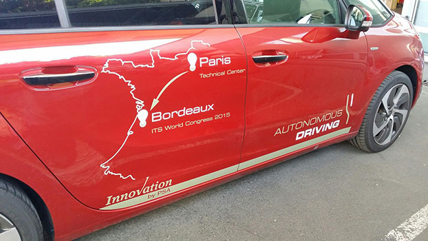
    The Global Car GPS Industry 2015 Market Research Report is a professional and in-depth study on the current state of the car GPS market spread across 108 pages, profiling 21 companies and supported with 245 tables and figures. The report is divided into 13 major chapters that offer an overview of the current market, as well as forecasts for the car GPS industry.

    The report provides a basic overview of the car GPS industry, including definitions, classifications, applications and industry chain structure. Analysis is provided for the international markets, including development trends, competitive landscape analysis and key regions’ development status. Development policies and plans of the car GPS industry are discussed and analyzed, as well as manufacturing processes and cost structures. This report also states import/export consumption, supply and demand figures, cost, price, revenue and gross margins.

    The report focuses on major global players in the car GPS industry, providing information such as company profiles, product picture and specification, capacity, production, price, cost, revenue and contact information. Upstream raw materials and equipment and downstream demand analysis is also carried out. Industry development trends and marketing channels are analyzed. Finally, the feasibility of new investment projects are assessed and overall research conclusions offered.

    With 245 tables and figures supporting the car GPS industry analysis, the research provides key statistics on the state of the industry and is a source of guidance and direction for companies and individuals interested in the market. Companies profiled include Coagent Electronic S&T Co. Ltd. (Guangdong), Denso (Tianjin), Soling Industrial (Shenzhen), Rotiss Electronics (Huizhou), Shinco (Jiangsu), Skypine Electronics (Shenzhen), UniStrong (Beijing), RoadRover Technology (Shenzhen), Bosch (Shanghai), Newsmy (Beijing), Pioneer (Shanghai), Wanlida Group (Xiamen), BDStar Navigation (Beijing), FlyAudio (Guangzhou), ChanghongIT (Sichuan), Saige GPS (Shenzhen), Panasonic (Beijing), Link Create (Shenzhen), Clarion (Dongguan), Alpine (Beijing)  and Aisin (Tianjin).

    A related study titled “2015 Deep Research Report on Global Vehicle GPS Industry” provides a basic overview of the industry including definitions, classifications, applications and industry chain structure. The vehicle GPS market analysis is provided for the China markets including development trends, competitive landscape analysis, and key regions development status.

    With 147 tables and figures, the report provides key statistics on the state of the industry and is designed to be a valuable source of guidance and direction for companies and individuals interested in the market. The report focuses on China’s major leading industry players, providing information such as company profiles, product picture and specification, capacity, production, price, cost, revenue and contact information. Upstream raw materials and equipment and downstream demand analysis is also carried out.

    Vehicle GPS industry development trends and marketing channels are analyzed. Finall,y the feasibility of new investment projects are assessed and overall research conclusions offered. Companies such as Garmin, TomTom, Cobra, GlobalSat, Jensen, Deeper, Dragonpad, PUMPKIN, Pupug, Pyle, Rand McNally, Raymarine, Soundstream, Sourcingbay, Stouch, Uniden, YINUO, Generic  and Humminbird  are profiled.
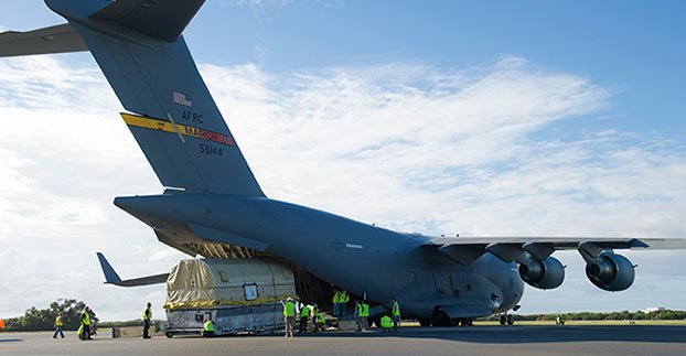
  • Cobham Launches Two ‘Sailor’ Marine Receivers

    Cobham Launches Two ‘Sailor’ Marine Receivers

    SAILOR 6560 GNSS_500x500
    The Sailor 6560 GNSS System is delivered with the Sailor 6004 Control Panel and the corresponding Sailor 6285 GNSS Antenna or Sailor 6286 DGNSS Antenna.

    Cobham SATCOM has launched two new Sailor satellite navigation receivers. Both the Sailor 656X GNSS and new Sailor 657X DGNSS (Differential GNSS) are black-box products designed to be part of a system Cobham SATCOM refers to as its “multi-function universe.”

    The advanced touchscreen Sailor 6004 Control Panel at the heart of the Multi-Function Universe provides full control for all products connected to it from a single device. The Sailor 656X GNSS and Sailor 657X DGNSS join the Sailor 6391 Navtex and Sailor 628X AIS as new generation Sailor products designed to work with the Sailor 6004 Control Panel. Operation of all systems connected to the Sailor 6004 Control Panel is done by selecting the icon for the product on the touchscreen, providing access to set-up, functions and diagnostics.

    “The Multi-Function Universe approach means that a variety of products can all be accessed from a single screen on the bridge and anywhere else a repeater is needed, making installation far more flexible than with traditional products that all require their own screen. The approach also saves space on the bridge, and importantly, makes the life of maintenance engineers easier as they have a single point of entry to the network,” explains Claus Hornbech, Business Manager, Cobham SATCOM.

    The Sailor 656X GNSS and the Sailor 657X DGNSS collect satellite data from any available navigation satellites including GPS and GLONASS and distribute it to a variety of on board systems such as; ECDIS (Electronic Chart DISPlay System), INS (Integrated Navigation System), GMDSS (Global Maritime Distress & Safety System), SATCOM (Satellite Communication System), MCS (Master Clock Systems) and PABX (Telephone Exchanges).

    Cobham SATCOM offers four variants of its new satellite navigation products, all of which are designed 100% in house. The Sailor 6560 GNSS System and Sailor 6570 DGNSS System are delivered with the Sailor 6004 Control Panel and the corresponding Sailor 6285 GNSS Antenna or Sailor 6286 DGNSS Antenna, while the Sailor 6561 GNSS Basic and Sailor 6571 DGNSS Basic are delivered with the antennas only.

    All four variants use the same proprietary Sailor 6588 DGNSS Receiver, which provides highly accurate data, enhanced by means of Satellite Based Augmentation System (SBAS) from various areas including WAAS (Wide Area Augmentation System) for the United States, EGNOS (European Geostationary Navigation Overlay Service) in Europe, and systems from Japan, India and Russia. The Sailor 6285 GNSS Antenna and Sailor 6286 DGNSS Antenna are also both new, designed and manufactured according to Cobham SATCOM’s quality standards.

    “The accuracy and availability of satellite positioning and timing data is vital to vessel safety as so many critical navigation and communication systems rely on it to operate,” adds Jan Kragh Michelsen, VP Maritime Business Development, Cobham SATCOM. “All elements, from the black-box to the antennas, multi-function display and the user-interface of the systems are new and developed 100 percent in house at Cobham SATCOM, so customers can be confident in the reliability of our new GNSS and DGNSS products, in addition to our revolutionary Multi-Function Universe operating concept.”

  • UK Government Releases Space Weather Preparedness Strategy

    UK Government Releases Space Weather Preparedness Strategy

    The different space weather phenomena. (Image: UK Department for Business Innovation & Skills)
    The different space weather phenomena. (Image: UK Department for Business Innovation & Skills)

    A “Space Weather Preparedness Strategy” has been issued by the government of the United Kingdom. The document sets out the nature of the risk to the UK from severe space weather, as well as progress made to prepare for the risk and priorities for future work.

    Responsibility for managing the risk passed from the Cabinet Office to the Department for Business, Innovation and Skills in 2015.

    The strategy — produced for government and local responders to guide preparedness — has been shared with international, industry and academic stakeholders. It is an updated version of the “Space Weather Preparedness Strategy” produced in July 2014.

    The UK approach to space weather preparedness is underpinned by three elements: designing mitigation into infrastructure where possible; developing the ability to provide alerts and warnings of space weather and its potential impacts; and having in place plans to respond to severe events.

    “The main challenge we face is that awareness of the risk is low,” reads the report’s executive summary. “Much more needs to be done to encourage potentially vulnerable sectors to adopt measures to mitigate the likely impacts.”

    Space weather, resulting from solar activity, can produce X-rays, high energy particles and coronal mass ejections of plasma. According to the executive summary, “Where such activity is directed towards Earth there is the potential to cause wide-ranging impacts. These include power loss, aviation disruption, communication loss, and disturbance to (or loss) of satellite systems. This includes GNSSs, on which a range of technologies depend for navigation or timing.”

    GPS World reported on Richard Langley’s ionospheric research project in the March issue. Langley manages the CANSPACE Listserv, which includes frequent updates about ionospheric events.

    The sun has an 11-year cycle of activity, with the current cycle peaking in early 2014. (Image: UK Department for Business Innovation & Skills)
    The sun has an 11-year cycle of activity, with the current cycle peaking in
    early 2014. (Image: UK Department for Business Innovation & Skills)


  • Newest GNSS Satellites Being Tracked

    News courtesy of CANSPACE Listserv.

    Galileo has added two satellites to its constellation.

    Shortly after the Galileo satellite using the E24 PRN code started transmitting, its sibling began transmitting using code E30. Several stations participating in the International GNSS Service Multi-GNSS Experiment are tracking the new satellites.

    Prof. René Warnant from the University of Liege has reported that as of 10 October, their  PolaRx4 and PolaRxS receivers (but not yet NetR9 receivers) are tracking one of the new Galileo satellites using code E24.

    Meanwhile, the latest BeiDou satellite, BeiDou I2-S, appears to have reached its orbital slot with a nominal nodal longitude of 95 degrees east.

  • Prototype Car Travels from Paris to Bordeaux in Autonomous Mode

    Prototype Car Travels from Paris to Bordeaux in Autonomous Mode

    An autonomous Peugeot Citroën has driven itself all the way from Paris to Bordeaux, a distance of 360 miles (550 km). (Credit: PSA Peugeot Citroën)
    An autonomous Peugeot Citroën has driven itself all the way from Paris to Bordeaux, a distance of 360 miles (580 km).
    (Credit: PSA Peugeot Citroën)

    On Oct. 2 one of PSA Peugeot Citroën’s four autonomous vehicles traveled the motorway from Paris to Bordeaux to take part in Intelligent Transport Systems (ITS) World Congress, which was held Oct. 5–9.

    The 580-km trip was completed entirely in autonomous mode without driver involvement. The car autonomously adjusted its speed and changed lanes to overtake, taking into account other vehicles, speed limits and infrastructure.

    In July 2015 PSA Peugeot Citroën became the first carmaker to obtain the relevant authorizations to carry out open road tests using four autonomous prototypes and some 15 such models in 2016.

    PSA Peugeot Citroën is working to develop solutions and technologies to make the car of tomorrow smarter, the carmaker said, to enhance driver comfort and adapt to changing customer behavior and expectations. Autonomous driving features will help cut the number of accidents linked to human error and reduce driver fatigue in monotonous driving situations. These projects will soon be applied to production models, with the gradual deployment of driverless features.

    “The journey made by our prototype today proves that autonomous vehicles are no longer of matter of science fiction. This ushers in a new era for mobility, which I find truly exciting,” said Carlos Tavares, chairman of the managing board of PSA Peugeot Citroën.

    At the ITS World Congress PSA Peugeot Citroën presented its car-to-car and car-to-infrastructure communication systems, along with its autonomous vehicle. The systems, which offer a new source of information, use data transmitted by other vehicles and infrastructure to enhance awareness of the vehicle’s surrounding environment. The idea is to improve road user safety by anticipating certain critical situations to reduce the number of accidents.

  • Satlab Offers Hydrographic Echo Sounder for GNSS Rover

    Satlab Offers Hydrographic Echo Sounder for GNSS Rover

    Photo: Satlab Geosolutions AB

    Swedish-based Survey and GIS equipment maker Satlab Geosolutions AB has announced the availability of its SLD-100 GNSS Rover accessory to facilitate Hydrographic measurement in bodies of water up to 100 meters in depth. It is designed for those who find themselves needing to survey into bodies of water, streams and rivers.

    Photo: Satlab Geosolutions ABWith survey-grade accuracy, the Satlab SLD-100 can be added to any brand GNSS RTK Rover to allow for position and depth measurements to be made simultaneously. With a built-in 10-hour lithium battery and transmitter unit with Bluetooth connectivity, the SLD-100 provides standard depth data streams in several industry standard NMEA formats at 1Hz, 4800 bps, providing compatibility with any hydrographic surveying software package.

    “Our new SLD-100 survey receiver is extremely easy to use with position and depth information externally logged on a computer or controller,” said Birol Güçlüer”, CTO and partner of Satlab. “With the included transom mounting hardware, installation is quick and easy.”

    The SLD-100 is available now for a suggested retail price of US$2995.

  • ISRO: All 7 IRNSS Satellites in Orbit by March

    All seven satellites of Indian Regional Navigation Satellite System (IRNSS) are expected to be in orbit by March 2016, reports New Delhi Television, citing Indian Space Research Organisation (ISRO) Chairman Kiran Kumar.

    “We expect by March 2016 all the seven constellation of IRNSS to be in orbit,” Kumar said.

    Four IRNSS satellites are now in orbit, with three remaining to complete the system. The next IRNSS satellite, 1E, is scheduled for launch in November, and 1F is set for launch in December.

    Also, the GSAT-15 satellite, which has a GAGAN payload, will be launched on Nov. 10.

    Kumar made his comments after inaugurating GNSS User Meet 2015 at the ISRO Satellite Centre (ISAC) in Bengaluru, India. The event was jointly organized by ISRO and Airports Authority of India (AAI).


  • Bluesky Completes Aerial Mapping Project for UK Utilities

    Bluesky Completes Aerial Mapping Project for UK Utilities

    Photo: Bluesky

    Bluesky has completed a multi-million pound aerial mapping project to assess the impact of vegetation on the electricity network of East Anglia and the South East of England. Working on behalf of UK Power Networks, Bluesky undertook the largest ever combined laser mapping and aerial photography survey commissioned by an electricity distribution network operator in the UK — some 34,000 square kilometers.

    The laser mapped (LiDAR) data and aerial photographs were then analyzed to assess the proximity of vegetation to the overhead power lines in order to create a proactive three-year vegetation management program. Bluesky worked in partnership with ADAS, an agricultural and environmental consultancy, to complete the project.

    Dedicated survey planes equipped with a lidar mapping system and aerial survey equipment flew the whole of the South East and East of England. Capturing millions of individual laser mapped height measurements and approximately 310,000 aerial images in just over three months, Bluesky successfully completed the unprecedented data capture element of the project within tight project deadlines, in challenging weather conditions and in adherence with strict Air Traffic Control restrictions.

    The 80 terabytes of raw data was then processed and analyzed to identify which overhead line spans had vegetation infringement; for example the length of vegetation infestation along each span and its location and distance from the overhead line.

    This information has now been incorporated into a 3D web portal that can be viewed from the desktop, enabling UK Power Networks employees to carry out virtual patrols of the network, saving time and reducing the risk of foot patrols, sometimes across difficult terrain including physical barriers such as rivers, ditches, livestock and numerous other potential hazards.

    “This innovative £2.5 million project is of immense benefit to our customers and to the company,” said Nigel Hall, head of service development at UK Power Networks. “The risk-based tree-cutting program will help reduce tree-related power cuts for customers, with the additional benefit that it could be carried out without any disturbance to local landowners because it was done from the air rather than on foot.

    “As a company it will help us get best value from our £19 million annual tree cutting budget, and the web portal will mean staff can carry out ‘virtual patrols’ from their desk, saving them time and reducing the potential hazards if they had had to walk the lines themselves.”

    “Prior to commissioning the LiDAR and aerial mapping project, UK Power Networks undertook regular manual surveys as part of its assessment of network resilience, but the capture of LiDAR and associated aerial photography for the entire catchment area allows for evidence based decision making and long term planning, and provides a proven solution for other network operators,” added Rachel Tidmarsh, managing director of Bluesky.

    Roy Dyer, Head of Arboriculture in ADAS and manager of the ADAS contribution to this contract said, “This has been a ground breaking contract. The combination of Bluesky’s technical ability and ADAS’ consultancy experience in managing vegetation near overhead lines enabled us to successfully deliver this challenging contract and improve the management and resilience of the overhead lines owned by UK Power Networks.”

  • FAA Expands Unmanned Aircraft Pathfinder Efforts

    The Federal Aviation Administration (FAA) has entered into a Pathfinder agreement with CACI International Inc. to evaluate how the company’s technology can help detect Unmanned Aircraft Systems (UAS) in the vicinity of airports.

    In testimony today before the House Aviation Subcommittee, FAA Deputy Administrator Mike Whitaker said that flying an unmanned aircraft near a busy airfield poses an unacceptable safety hazard. During the hearing “Ensuring Aviation Safety in the Era of Unmanned Aircraft Systems,” Whitaker told the congressional panel the FAA signed an agreement this week to assess the safety and security capabilities of CACI’s product within a five-mile radius of airports, and the agency also will collaborate with its government partners.

    A steep increase in reports of small unmanned aircraft in close proximity to runways is presenting a new challenge for the FAA. It is the agency’s responsibility to identify possible gaps in safety and address them before an incident occurs.

    CACI’s prototype UAS sensor detection system will be evaluated at airports selected by the FAA. The agency and its federal government partners will work with the company to evaluate the effectiveness of the technology, while also ensuring that it does not interfere with the safety and security of normal airport operations.

    The CACI partnership is part of the larger UAS Pathfinder Program, which the FAA announced in May. Pathfinder is a framework for the agency to work closely with industry to explore the next steps in unmanned aircraft operations beyond those proposed in February in the draft small UAS rule.

    “Safety is always the FAA’s top priority, and we are concerned about the increasing number of instances where pilots have reported seeing unmanned aircraft flying nearby,” said Whitaker. “We are looking forward to working with CACI and our interagency partners to identify and evaluate new technologies that could enhance safety for all users of the nation’s airspace.”

    “CACI is proud to partner in the FAA’s Pathfinder cooperative research and development agreement to address the escalating Unmanned Aircraft Systems safety challenges that airports are facing nationwide,” said John Mengucci, CACI’s CEO and president of U.S. operations. “The agreement provides a proven way to passively detect, identify, and track UAS — or aerial drones — and their ground-based operators, in order to protect airspace from inadvertent or unlawful misuse of drones near U.S. airports. This CACI-built solution will help ensure a safe, shared airspace while supporting responsible UAS users’ right to operate their aircraft.”