A team of four climbers has returned from the highest point in North America, Mount McKinley in Alaska, with new GPS survey data to determine a more precise height of the mountain’s summit. The data collected will update the commonly accepted elevation of McKinley’s peak, 20,320 feet. The last survey was completed in 1953.
The USGS, along with NOAA’s National Geodetic Survey (NGS), and the University of Alaska Fairbanks (UAF), are the primary partners supporting the survey. The survey party included three mountaineers from CompassData, a subcontractor for Dewberry and a scientist from UAF’s Geophysical Institute.
Using modern GPS survey equipment and techniques, the partners will be able to report the summit elevation with a much higher level of accuracy and confidence than has been possible in the past. It is anticipated the newly surveyed elevation will be announced in late August.
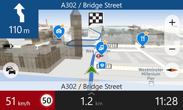
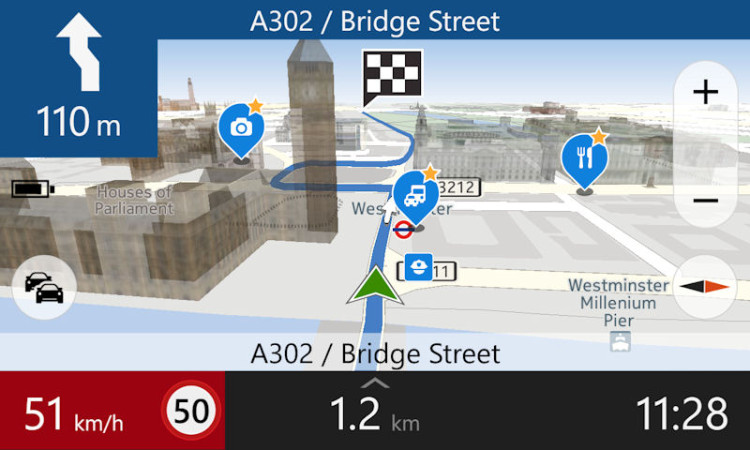
After months of negotiation, Nokia will sell its HERE Maps division to a consortium of German automakers — BMW, Daimler and Volkswagen — for $2.71 billion, according to the TU Automotive website.
Under the agreement, HERE Maps would turn into an open platform that all car manufacturers can use for navigation and mapping inside vehicles, giving automakers independence from companies such as Google for maps and navigation at a time when the technology moves toward the connected and self-driving car, which rely on navigation technology.
The three German car makers plan to offer the platform to Fiat Chrysler, Renault, Peugeot, Ford, Toyota and General Motors, allowing them to use the mapping service for free without licensing issues.
Nokia is selling the entire unit of HERE, meaning the car consortium will likely continue hiring developers to work on the platform. Companies like Chinese search giant Baidu and Facebook use HERE Maps to power its own mapping services. It remains to be seen how the new deal will affect those services.
“Only with high-precision maps will automated driving on freeways be possible from 2020,” said Bosch board member Dirk Hoheisel. TomTom says it plans to have new high-precision maps for automated driving for all freeways and freeway-like roads in Germany by the end of 2015.
AGCO and Trimble are partnering to deliver wireless connectivity between AGCO’s VarioDoc and AgCommand systems and the Trimble Connected Farm solution. The functionality is expected to be available to customers in North America in September and in Europe, Africa and the Middle East in the fourth quarter of 2015. AGCO is a worldwide manufacturer and distributor of agricultural equipment and infrastructure.
The collaboration allows customers to access their AGCO machine data via AGCO’s telemetry product AgCommand, as well as their agronomic data through AGCO’s VarioDoc task file management platform, from within the Trimble Connected Farm dashboard. This deeper integration of AGCO and Trimble technologies delivers a more streamlined approach to total farm management, simplifying the grower’s ability to access and act on live machine and task data within a single, Web browser-based user interface, the companies said in a statement.
“The inclusion of AGCO’s AgCommand information into Connected Farm aligns well with Trimble’s continued focus on providing a complete solution for growers to manage a mixed fleet of vehicles and implements,” said Joe Denniston, vice president of Trimble’s Agriculture Division. “AGCO customers now have access to one central location in Connected Farm for monitoring their farm operations including fleet data, rainfall and weather information, commodity quotes, and irrigation monitoring to enable improved decision making from the office to the field.”
“This collaboration gives our customers easier access to their operational data for enhanced productivity, mobility and decision making,” said Eric Hansotia, senior vice president, Global Harvesting, Crop Care, Advanced Technology Solutions and Dealer Tech Support at AGCO. “Strategic development with platforms like Connected Farm gives growers a single location from which to monitor their entire operation.”
The development expands on the February 2014 announcement of the connection between Trimble’s Farm Works Software and VarioDoc. This new integration will give Trimble customers the option to sync their task data sent via VarioDoc in either Farm Works or Connected Farm.
The integration between Trimble’s Connected Farm and AGCO’s AgCommand will be the first to utilize AGCO machine data via the AgCommand API (Application Programming Interface). The API will open globally in the fourth quarter of 2015 to developers and service providers who wish to incorporate machine data into custom applications and tools for growers. This offers more points of access to end users, allowing AgCommand data to be integrated into the grower’s farm management platform of choice.
Trimble joins AGCO’s growing list of partners that are part of AGCO’s Fuse Technologies open approach to precision agriculture and precision machine management.
Two BeiDou navigation satellites were launched into medium Earth orbit on Saturday, July 25, at 12:29:04.411 UTC, according to a NASASpaceFlight.com Forum blog. The satellites are drifting to their designated orbits. U.S. Joint Space Operations Center / NORAD is tracking the satellites.
The satellites are designated BDS M1-S and M2-S — the “S” in the satellite names might stand for “Test” (in Chinese: 试验 = Shiyan).
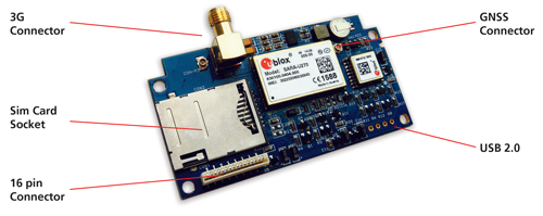
Reyax Technology, a telematics tracking systems provider for the automotive industry, has developed an industrial high-integration 3G GNSS tracking platform, the Reyax RY277AI, which is fully based on technology from u-blox.
“Our vehicle tracking platforms are dependent on highly accurate position data to deliver the performance crucial to meet the demands of our customers. u-blox’s highly reliable products as well as a flawless technical support were convincing,” said Ritchie Chang, general manager of Reyax Technology. “u blox’s MAX M8C positioning module and SARA U270 cellular module were the right choice for this new platform,” he added.
RY277AI is designed for 3G telematics applications, in particular vehicle tracking, fleet management and insurance box. With both MAX-M8C and SARA U270 modules embedded, it also benefits from two of u blox’s GNSS and wireless technology services. With AssistNow, Assisted GNSS (A-GNSS) accelerates the calculation of a position by delivering satellite data to the GNSS receiver via wireless networks or the Internet, also ensuring faster TTFF (time to first fix).
CellLocate, another of u-blox’s trademarked technologies, matches cellular positioning data with previously successful GNSS fixes in shielded environments such as indoors. This is especially useful in case of jammed GNSS signals and in M2M applications. Additionally, u-blox’s nested design enables hosting of next-generation wireless and positioning modules on the same PCB.
“We are excited about this co-operation with Reyax Technology, the recognized leader in telematics tracking systems. Reyax-based solutions make full use of u-blox’s advanced positioning and cellular technologies to enhance vehicle tracking. This solution is an answer to the growing encouragements by the Taiwanese government to promote IoT/M2M applications and whose vision we share.” explained Ming Chiang, country manager of u-blox Taiwan.
RY277AI comes in an LGA package, with a dimension of 70mm x 30mm x 7mm, and an operating temperature of -40~+85° C.
The University of Michigan (U-M) has opened Mcity, a controlled environment designed to test the potential of connected and automated vehicle technologies that will lead the way to mass-market driverless cars.
Mcity is a 32-acre simulated urban and suburban environment that includes a network of roads with intersections, traffic signs and signals, streetlights, building facades, sidewalks and construction obstacles. It is designed to support rigorous, repeatable testing of new technologies before they are tried out on public streets and highways.
“There are many challenges ahead as automated vehicles are increasingly deployed on real roadways,” said Peter Sweatman, director of the U-M Mobility Transformation Center (MTC). “Mcity is a safe, controlled, and realistic environment where we are going to figure out how the incredible potential of connected and automated vehicles can be realized quickly, efficiently and safely.”
In particular, Mcity allows researchers to simulate the environments where connected and automated vehicles will be most challenged. Even seemingly minor details a vehicle might encounter in urban and suburban settings have been incorporated into Mcity, such as road signs defaced by graffiti and faded lane markings.
The types of technologies that will be tested at the facility include connected technologies — vehicles talking to other vehicles or to the infrastructure, commonly known as V2V or V2I — and various levels of automation all the way up to fully autonomous, or driverless vehicles.
Mcity was designed and developed by U-M’s interdisciplinary MTC, in partnership with the Michigan Department of Transportation (MDOT). It is a public-private partnership among industry, government and academia. The center was established to lay the foundation for a commercially viable ecosystem of connected and automated mobility that will revolutionize the movement of people and goods worldwide. A key MTC goal is to put a shared network of connected, automated (including driverless) vehicles on the road in Ann Arbor by 2021.
“We believe that this transformation to connected and automated mobility will be a game changer for safety, for efficiency, for energy, and for accessibility,” Sweatman said. “Our cities will be much better to live in, our suburbs will be much better to live in. These technologies truly open the door to 21st century mobility.”
The facility also underscores Michigan’s emergence as a leader in advanced mobility, building on the state’s position as the global center of automotive research and development for more than a century, U-M said in a news release. Today, Michigan is home to 375 automotive research centers, and has the highest concentration of industrial and mechanical engineers in the country.
MTC is a public-private partnership among industry, government and academia. The center was established to lay the foundation for a commercially viable ecosystem of connected and automated mobility that will revolutionize the movement of people and goods worldwide. A key MTC goal is to put a shared network of connected, automated (including driverless) vehicles on the road in Ann Arbor by 2021.
MTC’s industry and government partners reflect the diversity of perspectives required to meet the challenges ahead. In the private sector, MTC partners include automakers and top-tier auto suppliers, but also traffic signal and traffic sensing companies, insurance providers, telecommunications, big data, IT and more. On the public side, MTC is working with federal, state and city governments.
“Mcity represents an important partnership between government at all levels, private industry and academia,” said Kirk Steudle, director of the Michigan Department of Transportation. “State of Michigan officials are thrilled to be part of this vital collaborative, which will ensure that Michigan continues to be the world’s auto leader.”
In addition to Mcity, MTC has three on-roadway connected and automated vehicle deployments underway. With the help of the Michigan Economic Development Corporation, MTC is building on a nearly 3,000-vehicle connected technology project launched three years ago by the U-M Transportation Research Institute to create a major deployment of 9,000 connected vehicles operating across the greater Ann Arbor area. MTC is also partnering with industry and the Michigan Department of Transportation to put 20,000 connected vehicles on the road in Southeast Michigan. The third piece of the plan calls for deploying a 2,000-vehicle mobility service of connected and automated vehicles in Ann Arbor.
MTC was launched in 2013 and Mcity construction began last year. About $10 million has been invested in the test facility, with funding coming from U-M and MDOT. Mcity will be available for use by any organization, but priority will be given to MTC partners and U-M faculty and students.
MTC is working with 15 Leadership Circle member companies, each investing $1 million over three years, and engaging in thought leadership. Thirty-three Affiliate Members are also contributing, and investing $150,000 over three years. Current Leadership Circle companies are:
The Leica Geosystems ZenoCollector2 comes with Esri Collector for ArcGIS.
Esri Collector for ArcGIS, a configurable mobile app for collecting and editing data in the field, has combined with the Zeno 20, Leica Geosystems’ ultra-rugged Android-based professional-grade handheld, in a new solution called ZenoCollector. ZenoCollector uses Collector for ArcGIS as its main user interface and comes bundled with an ArcGIS Online organizational subscription for one year.
“Esri and Leica Geosystems recognize that enterprises may have particular field data collection challenges that smartphones can’t ideally meet,” said Esri president Jack Dangermond. “We’re excited to combine Collector for ArcGIS with Leica Geosystems’ industry-standard surveying units to create a more rugged and accurate solution for the more exacting needs of organizations.”
ArcGIS Online connects ZenoCollector to the ArcGIS platform, automatically syncing field changes to enterprise information and giving everyone access to the latest data gathered in the field. Collector for ArcGIS also supports offline data collection. Any updates will be synchronized with the map once the user is reconnected.
“We’re excited to raise mobile data collection solutions to the next level of precision and interoperability through rigorous connectivity between our survey-grade Leica Zeno series and Esri’s GIS solutions,” said Hexagon Geosystems President Juergen Dold. “This industry collaboration between Leica Geosystems and Esri is another joint commitment to make it easier for professionals around the world to capture, manage, and share their data, regardless if they’re in the office or the field, without sacrificing precision or interoperability.”
Although Collector for ArcGIS is most often used on smartphones, field crews may need higher precision that only a dedicated survey device can deliver. ZenoCollector contains a professional-grade GNSS receiver that provides significantly higher position accuracies than GPS receivers on smartphones and other handheld GIS devices on the market.
Leica’s Zeno series devices are also waterproof, even with the latch open, suiting the requirements of organizations operating in wet environments that would stress the tolerances of consumer-grade mobile devices.
In a striking contrast, the positive and negative sides of unmanned aerial vehicles were highlighted in a single day, July 17. First, in a government-approved demonstration, drones were used to deliver prescription medicine to patients at a temporary health clinic in rural Virginia, reports the Wall Street Journal. The event, reported previously by GPS World, aimed to show how UAVs can alleviate the problem of health-care access while creating economic opportunity for communities.
A manned aircraft carried the packages most of the way, and the flight plan originally called for the drone to make six round trips to carry a total of 10 pounds. But after two successful deliveries, officials decided to send the rest of the payload in one flight.
In stark contrast to that beneficial use of drones, efforts by firefighters to battle a fierce wildfire in California on July 17 were hampered by hobbyists flying consumer drones to capture video of the flames. Planes attempting to deliver water drops found their flights delayed or blocked by the presence of the drones, with private drones flying over the wildfire grounding firefighting aircraft for almost half an hour.
State lawmakers in California are drafting a bill that would impose heavy fines and potential jail time on anyone whose personal drone interferes with firefighting efforts.
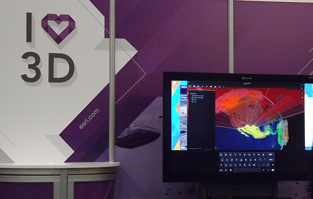
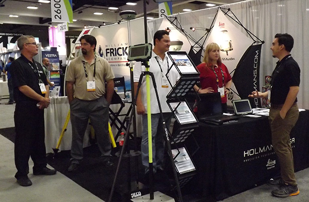
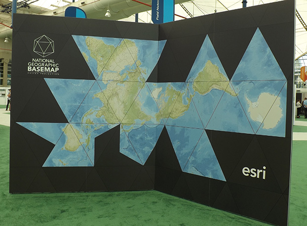
The Esri 2015 Exhibit Hall. (Photo: Tracy Cozzens)
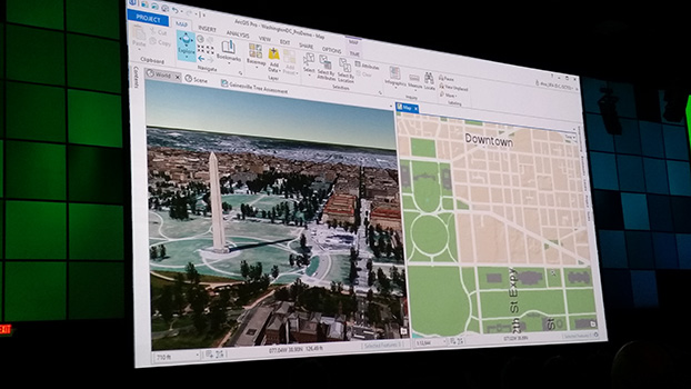
More than 16,000 people from 120 countries around the world are expected to converge in San Diego, Calif., this week to discuss the power of maps and applying geography at the 2015 Esri User Conference (Esri UC). The Esri UC and related events are taking place July 18–24, featuring a variety of speakers from a presidential candidate to global first responders. Attendees will share ideas and best practices for improving our world through maps.
GPS World/Geospatial Solutions staff is on site, and we will be posting news, photos and videos live from the show on this page. Also follow us on Twitter at @GSS_NCM and @GPSWorld.
A new president and council were elected at the annual meeting of the Royal Institute of Navigation (RIN), held at the Royal Geographical Society in London on July 15.
The meeting, which included presentations on the Mary Rose Trust and quantum technology, concluded with the declaration of ballot results for the new president, officers and council members.
The RIN’s Patron, HRH The Duke of Edinburgh Prince Philip, divested outgoing President R. A. McKinlay and placed the Presidential Medal on the new incumbent, Captain James B. Taylor. James Taylor paid tribute to McKinlay and his outgoing officers and council members for their impressive leadership while in office.
GPS World magazine founding editor Glen Gibbons received the Harold Spencer Jones Gold Medal from the duke in recognition of his “outstanding contribution to navigation as the founder and editor of various world-leading GNSS publications for more than 25 years, thus fulfilling a vital role in raising awareness and understanding of Global Navigation Satellite Systems.”
Two President’s Invitation Addresses were given. Rear Admiral John Lippiett, chief executive of the Mary Rose Trust, gave a talk entitled “Insights into Tudor navigation from the Mary Rose,” and Prof. David Delpy, chair of the Strategic Advisory Board of the Engineering and Physical Sciences Research Council Quantum Technologies Programme, and chair of the MOD’s Scientific Advisory Council, gave a talk entitled “The UK National Quantum Technologies Programme and its relevance to Navigation.”
Council members for 2015-16 are:
President: Capt. J. B. Taylor, Order of the British Empire (OBE, Officer), Royal Navy (RN)
Vice Presidents: Prof. T. Moore and Wg. Cdr. J. W. Lindsay, Royal Air Force (RAF)
Treasurer: D. Cockburn
Chairman of the Technical Committee: Dr. Sally Basker
Chairman of the Membership & Fellowship Committee: D. Rydlard
Chairman of the Audit & Risk Committee: D. Goddard, Order of the British Empire, Member (MBE)
Other members of the Council:
R. Angel
D. Barrie (Order of the British Empire, Commander)
Sqn. Ldr. J. Cairns, RAF (Retired)
Lt. Cdr .F. A. Egeland-Jensen, RN
Lt. Cdr. S. E. Gaskin, RN
Dr. M. A. Hadley
P. K. Hope-Lang
Prof. S. Kos
Ms. M. M. G. M. von Wendland
Ex Officio Members:
P. J. Brook, OBE, CAA
Wg. Cdr. S. Gilbert, RAF
John Pottle (Corporate), Spirent
To be named, RN
Septentrio, a designer and manufacturer of GNSS receivers, has launched a new software suite called PinPoint-GIS, which is designed to make GIS data collection and visualization straightforward. Septentrio’s PinPoint-GIS provides several methods of data collection, based on a standard web browser hosted on the Altus APS-NR2 and a mobile app integrated with Esri’s ArcGIS or other GIS mapping systems.
Users of PinPoint-GIS benefit from bringing the data-collection process into their familiar GIS environment, Septentrio said. Data collected with Altus and Septentrio receivers is directly available in the user’s GIS application. This data is processed into the database without any intermediary steps, greatly reducing the time and complexity of the collection process for the user. This allows the user to focus on the project objectives by easily customizing and updating maps instead of losing time on the mechanics of data collection and transmission.
Altus APS-NR2 and GeoPod are well known for providing consistent and accurate data. Thanks to PinPoint-GIS, this data becomes seamlessly integrated with the GIS database. The data becomes easily accessible to the field worker though existing hardware such as commercial and ruggedized mobile devices, regardless of their operating system.
“By introducing PinPoint-GIS, Septentrio is committed to making accurate and reliable GIS collection as simple and cost effective as possible. Once installed Pinpoint GIS works without user involvement to place high quality positions into the users existing GIS data collection tools by using the three components of the software,” said Gustavo Lopez, PinPoint-GIS product manager. “Thanks to PinPoint-GIS, Septentrio provides a seamless interface for capturing data in the field, customizing maps, access to data and user functionality. More field workers can get greater productivity from their existing GIS tools.”
Septentrio will be presenting PinPoint-GIS at Esri AEC Summit, held at the Manchester Grand Hyatt July 18-21, and at the Esri User Conference, held July 20-24. Both events take place in San Diego, Calif.
Esri President Jack Dangermond will deliver the keynote speech at Esri UC.
More than 16,000 people from 120 countries around the world are expected to converge in San Diego to discuss the power of maps and applying geography at the 2015 Esri User Conference (Esri UC). The Esri UC and related events will take place from July 18–24, featuring a variety of speakers from a presidential candidate to global first responders. Attendees will share ideas and best practices for improving our world through maps.
“We have millions of users around the globe who do amazing things with our technology every day,” said Esri president Jack Dangermond. “The User Conference is our opportunity to recognize their important work, learn from them, and empower them with even better tools and techniques to continue their mission.”
Other featured speakers will include operations staff from Hartsfield-Jackson Atlanta International Airport, executives from JPMorgan Chase, the director of Strategic Cooperation at the International Centre for Integrated Mountain Development (ICIMOD), and the president and CEO of the National Geographic Society. Former Maryland governor Martin O’Malley headlines a list of innovators from across every industry who will demonstrate how geospatial technology can make government smarter, combat global health challenges, ensure public safety, and drive greater revenues for businesses.
With a full week of activities, the 2015 Esri User Conference is shaping up to be the biggest yet.
Starting Off the Week with a Bang. Before the Esri UC even kicks off, a series of concurrent events related to business; education; national security; architecture, engineering, and construction (AEC ); and 3D mapping will take place July 18 and 19 in and around the San Diego Convention Center. These focused events will give attendees a deeper dive into various functional areas and equip them with an action plan to immediately invigorate their own organizations.
Real Stories from Real People. Throughout the week, more than 1,000 users will deliver presentations detailing how GIS helps their organizations in a number of ways. Whether they’re onstage for Monday’s Plenary Session or leading one of the nearly 300 moderated paper sessions, speakers will share lessons learned and best practices that can help their peers succeed.
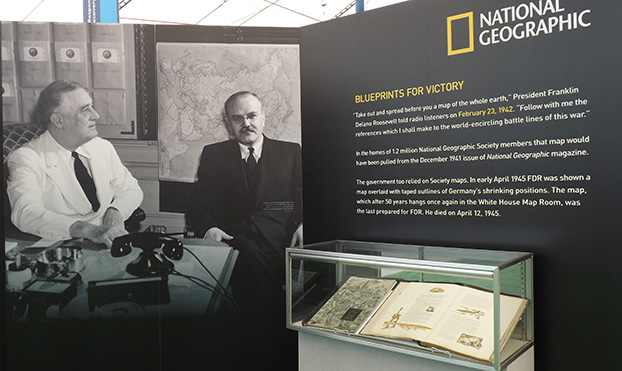
Celebrating 100 Years of Mapping. The National Geographic Society will be on hand to continue celebrating the organization’s 100 years of making maps. A chronicle of the history of maps and the American presidency, from future President Dwight Eisenhower carrying maps into battle during World War II to President Barack Obama receiving official presidential maps in the White House, will present the art and science of where. Gary E. Knell, president and CEO of the National Geographic Society, will also speak at the Plenary Session about the importance of geography in science, technology, engineering, and mathematics (STEM) education.
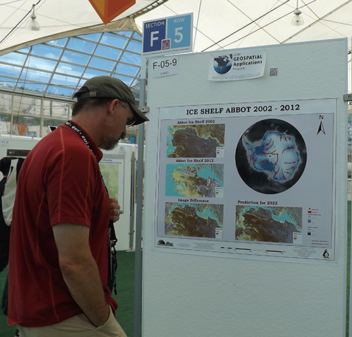
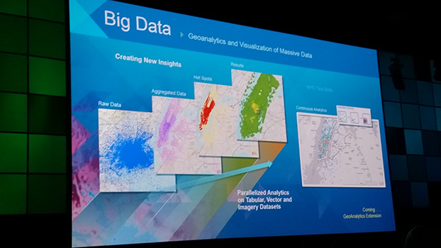
Innovation on Display. From hundreds of expert-led technical workshops to the expansive GIS Solutions EXPO featuring more than 300 technology companies and start-ups, attendees will immerse themselves in the latest and greatest in mapping and spatial analysis. Attendees will find a range of demos, talks, and resources about hot topics—big data, 3D visualization, unmanned aerial vehicles (UAVs), and more.
The Esri UC and related events will span seven days and offer opportunities for both technologists and managers to understand how geography can be applied to every organization’s challenge to drive better outcomes. For more information, visit esri.com/uc.













 More than 16,000 people from 120 countries around the world are expected to converge in San Diego, Calif., this week to discuss the power of maps and applying geography at the 2015 Esri User Conference (Esri UC). The Esri UC and related events are taking place July 18–24, featuring a variety of speakers from a presidential candidate to global first responders. Attendees will share ideas and best practices for improving our world through maps.