Author: GPS World Staff

  • Combining the Onboard GPS Capability of Smartphones with KML Files

    Following is a submission to our “$100 for 300 Well-Chosen Surveyor Words” contest. To submit your own surveyor’s story, send 300 (or more) words to [email protected].


    By Jay Satalich, P.L.S.

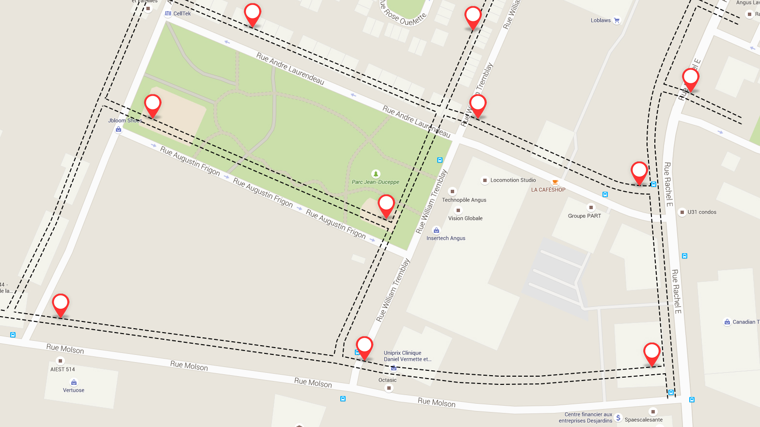
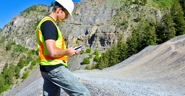
    At Caltrans District 7 in Los Angeles, we use the onboard GPS capability of smartphones to navigate in real time to the locations of proposed aerial targets and NGS control stations.

    KML files are created in the office using desktop GIS, then downloaded to smartphones for use in the field. We create KML files specifically for use by our surveyors during every aerial mapping project within Los Angeles and Ventura Counties.
    The aerial target layer also shows the proposed locations of stereo model limits on the smartphone.

    Having the stereo model limits as a data layer becomes a handy piece of information in the event an aerial target needs to be relocated due to unfavorable field conditions. The heads-up capabilities of GPS aboard the smartphones and KML files can also show the easiest path to reach either target location or control stations. The NGS control station layer hyperlinks to the NGS website so the field surveyor always has the recovery note available in an electronic format.

    The field surveyors are also given hardcopy maps of the target locations and control stations, but those are now only used as a back-up to the KML files loaded onto the smartphones.

    We have found that leveraging the onboard GPS capability of smartphones with GIS-based data layers in the field has increased production. Using smartphones provides the surveyors with information more concisely and clearly, so better decisions can be made while in the field. The project surveyor has the ability to tailor datasets specifically to project needed by the field surveyors. 

    Once the aerial targets have been placed and the NGS control stations recovered, the field surveyors then position the aerial targets and control stations using carrier phase GNSS.

  • GPS IIF-10 Launches from Cape Canaveral

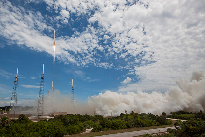
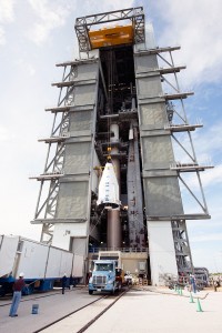
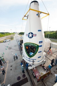
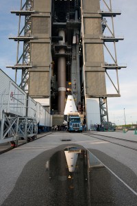
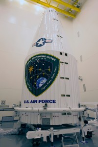
    GPS IIF-10 Launches from Cape Canaveral

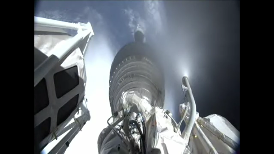
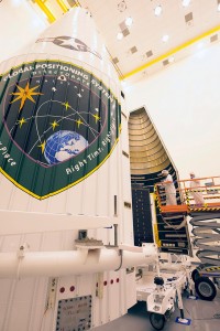
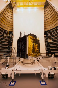
    After the first main engine cut-off, the GPS IIF-10 mission entered a three-hour coast phase. (Courtesy:  ULA)
    After the first main engine cut-off, the GPS IIF-10 mission entered a three-hour coast phase. (Courtesy: ULA)

    UPDATE (July 15, 4 p.m. ET): United Launch Alliance (ULA) officials have declared the launch mission a success. The Centaur upper stage completed its second burn and released the GPS IIF-10 satellite into the navigation network to complete today’s launch of the Atlas 5 rocket.

    “Congratulations to the U.S Air Force and the entire mission team on today’s successful launch of the 10th GPS IIF satellite! In just a few days, on July 17, the Global Positioning System will celebrate the 20th anniversary of GPS achieving fully operational status,” said Jim Sponnick, ULA vice president, Atlas and Delta Programs. “ULA is very proud to play a role in delivering these satellites to orbit, with Atlas and Delta rockets having launched all 58 operational GPS satellites.”

    “Today’s successful launch is a testament to the outstanding teamwork of  government and industry partners’ commitment to mission success. The GPS IIF satellites are critical for GPS constellation global service for years to come,” said Lt. Gen. Samuel Greaves, Space and Missile Systems Center commander. “Thanks to the men and women of SMC, the 45th, 50th, 310th Space Wings, Boeing, United Launch Alliance, The Aerospace Corporation, the GPS IIF, and the Atlas V launch teams, we are sustaining and modernizing the world’s greatest space-based, precise positioning, navigation and timing service.”


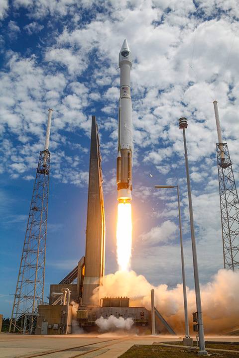
    The tenth GPS IIF satellite lifted off from the Space Launch Complex (SLC)-41 at Cape Canaveral, Fla., on schedule at 11:36 local time (15:36 UTC) on July 15,  at the start of a nineteen-minute launch window.

    This is the second of three GPS constellation replenishment flights planned in 2015. The first launch, of GPS IIF-9 using a Delta IV rocket, occurred on March 25. A third launch, of GPS IIF-11 using an Atlas rocket, is scheduled for Sept. 22. The launch of GPS IIF-12 is scheduled for Jan. 26, 2016.

    The Boeing-built GPS IIF-10 is one of the next-generation GPS satellites, incorporating various improvements to provide greater accuracy, increased signals, and enhanced performance for users. GPS IIF-10 was the 70th spacecraft to be launched as part of the GPS constellation and the tenth in the Block IIF series that began launching in May 2010.

    GPS IIF-10 marks the 55th Atlas V launch since the vehicle’s inaugural launch in 2002 and the 27th flight of the 401 configuration. Every operational GPS mission has launched on a United Launch Alliance or heritage rocket. While the government has certified ULA competitor SpaceX for GPS III launches, a SpaceX Falcon 9 rocket exploded June 29, two minutes after launch of an International Space Station resupply mission.

    The Boeing-built GPS IIF satellites provide improved signals to support both the warfighter and the growing civilian needs of the global economy, the U.S. Air Force said in a statement. The GPS IIF satellites will provide improved accuracy through advanced atomic clocks, a longer design life than previous GPS satellites, and a new operational third civil signal (L5) that benefits commercial aviation and safety-of-life applications. It will also continue to deploy the modernized capabilities that began with the GPS IIR satellites, including a more robust military signal.

    Launch Photos

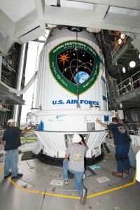
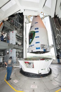
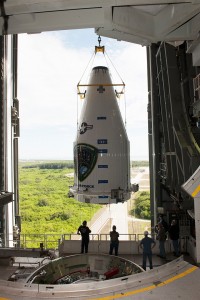
    Pre-Launch Photos

  • Garmin Adds eTrex with Touchscreen to Outdoor Line

    Garmin Adds eTrex with Touchscreen to Outdoor Line

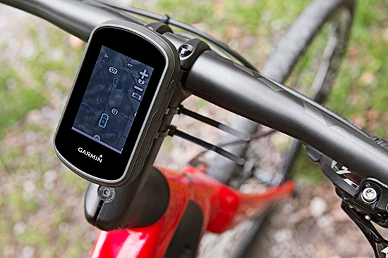
    The Garmin eTrex
    The Garmin eTrex can be mounted on bicycles, boats, ATVs or in the car.

    Garmin International this summer is releasing the eTrex Touch 25, 35 and 35t, adding new touchscreen models to its line of outdoor handhelds.

    The eTrex Touch series has a completely updated user interface, improving the ease-of-use of the device, as well as a 2.6-inch capacitive touchscreen display, the largest display that’s ever been put on an eTrex device. The eTrex Touch series also features new activity profiles for easy-to-use navigation for multiple activities and an enhanced track manager to easily start and stop recording.

    The new eTrex Touch series has a high-sensitivity, WAAS-enabled GPS receiver with GLONASS support and HotFix satellite prediction to locate users’ position quickly and precisely, even in heavy cover and deep canyons.All units in the eTrex Touch series have a built-in 3-axis tilt-compensated electronic compass, which gives directional information even when standing still. The eTrex 35 and 35t also have a barometric altimeter to get more accurate altitude, elevation and climb information, as well as indications of pending weather changes.

    The eTrex Touch 25, 35 and 35t are compatible with an array of mounts that are easy to use on bicycles, boats, ATVs or in the car, and offer a long-lasting 16-hour battery life, and a rugged ergonomic design to withstand the elements.

    The eTrex Touch series integrates a variety of new activity profiles. The device remembers how each profile is set up to each activity, and will set it up for users the same way every time, making it comfortable, quick and intuitive to use the same device for entirely different purposes. No matter if users are out rock climbing, hiking, hunting, cycling, geocaching or fishing, with an eTrex Touch, switching between activities is easier than ever, even if they’re done all in one afternoon.

    The eTrex Touch series comes preloaded with a worldwide shaded relief basemap, 4 GB of internal memory on the 25 and 35 models and 8 GB of internal memory on the 35t. The eTrex 35t also comes preloaded with TOPO U.S. 100K. With the built-in microSD card slot, users can install even more maps, like HuntView to see public and private land data while hunting, BirdsEye Satellite Imagery or TOPO U.S. 24K. All models come preloaded with 250,000 geocaches from Geocaching.com, so right out of the box users can start their geocaching adventure virtually anywhere in the world.

    The eTrex 35 and 35t incorporate wireless ANT+ connectivity to accessory sensors like heart rate monitors, the Tempe temperature sensor, Chirp geocaching beacon, or the cycling speed sensors and cadence sensors. The eTrex 35 and 35t can also act as a wireless remote control for the VIRB line of action cameras. The eTrex 35 and 35t can connect via Bluetooth to compatible smartphones to receive smart notifications and stay connected out on the trail, but keep their phone safely packed away from the elements. Additionally, these units are compatible with the the Garmin Connect mobile app, for features such as LiveTrack. With LiveTrack, users can pair their device with the app, and invite friends and family to follow their activity in real time. This provides peace of mind, especially if users are alone.

    The eTrex Touch 25 will have a suggested retail price of $249.99, the eTrex Touch 35 will have a suggested retail price of $299.99 and the eTrex Touch 35t will have a suggested retail price of $349.99.


  • New Speakers Announced for Thursday’s Street Smart Webinar

    New Speakers Announced for Thursday’s Street Smart Webinar

    Three new speakers have been announced for Thursday’s GPS World Market Insights Webinar. The webinar, “Street Smart: City Modeling and Other New Geospatial Techniques in Urban Mapping and Navigation,” will be held July 16, 1 p.m. EDT/ 10 a.m. PDT/ 5 p.m. GMT. Registration is free.

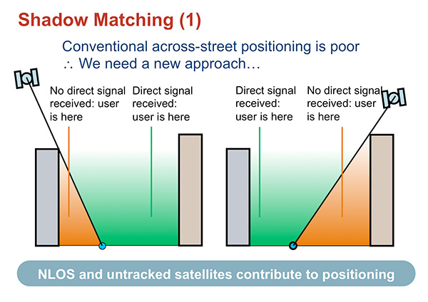
    The webinar provides a high-level overview of the latest enhancements to computerized geometric city models, which can help overcome data gaps and inaccuracies created by signal obstruction, to improve GNSS positioning in dense urban areas. The webinar will focus on use of 3D mapping to aid GNSS in three different ways: shadow matching, height aiding and non-line-of-sight (NLOS) detection for conventional positioning.

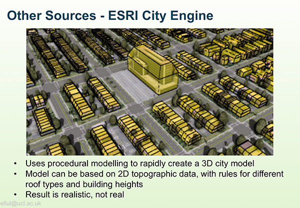
    Claire Ellul, University College London, will discuss creating 3D datasets from photogrammetry, LiDAR, building information models (BIMs), Esri City Engine, Sketch Up, Google Earth and Open Street Map.

    A page from Claire Ellul's upcoming webinar presentation.
    A page from Claire Ellul’s upcoming webinar presentation.

    Also speaking are Rahul Gupta, Spirent Communications, and Gregory Moura, OKTAL Synthetic Environment, who leads the development of SE-NAV, a RayTracing simulator computing the propagation of GNSS signals in urban environments. The new version of this software can be embedded in a hardware in the loop process with Spirent’s SimGen to assess the performances of HW receiver in constrained environments.

    Paul Groves will discuss “Better GNSS Positioning in Cities using Enhanced 3D Mapping,” addressing the problems of poor GNSS geometry in urban canyons, showing how 3D mapping improves GNSS positioning in several ways: height aiding,  non-line-of-sight prediction, model-aided ranging and shadow matching.

    A page from Paul Grove's upcoming webinar presentation.
    A page from Paul Grove’s upcoming webinar presentation.

    Visit our webinar page for full biographies of the speakers, and more information about our webinars.

  • QinetiQ Announces Robust GNSS Receiver for Galileo PRS

    QinetiQ Announces Robust GNSS Receiver for Galileo PRS

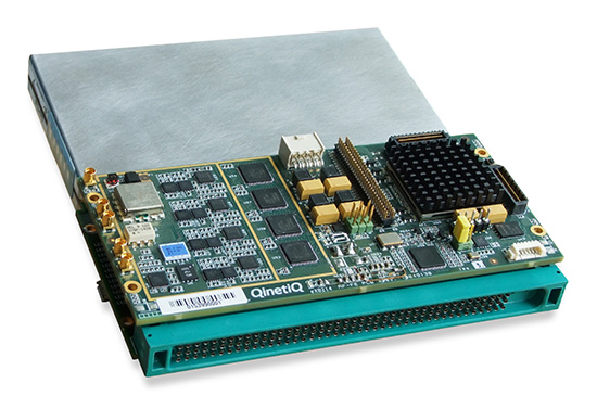
    The QinetiQ PRS receiver.
    The QinetiQ PRS receiver.

    QinetiQ today announced a major breakthrough in developing a robust navigation receiver that will use the Galileo, Europe’s satellite navigation system — in particular, the secured Public Regulated Service (PRS).

    QinetiQ’s new high-performance, next-generation GNSS receiver is multi‑constellation and multi‑frequency, and is designed to process encrypted signals from the Galileo PRS service as well as open services such as GPS. Qinetiq introduced the receiver today at the UK Space Conference, being held July 13-15 in Liverpool.

    The receiver — now a in prototype form — is a significant step towards developing an end-user product for navigation, tracking and timing, QinetiQ said. It will offer highly secure, accurate and reliable position, velocity and timing intended for users with a mission-critical need such as governments, the military and emergency services across Europe. 

    “We are delighted that, after years of QinetiQ R&D and collaboration with the EU, European Space Agency (ESA) and UK government, we have achieved this major step towards our goal of offering robust navigation products using Galileo,” said Nigel Davies, head of QinetiQ’s Secured Navigation Group. “It is a significant breakthrough for us to have built a fully operational receiver on a platform, which proves our product architecture, functionality and algorithms.”

    “Our next step will be working to refine the product family and preparing it to be brought to market, which includes developing additional features and reducing its size to that of a postage stamp, in a form factor similar to our existing, highly successful Q20 receiver,” Davies said. “We have full confidence in this product and are proud to be at the forefront of this exciting new phase in European navigation.”

    The prototype receiver is a multi-constellation, multi-frequency, all‑in‑view receiver that can receive and process the Galileo PRS as well as Galileo Open Service and GPS Standard Positioning Service. It is also designed to utilize other GNSS signals including the Russian GLONASS and Chinese Beidou systems as well as space-based augmentation services (SBAS) such as WAAS and EGNOS.  

    The receiver, which is based on the military standard SEM-E form factor, is also designed for integration into multi-sensor navigation systems and is designed to provide high levels of protection against jamming and spoofing.  It has a fast acquisition capability and is designed for government security accreditation.

    It is expected that a suite of robust products will be ready by 2020 to coincide with the completion of the Galileo project, which will be the world’s third GNSS to be completed after the United States and Russian systems.

    The new receiver is part of a long pedigree in robust GNSS receivers. Q20 was QinetiQ’s first GPS receiver, designed for specific challenging applications: high dynamics, or high sensitivity like tracking from inside a shipping container. QinetiQ’s family of receivers will include two new products based on the new receiver. Q40 will be QinetiQ’s next-generation robust open service receiver, which will be a multi‑constellation, multi‑frequency open-service receiver which can use signals from all of the GNSS open services. Q50 will incorporate all of the functionality of the Q40 receiver, but also offer Galileo PRS for authorized users who need the additional capabilities and robustness.

    “The device we have built is a major stepping stone to Q40 and Q50 as the technology has all been built for the receiver products and is designed to be shrunk on to a single ASIC microchip,” Davies said. “Our focus of attention will now be to turn what we have built into an ASIC product which is ready for market.”

  • Juniper to Exhibit Sub-Meter GPS Solution at Esri User Conference

    Juniper to Exhibit Sub-Meter GPS Solution at Esri User Conference

    Photo: Juniper Systems 

    Juniper Systems is exhibiting its sub-meter GPS solution using Esri ArcPad, Effigis’ EZSurv Post-Processing software, and its ultra-rugged handheld computers — a combination the company says is budget-friendly and easy-to-use — at the Esri User Conference, being held in San Diego July 20–24.

    The sub-meter solution involves collecting GIS data using a Juniper Systems rugged handheld running ArcPad data collection software, and then using Effigis’ EZSurv software to post-process the data, resulting in sub-meter GPS accuracy. Users can import and export data, including custom attributes, from their GIS. The data collection process bypasses the need for expensive survey-grade GPS receivers, providing both an affordable and simple solution for professionals who require sub-meter accuracy, Juniper Systems said.

    “This solution is a great option for people looking for sub-meter accuracy without the steep price,” said Trevor Brown, Natural Resources market manager at Juniper Systems. “The range of applications that can benefit from this type of solution is very broad, with uses in forestry, agriculture, environmental monitoring, and asset management, to name a few. And not only is it inexpensive, it’s also super simple. You can have sub-meter accuracy with the click of a button.”

    Those attending the Esri User Conference can see this affordable sub-meter solution at Juniper Systems’ booth #2212. The data sheet can be downloaded,  or visit Juniper Systems’ website to learn more.

  • Flight Navigation the Focus of New Market Report

    MarketsandMarkets.com has released a new report focusing on NextGen flight navigation systems and how they will affect the future of aircraft.

    Flight Navigation System Market by Product, Flight Instrument & Application Forecast to 2020” covers:

    • avionics and communications systems
    • instrumentation such as altimeters, gyroscopes, autopilots and sensors
    • applications (commercial and military)
    • geography

    The time frame covered is 2014 to 2020.

    Market Research Report is available as a PDF download either for single users or for corporate use.

  • Drones Could Assist Lifeguards in Rescues, Shark Sighting

    Lifeguards in the United States are testing how drones may help save lives in coastal waters. Cameras on drones can spot sharks from above, and drones are able to reach struggling swimmers faster than lifeguards to deliver life preservers.

    In Seal Beach, Calif., lifeguards are using the flying device to monitor sharks. “It’s an extremely valuable tool for our water observation,” said Joe Bailey, chief of Seal Beach’s Marine Safety and Lifeguard Department, told the Los Angeles Times. The Seal Beach Marine Safety Department purchased a DJI Phantom 3 drone to monitor sharks off the coast. Safety officials fly the device at least twice a week to track juvenile great white sharks.

    Meanwhile, lifeguards in Long Branch, N.J., are testing using drones to get life preservers out to swimmers in the ocean faster than a lifeguard could reach them. It would not replace the rescue work done by lifeguards in the water, however, who would still swim or row out to a victim. But it would buy a struggling swimmer extra time.

    The Phantom 3 in flight at a press event.
    The Phantom 3 in flight at a press event.

    “This is not to cut back on any lifeguards. This is a lifeguard’s tool to help move them along a lot faster in making the save, getting a life preserver out to a person,” said Michael Sirianni, president of the Long Branch City Council, told the Asbury Park Press.

    The drones would be especially helpful when conditions are extreme, such as big surf and high winds that make it difficult to reach someone stranded. The drones could fly out a mile or two to reach distressed stand-up paddle boarders, kite surfers or capsized boats. Its camera could help locate submerged persons quicker, while microphones and speakers could enable lifeguards to talk to a person in the water.

  • Carlson Software Releases Surveyor2 Handheld

    Carlson Software Releases Surveyor2 Handheld

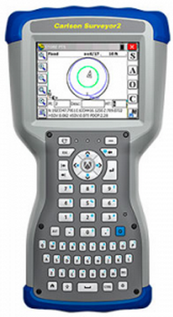
    Carlson Surveyor2
    Carlson Surveyor2

    Carlson Software has released the Carlson Surveyor2, the newest model in its Carlson Surveyor line of data collectors. The Surveyor2 is paired with Carlson’s software to provide a powerful, complete solution for surveying, stake out, construction layout, and GIS mapping, the company said.

    Designed and manufactured by Juniper Systems, the Carlson Surveyor2 is built to withstand the harshest conditions, with an IP68 rating for dust and water and superb durability when dropped or exposed to cold, heat or other rugged environments.

    With minimal increase in weight compared to the original Surveyor, the Surveyor2 offers greater memory and data storage, a faster, 1.0-GHz processor, and significantly improved Bluetooth range — up to 1,500 feet. The data collector also features a new QWERTY keyboard with large buttons for easy data entry, enhanced battery power with 20+ hours of runtime, and a larger, brighter display, providing excellent visibility in any lighting conditions.

    The Surveyor2 runs Windows Embedded Handheld 6.5.3 and can be purchased with Carlson SurvCE 4.0, Carlson’s powerful data collection software. SurvCE offers exceptional usability, with a tab-based menu and advanced graphics for easy-to-use functionality, the company said.

    “The Surveyor2 and SurvCE together create an advanced solution for surveying applications, while maintaining simplicity and ease-of-use,” said Debbie Trolson, geomatics market manager at Juniper Systems. “The Surveyor2 offers significant improvements over its predecessor, providing surveyors with the features they need to perform their work productively and effectively.”

    The Surveyor2 was previewed at INTERGEO 2014.

  • Leica Updates CrossCheck for GNSS Reference Station Monitoring

    Photo: Leica CrossCheck service

    Released today, the latest version of the web-based Leica CrossCheck service for GNSS reference station network integrity and deformation monitoring now comes with enhanced visualization and reporting options. Customizable, automatically generated reports can be distributed to multiple viewers, according to Leica Geosystems. Dashboard and status views allow easy and fast interpretation of complex data of reference network coordinates and area deformation, the company said.

    Highly trained experts at Leica Geosystems process monitoring data using the latest geodetic software and algorithms to provide highly accurate assessments of any site movement on various types of infrastructure platforms such as oil platforms, bridges or dams. Customizable reports can then be distributed via email or downloaded on demand.

    Leica CrossCheck is a secure web-based application that provides interactive and flexible, round the clock access to project data. Intuitive and easy-to-use  tools simplify project site movement analysis, speed up decision making when there is a need to react to changes.

  • ESA Releases Guide on Galileo 5 and 6 Recovery

    The European Space Agency has published a short guide on the recovery of Galileo satellites 5 and 6. The PDF of “Salvage in Space: Recovering Galileo 5 and 6” can be downloaded.

    The four-page guide, written for a non-technical audience, describes the root cause of the anomaly that placed the two satellites into the wrong orbit, and the solution used to correct the orbits.