Author: GPS World Staff

  • GSA Flight Event Celebrated, Demonstrated EGNOS

    GSA Flight Event Celebrated, Demonstrated EGNOS

    GSA-EGNOS-flight-event-O
    Screenshot from GSA video. See full GSA Flight Event 2015 video below.

    News from the European GNSS Agency

    Since its certification for civil aviation in 2011, EGNOS — the European satellite-based augmentation system — has been making flights in Europe safer, greener and more efficient. To celebrate this achievement and further promote EGNOS, the European GNSS Agency (GSA) in collaboration with the European Commission, invited the media and European aviation stakeholders for a unique EGNOS Flight Event in Toulouse, France, May 6-7.

    Today, more than 140 airports in 15 countries across Europe benefit from EGNOS — with many more preparing for implementation. 171 LPV (localizer performance with vertical guidance) and 86 BARO approaches are already certified for use.

    To highlight this impact, the EGNOS Flight Event, organized in collaboration with the European Commission, ESSP, ATR and Airbus, brought together aviation media and other sector stakeholders for a comprehensive briefing and demonstration of EGNOS, how it works and its significant benefits for the aviation sector. Along with flight demonstrations, the event assembled a unique array of EGNOS-experienced players — from pilots to operators, service providers and air traffic managers – to discuss how EGNOS is reshaping the future of air transportation in Europe.

    Across-the-Board Benefits

    Commercial, business and general aviation are all key market segments for EGNOS. For example, business and general aviation operators need to get to meetings as quickly and efficiently as possible, often requiring landing at smaller airports where Instrument Landing System (ILS) or other expensive ground-based navigation aids are simply not feasible. Thus, the implementation of EGNOS-based procedures at these airports significantly improves accessibility. “EGNOS, Europe’s first satellite navigation system, already has a good success story to tell,” says GSA Executive Director Carlo des Dorides. “EGNOS delivers continuous integrity protection in compliance with ICAO standards, allowing Cat I approaches with over 99 % availability. Today, 142 airports across Europe are benefitting from EGNOS — and the number is growing steadily.”

    According to GSA Head of Market Development Gian Gherardo Calini, the Agency has the capacity to support airports and operators wanting to benefit from EGNOS. For example, this year the Agency has allotted €6 million to co-fund projects to implement EGNOS in aviation. A similar amount had also been allocated in 2014.

    Airborne with EGNOS

    Demonstrations of EGNOS included a briefing on EGNOS for rotorcraft and with the presentation of the GARDEN project. The project is using EGNOS to enable increased safety and better access for helicopters, for example, enabling air ambulances to access city centre hospitals. Participants were also given a first-hand look at EGNOS implementation in the cockpit of an Airbus H175 rotorcraft.

    EGNOS in action was demonstrated by a series of flights using EGNOS for landing procedures with an ATR 42-600 turboprop, which was equipped with additional avionics in the main cabin so invited media could witness the technology at work. The flight demonstration took off from the Blagnac Airport in Toulouse, the venue for the EGNOS event, for a 15 minute circuit around Toulouse beforedemonstrating an EGNOS LPV approach and landing.

    EGNOS for A350

    A highlight on the tarmac was the Airbus A350WXB. Participants were given a tour of this new, state-of-the-art wide-bodied airliner — including a simulation of an EGNOS-enabled LPV landing in the cockpit. Airbus test pilot Jean-Christophe Lair described the A350’s new Satellite-based Landing System (SLS) that works with Satellite Based Augmentation Systems (SBAS) such as EGNOS. This is the first time such a system has been installed on a wide body airliner and will be supplied as a standard feature to customers.

    According to Lair, EGNOS is fully integrated into a common, harmonised landing system interface on the A350 – the SLS. This allows the pilot to fly precision approaches like an ILS with geometrical vertical guidance down to 200 feet. This new navigation system will provide Airbus operators a wider range of solutions to optimise operations and increase accessibility without any compromise to safety.

    EGNOS Expansion

    The potential for expansion of EGNOS/SBAS is huge both in terms of global coverage and potential for use in Europe.

    GSA Head of EGNOS Exploitation, Jean-Marc Piéplu, outlined the future upgrade of the system from the current Version 2 to EGNOS Version 3. “Version three will feature new capabilities, including dual frequency and dual-constellation with both GPS and Galileo,” he said.

    This extension could potentially widen EGNOS/SBAS global coverage for aviation to over 90%. When asked about the timescale for this extension of coverage, Piéplu indicated that if the political will was there to implement, then this could be accomplished in 10 years as there were no outstanding technical issues.

    According to International Council of Aircraft Owner and Pilot Association (IAOPA) Senior Vice President Martin Robinson, there is a huge potential for growth in Europe. Currently there are 4,649 aerodromes in Europe and some 50,000 general aviation aircraft operating. Compared to the US, only a fraction of these are SBAS enabled. In the US, the larger uptake of WAAS is due to a deliberate government-led industrial policy.

    “Europe still lags behind the United States and there’s definitely room for growth,” said Robinson. “EGNOS will help to provide greater access to aerodromes throughout Europe and improve safety — but we need to be quicker if we are to realize these benefits sooner.”

  • European GNSS R&D: There’s an App for That!

    European GNSS R&D: There’s an App for That!

    Cover: European GNSS AgencyA free app for both iOS and Android features the results of European GNSS Agency (GSA) supported research and development initiatives. The new EGNSS Research and Development (R&D) application highlights the tangible results coming out of the 7th Framework Programme (FP7) and is designed to serve as inspiration for those participating in the Horizon 2020 (H2020) period.

    The FP7 and H2020 programs, supported by the GSA, aim to support the development of EGNSS applications in key market segments. Both are geared towards accelerating the development of a European market for satellite navigation applications and creating new opportunities for European industry.

    “The app is an excellent opportunity for the GNSS community to take stock in the lessons learned during the FP7 funding period and set our sights on future R&D initiatives,” said GSA Executive Director Carlo des Dorides. “The application’s segment-specific search feature responds to the varied needs of our users, providing them with easily accessible and relevant information at their fingertips.”

    In addition to the search function, des Dorides notes that the demographics included with each project can help users identify opportunities for partnerships across segments and regions, and create virtual R&D networks.

    The FP7 programmes had a considerably positive impact on the GNSS market, GSA said (download the brochure). Within the frame of the projects, 45 products were developed, and 80 prototypes were tested and validated during the 115 demonstrations that took place.

    Today, Horizon 2020 is bringing new opportunities for GNSS applications development. Information on the 25 projects granted in the first H2020 Galileo call is already included in the application, and early next year it will be updated to include the 2nd call portfolio of projects.

    The app is available for free download from the iTunes and Google Play stores.

  • DIRECTV Subscribes to Fleetmatics for Service Fleet

    Fleetmatics Group PLC, a global provider of mobile workforce solutions for service-based businesses of all sizes delivered as software-as-a-service (SaaS), has entered into a master subscription services agreement with DIRECTV to enhance tracking, driver safety and on-time arrivals for its fleet of vehicles that are making service calls.

    Fleetmatics says its REVEAL is a powerful yet simple-to-use fleet management solution designed to drive cost savings and improve productivity for mobile workforces. Fleetmatics REVEAL+ enables enterprise customers with larger fleets, such as DIRECTV, to manage complex organizational structures and large numbers of users, as well as to deliver actionable executive level business intelligence across the entire enterprise.

    “Fleetmatics’ advanced tracking system offers the ideal mobile workforce solution for DIRECTV’s field-based operations,” said David Baker, senior vice president of Field Services for DIRECTV. “This partnership will help our business operate more efficiently while continuing to deliver on our promise of industry-leading customer service.”

    “With more than 6,200 new subscriptions, we look forward to delivering actionable business intelligence to DIRECTV,” said Jill Ward, president and CEO of Fleetmatics. “By arming thousands of DIRECTV vehicles with the most powerful telematics solution for the enterprise, we’re helping the company drive cost efficiencies and increase field service worker productivity.”

    DIRECTV is a provider of digital television entertainment services to more than 39 million customers in the U.S. and Latin America.

  • Location Intelligence Platform Aims at Local Marketing

    Local ID has closed a $1.9 million seed round of funding led by Crosscut Ventures. Local ID is a local intelligence platform that provides multi-unit brands with the data, tools and process needed to maximize their local marketing efforts, according to the company.

    Other investors in the round included Technicolor, TenOneTen, Baroda Ventures, Double M Partners, Tallwave, Wavemaker Partners and Queens Bridge Venture Partners. 

    Founded by a team with more than 60 years of collective retail experience, Local ID is a cloud-based platform that provides brands with visibility into each store’s trade area. For example, Local ID:

    • surfaces local events that present timely and contextual marketing opportunities;
    • identifies competitive intrusions;
    • provides proactive preparation for weather events; and
    • incorporates a wealth of other data on the hundreds of local marketing opportunities taking place each day within a store’s trade area.

    With brick and mortar representing 94 percent of the $4.5 trillion retail sales market, according to eMarketer, Local ID gives multi-unit brands an edge in capturing a larger share of this vast but extremely competitive market, the company said.

    “Local ID is the first local intelligence platform designed to solve at-scale local store marketing for large brick and mortar brands,” said Alex Nocifera, Founder & CEO of Local ID. “Our dynamic, enterprise platform will increase same store sales and traffic for our customers by systemizing the way they plan, execute and track their local marketing activities. This funding, along with the extensive outreach we’ve done over the last year with large brands, has validated the timeliness of our solution to solve brands’ decentralized, inefficient inability to execute and measure local marketing at scale. Overall, I could not be more excited about our team, the early market signals and the product we are taking to the market.”

    Local ID is a single-source solution that will centralize all local store marketing programs, institutionalize market-specific knowledge and systemize best practices across the enterprise. The platform leverages Esri mapping software, integrates multiple data streams and then custom curates brand opportunities for every store in the system. The core pillars include:

     Store Profiles A dynamic database of every store in a brand’s system providing visibility into every location and activity

    People Profiles Details, activities and insights of all employees engaged in local marketing at any level

    Relevant Opportunities Custom curated, brand relevant opportunities in each market

    Marketing Activities   An innovative and engaging task management tool for tracking and systemizing local marketing activities

    The company will use the new funding to invest in product development, research and acquiring key talent. Nocifera previously served as founder and CEO of both Ripple TV and Circle Street, two venture-backed start-ups focused on helping big brands solve complex local challenges. Ripple TV was acquired by TargetCast Networks (now part of Brite Media Group). Circle Street was acquired by Valassis, the largest local advertising company for promotional media to retail and CPG brands.

    “Local ID has the opportunity to be the Salesforce.com of the trillion dollar local marketing space by solving the conundrum large, multi-unit brands face in executing successful local store strategies at the enterprise level,” said Brian Garrett, co-founder and managing director of Crosscut Ventures. “It’s a massive, untapped market and one that the Local ID team, with deep experience in RetailTech, is perfectly situated to address.” 

  • Topcon Acquires Agriculture Sensing Company NORAC

    Topcon Positioning Group has acquired NORAC Systems International, a developer of ultrasonic sensing and boom control technology for agricultural equipment, in a private transaction.

    NORAC provides advanced automated boom height control technology for the global agricultural marketplace. Its current product line includes systems to precisely maintain a spray boom height above the top of the crop or the ground to ensure optimum application of needed fertilizers and plant protection products.

    The agreement marks the third precision agriculture-related purchase Topcon has made since November 2014.  It adds an additional engineering and manufacturing facility in Canada and raises the total number of Topcon employees dedicated to precision agriculture solutions to more than 700.

    “For more than 40 years NORAC has created innovative solutions to improve efficiency on the farm,” said Ray O’Connor, president and CEO of Topcon Positioning Group. “Its automated boom height control technology has transformed the use of agricultural sprayers. We are excited to unite with another precision agriculture leader, especially one that has established its leadership in a way that mirrors the growth of Topcon — by being the first to bring best-in-class technology to the market.”

    “It’s another example of our optimism for investing in the agricultural marketplace,” said O’Connor. “Topcon is committed to developing automation and management solutions that bring the power of the Industrial Internet of Things (IIoT) to every farm.”

    “We are thrilled to have the opportunity to join the Topcon family,” said Bill Strelioff, president and CEO of NORAC Systems International. “NORAC and Topcon have collaborated well in numerous precision agriculture development projects and know that our synergistic technologies and distribution channels make this a great fit. But just as importantly, we recognize that our company cultures are very closely aligned. That’s the real key to multiplying the benefits of this union.”

    Founded in 1974, NORAC pioneered automated boom leveling, and currently enjoys a leading market share within the agricultural industry. In addition to the headquarters in Saskatoon, Saskatchewan, Canada, three branch offices include NORAC, Inc. (Minnesota, U.S), NORAC Europe sarl (Guéreins, France) and NORAC Trading (Shanghai, China).

    “We are excited to welcome the skilled employees at the world-class facilities of NORAC to the precision agriculture team at Topcon,” said Albert Zahalka, president of Topcon Precision Agriculture. “As a global leader for boom leveling, NORAC will add considerable strength to our original equipment manufacturer (OEM) offering, and is an ideal complement to our extensive portfolio of innovative precision agriculture solutions.”

  • Four Galileo Satellites Now at ESTEC

    Four Galileo Satellites Now at ESTEC

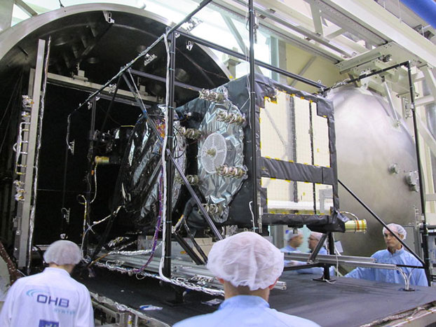
    chamber. Weeks of testing simulated the airlessness and temperature extremes of orbital space, taking place at the ESTEC Test Centre in Noordwijk, the Netherlands during May 2015. (Photo: ESA)
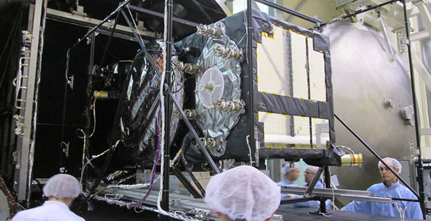
    Weeks of testing simulated the airlessness and temperature extremes of orbital space, taking place at the ESTEC Test Centre in Noordwijk, the Netherlands during May 2015. (Photo: ESA)

    News by the European Space Agency

    Europe’s latest Galileo was unboxed at ESA’s technical centre in the Netherlands in May, bringing the total number of satellites at the site to four.

    ESTEC in Noordwijk is the largest satellite test facility in Europe, with all the equipment needed to simulate every aspect of the launch and space environment under a single roof. It is an essential stop on the way to space for Europe’s Galileo satellites, built by OHB in Bremen, Germany, with navigation payloads from Surrey Satellite Technology Ltd. in Guildford, UK.

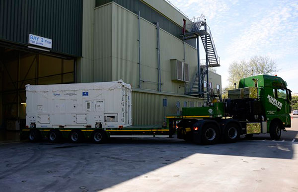
    The 12th Galileo arrived by lorry from Bremen on May 13, in a custom-built environmentally controlled container. The satellite will begin with a thermal vacuum test in a 4.5-meter-diameter stainless steel chamber, subjected to about five weeks of hard vacuum and the temperature extremes of space.

    Galileo-11 recently completed the same trial before moving on to final system testing, including a compatibility run with the ground network.

    Meanwhile, the ninth and tenth satellites are in storage at ESTEC, having passed their own checks. They will be flown to Europe’s Spaceport in French Guiana in late July for launch by Soyuz in September, which will bring the total in orbit into double figures.

    The 12th Galileo satellite, FOC FM-08, arrived at the ESTEC Test Centre on May 13. It was transported by lorry from Bremen in a protective air-conditioned container.
    The 12th Galileo satellite, FOC FM-08, arrived at the ESTEC Test Centre on May 13. It was transported by lorry from Bremen in a protective air-conditioned container.

    The first four Galileos, launched in 2011 and 2012, were in-orbit validation satellites, built by prime contractor Airbus Defence & Space. They confirmed that the overall system worked as planned, while also serving as the foundation of the full constellation to follow.

    The follow-up Full Operational Capability satellites are now being launched regularly to increase the size of the constellation to the point where early Galileo services can begin next year.

    European Partners. Galileo is a collaboration between ESA and the European Commission (EC). The validation phase was co-funded by ESA and the EC, while the full operational phase is funded by the EC. Under a delegation agreement, ESA acts as design and procurement agent on behalf of the commission.

  • OriginGPS Unveils Multi-GNSS Module with Antenna for Wearables

    OriginGPS Unveils Multi-GNSS Module with Antenna for Wearables

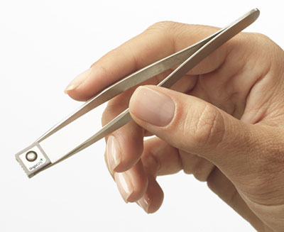
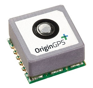
    The Multi Micro Hornet by OriginGPS was designed small with wearables in mind.
    The Multi Micro Hornet by OriginGPS was designed small with wearables in mind.

    OriginGPS has launched the Multi Micro Hornet, a tiny fully integrated multiple constellation antenna module. The innovative architecture packs functionality and high-quality components in a small space to improve wearables’ fashion and function, the company said.

    “A recent study by the European Global Navigation Satellite Systems Agency (GSA) showed that multi-constellation is becoming a standard feature in today’s user equipment,” said Gal Jacobi, CEO of OriginGPS. “Developers of wearables need modules with these features in the smallest size possible to be competitive in a market the GSA predicts will reach 14 million by 2023.”

    GPS World reported on the GSA market report in its April issue, and held a webinar on the report on April 16, which can be viewed for free.

    The Multi Micro Hornet is designed for devices that require a small form factor, low power consumption, and high sensitivity. In keeping with the company’s “Mini + Mighty” corporate mantra, OriginGPS has reduced the total volume in size by over 68 percent of other GNSS antenna modules without sacrificing performance, the company claims.

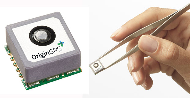
    The Multi Micro Hornet by OriginGPS.
    The Multi Micro Hornet by OriginGPS.

    The Multi Micro Hornet has features that will improve the navigation experience of wearables and other Internet of Things devices, including:

    • Small size, high performance: Despite its miniature outline of 10 x 10 mm and height of 5.9 mm, the Multi Micro Hornet module offers superior sensitivity and outstanding performance, achieving rapid Time To First Fix (TTFF) of less than one second, accuracy within as little as one meter, and sensitivity at -165 dBm by tracking both GPS and GLONASS constellations simultaneously.
    • High sensitivity and noise immunity: The Multi Micro Hornet continues to leverage OriginGPS’ patented and proprietary Noise Free Zone NFZ technology to ensure high sensitivity and noise immunity even under marginal signal conditions.
    • Reduced power consumption without compromising connectivity: It detects changes in context, temperature, and satellite signals to achieve a state of near continuous availability. By opportunistically updating its internal fine time, frequency and satellite ephemeris data, the Multi Micro Hornet is able to stay connected while consuming mere microwatts of battery power.
    • An intelligent design that shortens time to market: The Hornet family of GPS / GNSS antenna modules integrates a GNSS receiver and patch antenna in a single module. As a cornerstone of the OriginGPS portfolio, the Multi Micro Hornet’s pin-to-pin compatibility with the Micro and Nano Hornet modules ensures a seamless migration from GPS to GNSS and gives developers the ability to create new product offerings in the shortest time to market while minimizing costly design risks. Developers can connect it to a power source on a single layer PCB and be off and running.

    Additionally, the Multi Micro Hornet module combines OriginGPS’ proprietary low-profile GPS+GLONASS antenna with a dual-stage LNA, RF LDO, SAW filter, TCXO, RTC crystal and RF shield with SiRFstarV GNSS system on chip.

  • Cold Assets: GeoDecisions Platform Used to Track Icebergs

    Cold Assets: GeoDecisions Platform Used to Track Icebergs

    This photo shows drifting icebergs from the Amundsen during research expedition. (Photo: courtesy of Greg McCullough, University of Manitoba)
    This photo shows drifting icebergs from the Amundsen during research expedition. (Photo: courtesy of Greg McCullough, University of Manitoba)

    A Canadian expedition team used GeoDecisionsGeoILS platform to help track icebergs during a voyage to better understand how icebergs drift. An intelligent location server using the Esri ArcGIS platform, GeoILS enables users to monitor and locate assets and facilitate quick and coordinated responses.

    GeoDecisions, an information technology company specializing in geospatial solutions, partnered with Solara Remote Data Delivery Incorporated, Canada’s Carleton University and Esri during the project.

    Led by University of Manitoba Scientist David Barber, the crew of Canadian Coast Guard Icebreaker Amundsen sailed off the coast of Newfoundland and Labrador to research ice hazard mitigation, the effects of climate change, and polar region technology requirements. GeoILS location intelligence helped crew members visualize, analyze, and leverage project-pertinent data.

    “During the expedition, researchers and scientists used GeoILS to assess drifting through sensor monitors attached to the icebergs,” said Brian Smith, vice president of commercial solutions with GeoDecisions. “In addition to reporting and notifications, GeoILS provided the project team with maps that were tailored by selecting desired iceberg information and the geographic area of interest based on user-defined criteria.”

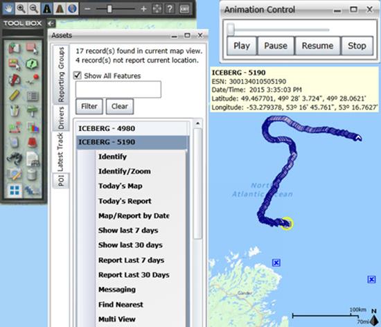
    Above is a representative snapshot of GeoILS’ features and range of functionality used during the Canadian iceberg expedition.
    Above is a representative snapshot of GeoILS’ features
    and range of functionality used during the
    Canadian iceberg expedition.

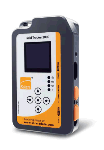
    GeoDecisions’ data portal was used with Iridium Solara tracking devices during the iceberg research project. “We are excited to provide tools to scientists who are gaining critical insights into the behavior of icebergs and global climate change,” said Tom Tessier, president of Solara Remote Data Delivery Incorporated.

    Solara Field Tracker 2000.
    Solara Field Tracker 2000.

    “GeoILS and the satellite tracking beacons worked very well during this project,” added Derek Mueller, assistant professor and physical geography program supervisor with Carleton University. “Thanks to our partners’ efforts, we now have a great new suite of tools for examining our data.”

  • Blink: Researchers Demonstrate Nanosecond Accuracy for Wireless Networks

    Researchers experimentally demonstrate the first wireless network synchronized with accuracy of a billionth of a second.

    A new timing protocol, dubbed “Blink,” would allow for timing greater than that provided by GPS satellites. According to researchers, the protocol would allow for wireless transmission over longer distances with less energy — while improve the overall efficiency of wireless networks.

    Such an enhanced timing technology could result in applications like coordinated signal jamming of enemy military receivers; extremely precise localization; coordinated navigation, tracking, and operation of UAVs; convoys of autonomous vehicles; and distributed beam forming.

    At the 2015 IEEE International Conference on Communications, being held June 8-12 in London, Andreas Molisch, professor of Electrical Engineering at the University of Southern California’s Viterbi School of Engineering, presented the paper, “Experimental Demonstration of Nanosecond-Accuracy Wireless Network Synchronization.”

    Molisch co-authored the paper with Marcelo Segura and S. Niranjayan, former post-doctoral students at USC, and Hossein Hashemi, also professor of Electrical Engineering at USC Viterbi.

    In the paper, the researchers experimentally demonstrate the first wireless network synchronized with nanosecond accuracy.

    Segura, Niranjayan, Hashemi and Molisch have developed a prototype, consisting of four nodes that synchronize to each other with an accuracy of approximately three nanoseconds. They also introduced a scalable protocol, which they call the “Blink” algorithm, that extends the same accuracy of the current small-size prototype (in this case, four wireless devices) to hundreds or even thousands of wireless devices.

    “Previous research has addressed precision synchronization, but, in the publically available literature, nanosecond accuracy was achieved only by connecting devices via cables, and only between few wireless devices. Even though GPS is widely used and is considered very precise, it does not easily provide this level of accuracy, and cannot be used in many indoor settings,” Hashemi said.

    Instead of requiring a precision of minutes, wireless devices have to make their clocks match within very small fractions of a second. This “clock synchronization” is needed for a large range of purposes — from increasing cellphone coverage, to increasing data speed rates, to enabling precision localization in places where GPS is not available. Some of these activities require synchronization within “only” a millionth of a second, a requirement that has been achieved by a variety of methods.

    One nanosecond, a billionth of a second, is how long it takes light to travel over one foot through the air. It is at this focused level that researchers have competed to develop solutions to push synchronization to a billionth of a second, or what is known as “nanosecond accuracy.”

    Synchronizing a whole network of wireless devices to such accuracy would enable a host of new possible applications, from precise localization to energy-efficient transmission for “Internet of things” sensor networks. However, it is remarkably hard to achieve such a level of synchronization, especially when the clocks in the devices are low-cost and not very precise.

    While this work has considerable applications for the military, it also has indications for other instances in which increased precision is necessary such as communication among a group of driverless cars to share location information.  Other possible applications include helping a person with limited sight navigate an indoor physical space, or providing a map for robots employed in the home or in industrial settings.

    The research was supported primarily by the Office of Naval Research and the Ming Hsieh Institute at USC.

  • Device Tracks Soldiers’ Movements without GPS

    Device Tracks Soldiers’ Movements without GPS

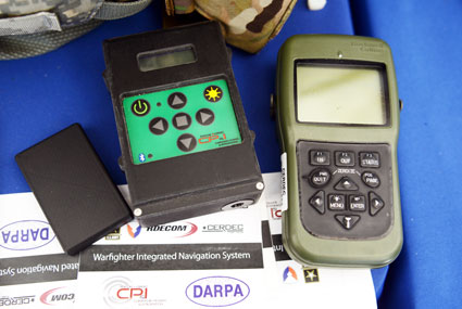
    The Warfighter Integrated Navigation System, center, uses inertial systems to determine a Soldier's location in the absence of a GPS signal. On the left, a smaller version of WINS. On the right, the Defense Advanced GPS Receiver, which soldiers use now for position, navigation, and timing. All three devices were on display at the DOD Lab Day, May 14, at the Pentagon. (Photo: U.S. Army/C. Todd Lopez)
    The Warfighter Integrated Navigation System, center, uses inertial systems to determine a Soldier’s location in the absence of a GPS signal. On the left, a smaller version of WINS. On the right, the Defense Advanced GPS Receiver, which soldiers use now for position, navigation, and timing. All three devices were on display at the DOD Lab Day, May 14, at the Pentagon. (Photo: U.S. Army/C. Todd Lopez)

    When GPS satellites can’t be seen due to dense jungle canopy, or they are blocked due to enemy interference, soldiers will still be able to track their location digitally using the Warfighter Integrated Navigation System (WINS), a device now under development at the Communications Electronics Research Development and Engineering Center (CERDEC).

    During the U.S. Department of Defense Lab Day held May 14 at the Pentagon, CERDEC researcher Osie A. David explained how the technology behind WINS will one day be transitioned to an Army program manager to bring assured navigational capability to soldiers.

    The WINS is a device small enough to carry in a soldier’s cargo pocket, about half the size of a pack of cigarettes.

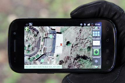
    “It’s got a number of inertial sensors, such as a pedometer and an accelerometer, things you will find on your cell phone but of a higher quality,” he said. “Even if the enemy is denying you GPS or the terrain is, you can still get known location on here so it will show up on your Nett Warrior device or your command and control system.” The Nett Warrior is an integrated dismounted situational awareness and mission command system for use by leaders during combat operations, using advanced navigation and information sharing capabilities to allow for faster and more accurate decisions during the tactical fight.

    The Nett Warrior
    The Nett Warrior

    Those inertial sensors will calculate an offset from the last-known location using footsteps taken, speed, acceleration and time, for instance. The device even has way to measure altitude. “It’s got a pressure reader so it knows if you are on the third floor or first floor of a building,” David said.

    The WINS isn’t perfect. As time goes by without a new GPS signal, its estimate of current location will degrade. But the device provides for the user an estimate of its own miscalculation. “After a time, it’ll show you a circle radius for the error range,” he said. “It’s still better than having no GPS at all.”

    David said knowing location is everything in combat, and the WINS, or a follow-on system that uses technology from WINS, will make sure that soldiers have that no matter what happens to GPS.

    “Say we go to Southeast Asia and I’m in the middle of the jungle. There are not a lot of good landmarks. I’m navigating around and I lose the GPS because with the triple-canopy jungle, the GPS can’t penetrate that. I don’t know where I am on the map, so I’m in a bad situation. If I want to know exactly where I am so I can call for reinforcements or resupply, WINS is going to give me my location on a map, no matter where I am.”

    David said CERDEC is still working on issues like where soldiers should wear the device. He also said that he expects the engineering specifications for WINS to be transferred to Program Executive Office, Intelligence and Electronic Warfare & Sensors by 2017. It will be inside an Army program manager’s office, not an Army lab, that WINS or the technology it contains will be made available to soldiers.

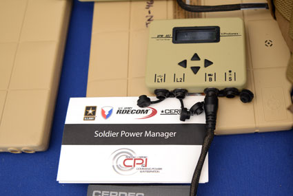
    The Soldier Power Manager sits on top of a conformal battery. Allowing multiple devices to be connected to a battery, it reports battery usage, power remaining,  and power usage by connected devices. (Photo: U.S. Army/C. Todd Lopez)
    The Soldier Power Manager sits on top of a conformal battery. Allowing multiple devices to be connected to a battery, it reports battery usage, power remaining, and power usage by connected devices. (Photo: U.S. Army/C. Todd Lopez)

    David also had with him a device he called the Soldier Power Manager. The power manager was connected to a “conformal battery,” which was also developed at CERDEC in conjunction with industry. The conformal battery is flexible and slips easily into a soldier’s tactical vest without being uncomfortable due to stiffness. It wraps around a soldier’s torso.

    The power manager allows multiple devices to connect to a battery, and provides a display saying how much power is left in the battery, what devices are connected to the battery, and how much power each device is using.

    “It lets you know how much energy is left and what is plugged in,” David said. He said one advancement the lab has made on the system is to transfer the user interface to a Nett Warrior device, so soldiers can see it on that screen.

    “It lets you see the total power left on the device and how much energy each device is pulling, so you can make a decision about what device to pull — when energy gets low — to make sure you have enough power to meet mission needs. We have sort of integrated the energy component with the information to make better choices in the battlefield in terms of operational energy.”

  • Harris, exactEarth Form Alliance for Global Maritime Tracking

    exactEarth Ltd. and Harris Corporation have formed an alliance to provide a new level of Satellite Automatic Identification System (AIS) data service that will deliver real-time global coverage for maritime vessel tracking. The new service will leverage the persistent global coverage and real-time connectivity of the Iridium NEXT constellation through the implementation of 58 hosted payloads covering the Maritime VHF frequency band.

    Harris is a space, geospatial and remote sensing company, and exactEarth is a provider of AIS data services.

    Compatibility testing of the hosted payload with the Iridium satellites has been completed. The first launch is scheduled for early 2016, with the completed constellation expected in 2017. The new service will provide customers with the fastest, most accurate vessel information available. With revisit times and latency under one minute, the service expansion represents a leap forward in the ability for both Harris and exactEarth to offer global ship tracking and maritime information solutions, the companies said in a statement.

    The alliance leverages exactEarth’s proven and patented signal de-collision detection technology and Harris’ expertise in satellite hosted payloads, advanced radio frequency technology and antenna solutions. Harris becomes the exclusive provider to the US government of AIS products and services produced under the alliance, including exactEarth’s exactAIS product portfolio, while exactEarth continues to serve all other global markets.

    “This alliance will expand our IntelliEarth family of innovative solutions, which leverage Harris’ world-class remote sensing capabilities to help customers around the globe make smarter operational and business decisions,” said Bill Gattle, vice president and general manager, National Programs, Harris Government Communications Systems. “Harris is committed to exploring new technologies and partnering with world-leading organizations to provide our customers with the greatest value.” 

    “As the recognized Satellite AIS industry leader, this announcement further strengthens our commitment to provide best-in-class maritime intelligence solutions to our customers worldwide,” said Peter Mabson, Ppresident of exactEarth.  “We are thrilled to be able to offer the shortest revisit times and lowest latency for developing true maritime domain awareness. This partnership with Harris will allow us to significantly expand the range of advanced value-added services and information solutions that we can bring to the global maritime market.”

  • FOIF GNSS Receivers Aid with Australian Pipeline Survey

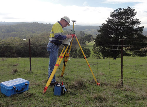
    Photo: FOIF GNSS Receivers

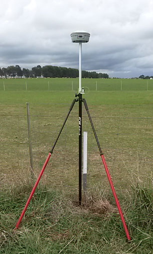
    Three years ago, engineering survey company G & C Sadlier Design was engaged to perform a route selection and centerline pegging survey for a gas pipeline duplication between Somerton in Victoria and Young in New South Wales, Australia. To accomplish the work, G & C Sadlier Design turned to FOIF GNSS receivers.

    So far, about 225 kilometers have been surveyed and constructed, with 306 kilometers still to be surveyed, designed and built, according to surveyor Greg Sadlier. The current focus is a 100-kilometer section in Victoria and a 70-kilometer section in New South Wales. Recently completed are two linear static control surveys over 80 kilometers in Northern Victoria and 70 kilometers at the end of the project near Young in New South Wales.

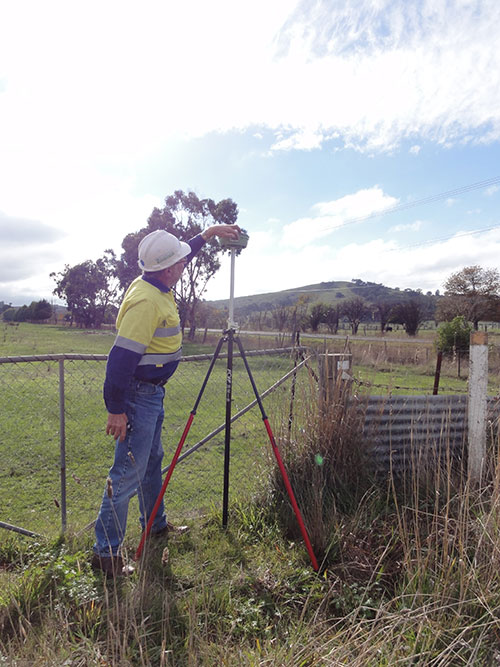
    Photo: FOIF GNSS Receivers

    “These surveys have been done using a FOIF F60 Base GNSS receiver and two FOIF A30 Rover receivers. (Two one-man survey crews are used),” Sadlier said. The procedure is to set up the F60 base over a point with known coordinates and elevation, approximately in the center of the alignment to be surveyed.

    The base was set first, to record 1-second data to the datacard over the duration of the survey. One surveyor started the base, and surveyed forward to the end of the alignment, and the other rover crew started at the beginning of the alignment and surveyed towards the base. The rovers were also set to record 1 second data to the datacard.

    “The control points were 0.75-m steel star pickets driven flush with the ground surface, and witnessed with a galvanized 1.5-m steel star picket,” Sadlier explained. “Each rover point was surveyed for 20 minutes plus 1 minute per kilometer of the distance to the base. That is, a point that is 35 Km from the base will be occupied for 55 minutes or 3300 epochs. With the control points at easy accessed positions, usually roads crossing the alignment, at intervals of about 8 kilometres mean that the survey of 80 Km is completed in one day.

    Photo: FOIF GNSS Receivers “We have found the FOIF GNSS receivers are very easy to use, and the epoch readout on screen is very reassuring that the data is being stored, and easily confirms that the correct amount has been stored. The data is easily downloaded from the card and converted to Rinex format with FOIF RnxTransform. The data was post processed by a third party.”

    The control survey results were adjusted (Helmert adjustment) onto check Permanent Marks at both ends. “This made a rotation of 0°00’00.001” and a shift of 0.007 meters E and 0.005 meter N. An elevation difference of .035 meters was manually adjusted out over the 80 kilometers,” Sadlier said.

    “We are now using the control survey while surveying the route selection and features survey,” Sadlier said. “We have two RTK base locations at the 25-kilometer mark and 52-kilometer marks, and using our VHF radio solution have coverage over the entire job with a 10-kilometer overlap in the center.

    “We have found that RTK observed control readings of 180 epochs return residuals of less than 010 meters for both coordinate and elevation for all the static control points. Very impressive results considering the length of the survey,” Sadlier said.

    The engineering firm has yet to process the New South Wales data, but expects the same or better, Sadlier said, as the overall length is a little less and the surveyed control points were in more open country with less tree cover.