Author: GPS World Staff

  • New Airbus A350 Airliner Comes EGNOS-Capable

    New Airbus A350 Airliner Comes EGNOS-Capable

    Airbus_A350_node_full_image_2
    The twin-engine, wide-body Airbus A350 XWB, seen here at Spain’s Adolfo Suárez Madrid-Barajas airport, comes with EGNOS capability.

    News by the European Space Agency

    The EGNOS system, developed by the European Space Agency (ESA) for sharpening the accuracy of satnav across Europe, has been adopted by a growing number of airports to enable satellite-guided landing approaches. The new Airbus A350 airliner, currently entering service, comes fitted with it as standard.

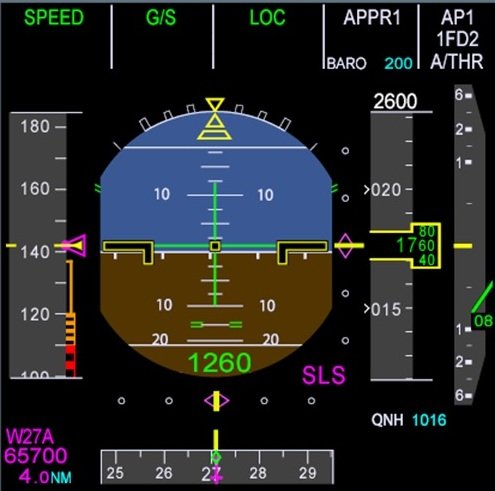
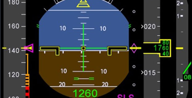
    “For the first time on the A350 we have a new system called the Satellite Landing System,” explained Jean-Francois Bousquie, an Airbus flight-test engineer focused on avionics. “This allows pilots to perform precision landing approaches guided by EGNOS or its U.S. equivalent, WAAS, offering vertical guidance down to a minimum of 60 meters before the pilot sights the ground to make the go/no-go decision on the final landing descent.”

    A350 isi equipped with a new system called the Satellite Landing System, allowing pilots to perform precision landing approaches guided by EGNOS or its US equivalent WAAS. This capability offers vertical landing guidance down to a minimum of 60 m before the pilot sights the ground to make the go/no-go decision on the final landing descent.
    The A350’s Satellite Landing System allows pilots to perform precision-landing approaches guided by EGNOS or its U.S. equivalent, WAAS. The capability offers vertical landing guidance down to a minimum of 60 miles before the pilot sights the ground to make the go/no-go decision on the final landing descent.

    The European Geostationary Navigation Overlay System, or EGNOS, can provide horizontal and vertical guidance to anywhere in Europe, without the need for any additional airport-hosted infrastructure. By using three geostationary satellites and a 40-strong network of ground stations, EGNOS improves the accuracy of GPS signals over European territory, while also providing continuous updates on their integrity.

    The result is that the EGNOS-augmented signals are guaranteed to meet the extremely high performance standards set out by the International Civil Aviation Organisation standard, adapted for Europe by Eurocontrol, the European Organisation for the Safety of Air Navigation. The signals from space can therefore be relied on routinely for the safety-critical task of vertically guiding aircraft during landing approaches.

    A total of 131 airports in Europe offer some 225 EGNOS-based approach procedures. By 2020, 582 landing procedures are expected across 20 European countries. The largest international airports use Instrument Landing System (ILS) infrastructure, with radio beams offering a truly precision landing capability, including the ability to autoland when visibility is at its worst.

    But ILS is expensive to install and maintain, so smaller regional airports often forego it. The same is true of many new or expanding airports. Even with larger airports, in many cases only their busiest runways are equipped with ILS. So EGNOS offers a cost-effective way of safely increasing use of remaining runways, boosting the flexibility of any given airport.

    “By reducing the value of the minima — the lowest safely guided altitude — for non-ILS runways, EGNOS increases the efficiency and safety of aircraft landings,” added Bousquie. “The take-up of EGNOS by European airports remains relatively low for now, but this should change over time. And with the A350, we are really designing for the long term — each aircraft will have a working life of 25 to 30 years.”

    “Every qualified commercial airline pilot has been trained on ILS, to follow its radio beam,” Bousquie said. “So the Satellite Landing System works by having them follow the same type of cues as much as possible on a ILS ‘look-alike’ basis, employing all available navigation data including EGNOS.”

    A pair of onboard Multi Mode Receivers manage the A350’s radio sensors, compute the deviations and ensure interface with display and guidance systems.

  • International Galileo Colloquium Issues Second Call for Papers

    The fifth International Colloquium on Scientific and Fundamental Aspects of the Galileo Programme will be held in Braunschweig, Germany, Oct. 27–29.

    Authors are invited to submit their abstracts using the online abstract submission form on the symposium website.

    The deadline for abstract submission has been extended from May 15 to May 21. Since 2007, the worldwide scientific community has met every two years to discuss the scientific possibilities of Galileo and other Global Navigation Satellite Systems (GNSS).

    This colloquium will bring together members of the European scientific community and their international partners involved in the use of GNSS signals in their research, specifically Galileo signals. Major academic players will meet with institutional and industrial executives to share innovative ideas and influence the future evolution of Europe’s own GNSS.

    The colloquium focuses on four major areas of research:

    • Scientific applications in meteorology, geodesy, geophysics, space physics, oceanography, land surface and ecosystem studies, using either direct or reflected signals, differential measurements, phase measurements, radio occultation measurements, using receivers placed on the ground, in aircraft or on satellites.
    • Scientific developments in physics, dealing with future GNSS, particularly in testing fundamental laws in astronomy and in quantum communication. Relativistic reference frames and relativistic positioning will be addressed — also taking into account the scientific opportunities in tracking the first two Galileo Full Operational Capability satellites in their elliptical orbits.
    • Aspects of metrology such as reference frames, onboard and ground clocks, and precise orbit determination.
    • Scientific aspects of satellite navigation and positioning such as signal propagation, tropospheric and ionospheric corrections and the means to model and mitigate multipaths and interference.

    The various possibilities to use navigation satellites such as Galileo for scientific purposes will be reviewed, and the contribution of scientific applications to making the most of the present systems and defining their evolution will be scrutinized.

    For those interested in submitting papers, online submission of abstracts opens May 15 through the colloquium website, where other details of the event can also be found.

  • Apple Acquires GPS Company Coherent Navigation

    Apple has acquired Coherent Navigation, according to various media reports.

    Coherent Navigation is a Bay Area GPS firm founded in 2008 by engineers from Stanford and Cornell. One of its areas of focus was high-integrity GPS (iGPS), an enhanced version of GPS that uses both normal, high-altitude GPS satellites and lower-altitude voice and data satellites from Iridium to increase the accuracy of a consumer’s GPS reading from the ground.

    The acquisition seems to be Apple’s latest efforts to bolster its mapping capabilities.

  • Derailed Train in Philadelphia Lacked Automatic Controls

    An automatic train control system — many of which use GPS — was not installed on the commuter rail route where an Amtrak train left the track on Tuesday, according to the National Transportation Safety Board. The advanced safety technology, known as positive train control, is designed to prevent high-speed derailments.

    Seven people were killed and more than 200 injured when Amtrak Northeast Regional Train 188 with seven cars derailed while rounding a curve at more than double the 50-mph speed limit.

    An Advanced Civil Speed Enforcement System (ACSES) was due to be installed on the route before the end of the year.

    The U.S. Department of Transportation describes these methods of positive train control, most of which use GPS:

    • ACSES (Advanced Civil Speed Enforcement System). A transponder-based system, in use on Amtrak’s Northeast Corridor originally put into use on the Northeast Corridor by the specific requirements of an Order of Particular Applicability. This type of positive train control system has been approved and certified by the Federal Railroad Administration (FRA).
    • ETMS (Electronic Train Management System). A GPS- and communications-based system being deployed by BNSF Railway.
    • I-ETMS (formerly called Vital Electronic Train Management System). A GPS- and communications-based system, not yet ready for deployment. It is the system of choice for CSX Transportation, Norfolk Southern Railway and Union Pacific Railroad. BNSF Railway is to upgrade to it when software is available; various passenger/commuter and other railroads are adopting it for compatibility and interoperability.
    • ITCS (Incremental Train Control System). A GPS- and communications-based system used by Amtrak on its Michigan line, authorized for passenger train speeds up to 110 mph, originally put into use by the specific requirements of an FRA-approved waiver. ITCS certification through Amtrak’s request for expedited certification process is pending successful resolution of a few remaining issues before FRA approval for certification.

    The Rail Safety Improvement Act of 2008 mandates that positive train control be implemented across a significant portion of the nation’s rail industry by Dec. 31, 2015.

  • McMurdo Opens Emergency Response Experience Center

    McMurdo Opens Emergency Response Experience Center

    Photo: McMurdo

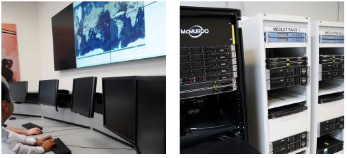
    McMurdo has opened an Emergency Readiness and Response Experience Center at its Washington, D.C., location. The center will showcase the latest innovations and technology developments for search and rescue (SAR) in an immersive experience with real-time demonstrations of the entire SAR process — from distress beacon activation to satellite-based location detection to emergency response coordination.

    The facility will feature a working MEOSAR (Medium Earth Orbit Search and Rescue) satellite-based search and rescue system, the next-generation version of the current Cospas-Sarsat satellite system that has saved more than 37,000 lives since 1982. When fully deployed in the next 3 to 5 years, MEOSAR will greatly improve the existing SAR process with global coverage, near instantaneous distress beacon detection and a unique Return Link Service feature that acknowledges distress signal receipt. MEOSAR’s advanced technologies will be able to accurately detect and locate a distress beacon signal almost instantaneously instead of taking up to 30 minutes today.


    For background on how GNSS satellites will be used in the MEOSAR system, see “The Distress Alerting Satellite System” Innovation article.


    Visitors to the center will gain an understanding of the different search and rescue technologies by taking part in various search and rescue scenarios. Participants will also have the opportunity to sit at the controls of mission control center and rescue coordination center systems, similar to the McMurdo solutions used around the world by NASA, National Oceanic and Atmospheric Administration (NOAA), Australia Maritime Safety Authority (AMSA), Maritime New Zealand (MNZ) and other SAR authorities.

    “This cutting-edge Experience Center allows us to demonstrate the incredible advancements being made in search and rescue all in a single location,” said Jean-Yves Courtois, CEO of McMurdo. “Our decades of experience in pioneering the latest SAR advancements, our leadership position as the only company that provides an end-to-end SAR ecosystem and our ongoing commitment to saving lives put us in the unique position to showcase these emergency readiness and response solutions for our customers, our partners and the industry.”

    Guests will also see SAR-enhanced applications such as fleet management, coastal surveillance and innovative partner solutions for aviation, fishing, maritime, military and other industries. Classroom training and other educational sessions led by industry experts and SAR specialists will take place at the new center.

    “The McMurdo Experience Center is unique in its ability to make the entire search and rescue process come to life, which we haven’t seen done before in a centralized setting,” said Bruce Reid, CEO, International Maritime Rescue Federation (IMRF). “We at the IMRF are delighted to be working with McMurdo on a variety of SAR training, education and awareness activities. Access to this location as a true center of excellence for the search and rescue sector can only enhance this activity.”

    Personalized, custom tours of the McMurdo Experience Center for customers, partners and press can be reserved.

    McMurdo products and services are used by some of the biggest names in the world including Airbus, Boeing, British Airways, Embraer, Southwest and United Airlines as well as the British Royal Navy, U.S. Coast Guard and numerous global search and rescue authorities. McMurdo was instrumental in the high-profile rescue of Clipper Round the World Race Sailor Andrew Taylor and was recently named as the official safety beacon partner of the hit reality series Deadliest Catch.

  • FAA Selects Mississippi State as Center of Excellence for UAS

    After a rigorous competition, the Federal Aviation Administration (FAA) has selected a Mississippi State University team as the FAA’s Center of Excellence for Unmanned Aircraft Systems (COE UAS). The COE will focus on research, education and training in areas critical to safe and successful integration of UAS into the nation’s airspace.

    The team brings together 15 of the nation’s leading UAS and aviation universities that have a proven commitment to UAS research and development and the necessary resources to provide the matching contribution to the government’s investment.

    “This world-class, public-private partnership will help us focus on the challenges and opportunities of this cutting-edge technology,” said U.S. Transportation Secretary Anthony Foxx. The Department of Transportation oversees the FAA. “We expect this team will help us to educate and train a cadre of unmanned aircraft professionals well into the future.”

    The COE research areas are expected to evolve over time, but initially will include:

    • detect and avoid technology
    • low-altitude operations safety
    • control and communications
    • spectrum management
    • human factors
    • compatibility with air traffic control operations
    • training and certification of UAS pilots and other crew members, in addition to other areas.

    “This team has the capabilities and resources to quickly get up and running to help the FAA address the demands of this challenging technology over the next decade,” said FAA Administrator Michael Huerta.

    The FAA expects the COE will be able to begin research by September 2015 and be fully operational and engaged in a robust research agenda by January 2016.

    Congress appropriated $5 million for the five-year agreement with the COE, which will be matched one-for-one by the team members.

    In addition to Mississippi State University, the other team members include: Drexel University; Embry Riddle Aeronautical University; Kansas State University; Kansas University; Montana State University; New Mexico State University; North Carolina State University; Oregon State University; University of Alabama, Huntsville; University of Alaska, Fairbanks; University of North Dakota; and Wichita State University.

    The FAA will determine the relationship between the new COE and the six UAS sites the FAA announced last year once the new team develops detailed research plans. The FAA expects COE flight testing to occur at one or more of the existing test sites.

    Congress mandated that the FAA establish the COE under the Consolidated Appropriations Act of 2014. Like university think tank partnerships, the agency’s Centers of Excellence bring together the best minds in the nation to conduct research to educate, train and work with the FAA toward solutions for aviation-related challenges.

  • ESA Aims to Map Sea Surfaces with GNSS Radio Occultation

    ESA Aims to Map Sea Surfaces with GNSS Radio Occultation

    The International Space Station. (Photo: ESA)
    The International Space Station. (Photo: ESA)

    Feature from the European Space Agency

    A new concept that involves mounting an instrument on the International Space Station and taking advantage of signals from navigation satellites could provide measurements of sea-surface height and information about features related to ocean currents, benefiting science and ocean forecasting.

    We have all seen the beautiful photographs of our planet taken by astronauts, but orbiting Earth 16 times a day just 400 km above, the Space Station also offers a platform from which to measure certain variables related to climate change.

    So, in 2011 the European Space Agency (ESA) called for proposals to explore how the Space Station could be used to make scientifically valid observations of Earth. After reviewing and assessing numerous proposals, the result is to further develop the GEROS-ISS mission concept.

    Jason Hatton, GEROS-ISS project coordinator, said, “The concept is still going through feasibility studies, but the aim is to launch the experiment towards the end of 2019. It would be carried to the Space Station on a cargo vehicle and installed on ESA’s Columbus space laboratory using a robotic arm, after which GEROS-ISS would run for at least a year.”

    GEROS-ISS stands for GNSS reflectometry, radio occultation and scatterometry on board the ISS. GPS and Galileo satellites send a continual stream of microwave signals to Earth for navigation purposes, but these signals also bounce off the surface and back into space.

    The idea is to install an instrument with an antenna on the Space Station that would capture signals directly from these satellites as well as signals that are reflected or scattered from Earth. This process could be used to calculate the height of the sea surface, and to measure waves — or “roughness” — that can then be used to work out the speed of surface winds.

    Sea-surface_height_cm-W
    Variations in sea-surface height (cm) obtained by merging multiple altimeter measurements. GEROS-ISS would be able to observe this variability so that maps covering latitudes 51° N to 51° S can be produced every four days. (Photo: ESA)

    GEROS-ISS is primarily an experiment to demonstrate new ways of observing Earth. However, if taken beyond the testing phase this new approach would complement measurements from satellites carrying altimeters such as CryoSat and Sentinel-3, and satellites carrying wind scatterometers such as MetOp.

    Importantly, it is the first concept to assess the potential of spaceborne GNSS reflectometry to determine and map ocean height at scales of 10–100 km or longer in less than four days. Current satellite altimeters, in comparison, offer global maps at scales of around 80 km, which are produced from multiple datasets every 10 days.

    A system based on GEROS-ISS would, therefore, complement existing satellite systems, helping to map ocean variability at finer spatial and temporal scales over a range of seas in tropical and temperate regions. It would also refine our understanding of how well the concept would work for measuring the roughness of the ocean surface.

    In this respect, the development of GEROS-ISS benefits from experience gained with the UK’s TechDemoSat-1, which also measures ocean-surface roughness using a similar technique. It is also hoped that NASA’s upcoming CYGNSS constellation of mini satellites will help pave the way for GEROS-ISS.

    In addition, GEROS-ISS uses a technique called radio occultation whereby the antenna receives signals that are refracted as they pass through the atmosphere. This can be used to generate vertical profiles of atmospheric humidity, pressure and temperature, as does the GRAS instrument on the MetOp satellites, for example.

    Europe’s Columbus space laboratory, photographed by ESA astronaut Luca Parmitano during his spacewalk on July 9, 2013.
    GEROS-ISS will be installed on the upper balcony of ESA’s Columbus space laboratory, which provides mechanical interface plates as well as power, command and data links to the ISS systems. (Photo: ESA, taken by ESA astronaut Luca Parmitano during his spacewalk on July 9, 2013. )

    “It is very flexible, combining different mission concepts and applications in one: GNSS-reflectometry to determine sea-surface height, scatterometry to measure sea-surface roughness and radio occultation for atmospheric studies,” said Jens Wickert who leads the science team that proposed GEROS-ISS.

    ESA engineer Manuel Martin-Neira noted, “The original concept actually goes back over 20 years and has matured considerably through numerous studies and campaigns, however, it has never been duly tested from space.”

    “Being able to use the International Space Station in this way means that we can quickly validate innovative observing techniques without having to build an entire satellite, and we expect this to lead to new opportunities for science,” added Michael Kern, ESA’s GEROS-ISS mission scientist.

    The GEROS-ISS feasibility studies are being carried out through ESA’s General Studies Programme.


    Editor’s Note: GPS World discussed the use of GPS for radio occultation in its March 1994 Innovation column, “Monitoring the Earth’s Atmosphere with GPS,” by Rob Kursinski.

  • UAV Product Showcase

    UAV Product Showcase

    BramorRTK-C-Astral-W

    GNSS Post-Processing UAS

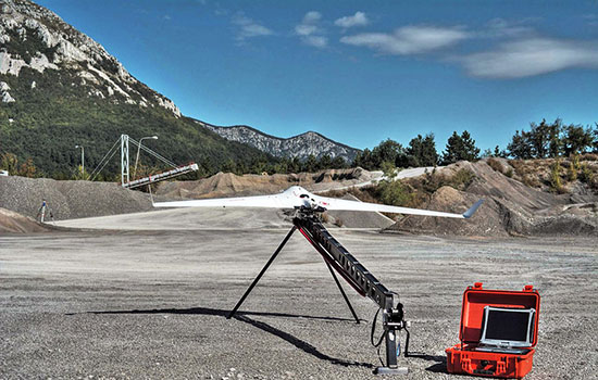
    The Bramor RTK GNSS Post-Processing UAS is designed for surveying and remote-sensing applications that need a quick, high-precision set of results down to sub-centimeter level in the absence of a grid of ground control points. It is equipped with C-Astral high-rate GPS and IMU precision data-logging electronics. The system has both air and ground segments, consisting of a GNSS onboard receiver and ground base station. It has an L1 and L2 GNSS reciever (GPS, GLONASS, BeiDou and Galileo-ready), plus a survey-grade antenna.

    C-Astral, www.c-astral.com


    QuestUAV-water-W

    Aqua Drone for Offshore Missions

    The QuestUAV Aqua Pro is designed for offshore/onshore data-gathering in fields such as environmental, gas and oil, coast guard and security. It is a fixed-wing waterproof UAV based on the QuestUAV 200 airframe.

    The Aqua Pro is capable of offshore missions and recovery in both fresh- and salt-water environments. It can withstand pressure differentials induced by rapid temperature changes, and overcome complexities of waterproofing/marine-grade electronics, sensors and avionics. It uses a GPS unit from SkyCircuits.

    QuestUAV, www.questuav.com


    GAJT-AE-34-W

    Electronic Warfare System

    NovAtel’s GAJT-AE GPS anti-jam technology is designed for military and security weight- and size-constrained airborne and ground unmanned platforms, including UAVs. GAJT-AE provides the null forming antenna control electronics for a four-element controlled reception pattern antenna.

    NovAtel, www.novatel.com


    RIEGL_RiCOPTER_W

    High-Accuracy Laser Scans

    The Riegl RiCopter is an unmanned multirotor UAS, integrating a high-performance and complete LiDAR system, the RIEGL VUX-SYS. The VUX-SYS comprises the VUX-1 LiDAR sensor, the Applanix AP20 IMU/GNSS system, a control unit, and up to four high-resolution cameras.

    The Riegl RiCopter can acquire high-accuracy, high-resolution laser scan and image data. The excellent measurement performance of the VUX-1 in combination with a precise fiber-optic gyroscope and GPS/GLONASS receiver results in survey-grade measurement accuracy in fields such as precision farming, forestry and mining. The IMU/GNSS unit provides roll and pitch accuracy of 0.015 degrees and heading accuracy of 0.035 degrees. Riegl is a maker of laser scanners, and using a high-end unmanned airborne platform allows data acquisition in dangerous and hard-to-reach areas.

    Riegl, www.riegl.com


    eBee-RTK-over-mine-W

    Survey-Grade Mapping Drone

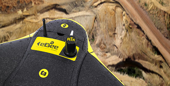
    The eBee RTK by senseFly is a fully autonomous survey-grade mapping drone with a built-in L1/L2 GNSS receiver capable of receiving corrections from most leading brands of base station. This ensures high positional accuracy without the need for ground control points, so the aerial photography can produce orthomosaics and 3D models with accuracy down to 3 centimeters. It has 226 channels and tracks GPS L1, L2, L2C; GLONASS L1, L2, L2C; and SBAS.

    Sensefly, www.sensefly.com

  • Satnav Augmentation Systems Settle on Common Channels Post-2020

    Satnav Augmentation Systems Settle on Common Channels Post-2020

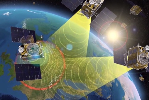
    EGNOS is Europe’s first venture into satellite navigation. EGNOS broadcasts augmented information through a trio of geostationary satellites linked to a network of monitoring ground stations, to sharpen the accuracy and reliability of GPS signals across the continent.
    EGNOS is Europe’s first venture into satellite navigation. EGNOS broadcasts augmented information through a trio of geostationary satellites linked to a network of monitoring ground stations, to sharpen the accuracy and reliability of GPS signals across the continent. (artist’s concept: ESA)

    News from the European Space Agency

    The next decade’s aircraft pilots will be able to rely on enhanced, reliable satellite navigation signals on a seamless basis across much of the world, thanks to decisions made at the latest gathering of worldwide satnav augmentation system providers and experts.

    The U.S. Wide Area Augmentation System (WAAS) and European Geostationary Navigation Overlay Service (EGNOS) are leading examples of satellite-based augmentation systems (SBAS) that apply additional ground stations and satellite transponders to sharpen the accuracy and reliability of existing satnav services across given geographical regions.

    These performance enhancements permit satnav to be employed for safety-of-life services, especially aviation. Such systems are based on the U.S. GPS for now, but plans are being laid to move to a multi-constellation design employing Europe’s Galileo, China’s Beidou and Russia’s GLONASS satnav systems beyond 2020.

    The 28th Satellite-based Augmentation Systems Interoperability Working Group (IWG), planning standardization of SBAS systems to come, was hosted at ESA’s ESTEC technical centre at Noordwijk, the Netherlands, on April 1-3.

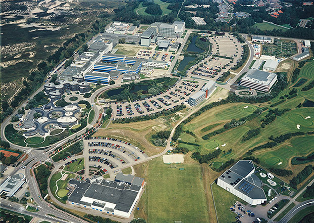
    The ESTEC facility in Noordwijk, The Netherlands.
    The ESTEC facility in Noordwijk, The Netherlands. (Photo: ESA)

    All participants unanimously endorsed the “message definition” for a new secondary SBAS channel — to be known as L5, along with the current L1 — for the planned second-generation SBAS systems, which will utilize dual-frequency multi-constellation signals.

    Using dual frequencies greatly increases the accuracy of navigation systems, by allowing interference from the ionosphere — an electrically active outer layer of Earth’s atmosphere — to be largely subtracted from the final result.

    “This definition is presented in what is called the Dual Frequency Multi-Constellation Definition document,” explained Didier Flament, representing ESA. “It represents the outcome of a four-year activity, which started at IWG 19 in Japan, back in 2010, coordinated between all IWG members under the technical leadership of ESA and French space agency CNES on the European side, and the Federal Aviation Authority (FAA) and Stanford University on the U.S. side.

    “The formal IWG review loop for the document took six months to conclude, with this IWG 28 then allowing endorsements to be gathered by SBAS project managers, culminating in formal signatures to the document,” Flament said.

    Planned_SBAS_coverage_for_2020-W
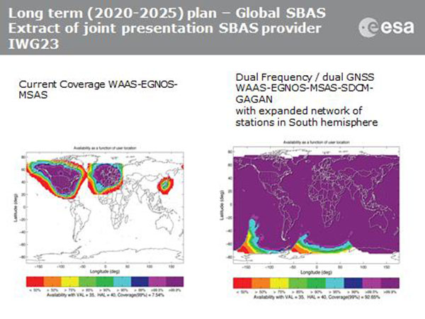
    SBAS coverage for 2020: Comparing current worldwide SBAS coverage — based on WAAS, EGNOS and MSAS — to the situation envisaged for 2020–25: near-global coverage based on WAAS, EGNOS, MAAS, SDCM and GAGAN, with an expanded network of stations in the southern hemisphere, all based on a common dual-frequency/dual satnav standard being finalized by the SBAS Interoperability Working Group. (Image: ESA)

    IWG members now intend to have this document accepted by the official international SBAS standardization bodies: the International Civil Aviation Organisation, the U.S. Radio Technical Commission for Aeronautics (RTCA) and the European Organisation for Civil Aviation Equipment.

    “This next step is very important,” added Didier. “Not only for the coming 2016-22 implementation of the European EGNOS v3 but for implementation of other second generation SBAS in other regions of the world.”

    The meeting also reported on the state of development of the other global SBAS systems. Along with the four operational systems — the U.S. WAAS, European EGNOS, Japan’s Multi-functional Satellite Augmentation System (MSAS) and India’s GPS-aided geo-augmented navigation or GPS and geo-augmented navigation system (GAGAN) — these comprise South Korea’s KASS, China’s Beidou SBAS, Russia’s System for Differential Corrections and Monitoring (SDCM) and the West African Agency for Aerial Navigation Safety in Africa and Madagascar (ASECNA) SBAS.

    The follow-up IWG meeting will take place in October, hosted by the FAA in Washington, D.C., in conjunction with the next RTCA meeting.

  • Hemisphere GNSS Releases Next-Generation GNSS RTK Engine

    Hemisphere GNSS has released Athena, its next-generation GNSS engine. Offering significantly enhanced performance, Athena provides Hemisphere with a new, future-oriented foundation providing strong performance, flexibility and reliability, according to the company.

    Athena has yielded outstanding performed in virtually every environment where high-accuracy GNSS receivers can be used, the company stated. Hemisphere customers have tested Athena’s performance in long baseline, in open-sky environments, under heavy canopy, and in geographic locations experiencing significant scintillation.

    Hemisphere has designed its new core engine to maximize the company’s ability to excel at the rigorous GNSS requirements in multiple market segments, supplying its customers in machine control, survey and GIS, with a design for now and in the future, Hemisphere said in a statement.

    The release of Athena is a significant milestone for Hemisphere, which promises another new product entry into the market in the coming months.

    Features of Athena include these capabilities:

    • Initialization time — A reliably consistent initialization performance, less than 15 seconds at better than 99.9 percent reliability.
    • Robustness in difficult operating environments — Extremely high productivity under the most aggressive of geographic and landscape oriented environments for GNSS, while delivering up to 50 percent better performance in user tests matched against competitive systems.
    • Performance on long baselines — Position stability for long baseline applications, with position quality often times exceeding the performance of other leading RTK systems on the market.
    • Performance under scintillation — Sustained accuracy under ionospheric scintillation activities, providing one of the most reliable means to work with GNSS in scintillation-affected areas.

    Rodrigo Leandro, Hemisphere’s director of engineering, GNSS Positioning Systems, gave this description of the design process for Athena.

    “Development of Athena started shortly after I came to Hemisphere in August of 2013. The company has been a leader in RTK solutions for many years. During those years, we focused in certain specific market segments such as agriculture, and under new leadership we determined there was a need to address a wider spectrum of market segments, with very high accuracy and feature rich capabilities built on the strong legacy platform we had already established. So, working with Mike Whitehead, the company CTO and our main RTK technologist, we identified the goal of reengineering our RTK engine to match the needs of RTK for the next 10 years, and to provide a foundation for future product development.”

    Leandro continued, “As part of this, we made a decision to build an expanded, world-class software development team, pulling great talent from around the industry to create a group of 11 totally focused on what we should do to move GNSS technologies forward — looking at all types of positioning techniques, not just RTK. Athena is just the first result of that work to become publicly available — you will see plenty more coming from the team over time.

    “Looking at Athena specifically, we did a complete review, touching every part of the engine — from how we deal with the atmosphere, quality-control of the data, modeling the clock of the receiver, and so on, through to how to do external corrections, whether single-based or network-based. We even looked at and modified the receiver system, improving the multitasking architecture to more actively use the CPU for our computational work,” Leandro said.

    I’m proud to say that the results of all that work match up to what we envisioned. RTK is a pretty mature technology at this point, so improving on what is available in the industry is a tough ask. However, our extensive competitive testing shows that the engine performs really well in terms of initialization, accuracy, and stability across a range of different environments, for instance in long baselines and under tree canopy, and our tests of scintillation are showing great results as well. Overall, we have seen excellent accuracy coming out of this engine compared to legacy as well as others in the marketplace. It’s hard to win every single time in a toe-to-toe comparison, as systems and conditions differ in every test, but our broad testing shows us not only matching, but beating competitive systems pretty consistently.”
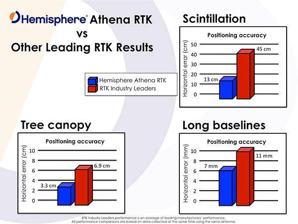
    Photo: Hemisphere GNSS

    “In our user base, both Hemisphere branded products and our OEM boards, we get exposed to a wide variety of applications and environments, from agriculture and marine, through machine control applications and survey systems,” Leandro said. “Our goal from the start was to build a system that performed across that user base, and we are proud to say that we have delivered with Athena.”

    “In terms of availability, we want to get the Athena engine on as many current and legacy systems as possible, so our users have the best possible experience. However, we have also been improving the legacy engine as well, delivering gradual steps of improvement to our customers, so whatever version they are using, their experience should be much improved,” Leandro concluded.

    Test Reports

    Hemisphere GNSS provided the following statements by an independent tester and from customers, widely distributed around the industry.

    “I’ve had an opportunity to thoroughly test Athena in both moderate and extreme environments,” said Andy Carbognin, an independent GNSS test specialist at Vecto Geomatics of Ottowa, Canada. “I’m very impressed with the performance, and we’ve tested alongside the current industry leaders’ top-of-the-line products. In every situation, Athena is proving to be a tremendous improvement over Hemisphere’s most widespread legacy firmware versions, at a minimum, matching the industry’s best while in many cases exceeding their performance.”

    “Carlson Software has extensively tested Hemisphere’s new Athena RTK engine on the Carlson BRx5 GNSS receiver,” said Butch Herter, director of Hardware Development, Carlson Software. “The Athena RTK engine provides precise, reliable, and repeatable positions. Athena exceeds or matches the performance of all other GNSS receivers it has been tested against. We have been particularly impressed with the performance of the Athena engine, when using a long baseline or in areas where there is a limited view of the sky. Athena is a first class RTK engine.”

    “We’ve been working with Hemisphere’s technology for a number of years,” states Randy Noland, vice president of business development and director of Machine Control, Carlson Software. “I’m amazed at the team they’ve brought together and how they’re radically modernizing their technology. Collaborating with the ‘new’ Hemisphere has been an eye-opening experience, and I’m excited at how their innovative technologies will positively impact our future business.”

    “In the marine construction and hydrographic survey markets, time is money. We’ve seen very high system reliability and impeccable results using the Athena RTK engine, which ensures we are achieving maximum up-time,” said Harrison Steves, operations manager at Cable Arm. “As well, not being tied to a specific make of RTK base gives us flexibility with our equipment deployment.”

    “We’ve found Athena to offer exceptional performance, especially their RTK fix times and maintaining RTK lock on long baselines,” said David Vaughn, CEO, Novariant. “With the latest competitive performance testing completed, Novariant is excited about adding Hemisphere’s Athena offering to the list of the Novariant-recognized certified receivers that, when combined with our precision steering solution, can assure centimeter-level steering control in the toughest environments in the world.”

    CEO Statement

    “Our goal is to be nothing short of the best GNSS technology partner in the industry, and a key component of that is delivering market-leading technologies tailored to our customer’s needs,” said Chuck Joseph, Hemisphere GNSS CEO and president. “To that end, we have put together a world-class team that is totally rethinking our product family, and our new Athena engine is just the first, powerful proof of our fresh approach. Watch this space!”

    Availability

    Before the end of this month, Athena will be included in all Hemisphere multi-frequency, RTK-capable products, such as the A325, R330, S320 and VS330. To download and install Athena, visit Hemisphere’s Software page.
  • Sky-Watch Partners with General Dynamics on UAVs for Defense

    Sky-Watch Partners with General Dynamics on UAVs for Defense

    Artist's concept of the proposed Airborne Swarm Protection Shield by GDELS and Sky-Watch.
    Artist’s concept of the proposed Airborne Swarm Protection Shield over a GDELS armored vehicle (image courtesy of Sky-Watch).

    General Dynamics European Land Systems (GDELS) has signed a Memorandum of Interest (MOI) with Danish UAV company Sky-Watch in Støvring, which allows the two companies to explore potential areas of cooperation within next-generation applications of UAV technology in the battlefield.

    “Sky-Watch is constantly striving to be at the forefront of the rapidly developing UAV technology,” said Michael Messerschmidt, Sky-Watch chief business development officer. “We offer our vast accumulated know-how within sensor fusion to our partners, in the pursuit of finding new ways to solve tomorrow’s challenges. We constantly rethink and redefine the value proposition, of our own as well as our partners’ ideas and concepts and I believe that we can identify some very exiting avenues of cooperation with General Dynamics European Land Systems.”

    Sky-Watch offers the Huginn X1 multi-purpose Quadrotor UAV deployed all over the world and is developing the Muninn X1, a next-generation fixed-Wing VTOL UAV. The future of UAVs in the battlefield will be explored by Sky-Watch Labs, the research and development arm of Sky-Watch, in cooperation with partners such as the Technical University of Denmark on a variety of projects.

    With regard to the acquisition of new Armored Personnel Carriers (APC) for the Danish Army, General Dynamics European Land Systems is prepared to take its partnerships with Danish industry to the next level and explore business in adjacent markets like the one of Sky-Watch. GDELS has signed Industry Cooperation agreements with 40 Danish companies of all sizes across the country, and has already defined projects in excess of 3,7  billion  kroner covering all of the technology areas defined in the Danish Government’s Defence industry strategy.

    “Throughout the past 20 years, GDELS Industry Cooperation program has been one of the catalysts for the development of the Danish defence industry. We have executed projects of almost 1,7 billion kroner with the industry, which has helped to contribute to the development of new products and technologies in a variety of companies. By engaging with an innovative and creative company such as Sky-Watch, we help plant the seed for the future of the Danish defence industry,” said Jens Bauer, GDELS Senior Director International Business & Services, responsible for Industrial Participation.

    GDELS’s Industry Cooperation plan for the APC program is based on 20 years of experience and partnership with Danish industry. The program expands relationships beyond production and sustainment contracts to also include research & development projects, which will lay the foundation for growth in the Danish Defence industry for decades to come.

  • Trimble’s New OEM Module Combines GNSS with MEMS Inertial

    Trimble’s New OEM Module Combines GNSS with MEMS Inertial

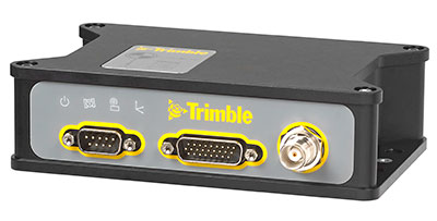
    Trimble BD935-INS module.
    Trimble BD935-INS module.

    Trimble has introduced the Trimble BD935-INS module that features precision GNSS with an integrated 3-D Micro-Electro-Mechanical Systems (MEMS) inertial sensor package. As part of Trimble’s GNSS OEM portfolio, the new compact module augments real-time precise positioning with 3-D orientation.

    The BD935-INS module’s simple connectivity and configuration capabilities allow system integrators and OEMs to easily add GNSS and attitude to specialized or custom hardware solutions, Trimble said in a news release.

    Trimble made the announcement at AUVSI’s Unmanned Systems 2015 Conference and Exhibition.

    “The OEM and system integrator communities demand high performance, reliability and support for their positioning solutions,” said Dale Hermann, general manager of Trimble’s Integrated Technologies Division. “The Trimble BD935-INS delivers the latest GNSS and inertial technology in an easy-to-integrate form factor for demanding conditions and applications such as lightweight robotic or unmanned vehicles. With the BD935-INS module, customers are purchasing a robust navigation solution, extending performance beyond that of a GNSS receiver only.”

    Taking advantage of Trimble’s expertise in both GNSS and inertial technologies, the Trimble BD935-INS module has been designed for applications requiring both RTK and orientation in a compact package. By integrating inertial sensors onto the GNSS module, users can experience more robust performance in a variety of challenging environments, Trimble said.

    The BD935-INS features triple frequency for both GPS and GLONASS constellations, as well as dual frequency for BeiDou and Galileo. The module delivers fast and reliable RTK initialization for 1–2 centimeter positioning. For applications that do not require centimeter accuracy, the BD935-INS integrated GNSS-inertial engine delivers high-accuracy GNSS and DGNSS positions in challenging environments such as urban canyons, tunnels, heavy canopy or other GNSS-denied environments, the company said.

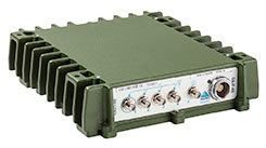
    Trimble also announced the new BX935-INS, which is an environmentally rugged enclosure for OEM or system-level integration. The BX935-INS houses the Trimble BD935-INS module for easy installation and immediate access to high-rate position and attitude data for a variety of applications.

    The Trimble BD935-INS and BX935-INS is expected to be available in the third quarter of 2015 through Trimble’s Integrated Technologies Precision GNSS sales channel.