SBG Systems, a manufacturer of inertial navigation systems (INS), has selected the Septentrio AsteRx4 OEM GNSS receiver to equip its Apogee product line. The announcement was made during Ocean Business 2015, held April 14-16 in Southampton, England.
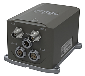
SBG Systems’ Apogee-D
“We are delighted that SBG Systems — a respected specialist in designing INS/GNSS — endorses our newly released GNSS receiver for its performance,” said, Laurent Le Thuaut, business development manager at Septentrio. “The SBG products are recognized amongst the preferred choice for accurate MEMS-based INS and we are extremely proud that our technology is included in their top of the line.”
Apogee is a new product line of high-accuracy inertial navigation systems based on robust and cost-effective MEMS technology. The INS/GNSS solution combines the latest generation of MEMS sensors and the OEM version of the AsteRx4, a newly introduced high-precision GNSS receiver from Septentrio. The Apogee series is especially suited for applications such as hydrography, mobile mapping and aerial survey where survey-grade positioning measurements are required.
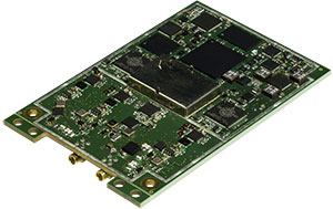
AsteRx4 OEM
The AsteRx4 OEM is a multi-frequency and multi-constellation dual antenna receiver that incorporates the latest innovative GNSS tracking and positioning algorithms from Septentrio. The AsteRx4 is scalable to one centimeter and integrates the entire suite of GNSS+ algorithms proposed by Septentrio to maintain tracking during heavy vibration of machines. This assures position accuracy under difficult ionosphere conditions and mitigates or rejects intentional or unintentional interference with GNSS signals.
“The compact design and the practical and well-designed interface of the AsteRx4 allowed a seamless and an easy integration into our solutions” said Raphaël Siryani, chief marketing & sales officer of SBG Systems. “The AsteRx4 largely contributes to the robust and accurate heading as well as the reduced power consumption of the INS/GNSS Apogee products.”
Both the AsteRx4 OEM receiver and the Apogee INS/GNSS are on display at booth No. W40 (Septentrio) and booth E5c (SBG Systems) at Ocean Business.
Hemisphere GNSS is offering a new RTK-enabled Vector V320 GNSS compass. The Vector V320 smart antenna supports multi-frequency GPS, GLONASS, Galileo (future firmware upgrade required) and BeiDou, and Hemisphere GNSS says it’s “the first of its kind.”
Designed for the professional marine and marine survey markets, the Vector V320 is the a multi-frequency, multi-GNSS, all-in-one smart antenna capable of both RTK-level positioning accuracy and better than 0.2-degree heading accuracy in a simple-to-install package.
“The Vector V320 combines our expertise in GNSS and smart antenna design,” said Lyle Geck, senior manager, Product Marketing, at Hemisphere GNSS. “With RTK performance that competes with current industry leaders, extremely accurate accelerometer-aided GNSS heading, and the simplicity of install offered by the smart antenna design, it is an incredible product.”
The Vector V320 is the latest in a line of GPS/GNSS compasses, including the multi-frequency, multi-GNSS Vector VS330 receiver as well as the Vector V102, Vector V103 and Vector V104 compass smart antennas.
“There has been a void in the market. Our customers have been looking for a product that provides RTK accuracy together with precision heading in an easy-to-install package,” said Andy Smith, managing director of Saderet Ltd. “The Vector V320 delivers.”
The Vector V320 GNSS compass is being featured by Hemisphere GNSS at Ocean Business in Southampton, UK, April 14-16, at stand K12.
One of the Honeywell Global Tracking ESA installations.
Honeywell’s Global Tracking solution has passed the final acceptance test for use on the European Space Agency’s (ESA) Galileo search and rescue program by demonstrating dramatically reduced emergency response times, Honeywell said.
Honeywell Global Tracking, part of Honeywell’s Scanning and Mobility business, is working in partnership with the Aerospace & Defense division of Capgemini, the prime contractor for the Galileo search and rescue program, to deliver a high-precision positioning system that is fully compatible with the international standard, which is known as the Cospas-Sarsat standard. Tests using the Honeywell system have proven that the time from beacon transmission to detection and processing has been reduced from several hours to a few minutes — often the difference between life and death in an emergency situation.
The international Cospas-Sarsat program is a satellite-based search and rescue distress alert detection and information distribution system, best known for detecting and locating emergency beacons activated by aircraft, ships and remotely located people in distress. Honeywell’s satellite tracking technology, which detects faint alerts sent by emergency beacons around the world using a combination of Doppler curves, noise reduction, and advanced signal processing, quickly calculates the exact location of the beacon and sends the results to the relevant Mission Control Centers in the region.
“Our Medium Earth Orbit-based search and rescue solution will lead to faster recovery missions and improved international search and rescue operations, and we’re pleased to partner with the European Space Agency to help execute on this important, life-saving system,” said David Sharratt, general manager, Honeywell Global Tracking. “With decades of experience developing this technology, Honeywell Global Tracking is the global leader of search and rescue solutions.”
“Up until now, Cospas-Sarsat has relied on satellites in low and high orbits, but medium orbits with satellites such as Galileo are better for search and rescue purposes; they combine a wide field of view with strong Doppler shift, making it more likely a distress signal is pinpointed promptly and accurately,” said Fermin Alvarez, ground station and fielding engineer with ESA. “Together with Honeywell, we are encouraged to see Galileo performing so strongly, thereby solidifying our ability to support precise and speedy search and rescue efforts.”
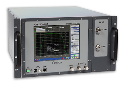
Cobham AvComm, formerly the Aeroflex AvComm business unit, has introduced the ATC-5000NG NextGen ATC/DME Test Set.
Designed for engineering development, design validation, manufacturing and return-to-service test applications, the ATC-5000NG is the replacement product for the legacy SDX-2000 and the ATC-1400A/S-1403DL. The software defined radio architecture supports more transponder RTCA DO-181E test capability than the legacy products did and has new capability needed to support the Federal Aviation Administration’s NextGen test requirements including ADS-B (RTCA DO-260B) and UAT (RTCA DO-282).
ADS-B is the Automatic Dependent Surveillance-Broadcast for next-generation (NextGen) aircraft navigation. The FAA has mandated that aircraft operating in airspace that now requires a Mode C transponder must be equipped with ADS-B Out by Jan. 1, 2020.
“We are excited to introduce the new ATC-5000NG which offers our customers the most comprehensive test set available in the market today. This will help our customers prepare for new requirements driven by the FAA’s NextGen and Europe’s SESAR projects,” said Ryan Panos, vice president and general manager of Cobham AvComm.
In September 2014, Cobham completed its acquisition of Aeroflex for $1.46 billion.
The Rohde & Schwarz CMW500 is being used to test the ERA-GLONASS system.
The Certification Center Svyaz-Certificate in Russia is now using the R&S CMW500 to certify ERA-GLONASS systems in line with the TR CU 018/2011 technical guideline. The independent Russian test lab is currently the only test lab in Russia accredited to certify these systems. The R&S CMW500 is a wideband radio communication tester.
Equipped with the R&S CMW-KA095 application software, the R&S CMW500 meets all requirements for testing ERA-GLONASS systems and provides reliable, reproducible tests in line with the Russian GOST R 55530 specification, Rohde & Scwarz said. In addition, the R&S CMWrun sequencer software (R&S CMW-KT110) makes the test solution fully automated and user-friendly.
Effective January 1, 2015, all new car models introduced to the Russian market must be equipped with an automatic ERA-GLONASS emergency call system.
DARPA is looking for technology communities that can team to provide expertise and innovation for small sensors, expendable and small unmanned systems, and distributed communications and navigation technology.
The Defense Advanced Research Projects Agency (DARPA) is researching a drone that can hibernate on the ocean floor for years at a time before being launched to the surface and into the air.
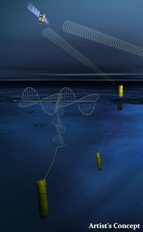
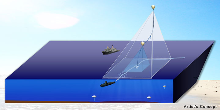
The “Upward Falling Payload” (UFP) concept centers on developing deployable, unmanned, nonlethal distributed systems that lie on the deep-ocean floor in special containers for years at a time. These deep-sea nodes could be remotely activated when needed and recalled to the surface. As DARPA terms it, they “fall upward.”
The new drones are part of a new focus by the U.S. military to develop and improve technology for emerging threats. “Today, cost and complexity limit the Navy to fewer weapons systems and platforms, causing strain on resources that must operate over vast maritime areas. Unmanned systems and sensors are commonly envisioned to fill coverage gaps and take action at a distance. However, power and logistics to deliver these systems over vast ocean areas limit their utility. The Upward Falling Payload (UFP) program intends to overcome these barriers,” DARPA said on its website.
DARPA’s statement continues: “Nearly 50 percent of the world’s oceans are deeper than 4 km, which provides vast areas for concealment and storage. As a consequence, the cost to retrieve UFP nodes is asymmetric with the likely cost to produce and distribute them to the seafloor. Concealment provided by the sea also provides the opportunity to quickly engage remote assets that may have been dormant and undetected for long periods of time, while its vastness allows simultaneous operation across great distances. Getting close to objects without warning, and instantiating distributed systems without delay, are key attributes of UFP capability.”
The UFP system would have three key subsystems:
The payload, which executes waterborne or airborne applications after being deployed to the surface
The UFP riser, which provides pressure tolerant encapsulation and launch of the payload
The UFP communications, which trigger the UFP riser to launch.
The program would need to demonstrate a system that can:
survive for years under extreme pressure
be triggered reliably from standoff commands
rapidly rise through a water column and deploy its payload.
The drones wouldn’t require fuel, as they would be powered with energy generated by ocean currents. Ocean drones would be difficult to manufacture, however, because researchers would need to figure out how to activate the drone, how to help the drone breach the surface, and make sure the drone is protected in salt water for long periods.
This artist’s concept shows a potential communications application of an upward falling payload. (Credit: DARPA)
Phase 2. The program is completing its first phase and is about to enter its second. During Phase 1, DARPA supported more than 10 study and design efforts to figure out approaches for long-range communications, deep-ocean high-pressure containment, and payload launch. The study teams also addressed a variety of missions for the payloads.
“In this first phase, we really learned about how the pieces come together, and built a community of developers to think differently about unmanned distributed solutions for the maritime domain,” said Andy Coon, DARPA Program Manager for the effort. “The trick is to show how these systems offer lower-cost alternatives to traditional approaches, and that they scale well to large open-ocean areas.”
In the next Phase, DARPA intends to learn from the studies, and develop and demonstrate prototype systems. DARPA is seeking teams to develop UFP nodes that combine expertise in both deep-ocean engineering and advanced payload development.
“We’re also looking for the communications technologies for these nodes. As long as you can command the nodes remotely and quickly, and don’t have to send a ship out to launch it, you’re in good shape. Some Phase 1 approaches were more exotic than others, but we were pleased by the range of challenging options,” said Coon.
In today’s fiscally constrained environment, such a system of pre-positioned, deep-sea nodes could provide a full range of maritime mission sets that are more cost-effective than existing manned or long-range unmanned naval assets.
For Phase 2, DARPA is particularly looking for technology communities that can team to provide expertise and innovation for small sensors, expendable and small unmanned systems, distributed communications and navigation technology, novel long-range underwater communications, and long-endurance mechanical and electrical systems that can survive for years in dormant states.
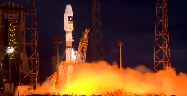
Galileo 7 and 8 were launched into orbit March 27. (Screenshot of ESA/Arianespace livestream feed.)
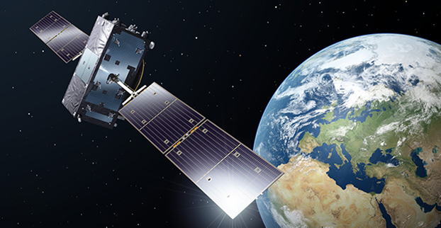
Europe’s two newest Galileo satellites — launched March 27 — have carried out maneuvers to take them down to their working positions in orbit. Both satellites are performing well. Galileo 7 and 8 were launched into a circular 23,522 km altitude orbit about 300 km above their final orbit.
Using their onboard thrusters, the two Galileo satellites have performed all their Launch and Early Operations Phase (LEOP) maneuvers, reports the European Space Agency (ESA). The maneuvers began as soon as the automatic initialization sequence was completed.
A joint team of ESA and CNES personnel oversaw the LEOP process from the French space agency CNES in Toulouse. On March 28, the team ensured that the two satellites’ solar arrays deployed correctly and oversaw the gradual switch-on of the satellites systems.
Once the two satellites passed inspection, control was passed to Galileo’s Oberpfaffenhofen-based Control Centre (run by SpaceOpal, a joint venture by DLR Gesellschaft für Raumfahrtanwendungen and Telespazio) to prepare for their final In-Orbit Testing (IOT) in two phases: commissioning for the host satellite platforms, and then their navigation and search and rescue payloads. Platform commissioning is now taking place.
The Galileo satellites’ navigation and the search and rescue payloads will be switched on in few weeks and will begin detailed in-orbit testing, overseen from ESA’s Redu centre in Belgium, which is equipped with a 20-meter antenna for high-resolution acquisition of the navigation signals.
The hosting of Galileo’s LEOP team alternates between CNES in Toulouse and ESA’s ESOC control centre in Darmstadt, Germany. Early operation of the next pair of Galileo satellites will be masterminded from ESOC — launch is scheduled for September.
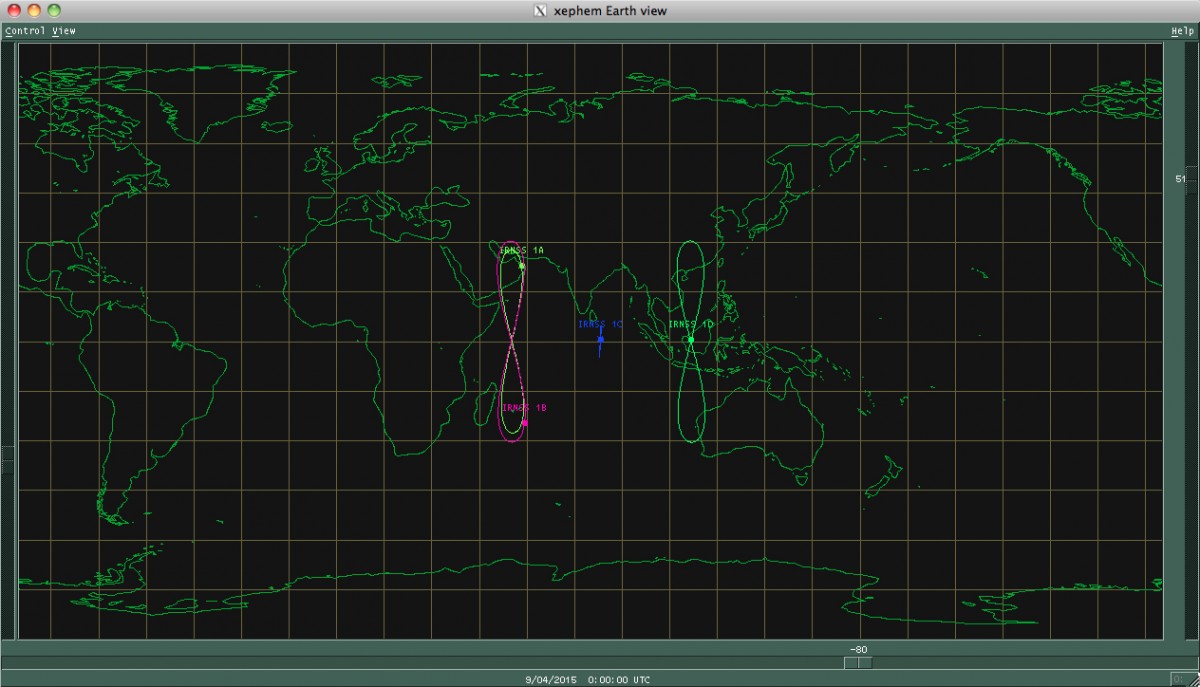
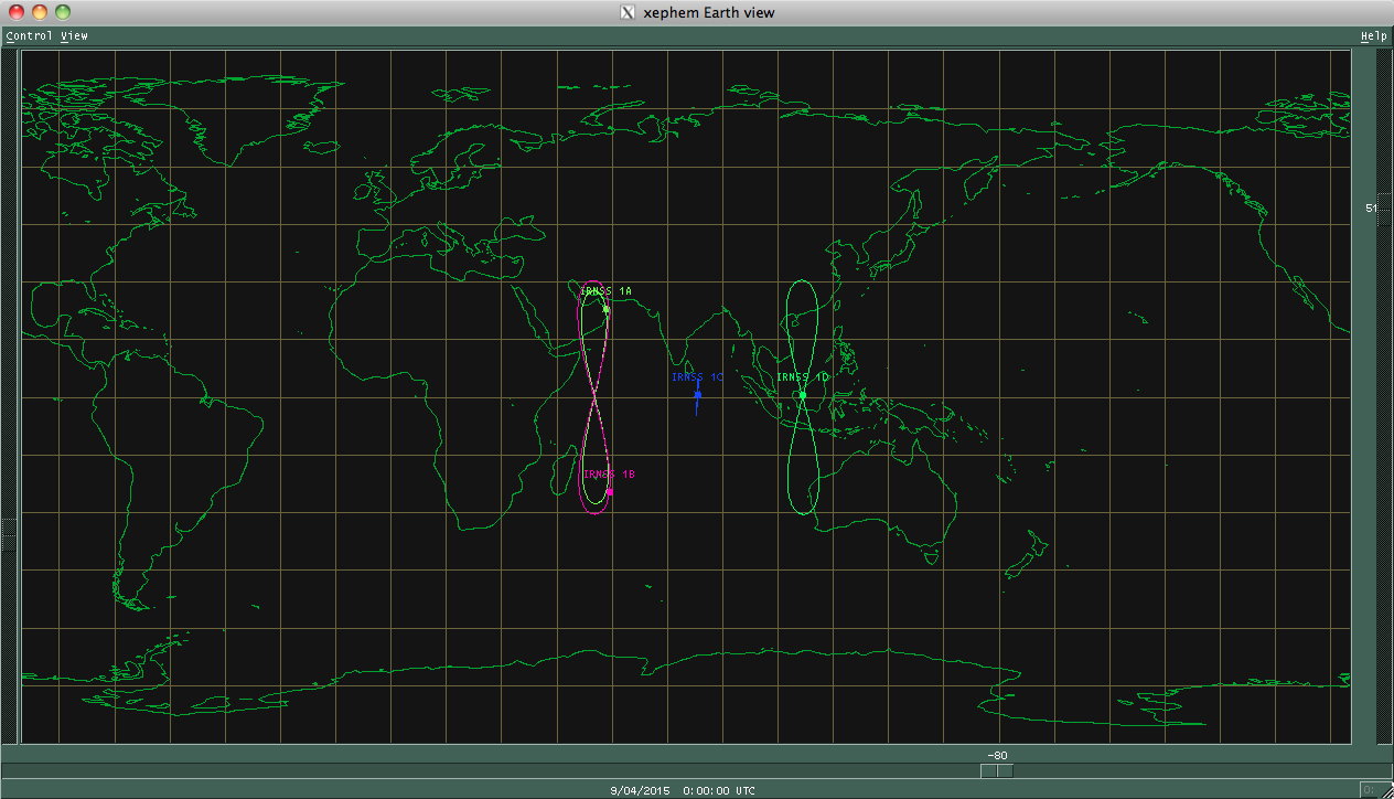
The fourth satellite in the Indian Regional Navigation Satellite System, launched on March 28, has arrived at its designated orbital slot.
Based on data supplied by the U.S. Joint Space Operations Center, IRNSS-1D is in an inclined geosynchronous orbit with an inclination of 30.5 degrees and a nodal longitude of 111.7 degrees east, within the allowed limits of the assigned longitude of 111.5 degrees east.
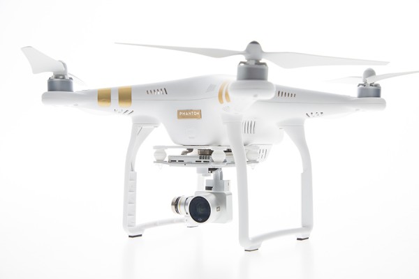
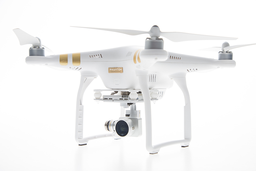
DJI has launched a new drone in its Phantom series. The Phantom 3 comes in two variations, Professional and Advanced, both of which provide greater control and creative options than the popular Phantom 2. On April 8, DJI held three simultaneous events in London, Munich, and New York to mark the release of the Phantom 3.
Both Phantom 3 versions feature the strongest professional control features DJI has developed so far. Using DJI’s Visual Positioning system, the Phantom 3 can hold its positioning indoors without GPS and can easily take off and land with the push of a button. With Vision Positioning technology, visual and ultrasonic sensors scan the ground beneath the Phantom 3 for patterns, enabling it to identify its position and move accurately.
DJI’s Lightbridge technology is also integrated, enabling control at up to 1.2 miles (2 km) away and a live HD video stream from the camera with almost no latency.
“In developing the next generation Phantom, DJI remained committed to providing a top-tier flight experience in one easy-to-use platform,” said DJI CEO Frank Wang. “We pride ourselves in creating a flying camera that fits in a backpack and can be ready to take professional quality videos from the sky in less than a minute.”
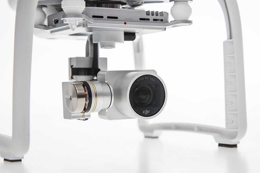
The Phantom 3 Professional is capable of shooting 4K video at up to 30 frames per second, while the Phantom 3 Advanced records at resolutions up to 1080p at 60 frames per second. These cameras are stabilized using 3-axis gimbals to keep the video smooth regardless of flight or wind conditions.
Both models shoot 12-megapixel photos using a 94-degree FOV, distortion-free lens, and a high-quality, 1/2.3-inch sensor that is more sensitive to light than the sensor in previous Phantom 2 Vision models.
All camera settings — including ISO, shutter speed and exposure compensation — can be set using both the DJI Pilot app and the physical controls on the remote controllers. The DJI Pilot app also features a Phantom 3 flight simulator for virtually practicing aerial maneuvers, and a Director feature, which automatically edits the best shots from flights into short videos that can be shared immediately after landing. The upgraded app also allows pilots to livestream their flights to YouTube.
“Pilots, whether they are journalists, extreme athletes, or global travelers — will not just be able to share aerial videos of where they were, but will also be able to send a YouTube link to their friends and colleagues to show them the aerial perspectives of where they are right now,” said DJI’s San Francisco General Manager Eric Cheng. “This has tremendous potential for changing the way we share experiences with one another.”
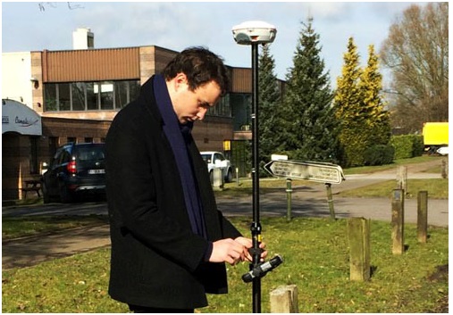
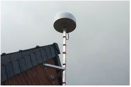
Experiencing the Qiao Station with ComNav T300 for surveying.
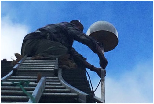
Europe’s first commercial BeiDou CORS station — Qiao CORS Station — has been built in Wallonia, Belgium. ComNav partnered with local company CGEOS – Creative Geosensing on the project. ComNav develops and manufactures GNSS OEM boards and receivers for demanding high-precision positioning applications.
Qiao means bridge in Chinese, and Joël van Cranenbroeck, managing director of CGEOS, is working to build the bridge between the Chinese and European GNSS industries by introducing the Chinese high-precision GNSS technologies of ComNav Technology to European users, ComNav said in a statement.
The Qiao Station can track BeiDou Navigation Satellite System on the three frequencies and transmit observation data in RTCM format in real time through NTRIP and observation data in RINEX format. It enhances the positioning performance and result by combining BeiDou with GPS and GLONASS.
Currently, the BeiDou Navigation Satellite System mainly covers the Asia Pacific region. Though China is still in the process of building it into a global network, up to six BeiDou satellites can now be tracked in Europe during certain periods of the day. With the new Qiao Station, European users can now try the BeiDou system.
Setting up Qiao Station.
European’s first BeiDou CORS station has been built in Belgium.
The European GNSS Service Centre has issued Notice Advisories to Galileo Users announcing the completion of a ground segment upgrade and system testing as of 1 April 2015. The three fully operational Galileo satellites (GSAT0101, GSAT0102, and GSAT0103) have been declared available from 1 April 2015 at 00:00 UTC.
GSAT0101 (ID:11) payload on PHM clock
GSAT0102 (ID:12) payload on RAFS clock
GSAT0103 (ID:19) payload on PHM clock
GSAT0104 (ID:20) is still considered unavailable as it only transmits an E1 signal.
GSAT0201 (ID:18) and GSAT0202 (ID:14), although now in improved orbits, have not been declared available.
Meanwhile, the two recently launched satellites (GSAT0203 and GSAT0204) are slowly drifting to their assigned orbits. They are not yet transmitting standard L-band signals.
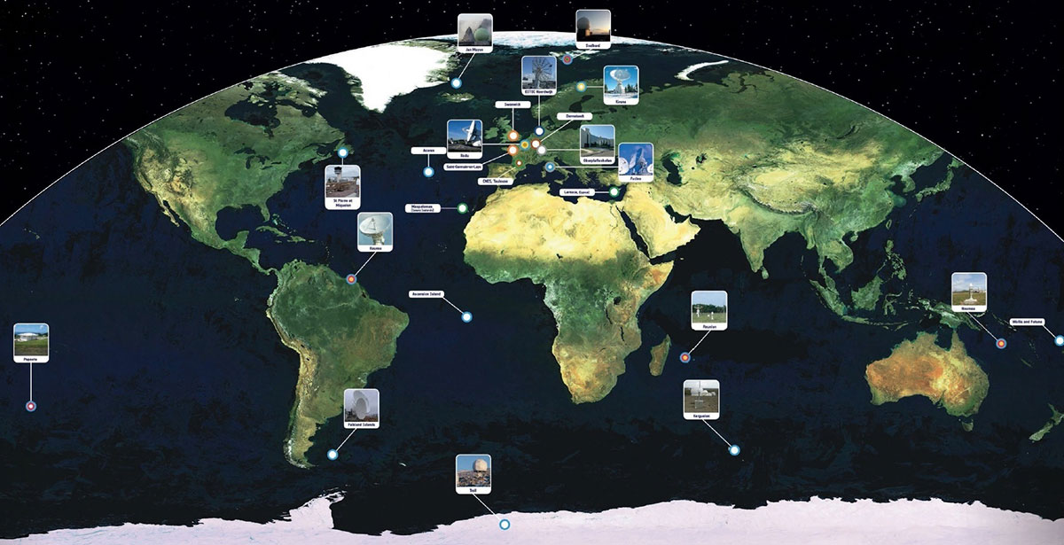
Galileo’s worldwide ground segment as of March 2013.
News from the European Space Agency
The worldwide Ground Mission Segment providing all Galileo navigation messages has completed a full-scale hardware and software migration to version V2.0, and is now fully operational again.
The Ground Mission Segment was turned off Jan. 26, allowing the migration to take place over the month of February. The following month was taken up with detailed checking by operations and system, concluding in a final “check point” on March 31 to validate the successful migration.
“The upgrade of the Galileo Ground Mission Segment from V1.2 to V2.0 has provided better overall performance and availability, along with improved robustness, security and operability,” explained Martin Hollreiser, overseeing mission segment development for ESA, with Thales Alenia Space France as prime contractor. “The overall outcome of our check point confirmed that the new GMS V2.0 migrated to the operational chain is a major improvement and no blocking issues were identified. An overall 25 percent performance improvement is confirmed.”
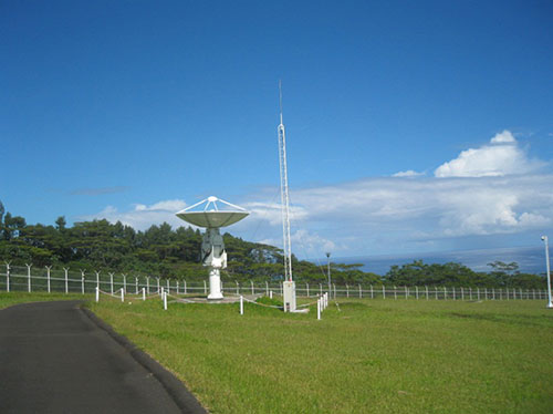
The new Papette Uplink Station in Tahiti, French Polynesia, used for uplinking navigation messages for rebroadcast to users from Galileo satellites.
“The process began with the upgrade of the infrastructure hardware at Galileo’s control centre in Fucino, Italy, and remote sites disconnected from the system to be monitored locally,” Hollreiser said. “This physical process was followed by a software update, and then a full-scale test campaign before handing back to operations and resuming the nominal Galileo mission on 6 March.
“Three new sensor stations (Kiruna, Ascension and Azores) — used to monitor the satellite navigation signals — were also added to the operations chain, as well as a new uplink station (Papeete) — used to uplink corrections incorporated in the navigation message to the satellites for broadcast to the users.”
Papette Uplink Station
Galileo is Europe’s satellite navigation system. The accuracy of its positioning fixes ultimately comes down to accurate satellite orbit determination and timing measurements and corrections that are precise down to a few billionths of a second. A satnav receiver determines its position by calculating the time it takes for signals to arrive from multiple satellites in space.
To keep those timings sufficiently precise, the entire Galileo system can be thought of as one gigantic planetary-scale clock, with the Ground Mission Segment at its core, determining the exact satellite orbits and synchronizing all the satellite and terrestrial elements of that clock: the relevant control center is linked to a global network of ground stations (sensor and uplink stations).
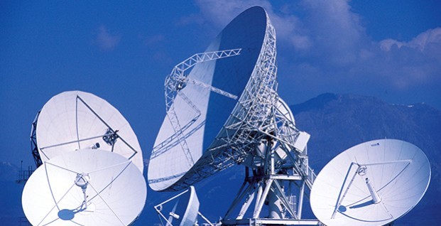
Operated by Telespazio, Fucino in central Italy is among the world’s largest satellite ground stations.
Each of the Galileo satellites in space carries multiple atomic clocks on board, which, although very accurate, drift slightly over time. So sensor stations on the ground extract measurements from the satellites’ signals and send these to the Galileo control center in Fucino, Italy. Here, processing takes place to derive very accurate satellite orbits and clock synchronization.
Any necessary corrections are then built into an updated navigation message that is then transmitted to the satellites via a set of five uplink stations. The satellites themselves then rebroadcast these corrections down to the users, to be automatically interpreted by receivers to maintain service precision.
Worldwide Galileo Ground Segment
During the upgrade, this regular updating of navigation messages no longer took place, so the accuracy of the Galileo signals to users slowly degraded. Users were informed of this process through a flag in the signal itself, as well as through the online Notice Advisory to Galileo Users (NAGU) notification process.
An updated NAGU has been issued to inform users that Galileo services are back. Right now the signals are being used for technical testing, with early services for the public projected for 2016.
“A further Galileo Ground Mission Segment update is foreseen for the end of this year,” Martin said. “But this time the upgrade should be executed in a seamless manner, with no interruption of services.”