OxTS has released the xNAV550, its new compact and lightweight GNSS-aided inertial navigation system, along with an OEM board set version, the xOEM550.
xNAV550. The xNAV550 is the latest model in the xNAV family and the first to offer a position accuracy of 2 cm, yet remains a compact GNSS-aided inertial navigation system at 425 grams. Suitable for all applications where size and weight as well as performance matter, it is designed for use on UAVs and in other weight-constrained applications.
Featuring dual GNSS receivers and a custom-built inertial measurement unit, the xNAV550 constantly monitors position, orientation and velocity with high accuracy in real-time. Four gigabytes of on-board storage is available, automatically logging data for an added layer of protection. Data can be downloaded from the system and post-processed using OxTS’s advanced software, which is included as standard at no extra cost.
Integrating the xNAV550 with cameras, laser scanners or other sensor arrays is easy using the NMEA outputs, OxTS said, with 1-PPS and event input triggers for synchronization and time stamping. These features and the convenience of the one-box solution ensure that the xNAV550 make it quick and easy to acquire accurate data required for direct georeferencing, the company said.
xOEM550. The xOEM550 is designed for system integrators looking for a high-performance INS to build into a complete scanning and georeferencing system. Weighing 165 grams, it won’t add bulk to a system, and the free and distributable OxTS post-processing software enables system integrators to offer a turnkey solution at a competitive price, the company said.
OxTS will be exhibiting at ILMF 2015 in Denver, Colo., Feb. 23-25. Stop by Booth #30 to take a look at the xNAV and xOEM systems or contact [email protected] for more information.
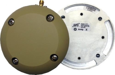
GPS Source has released a new GNSS antenna that is robust, lightweight, and suitable for harsh environments. It is designed for long-term, high-precision applications worldwide, the company said.
The antenna was engineered for the demanding aviation environment, in both commercial and military applications. Built to military standards (MIL-STD), it is impact resistant, tolerant of exposure to dust, chemicals and jet fuels, and has the ability to withstand shock and vibration.
Signal reception is unaffected by antenna placement. Designed to operate in the most extreme and demanding applications, it gives outstanding results, enabling maximum satellite reception, with ultra-low Dilution of Precision (DOP), GPS Source said.
“We are very excited about the new GNSS antenna,” said Robert Horton, CEO of GPS Source. “Our advanced technology provides superior performance in both GPS L1/L2 and GLONASS L1/L2. This is the best solution for technically demanding users.”
The antenna is available in multiple colors and with multiple connector options.
Fugro has launched the G4 service, designed to provide GNSS augmentation for offshore positioning applications. The new satellite correction service takes advantage of all four GNSS: GPS, GLONASS, BeiDou and Galileo.
By using all available GNSS satellites, Fugro’s G4 service is designed to improve availability and reliability of offshore positioning and thus enhance the safety and productivity of a wide range of survey and other activities offshore. G4 represents a significant advancement compared to augmentation systems which are based on GPS-only or GPS + GLONASS, the company said.
The BeiDou system operated by China currently provides coverage in the Asia-Pacific region. Fugro’s G4 service already utilises the first BeiDou satellites and is ready to start using the Galileo satellites as soon the EU announces Initial Operational Capability (IOC) status for this system. Galileo and future BeiDou satellites will be automatically included as they come online, steadily increasing availability and robustness of the integrated augmentation service.
The new G4 service will be particularly beneficial when the line-of-sight to certain satellites is obstructed by offshore structures – a key consideration during critical positioning operations. The G4 augmentation signals, transmitted via seven high–powered communication satellites to provide at least two independent broadcast channels anywhere in the world, will offer Fugro’s customers unrivalled coverage and availability.
A Walkera QR X350 quadcopter. (Photo credit: Wikimedia Commons).
The Federal Aviation Administration has proposed a framework of regulations that would allow routine use of certain small unmanned aircraft systems (UAS) in today’s aviation system for commercial purposes.
“We have tried to be flexible in writing these rules,” said FAA Administrator Michael Huerta in a statement. “We want to maintain today’s outstanding level of aviation safety without placing an undue regulatory burden on an emerging industry.”
The FAA proposal offers safety rules for UAS under 55 pounds conducting “non-recreational” operations. The rule would limit flights to daylight and visual line-of-sight operations. It also addresses height restrictions, operator certification, optional use of a visual observer, aircraft registration and marking, and operational limits.
The proposed rules also includes extensive discussion of the possibility of an additional, more flexible framework for “micro” UAS under 4.4 pounds. The FAA is asking the public to comment on this possible classification to determine whether it should include this option as part of a final rule. The FAA is also asking for comment about how the agency can further leverage the UAS test site program and an upcoming UAS Center of Excellence to further spur innovation at “innovation zones.”
The public will be able to comment on the proposed regulation for 60 days from the date of publication in the Federal Register. The FAA also intends to hold public meetings to discuss innovation and opportunities at the test sites and Center of Excellence. These meetings will be announced in a future Federal Register notice.
“Technology is advancing at an unprecedented pace, and this milestone allows federal regulations and the use of our national airspace to evolve to safely accommodate innovation,” said Transportation Secretary Anthony Foxx.
The proposed rule would require an operator to maintain visual line of sight of a small UAS. The rule would allow, but not require, an operator to work with a visual observer who would maintain constant visual contact with the aircraft. The operator would still need to be able to see the UAS with unaided vision (except for glasses). The FAA is asking for comments on whether the rules should permit operations beyond line of sight, and if so, what the appropriate limits should be.
Under the proposed rule, the person actually flying a small UAS would be an “operator.” An operator would have to be at least 17 years old, pass an aeronautical knowledge test and obtain an FAA UAS operator certificate. To maintain certification, the operator would have to pass the FAA knowledge tests every 24 months. A small UAS operator would not need any further private pilot certifications (such as a private pilot license or medical rating).
The new rule also proposes operating limitations designed to minimize risks to other aircraft and people and property on the ground:
A small UAS operator must always see and avoid manned aircraft. If there is a risk of collision, the UAS operator must be the first to maneuver away.
The operator must discontinue the flight when continuing would pose a hazard to other aircraft, people or property.
A small UAS operator must assess weather conditions, airspace restrictions and the location of people to lessen risks if he or she loses control of the UAS.
A small UAS may not fly over people, except those directly involved with the flight.
Flights should be limited to 500 feet altitude and no faster than 100 mph.
Operators must stay out of airport flight paths and restricted airspace areas, and obey any FAA Temporary Flight Restrictions (TFRs).
The proposed rule maintains the existing prohibition against operating in a careless or reckless manner. It also would bar an operator from allowing any object to be dropped from the UAS.
Operators would be responsible for ensuring an aircraft is safe before flying, but the FAA is not proposing that small UAS comply with current agency airworthiness standards or aircraft certification. For example, an operator would have to perform a preflight inspection that includes checking the communications link between the control station and the UAS. Small UAS with FAA-certificated components also could be subject to agency airworthiness directives.
The new rules would not apply to model aircraft. However, model aircraft operators must continue to satisfy all of the criteria specified in Sec. 336 of Public Law 112-95, including the stipulation that they be operated only for hobby or recreational purposes. Generally speaking, the new rules would not apply to government aircraft operations, because we expect that these government operations will typically continue to actively operate under the Certificate of Waiver or Authorization (COA) process unless the operator opts to comply with and fly under the new small UAS regulations.
In addition to this proposal, earlier today, the White House issued a Presidential Memorandum concerning transparency, accountability, and privacy, civil rights, and civil liberties protections for the Federal Government’s use of UAS in the national airspace system, which directs the initiation of a multi-stakeholder engagement process to develop a framework for privacy, accountability, and transparency issues concerning commercial and private UAS use.
The current unmanned aircraft rules remain in place until the FAA implements a final new rule. The FAA encourages new operators to visit www.knowbeforeyoufly.org.
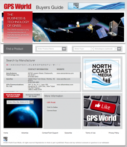
GPS World, the leading publication serving the GNSS Industry, is pleased to announce the industry’s first online buyers guide — gpsworldbuyersguide.com — featuring access to information on hundreds of manufacturers, products and services.
“We’ve taken the GPS World Buyers Guide in print, which we’ve been publishing for 20+ years, to an entirely new level,” said Alan Cameron, editorial director and group publisher of GPS World. “Adding a robust online version offers many benefits to the industry.”
Engineers, integrators, professional end-users and others in search of products and services will continue to have two resources available to them — the print Buyers Guide publishing in June — and the cutting-edge, robust version accessible 24/7 at: gpsworldbuyersguide.com.
Visitors can search for manufacturers by name or location. Products and services are searchable by name or via the following categories:
Vehicle location/tracing workstations and systems (computer-aided dispatch)
These categories are also searchable by sub-categories.
Manufacturers and suppliers are now in control of their listings year-round by having the ability to make listing updates in real time. Listings are free and numerous upgrades are available. Listings found at gpsworldbuyersguide.com will automatically be used to create the print version of the directory.
“GPS World’s new online product offers many economical ways for a manufacturer or supplier to enhance their exposure,” said Steve Copley, GPS World publisher. “We’re excited to offer an online element to our print product and provide a positive experience for users.”
Manufacturers and suppliers are encouraged to review their current listings by using the search functionality found on the directory’s home page. Manufacturers and suppliers not listed in directory are encouraged to create a new listing. All questions relating to the online directory should be directed to Chloe Kalin, Buyers Guide Marketing & Sales Manager, at 216-363-7929.
The U.S. Department of Transportation will host a third workshop to continue discussions of the GPS Adjacent Band Compatibility Assessment on March 12.
The workshop will focus on the following topics:
Identification of GPS and GNSS receivers to be considered for testing that are representative of the current categories of user applications
Discussion of a GPS/GNSS receiver test plan.
Anyone interested in presenting on either or both of the above topics should contact Stephen Mackey by March 2.
The workshop will be held 8:30 a.m.-3:30 p.m. PDT at Aerospace Corporation, 2310 E. El Segundo Blvd., El Segundo, California.
The Indian Space Research Organization (ISRO) will launch Google’s Skybox Imaging satellite by the end of this year, according to The Asian Age.
ISRO will launch its first U.S. satellite from the Satish Dhawan Space Center in Sriharikota, according to the news brief.
Google acquired Skybox Imaging in August of 2014 to develop advanced GPS mapping using its own network of satellites, according to the company’s blog. The Asian Age says Skybox had previously entered into an agreement with Antrix Corporation.
The article says the satellite will launch alongside a main payload this year.
Two new apps developed at Texas A&M University-Corpus Christi use social media to help police officers, news stations, and the public navigate the many incidents and minor emergencies that may occur on a daily basis.
Richard Smith, creator of the two emergency response apps, is collaborating with Michelle Maresh-Fuehrer, assistant professor of Communication at A&M-Corpus Christi, to identify how the apps could aid first responders during emergencies.
“With the combination of SituMap and PhotoSorter, the public can be encouraged to submit photos and videos that may be helpful during an investigation,” said Smith, assistant professor of Geographic Information Science and Geospatial Surveying Engineering at the Island University. “For example, during an active shooter event, photos and videos of the suspect or their location can be taken with a cell phone and easily sent to responders. This could drastically improve response time and ultimately save lives.”
Photo credit: Texas A&M
Smith developed the mapping applications to provide a way for first responders to rapidly, and easily, receive and map information so they could have a more comprehensive awareness of emergency situations. Maresh-Fuehrer is working on extending the use of Smith’s social media mapping applications to enhance communication before, during, and after a crisis.
“A crisis event is typically a time of high stress and increased uncertainty for organizations and responders,” said Maresh-Fuehrer, who studies crisis communication strategies. “The applications developed by Dr. Smith have several features that allow for more informed and efficient crisis response.”
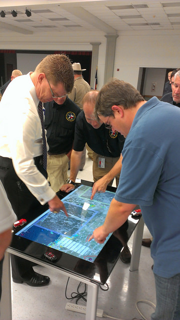
SituMap acts as a tablet-like digital command center that shows officers maps of the crisis area. With the touch of a finger the table-size display can be zoomed, rotated and drawn on. Like a personalized version of Google Maps, officers can search for locations and measure distances. But it goes further than Google Maps. A pin can be created in the application that could represent a person, police car, or groups of people. The pin can be strategically positioned around the area and directions can then be relayed to officers at the emergency location.
“An organization’s crisis team, along with emergency responders, can use SituMap to identify where people should be during a specific crisis,” said Maresh-Fuehrer. “With this application, responders can even view floor plans. This could help to identify safe locations such as fire exits and stairwells.”
PhotoSorter works in tandem with SituMap by allowing emergency responders, crisis planners and community members to share pictures or video of the crisis. Emergency responders can then upload the photos and video into SituMap to help in important decision-making situations.
SituMap and PhotoSorter were designed and developed at the Island University by Smith. The University Police Department is currently using a beta version of SituMap in training sessions.
In today’s digital world, people all over the globe can be connected through social media and, with the touch of a button, information about a major accident can be shared worldwide. With SituMap, important responders, as well as the community, can see real-time information on traffic congestion, roadblocks, and closed roads, which will aid in faster response times. The app also has a weather feature built into it which could be used during severe weather events such as a hurricane.
Lawyers for 11 Pennsylvania residents injured in 2013 when their charter bus slammed into an overpass in Boston, Mass., are suing GPS device manufacturers TomTom and Garmin, seeking more than $15 million in damages.
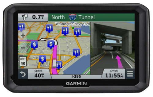
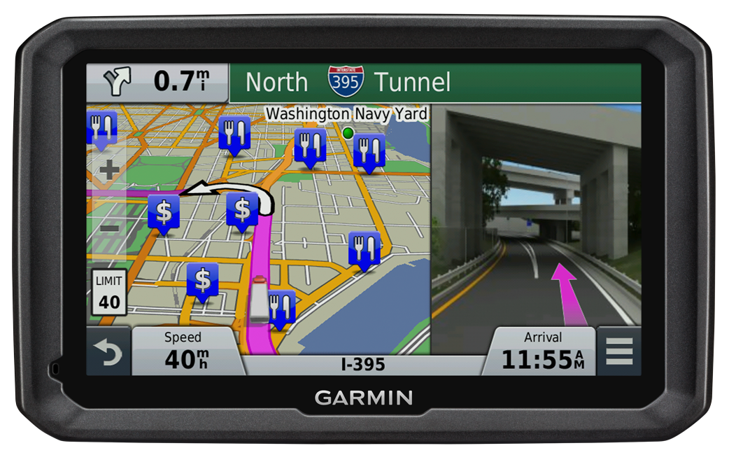
The bus driver was using both a Garmin and a TomTom satnav, neither of which were intended for use by commercial vehicles, but the lawsuit filed in January claims that the GPS units were at fault for not providing road height restrictions.
The bus driver, Samuel J. Jackson, told police he drove the 11-foot-high bus onto Soldiers Field Road, which is off-limits to vehicles more than 10 feet high, because he was “following the GPS.” At least one sign warning of this restriction was missing or damaged, and construction on the Harvard Street overpass obstructed other warning signs, the suit said.
Passengers were injured when the bus roof crushed backwards in the crash dropping the luggage rack and television onto the heads of the passengers, the Boston Globe reports.
Both TomTom and Garmin manufacture GPS units for professional drivers which feature information on bridge underpass height restrictions.
The new RX520 dual-frequency GNSS receiver from TeeJet Technologies brings reliable, upgradable accuracy and performance to precision farming applications, TeeJet said. It features an integrated L1/L2 GPS+GLONASS receiver and antenna in a single compact enclosure. Integral magnetic mounting allows for a clean, low-profile installation.
All RX520 receivers include ClearPath technology, which ensures smooth, consistent position data even if brief signal losses occur. The standard L1/L2 SBAS receiver offers +/- 5-8 in pass-to-pass accuracy for a wide variety of field operations. Optional precise point positioning (PPP) provides improved +/- 2-4 in pass-to-pass accuracy and year-to-year repeatability, making it suitable for strip-till and other high-precision operations. PPP accuracy is delivered via TerraStar subscription signal and is offered in 1-, 3-, 6- and 12-month packages.
“This is a very versatile receiver that is compatible with TeeJet and many third-party guidance and auto steer products,” said Tim Stuenkel, global marketing manager with TeeJet Technologies. “Another great feature is the ability to pay for only the accuracy you need today, with the flexibility to upgrade to higher performance down the road as your needs change.”
TeeJet Technologies manufactures a comprehensive line of products including agricultural spray nozzles for various pesticide/fertilizer applications, boom components, valves/manifolds, strainers, and spray guns, as well as GPS guidance systems, sprayer control systems, ISOBUS job computers, assisted steering systems and other precision farming products. In addition, TeeJet Technologies continues to invest in research and development to advance precision application and control technology.
Antenna maker Maxtena has launched an L1 L2 GPS/GLONASS active helix antenna for GNSS satellite applications. The new antenna M1227HCT-A2-SMA antenna will replace its predecessor the M1227HCT-A-SMA antenna, which made its debut in 2010.The new antenna has been mechanically upgraded. It is packaged in a high-quality, durable IP67/68 sealed radome housing and terminated with a gold-plated SMA connector for RF feed/input and DC bias/power typically powered from the applications’ GNSS RF module.
The M1227HCT-A2-SMA active helix design features Maxtena’s patented compact and light-weight Helicore Quadrifilar antenna technology and a built-in dual-stage low noise amplifier (LNA) and filtering, offering up to 30-dB gain for GNSS applications that use GLONASS and GPS in one radome housing with a single 50-Ohm SMA connector.
The tiny antenna is designed for applications across various markets such as UAVs, GIS and wearable GNSS.
The German Galileo test and development infrastructure GATE has been recertified to serve as a Galileo open‐air test laboratory, for receiver integrity testing (RAIM) for safety‐of‐life (SoL) applications, and for Galileo SIS ICD conformance of signal characteristics and signal quality.
The GATE facility, in Berchtesgaden, is operated by IFEN GmbH. Certification was conducted by TÜV SÜD, an international service corporation focusing on consulting, testing, certification and training.
GATE consists of eight transmitting stations that emit Galileo signals in the GATE test area in Berchtesgaden, as well as two monitoring stations that receive and process these signals.
For application tests, it is essential for GATE to provide constant Galileo specifications for tests, including position accuracy, signal spectrum and navigation data. This is necessary for both test types: tests with the eight “GATE satellites” only and tests with simultaneously usage of the already-existing Galileo satellites in orbit.
The compliance to the specification was verified by the company NavCert GmbH from Braunschweig, Germany, in a recertification of the GATE test bed. Compared to a full certification, taking place every three years, a recertification only verifies the compliance to the specification by the use of random inspections though tests in GATE.
The recertification also includes an audit of the operation processes of the operating company IFEN GmbH. Here, the implementation and adherence to process procedures for GATE operation were verified. This includes questions such as whether a sufficiently technical skilled team is available for operating GATE, if the performed application tests are documented in a reproducible way, and how the GATE team handles non‐conformances to the specification and improvements to the system.
With finalization of the recertification work, the GATE certificate was extended by TÜV SÜD to January 2016. Because of this, GATE customers can rely on the independent verification of the GATE test and development environment for upcoming testing activities, IFEN said.
As an add‐on, customers of IFEN’s NavX‐NCS GNSS simulator benefit from the recertification by obtaining a confirmation from an independent organization (TÜV Süd), reassuring the functionality of GPS and Galileo signal characteristics and signal quality as per SIS ICD, IFEN said.



 GPS World, the leading publication serving the GNSS Industry, is pleased to announce the industry’s first online buyers guide —