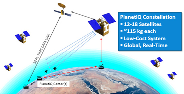
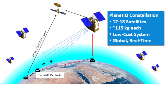
The company PlanetiQ plans to use GNSS to make real-time weather forecasts. PlanetiQ plans to launch a commercial weather satellite constellation by 2017, composed of 12 to 18 small satellites that will capture data as GNSS satellites pass through Earth’s orbital horizon.
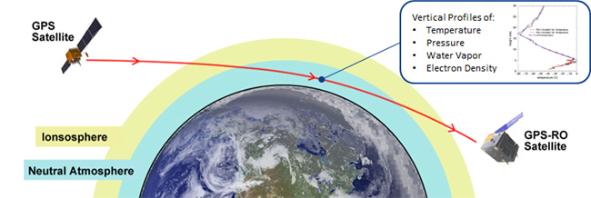
The satellites will use radio occultation to collect data that will supplement computer models on weather, producing more accurate and timely weather forecasts and assessments, PlanetiQ said. The satellites will measure how GPS, GLONASS, and BeiDou radio waves bend as they travel through the atmosphere, a technique that provides snapshots of temperature, pressure and water vapor, as well as insight into whether solar storms are active in the ionosphere, reports Discovery News.
Figure credit: PlanetiQ.
More than 30,000 occultation measurements can be collected each day.
PlanetiQ is one of five companies in the United States looking to commercialize weather forecasting. GeoOptics is working on a similar system and plans to launch its first satellite this year.
Explore further:
PlanetiQ President and CEO Anne Hale Miglarese discussed the project on The Weather Channel in August 2014.
Attila Komjathy, a NASA Jet Propulsion Laboratory principal investigator and adjunct professor in the University of New Brunswick’s Department of Geodesy and Geomatics Engineering, was named a Fellow of the Institute of Navigation in January for his work on remote sensing of the Earth’s ionosphere using signals from GNSS.
Three telecommunications companies are joining together to fight patent-infringement claims involving the use of assisted GPS in their mobile networks, reports ZDNET.
Telstra and Optus are Australian telecommunications and media companies, and Vodafone is based in the United Kingdom.
The claim by Australian company Voxson alleges that the mobile network operators are infringing on two patents held by Voxson since the 1990s. One patent, Vox 1, deals with how customers’ mobile phones are tracked on mobile networks, and forms the basis for the assisted GPS used by the networks to deliver location information to their customers. The other patent, Vox 2, deals with video streaming.
The lawsuit was brought against the three companies in 2013, and the allegations cover the 2G, 3G, and 4G networks of all three carriers.
Russia and China have signed a cooperation agreement on satellite navigation, a Russian Space Agency spokesperson told RIA Novosti on Tuesday.
Roscosmos chief Igor Komarov met with Xu Dazhe, the leader of China’s National Space Administration, on an official visit in Beijing.
“The first provision to set up a committee and a protocol were signed during the first working session. Igor Komarov and Xu Dazhe discussed issues of bilateral cooperation in the field of electronic components for rocket construction and building rocket engines,” the spokesperson said.
A Russian-Chinese committee on satellite navigation was established in October 2014 at the meeting between Russia’s Deputy Prime Minister Dmitry Rogozin and his Chinese counterpart, Wang Yang.
In November, China North Industries Corporation (NORINCO) and the Russian GLONASS nonprofit partnership agreed to establish a joint venture to promote worldwide services based on GLONASS and BeiDou.
Russia and China also recently completed joint reconnaissance for the placement of GLONASS differential correction and monitoring stations in the Chinese cities of Urumqi and Changchun. Each country is expected to accommodate three such facilities.
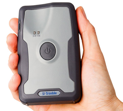
Trimble has introduced the R1 GNSS receiver, a pocket-sized, rugged, standalone receiver that works with iOS, Android or Window mobile handhelds, smartphones and tablets using Bluetoothconnectivity. When paired with a smart device, the receiver adds professional-grade GNSS geo-location capabilities to transform consumer devices into high-accuracy mobile data collection systems.
With the evolution of smartphones and tablets, more field workers now have access to positioning technologies for geospatial data collection. The Trimble R1 GNSS receiver is designed to collect data and inspect or manage assets using smart devices without an integrated high-accuracy GNSS receiver. Adding the optional Trimble ViewPoint RTX correction service to the R1 receiver enables users to achieve reliable sub-meter accuracy, Trimble said.
The Trimble R1 receiver is compact and portable, weighing 6.5 ounces (187 grams). With an all-day battery life, the receiver can be carried in a vest pocket, attached to a belt using the optional belt pouch, or pole mounted. The receiver also integrates with Trimble TerraFlex, Trimble TerraSync and Trimble Positions mapping and Geographic Information System (GIS) field software.
“The addition of the R1 GNSS receiver expands our portfolio to address the needs of organizations that have adopted a workplace Bring Your Own Device (BYOD) strategy for their businesses. We are providing an innovative solution to enable next generation capabilities for a much broader base of field workers to collect high-accuracy geospatial data,” said Alain Samaha, business area director of GIS and Software for Trimble’s Geospatial Division. “Our focus is to provide customers with a variety of options and flexibility when it comes to mobile device deployment and authoritative data collection to increase productivity and improve operations.”
The Trimble R1 GNSS is a multi-constellation receiver that supports GPS, GLONASS, Galileo, BeiDou and QZSS satellite signals. The Trimble ViewPoint RTX corrections are delivered via cellular data network coverage or over satellite in remote locations — without the need for a traditional base station or VRS network — when using Trimble’s Mapping & GIS software or API. In addition, the R1 receiver can leverage SBAS and VRS correction sources to achieve sub-meter accuracy.
Trimble TerraFlex is a scalable cloud-based solution for geospatial data collection. TerraFlex addresses a wide variety of field requirements including attribute-rich GIS data collection on professional and consumer devices.
The ground control system (OCX) that Raytheon is developing for the next-generation GPS program has passed a Pentagon review, reports Reuters. The program will be monitored to ensure it stays on track, a senior Air Force official said on Feb. 6 as reported by the news service.
Major General Roger Teague, director of space programs for the Air Force acquisition chief, said a review by chief arms buyer Frank Kendall went well, but program officials and the contractor got “tough marching orders” to stick to schedule and cost targets.
Raytheon’s program manager Matt Gilligan said the review provided the company with “clear direction, the best technology, and appropriate resources to…deliver OCX on a schedule that meets GPS enterprise needs.”
Kendall had ordered the review after an Air Force restructuring that increased the cost of the program by 80 percent to $1.6 billion.
The Delta 4 rocket that will launch the next GPS satellite has been rolled out to the launch pad, reports Spaceflight Now. The satellite itself, GPS IIF-9, will be attached to the rocket in March. The United Launch Alliance vehicle is scheduled for launch March 25.
The launch will be the 371st Delta rocket since 1960 and the 29th Delta 4 since 2002. It also marks the 69th GPS satellite launch and the 55th to use a Delta rocket.
A new report by Beecham Research examines how the agricultural sector is embracing precision farming to face challenges raised by an increasing worldwide population and the impact of climate change.
The United Nations predicts the global population will reach 8 billion by 2025, and 9.6 billion by 2050, meaning food production must increase by 70 percent by 2050.
The report explores how agricultural operations are changing through the Internet of Things (IoT) and related smart and connected farms concepts, including precision agriculture guided by GPS. It provides a geographic analysis discussing public policies, adoption drivers and barriers, and opportunities for the M2M/IoT community.
The Executive Summary of the report, “Towards Smart Farming: Agriculture Embracing the IoT Vision,” is available here.
A senior Chinese government space official on Feb. 5 said precision-navigation user receivers in China will be fitted with chipsets receiving satellite signals from BeiDou, GPS, GLONASS, and Galileo, according to Space News. The move could accelerate the trend among navigation chipset and receiver makers to build gear for multi-constellation reception, and at the same time undermine regional measures to promote one system over others.
Chen Zhi, deputy chief designer of the China Aerospace Science and Industry Corp., said China’s early deployment of satellite navigation receivers for precision agriculture already feature multi-constellation GPS-Beidou receivers.
The United States and European Union have signed World Trade Organization agreements for their constellations, GPS and Galileo. China and Russia are not part of the agreements.
A U.S. judge dismissed the bulk of two lawsuits by LightSquared and equity owner Harbinger Capital Partners, reports Reuters. The suits accused Trimble, Garmin and Deere & Co. of misleading them about interference concerns and hastening the company’s fall into bankruptcy.
In an opinion issued Feb. 5 in Manhattan federal court, Judge Richard Berman threw out Harbinger’s lawsuit, and denied nine of 11 claims by LightSquared.
LightSquared has been in bankruptcy since 2012, when the Federal Communications Commission revoked its license to build a planned wireless network over concerns it could interfere with GPS.
The lawsuits alleged that Deere, Garmin International , Trimble Navigation Ltd, and a GPS industry group led LightSquared to believe the planned network would not pose an interference risk. It wasn’t until LightSquared had pumped $4 billion into the project, the plaintiffs argued, that the GPS industry voiced their concerns.
Judge Berman dismissed many claims from both plaintiffs, including breach of contract and civil conspiracy, leaving alive only LightSquared’s claims for negligent misrepresentation and constructive fraud.
Because the judge did not dismiss all claims, LightSquared could still be able to probe the GPS companies’ books and records during discovery.
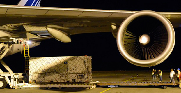
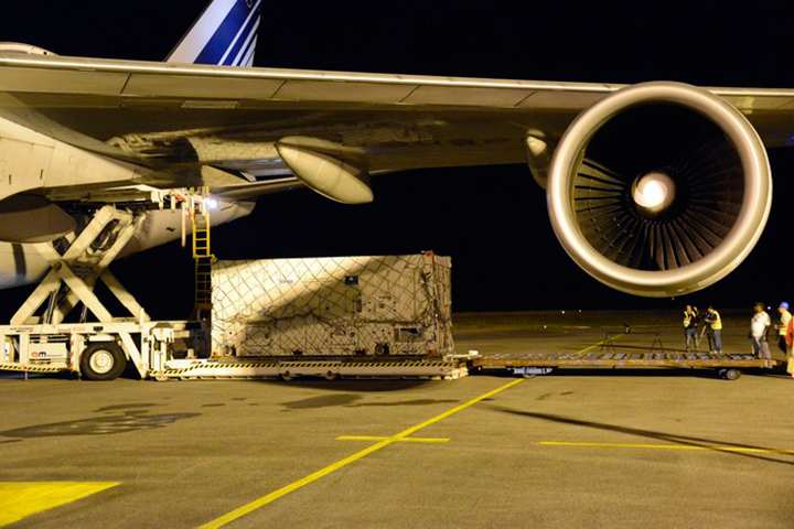
One of two Galileo satellites, safely in its protective container, is unloaded from an Air France Boeing 747 at Cayenne–Félix Eboué Airport in French Guiana.
News from the European Space Agency
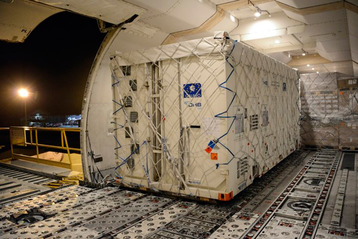
Another two Galileo satellites have touched down in French Guiana ready to take their place in Europe’s satellite navigation constellation. The pair, safely cocooned inside their air-conditioned containers inside an Air France Boeing 747, landed at Cayenne–Félix Eboué Airport yesterday.
They were then taken by lorry to be installed in the cleanroom surroundings of Europe’s Spaceport to begin final preparations for launch.
The seventh and eighth Galileo satellites will be launched together by Soyuz in late March, resuming the interrupted building of the satnav constellation. The previous Soyuz launch saw the satellites released into the wrong orbit.
Galileo satellite in its protective air-conditioned container, about to be unloaded from the Air France cargo plane.
The reason for the malfunction has been pinned down to an installation error in the Fregat upper stage that delivers the satellites into their final orbits. A hydrazine fuel line was bracketed next to a liquid helium line, freezing the hydrazine and resulting in Fregat’s faulty orientation.
Arrival in French Guiana is the final stop in a complex production and test line that snakes back across Europe. The satellites are built by OHB in Bremen, Germany, with their navigation payloads coming from Surrey Satellite Technology Ltd in Guildford, UK, both companies being supplied in turn by subcontractors across much of the continent.
The complete satellites are then delivered to ESA’s ESTEC technical centre in Noordwijk, the Netherlands, home to Europe’s largest satellite test centre.
There, a series of tests reproduces every aspect of the space environment, including acoustic noise and thermal vacuum simulations, to ensure their readiness for space.
Each satellite is also plugged into the entire worldwide Galileo ground network for days on end to check it works as planned.
Their testing ended with a clean bill of health and they received clearance on Tuesday to travel to French Guiana. Loaded onto lorries on Wednesday, they arrived at Paris Charles de Gaulle Airport later that day, taking off for French Guiana on Thursday.
These two satellites are planned to be launched during last week of March, following the European Commission’s endorsement of the resumption of Galileo launches.
The seventh and eighth Galileo satellites were flown on this Air France Boeing 747 from Paris Charles de Gaulle Airport in France to Cayenne–Félix Eboué Airport in French Guiana on Feb. 5
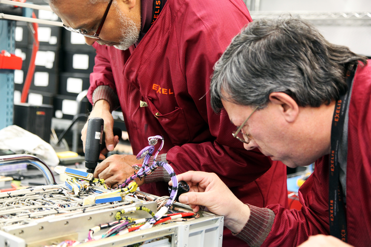
Harris Corporation and Exelis Inc. today announced a definitive agreement under which Harris will acquire Exelis in a cash and stock transaction valued at $23.75 per share, or an approximately $4.75 billion enterprise value. The agreement has been unanimously approved by the boards of directors of both companies.
The transaction is expected to close in June 2015 and is subject to customary closing conditions, including regulatory and Exelis shareholder approval.
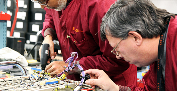
Exelis is a global aerospace, defense, information and services company with a 50-year legacy. It was previously under the ITT Corporation umbrella, but spun off in 2011. Headquartered in McLean, Va., Exelis employs about 10,000 people.
Exelis employs about 10,000 people. the combined Harris/Exelis company will have about 23,000 employees. including 9,000 engineers and scientists.
One of Exelis’ biggest product offerings in the past year has been its Signal Sentry 1000, which detects and locates sources of intentional and unintentional interference to GPS signals and provides users with actionable intelligence. Exelis navigation payloads and components have been on board every U.S. GPS satellite ever launched and have more than 700 years of accumulated on-orbit success.
Harris is an international communications and information technology company serving government and commercial markets in more than 125 countries. Headquartered in Melbourne, Fla., the company has about $5 billion of annual revenue and 13,000 employees. Harris is engaged in a five-year contract with Aireon LLC that will create the first global satellite-based aircraft tracking system. The company’s Automatic Dependent Surveillance-Broadcast (ADS-B) 1090 Extended Squitter receiver payload has been successfully tested and qualified for simulated operation in the harsh environment of space for more than 12 years.
Under the terms of the transaction, Exelis shareholders will receive $16.625 in cash and 0.1025 of a share of Harris common stock, based on Harris’ closing price as of Feb. 5, for each share of Exelis common stock. Upon closing, Harris shareholders will own approximately 85 percent of the combined company, and Exelis shareholders will own approximately 15 percent. On a pro forma basis for the latest 12 months ended Dec. 31, 2014, the combined company would have had more than $8 billion in revenue and about 23,000 employees globally, including 9,000 engineers and scientists.
“Acquiring Exelis is transformational for Harris,” said William M. Brown, chairman, president and chief executive officer of Harris. “The combination of the two companies’ highly complementary core franchises creates a competitively stronger company with significantly greater scale. We are expanding in a market, where we have decades of success and a workforce dedicated to providing our customers with innovative and cost-effective solutions for some of their most complex challenges.”
“This agreement to become part of Harris Corporation represents an exciting new chapter for Exelis,” said David F. Melcher, chief executive officer and president of Exelis. “Combining the companies not only creates shareholder value, but the commitment to excellence and innovation that both companies share will significantly benefit customers and provide new opportunities for employees.”
Melcher also noted, “Our 2014 was another strong year, and we expect to report revenue of approximately $3.25 billion and adjusted operating margin between 12.4 and 12.5 percent, which is in line with our previous guidance.” Exelis indicated that approximately $25 million of its anticipated free cash flow for 2014 shifted into 2015 due to some delayed collections, but that its estimate for 2015 free cash flow is being increased to approximately $275 million. Exelis also expects depreciation and amortization of approximately $106 million in 2014, net debt of $139 million and a net unfunded pension liability of approximately $1.9 billion at the end of 2014. Exelis ended the year with an estimated $2.8 billion in funded backlog.
Integration plan. Harris said it has developed a detailed execution plan to ensure seamless integration and achieve identified cost synergies. The dedicated integration team will have executive leadership and be comprised of senior members of both organizations. Harris is confident in its ability to effectively combine these two companies and provide the organizational alignment to achieve full strategic value, the company stated in a news release.
At the 2014 ION GNSS+ Conference Sept. 9-12 in Tampa, Fla., Lori Thompson of Exelis provided GPS World readers with updates about the company’s activities.
TextBuster, a device by Access 2 Communications that prevents drivers from accessing text, email and Internet functions while driving, allows GPS to function while driving.
It does not interfere with inbound and outbound calling. The firmware technology behind TextBuster sends a blocking signal to the user’s phone automatically, every time the user enters the vehicle.
TextBuster will not interfere with any other hands-free or Bluetooth items in the vehicle, according to the company. It is a patent-pending device that will disable the data functions to the driver’s phone only while inside the vehicle without interfering with inbound and outbound calls. It includes two components, the mobile app, which is a free download, and a small “brain box” that is mounted under the dash.
Ohio-based Access 2 Communications developed the distracted driving device with the hopes of significantly reducing the number of preventable distracted driving fatalities worldwide.
TextBuster will be available in Target stores nationwide starting in mid-November, according to TextBuster.



 TextBuster, a device by Access 2 Communications that prevents drivers from accessing text, email and Internet functions while driving, allows GPS to function while driving.