Author: GPS World Staff

  • PCTEL Offers Two New Fleet Management Antennas

    PCTEL Offers Two New Fleet Management Antennas

    PCTEL-antennas-fleets

    PCTEL has introduced two new fleet-management antennas intended to make high-speed data communications easier. The high-performance antennas include LTE, Wi-Fi, and GPS capabilities in a single low-profile housing.

    The first new antenna is a magnetic-mount version of PCTEL’s 5-port multiband fleet management antenna, designed to support temporary installations such as rental vehicle fleets. The 5-port GPS and communications antenna provides outstanding performance for critical fleet management applications, PCTEL said.
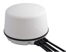
    LTE MIMO, GPS Multiband Antenna with Magnetic Base
    LTE MIMO, GPS Multiband Antenna with Magnetic Base

    Features of the LTE MIMO, GPS Multiband Antenna with Magnetic Base include:

    • Optimal 4G LTE MIMO and dual-band 802.11n Wi-Fi
    • High rejection GPS LNA assembly
    • Low-profile housing in white or black
    • An IP67-compliant design
    • High-performance, low loss cable and high-quality connectors
    • Rare earth magnets for outstanding pull force resistance

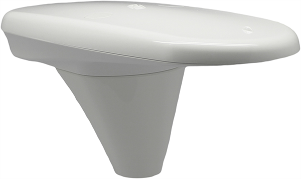
    The second new antenna is a sleeker, more aerodynamic fleet-management antenna designed for public safety or other vehicular applications requiring a smaller footprint, making it PCTEL’s most compact multiband GPS and communications option.
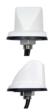
    LTE, Dual 802.11n, GPS Multiband Antenna
    LTE, Dual 802.11n, GPS Multiband Antenna

    Features of the LTE, Dual 802.11n, GPS Multiband Antenna include:

    • Optimal 4G LTE and dual-band 802.11n Wi-Fi
    • High Rejection GPS LNA assembly
    • Aerodynamic, compact, UV-resistant housing in white or black
    • IP67 compliant design
    • High-performance, low loss cable and high-quality connectors

    Both new magnetic-mount antennas are now available for shipment. New smaller footprint antennas will be available in March.

  • Tallysman Wraps Antennas in Armored Cable for Precision Ag, M2M

    Tallysman Wraps Antennas in Armored Cable for Precision Ag, M2M

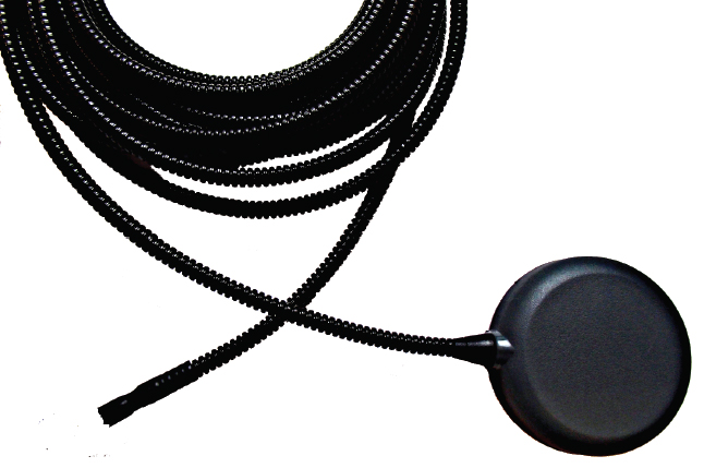
    This photo shows the corrugated conduit covering the RG174 cable with Tallysman’s TW2410 antenna.
    This photo shows the corrugated conduit covering the RG174 cable with Tallysman’s TW2410 antenna.

    Tallysman’s enclosed antennas now come with optional armored corrugated cable. The standard RG174 cable is encased in a corrugated conduit of tough plastic, which maintains its functionality between the temperatures of -40 to +150C.

    The extra protection increases the resilience of the antenna for use in precision agriculture, machine-to-machine, and other rugged applications.

    Tallysman is a manufacturer of high-performance, high-quality products for a wide range of GNSS applications.

  • Mojio Partners with Dooing to Offer Live Fleet Tracking

    dooing-in-iphone6-171x300Mojio, an open platform for connecting cars, has announced a partnership with Dooing, a new team management platform for businesses that can dispatch jobs and track teams.

    “With Dooing, any business can dispatch jobs and track teams on the move, from three people to thousands,” said David Barton-Grimley, a Mojio developer and co-founder of Dooing. “iOS and Android apps are used to manage field staff, assigning and tracking a job’s life cycle from start to finish with reports on key performance metrics. Enterprises and startups alike can build Dooing into their own products with our API.”

    With the partnership Mojio says businesses can narrow down on fuel consumption, prevent breakdowns with diagnostics insights and track in real time.

    “Mojio is the first platform we’ve integrated into Dooing, enabling Mojio customers to track jobs with live fleet data,” Barton-Grimley said. “Additionally, we’ve added to the ability to track and report on key metrics like fuel consumption and distance traveled down to the specific job.”

    Mojio, the only open-platform connected car device — according to the company — has plans to continue growing its ecosystems of drivers, partners and developers.

  • Septentrio RTK Receivers Power DigPilot 3D Machine Guidance

    Septentrio RTK Receivers Power DigPilot 3D Machine Guidance

    Septentrio-DigPilotDigPilot, a Norwegian supplier of surveying equipment and instruments for building and construction, has developed a flexible 3D machine guidance system based on Septentrio’s AsteRx2eH OEM GNSS receivers.

    AsteRx2eH is a single-board dual-frequency dual-antenna 272-channel GPS/GLONASS OEM heading receiver, which provides 20-Hz data output of position, heading and pitch/roll data to the machine guidance system. As a member of Septentrio’s AsteRx family of compact OEM boards, the AsteRx2eH receiver is built around the same advanced GNSS chipset and shares the family’s all-in-view GPS and GLONASS tracking and advanced signal processing algorithms for robust tracking and high-precision positioning, even in challenging environments.

    The DigPilot machine guidance system uses wireless technology for all of the installed sensors, instead of being hard-wired into the machine. All the components come packed in a hardened plastic case for transportation from one machine to another. The sensors can be clipped into brackets on the excavator arm and cab and calibrated to the machine and bucket in a matter of minutes, Septentrio said. The operator uses an intuitive graphics display on a rugged touchscreen console to control the arm and shovel following a preloaded grade plan.

    The DigPilot machine guidance systems have been documented to improve on-the-job safety, productivity and quality of work while reducing costs dramatically. With the DigPilot system, companies can move the 3D guidance system around the fleet of construction equipment as needed, at a fraction of the cost of installing hard-wired systems on multiple machines, Septentrio said.

    DigPilot customers are also using APS-3 GNSS RTK receivers from Altus Positioning Systems, a Septentrio company, in conjunction with the on-board machine guidance system for high-precision site surveys and as-builts.

    “With the Septentrio OEM receivers we know we can count on the highest levels of accuracy, reliability, ruggedness and performance,” said Jan Floberg, CEO and founder of DigPilot. “We tested all other available GNSS products on the market before deciding on Septentrio. The AsteRx2eH outperforms the other brands in its ability to obtain and hold fix and heading in the rugged terrain of western Norway. We have deployed over 1,000 systems to date.”

    Altus and Septentrio products will be on display at World of Concrete in Outdoor Booth 032025 at the Las Vegas Convention Center, Feb. 3-6.

  • Handheld Makes Algiz 10X Rugged Tablet More Powerful

    Handheld Makes Algiz 10X Rugged Tablet More Powerful

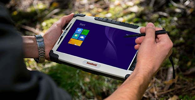
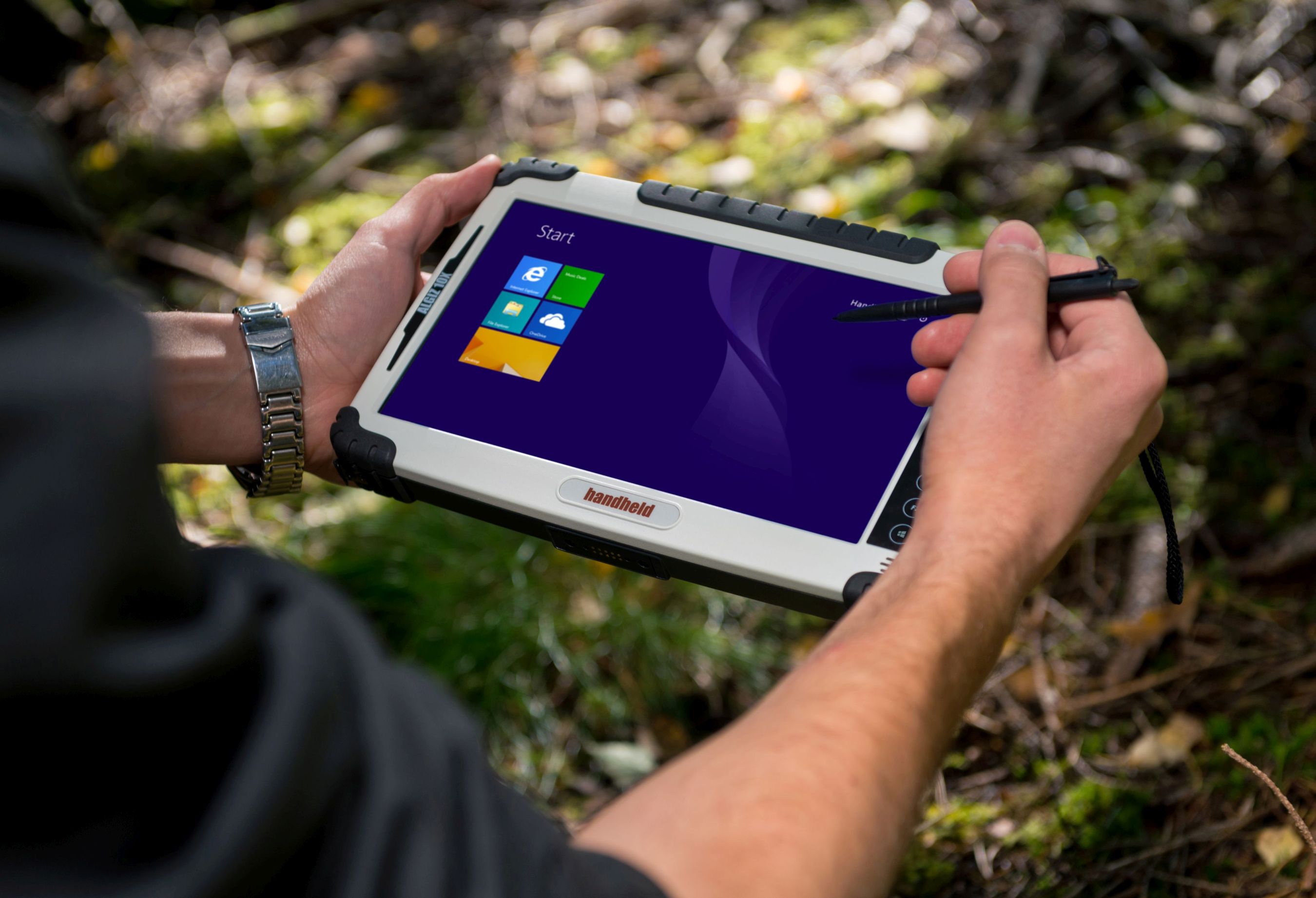
    Handheld's Algiz 10X rugged tablet now has Windows 8, a faster processor.
    Handheld’s Algiz 10X rugged tablet now has Windows 8, a faster processor.

    Handheld Group is upgrading its Algiz 10X tablet. With the upgrade, the rugged tablet for field professionals now features the Windows 8.1 Pro operating system, which is downgradable to Windows 7. Windows 8.1 Pro offers enhanced features to help users connect to company networks, access one PC from another, encrypt data and more.

    The upgraded Algiz 10X also has a more powerful processor that speeds startup and operation, increases software compatibility and doubles processor performance. Its has an integrated u-blox GPS receiver with WAAS/EGNOS/MSAS capability.

    Like all of Handheld’s rugged PDAs, smartphones and mobile computers, the Algiz 10X is specifically developed for field workers in industries such as geomatics, logistics, forestry, public transportation, utilities, construction, maintenance, mining, military and security. It is IP65-rated and meets stringent MIL-STD-810G military standards — protected against dust, water, vibrations, drops and extreme temperatures. It has a 10.1-inch touchscreen, weighs 1.3 kilograms (2.9 pounds) and is 32 millimeters (1.2 inches) thick.

    “By using the very latest operating system available from Microsoft, customers can now enjoy quicker startup and operation, increased software compatibility and improved support for touchscreen-based tablets, among other benefits,” said Johan Hed, Handheld’s director of product management.

    The new Algiz 10X also has the powerful Intel quad-core N2930 1.83 GHz processor with 2.16 GHz boost. This processor allows for both higher performance and cooler running temperatures. Compared to the Algiz 10X’s previous processor, the N2930 more than doubles performance benchmarking, RAM support, number of cores and performance per watt.

    “We have dramatically increased performance levels without sacrificing operating time or mechanical design,” Hed concludes. “We have also improved our wireless communication support. Besides 802.11 b/g/n on 2.4 GHz, we now support both 802.11ac and 802.11a on 5 GHz. The upgraded Algiz 10X also supports LTE, which provides substantially faster data speeds, both up- and downstream, and increased overall network coverage.”

    Key features of the Algiz 10X version 2:

    • Powerful Intel quad-core N2930 1.83 GHz processor
    • 128 GB SSD, expandable via microSD
    • 4 GB of DDR3 RAM
    • Windows 8.1 Industry Pro (downgradeable to Windows 7)
    • 10.1-inch touchscreen with high-brightness MaxView screen technology
    • IP65 rating and conformity to stringent MIL-STD-810G test standards
    • LTE capability with a fully integrated modem and antennas
    • Integrated u-blox GPS receiver and WAAS/EGNOS/MSAS capability
    • Antenna pass-through connectors for both GSM and GPS
    • Several connectivity options, including WLAN and BT, USB 2.0 and USB 3.0, VGA and RS232 ports

    The upgraded Algiz 10X is available now and orders can be placed immediately.

    Below is a video about the new Algiz 10X.

  • Hemisphere GNSS Introduces Tiny High-Accuracy GPS Compass

    Hemisphere GNSS Introduces Tiny High-Accuracy GPS Compass

    The Hemisphere GNSS V-104 compass.
    The Hemisphere GNSS V104 compass.

    Hemisphere GNSS is offering the Vector V104, a tiny high-accuracy, dual-receiver GPS compass and the latest addition to its precise heading and positioning product line.

    “Our Vector V104 provides an astonishing level of accuracy in such a small form factor,” said Chuck Joseph, Hemisphere president and CEO. “The smart, compact design offers better than 2° heading accuracy and sub-meter DGPS position accuracy without requiring maintenance or calibration and while being immune to magnetic interference.”

    Based on the company’s patented Crescent Vector technology, the Vector V104 integrates two GPS antennas, a multi-axis gyro, and a tilt sensor into a single, easy-to-use system. The dual-integrated antennas provide both heading and position data, and the gyro and tilt sensor improve system performance and provide backup heading information if the GPS-based heading is ever lost.

    The Crescent technology provides highly accurate code phase management and outstanding multipath mitigation. This results in excellent accuracy and stability, enabling the user to install the V104 in areas where competing products have difficulty.

    “As the world’s smallest GPS compass, the V104 will significantly change the onboard experience in navigation, making it more accurate, easier to install, and more cost efficient,” said Anders Bergström, founder and senior partner of True Heading AB, who sells a custom-branded V104 as the Vector Compact into the marine market.

    An alternative to traditional gyro and fluxgate compass sensors, the Vector V104 offers a choice of either serial or NMEA2000 communications and is designed for a wide array of applications, especially in the marine, GIS mapping, and machine control markets.

  • Trimble Offers Fleet Management App for Concrete Industry

    Trimble Offers Fleet Management App for Concrete Industry

    The TrimView fleet usage screen on an Android.
    The TrimView fleet usage screen on an Android.

    Trimble has introduced Trimble TrimView Direct, a mobile application that leverages existing real-time data collected by Trimble’s TrimFleet Suite for the ready-mix concrete industry. Trimble has teamed with development partner, BCMI, to expand on how the data is viewed and used by top-level management.

    The announcement was made at the World of Concrete.

    By leveraging mobile technology, organizations have access to instantaneous information so managers no longer need to wait for paper reports to understand the state of their business. Using TrimView Direct, ready-mix producers and management across the organization have real-time access to critical data that impact their daily business decisions. The app collects information from existing systems and integrates it in a Web-based environment to deliver an accurate view of the company’s strengths, customer trends and opportunities for improvement on a mobile platform.

    The app, available on iOS and Android devices, provides a dashboard of real-time data, including order status, ticket details, order timelines, fleet analytics and performance, vehicle location, trip status, signal health, driver hours and performance. The data can be filtered and viewed using maps, graphs, charts and timelines for a visual representation of critical information.

    TrimView Direct is organized in modes: delivery, fleet and driver. Navigating using scrolling menus and toggle screens, users can tap or swipe the page to instantly find and record data.

    For example, managers use the fleet dashboard to see average cycle miles, current fleet usage, average costs, signal health and delivery performance for a fleet, plant, truck or group of trucks. Sales and account managers who are on a customer site can reference data in the field, including order status, performance, timeline and ticket information.

    “Our work with BCMI empowers today’s mobile worker,” said Glenn Bramer, director of marketing for Trimble Construction Logistics. “As we continue to develop solutions that transform the way work is done, we must look at how we can extend valuable information beyond desktop users and enable management to make smarter decisions anytime, anywhere. TrimView Direct is a bold step in this direction.”

    “Coupling Trimble’s expertise in collecting real-time data for improved productivity with our movement to modernize the tools and processes for ready mix operations, we have enabled the entire concrete production chain, both human and machine, to interact with actionable, real-time information,” said Bernie Benson, co-founder of BCMI.

  • Vodafone MachineLink 3G Plus Advances M2M Adoption

    NetComm Wireless Limited and Vodafone have added the Vodafone MachineLink 3G Plus to the Integrated M2M Terminals range, offering an alternative for unconnected machines that need a larger selection of interface options. Developed by NetComm Wireless to facilitate the uptake of Machine-to-Machine (M2M) across a multitude of industries globally, the Vodafone MachineLink 3G Plus enables M2M connectivity in areas such as healthcare, agriculture, vending, point of payment and energy.

    The Vodafone MachineLink 3G Plus is a 3G penta-band modem and router with built-in GPS. It is compatible with Vodafone or Vodafone M2M partner networks worldwide, and the Vodafone M2M Global Platform. The device supports multiple communication protocols and interface options with features including Ethernet, Serial (RS232/422/485), I/O and USB 2.0 ports. Designed for flexible customization, the Vodafone MachineLink 3G Plus features an embedded Software Development Kit (SDK) and open source Linux OS to support unique business functions.

    Vodafone’s second annual M2M Adoption Barometer found that M2M adoption has grown more than 80%, with more than one-fifth of companies actively using the technology. The Vodafone MachineLink 3G Plus is expected to advance this growth by allowing businesses to upgrade from legacy serial connectivity to IP connectivity with access to a broader range of connection choices.

    “The Vodafone MachineLink 3G Plus is the second bespoke product developed for Vodafone which gives businesses the ability to select the best solution for their individual applications. It presents a tremendous opportunity for businesses that need extra options to connect and manage valuable assets,” saidDavid Stewart, CEO and managing director, NetComm Wireless.

  • Automated Pile Driver from Orteco Uses Altus APS-U for Machine Control

    Automated Pile Driver from Orteco Uses Altus APS-U for Machine Control

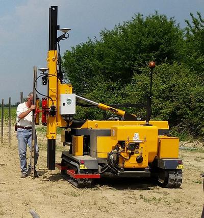
    Orteco is an Italian manufacturer of pile-driving equipment.
    Orteco is an Italian manufacturer of pile-driving equipment.

    Orteco, a specialized manufacturer of pile driving machines based in northern Italy, has introduced a series of robotic pile drivers using APS-U GNSS RTK receivers from Altus Positioning Systems. The products are being supplied to Orteco by Altus’ parent company, Septentrio NV.

    The driverless tracked crawler maneuvers automatically under control of the APS-U, which provides centimeter-level position coordinates and heading information within 0.3 degrees, following a project map loaded into the machine’s computer. It automatically drives itself to each location, positions the mast and drives the post in a perfectly vertical position, stopping the installation at exactly the desired height, then moves automatically to the next spot.

    The Altus APS-U-HDG is a high-precision 272-channel GPS/GLONASS/SBAS receiver with dual antennas designed to provide highly accurate heading and position for machine control applications. Cased in a rugged MIL-STD-810C aluminum housing, the instrument is built to the most rigorous standards for waterproofing, humidity, dust, shock, vibration and extreme temperatures.

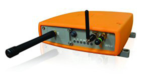
    The Altus APS-U-HDG.
    The Altus APS-U-HDG.

    Orteco is building the GNSS-controlled pile driver in various configurations for applications such as photovoltaic farms, fences, roadside barriers and agriculture. It makes pile driving jobs faster, safer and more accurate with fewer workers, increasing productivity and reducing costs, Altus said.

    “The Orteco machines provide a perfect demonstration of the ruggedness, power and performance of the APS-U as a highly accurate heading and positioning sensor in one of the most demanding environments imaginable,” said Altus CEO Neil Vancans. “In extensive tests conducted by Orteco, the APS-U receivers proved themselves up to the task, performing reliably under the constant heavy pounding and vibration of the pile driver.”

    Based in Bologna, Orteco is a specialized manufacturer focused on pile driving with a 40-year history. In 2011, the company reached a milestone of 1,000 pile drivers produced and distributed all over the world. The company’s GNSS-controlled agricultural pile driver, designed to install posts in large vineyards, was recognized as a winner of the Innovation Challenge Enovitis in campo 2014 by Unione Italiana Vini and Veronafiere.

  • Sokkia Introduces ‘Reimagined’ Field Receiver, the GCX2

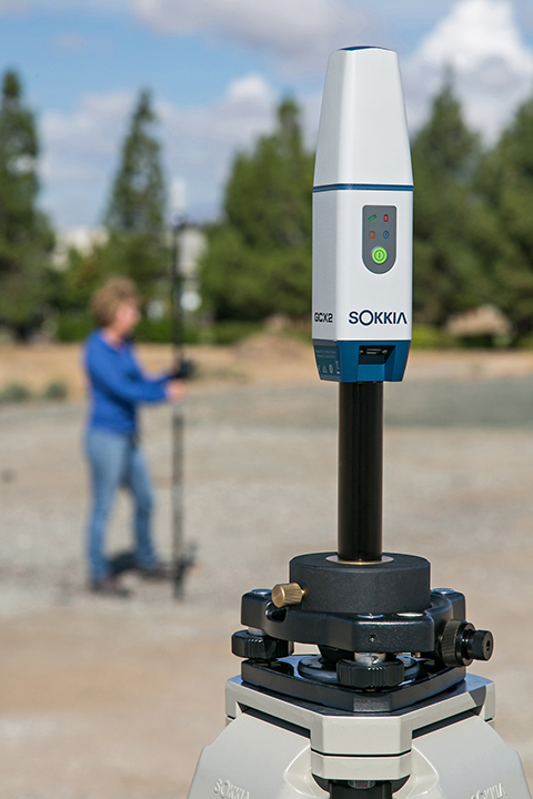
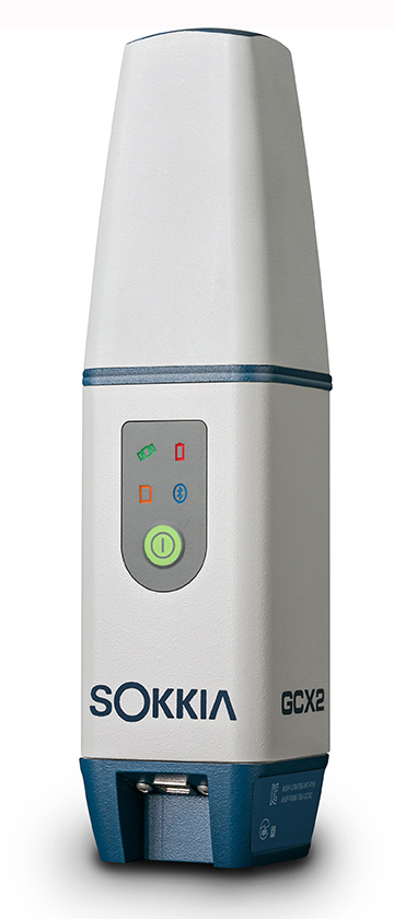
    The GCX2 receiver uses 226 channels.
    The GCX2 receiver uses 226 channels.

    Sokkia has introduced a GNSS integrated receiver designed for lightweight and convenient field operation — the GCX2.

    “Nicknamed ‘the bullet’, the GCX2 exemplifies a completely reimagined approach to receiver design that offers an ultra-lightweight and ergonomic solution at a low cost,” said Eduardo Falcon, executive vice president and general manager of the GeoPositioning Solutions Group.

    The multi-constellation and dual-frequency receiver is designed to offer affordable high-quality results for traditional applications in the surveying and construction fields — as well as unconventional uses such as in landscape architecture, GIS, BIM and forensic mapping. The receiver connects via Bluetooth to the Sokkia S-10 or GHX2 field controller, enabling ease-of-operation within the MAGNET suite of software. The GXC2 uses 226 channels, each one optimized to constantly track any currently available satellite signals.

    “This is the smallest and lightest integrated receiver Sokkia has ever offered,” said Falcon. “The innovative POST (Precision Orbital Satellite Technology) antenna element allows for a form that is both ergonomic and extremely lightweight, which fully differentiates it from existing receivers in the market. The unique ‘bullet’ shape appears as a small extension of the range pole — almost as if it’s not even there.”

    GCX2_studio_Sokkia-WThe receiver features radio-free RTK operation via interference-free data communication technology, which eliminates licensing issues. When used as a base station, it can support up to three concurrent GCX2 rovers at a range of up to 300 meters. Each receiver can be used as a base or as a rover.

    For network operation, the GCX2 may be paired with a cellular-enabled data-controller to provide RTK network corrections and connectivity with MAGNET Enterprise.

    “The GCX2 delivers a high level of performance and efficient workflow, and it’s offered with a substantial pricing advantage over competitive systems,” said Falcon.

    Additional features include a rechargeable battery and Sokkia receiver utility (SRU) software compatibility.

  • Air Force Orders Two More GPS III Satellites

    The United States Air Force plans to order two more GPS III satellites from contractor Lockheed Martin, according to SpaceNews. Lockheed Martin is under contract to build eight GPS III satellites, with the first planned to be launched in 2016. The contract includes options for up to four more satellites.

    However, the Air Force plans to open up construction of subsequent GPS satellites for competitive bidding with GPS III space vehicle 11, reports Aviation Week.

    The satellites are part of the Air Force’s $167.3 billion budget request for fiscal 2016, up from $152.8 billion provided by Congress for fiscal 2015.

    The Air Force also intends to buy only one GPS satellite — from Lockheed Martin or a different contractor — in 2017 rather than the three included in the current budget blueprint, according to the SpaceNews.

  • ION Announces 2015 Award Winners, Fellows

    ION Announces 2015 Award Winners, Fellows

    The Institute of Navigation (ION) presented its Annual Awards during the ION International Technical Meeting in Dana Point, Calif., Jan. 26-28. The annual awards recognize individuals making significant contributions or demonstrating outstanding performance relating to the art and science of navigation. ION also announced its elected Fellow members.

    Award Winners

    • Mathieu Joerger received the Early Achievement Award for outstanding contributions to the integrity of multi-constellation and multi-sensor navigation systems. The award is presented in recognition of outstanding contributions made early in one’s career.
    • Captain Samantha Ekwall received the Superior Achievement Award for her heroic actions as the lead navigator for a five-ship formation during the refueling of the battle damaged CV-22 Ospreys during a U.S. embassy evacuation attempt in South Sudan. The Superior Achievement Award is presented to an individual demonstrating outstanding accomplishments as a practicing navigator.
    • Hamid Mokhtarzadeh and Demoz Gebre-Egziabher received the Dr. Samuel M. Burka Award for their paper “Cooperative Inertial Navigation” published in the Summer 2014 issue of NAVIGATION: Journal of the Institute of Navigation, Vol. 61, No. 2,pp.77-94. The award recognizes outstanding achievement in the preparation of a paper contributing to the advancement of the art and science of positioning, navigation and timing.
    • Patricia Doherty received the Captain P. V. H. Weems Award for her contributions to the management and encouragement of advanced navigation research and for her service to ION. The award is presented to individuals for continuing contributions to the art and science of navigation.
    • Bruce Haines received the Tycho Brahe Award for notable achievements in astrodynamics-navigation, precise orbit determination and satellite applications to geophysics and oceanography. The Tycho Brahe Award is presented to recognize outstanding contributions to the science of space navigation, guidance and control.
    • Neeraj Pujara received the Norman P. Hays Award for his inspired leadership, outstanding encouragement, inspiration and dedicated support contributing to the advancement of navigation. The award is given in recognition of outstanding encouragement, inspiration and support contributing to the advancement of navigation.
    • Todd Humphreys received the Thomas L. Thurlow Award for contributions that enhance radionavigation security and robustness in the face of intentional spoofing and natural interference. The award recognizes outstanding contributions to the science of navigation. Humphreys has written several articles for GPS World, the latest being the February cover story, “Accuracy in the Palm of Your Hand.”
    • Patricia Doherty received the Distinguished Service Award, presented for extraordinary service to ION.
    ION's new Fellows: (from left) Attila Komjathy, Yu (Jade) Morton, and Frank van Digglen.
    ION’s new Fellows: (from left) Attila Komjathy, Yu (Jade) Morton, and Frank van Digglen.

    Fellows

    ION also announced recipients of 2015 Fellow memberships. Election to Fellow membership recognizes the distinguished contributions of ION members to the advancement of the technology, management, practice and teaching the arts and science of navigation; and/or lifetime contributions to ION.

    • Attila Komjathy has been elected for contributions to remote sensing of Earth’s ionosphere using GNSS signals.
    • Yu (Jade) Morton has been elected for contributions to GNSS software receivers and the development of a worldwide network of space weather monitoring stations.
    • Frank van Digglen has been elected for contributions to satellite-based navigation for consumer applications, especially mobile handheld devices. van Diggelen joined the GPS World Advisory Board in 2014.