Author: GPS World Staff

  • ESA Summer School Will Navigate Students through Satnav World

    ESA Summer School Will Navigate Students through Satnav World

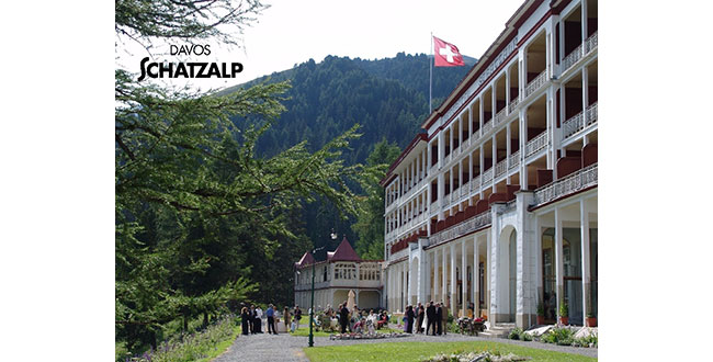
    ESA International Summer School on GNSS 2013 will take place this year in Davos, Switzerland, July 15-25, 2013, at the Schatzalp Snow & Mountain Resort.

    Satellite navigation technology is changing all our lives — and here is your chance to gain an expert overview. This summer’s Navigation Summer School, hosted by the Swiss Space Office and the Swiss Space Center in Davos, Switzerland, will bring together top experts in the field with graduate students and young professionals. Registration is now open.

    Activities equivalent to 6-7 percent of European GDP already depend on satnav services, equivalent to €800 billion in value, and Europe’s own Galileo system is anticipated to further boost satnav’s economic impact. The first four Galileo satellites are operational in orbit, with initial navigation services projected to begin at the end of next year.

    But how does satellite navigation work in practice? July’s two-week International Navigation Summer School aims to give participants a comprehensive theoretical and practical overview of the field, from the basics of GNSS to signal reception and processing to determine the position-navigation-time solution.

    The program is open to graduate students (with a first university degree), Ph.D. candidates, early-stage researchers and young professionals wishing to broaden their knowledge.

    Lectures by internationally renowned specialists will be combined with practical exercises and lab work. Principles of project management, entrepreneurship and marketing will also be covered in detail, with the participants tasked to develop an innovation-based group project over the course of the event.
    Pascal Rochat of Spectratime, CEO of the Swiss company that designed the atomic clocks at the heart of Galileo, will give the inaugural lecture.

    ESA’s International GNSS Navigation Summer School takes place in cooperation with the Joint Research Center, EC, in Ispra, Stanford University,  the Institut Supérieur de l’Aeronautique et de l’Espace in Toulouse, Graz University of Technology and University FAF Munich, with the support of the Swiss Space Office and the Swiss Space Center.

    For more information, and to apply to take part, see the Summer School website.

  • Parkinson Presentation at Smithsonian Now Online, Exhibit Opens April 12

    Parkinson Presentation at Smithsonian Now Online, Exhibit Opens April 12

    Bradford W. Parkinson, professor of Aeronautics and Astronautics Emeritus at Stanford University, discussed “GPS for Humanity — The Stealth Utility” at a special Smithsonian event Thursday, March 21. If you missed his talk, you can view it now on UStream.

    Parkinson’s lecture at the National Air and Space Museum in Washington, D.C., was part of the introduction of the new Smithsonian exhibition Time and Navigation: The Untold Story of Getting from Here to There, which opens April 12. Don Jewell, GPS World’s contributing editor for Defense, discusses the exhibit in his February column.

    According to the Smithsonian, for centuries, nations have invested enormous resources to determine time and place for geopolitical reasons, and their research has changed people’s view of the world. Advanced technology that was once available only to the military has become commonplace in car dashboards, cell phones and a growing number of other portable devices of daily life. The Time and Navigation exhibit explores how revolutions in timekeeping over three centuries have influenced how people find their way. It is organized into five sections: Navigating at Sea; Navigating in the Air; Navigating in Space; Inventing Satellite Navigation; and Navigation for Everyone.

    Bygrave Position-Line Slide Rule.
    Bygrave Position-Line Slide Rule.

    Andrew Johnston (geographer, Center for Earth and Planetary Studies, National Air and Space Museum) gave a presentation about the exhibit at ION GNSS in Nashville, Tennessee.

    In the 1970s, Parkinson was the chief architect and original program director for GPS. In his lecture, he will present the history, applications, and future of GPS and the GNSS. Central to operation of GPS is the relationship between time and navigation, and GPS will be explored in the Time and Navigation exhibit.

    Smithsonian-floorplan
    photo: Bradford W. Parkinson


  • Social Media and Big Data 101 for GIS professionals

    Original Broadcast Date:   Thursday, March 28, 2013

    Webinar Topic/Abstract:  Social Media and Big Data 101 for GIS professionals

    Experts in this growing field will discuss the basics for those new to leveraging the technology in their GIS operation. Topics will include different kinds of social media, human geography, traits of each, other related public media, several case studies/examples.

    Moderator:

    Art Kalinski
    Art Kalinski

    Art Kalinski
    Editor, GeoIntelligence Insider Newsletter

    A career Naval Officer, Art established the Navy’s first Geographic Information System (GIS) in the mid-eighties.  Completing a post graduate degree in GIS at the University of North Carolina, he joined the Atlanta Regional Commission (ARC) as the GIS Manager from 1993 to 2007.  He pioneered the use of oblique imagery for public safety and participated in numerous disaster response actions including: GIS/imagery support of the National Guard during Katrina, UASI (Urban Area Security Initiative) a NIMS based field exercises in Atlanta and a fully manned, hardware equipped joint disaster response exercise in New York City.  Art retired early from ARC to join Pictometry International to direct military projects using oblique imagery which led to him joining Soft Power Solutions, LLC.  He has written articles for numerous geospatial publications including a monthly column for GeoSpatial Solutions/GPS World aimed at federal GIS users.


    Speakers:
    Eric Gakstatter
    Editor, Geospatial-Solutions.com, Geospatial Solutions Monthly Newsletter
    Dr. Dan Tolley
    CEO, Soft Power Solutions, LLC
    Bob Dowling
    Co-founder, GeoCOP
    Gen. Edwin “Skip” Vincent (USAF Ret.)
    Founder, Soft Power Solutions, LLC
    Steve Lutton
    Director, Product Management, Geosemble Solutions
  • Real-time PPP with Galileo Demonstrated by Fugro

    Real-time PPP with Galileo Demonstrated by Fugro

    Fugro Seastar AS has been looking forward to demonstrating Real-Time Precise Point Positioning (PPP) based solely on Galileo signals since the last two satellites were launched October 12, the company said.

    Those two satellites brought the constellation to a total of four satellites, the minimum required to permit calculation of a Galileo-only position. Fugro achieved this task on March 18, within a week of all four Galileo satellites being activated. Fugro is now generating Galileo orbit and clock corrections, which can be used in conjunction with the Fugro G2 decimeter-level corrections associated with its GPS/GLONASS PPP service.

    The plot below shows performance of the Fugro orbit and clock service using GPS, GLONASS and Galileo satellites between 06:00 and 08:00 UTC,  March 18, 2013, in Oslo, Norway. Between 07:00 and 07:30 UTC, only the four Galileo satellites were used for the solution, which achieved a similar accuracy to Fugro’s existing service, the company said.

    “It is interesting that the noise level of the position is better with Galileo alone than when GPS and GLONASS satellites are also used,” Fugro said in a statement. “This is very encouraging as with only four satellites to choose from, the geometry of the Galileo-based solution is much weaker than the solutions before and after the Galileo-only period. This performance exceeds our expectations and suggests a strong future for Fugro’s Galileo PPP solution.”

    Fugro-chart

  • AtlasCT to Release Voice-Guided Navigation for Firefox OS

    AtlasCT has announced an April release date for the first, full featured, voice-guided turn-by-turn navigation solution for the Firefox OS. The software program will be released under the brand name of “EverNav for Firefox.” This announcement follows Mozilla’s launch of the Firefox OS during the Mobile World Conference in Barcelona in February.

    EverNav was initially released on September 2012 as an HTML5 turn-by-turn solution aimed at application developers and mobile marketing campaigns. The solution was quickly adapted by a large number of customers. Now, as part of the preparation for Mozilla’s release of the Firefox OS, a dedicated EverNav version will be released in April.

    “We were one of the first few companies to release HTML5 based navigation back in 2012 and we are proud to be the first to release a dedicated navigation solution for the Firefox OS today. HTML5 technology has come to the point that we were able to develop a full-featured navigation user experience, and we are extremely happy with the result,” said Ziv Avni, AtlasCT’s marketing director.

    EverNav for Firefox OS will include a personalized navigation experience with features like local information, live traffic reports, favorites and history sections, share location capability, social integration and more.

    “As the leading provider of HTML5 turn-by-turn navigation solutions, as soon as we learned about the Firefox OS, we decided to release a dedicated version,” said Shlomo Emanuel, AtlasCT’s CEO. “We are still looking into a number of possible business models for the services and this is one of the subjects we are discussing with mobile carriers that have already committed to backing the open web device initiative.”

    EverNav for Firefox OS will be available both on the Firefox Marketplace and on the EverNav website.

  • BeiDou Ground System Approved

    A ground system aimed at enhancing the navigation precision of China’s homegrown BeiDou Navigation Satellite System (BDS) was approved in central China’s Hubei Province on Friday, according to NZWeek.

    The BeiDou Ground Base Enhancement System (BGBES) is a network consisting of 30 ground base stations, an operating system and a precision positioning system. It was approved by the evaluation committee led by Sun Jiadong, an academician with the Chinese Academy of Sciences (CAS) and chief designer of the BDS.

    The system is expected to improve the BDS’ positioning precision to 2 centimeters horizontally and 5 centimeters vertically via tri-band real-time precision positioning technology, and to 1.5 meters with the single-frequency differential navigation technology.

  • GPS Innovation Alliance Welcomes New Affiliates

    Five major national organizations representing a variety of industries are joining the GPS Innovation Alliance as affiliate members.

    The alliance announced today that the American Trucking Association, the Association for Unmanned Vehicle Systems International (AUVSI), Boat U.S., the National Rural Electric Cooperative Association (NRECA) and the National Society of Professional Surveyors (NSPS) have signed on as alliance affiliates. Each shares in the alliance’s goal of protecting, promoting and further enhancing one of the world’s most important enabling technologies — technologies that improve the lives of people around the globe.

    Headquartered in Washington, D.C., the GPS Innovation Alliance was launched in February. Its founding members are Garmin, John Deere, Topcon Positioning Systems and Trimble. Affiliate members previously announced include the Association of Equipment Manufacturers (AEM), General Aviation Manufacturers Association (GAMA) and the National Association of Manufacturers (NAM).

    Following are comments from representatives of the newly announced affiliates.

    Ted Scott, director of Engineering, American Trucking Associations: “GPS is important to the trucking industry. A robust and reliable GPS system enables drivers and fleet managers to select the best routes to guarantee pickup and delivery times, and to track shipments and fleets. It also helps save fuel by providing the most efficient routes. As GPS continues to modernize, we are pleased to support the GPS Innovation Alliance as an affiliate.”

    Curtis W. Sumner, executive director, National Society of Professional Surveyors: “The productivity and precision benefits GPS provides professional surveyors are boundless. Virtually all surveyors use it for a growing number of applications that improve the national infrastructure every day. The modernization of GPS is critical to the future of surveying, which is why NSPS is pleased to offer the GPS Innovation Alliance its support moving forward.”

    Michael Toscano, president and CEO, Association for Unmanned Vehicle Systems International: “All around the world, unmanned systems (air, ground and maritime) rely on accurate, dependable GPS signals. The lack of a reliable GPS signal poses a serious threat to our public safety and national defense, and this is why we support the GPS Innovation Alliance. We look forward to working with the Alliance in its effort to emphasize the importance of protecting our GPS.”

    Margaret Bonds Podlich, president, Boat U.S.: “For anyone who has sailed their boat in unfamiliar cruising grounds, sought out new fishing holes, had to navigate in foul weather or simply stay the course in an unmarked channel, a reliable GPS system is a critical safety issue for everyone aboard. It is the only electronic navigation system available to boaters, and for our half a million BoatU.S. members, it must work every time, all of the time.”

    Laura Marshall Schepis, senior director, Legislative Affairs, National Rural Electric Cooperative Association: “NRECA is pleased to be a part of the GPS Innovation Alliance. Electric cooperatives are increasingly relying on GPS technology as they upgrade and modernize the nation’s electric system. The GPS Innovation Alliance can support modernization by ensuring utilities have access to the spectrum they need for these new applications.”

    The GPS Innovation Alliance recognizes the ever increasing importance of GPS and other GNSS technologies to the global economy and infrastructure and is firmly committed to furthering GPS innovation, creativity and entrepreneurship. The GPS Innovation Alliance seeks to protect, promote and enhance the use of GPS.

  • Apple Buys Indoor Location Company WiFiSLAM

    The Wall Street Journal is reporting that Apple has acquired indoor-location company WiFiSLAM. Apple reportedly paid about $20 million for the Silicon Valley-based company. Apple has confirmed the purchase to MacRumors, but offered no details on its plans for the acquisition.

    Analysts say this is a sign that the war over indoor mobile location services is heating up.

    Apple’s acquisition of WiFiSLAM illustrates how 2013 will be a breakout year for indoor location as initial trials shift to technology deployments, application development, and revenues, according to ABI Research.

    Two-year-old start-up WiFiSLAM has developed ways for mobile apps to detect a phone user’s location in a building using Wi-Fi signals, according to the Wall Street Journal. It has been offering the technology to application developers for indoor mapping and new types of retail and social networking apps. The company has only a few employees. Co-founders include former Google software engineering intern Joseph Huang.

    “The move comes as Apple continues to build its arsenal against Google in mapping,” according to Wall Street Journal blogger Jessica E. Lessin. “It debuted its own mapping service last year to poor reviews and user complaints about inaccurate data. Apple chief executive Tim Cook apologized for the quality of the product, and Apple has continued to improve it.

    “Google already offers indoor mapping in certain locations like airports, shopping centers and sports venues,” Lessin said.

    ABI Research’s latest report “Indoor Location in Retail: Where Is the Money?” provides an overview of all major technologies, revenue opportunities and competitive environment. “Analyzing across 10 retail sectors, we are seeing a lot of cross pollination as companies combine handset and infrastructure based Wi-Fi, Bluetooth, and sensor location technologies. The emergence of public venue small cells and carrier Wi-Fi will also create a new wave of opportunity,” commented Patrick Connolly, senior analyst. “As a result, we expect to see a flurry of acquisitions and partnerships in 2013, as major players start to make their moves.”

    In support of these technologies, ABI Research is also forecasting smartphone retail apps to break 1 billion downloads, while indoor maps will break 1 million buildings, over the forecast period.

  • Hyundai Heavy Industry to Track Equipment with Telit

    3.20.13_Taeha_TH- RMCU_ ANTENNA-1.jpgTelit Wireless Solutions will provide the M2M communication module for the Taeha Mechatronics Remote Monitoring System (RMS). Taeha Mechatronics is a South Korean-based provider of electromagnetic control solutions for healthcare and industrial devices.

    The Taeha Mechatronics TH-RMCU, a remote management control unit, integrates Telit’s HE910, HSPA+ module, which delivers 14.4 Mbps downlink data rates. The solution has obtained SK Telecom certification, and will be used for tracking the location of Hyundai Heavy Industry’s global assets. This is the first such authorization by SK Telecom for a system to be used locally and globally. As a result the device can be used in other countries simply by roaming without need for additional regional variants, Telit said. This move is expected to allow more Korean companies to operate more easily abroad.

    The HE910 supports a large number of WCDMA frequency bands (850/900/1700/1900/2100 MHz), making it possible for it to be used in all countries with 3G networks via simple roaming, with no need for production of regional variants to address local frequency band availability, Telit said.

    Hyundai Heavy Industry installs an RMS device, composed of the control unit and antenna, into various types of heavy equipment in the field. It uses the solution to trace equipment location with the integrated GPS which transfers the related data to a server in real-time. With that the company looks to prevent theft and loss of its assets. Also, with the monitoring function, the company can effectively manage fuel consumption of their equipment, actively using it to reduce carbon emissions, Telit said.

    HE910 is a RoHS-compliant module that combines GSM, GPRS, EDGE and HSPA+ network compatibility with digital telecommunication service access. It is world’s smallest (28.2×28.2×2.6 mm) LGA form factor, and ideal for applications that process high-capacity multimedia data, such as e-readers, PDAs and real-time location tracing devices. The HE910 HSPA+ transmission speed is 14.4 Mbps on the downlink, and 5.7 Mbps on the uplink. It supports high-speed serial port, receive antenna diversity, with optional embedded high-sensitivity GPS; and simultaneous voice and data.

    “Solutions developed solely by Korean companies needed to go through many different testing processes to be able to be provided to global customers. By adapting Telit’s standard-based module, we were able to not only reduce cost, but also reduce time for development. We are planning to expand the usage of this solution from location tracing for asset management to other areas,” said Sang-hee Lim, CEO of Taeha Mechatronics.

    “As the interest grows in security and safety globally, tracking solutions are also becoming smarter, in particular for the manufacturing industry, which uses various types of equipment. Companies can dramatically improve management efficiency and productivity simply by deploying cutting-edge monitoring systems. We expect to see continued demand for M2M,” said Derick Tsang, APAC manager of Telit.

  • Trimble Launches New Mobile Apps, Website for Sportsmen

    Trimble has launched a new mobile mapping product for hunters and anglers. The launch includes two smartphone apps (Trimble GPS Hunt and Trimble GPS Fish), one tablet app (Trimble GPS Maps), and a new Website — GPSHuntFish.com.

    The offerings combine the latest in mobile GPS technology and Trimble’s exclusive outdoor maps to help sportsmen plan trips, navigate in remote areas, record GPS information, and privately share details with friends.

    “We are excited to launch a comprehensive solution for hunters and anglers,” said Rich Rudow, general manager at Trimble Outdoors. “Now hunters can scout a future hunt at GPSHuntFish.com then send maps and GPS details to their iPhone, Android, or iPad to use in the field. In addition, they can print custom waterproof maps that compliment the digital maps displayed in the mobile apps.”

    The launch includes:

    Trimble GPS Hunt App

    Runs on: iPhone and Android phones

    Find hunting spots on detailed outdoor maps, navigate in remote areas and track wildlife. The Trimble GPS Hunt app uses the GPS built into smartphones to track position in the field—even in areas without a cell or data connection. In addition, users can mark waypoints, record tracks, view weather forecasts, see sun and moon phases, and view compass and trip details.

    Trimble GPS Fish App

    Runs on: iPhone and Android phones

    Use Trimble GPS Fish to record fishing trips and keep a report of daily catches. Pinpoint the exact location of each catch, take photos, record GPS tracks, and view detailed street, topo and terrain maps. Use the app to return to previous fishing hotspots. In addition, with an Elite membership, users have access to more than 6,900 lake maps showing 10-foot lake depth contours.

    Trimble GPS Maps App

    Runs on: iPad

    Plan and organize your next hunting trip or fishing trip with the Trimble GPS Maps app. Research hunting lands, find fishing spots and scout access roads on your iPad. This app allows users to fade between street, aerial and topographic maps, and instantly copy-and-paste GPS coordinates onto the digital maps.

    GPSHuntFish.com

    Works on: PC and Mac with an Internet connection

    GPSHuntFish.com is a portal for all of the Trimble hunting and fishing apps. In addition, users can view and store their trips, view maps in large format, and print maps at home or as a custom print by MyTopo.com. All trips created in the Trimble fishing and hunting apps are stored in the Trip Cloud, an online service that auto-syncs trips between a computer, smartphone and tablet device.

    Trimble Elite

    Works with Trimble GPS Fish, Trimble GPS Hunt, Trimble GPS Maps, GPSHuntFish.com

    Trimble Elite members have access to public land boundaries for 46 states, lake maps for 6,900 lakes, forest road overlays for 134 national forests, real-time weather maps, online trip planning tools and discounts off printed maps. In addition, users can pick from a library of 3,000 Mega Offline Map bundles. These topo map bundles can be downloaded by state, county, or hunt unit and be accessed on the mobile device in remote areas, even with no cell or data connection.

    How to Buy. Trimble GPS Hunt and Trimble GPS Fish are available in the Apple App Store and Google Play store. Trimble GPS Maps are available in the Apple App Store. Each app comes in a free or pro version for $4.99. The Elite membership is available for purchase in all the apps and at GPSHuntFish.com for $29.99/year or $2.99/monthly.

  • New Series of SPAN MEMS IMU Products Introduced by NovAtel

    New Series of SPAN MEMS IMU Products Introduced by NovAtel

    NovAtel Inc. has announced a new SPAN-IGM series of Micro Electromechanical Systems (MEMS) inertial sensor products, including the IMU-IGM-A1 MEMS enclosure and the SPAN-IGM-A1 GNSS/INS enclosure.

    The IMU-IGM-A1 is a small, rugged enclosure that houses a MEMS inertial sensor. The IMU-IGM-A1 can be configured from the factory as an integrated GNSS + Inertial Navigation System (INS) or as a standalone IMU sensor for pairing with a customer’s existing NovAtel SPAN enabled OEM6 receiver. Featuring regulated 10-30 VDC input and a dedicated wheel sensor input to enhance GNSS outage bridging capabilities, the IMU-IGM-A1 delivers a 200 hertz navigation solution and raw measurement output.

    “The IMU-IGM-A1 is the smallest, lightest IMU enclosure in our SPAN GNSS/INS product portfolio,” said Jason Hamilton, director of marketing for NovAtel. “It provides NovAtel customers with the ability to leverage our powerful SPAN technology in new applications that are size and weight constrained but still require highly precise position, velocity, roll, pitch, and heading.”

    The SPAN-IGM-A1 combines NovAtel’s OEM615 GNSS receiver card with a MEMS inertial sensor in a single enclosure. By integrating the MEMS IMU with NovAtel’s tightly coupled OEM6 GNSS/INS SPAN engine, advanced positioning options such as AdVance RTK, ALIGN heading technology and RAIM are available to maximize performance.

    Shipments of the new IMU-IGM-A1 enclosure and the SPAN-IGM-A1 GNSS/INS integrated enclosure commence early Q2 2013.

  • U.S. Air Force to Test CNAV on GPS L2C and L5 Signals

    News courtesy of CANSPACE Listserv.

    U.S. Air Force Space Command has issued a notice that CNAV capabilities on the GPS L2C and L5 signals will be tested in June. No GPS satellite outages are planned. Below is the official notice.


    Notice of Test

    A Notice by the Air Force Department on 03/20/2013

    Action: GPS Test Notice.

    Summary: The purpose of this notification is to inform users of an upcoming event related to the GPS satellite constellation. U.S. Air Force Space Command will be testing CNAV capabilities on the GPS L2C and L5 signals on 15-29 June 2013. There are no planned GPS satellite outages for this activity. The broadcast navigation messages will be in compliance with IS-GPS-200 and IS-GPS-705. L2C/L5 CNAV testing will be transparent to GPS receivers that do not process L2C or L5 CNAV. U.S. Air Force Space Command expects to conduct one to two CNAV tests per year over the next few years. These test events will provide an opportunity for civil users and manufacturers to participate in L2C/L5 evaluation and will result in enhanced provider and user readiness for L2C/L5 operations once the Next Generation GPS Operational Control System comes online in 2016.

    The draft test plan is available. The draft test plan communicates details of the broadcast, data collection, and results reporting plans.

    U.S. Air Force Space Command and the National Space-Based Positioning, Navigation, and Timing Systems Engineering Forum (NPEF) encourage L2C and L5 users and receiver manufacturers to review the test plan, provide comments, and participate in the evaluation process.

    Comments to the test plan must be submitted on a Comment Resolution Matrix by 29 April 2013 and sent to [email protected].

    The final test plan will be posted once all comments have been adjudicated.

    All user and manufacturer comments and the resulting adjudications will also be posted consistent with the GPS public ICWG process.

    Any military or civil users who encounter user equipment problems during or after testing should contact the GPS Operations Center (GPSOC) (military), NAVCEN (civil, non-aviation) as soon as possible. Aviation users should file reports consistent with FAA-approved procedures.

    FOR FURTHER INFORMATION CONTACT:
    Send all questions or concerns regarding the CNAV Test Plan to [email protected].

    Henry Williams Jr.
    Acting Air Force Federal Register Liaison Officer