Mapping company NavVis has launched the M6, a next-generation indoor mobile-mapping system that the company says can overcome the scalability and data quality constraints of reality capture technology.
Surveyors and architecture, engineering and construction (AEC) professionals can now use reality-capture technology for large-scale indoor mapping projects. The M6 can be used for factory planning and creating and updating as-built BIM (building information modeling) models and construction monitoring.
The NavVis M6 is an all-in-one system that captures 360-degree immersive imagery, photorealistic point clouds, Bluetooth beacons, Wi-Fi signals and magnetic field data.
The NavVis M6 features a mobile lidar system that lets it scan up to 30 times faster than stationary devices, letting users capture up to 30,000 square meters in a day.
Cutting-edge 6D simultaneous localization and mapping (SLAM) technology significantly improves the quality of data captured. Thanks to 6D SLAM, M6 continuously scans even complex indoor environments, including uneven surfaces or changing elevations such as ramps, open spaces or long corridors without compromising the quality of the data.
M6’s innovative software is complemented by hardware features designed to improve the quality of data and ease of capture: four laser scanners with a range of up to 100 meters are arranged to maximize scan coverage, while six cameras automatically take high-resolution images during mapping. The innovative design of the M6 includes camera placement that keeps the operator in a blind spot.
NavVis IndoorViewer software gives stakeholders access to the scanned environment through an interactive virtual building in their browser.
“The NavVis M6 marks a quantum leap in indoor mobile mapping,” Felix Reinshagen, CEO of NavVis. “Anyone who needs to scan large properties, run repeated scans or would like to move into the field of reality capture will profit from the groundbreaking data quality.
“With M6, users can now quickly capture large, complex indoor environments for typical tasks such as updating floorplans, documenting construction progress or creating as-built BIM models. At the same time, M6 captures the data needed to provide customers with additional deliverables such as browser-based immersive walkthroughs and indoor navigation,” Reinshagen said.
TCarta, a global provider of marine geospatial products, has delivered pre- and post-disaster surface models for the Caribbean islands of Antigua and Barbuda for use in Hurricane Irma recovery efforts.
The satellite-derived surface models contain seamless datasets of onshore elevation and offshore water-depth measurements for each island.
The United Kingdom government commissioned the Hurricane Irma disaster mapping for Antigua and Barbuda as part of the Commonwealth Marine Economies Programme. TCarta won a competitive tender, which specifically requested end products derived from satellite imagery.
“By specifying satellite-derived data as the deliverable in its tender, the U.K. government acknowledged the speed and cost advantages this technology offers compared with traditional shipborne surveying or airborne lidar collection,” said TCarta CEO David Critchley.
Hurricane Irma devastated the Caribbean in September 2017. The governments of Antigua and Barbuda requested accurate data for onshore land elevations and offshore water depths from before and after the storm hit.
The datasets will be used in digital change detection analyses to determine how Irma altered the surfaces of the land and seafloor. This will be vital information in repairing onshore drainage systems and updating coastal navigation charts.
“A seamless onshore-offshore dataset is crucial for the hydrographic computer modeling to accurately visualize the integrated nature of the dynamic terrestrial and near-shore environments,” Critchley said.
For the seafloor dataset, the TCarta team generated satellite-derived bathymetry products by extracting accurate water-depth measurements from high-resolution multispectral imagery acquired by the DigitalGlobe WorldView satellites. In the clear Caribbean waters around Antigua and Barbuda, bathymetric points were delivered on a 2-meter spacing to deeper than 20 meters.
The TCarta team created digital surface models of the terrain on Antigua and Barbuda, using a technique to derive surface elevations at 0.5-meter point spacing from multiple WorldView images captured over the islands. Vegetation was then removed from surface models to yield bare-Earth elevation models.
TCarta delivered the high-quality before-and-after datasets to the UK government which in turn distributed them to scientists on Antigua and Barbuda for damage assessment and planning for the coming hurricane season.
Teledyne Optech will exhibit at the United States Geospatial Intelligence Foundation’s GEOINT Symposium April 23-25 in Tampa, Florida.
Technology partners from Teledyne Scientific & Imaging, Teledyne DALSA and Teledyne CARIS will exhibit together as part of Teledyne Imaging – Space & Defense in booth 1148.
At GEOINT 2018, visitors can discover the advanced capabilities of the Optech Galaxy PRIME, the latest model of Teledyne’s Galaxy airborne laser terrain mapper, with enhanced range performance, collection efficiency, vegetation penetration and low-reflectance target detection.
The Polaris Terrestrial Laser Scanner (TLS) will be on hand so that visitors can experience its highly automated and user-friendly interface and see its performance at ranges from 1.5 to more than 2,000 meters.
In addition, attendees can learn about the Optech Maverick, the company’s first wearable mobile-mapping system that fits on a backpack.
The Teledyne Imaging – Space & Defense initiative brings together the experience and capabilities of Teledyne Optech, Teledyne Scientific and Imaging, Teledyne DALSA, Teledyne e2V and Teledyne CARIS to expand the breadth of Teledyne Imaging solutions for geospatial intelligence. Representatives of end-user agencies, integrators or original equipment manufacturers (OEM) can visit booth #1148 to learn about a range of new developments and offerings.
Lockheed Martin has submitted a competitive and fully compliant proposal for the U.S. Air Force’s GPS III Follow On (GPS IIIF) program, which will add enhanced capabilities to the most advanced GPS satellites ever designed. The GPS IIIF program intends to produce up to 22 next-generation satellites.
The U.S. Air Force’s first 10 GPS III satellites, now in full production at Lockheed Martin, are already the most powerful GPS satellites ever designed. GPS III will have three times better accuracy and up to eight times improved anti-jamming capabilities. Spacecraft life will extend to 15 years, 25 percent longer than the newest GPS satellites on-orbit today. GPS III’s new L1C civil signal also will make it the first GPS satellite to be interoperable with other international global navigation satellite systems, like Galileo.
Lockheed Martin’s proposal for the GPS IIIF program adds further power, resiliency and capabilities to GPS III.
The biggest feature of GPS IIIF will be a regional military protection capability, which will increase anti-jam support in theater to ensure U.S. and allied forces cannot be denied access to GPS in hostile environments.
Lockheed Martin’s GPS IIIF will feature a fully-digital navigation payload. The payload on the first 10 GPS III satellites is already 70 percent digital.
Each GPS IIIF satellite will include a laser retro-reflector array, which allows the positioning of on-orbit satellites to be refined with ground-based, laser precision. The precise positioning of each satellite ultimately enhances the positioning signals they generate.
Additionally, the U.S. government will provide each GPS IIIF with a new search-and-rescue payload. These hosted payloads, spread around the globe on GPS IIIF satellites, will make it easier for first responders to detect and respond to emergency signals.
“When we developed our design for the first 10 GPS III, we used a flexible, modular architecture that would allow for the insertion of modern technologies and new Air Force requirements in a low-risk manner,” said Johnathon Caldwell, program manager for Lockheed Martin’s navigation systems mission area. “In addition, our GPS IIIF solution is based off a design already proven compatible with both the Air Force’s next generation Operational Control System (OCX) and the existing GPS constellation.”
The first 10 GPS III satellites are in full production at Lockheed Martin’s GPS III Processing Facility, a $128 million cleanroom factory designed in a virtual reality environment to drive efficiency and reduce costs in satellite production.
GPS III SV02 completed rigorous Thermal Vacuum (TVAC) testing in December 2017, is in final environmental testing, and is expected to be declared AFL in summer 2018. GPS III SV03 was fully integrated in fall 2017 and recently began TVAC, and SV04 was recently integrated in anticipation of environmental testing later this summer. GPS III SV05 has now received its navigation payload and is in final vehicle build up. Not far behind, GPS III SV06 has begun its initial build with GPS III SV07 also planned to begin production this spring.
To date, more than 90 percent of parts and materials for all 10 satellites have been received, from more than 250 aerospace companies from 29 states, to help ensure GPS III maintains the gold standard in position, navigation and timing.
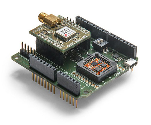
Xsens has expanded its MTi product portfolio with the introduction of the MTi-7, a miniature inertial navigation system (INS) module that uses input from an external GNSS receiver to provide an accurate, real-time position, velocity and orientation data stream.
The module has a compact 12 x 12-millimeter footprint, weighs less than 1 gram and consumes under 100 milliwatts, making it suitable for use in space- and power-constrained devices such as drones, as well as autonomous or remote-controlled mapping and imaging equipment.
Image: Xsens
Operating at output data rates up to 800 Hz, the MTi-7 achieves very low latency of 2 milliseconds, allowing for real-time operation of dynamic functions such as flight control and camera stabilization, the company said.
The module also offers a position and velocity output suitable for the navigation of autonomous ground vehicles in sectors such as smart farming and robotics.
The high performance of the MTi-7 is due to the advanced sensor fusion algorithms developed by Xsens to synchronize the inputs from the module’s onboard accelerometer, gyroscope and magnetometer with the signals from an external GNSS receiver or barometer.
The raw sensor signals are combined and processed at high speed in the MTi-7 module to produce a real-time data stream showing the device’s horizontal and vertical position, velocity, roll, pitch and yaw. This user-friendly data stream may be supplied to a host processor via a standard I2C, SPI or UART interface.
Based on the design of the successful MTi 1-series, the MTi-7 offers a straightforward upgrade path for current MTi-1 users on the same form factor. It is also able to provide heading, positioning and orientation accuracy more commonly found in much larger, heavier and higher power devices.
Image: Xsens
:We are seeing exploding demand for accurate control of autonomous or computer-guided equipment such as drones and smart farming ground vehicles,” said Hein Beute, director of product marketing at Xsens. “With its tiny footprint, light weight and low power consumption, the MTi-7 provides the industry’s best solution for any such application that is limited in terms of space or power but that needs a high degree of accuracy and precision in position and orientation data.’
The MTi-7 module is supported by an Arduino-compatible development kit (the MTi-7-DK), which provides access to the module’s I2C, SPI and UART interfaces via micro-USB connections.
Developers can configure the operation of the MTi-7 via the freely available Xsens MT Software Suite. The MT Software Suite includes a GUI for PCs operating on the Linux or Windows platforms, as well as a full Software Development Kit including example source codes and complete documentation.
MicroStrategy Incorporated, a worldwide provider of enterprise analytics and mobility software, has launched MicroStrategy 10.11, the newest feature release to the company’s MicroStrategy 10 platform.
New capabilities in 10.11 include enhanced mapping for conducting geospatial analytics with Mapbox, a location data platform for mobile and web applications.
Version 10.11 also introduces out-of-the-box visualizations, intelligent recommendations for content, prompts for dossiers and a native MicroStrategy Library app for smartphones.
Library app. Users can now interact with data on dossiers via native apps optimized for iOS and Android smartphones. MicroStrategy customers can to operationalize the platform’s latest and modern interfaces with touch-optimized workflows on these handheld devices. Users can download the MicroStrategy Library app for iPhone by visiting the Apple app store or the MicroStrategy Library app for Android by visiting the Google Play app store, respectively.
Geospatial services powered by Mapbox. MicroStrategy 10.11 introduces MicroStrategy Geospatial Services and delivers new mapping capabilities via a native integration with Mapbox. The new and enhanced map visualization is available for dossiers on all interfaces, including MicroStrategy Desktop, MicroStrategy Workstation, MicroStrategy Web, MicroStrategy Mobile and MicroStrategy Library.
Users can visualize and analyze spatial data with advanced mapping capabilities, including intelligent clustering and aggregation, dynamic layers with interactive zoom and thresholds for attributes. This mapping service is available in addition to out-of-the-box Esri maps, and offers support for markers, bubbles and area types on a variety of map styles.
Geospatial Services features include:
Vector maps that improve performance and response times by 300% over traditional tiled maps, including for millions of records.
Global postal and administrative boundaries that let users bin their data by geographies ranging from Indian postal codes to Chinese prefectures.
Map style options tailored to the user’s visualization, including basic, light, dark, streets, topographic and satellite maps.
Advanced clustering and aggregation capabilities to understand spatial trends in data beyond density.
Full control of data layers and levels of detail based on a map’s zoom level.
Out-of-the-box visualizations. MicroStrategy 10.11 introduces three new visualizations that expand visual analytics capabilities for new use cases. With this latest release, users can plot and interact with data using waterfall, histogram and box plot visualizations, all of which are available out-of-the-box in all MicroStrategy interfaces.
“We are extremely excited about the launch of version 10.11 and all of its powerful new features. Business teams can now confidently take the first step towards establishing an enterprise-wide, data-driven culture on their own,” said Tim Lang, senior executive vice president and chief technology officer, MicroStrategy. “Version 10.11 empowers teams with self-service data discovery and departmental analytics, while creating the foundation for governed data discovery at scale and enterprise-worthy analytics. The latest capabilities available in MicroStrategy 10.11 are central to MicroStrategy’s commitment to deliver the next generation of enterprise analytics and advance our goal of building the ultimate analytics platform for the Intelligent Enterprise.”
To see MicroStrategy 10.11 in action, users can register for the upcoming webcast Unveiling MicroStrategy 10.11, to be held Wednesday, May 16,at 2 p.m. EDT.
Australian geospatial startup Spookfish has won a major Asia Pacific industry award for exporting imaging technology to the North American market.
Spookfish has partnered with U.S.-based EagleView Technology Corporation, a North America provider of aerial imagery, and the two companies have collaborated to develop new technologies to meet the demands of the North American market.
In mid-2017, EagleView placed its first large order for multiple Spookfish platforms following an extensive flight-test program. Spookfish is now building the platform in significant volumes to meet EagleView’s demands.
Meanwhile, rollout of the Spookfish imaging technology for Australian customers is underway. Perth-based Spookfish offers high-resolution imagery of Perth, Melbourne and Adelaide online, with Sydney and Brisbane in the works.
Spookfish’s technology enables rapid imaging of vast areas in high resolution from a multitude of angles at a fraction of the cost of contemporary systems, the company claims. Spookfish aims to use these capabilities to make it easy for organizations of all sizes to gain access to premium imagery content and pervasive 3D models allowing concise, accurate and cost effective decision-making.
The Asia Pacific Spatial Excellence Awards (APSEA) showcase excellence within the spatial industry. Presented at Locate & GeoSmart Asia Conference in Adelaide, Australia, the APSEA award recognizes Spookfish’s success in innovating, commercializing and exporting its imagery capture and processing technology. Spookfish took home the APSEA Export Award after competition from companies around the Asia Pacific region.
“This is an exciting achievement for Spookfish and the beginning of a substantial export opportunity for Australia,” said Spookfish CEO Jason Waller. “The award is a testament to the entire Spookfish team and their ability to research, innovate and successfully bring new technology into operation.
“Spookfish has begun delivering multiple systems to our strategic partner, EagleView Technologies, with the export program generating significant revenue from capture systems and expected future royalty payments.
“More importantly, the partnership with EagleView delivers extensive benefits to our Australian customers because as our world-leading technology continues to develop, it immediately becomes available in the domestic market.”
The U.S. Department of Homeland Security (DHS) has released a memorandum about a GPS rollover event coming in April 2019.
The memorandum, U.S. Owners and Operators Using GPS to Obtain Time, is intended to provide an understanding of the possible effects of the April 6, 2019, GPS Week Number Rollover on Coordinated Universal Time (UTC) derived from GPS devices.
DHS recommends that critical infrastructure and other owners and operators prepare for the rollover. They should:
investigate and understand their possible dependencies on GPS for obtaining UTC;
contact the GPS manufacturers of devices they use to obtain UTC;
understand the manufacturers’ preparedness for the ollover;
understand actions required by CI and other owners and operators to ensure proper operation through the ollover, and
ensure that the firmware of such devices is up to date.
The memorandum is sponsored by the Department of Homeland Security’s National Cybersecurity and Communications Integration Center in coordination with the Department of Homeland Security’s Science and Technology Directorate, the Department of Homeland Security’s National Protection and Programs Directorate Office of Infrastructure Protection and the National Coordination Office for Space-Based Positioning, Navigation and Timing.
GPS World discussed in-depth the previous rollover event in an Innovation column.
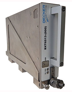
Becker Avionics has received certification for the its BXT65XX Mode S transponder, designed specifically for the rigorous flying environment characteristic of helicopter operations.
Paired with a FreeFlight Systems’ 1203C SBAS/GNSS sensor, the remote-mounted solutions provide helicopter operators a complete and cost-effective way to equip with ADS-B Out to meet the Jan. 1, 2020, mandate.
The system is a part of the company’s robust BXT65XX line of ADS-B Mode S transponders. Manufactured with a standard ARINC 429/743 output, this transponder easily integrates with the FreeFlight Systems Model 1203C SBAS/GNSS sensor for complete ADS-B Out compliance, the company said. It can also be installed either as dual installation for primary transponder interrogations or as single install for a dedicated ADS-B transmission.
The transponder can be installed on aircraft not equipped with a traffic collision avoidance system. Its enhanced privacy settings can disable both ADS-B and Mode S transmissions.
“We are pleased to announce this new milestone in our transponder product line,” said Forrest Colliver, Becker Avionics’ managing director. “This new system showcases how we tailor our compact, robust, and durable avionics to our clients’ requirements in order to provide the best solution for where and how they fly.”
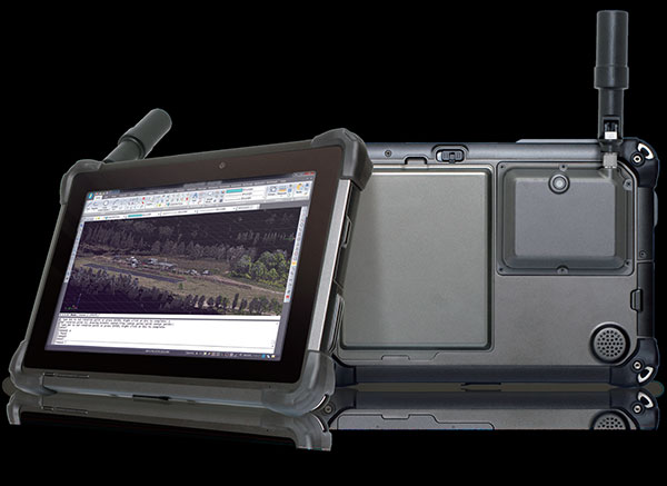
DT Research has released the DT301T rugged RTK tablet (DT301T-RTK), a lightweight military-grade tablet purpose-built for GIS mapping applications. It features real-time kinematic (RTK) satellite navigation to enhance the precision of GNSS position data.
The tablet enables 3D point cloud creation with centimeter-level accuracy, meeting the high standards required for scientific-grade evidence in court.
The DT301T-RTK is a rugged tablet with scientific-grade GNSS. (Photo: DT Research)
The DT301T Rugged RTK tablet is military-grade with an IP65 rating. Because it’s lightweight, the DT301T can be used in the field, office and vehicles, the company said.
A dual-frequency GNSS module is built into the tablet, which uses real-time reference points within 1–2-centimeter accuracy to position 3D point clouds created from aerial photogrammetry, using GPS, GLONASS and Galileo receivers. Users can measure with the RTK GNSS positioning directly using a foldable antenna or connect to an external antenna for more robust receiving and survey-grade precision.
“We’ve seen a dramatic uptick in the need for rugged tablets to be purpose-built for a range of mapping uses across industries,” said Daw Tsai Sc.D., president of DT Research. “In designing the DT301T with RTK satellite navigation, we also took into consideration the other features and capabilities necessary within a rugged tablet to quickly and easily conduct forensic mapping, land surveying, e-construction, building information modeling (BIM) and other mapping scenarios.”
The DT301T is compatible with existing GIS software for mapping applications and brings together the advanced workflow for GIS data capture, accurate positioning and data transmitting.
Uses
According to DT Research, the tablet can be used in a variety of scenarios.
Forensic mapping. Public safety teams, investigators and crash reconstructionists can use the DT301T Rugged RTK tablet to accurately collect measurements that are scientifically defensible by using the real-time centimeter reference points to position 3D point clouds created from aerial photogrammetry or take stand-alone measurements.
DT301T-RTK tablet during forensic mapping training. (Photo: DT Research)
The results will have the precision necessary to stand up as evidence in court, said Andrew S. Klane, a former Massachusetts State Police Lieutenant who teaches Forensic Mapping and is now the chief operating officer at Forensic Mapping Solutions Inc.
“As more drones are being used for mapping, there is a growing need for ground-control positioning devices,” Klane said. “By using a DT301T Rugged RTK Tablet in combination with a drone, users can more quickly and cost-effectively create a 3D model to deliver an accurate representation of the scene with scientific-grade tolerance that will hold up in a court of law.”
It could also help clear crash scenes faster, restoring the normal flow of traffic on congested roadways, reducing secondary crashes and lowering the chance of first responders and other workers getting hurt while clearing the scene.
Land surveying. Surveyors can use the DT301T tablet to measure the altitudes, angles and distances on the land surface so that they can be accurately plotted on a map to determine property boundaries, construction layout and mapmaking.
E-construction. Construction workers can manage the collection, review, approval and distribution of highway construction contract documents in a paperless environment using the DT301 tablet.
Building information modeling (BIM). Architecture, engineering, and construction (AEC) professionals can use the tablet to create 3D models to efficiently plan, design, construct and manage buildings and infrastructure.
FEATURES
The DT301T Rugged RTK tablet has been purpose-built for precision mapping in a variety of environments and includes the following features and capabilities:
Dual-frequency GNSS module: GNSS L1 and L2 RTK that receives GPS, GLONASS and Galileo signals up to 372 channels with RMS 10 mm + 1 ppm accuracy.
High-performance CPU and Windows OS: Intel 6th-generation core i5 or i7 processor with Microsoft Windows 7 Professional or Windows 10 IoT Enterprise. Units come with either 8 GB or 16 GB of RAM.
Sunlight-readable display: A 10.1 inch LED-backlight, sunlight-readable screen with capacitive touch and 1920 x 1200 resolution.
Wireless connectivity: Long-range Class 1 Bluetooth powers connectivity up to 1,000 feet and 4G mobile broadband for LTE, HESPA+, GMS/GPRS/EDGE, EV-DO, Rev A and 1xRTT.
Storage: For field data collecting, the tablet can store up to 1 terabyte of data.
Military standards: The tablet is fully ruggedized to meet the highest durability standards with an IP65 rating, MIL-STD-810G for vibration and shock resistance, and MIL-STD-461F for EMI and EMC tolerance.
Battery pack: High-capacity hot-swappable battery pack delivers 60 or 90 watts for up to 15 hours of continuous mobile communications.
Accessories: Those available include external antennas, pole mount cradles, detachable keyboards, battery charging kits and digital pens.
A: The availability and quality of GPS in the application is critical. Industrial-grade MEMS IMUs can provide survey-grade performance when high-quality GPS is continuously available, but even tactical-grade MEMS cannot provide more than a couple of minutes of GPS-denied navigation. The level of integration between the two technologies is also important. Even comparing two systems using the same sensors, the performance is highly dependent on the ability of the system designer to leverage their respective strengths.
A: Successful integration of inertial sensors with GNSS requires understanding both the goals and environment of the application. Consider the required accuracy of attitude and position, severity of GNSS obstructions, expected dynamics and environmental conditions. Tradeoffs in size, power and cost narrow the choices, but achieving the desired performance is more nuanced. Data sheets for IMUs can also be notoriously difficult to compare. My advice is to focus on the goals and listen to the experts.
A: There is a clear need for reliable consumer-grade GNSS/INS in GNSS-degraded environments. In this case, two key aspects are: removal of measurement outliers, mostly caused by multipath; and adequate modeling of inertial errors. The first aspect is efficiently addressed via residual monitoring, especially with GNSS carrier phase. A 15-state INS error model is generally sufficient. Yet, modeling parameters and contribution of other terms such as axis misalignment must be evaluated using test data.
By Yanming Feng and Charles Wang,
Queensland University of Technology, Australia,
and
Charles Karl, Australia Road Research Board, Australia /
Presented at ION International Technical Meeting 2018
Connected vehicle safety and traffic applications depend on communication, position and velocity information to function. However, road users may have different vehicle communicating and positioning capabilities. Further, the performance of communicating and positioning could vary from time to time and location to location.
The vehicle safety system must be fully aware of the performance of vehicle positioning outputs and warn drivers when the positioning system cannot be used for the intended level of safety applications. Minimum operational performance standards about positioning have not been established in the road community.
This paper reviews and develops the required navigation performance parameters for vehicle positioning capability in terms of accuracy, integrity, timeliness and interrogability of positioning solutions.
It attempts to adjust the integrity performance parameters for vehicle safety positioning and provide the analysis for integrity risk, protection level and different alert limits. It introduces the error ellipse representation to visualize the protection bubble area of each vehicle on the road. Experimental results demonstrate how different capability levels meet different integrity alarm limits.
 Mapping company NavVis has launched the M6, a next-generation indoor mobile-mapping system that the company says can overcome the scalability and data quality constraints of reality capture technology.