Author: Tracy Cozzens

  • CGSIC meeting material available for download

    CGSIC meeting material available for download

    CGSIC logo

    By Rick Hamilton, CGSIC Executive Secretariat, U.S. Coast Guard Navigation Center

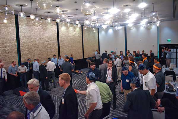
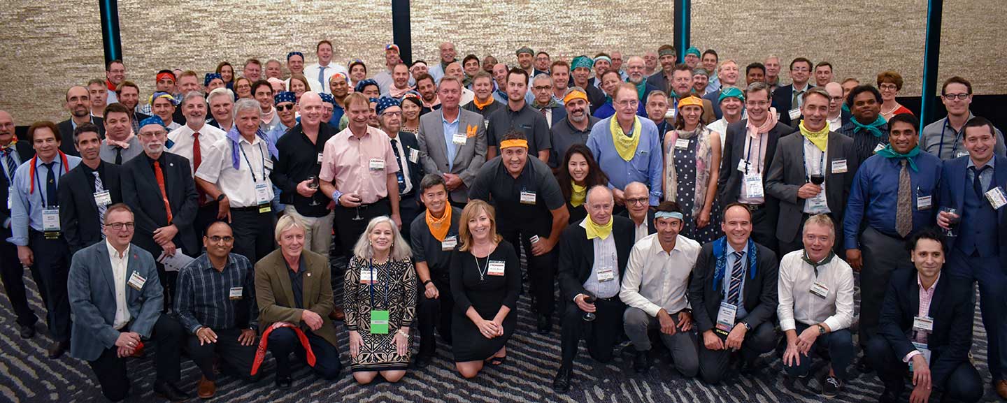
    The 59th meeting of the U.S. Civil GPS Service Interface Committee was held Sept. 16-17 at the Hyatt Regency Miami hotel in Miami, Florida, in conjunction with the Institute of Navigation’s GNSS+ (ION-GNSS+) conference.

    For readers who were unable to attend, a synopsis of the meeting is provided below. The full agenda and presentations are available for download from the GPS.gov website.

    The meeting of the CGSIC is an annual event, free and open to the public, conducted to provide updates from U.S. GPS program officials and ensure effective information exchange between the U.S. government and civil GPS users.

    The two-day meeting is hosted by the U.S. Department of Transportation (DOT) and the Coast Guard Navigation Center (NAVCEN). DOT serves as the civil lead for GPS and chairs the CGSIC in this capacity. NAVCEN is assigned duties as Deputy Chair and Executive Secretariat for the CGSIC.

    Engaging sessions were conducted throughout the day of Sept. 16 for the CGSIC Timing, Surveying Mapping and Geo-Sciences, and International Information Subcommittees. The plenary session of the full committee was held on Sept. 17.

    Keynote. Diana Furchtgott-Roth, deputy assistant secretary, Office of the Assistant Secretary for Research and Technology, U.S. Department of Transportation provided the keynote for this year’s plenary session.

    She conveyed to the audience the importance of the U.S. GPS for transportation safety and numerous other civil applications and that its spectrum must be protected from harmful interference.

    However, given threats from jamming and spoofing, the U.S. is committed to leading the world in positioning, navigation and timing (PNT) and to building and using the best possible PNT solutions to maintain resiliency.

    James Platt, director at the PNT Program Management Office of the U.S. Department of Homeland Security, highlighted the need to understand cyber vulnerabilities in critical infrastructure supply-chain management.

    The meeting included many other interesting briefings related to the status of the U.S. GPS program and the use of GPS around the world, including presentations from the National Space-Based PNT Coordination Office, U.S. Air Force, State Dept., FAA, DOC and NASA.

    Presentations during the plenary session focused on the operational status of the GPS constellation and ground control system modernization, U.S. Space-Based PNT policy, GPS augmentation systems, U.S. engagement with other international GNSS providers, as well as a variety of topics related to the status and progress of ongoing GPS programs in the U.S. government.

    If you have suggestions for topics to include in upcoming CGSIC meetings, would like to present a topic, or if you found information from past meetings useful and would like to hear more, contact Hamilton via the Navigation Center “contact us” form. Be sure to select “Civil GPS Service Interface Committee (CGSIC)” from the pull-down menu.

    From a GPS operational perspective, civilian non-aviation users can submit GPS-related inquiries or report signal interference or degradation to the U.S. Coast Guard Navigation Center online or to the 24 hour watch desk at 703-313-5900.

    Civil aviation users within the United States should contact the Federal Aviation Administration for GPS user support. The GPS Operations Center at Schriever Air Force Base, Colorado, is the lead in the Department of Defense for operational issues and questions from military users of GPS.

  • FAA grants CMC Electronics approval for ADS-B Out compliance solutions

    FAA grants CMC Electronics approval for ADS-B Out compliance solutions

    The U.S. Federal Aviation Administration (FAA) has approved two Supplemental Type Certificates (STCs) for CMC Electronics, to help airplanes comply with automatic dependent surveillance-broadcast out (ADS-B Out) requirements.

    Boeing 737 Next-Generation Aircraft

    CMA-5024. (Photo: CMC Electronics)
    CMA-5024. (Photo: CMC Electronics)

    The FAA has approved an STC to install the SBAS-capable CMA-5024 GPS on Boeing 737 Next-Generation aircraft to comply with worldwide ADS-B Out mandates as well as SBAS/GPS navigation enabling the first localizer performance with vertical guidance (LPV) approaches for B737NGs.

    CMC’s solution, developed in collaboration with the FAA’s Navigation Programs office, offers operators the advantage of a cost-effective alternative to replacing their current multi-mode receiver (MMR).

    The CMA-5024 is an approved DO-260B ADS-B Out positioning source that may be paired with any DO-260B compliant transponder, allowing operators to meet FAA and EASA ADS-B Out requirements, the UAE’s ADS-B Out and RNP requirements mandated by GCAA as well as India’s GAGAN requirements.

    The CMA-5024 is the only solution available that is approved to introduce LPV on B737NG aircraft. With the CMA-5024, the B737NG aircraft can take advantage of satellite-based augmentation system (SBAS) navigation throughout all phases of flight.

    An LPV approach is the highest precision GPS instrument approach available not requiring specialized crew training. It aims to reduce costs associated with flight delays or cancellations and provides airlines with a safe approach into airports when ILS is unavailable.

    The CMA-5024 meets the requirements for an IFR civil certified GNSS and is compatible with all SBAS systems operating around the world such as WAAS, EGNOS, GAGAN and MSAS. SBAS augments GPS to provide an extremely accurate navigation solution throughout all phases of flight, from departure to en-route, through LPV CAT-l equivalent approach. The CMA-5024 complies with published Communication Navigation Surveillance/Air Traffic Management (CNS/ATM) navigational mandates.

    EASA approval of the STC is in progress. Future growth to GBAS GLS precision approach capability can be obtained by upgrading to CMC’s new CMA-6024 GPS/SBAS/GBAS receiver system.

    For Business Jets

    CMC Electronics and DAC International received an FAA STC (ST00934DE) for aircraft equipped with Honeywell’s Primus II avionics suite.

    The new STC provides a low-cost alternative to upgrading the existing onboard Honeywell equipment while meeting the DO-260B ADS-B Out worldwide mandate. This is achieved by replacing the existing non-compliant Primus II transponder with the Becker BXT6553 Diversity Transponder, paired with CMC Electronics’ CMA-3024 GPS/SBAS (GNSSU) receiver.

    The STC extends the operating life of a broad range of aircraft such as Bombardier’s Challenger 600 series, Hawker 800/800XP, Learjet 45, Gulfstream G-IV and GIV-X, Cessna Citation II and V, and many more.

    This is the latest addition to already existing STCs (ST03424CH and ST04159CH), which pair CMC’s CMA-3024 with the Rockwell Collins TDR-94/94D or Honeywell RCZ-8XX Primus II Com/Transponder to meet the DO-260B ADS-B Out standards mandated by the UAE’s GCAA, FAA and EASA for 2020.

    Claude Chidiac, Vice President, Sales and Marketing, at CMC Electronics said: “These STCs bring together the best that CMC and DAC have to offer to economically support business jet operators. They combine the respective technological strengths of both companies, namely the most advanced GPS receiver with DAC’s worldwide distribution channels and FAA approved kits. Our joint ADS-B Out solutions deliver high integrity and the cost-effectiveness that business aviation has been waiting for.”

    The CMA-3024 aviation sensor provides fully ADS-B compliant SBAS/GPS primary means navigation for business, regional, commercial air transport and helicopter aircraft. It is fully compatible and operational with all SBAS signals worldwide.

    With SBAS coverage, differential corrections are incorporated to further improve RNP capability, providing RNP0.1 with outstanding navigation system availability.

    Full installation kits, including the CMA-3024 and STC package, are provided by DAC International.

  • AgilLOC antenna element combats GNSS jamming at sea

    With the proliferation of jamming devices readily available, maritime vessels need to be situationally aware of GNSS interference and disruption. The threat of GNSS jamming is made even more critical in situations that require navigation through narrow straits under poor visibility, with no sea lane markers in sight.

    Case in point being the British-flagged oil tanker Stena Impero, which was seized by Iran’s Revolutionary Guards while sailing through the Strait of Hormuz. Iranian Islamic Revolutionary Guard Corps stated that Stena Impero had taken a wrong route when entering the Strait of Hormuz.

    This happened during a time when an advisory warning by the U.S Maritime Administration had already been released, stating that vessels operating in the Persian Gulf, Strait of Hormuz and Gulf of Oman may encounter GPS interference, bridge-to-bridge communications spoofing or other communications jamming with little to no warning.

    This episode could have been avoided if better awareness of the navigation system was employed.

    Jamming protection at sea. ST Engineering has developed AgilLOC Antenna Element Compact (AEC), which provides GNSS protection against three simultaneous jamming/interference sources with its adaptive nulling algorithm for the maritime sector, ensuring continuous GNSS protection to connected systems.

    AgilLOC AEC was designed for easy integration with new or existing legacy systems that required uninterrupted GNSS reception. Despite its lightweight and compact design, AgilLOC AEC provides a robust response to narrow and wideband interference, the company said.

    When disruption happens. In a disruption, the crew onboard can only rely on radar or cross bearings using compass, terrestrial radio navigation or even sextants.

    The loss of GNSS input to the ship’s surface search radar, gyro units and electronic chart display and information system (ECDIS) will result in a lack of GNSS data for position fixing, radar over ground speed inputs, gyro speed input as well as the loss of collision avoidance capabilities on the ECDIS radar display. It is imperative that all ship’s crew are aware of the status of their GNSS reception.

    Many GNSS receivers currently installed onboard vessels do not provide for jamming monitoring or mitigation. Deliberate or unintentional GNSS inference are becoming more prevalent, increasing the risk of receivers being overwhelmed by elevated levels of interferences.

    Satellite navigation is essential for all maritime applications under all weather conditions. The AgilLOC AEC protects the GNSS signals for a smooth navigation and precision landing alongside with other navigational systems.

  • UN, Geospatial Media cooperate on geospatial infrastructure

    Letter signed to advance role of geospatial knowledge infrastructure in global society and economy

    Geospatial Media & Communications has signed a letter of cooperation with the United Nations Statistics Division (UNSD) to work together to advance the role of geospatial knowledge infrastructure in global society and economy.

    Consistent with their respective mandates, the UNSD and Geospatial Media will collaborate to carry out activities related to their common objective of demonstrating the value of global geospatial knowledge, the data ecosystem, public-private partnerships, and their contribution towards building Geospatial Knowledge Infrastructure and the Global Development Agendas.

    The agreement was signed by Stefan Schweinfest, director, UNSD, Department of Economic and Social Affairs, and Sanjay Kumar, CEO, Geospatial Media, in New York on Oct. 31.

    “The United Nations 2030 Sustainable Development Agenda is ambitious and requires countries to have solid national information systems to successfully stir the process of implementation. It is a central task of my office, the United Nations Statistics Division, to support countries in building the necessary national information capacities, both in the area of statistics and geospatial information. For this challenging task we need the cooperation of the private sector through well established public-private partnerships. Geospatial Media & Communications is a unique partner in this respect, due to its global reach and its in-depth knowledge and understanding of country needs. I am, therefore, delighted to cooperate with them closely in the coming years,” said Mr. Schweinfest.

    “Pursuing its vision to make a difference through geospatial knowledge in world economy nad society, Geospatial Media has been evangelizing geospatial industry globally for over two decades through research, advocacy, media and knowledge exchange platforms. It has contributed in the formation and strengthening of several institutions, including the Association of Geospatial Industries (AGI), World Geospatial Industry Council (WGIC), UNGGIM Private Sector Network and the National Think Tank on Geospatial Strategy for New India. Through this collaboration, our intent is to further our vision to showcase high level value of geospatial knowledge in global development agenda and facilitate alignment and evolution of geospatial stakeholders with emerging socio-economic development models in the fourth Industrial age,” said Mr. Sanjay Kumar.

    The intended collaboration will focus on a number of common objectives at national, regional and global levels which will include:

    1. Working together to create joint programs and projects to develop geospatial knowledge infrastructure, networks and human resource capacities;
    2. Assessment of the prospective role of geospatial knowledge infrastructure in global society and economy;
    3. Collaboratively developing broader methods, guidelines, architectures and policy frameworks for the adoption, utilisation and benefits of geospatial knowledge infrastructure;
    4. Develop documents, training modules and other resources to assist National Geospatial Information Agencies in their transformation and modernization aspirations in alignment with the national to global vision of the Integrated Geospatial Information Framework;
    5. Facilitate a collaborative knowledge exchange and engagement atmosphere between the commercial geospatial industry, national geospatial agencies, and the broader user industries and civil society, towards developing public-private partnership models for co-creating geospatial knowledge infrastructure and strengthening of industry and institutional capacities; and
    6. Advocate, communicate and promote the value and utility of geospatial information and enabling technologies for sustainable development.
  • First Fix: The PNT enterprise is real

    First Fix: The PNT enterprise is real

    Jules McNeff
    Jules McNeff

    Guest column by Jules McNeff
    Consultant and GPS World Editorial Advisory Board member

    GPS World publications are evolving, as this new column confirms. And the PNT world itself is evolving, first with the emergence of GPS in the 1990s, next with its universal adoption and duplication by others, and now with its foundational role in PNT-enabled applications for technologies of the 2020s and beyond.

    Millions of people have grown up in a world where GPS-enabled PNT applications pervade their daily lives, and mostly for the better. But GPS is no longer the only face of PNT around the world, though it is still the best known even as other space-based systems from international providers have joined the party.

    From its infancy, GPS was married with inertial systems and clocks. For a short time, GPS emergence stymied the commercial development of both, but as the viability of the marriage was validated, development turned toward miniaturization of the combination and adding more pieces as well.


    It is now clear that GPS was the spark, and a multi-faceted PNT enterprise is the new reality.


    Because of its free availability, GPS has been the foundational element in most of these integrated applications, and without GPS, many will not work as well — or at all. Consequently, dependence on GPS for efficient operation of many PNT-related activities has become a de facto reality. GPS timing is at the heart of interoperable telecommunications and data networks (most notably the internet) and of modern power grids. GPS positioning was the catalyst for adoption of the U.S. National Grid as a federal spatial interoperability standard for search-and-rescue and emergency response and by the SAE as a standard for commercial land mobility as well.

    However, dependencies create vulnerabilities, and over-reliance on GPS has been cited as a potential Achilles heel for both national security and economic critical infrastructure. Efforts have been under way for several years by the U.S. Air Force to strengthen all aspects of GPS and, more recently, much attention has focused on making use of complementary technologies to increase the resilience and performance of integrated PNT devices.

    Smartphone and autonomous vehicle developers have used such techniques for years to augment GPS for their applications. The awareness of value from ubiquitous access to precise position and time that was awakened by GPS in 1995 has now evolved into an understanding that diverse services from a broader PNT enterprise are necessary to preserve that access with assurance into the future.

    Congress and the DoD have recognized that reality, with Congress directing and DoD implementing a DoD PNT Enterprise Oversight Council to manage future acquisition of PNT capabilities for the military. In August, the Department of Defense (DoD) also released a public version of its Strategy for the DoD PNT Enterprise, highlighting the processes it has created to implement resilient PNT for the Joint Force. Congress and the White House both have also recognized that the imperative for resilient PNT must be extended to domestic critical infrastructure, and this has resulted in direction to civil federal agencies to both strengthen and back up GPS use for their constituencies. It is now clear that GPS was the spark, and a multi-faceted PNT enterprise is the new reality.

  • GPS World honors leaders in GNSS/PNT

    GPS World honors leaders in GNSS/PNT

    On Sept. 19, in conjunction with the ION GNSS+ conference, GPS World hosted its annual Leadership Awards dinner. Five honorees — chosen by a panel of GNSS experts — were recognized for their outstanding recent contribution or achievement in four categories: Satellites, Signals, Services and Products.


    SATELLITES AWARD: Presented by Johnathan Caldwell (left) to Mark Crews, both of Lockheed Martin. Crews accepted on behalf of Tim Hartman. (Photo: GPS World)
    SATELLITES AWARD: Presented by Johnathan Caldwell (left) to Mark Crews, both of Lockheed Martin. Crews accepted on behalf of Tim Hartman. (Photo: GPS World)

    Satellites Award

    TIM HARTMAN: Satellites Award winner
    TIM HARTMAN: Satellites Award winner

    Tim Hartman, Chief Engineer, Military Space Programs, Lockheed Martin

    Hartman was recognized for serving as the program manager for GPS IIRM and GPS III Space Segments. Tim’s leadership and program dedication helped support the U.S. Air Force’s decision to declare GPS III ready for launch on Oct. 17, 2017.

    Sponsor: Lockheed Martin

    On Aug. 22, Lockheed Martin Space celebrated the successful launch of the second of up to 32 next-generation GPS III/IIIF satellites that the U.S. Air Force contracted the company to design and build. Lockheed Martin’s commitment to positioning, navigation and timing can be found in the exemplary performance of the 18 Lockheed Martin-built GPS IIR and IIRM satellites that are a proud part of today’s 31-satellite GPS constellation. The company also is proud to support the Air Force with its continued sustainment of the current GPS Operational Control Segment.


    SIGNALS AWARD: Presented by Joe Rolli of L3Harris (left) to Ramsey Faragher. (Photo: GPS World)
    SIGNALS AWARD: Presented by Joe Rolli of L3Harris (left) to Ramsey Faragher. (Photo: GPS World)

    Signals Award

    Ramsey Faragher, Founder and CEO, Focal Point Positioning

    Focal Point Positioning’s new supercorrelator approach to indoor and urban GNSS signal processing could revolutionize smartphone-based GNSS. New signal processing methods for the correlation stage of a GNSS receiver enable several seconds of coherent integration while the receiver is undergoing dynamic motions. This improves accuracy and integrity, and provides anti-spoofing and spoofer-localization capabilities — without hardware changes or requiring access to encrypted signals.

    Sponsor: L3Harris

    L3Harris Technologies is an agile global aerospace and defense technology innovator, delivering end-to-end solutions that meet customers’ mission-critical needs. The company provides advanced defense and commercial technologies across air, land, sea, space and cyber domains. L3Harris has approximately $17 billion in annual revenue and 50,000 employees, with customers in 130 countries.


    SERVICES AWARD: Presented by Mike Shepherd of Collins Aerospace (back) to Simon Banville (front left) and Denis Laurichesse. (Photo: GPS World)
    SERVICES AWARD: Presented by Mike Shepherd of Collins Aerospace (back) to Simon Banville (front left) and Denis Laurichesse. (Photo: GPS World)

    Services Award

    Denis Laurichesse, Navigation Systems Department Expert, Centre National d’Études Spatiales (CNES)

    Simon Banville, Senior Geodetic Engineer, Natural Resources Canada (NRCan)

    Laurichesse and Banville demonstrated instantaneous, centimeter-level, multi-frequency precise point positioning (PPP). Their work shows PPP might become, within a few years, a practical alternative to real-time kinematic (RTK) for a wide range of applications.

    Sponsor: Collins Aerospace

    Collins Aerospace Systems, a unit of United Technologies Corp., is a leader in technologically advanced and intelligent solutions for the global aerospace and defense industry. Created in 2018 by bringing together UTC Aerospace Systems and Rockwell Collins, Collins Aerospace has the capabilities, comprehensive portfolio and expertise to solve customers’ toughest challenges and meet the demands of a rapidly evolving global market.


    PRODUCTS AWARD: Accepted by Paul Alves (left) from presenter Jeff Martin of NovAtel. (Photo: GPS World)
    PRODUCTS AWARD: Accepted by Paul Alves (left) from presenter Jeff Martin of Spirent Federal Systems. (Photo: GPS World)

    Products Award

    Paul Alves, P.Eng, Ph.D., Technology Manager — Correction Services, NovAtel, part of Hexagon

    Alves was recognized for his work on localization of interference sources for GNSS users leveraging the Interference Tool Kit. With the ITK, users can detect and mitigate adversarial jamming of GNSS signals, as well as unintentional interference from external sources.

    Sponsor: Spirent Federal

    Spirent has more than 30 years of experience delivering the world’s best test equipment. Spirent’s test solutions for GPS and GNSS, critical infrastructure SCADA vulnerabilities, Internet L3-L7 common vulnerabilities and exposures, and mobile vulnerabilities allow the world to communicate and collaborate faster. Spirent Federal Systems is a wholly owned subsidiary of Spirent Communications and was established to offer the world’s leading simulation equipment to U.S. government customers, armed services, education institutions, and prime contractors. Spirent Federal’s SimMNSA was the first to be granted Security Approval by the Global Positioning System Directorate.


    PNT CHAMPS: The L3Harris team earned the most total points in all six games, and took home a trophy each. (Photo: GPS World)
    PNT CHAMPS: The L3Harris team earned the most total points in all six games, and took home a trophy each. (Photo: GPS World)

    PNT Games

    After dinner, guests broke into teams to test their personal positioning, navigation and timing skills, precisely determined by their ability to toss rings and throw horseshoes under time pressure. Each team rotated through yard games such as ladder toss, ring toss, corn hole and horseshoes to prove who was the most accurate and resilient. The L3Harris team took home the first-place prize.

    RAINBOW CONNECTION: Taking on giant pong are members of the rainbow bandana team, (from left) Sanjeev Gunawardena, Thomas Pany, Steffen Thoelert and André Hauschild. (Photo: GPS World)
    RAINBOW CONNECTION: Taking on giant pong are members of the rainbow bandana team, (from left) Sanjeev Gunawardena, Thomas Pany, Steffen Thoelert and André Hauschild. (Photo: GPS World)
    ORGANIZED CHAOS: Wearing different-colored bandanas, teams cheer on their team members and fight for every point. (Photo: GPS World)
    ORGANIZED CHAOS: Wearing different-colored bandanas, teams cheer on their team members and fight for every point. (Photo: GPS World)
    After all the awards were given, everyone got together for a memorable group photo. (Photo: GPS World)
    After all the awards were given, everyone got together for a memorable group photo. (Photo: GPS World)


  • Webinar talks GNSS final frontier — space

    A free GPS World webinar on Nov. 21 tackles a new frontier, if not the final one, for GNSS. “Developments in Space GNSS Navigation,” sponsored by NovAtel, brings together experts from NASA, ESA, NovAtel and Spire (the CubeSat company) to discuss how they’re taking GNSS capabilities beyond Earth’s boundaries.

    Navigating through space has long proven to be challenge for aerospace engineers and professionals because of the complex combination of technology and cost required for success.

    However, with advancements in GNSS and receiver technology, organizations and nations around the world are increasingly interested in space exploration activities.

    Today, the space industry is seeing GNSS technology used in low-Earth orbit (LEO) and highly elliptical orbit scenarios.

    In this webinar, speakers from NASA, ESA (the European Space Agency), NovAtel and Spire will examine emerging trends regarding the usage of GNSS technology in the space industry, including an increasing need for situational awareness while navigating through space and the ability to service satellites while in orbit.

    These experts will also provide a look into their own experiences with a variety of ambitious space projects and applications.

    Speakers include:

    • Werner Enderle, Head of Navigation Support Office, ESA European Space Operations Center
    • Benjamin Ashman, Aerospace Engineer, NASA
    • Erin Kahr, Critical Safety Systems, NovAtel
    • Dallas Masters, GNSS Program Manager, Spire

    Date: Thursday, November 21, 2019
    Time: 1 p.m. EST / 10 a.m. PST / 7 p.m. (1900h) Central European Time

    Learn details of the webinar, or register for free.

  • China launches a new BDS-3 satellite

    China launches a new BDS-3 satellite

    China sent a new satellite of the BeiDou Navigation Satellite System (BDS) into space from the Xichang Satellite Launch Center in Sichuan Province at 17:43:04.482 UTC on Nov. 5.

    Launched on a Long March-3B carrier rocket, it is the 49th satellite of the BDS satellite family and the 24th satellite of the BDS-3 system.

    It also marked that a total of three BDS-3 satellites have been sent into the inclined geosynchronous Earth orbit.

    The launch was the 317th mission for the Long March series of carrier rockets.

    The new satellites and the carrier rocket were developed by the China Academy of Space Technology and the China Academy of Launch Vehicle Technology, under the China Aerospace Science and Technology Corporation.

    China will launch another six BDS-3 satellites to complete the BDS global network.

    A new BeiDou satellite is launched from the Xichang Satellite Launch Center in southwest China's Sichuan Province on Nov. 5. (Photo: Liu Xu/Xinhua)
    A new BeiDou satellite is launched from the Xichang Satellite Launch Center in southwest China’s Sichuan Province on Nov. 5. (Photo: Liu Xu/Xinhua)
  • New Trimble R12 receiver boosts surveying performance

    New Trimble R12 receiver boosts surveying performance

    Photo: Trimble
    Photo: Trimble

    Trimble has introduced the the R12 GNSS receiver, a high-performance GNSS surveying solution. Powered by a new real-time kinematic (RTK) and Trimble RTX positioning engine, it features Trimble ProPoint GNSS technology that empowers land surveyors to quickly measure more points in more places than previously.

    Surveyors who work in challenging GNSS environments can use the Trimble R12 receiver to help reduce both the time in the field and the need for conventional techniques such as using a total station.

    The new Trimble ProPoint GNSS technology allows for flexible signal management, which helps mitigate the effects of signal degradation and provides a GNSS constellation-agnostic operation.

    In head-to-head testing with the Trimble R10-2 in challenging GNSS environments such as near and among trees and built environments, the Trimble R12 receiver performed more than 30 percent better across a variety of factors, including time to achieve survey precision levels, position accuracy and measurement reliability.

    “As a leader in the field of GNSS technology and innovation, Trimble dedicated many years of intensive research into developing the Trimble R12,” said Ronald Bisio, senior vice president of Trimble Geospatial. “This has culminated in a first-class solution, which enables our users to extend the reach of their systems to places where other RTK GNSS systems experience degraded performance.”

  • “Unacceptable! Never again!”: EC Deputy on Galileo outage

    “Unacceptable! Never again!”: EC Deputy on Galileo outage

    Pierre Delsaux speaks at an EU breakfast on space policy . (Photo: European Union)
    Pierre Delsaux speaks at an EU breakfast on space policy . (Photo: European Union)

    Responding to a suggestion about the Galileo outage this past summer to the effect of “these things happen,” a senior European Commission (EC) official pushed back strongly, calling the event “Unacceptable!” and vowing “Never again!”

    The comments by Pierre Delsaux came during a question-and-answer session at breakfast hosted by the European Union on “EU Space Policy: Trends for the Future.” The breakfast was held as a parallel event to this year’s International Astronautics Conference in Washington, D.C.

    Delsaux is the European Commission Deputy Director General in charge of space and defense industries. In his presentation, Delsaux described the success of a number of European space initiatives, stressing civilian use and applications and how they have benefited the world.

    His comments highlighted a principle difference between Galileo and other GNSS systems including its being built and operated by an entirely civilian organization. With an accuracy of 20 centimeters, it exceeds other GNSS, he said. Also, that Galileo signals can be authenticated and trusted.

    Delsaux’s remarks were especially pertinent and timely being made this week in the United States. A strategy document recently made public by the U.S. Department of Defense states that civil dependence on GPS has limited its use as a military tool. Because of this, new military PNT technologies will be “increasingly classified,” which is understood to mean “not shared with civil users.”

    During the question-and-answer period, Delsaux was asked about criticism in the press this summer related to Galileo’s multi-day outage. European media outlets commented about poor communications and a lack of transparency during the outage, and the absence of a terrestrial backup system for when space is not available.

    Rejecting the idea that such outages might be expected in such a difficult undertaking, Delsaux said that the event was unacceptable and “never again!”

    While admitting things can always be done better, he thought that, given what was known with certainty at the time, a reasonable amount of information was made available.

    Subsequent investigation has shown that the primary cause was an initial human error compounded by that person not taking the right corrective action.

    Even with these compounded errors Galileo service would still not had been impacted, but for the mischance that this happened when a backup site was temporarily out of service.

    Going forward, the European Commission is committed to being as transparent as possible about the results of the investigation, given security constraints.

    Reinforcing the transparency message, other EC officials mentioned separately that Galileo personnel had given presentations about the outage at a recent Institute of Navigation Conference in Miami.

    Delsaux did not respond to press criticism over a lack of a backup system (the title of a Der Spiegel article about the Galileo failure translates as “Who relies on a single system is stupid!”).

    Later, other EC officials observed that that the European Radionavigation Plan recognizes that for critical applications, it is broadly accepted that GNSS, even multi-constellation and multifrequency, should not be the unique source of PNT information. For those applications, a complementary, alternative or backup solution should be maintained or developed.

    The EC is still developing its approach to this issue.

  • Raytheon upgrades WAAS with GEO 6 payload

    Raytheon upgrades WAAS with GEO 6 payload

    Photo: Nieuwland Photography/Shutterstock
    Photo: Nieuwland Photography/Shutterstock

    Raytheon has delivered the Wide Area Augmentation System Geosynchronous Earth Orbiting 6 satellite navigation payload to the U.S. Federal Aviation Administration (FAA) to broadcast the WAAS message, which corrects errors in GPS satellite signals, provides expanded coverage, improves accuracy and increases reliability.

    The WAAS GEO 6 payload is now operational and fully integrated into the WAAS network, working with two other WAAS satellite payloads already in orbit.

    The SES-15 satellite hosting Raytheon’s WAAS GEO 6 payload was launched in 2017 and completed extensive system integration in July 2019.

    GEO 6 replaces an older WAAS geostationary satellite that had reached its end-of-service life.

    About WAAS. Developed and installed by Raytheon for the FAA, WAAS is a North American satellite-based augmentation system that increases GPS satellite signal accuracy for precision approach at 200 feet altitude to meet strict air navigation performance and safety requirements for all classes of aircraft in all phases of flight.

    WAAS contains space and ground equipment that works together to identify GPS satellite corrections.

    Operational since 2003, the WAAS network consists of three geostationary satellites and 49 terrestrial-based stations dispersed across the continental U.S., as well as Alaska, Canada, Hawaii, Puerto Rico and Mexico.

    “Never has a consistent and precise GPS signal been more critical to ensuring safety of flight,” said Matt Gilligan, vice president of Raytheon’s Intelligence, Information and Services business. “As the airspace increases in complexity, there is absolutely no room for error.”

    To learn more about Raytheon’s portfolio of air traffic management solutions, visit here.

  • MicroSurvey CAD 2020 released

    MicroSurvey CAD 2020 released

    Photo: MicroSurvey
    Photo: MicroSurvey

    MicroSurvey has released MicroSurvey CAD 2020. MicroSurvey CAD is powered by the latest IntelliCAD 9.2 engine, providing users with unencumbered survey drafting and calculation workflows, including COGO, point tools for gridline-based projects, traverse input and adjustment, misclosure reporting, common data collector support, 3D surface representation and computation, corridor design, point cloud management and more.

    MicroSurvey CAD is perpetually licensed and is powered by IntelliCAD, which is compatible with AutoCAD drawing files. With five available feature levels — Basic, Standard, Premium, Ultimate and Studio — MicroSurvey CAD gives users the choice between several tiers of features to ensure they are getting precisely the tools and price point they need.

    Notable improvements in MicroSurvey CAD 2020 include:

    • IntelliCAD 9.2 which includes full support for AutoCAD 2018-2020 .dwg files, performance enhancements, new BIM tools, a block editor, start page, drawing cleanup tools, selection cycling, digital signatures, and much more;
    • Arc Labels have been drastically improved to utilize ArcAlignedText objects, which can be slid along an arc or polyline arc, in/out from the radius point, flipped upside down, and detected in the Lot Closure routine. Text on Arc also utilizes the ArcAlignedText objects to be editable as a single entity;
    • Upgraded CSMap Library includes over 125 new coordinate systems for Africa, Asia, Europe, Australasia and the U.S.

    Details are available in the MicroSurvey CAD 2020 Release Notes.