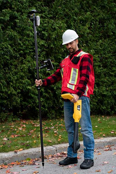
CHC Navigation has launched its LT700H RTK Android tablet, designed to increase efficiency and productivity of the mobile field workforce in applications requiring centimeter-to-decimeter positioning accuracy.
Photo: CHC Navigation
Portable, rugged and versatile, the LT700H enables precision GIS data collection, forensic mapping, construction site layout, environmental surveys, landscaping and earthmoving jobs.
Powered by 184-channel high-performance GPS, GLONASS, Galileo and BeiDou module and a superior tracking GNSS helical antenna, the LT700H provides position availability in demanding environments. Its integrated 4G modem ensures seamless communication from field-to-office and robust connectivity to GNSS real-time kinematic (RTK) networks corrections.
“With the LT700H RTK Tablet, we are offering a professional and accurate GNSS solution to any mobile applications requiring high-portability,” said George Zhao, CEO of CHC Navigation. “The LT700H enables further use of GNSS technology, from single operator to companies with large field crew.”
Combined with CHCNAV Landstar 7 field data-collection software, the LT700H has a vibrant 8-inch IPS sunlight-viewable screen that perfectly displays GIS data tables, vector and raster maps or high-resolution pictures.
The LT700H Google GMS certification guarantees compatibility with any common GIS and mapping Android applications.
This month, the University of Texas at Austin became a major research hub for the U.S. Army Futures Command.
On Oct. 12, the Futures Command broke ground on a $130 million research facility at the Texas A&M University System’s RELLIS Campus in Bryan, Texas. Efforts at both locations will include research on advanced and assured positioning, navigation and timing (PNT) systems.
The Army Futures Command was established in Austin during the summer of 2018. It has been working to build long-standing partnerships with University of Texas at Austin, Texas A&M University System and others in central Texas.
Groundbreaking ceremony for the Bush Combat Development Complex at the Texas A&M University System RELLIS Campus, named in honor of former President George H.W. Bush. (Photo: Texas A&M University)
“The Army designated UT Austin as a strategic partner,” said Professor Todd Humphreys, faculty lead for the Radionavigation Laboratory at the University of Texas, Austin. “UT will focus on two key areas: assured PNT and robotics.” Humphreys has a background in both.
Humphreys says his organization is eager to begin working with the Army. The main focus of his PNT efforts will be “… leveraging the tens of thousands of communications satellites projected to be in low earth orbit in the next few years for PNT services,” he said. “We are working with a major provider and already have some interesting results we can share.”
A member of Humphreys’s team is expected to discuss this work at a meeting of the National PNT Advisory Board next month.
A secondary focus for Humphreys’s lab will be development of integrated sensing equipment with GNSS, low-earth-orbit PNT, radar, vision, inertial, and communications that can deliver assured PNT for the Army’s mounted platforms.
“Assured PNT is one of the principal platforms we are working on,” said Greg Winfree, agency director of the Texas A&M Transportation Institute, a state agency and member of the A&M System. Winfree is also a board member for the RNT Foundation. “Our efforts will be complementary and collaborative with UT’s lead role.”
Winfree sees new PNT sources and their intersection with automated vehicle technologies, drones and robotics as an ideal area for his organization’s contributions. “Our core themes include four application areas that the A&M System could credibly bring forward: RF testing and analysis, vehicle communications and connectivity, unmanned aerial systems, and precision agriculture.”
This could generate a number of spinoffs for civilian agriculture. “Precision Agriculture is a key consideration since reliance upon GPS is a core technological underpinning. Texas A&M has the premier agricultural science program in the country.”
He sees specific areas ripe for investigation by A&M as including:
Creating software defined chips/modules and developing miniaturized antennae for new signal sources
Addressing the potential for degraded sensitivity posed by antenna miniaturization
Developing multi-frequency radios and sensors to allow automated vehicles, drones and robotics to seamlessly utilize GPS along with signals from sources such as ELoran, DSRC, C-V2X, and 5G
Developing AI equipped aerial and underwater drones to test functionality and reliability of signals in challenging environments.
The A&M System has a strong team to bring to bear on such issues, according to Winfree. It includes Dr. Stephen Cambone, associate vice chancellor for research security for the A&M System and the first DoD undersecretary for cybersecurity, and Dr. Byul Hur, assistant professor of engineering technology and industrial distribution and head of the A&M Radio Frequency Test Group.
Dana A. Goward is the president of the Resilient Navigation and Timing Foundation.
Eos Locate for Collector combines three core technologies: Eos Arrow GNSS receivers, Esri Collector, and the Vivax-Metrotech vLoc Series of locator devices.
With Eos Locate for Collector, one field worker can collect both GNSS locations and locator data (such as depth below cover) for any buried asset including water, sewer, electric, cable, gas, fiber infrastructure and more. They can do so quickly, accurately and without the need for any additional field or office support.
“We are giving our Arrow GNSS customers a solution today that allows them to combine both locator data and high-accuracy locations in web maps,” Eos CTO Jean-Yves Lauture said. “This greatly simplifies their workflow by allowing one person to do underground locates and GIS mapping simultaneously.”
“This is a big step forward for utility organizations who need to gain better visibility of their infrastructure,” said Doug Morgenthaler, Esri program manager. “With today’s technology, utilities can already see where new assets are being put in the ground. The challenge historically has been figuring out where existing assets are.”
Eos Locate for Collector not only streamlines underground-asset mapping, but also improves office production times. It eliminates the need to manually combine datasets from the locator and GPS devices within ArcGIS.
“Seeing all that information from utility locators and GPS receivers packaged directly into a GIS application is exceptional,” Vivax-Metrotech Eastern Regional Sales Manager Kelvin Cherrington said. “This solution will help utilities create maps of their underground assets with a much more modern and efficient methodology.”
Indiana American Water Early Adoption
Earlier this year, Indiana American Water approached Eos to seek a solution that consolidated their utility-locate workflow with their Arrow and Collector field work.
“We had the manpower to put paint down,” said Todd Chapman, Indiana American Water Senior GIS Analyst. “But we would need to hire another person to map the locations with our Arrow Gold GNSS receivers.”
Chapman estimates Eos Locate for Collector will cut their field time in half as well as enable the creation of extremely accurate buried-infrastructure maps in ArcGIS.
“Previously, we were seeing that our old water mains could be off by up to 20 feet,” Chapman said. “With the new Eos Locate for Collector, we’re seeing that it’s accurate to under an inch.”
The initial release of Eos Locate for Collector runs on Apple’s iOS iPhones and iPads and supports the vLoc Series from Vivax Metrotech. Future releases of Eos Locate for Collector will support additional locator models including the vScan series.
With accurate digital twins of their buried infrastructure, utilities across sectors can expect improvements to safety, damage prevention, field efficiency and regulatory compliance.
“Not only does this mean quicker responses to 811 tickets and fewer liabilities during field digs,” Lauture said. “But it also constitutes a major step forward toward the highly efficient future of 3D asset management and viable augmented-reality workflows.”
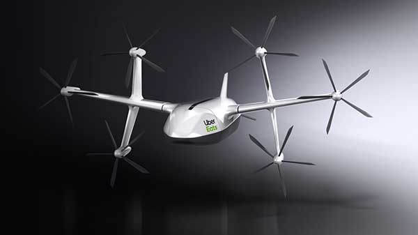
Uber Elevate, Uber’s aviation division, unveiled a new food-delivery drone at Forbes’ Under 30 Summit in Detroit, according to various news reports.
The six-rotor UAV is vertical- and horizontal flight-capable, Uber Elevate head Eric Allison said at the conference. It has a range of 18 miles and an 18-minute flight time, and can carry enough food for two adults.
The drones will land in designated safe-landing zones, where human couriers will pick up the food and bring it to customers’ doors. The company might also land the drones on parked Uber cars (tagged with QR codes), which will carry the meals to their final destinations.
Uber’s Elevate Cloud Systems will track and guide the drone, as well as notify a delivery driver when and where to pick up the food.
The program is expected to roll out next summer in San Diego, where Uber Elevate has been testing urban aerial delivery via the UAS Integration Pilot Program (IPP).
Uber’s vision of a city sky filled with Eats delivery drones. (Image: Uber)
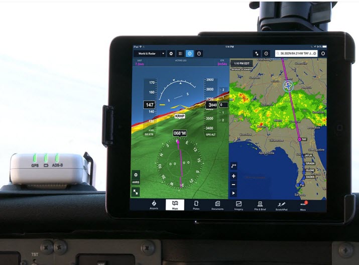
A cockpit equipped with ADS-B controls. (Photo: FAA)
Canada will be delaying the implementation dates for Phases 1 and 2 of its ADS-B Out Performance Requirements Mandate, according to a report by the Canadian Owners and Pilots Association.
ADS-B stands for Automatic Dependent Surveillance – Broadcast. Deadline for aircraft in the United States to be equipped with ADS-B Out capability is Jan. 1, 2020.
The original deadline for implementation in Canada was set for Feb. 25, 2021, for Phase 1-Class A airspace and Class E airspace above FL600, and Jan. 27, 2022 (Phase 2-Class B airspace).
Because numerous industry operators have stated they will not be able to meet those deadlines, new Phase 1 and 2 implementation dates will be set.
Transport Canada-Civil Aviation (TCCA) has also stated that some regulatory matters must be dealt with before implementation can take place.
There is no word yet on how this might affect the implementation of remaining phases — C, D and E), according to the report. Nav Canada’s performance requirements mandate document states that implementation of the different phases will be a minimum of one year apart.
ADS-B Out. ADS-B Out broadcasts information about an aircraft’s GPS location, altitude, ground speed and other data to ground stations and other aircraft once per second.
Air traffic controllers and aircraft equipped with ADS-B In can immediately receive this information.
Tbe ADS-B offers more precise tracking of aircraft compared to radar technology, which sweeps for position information every 5 to 12 seconds.
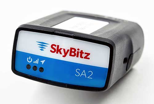
SA2012 offers customers configurable GPS tracking device on the latest 4G network
Photo: SkyBitz
SkyBitz has launched the SA2012, equipped with the latest 4G LTE with 3G fallback, positioned for the light- to medium-duty vehicle tracking market.
With the option to purchase a range of price packages with configurable feature sets, the SA2012 is designed for customers looking for a scalable vehicle telematics solution they can use to increase profit margins and satisfy customer demand.
The hardware can be installed using the Ops Center mobile device, either directly plugging it into the vehicle diagnostic port or covertly installing it behind the dashboard, depending on customer preference.
Once installed, the device feeds into the SkyBitz Ops Center platform, where users can manage the new device alongside all others via a single interface. Customers will have coverage across North America, including Mexico and Canada.
The basic package includes GPS location data and estimated odometer and engine hours. With several options leading up to the Pro package, SkyBitz offers a variety of location, engine, and safety data that can be selected based on the customers’ operational goals and budget.
Customers can configure their solution with minimal training, adding features such as advanced alarms and notification schedules and over-the-air upgrades when future features are released.
“SkyBitz strives to bring the latest technology to market that meets industry demand but also exceeds our customers’ expectations. This is one more device added to the SkyBitz product line that is now delivered on the latest network, and integrated into the SkyBitz Ops Center platform so customers can easily see vehicle and asset data on one dashboard,” said Debbie Sackman, senior product manager with SkyBitz. “This device targets small and medium businesses and offers a flexible package choice where customers can add additional features with OTA upgrades as their business grows.”
The Institute of Navigation is asking for abstracts for the 2020 ION Joint Navigation Conference. JNC 2020 will be held June 1-3 at the Northern Kentucky Convention Center in Covington, Kentucky/Cincinnati, Ohio.
The US ONLY CLASSIFIED sessions will be held June 4 at the Air Force Institute of Technology in Dayton, Ohio.
Abstracts are due Feb. 3, 2020.
JNC is the largest U.S. military Positioning, Navigation and Timing (PNT) technologies conference of the year with joint service and government participation. The JNC theme is Enhancing Dominance and Resilience for Warfighting and Homeland Security PNT.
The event will focus on technical advances in PNT with emphasis on joint development, test and support of affordable PNT systems, logistics and integration with more than 150 operational presentations.
Abstracts will be accepted through Feb. 3, 2020. For more information about JNC 2020, visit ion.org/jnc.
Exhibit Opportunities
JNC features a technical exhibit and showcase of guidance, navigation and control technology products and services. The exhibit hall (June 2-3) will be open to all conference participants, exhibiting organizations, their employees and related organizations.
All materials displayed in the exhibit hall shall be publicly releasable (Distribution A). For more information on exhibiting, visitwww.ion.org/jnc.
Attendance Restricted Technical Sessions
Conference attendance for both FOUO US ONLY (June 1-3) and US ONLY Secret Clearance (June 4) sessions will be screened by the Joint Navigation Warfare Center and will be restricted to US ONLY. Advance visit requests and approvals are required for all technical participants.
New solution integrates the real-time Kongsberg IRIS UAS airspace management picture into the AiRXOS’ Air Mobility Platform to provide integrated unmanned traffic management services around critical infrastructure
AiRXOS, part of GE Aviation, has fully integrated the real-time airspace picture from the Kongsberg Geospatial IRIS airspace management application into its own Air Mobility Platform for unmanned traffic management.
IRIS UAS is a spatial awareness system that allows UAS pilots to operate safely beyond visual line of sight (BVLOS). The system is shown here running on a Windows Surface Pro tablet. (Photo: Kongsberg Geospatial)
IRIS UAS fuses multiple disparate, real-time sensor feeds to create a highly accurate airspace picture around critical infrastructure locations such as airports.
This provides real-time calculation of aircraft separation, airspace monitoring alerts and communications line-of-sight prediction to enable detect and avoid for safe beyond visual line of sight (BVLOS) operations.
The real-time local airspace picture is then integrated into the cloud-based AiRXOS’ Air Mobility Platform, a dynamic, cloud-based foundation, purpose-built for advanced operations and the evolving future of transportation.
The Air Mobility Platform manages the volume, density, and variety of unmanned traffic management (UTM) data, and provides enterprises with a single platform to connect and manage operations, applications and devices.
Through this collaboration, the companies will provide UTM customers with a fully integrated view of airspace for real-time airspace insights, and greater scalability and repeatability of advanced operations.
“Situational awareness of the airspace across applications, unmanned aerial system (UAS) advanced operations, conformance monitoring, compliance, and pilots is critical to a UTM environment — allowing enterprises to be more responsive and efficient,” said Ken Stewart, CEO, AiRXOS. “Our partnership combines Kongsberg Geospatial’s expertise in airspace management with AiRXOS’ dynamic platform, applications, and services, providing customers with the opportunity to truly scale critical infrastructure advanced UAS operations like BVLOS and multi-vehicle, helping to lower risk and increase savings.”
“We’re very pleased to be working with an unmanned traffic management innovator like AiRXOS,” said Ranald McGillis, president of Kongsberg Geospatial. “Their ability to create a comprehensive surveillance view of operations and then to scale it for a nationwide use provides an excellent and very unique use case for our technology.”
Volkswagen and NXP to Deliver Safety to European Roads with Rollout of Communicating Car Technology
NXP Semiconductors N.V., a provider of automotive semiconductors, has rolled out its RoadLINK V2X (vehicle to everything) communication solution in the new Volkswagen Golf.
The recently released eighth-generation Golf is the first volume European car model equipped with V2X, offering a major boost to the deployment of the technology on European roads and beyond.
Life-saving tech. The technology can prevent accidents by having cars communicate with each other, independent of car brands and without the support of cellular infrastructure.
“Road safety forms the core of VW’s commitment to its customers. As a high-volume manufacturer we aim to be a pioneer in this space,” said Johannes Neft, head of Vehicle Body Development for the Volkswagen brand. “The introduction of V2X, together with traffic infrastructure providers and other vehicle manufacturers, is a major milestone in this direction. Volkswagen includes this technology, which doesn’t involve any user fees, as a standard feature to accelerate V2X penetration in Europe.”
“Volkswagen has taken a bold step to seize the road safety initiative through the implementation of V2X,” said Torsten Lehman, senior vice president and general manager of Driver Assistance and Infotainment at NXP. “After proving our technology in more than one million test days globally, we are pleased that our RoadLINK technology, developed in cooperation with Cohda Wireless, was chosen to enable new levels of safety in Europe’s most popular car model, the new Golf.”
NXP and Volkswagen have closely collaborated for high reliability and performance, as well as for standardization of V2X communication that addresses cybersecurity and privacy protection.
V2X in Europe. Wi-Fi-based V2X is a mature technology that has been tested for more than 10 years. Today, 1,000 kilometers (km) of European roads are equipped with V2X technology based on Wi-Fi with 5,000 km planned through the end of 2019.
Its research and development, testing and standardization has occurred within a strong global ecosystem of suppliers and car manufacturers to ensure reliability in diverse road and traffic conditions.
Wi-Fi therefore forms the basis of the European standard that has been chosen for vehicle-to-vehicle and vehicle-to-infrastructure communication, according to NXP. An additional benefit is its availability independent of paid cellular services. Other developing cellular-based technologies can be added complementary to Wi-Fi-based V2X.
Migration to autonomous. V2X communication is set to become a critical part of advanced driving assistance systems (ADAS) and the migration to autonomous cars that communicate with each other and with traffic infrastructure.
The benefit of Wi-Fi-based V2X is its robust, low latency, real-time communication regardless of any car brands.
It enables awareness and communication between cars, road infrastructure like traffic lights or street signs, and other road users such as cyclists and pedestrians.
It is a technology that is collaborative, allowing it to “tap into” surrounding sensor data from mutually equipped cars to warn of hazards and prevent accidents.
V2X is a technology that complements other ADAS sensing technologies such as radar, lidar and cameras.
It helps vehicles to “see” more than a mile ahead and around corners to provide early warning of obstacles, hazards and road conditions.
It has the ability to “see” through objects, delivering more information than that obtained through line of sight only.
Its sensing capabilities are unaffected by poor weather conditions.
SimActive Inc., a developer of photogrammetry software, announces that its Correlator3D software has been used by Air Data Solutions (ADS) in Florida to determine financial assistance following Hurricane Dorian.
Aerial imagery was collected before the storm for pre-hurricane assessment and after for damage analysis.
A Phase One 100MP aerial camera owned by ADS was flown to gather high-resolution images of the affected areas. The data was then processed by SimActive software to create mosaics of orthophotos.
The resulting geospatial data helped government authorities to calculate recovery aid funds.
“We have been impressed by the accuracy and speed of Correlator3D to support such a time-critical mission,” said Don Cummins, President of ADS. “Combined with a high-end aerial sensor, SimActive provides the best tool for emergency response.”
Air Data Solutions is an aerial, terrestrial, and aquatic data collection and modeling company.
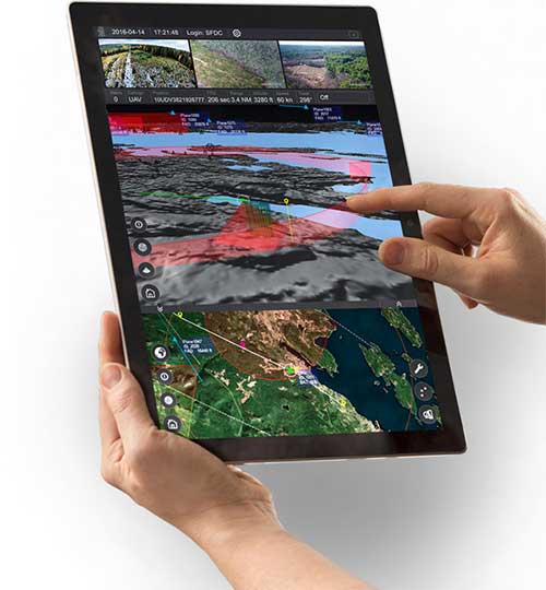
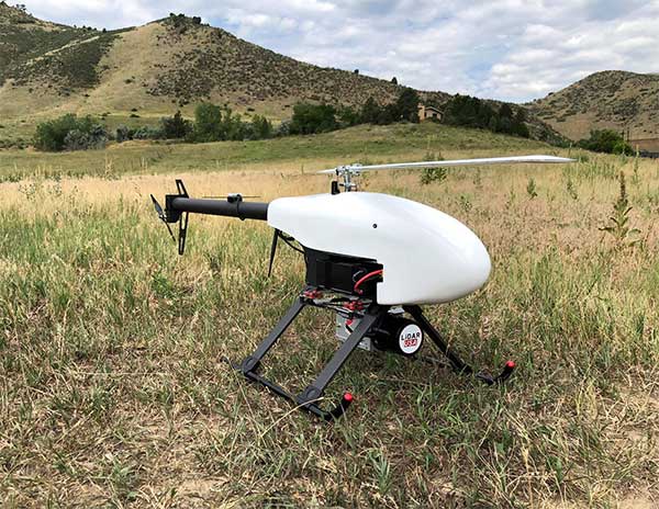
Lidar USA is partnering with Innoflight Technology, a manufacturer specializing in UAV systems for surveying, mapping and inspection.
As a result of the partnership, Lidar USA is offering the Galaxy 950 platform to carry any of its sensors while consistently providing flight times over 30 minutes.
Based in Somerville, Alabama, Lidar USA specializes in the design and integration of economical lidar sensors.
Innoflight and Lidar USA’s partnership is another step for both companies to offer turn-key solutions focused on quickly and safely acquiring high-quality data.
Innoflight designed the Galaxy 950 to simplify the flying aspect of remote sensing with UAVs. The helicopter includes a parachute, automatic takeoff and landing, and extended visual-line-of-sight capabilities to maximize productive time.
For corridor/electric utility line projects, the Galaxy 950 pairs well with the recently announced CL-90 by Teledyne Optech. As the first integration partner of the new compact lidar system, Lidar USA is offering maximum productivity at UAV flight ceilings while achieving improved canopy penetration and exceptional downward point density.
“Lidar USA and Innoflight Technology are both committed to customer success, and this partnership provides the whole package for lidar mapping solutions with UAV,” said Jeff Fagerman, CEO of Lidar USA. “Innoflight’s Galaxy 950 offers exceptional performance in safety, flight duration, and ease of use, which is what our customers need for their projects.”
The Galaxy 950 is now available from Lidar USA as an integrated package with any of their scanning systems.
Eutelsat Communications is investigating an incident on one of the two solar arrays on its Eutelsat 5 West B satellite. The satellite, launched Oct. 9, carries a payload for the European GNSS Agency (GSA) called GEO-3. GEO-3 is designed to be aboard a geostationary satellite to augment GNSS signals.
Eutelsat is working to assess the potential impact on the performance of the satellite and will communicate on it as quickly as possible, according to a statement from the company.
Eutelsat Communications said the satellite is fully insured against the eventuality of loss by a launch-plus-one-year insurance.
Eutelsat 5 West B hosts the GEO-3 payload of the European Geostationary Navigation Overlay System (EGNOS) under a 15-year agreement signed in 2017 with the European GNSS Agency (GSA), and valued at approximately $112 million dollars (102 million euros).
The EGNOS payload, manufactured by Airbus Defence and Space, will hone the accuracy of satellite navigation signals over Europe for use in aviation, maritime and other industries as part of the European Geostationary Navigation Overlay System (EGNOS).
Revenues generated in Financial Year 2018-19 by Eutelsat 5 West A, the satellite that West B is intended to replace, amounted to about $33.3 million (30 million euros).