The Institute of Navigation (ION)’s Satellite Division presented two prestigious awards Sept. 20 at the ION GNSS+ Conference in Miami.
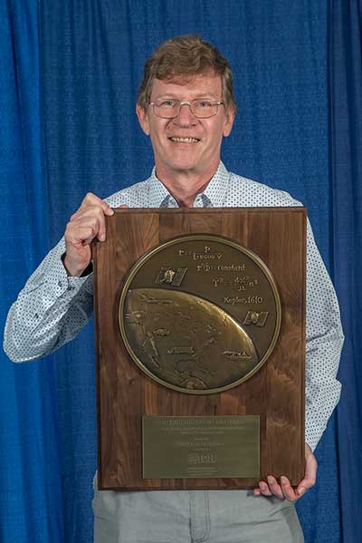
Peter Teunissen receives the prestigious 2019 Johannes Kepler Award from ION’s Satellite Division. (Photo: ION)
Peter Teunissen was honored with the career-highlight Johannes Kepler Award. The Johannes Kepler Award recognizes and honors an individual for sustained and significant contributions to the development of satellite navigation. It is the highest honor bestowed by the ION’s Satellite Division.
Teunissen was recognized for his influential and groundbreaking contributions to the algorithmic foundations of satellite navigation, and for sustained dedication to the global education of the next generation of navigation engineers.
Teunissen invented the Least Squares Ambiguity Decorrelation Adjustment (LAMBDA) method, the worldwide standard for ambiguity resolution, which revolutionized high precision GNSS positioning capabilities. LAMBDA has thus become an indispensable tool that is most widely used in land, air and space navigation; positioning and attitude determination; differential and network processing; and in surveying and geodesy. He also extended the method to MC-LAMBDA, a multivariate constrained resolution method for optimal GNSS attitude determination.
Among others, Teunissen laid the mathematical and algorithmic foundation of reliability theory, which enables a proper understanding of the quality of different integer ambiguity resolution methods and a rigorous characterization of their failure rates, which even led to the development of an optimal test for ambiguity validation.
His findings are particularly important for multi-GNSS processing, which require a proper understanding of individual system characteristics and their respective contributions to achieve navigation solutions of the highest precision and integrity.
Teunissen has made contributions in the field of precise point positioning, the exploitation of triple-frequency observation, and the joint use of new GNSS such as Galileo, BeiDou and QZSS. Pioneering work in this area include the early setup of multi-GNSS receiver test beds in the Asia-Pacific area; the discovery and proper handling of mixed-receiver inter-satellite-type biases, which were vital to fully exploit ambiguity resolution in the regional, BeiDou-2 system; and the first demonstrations of mixed GPS/Galileo/IRNSS/QZSS L5 processing for precise positioning applications.
Teunissen has made significant contributions to educating future generations. He is currently a Professor of Satellite Navigation at Delft University of Technology, The Netherlands and Curtin University, Australia.
He received his Ph.D. at Delft University of Technology in Mathematical and Physical Geodesy. He holds several honorary professorships and fellowships of numerous international organizations, including Australia’s prestigious Federation Fellowship of the Australian Research Council.
He has published more than 300 papers, seven books, is co-editor and author of the Handbook of Global Navigation Satellite Systems, and is a member of 13 editorial boards.
He is a regular contributor to ION and ION programs. He is a Fellow of the ION, the RIN and the Royal Netherlands Academy of Sciences.
Advanced RAIM topic earns Diaz the Parkinson Award
Santiago Perea Diaz receives the 2019 Bradford W. Parkinson Award from ION’s Satellite Division. (Photo: ION)
The Bradford W. Parkinson Award recognizes an outstanding graduate student in GNSS. It is presented in honor of Parkinson for his leadership in establishing the U.S. GPS and for his work on behalf of ION’s Satellite Division.
Santiago Perea Diaz was recognized for graduate student excellence in GNSS in his thesis, “Design of an Integrity Support Message for Offline Advanced RAIM.”
Any graduate student who is a member of the ION and is completing a degree program with an emphasis in GNSS technology, applications, or policy is eligible for the award.
Program enters integration and test phase on track to 2021 delivery
Raytheon Company’s GPS Next-Generation Operational Control System, known as GPS OCX, has completed full software and hardware development and entered the system integration and test phase. The milestone keeps GPS OCX, the enhanced ground control segment of a U.S. Air Force-led effort to modernize America’s GPS system, on track to meet its June 2021 contractual delivery deadline.
“GPS OCX is one of the largest, most complex software development programs in the Department of Defense, and we’re now in the home stretch toward full system delivery,” said Dave Wajsgras, president of Raytheon’s Intelligence, Information and Services business.
The GPS OCX team completed development of 1.5 million lines of software code, supported by a pivot to leading-edge commercial software development processes that began in 2016. Additionally, the team’s information assurance best practices helped the program achieve the highest level of cybersecurity protections of any DoD space system.
The U.S. Air Force used the cybersecure GPS OCX launch and checkout system, often referred to as Block 0, to launch the first modernized GPS III satellite into space in December 2018 and the second in August 2019.
The team’s focus for the remainder of 2019 is the delivery of the system’s new modernized receivers, which will measure and monitor legacy military and civilian signals sent by the current GPS satellite constellation plus the new signals sent by the next-generation GPS IIIs.
Ground antenna at Schriever Air Force Base, home of the 50th Space Wing. (Photo: Raytheon)
Trade wars may be THE only serious limiting factor
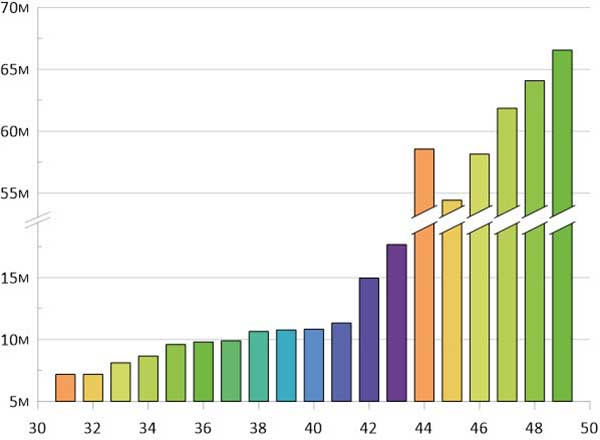
The GNSS chip market worldwide is projected to grow by $2.7 billion, guided by a compounded growth of 8%, to 2025, according to ResearchandMarkets. Other market reports cite “huge growth” and “strong development” in GNSS-related markets such as simulators, aviation and defense. We can count ourselves lucky — or remarkably prescient — to be part of such a robust industry, in such uncertain times.
The world conquest by smartphones, smart cities and the internet of things (IoT) will strongly support this market growth. Also on the horizon is the rising tide of GPS-enabled vehicles, putting automotive telematics on the road to assisted-driver and ultimately autonomous driving.
M&A. Meanwhile, the fast pace of mergers and acquisitions among manufacturers and integrators will strengthen the GNSS economy and propel it even higher. Such interactivity will bring higher revenue shares to key players as well as support overall profitability increases to come.
Accurate monitoring of operations and assets; the astonishing rise of drones to active roles in many industries; and the constant innovation and imagination churning out new products, solutions and augmented services — all will consolidate the strength of our remarkable economy. The much-heralded arrivals of BeiDou and Galileo fully upon the scene will only make the immediate future stronger for our industry.
Chart: GPS World
PNT Broadly. Where GPS, GNSS, and multi-GNSS go, they carry other positioning technologies along on their coat tails: inertial, signals of opportunity, Wi-Fi, ultra-wideband and more. The growing pie is certainly big enough for all to get a large share.
That’s not to say there are no barriers to growth, no clouds on the horizon. Licensing, laws and regulations will, as ever, constrict growth. This is not always a bad thing. Controlled growth and wise use benefit us all, and prevent runaway bubbles that can burst for lack of proper internal support.
Mapping. Meanwhile, a host of well-established businesses and nascent enterprises exploit the increased interest in location-based information as an enabler for many consumer, organizational and governmental services. This means that mapping and all manner of technologies associated with it — laser, lidar, infrared and more — may grow at even faster rates.
A brave new world awaits. Once GNSS is integrated with artificial intelligence, there’s no telling where we’re headed.
Of the many uncertainties across the globe, economic warfare poses a greater risk to GNSS than does military conflict. The latter, cynically enough, will actually benefit the industry in the short run, though its effect may chill in the long run.
Chart: GPS World
Trade. One of the biggest questions confronting the industry now is whether the trade and tariff war between the U.S. and China will continue, and what effect it will have. Experts disagree widely on both questions, though almost all of them, except the leaders who are supposed to listen to them, agree that it’s generally a bad thing.
As was stated in these pages at this time last year, if business confidence falls as a result, global output could also drop.
Opportunities Outweigh Obstacles
Industry leaders confront spectrum issues, jamming
In contrast to the rosy forecast on the previous page, serious issues confront the GNSS market. None of them are more serious, thornier or difficult to resolve (despite the many solutions offered) than spoofing and jamming.
Like a tragic hero, GNSS carries a potentially fatal weakness within its strength. To be ubiquitous and highly precise, the signals come from space. Coming from space, they are weak and susceptible to malicious meddling.
Other political and technological obstacles put pressure on the GNSS industry, and therefore upon the whole PNT industry. GNSS always will be the backbone, the center core holding together various adjunct positioning, navigation and timing technologies.
These issues, following closely on the heels of spoofing and jamming, include but are not limited to: spectrum competition and spectrum management; cybersecurity; privacy; net neutrality; national security export controls; product liability; and failure, however temporary, of GNSS systems.
We’ve seen this last most recently with Galileo, but all the GNSS have suffered such setbacks, and surely will again. The nature of the response to each occurrence is the most critical factor.
Keep on the Sunny Side. However, the opportunities far outweigh the obstacles. The greatest opportunities always arise from the greatest asset that the industry possesses: intellectual capital.
Many of the opportunities are cited on the previous page. While high precision will continue to lead the innovation charge and provide the highest profit margins, the smartphone and the automobile will increasingly take up the MVP (most valuable positioner) role within the industry.
Market Intelligence. All these factors make unprecedented demands on management attention and agility. Executives need good market intelligence to keep abreast and ahead of fast-developing research and development trends, market shifts, developments in neighboring or competing technologies, and protectionist tariffs and import/export controls.
Insight provided by all regions, sectors and job titles
This year’s State of the GNSS Industry Survey provides insight from around the globe.
Just over half our respondents work for companies or organizations headquartered in North America; 15% are from Asia-based operations; roughly 10% each for enterprises in Europe and Latin America; slightly less for the Pacific region; and the rest of the replies scattered across Africa, the Middle East and Russia. Truly an international sampling!
Chart: GPS WorldChart: GPS WorldChart: GPS WorldChart: GPS World
Demographics. For job titles, we drew in-depth data from:
owner/president/CEO, 21%
engineer, 20%
general, product or program manager, 19%
other, mostly surveyors or GIS analysts, 18%
researcher, 10%
vice president, CTO, COO, CFO or similar, 6%
sales and marketing, 5%
Sector. The intelligence in the following pages accumulated from these industry verticals:
survey and high precision, 29%
defense, security, government, 19%
mapping, data acquisition/processing, GIS, 14%
satellites, signals and simulation, 9%
machine control, precision agriculture, or transportation (non-autonomous), 6%
The mapping industry has taken to UAVs — sort of. Put it this way: UAVs are only one tool in the GIS (geographic information system) toolbox.
A third of our respondents (32%) say that UAVs will be used for less than 10% of field survey activity in the next three years. In contrast, a quarter of our respondents say that drones with variety of sensors (photogrammetric, lidar, hyperspectral, etc.) will perform up to half of mapping work.
The response is similar to replies in 2018. While UAVs are an exciting new technology for mapping, most respondents to our survey recognize the continued value of hands-on, in-the-field data collection. In fact, only 11% of respondents expect that mapping work on the ground will gradually disappear over the next three years.
Chart: GPS World
Sensors Aboard. When on board a UAV, 43% say the best sensor to use in conjunction with GPS/GNSS for mapping and data collection is a high-resolution still-image camera, which is highly preferred over video cameras. Today’s high-resolution cameras can capture details down to a few centimeters on the ground, even from an aircraft hundreds of feet in the air (see our August issue for more on aerial mapping).
Other top sensor choices for our readers include lidar (light detection and ranging) at 32% and multispectral imaging cameras at 14%. Lidar (light detection and ranging) uses a pulsed laser to measure distances and generate precise, three-dimensional information.
Rather than UAVs, airplanes and helicopters are the most commonly used platforms for acquiring lidar data over broad areas. Topographic lidar uses a near-infrared laser to map the land, while bathymetric lidar uses water-penetrating green light to measure seafloor and riverbed elevations. Lidar is used to create more accurate maps, make digital elevation models, assist in emergency response operations, to name a few applications. GNSS and INS systems translate the collected sensor data into static points for GIS.
Multispectral and hyperspectral cameras capture images in infrared (IR) and ultraviolet (UV) as well as traditional RGB (red, blue, green). The main difference between multispectral and hyperspectral is the number of bands and how narrow the bands are — from 3 to 10 bands for multispectral to hundreds for hyperspectral. Practically speaking, multispectral imagery can be used to map forested areas, while hyperspectral imagery can be used to map tree species within the forest.
Both types of cameras are used in agriculture, ecology, oil and gas, oceanography and atmospheric studies. They can map invasive species, monitor crop health, and help in mineral exploration. For building inspections, a multispectral camera can see water penetration, plumbing leaks, overloaded electrical circuits and malfunctioning mechanical systems.
Chart: GPS World
Cloudy, Chance of Maps. Anywhere, anytime access to geospatial data is increasingly important, fueled in part by both the internet of things (IoT) and smart-city initiatives. Geospatial technology enables effective and integrated planning by providing real-time location data and analytics.
Most mapping providers have developed cloud software and storage, which helps organizations access data to meet their specific requirements. Along with the cloud, advances in mobile computing are enabling organizations to take GIS to the field, interacting with the information needed to view, capture, update and synchronize changes between the field and office. The field workforce can use maps to add validity to data, record observations, and respond to events.
GIS software is also assisting connected cars and autonomous vehicles, an area expected to grow significantly (see page 38). The mobile GIS software market is expected to reach a CAGR of 18% by 2024, according to Global Market Insights.
It’s hard to overstate the importance of inertial sensors in the transportation and machine control markets. For the second year, using inertial navigation systems (INS) to augment positioning was selected by the most respondents (43%) as the best additional solution for positioning in GPS/GNSS-challenged environments.
Inertial measurement units are based on multi-axis combinations of precision gyroscopes, accelerometers and magnetometers using algorithms to determine location, direction and position. Other tech used to increase positioning accuracy includes signals of opportunity (cellular, radio, TV), visual indicators (such as lidar) and ultra-wideband.
Automakers are pushing hard to get autonomous vehicles on our roads and highways. Nissan and Renault (with Microsoft) plan to have 10 vehicles on sale by 2020 with “significant autonomous functionality.”
Ford plans to roll out autonomous vehicles by 2021, and Hyundai is targeting them for the highway by 2020 and urban driving by 2030. While industry experts debate the time frame, it’s clear autonomous vehicles are coming.
Every Tier 1 automaker has an autonomous navigation program, along with heavyweights such as Google, Apple an Amazon. Many automakers are teaming with tech companies on R&D, such as GM with Lyft, and BMW with Intel and Mobileye. Others are teaming with each other —Volkswagen and Ford partnered to acquire AI startup Argo. Daimler has joined Volvo to invest in the platooning concept, connecting trucks through wireless signals.
Stages of Autonomy. The move to autonomous won’t be a sudden jump, but will take place in incremental steps. Formerly only offered on luxury autos such as the Tesla or Mercedes, Honda has introduced semi-autonomous advanced-driver assistance systems (ADAS) options on its entry-level Civic, offering lane-keeping, automatic braking, and adaptive cruise control functionality for the mass market.
Automakers rely on SAE International’s J3016 standard, which defines six levels of automation from Level 0 (no automation) to Level 5 (full vehicle autonomy). The pivotal change occurs between Levels 2 and 3, when responsibility for monitoring the driving environment shifts from the driver to the system.
Chart: GPS World
At Level 1 (driver assistance) is cruise control.
Level 2 (partial automation) includes Audi Traffic Jam Assist, Cadillac Super Cruise, Mercedes-Benz Driver Assistance Systems, Tesla Autopilot and Volvo Pilot Assist.
Level 3 (conditional automation) puts the car in the driver’s seat, but prompts the driver to intervene in a difficult encounter (Audi Traffic Jam Pilot).
At Level 4 (high automation), the car operates without human input, but only under select conditions (road type, geographic area). For instance, the driver might manage all driving duties on surface streets then become a passenger as the car enters a highway.
At Level 5 (full automation), the driverless car can operate on any road and in any conditions a human driver could negotiate. There are no Level 5 autos yet, but Waymo is using a fleet of 600 Chrysler Pacifica hybrids to develop Level 5 tech for production.
Machine Control. Not having to deal as much with traffic, except to navigate to the work site, machines in agriculture and construction are much more autonomous than the family car.
For liability reasons, fully autonomous machines have yet to be approved for field work in the U.S. Nevertheless, manufacturers such as Case IH, New Holland, John Deere and Komatsu are continuing to push the tech, and most tractors sold in the U.S. today include auto-steering systems.
At construction sites, GNSS technology installed in bulldozers, excavators, graders and pavers increase productivity and provide situational awareness to operators. GNSS increases the efficiency and accuracy of these machines, with the input used in task management, data management and theft-detection applications.
Operators rely on GNSS information to position the cutting edge of a bulldozer blade or an excavator bucket. GNSS enables comparison of the position against a 3D digital design to compute cut and fill amounts. Display systems provide the operator with the visual information to manually move the machine’s blade or bucket for highest accuracy.
Nowhere is the interest in anti-jamming and anti-spoofing technology higher and more urgent than in the defense and security sectors. Overall, the anti-jamming market is about a tenth the size of the full GNSS market, but that still amounts to a considerable number. It is projected to grow at a slower rate than the overall market, according to one market report, or about 40% of the total GNSS industry pace from 2018 to 2023.
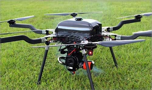
Major growth opportunities stem from high demand for robustness and resistance to enemy technology in military applications. This demand is primarily for unmanned aerial vehicles (UAVs) to conduct surveillance, reconnaissance and actual combat. Other demands are for munitions and guided implementations, and low-cost GPS anti-jamming solutions.
Chart: GPS World
While the military market has fueled growth in civil GPS products and services, this trend is being turned on its head.
For instance, U.S. Army light tanks were equipped in quick succession with new iterations of civil anti-jam units.
“[We] asked for exactly what we wanted and industry built exactly to that. We don’t know exactly what we want. Tell us how we should do this the best, and then we’ll test that,” said the acquisition officer in charge. This PNT program may set the mold for future U.S. military development — leaving requirements broad and open to change with the knowledge that technology develops quickly, and can just as quickly be shown to be vulnerable.
Go Small, Go Modernized. Two other key trends exert control over the defense market: the reduction in size, weight and requisite power (SWaP) of hundreds — if not more — of GNSS-dominated navigation and positioning devices installed aboard myriad different military platforms, and the coming need to retrofit all such platforms, not only for SWaP but for the new signals, prime among them M-code, coming with modernized and multi-GNSS.
Commercial activity in this sector is constrained to a degree by International Traffic in Arms Regulations (ITAR) and Export Administration Regulations (EAR), administered by different U.S. government departments to ensure that defense-related technology does not fall into adversarial or mischievous hands. Nevertheless, all those involved in defense and security will be very, very busy for several years to come.
Starting this year, new-generation GNSS-based landing systems — ground-based augmentation systems or GBAS — will be deployed at airports all around Europe to increase runway capacity by up to 6% in peak traffic periods, according to Indra, a key partner of the European GBAS Alliance.
The GBAS technology allows aircrafts to make steeper approaches, which saves fuel and reduces noise and CO2 emissions. GBAS further improves airport capacity by letting approaching aircraft use different glide slopes to avoid wake turbulence left by precedent aircraft in the runway.
According to research by the European Union’s SESAR initiative supported by Eurocontrol simulations, this can lead to a runway capacity increase between 2% and 6%.
The European GBAS Alliance includes airports, airlines, air navigation service providers and air- and ground-manufacturing industry working for a coordinated and synchronized deployment of ground-based augmentation systems (GBAS).
Photo: Indra
The plan is for deployment preparations to start this year, and ramp up in 2020. The focus is particularly on precision approaches in low-visibility conditions.
The first collaborative meeting took place in Toulouse, France, in June with more than 20 organizations represented.
GBAS is recognized as a supplement and, in the future, the replacement of instrument landing systems (ILS).
A synchronized GBAS implementation for low visibility operations (GBAS GAST D for categories II and III) will lead to environmental, economical, capability and safety benefits for airports, airlines and air navigation service providers.
Indra has been a driver for GBAS development for years, and is one of the initiators behind the European GBAS Alliance. It contributes with one of the technological pillars; the NORMARC GBAS system is an Indra Air Solution capable of guiding aircraft even in low visibility conditions (CAT II and III). The technology is ready, and the focus now is on getting the infrastructure and regulatory framework in place.
“The great response to this initiative is very encouraging,” said Hugo Moen, GBAS general sales manager at Indra. “In spite of the indisputable benefits to everyone, we need a collective effort to get out of a “chicken or egg” situation. Both airlines and airports need to make some investments, but airlines are reluctant to invest in GBAS receivers for aircraft as few airports have the required infrastructure. Likewise, airports or ANSPs are not investing since few aircraft can make use of the system.”
GBAS differs from ILS in being based on GNSS instead of conventional radio signals. Whilst ILS signals can be affected by topography and other physical objects, GBAS has no critical or sensitive areas. This allows for higher capacity during precision approaches, reducing the risk of diversion, cancellation and go-around.
“GBAS enables steeper and shorter approaches. Precision landings can be performed at airports where this has not been possible due to topography or other reasons. In Norway, we have used GNSS-based landing systems at 17 airports for many years, with great results. It is nice to see the industry working together so more countries can benefit from this new technology,” said GBAS Product Manager Linda Lavik from Indra.
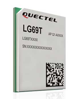
Quectel Wireless Solutions Co. Ltd., in association with STMicroelectronics, has released the LG69T module, an automotive-grade dual-band high-precision GNSS module that integrates dead-reckoning (DR) and real-time kinematic (RTK) technologies.
The new Quectel module, announced at 2019 Apsara Conference in Hangzhou, is designed to facilitate open-sky positioning performance with an accuracy of up to 10 centimeters, which is currently the industry’s most advanced positioning technology for the automotive market. LG69T will support next-generation precision positioning capabilities for smart vehicles and autonomous driving scenarios.
The Quectel LG69T GNSS module is based on ST’s STA8100GA, the latest Automotive-grade dual frequency positioning chip with 80 tracking channels and four rapid-acquisition channels that are compatible with many constellations: GPS, BeiDou, Galileo, NAVIC/IRNSS and QZSS.
It is an AEC-Q100-qualified dual-band (L1 + L5) GNSS module that integrates multi-band RTK technology for centimeter-level accuracy.
The LG69T module’s dead-reckoning capabilities feature an integrated inertial measurement unit (IMU) that provides continuous high-precision positioning. The LG69T supports corrections input for standard Radio Technical Commission for Maritime Services (RTCM) and centimeter-level navigation by using RTCM data from a third — local base stations. The module performs well under the highly challenging conditions of urban canyon environments.
“We are thrilled to collaborate with STMicroelectronics on our newest generation of high-precision positioning module,” said Min Wang, Quectel’s automotive product line general manager. “With this highly-integrated LG69T module, automakers and Tier 1 suppliers will no longer have to spend time selecting components, integrating hardware, adapting interfaces and conducting tests and verifications, which will greatly cut their time-to-market and costs, and help them accelerate the deployment of autonomous driving to seize early opportunities.”
“ST has strong experience and is the Global Automotive High Precise Positioning Technology and Market Leader. We are very proud to cooperate with leading Chinese smart driving high technology company,” said MH TEY, Greater China, South Asia and Korea automotive marketing and application head of department, STMicroelectronics. “Today, there is growing dependency on high-performance GNSS in automotive applications such as navigation, safety and autonomous driving. With this cooperation, we are very confident to become the market leader by providing cost-effective and unique best-in-class solution for autonomous vehicle.”
Engineering samples of Quectel’s LG69T module will be offered to automakers and Tier 1 suppliers by the end of 2019, and the product will be commercially available around mid-2020 and is expected to be deployed in mass produced models as early as 2021.
The application was developed with special interest paid to raw data recording and NTRIP service connection.
With the SXblue ToolBox iOS application, the user can analyze the position data provided by the SXblue receiver, as well as location metadata.
More important for SXblue clients, the application can record, save and transfer raw data from the GNSS receiver, thereby allowing post-processing activities. The application also acts as a NTRIP client, capable of connecting to a NTRIP server for real-time kinematic (RTK) corrections, and thus allows the receiver to issue very accurate location information.
Receiver configuration is easy through the application, with the ability to set up and save user-defined commands for subsequent use. The settings include constellation to be used, differential source, NTRIP login credentials list and more.
In addition, the iOS application includes a series of audible and visual alarms that are user-configurable to determine the thresholds of information provided by the SXblue GNSS receiver.
The main features of the iOS SXblue ToolBox application are:
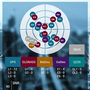
Display of location information and quality of positioning data
Skyplot of all-in-view constellations: GPS, GLONASS, Galileo BeiDou, QZSS, SBAS
Recording of raw data and data transfer
NTRIP/DIP client to receive RTK corrections
Terminal to send commands and view the output data of the SXblue device
Audible and visual alarms
Activation of options and licenses via the application.
A roundup of recent products in the GNSS and inertial positioning industry from the September 2019 issue of GPS World magazine.
OEM
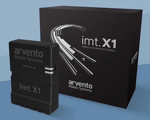
Vehicle tracker
Uses u-blox to detect panic breaking
Photo: u-blox
Arvento’s imt.x1 has a six-axis gyro sensor that can sense three-dimensional movement caused by emergency acceleration, panic braking and directional yaw and drift. With connectivity options including dual CANBus and Bluetooth, the system is eCall compatible and captures and provides data for accident analysis and other vehicle tracking functions. The system also uses the next-generation powerful Arm-based microcontroller. The system’s high position sensitivity and accuracy are based on integration of u-blox’s 2G, 4G and 5G-ready cellular modules as well as GNSS modules.
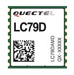
The compact LC79D module features concurrent multi-constellation GNSS receivers on dual GNSS bands. It uses L1 and L5 for GPS, Galileo and QZSS, L1 band for GLONASS and BeiDou, and L5 band for IRNSS. It can generally increase the number of visible satellites, significantly improve positioning drifting when driving in urban canyons and enhance positioning accuracy. Embedded with a low-noise amplifier (LNA) and multi-tone active interference, the module provides high sensitivity and reliable anti-jamming capability, ensuring exceptional acquisition and tracking even in weak signal areas.
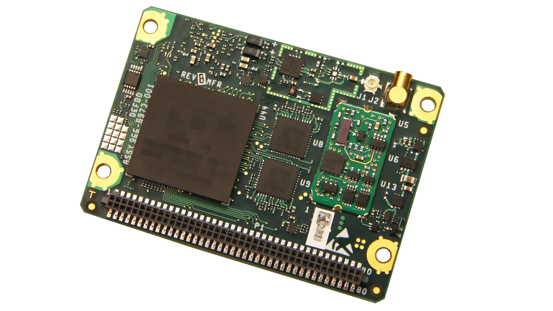
The mosaic development kit helps integrate mosaic into an existing system. Mosaic is a compact high-precision multi-frequency GPS/GNSS module that brings precision and reliability of high-end multi-frequency GNSS to mass-market applications. Its light weight and low power consumption makes mosaic suitable for robotics, automation, telematics and wearables. The kit supports connectivity through internet, COM ports, USB 2.0 and an SD Card slot. Mosaic provides Advanced Interference Mitigation (AIM+); extensive corrections support for high-accuracy positioning; integrity needed for safety-critical applications such as autonomous vehicles; and a 100-Hz update rate, suitable for robotics and fast-moving vehicles.
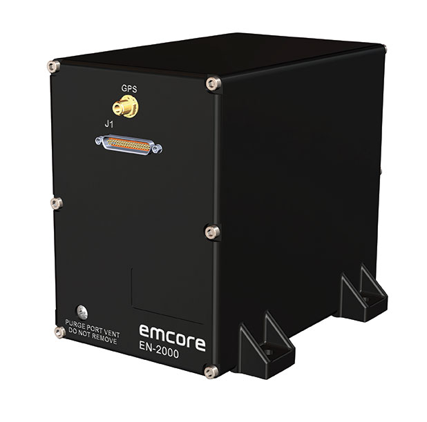
The EN-2000 is the newest addition to the Emcore-Orion series of micro-inertial navigation (MINAV) systems. It is compact and lightweight, weighing less than 7 pounds, with very low power consumption of 10 watts. It can deliver twice the performance of the EN-1000 with the same form factor. With its low size, weight and power (SWaP), the compact EN-2000 is suitable for unmanned aerial vehicles, unmanned underwater vehicles, unmanned ground vehicles, manned aircraft, rotorcraft and dismounted soldier applications. Its three-axis design uses a solid-state optical transceiver with advanced integrated optics, combined with new field programmable gate array (FPGA) electronics to deliver stand-alone aircraft-grade navigator performance at one-third the SWaP of legacy systems.
The Miniature PLGR Engine – M-Code (MPE-M) GPS receiver is a small Type II form factor ground receiver, and incorporates the company’s recently certified Common GPS Module (CGM). As a drop-in replacement for the thousands of customers using Collins’ Miniature PLGR Engine-SAASM (MPE-S) GPS receiver, the new MPE-M technology provides 10 times stronger anti-jamming capabilities for the direct acquisition of GPS signals than its predecessor. The MPE-M receives the current military Y-code GPS signal along M-code. It provides warfighters with improved security and assured positioning, and it satisfies the U.S. government’s requirement for all military GPS equipment to be M-code capable. It is designed for lightweight, ground-based applications such as radios, blue force trackers, targeting devices, vehicle line-replaceable units (LRUs) and small unmanned aircraft. The MPE-M’s security certification makes the receiver eligible for export to U.S. allies through the Foreign Military Sales (FMS) program.
The Catalyst software-defined GNSS receiver for Android phones and tablets is now available with a usage-based service plan: Trimble Catalyst On Demand. The new service plan meets the needs of industries and organizations that need a more flexible payment model. Organizations use Catalyst to record positions, navigate to points, measure relative distance and create digital maps. Trimble Catalyst On Demand provides scalable access to real-time kinematic (RTK)-quality GNSS positioning using a pay-per-use hourly pricing model in addition to the current Catalyst monthly plans. The service also enables automated domain-level email address access, which streamlines license allocation for organizations with a large number of users. (Pictured: Catalyst DA1 antenna).
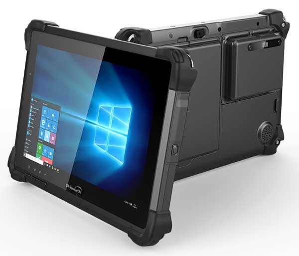
The DT301X is designed for 3D mapping. Its Intel RealSense Depth camera provides real-time 3D imaging combined with a dual-frequency GNSS module for real-time mapping and positioning. The digital images are better than high-definition standard, and are suitable for construction building information management (BIM) graphics. The highly durable IP65 and MIL-STD-810G-rated tablet in a slim case can be used in the field, office and vehicles. A bright 10.1-inch touchscreen provides indoor/outdoor viewing. The tablet includes long-range Bluetooth and 4G LTE mobile broadband for the latest in high-speed communications. An Intel 8th-generation Core i5 or i7 processor offers high performance while still being energy efficient.
Mapper for wide-area, mountain, urban and corridor surveys
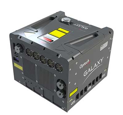
Photo: Teledyne Optech
The ALTM Galaxy PRIME wide-area lidar sensor offers collection efficiency, a small form factor and high-quality data sets that meet rigorous USGS lidar standards. It has a 6,000-meter above-ground-level (AGL) collection envelope and 1-MHz on-ground collection rate. Galaxy PRIME includes lidar technology enhancements to increase sensor performance and collection efficiency, improve data quality, and simplify the collection process. It can be used either gyro-stabilized or fixed-mounted, one camera or six, and full waveform or discrete. PulseTRAK technology enables a continuous operating envelope by eliminating data coverage gaps and irregular point density. Applications include wide-area mapping, urban mapping, natural resource management, engineering, infrastructure modeling, and powerline and transportation corridors.
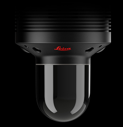
The Leica BLK247 real-time reality-capture device uses sensor fusion technology to detect and report physical changes within a space. It is designed for continuous 3D reality capture, extending capabilities for safety and security applications. The sensor provides real-time situational awareness through edge computing and lidar-enabled change-detection technology. Using artificial intelligence, the BLK247 can tell the difference between still and moving objects — such as a person walking who leaves a suitcase behind — and identify security threats to provide real-time alerts.
Version 15 of Grapher has new capabilities to improve the ability to model, analyze and interpret data as well as communicate the results. Grapher users can now access new Fit Curve, Axes and Statistical Plotting capabilities. Also, users are provided greater color customization functions in the latest release. Enhancements give Grapher users a more powerful ability to display and communicate the results of their work to others. The software provides 80 different 2D and 3D plot types for analyzing and displaying scientific data.
The Harris Aerial H4/H6 Hybrid multicopter is now offered as an integrated package with any Lidar USA scanning system. The Harris Hybrid can provide longer flights with lidar and industrial-grade cameras. The Harris Hybrids use a small generator running on 95 or higher octane fuel to power the UAV for up to five hours.The H6 can carry an A-series high-definition lidar system of 3 kg for 2.5 hours and a V-series of 5 kg up to 1.5 hours. For the lidar operator, this means most projects will require only one or two flights.
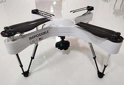
The US-1 was built with sensitive enterprise and government customers in mind. It was designed from the ground up in the United States with a battery-first approach to enable electric aircraft to compete with conventionally fueled incumbents. The US-1 runs on a secure open-source operating system by Auterion. It provides 78 minutes of flight time and high-resolution optical and thermal cameras. US-1 UAVs have been deployed to fight fires, locate pipeline leaks, and track armed suspects.
Impossible Aerospace, impossible.aero
The DRS-M600 reusable parachute safety solution, developed for DJI M600 and DJI M600 Pro, meets specifications of the ASTM F3322-18 standard. The successful completion of the ASTM standard test makes it possible for the Federal Aviation Administration to issue permits for its use on drones over crowds. The ASTM F3322-18 standard is the first standard for parachute systems designed specifically for small UAVs.
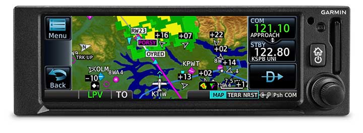
The GNC 355 is a GPS navigator with localizer performance with vertical (LPV) approach guidance. (Photo: Garmin)
The GNS 355 GPS navigator with localizer performance with vertical (LPV) approach guidance gives pilots the benefits of WAAS/SBAS GPS guidance with a modern communications radio. Intended for Class I/II aircraft that weigh 6,000 lbs./2,721 kg. or less, the GNC 355 is certified for more than 700 aircraft makes and models. Aircraft owners can incorporate the GNC 355 into an existing avionics stack because of its standard 6.25-inch wide by 2-inch tall design. The responsive touchscreen display allows pilots to quickly access direct-to functionality, moving map, flight plan, nearest, procedures, waypoint and terrain pages and create customizable data fields and shortcuts for quick, one-touch access to important information. Fully WAAS/SBAS IFR-approach-capable, the GNC 355 gives pilots the benefit of flying LPV, as well as Area Navigation (RNAV) approaches. Many approaches offer vertical approach guidance as low as 200-feet above ground level (AGL).
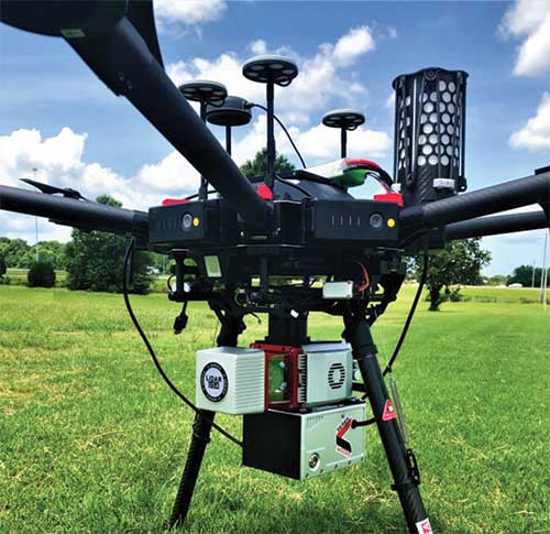
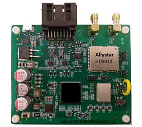
The Allystar INS Platform is a dual-antenna, multi-frequency, multi-GNSS inertial navigation system (INS) that delivers accurate and reliable position, velocity and orientation. It combines high-grade, six-axis, temperature-calibrated accelerometers and gyroscopes with a multi-frequency, multi-GNSS engine, the HD9300 series. The HD9300 is a dual-antenna chip-grade real-time kinematic (RTK) GNSS receiver for accurate positioning and heading. The Allystar INS platform contains an on-board sensor-fusion filter, plus navigation and calibration algorithms for different dynamic motions of land vehicles. The Allystar OBD Data Adapter (v1.0) enables users to read and monitor various sensors built into cars, obtaining real-time vehicle speed and gear signals from the on-board diagnostics (OBD) interface, and then output AT (attention) commands by serial port or serial peripheral interface (SPI).
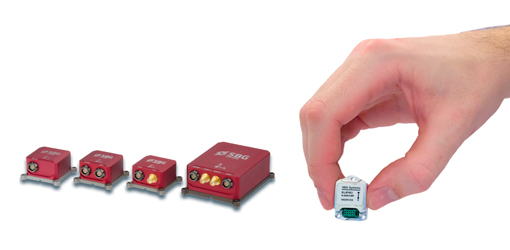
SBG Systems has announced a major firmware update for the Ellipse product line. New features have been added to version 1.7 to enhance performance of the sensor.
Automotive package. New features were developed to better answer needs of the autonomous testing and driving markets. These features include:
CAN odometer. Users now have the choice to connect an external odometer (DMI) with pulses or use their car odometer with velocity information. During the installation, users can enter a rough “resolution.” Then, SBG’s inertial sensor refines the odometer installation parameters to automatically obtain the best performance.
New outputs. Included are body velocity and slip angle, which calculates the “drift” angle between the vehicle assumed trajectory and its actual (deviated) trajectory.
Fixed lever-arms mode. For precision applications as well as low dynamics, and reduced warm-up time, the new Ellipse firmware allows users to run the Ellipse Kalman filter with no lever-arm estimation. This will ensure centimeter pass-to-pass accuracy for real-time kinematic (RTK) applications and allow operation in lower dynamics while reducing warm-up time.
To precisely calibrate the lever arms, the use of Qinertia Lite can be used to obtain centimeter precise lever arms. For general-purpose applications, the standard mode of operation that refines the lever arms in real time is still available.
Marine applications. The firmware update provides new features for advanced marine applications.
DVL aiding support. This helps to reduce drifts from the inertial sensor underwater, providing an interesting opportunity for projects such as short subsea navigation with affordable inertial sensors.
New output message (INDYN). INDYN brings support to performance sailing autopilots such as the B&G H5000.
Improved magnetic calibration (sbgCenter). The new sbgCenter embeds a new magnetic calibration algorithm that improves overall performance in challenging calibration while allowing even more difficult calibration conditions. This new calibration procedure also provides improved quality feedback.
The firmware download is protected by a password, the same credentials as for the last version. To request the password, e-mail [email protected].
The Royal Institute of Navigation: International Navigation Conference will take place Nov. 18-21 at the Edinburgh International Conference Centre in Edinburgh, U.K.
Navigation and Societal Benefits: From Animals to Autonomy
The International Navigation Conference (INC) offers a unique format, with keynotes morning and afternoon each day, to set the scene for the more in-depth session papers.
Resilient position and precise time are enabling the modern world. INC enables sharing of knowledge and experience to maximize the potential and positive impact of the industry.
Plus:
Pre-INC Training Seminar: Securing Positioning and Timing
On Monday, Nov. 18, RIN is offering a one-day short course to build understanding of satellite navigation vulnerabilities and threats, plus steps to toughen and augment systems.
At INC, technology, system and application experts meet with cognitive neuroscientists, human factors, legal, ethical and regulatory experts. Participants feed insights from RIN’s world-leading animal navigation forum and conference, offering insights, perspective and contacts to improve attendees impact and effectiveness.
INC creates value by bringing disciplines together to share knowledge, perspectives and insights. The RIN strives to make INC an enriching experience for all delegates, with a program designed to include plenty of time for networking, including social events on Monday, Tuesday and Wednesday evenings.
RIN aims for each delegate to leave INC with new insights, ideas and contacts.
Session Themes
Autonomy and Innovations in Robotics
Animal Navigation
Resilient PNT
Neuroscience and Cognition
Human Factors and Wayfinding
Innovation: Integrated Sensors and Indoor Navigation
Innovation: Artificial Intelligence
Innovative Navigation Solutions
User Sector Updates: CNI and Maritime
Scottish-led Innovation in Positioning, Navigation and Timing
Drone Regulation and Protection
UK Space and GNSS
For more information, including the programme and keynote speakers, visit the event website.