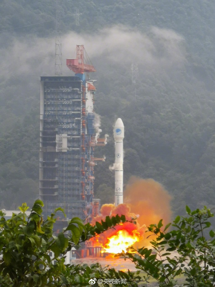
China launched two more BeiDou satellites on Aug. 25. (Photo: CCTV)
China successfully sent twin BeiDou navigation satellites into space on Aug. 25, aboard a single carrier rocket, according to news reports. The satellites are numbers 35 and 36 in the BeiDou navigation constellation.
Only a few weeks ago, China launched another pair of BeiDou-3 navigation satellites.
The Long March-3B carrier rocket lifted off from Xichang Satellite Launch Center in Southwest China’s Sichuan Province at 7:52 a.m. local time.
This was China’s 23rd orbital launch this year, surpassing the national record of 22 launches set in 2016. China Aerospace Science and Technology Corporation (CASC), the main contractor for the space program, is planning on 35 launches this year.
China launched two more BeiDou satellites on Aug. 25. (Photo: CCTV via Weibo)
A team from Aerospace Corporation won a U.S. Army challenge designed to identify artificial intelligence and machine learning tools that could improve the speed and accuracy of electronic warfare operations.
The Army Signal Classification Challenge invited participants to prove they had the best artificial intelligence and machine learning algorithms for performing “blind” radio frequency signal classification quickly and accurately.
An Interim Armored Vehicle “Stryker” and AH-64 Apache helicopters with Battle Group Poland move to secure an area during a lethality demonstration as part of Saber Strike 18 in June 2018. (Photo: U.S. Army/Spc. Hubert D. Delany III, 22nd Mobile Public Affairs Detachment)
The goal was to find solutions that could reduce the cognitive burden placed on electronic warfare soldiers by identifying signals of interest in the electromagnetic spectrum.
The Army , Rapid Capabilities Office (RCO) launched the challenge because the classic signal detection process is no longer efficient in understanding the vast amount of information presented to electronic warfare soldiers on the battlefield by an ever-increasing number of satellite signals, radars, phones and other devices.
More than 150 teams from across universities, laboratories, industry and government participated. The first-place award of $100,000 went to Platypus Aerospace from Aerospace Corporation, a federally funded research and development center.
Second place, with an award of $30,000, went to TeamAU, made up of a team of individual Australian data scientists. Third place and $20,000 went to THUNDERINGPANDA of Motorola Solutions.
“The amount of interest and quality of performance was remarkable, including from nontraditional organizations,” said Rob Monto, Emerging Technologies director for the RCO. “In doing this as a challenge, instead of a traditional Request for Information, we were really modeling what industry does to get at a problem quickly. It was performance-based, open to anyone and implemented without a lot of cost or burden placed on those entering. And now, in a matter of less than four months, we know mathematically who has the best performance for this initial step of applying AI and machine learning to signal classification.”
The challenge, which opened on April 30 and closed on Aug. 13, gave participants 90 days to develop their models and work with training datasets provided by the RCO. That was followed by two test datasets of varying complexity that were the basis for judging submissions.
Participants’ overall challenge score was based on a combined weighted score for both test datasets. Participants were also able to see how they were performing in relation to others in real time, via the participant leaderboard.
“This challenge targeted the upfront data collection, which is traditionally very labor intensive and time consuming,” Monto said. “Now we have a very accurate, very rapid algorithm for a specific problem set. With this research done on the front end, we can move forward with trying to build and integrate it into a real solution for the Army.”
A second phase of the competition is planned and details will be announced later this year.
“We’re thrilled to see our team win this competition through their novel application of artificial intelligence to secure the use and protection of the radio frequency spectrum,” said Steve Isakowitz, Aerospace president and CEO. “Their accomplishment is another great example of how Aerospace is employing cutting-edge technology to advance next-generation capabilities for the warfighter while solving one of our customer’s most difficult challenges.”
Aerospace engineers, named “Team Platypus,” win the Army AI Challenge. From left: Eugene Grayver, Alexander Utter, Andres Vila, Donna Branchevsky, Esteban Valles, Darren Semmen, Sebastian Olsen, Kyle Logue (not pictured). (Photo: Aerospace Corp.)
The group, known as “Team Playtpus,” consists of eight Aerospace communications systems and artificial intelligence engineers: Andres Vila, Kyle Logue, Esteban Valles, Donna Branchevsky, Sebastian Olsen, Alexander Utter, Darren Semmen and Eugene Grayver.
Out of more than 150 overall participants, including 49 teams that actively competed in the challenge, the Aerospace team won by correctly detecting and classifying the greatest number of radio frequency signals using a combination of signal processing and AI technologies.
“In its challenge, the Army RCO released a training set with synthesized data that the teams used to build their algorithms,” said Andres Vila, Aerospace team lead. “Our goal was to combine the team’s deep history and expertise in advanced satellite communications with our practical knowledge of the latest in machine learning and deep neural networks to provide a best-in-class solution.”
Vila added, “This win means that we have built a team that can excel in this new and exciting field of machine learning and specifically deep learning solutions for communication problems.”
The Korea Research Institute of Ships and Oceans Engineering (KRISO) has awarded UrsaNav a contract to supply an eLoran Transmitter Test Bed System in the Republic of Korea.
UrsaNav, the exclusive, worldwide distributor of Nautel’s NL Series transmitters, will provide eLoran transmitter technology, as well as timing and control equipment.
A meeting to kick off the eLoran work. (Photo: UrsaNav)
The contract, awarded through UrsaNav’s agent Dong Kang M-Tech, represents the first phase in a broader program to upgrade Korea’s Loran-C stations to be the foundation of a sovereign Enhanced Loran (eLoran) positioning, navigation and timing (PNT) service.
The Republic of Korea recognizes the challenges associated with relying solely on space-based signals, the relative ease with which those signals can be jammed or spoofed, and the necessity to provide trusted time and position to its citizens and critical national infrastructure, UrsaNav said in a press release.
The press release also included the following description of the importance of eLoran.
Accurate time and position are necessary components upon which many critical infrastructure sectors rely, including maritime, aviation, electrical distribution, telecommunications, finance/banking, and digital broadcast. A complementary PNT (CPNT) service provides continuity of operations through alternative and diverse timing and positioning information. CPNT is a vital element in ensuring national security and assuring Trusted Time and Trusted Position.
eLoran is the latest in the longstanding series of low-frequency (LF), LOng-RAnge Navigation (LORAN) systems. It meets the accuracy, availability, integrity, and continuity performance requirements for maritime harbor entrance and approach maneuvers, aviation En Route and Non-Precision Approaches, land-mobile vehicle navigation, and location-based services. It provides bearing (azimuth) information, even when the user is not moving, and has built-in integrity. Users within the coverage area can simultaneously synchronize their timing to absolute (not relative) UTC. Of equal importance is that the eLoran signal includes one or more Loran Data Channels that are available to provide one-way, low data rate, “Short Message Service” information.
eLoran is completely independent of GPS/GNSS, operates in the internationally protected 90 to 110 kHz spectrum, is built on internationally standardized Loran-C, and provides a high-power PNT service for use by all timing and navigation users. SAE International expects to release eLoran standards this year. The RTCM also has maritime-related eLoran standards underway.
eLoran is a key vertex of a Resilience Triad that would typically include space-based, terrestrial, and at least one other PNT source. It is a very-wide area (i.e., country-wide or “continental”) source of PNT that continues providing a resilient solution even when GNSS may be unavailable or untrustworthy. eLoran delivers information comparable to that of GNSS, but with completely different phenomenology. It is a very high-power, LF, pulsed transmission, whereas GNSS are low-power, UHF, multiple modulation scheme transmissions. eLoran is literally at the other end of the spectrum from GNSS, and has completely dissimilar failure modes. That is, an issue that disrupts GNSS is unlikely to disrupt eLoran. The unique characteristics of eLoran enable its use in environments where GNSS does not work very well, or at all (e.g., indoors, underwater, underground, and in mountain or urban canyons).
eLoran is exceptionally difficult to spoof or jam, and it is nearly impossible to do so at a distance. Just as equipment required to spoof and jam GNSS must mimic relatively low powered GNSS transmissions, spoofing and jamming eLoran requires very high powered transmissions. Equipment needs alone to disrupt eLoran over a significant area would be almost prohibitive for any actor other than a nation state engaged in open conflict. This is the reason that an independent assessment by researchers at Stanford University described eLoran as “for all practical purposes, unjammable” across any significant area. A MITRE paper concluded: “The analysis shows a very low probability of successfully producing operationally significant interference.”
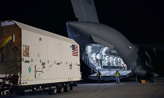
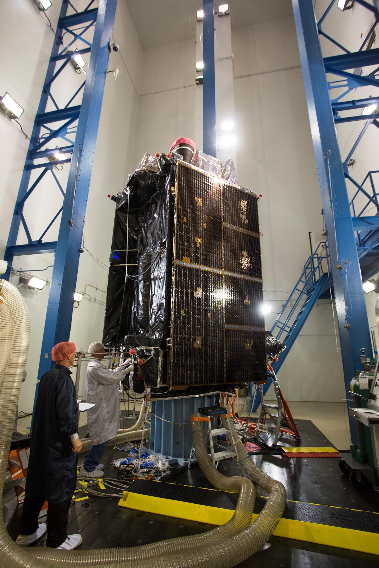
The first GPS III satellite has been delivered to Florida for launch in December on a SpaceX rocket.
On Aug. 20, Lockheed Martin shipped GPS III SV01 to Cape Canaveral. GPS III SV01 is the first of 10 new GPS III satellites being built under U.S. Air Force contract and in full production at Lockheed Martin.
Designed and built at Lockheed Martin’s GPS III Processing Facility near Denver, the satellite was transported in a custom container from the Buckley Air Force Base in Colorado to the cape on a massive Air Force C-17 Globemaster III aircraft originating from Joint Base Lewis-McChord, Washington. On Aug. 21, it arrived at the Space Coast Regional Airport in Titusville, Florida.
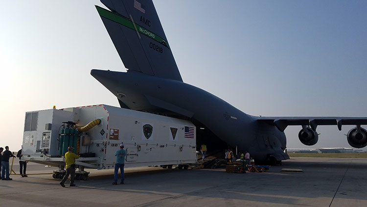
The first GPS III satellite is loaded aboard a U.S. Air Force C-17 at Buckley AFB, Colorado, to begin processing for a December launch aboard a SpaceX rocket from Cape Canaveral. (Photo: U.S. Air Force/Lt. Col. Erin Gulden)
Start the Clock. The delivery of Satellite Vehicle 01 (SV01) starts the clock for final testing and checkout of the space vehicle prior to launch. The satellite will be processed at the Astrotech Space Operations Florida facility.
A government and contractor team will ensure the integrity of the satellite after shipment by performing a Mission Readiness Test to verify the health and safety of the vehicle, as well as communication compatibility with the ground operations center.
The team will then prepare for propellant loading and encapsulate the satellite in its protective fairing. At the completion of these activities, the satellite will be headed for a first-of-its-kind horizontal integration with the SpaceX Falcon 9 launch vehicle.
GPS III improvements. GPS III will be the most powerful and resilient GPS satellite ever put on orbit. Developed with an entirely new design, for U.S. and allied forces it will have three times greater accuracy and up to eight times improved anti-jamming capabilities over the previous GPS II satellite design block, which makes up today’s GPS constellation.
GPS III also will be the first GPS satellite to broadcast the new L1C civil signal. Shared by other international global navigation satellite systems, like Galileo, the L1C signal will improve future connectivity worldwide for commercial and civilian users.
“The shipment of the first GPS III satellite to the launch processing facility is a hallmark achievement for the program,” said Lt. Gen. John F. Thompson, U.S. Air Force’s Space and Missile Systems Center (SMC) commander and program executive officer for Space. “The modernization of GPS has been an outstanding collaborative effort and this brings us another step closer to launch.”
Vespucci. The satellite is dubbed “Vespucci” in honor of Amerigo Vespucci, the Italian explorer for whom the Americas were named.
The transportation crew consisted of both contractor and government personnel who oversaw the entire operation to ensure that the conditions of the transport environment would not damage any of the satellite’s sensitive components, the Air Force said.
“While the launch of the last GPS IIF satellite marked the end of an era, the upcoming GPS III launch will be the start of a brand new one,” said Col. Steven Whitney, director of the GPS Directorate. “It is the first of our new GPS III satellites, first to integrate with a SpaceX rocket, first to interact with elements of GPS’ Next Generation Operational Control System (OCX) Block 0, and first to have spacecraft acquisition and on-orbit checkout from Lockheed Martin facilities. We are excited to be at this point and we are ready for the upcoming launch of Vespucci.”
December Launch. The modernized GPS III SV01 is slated to launch in December. It will augment the current constellation of 31 operational GPS satellites. GPS delivers the gold standard in positioning, navigation, and timing services supporting vital U.S. and allied operations worldwide, and underpins critical financial, transportation and agricultural infrastructure that billions of users have come to depend on daily.
“Once on orbit, the modern technology of this first GPS III space vehicle will begin playing a major role in the Air Force’s plan to modernize the GPS satellite constellation,” said Johnathon Caldwell, Lockheed Martin’s program manager for navigation systems. “We are excited to start bringing GPS III’s new capabilities to the world and proud to continue to serve as a valued partner for the Air Force’s positioning, navigation and timing mission systems.”
Sports data company STATSports is offering STATS GPS shirts to provide real-time GPS intelligence to athletes and coaches.
Wearing STATS GPS shirts, teams can monitor player metrics such as accelerations/decelerations, energy expenditure and count of zone entries, as well as time, distance and power thresholds.
The system uses a 50-Hz sampling frequency. It allows practitioners to monitor up to 100 players in real time and post session with more than 300 GPS, inertial measurement unit (IMU) and HR-derived metrics, the company said.
The shirts feature an embedded medical-grade ECG sensor that’s fully integrated with the GPS units, allowing for seamless real-time analysis with the STATS Dynamix online portal.
Customizable reports can include information on imbalance, cardiovascular metrics and running, explosive and brake symmetry.
Makers of heavy construction equipment are enabling their latest models to become smarter.
Topcon Positioning Group and JCB are collaborating to provide the Topcon X-53x as a plug-and-play option for the new JCB 220X crawler excavators — the first models in the next generation of JCB tracked machines for the global construction market.
The new excavators come with a Topcon pre-wire option from the factory. The Topcon X-53x is designed to provide precise positioning of the boom, stick and bucket at all times, maximizing output up to 30 percent more than machines without a 3D system, the company said. The X-53x also provides a customizable machine control platform to address future project demands.
Also, Topcon and Volvo CE have established a system to allow Topcon 3D machine control software (3D-MC) to seamlessly integrate with the Volvo CE Dig Assist system for a large range of excavators.
The integration of 3D-MC software is designed to complement the Dig Assist real-time guidance capability by including the use of 3D design files and connectivity with Topcon workflow solution platforms. Topcon 3D-MC can be added as an app on the Co-Pilot platform to connect the machine to the Topcon ecosystem.
Meanwhile, Kobelco Construction Machinery has introduced a Trimble-ready option for select excavator models that ship from the Kobelco factory. The excavators come ready for installation of the Trimble Earthworks Grade Control Platform, reducing the cost and complexity of installation for the contractor. Other Kobelco models released this year will also provide the Trimble-ready option.
Doosan Infracore is offering a Trimble-ready option for its Doosan DX225LC-5 excavator, enabling faster, simplified installation of Trimble’s GCS900 2D or 3D Grade Control System components with no welding, re-painting, drilling or disassembly required.
Trimble GCS900 makes design surfaces, grades and alignments accessible to the operator on a display inside the cab using GNSS, GPS, laser, sonic or total station technology to accurately position the blade or bucket in real time.
GPS data serves as the basis for a geodetic model of the Alps. Here, a horizontal strain field is derived from the data. Red areas indicate compression; blue indicates lateral spreading. (Image: DGFI-TUM)
Our Earth is constantly on the move, as the current Kilauea eruption dramatically illustrates. But capturing data on small shifts over time isn’t so easy.
A new computer model based on more than a decade of GPS data shows the dynamic movements of the Alps as the mountain range drifts and rises.
In general, the range drifts an average of one-half millimeter and rises 1.8 millimeters every year.
However, there are strong regional variances. In South and East Tyrol, a rotation towards the east is superimposed on the overall movement, while at the same time the mountain range is being compressed. And the rise in height is not identical everywhere, either. While very small in the southern part of the western Alps, it reaches its maximum with a speed of more than 2 millimeters per year in the central Alps at the boundaries of Austria, Switzerland and Italy.
To create the model, researchers at the Technical University of Munich (TUM) German Geodetic Research Institute evaluated measurements made by more than 300 GPS antennas over a period of 12 years, in the German, Austrian, Slovenian, Italian, French and Swiss Alps. Over that time, each of the stations has been making positioning measurements every 15 seconds.
The team’s model makes the movements visible on a comprehensive basis for the first time.
The scientists identified the positions of the measurement stations, accurate down to fractions of a millimeter; many of the stations were set up in the EU project ALPS-GPSQUAKENET and are in part operated by TUM.
Once corrected for snow weight and atmospheric interference, the data show horizontal and vertical shifts as well as lateral spreading and compression at a resolution of 25 kilometers.
Explains Florian Seitz, chair of Geodetic Geodynamics, “The data are a goldmine for geodesy, with its objective of accurately measuring the surface of the Earth and identifying any changes occurring.”
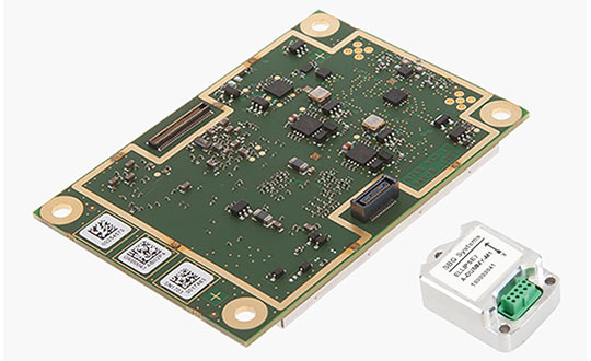
GNSS receiver manufacturer Septentrio has added the AsteRx-i S to its GNSS/INS product portfolio.
The AsteRx-i S combines Septentrio’s compact, multi-frequency multi-constellation GNSS engine with an ultralight external industrial-grade MEMS-based inertial measurement unit (IMU).
Designed around demanding requirements for size, weight, power consumption and temperature variation, the AsteRx-i S is designed for various applications such as inspections with UAVs, UAS photogrammetry, automation, robotics and logistics.
Calibrated for wide temperature ranges, the AsteRx-i S delivers accurate and reliable GNSS/IMU integrated positioning to the centimeter-level, as well as full attitude at high update rates and low latency, the company said.
Key benefits for users include:
GNSS/INS positioning with 3D attitude: heading pitch and roll
AIM+ interference monitoring and mitigation system
High-update rate, low-latency positioning and attitude
Small and ultralight IMU (10 grams)
Robust calibration for wide temperature ranges
“We are delighted to broaden our AsteRx-i GNSS/INS solutions range, bringing maximum flexibility and choice to our customers,” said Francesca Clemente, product manager at Septentrio. “Whether for direct georeferencing in mapping applications with UAVs, for managing containers in a port or for innovative small robots in agriculture, the compactness, affordability and robustness of the AsteRx-i range allows our customers to focus on their success.”
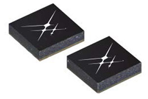
Skyworks has unveiled two new GNSS low-noise amplifier (LNA) front-end modules. The SKY65933-11 and SKY65943-11 both integrate Skyworks’ proprietary TC-SAW filters.
The modules are designed specifically for internet of things (IoT) applications including smartwatches, action cameras, drones, asset trackers and personal navigation devices. athey are designed for wireless module and IoT device manufacturers, providing a turnkey GNSS connectivity solution in a compact form factor.
Both solutions offer:
integrated pre- and post-filter, LNA and matching to reduce PCB area versus a discrete implementation
single DC supply for design flexibility and simplicity
multi-GNSS compatibility to cover GPS, GLONASS, GALILEO, COMPASS (BeiDou) and QZSS receiver applications in the 1559-1606 MHz frequency range
extremely low leakage current (1 uA max) benefitting battery-powered IoT devices
highly manufacturable and low-cost surface-mount technology (SMT) in a 2.5 x 2.5 mm multi-chip module (MCM) package.
SKY65933-11:
Fully integrates all functional blocks, no external components required
Supply range: 1.5 to 2.85 V
Package: 16L 2.5 x 2.5 mm
SKY65943-11:
Exceptional out-of-band rejection and P1dB compression point
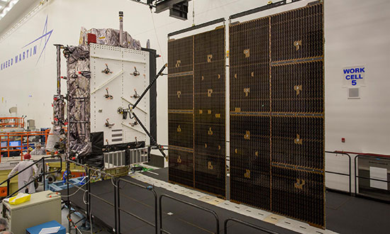
GPS III Space Vehicle 02 (GPS III SV02) is complete, tested and expected to launch in 2019.
As the first Lockheed Martin-built GPS III satellite prepares to ship to the launchpad, the U.S. Air Force has declared that the second GPS III satellite is complete, fully tested and ready to launch.
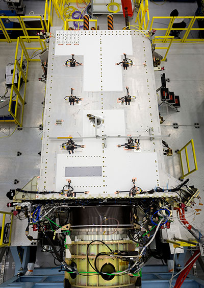
In May 2017, the U.S. Air Force’s second GPS III satellite was fully assembled and entered into Space Vehicle (SV) single line flow when Lockheed Martin technicians successfully integrated its system module, propulsion core and antenna deck. (Photo: Lockheed Martin)
The Air Force’s “Available for Launch” declaration is the final acceptance of Lockheed Martin’s second GPS III Space Vehicle (GPS III SV02), declaring it technically sound and ready to launch.
GPS III SV02 will bring new capabilities to U.S. and allied military forces, and a new civil signal that will improve future connectivity worldwide for commercial and civilian users.
GPS III SV02 now awaits official call up for launch in Lockheed Martin’s GPS III Processing Facility clean room in Denver. In June, the Air Force officially called up its first GPS III satellite for launch.
“The first GPS III satellite, GPS III SV01, was declared ‘Available for Launch’ in September 2017,” said Johnathon Caldwell, Lockheed Martin’s program manager for Navigation Systems. “It is now being prepared for shipment to Cape Canaveral, Florida, for a launch before the end of the year. With two GPS III satellites now ready for launch, and the third GPS III expected to be ready by early next year, we’re building strong momentum. These satellites will soon begin modernizing the current GPS constellation with new capabilities and more advanced technology.”
On July 13, 2017, the U.S. Air Force’s second GPS III space vehicle (GPS III SV 02) successfully completed acoustic testing. (Photo: Lockheed Martin)
GPS III will be the most powerful GPS satellite ever on orbit. It will have three times better accuracy and up to eight times improved anti-jamming capabilities.
GPS III’s new L1C civil signal also will make it the first GPS satellite to be interoperable with other international global navigation satellite systems.
Lockheed Martin is now in full production on 10 GPS III satellites at its GPS III Processing Facility near Denver.
In June, GPS III SV03 completed thermal vacuum testing, strenuous environmental trials simulating operations in the harshest space environments. In May, the antenna deck was added to GPS III SV04, fully integrating it into a complete satellite ready to begin environmental testing.
Right behind GPS III SV04 on the production line, the fifth, sixth and seventh GPS III satellites are in component build-up. The fifth satellite has its navigation payload and is expected to be fully assembled later this summer. To date, more than 90 percent of parts and materials for all 10 satellites under contract have been received.
In April, the company submitted a proposal to the government to build up to 22 additional GPS III Follow On (GPS IIIF) satellites which would bring even further enhanced capabilities to the GPS constellation’s more than four billion users.
In July 2017, Lockheed Martin tested the deployment of the solar arrays for the U.S. Air Force’s second GPS III space vehicle (GPS III SV02). (Photo: Lockheed Martin)
Laser Technology Inc. (LTI), manufacturer of professional-grade laser rangefinders, has released its improved TruPulse 360 laser, which features LTI’s TruVector 360° Compass Technology.
The rangefinder has numerous measurement capabilities. According to the company, it can measure slope distance, inclination and azimuth; instantly calculate horizontal and vertical distances; and calculate 3D missing line values.
The enhanced device offers 33 percent increased distance accuracy, 25 percent better target acquisition and a higher azimuth accuracy of 0.5° root mean squared (RMS).
“Given its limitless angle and tilt capabilities, the TruPulse 360 is extremely popular for GPS/GNSS offset mapping processes,” said Eric Miller, president of Laser Technology Inc. “The laser’s flexibility enables users to record offsets and attribute data of multiple features from a single location, making data collection quicker, easier and even safer in potentially hazardous situations.”
The new TruPulse 360 continues LTI’s mission of providing cutting-edge laser measurement solutions in an easy-to-use way, and this model represents an accumulation of more than a decade of work.
In 2007, the TruPulse 360 integrated LTI’s exclusive TruVector 360° Compass Technology, which was developed from the company’s stand-alone MapStar compass module. The combination of an integrated compass, inclinometer and distance laser gave measurement professionals the best possible azimuth accuracy — and mapping-grade precision — no matter the angle it was shot in, the company said.
Features
Photo: LTI
This latest version of the TruPulse 360, with an even more accurate electronic compass integrated into the laser, continues to deliver added value for the modern measurement professional. Uses include forestry, utilities, construction and GIS mapping.
In addition to its increased range and azimuth accuracy and Bluetooth-enabled communication, the TruPulse 360 features:
Reflectorless technology that enables data capture to any surface type;
advanced targeting modes to achieve accurate, repeatable results of the intended target;
seven-power superior optics technology that displays all measured and calculated solutions; and
Smart technology that recognizes adverse measurement conditions and prompts recalibration.
“By integrating our great compass technology into this already groundbreaking device, no other laser on the market can match the performance of the TruPulse 360,” Miller said. “And with our continuous commitment to making user-driven enhancements, the TruPulse 360 stands on its own as the best measurement and mapping laser rangefinder out there.”
The transaction is expected to close in the third quarter, contingent on normal regulatory approvals.
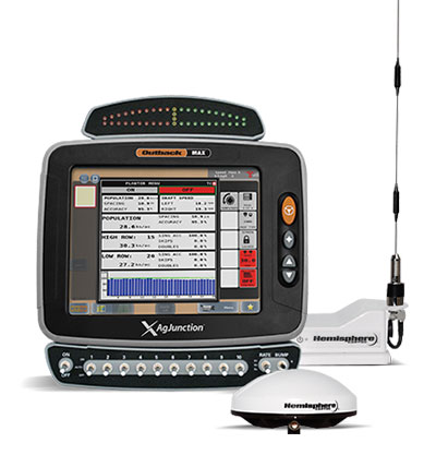
The Outback MAX terminal with ISOBUS. (Photo: Outback Guidance)
The acquisition aligns with Hemisphere’s continued push into the global agriculture market, Hemisphere GNSS said. In addition to the included IP licenses for business into the dealer channel, a second license was signed to allow agriculture steering solutions sales into OEM (original equipment manufacturer), VAR (value-added reseller) and all other segments of the agriculture supply chain.
As a result of these agreements, Hemisphere will assume ownership of the Outback Guidance assets, including channel, infrastructure and trademarks. Additionally, licenses to intellectual property and related technology have been executed.
Also included are two product development, sales, and support facilities, including personnel located in Hiawatha, Kansas, United States, and Winnipeg, Manitoba, Canada.
“The decision to acquire the Outback Guidance business will significantly accelerate Hemisphere’s expansion into the global agriculture market and allow stronger integration between Hemisphere’s core competency GNSS and Outback’s highly refined steering solutions,” said Farlin Halsey, president and chief executive officer of Hemisphere GNSS.
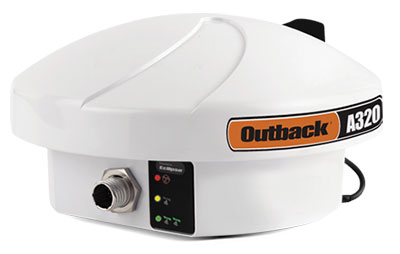
The Outback A320 smart antenna. (Photo: Outback Guidance)
“We are very pleased to be bringing on board additional seasoned personnel with strong agriculture domain experience, a strong product line with deeply embedded agricultural technology and a well-accepted, reputable brand in Outback,” Halsey said. “We will also be bringing back together many years of history and legacy between the two organizations.”
The addition of Outback Guidance represents Hemisphere’s continued effort to make significant investments to expand its presence in the global agricultural market. Hemisphere has seen successful revenues and wide-reaching positive feedback in recent years with its OEM focused agriculture products. Hemisphere seeks to further integrate its high-precision GNSS positioning technology via systems and services offered by the Outback Guidance dealer network, the company said.
The Outback Guidance channels of communication including customer support, sales, and website will remain as they currently operate. The Outback Guidance dealer network will not see any interruption during this transition period.