Author: Tracy Cozzens

  • GNSS Summer School slated for July

    The annual ESA/JRC International Summer School on GNSS will take place July 16-27 in Loipersdorf, Austria. The early registration discount ends May 15.

    The 10-day school will cover all aspects of satellite navigation, up to and including the creation of a satnav-based business. It is open to graduate students, Ph.D.s and postdoctoral researchers, as well as young engineers and academics working within industry or agencies, aged 35 or younger.

    The number of participants is limited to 50, on a first-come, first-served basis.

    Internationally renowned scientists and specialists will be giving lectures as well as overseeing practical exercises and lab work.

    Participants will receive a full-spectrum overview of satellite navigation, starting from the theoretical basis of Global Navigation Satellite Systems, their signals, the processing performed by signal receivers and how the position-navigation-time solution is worked out.

    Also discussed will be threats to the satnav systems, such as spoofing or jamming, and countermeasures available against them, along with back-up navigation solutions for a GNSS-denied environment.

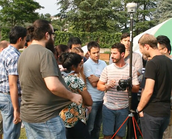
    Practical exercises will include receiving the various satnav constellations now in orbit — including Europe’s Galileo — to give course members direct, hands-on experience.

    In addition, lectures will cover business aspects, including patents and intellectual property rights.

    The main emphasis of the course will be the development of a group business project, building on an innovative idea to take in the planning of the product or service, its technical realisation and finally its marketing to customers.

    Image: Summer School
    Image: Summer School

    The school takes place in cooperation with Stanford University in the United States, the Institut Supérieur de l’Aeronautique et de l’Espace ISAE-SUPAERO in Toulouse, France, Graz University of Technology in Austria, and the University FAF Munich in Germany.

    Austria is this year’s host nation, and the summer school is supported by Graz University of Technology and the Austrian Institute of Navigation.

    For more information and to register, visit the summer school website.

  • Two more BeiDou-3 satellites launched for global coverage by 2020

    Two more BeiDou-3 satellites launched for global coverage by 2020

    China launched two more Beidou-3 satellites March 30, the seventh and eighth of the third phase of the Beidou system.

    Launch via Long March 3B rocket took place at 01:56 Beijing time Friday (17:56 UTC Thursday) from the Xichang Satellite Launch Centre, reports gbtimes.com.

    The satellites join six others orbiting at 21,000 kilometers above the Earth. BeiDou-3 is designed to expand Beidou navigation, positioning and timing services from regional to global coverage by 2020.

    The satellites were inserted into medium Earth orbits by a Yuanzheng-1 upper stage more than three hours after launch, with CASC, China’s main aerospace contractor, then confirming success.

    The satellites were developed by the Innovation Academy for Microsatellites at the Chinese Academy of Sciences (CAS), while the China Academy of Launch Vehicle Technology (CALT) under CASC provided the Long March 3B launch vehicle.

    A Long March rocket carries a pair of BeiDou-3 satellites to medium Earth orbit on March 30, 2018. (Photo: Liang Keyan/Xinhua)
  • Galileo ground segment keeps constellation on track

    Galileo ground segment keeps constellation on track

    News from the European Space Agency

    Galileo’s initial services have been running for more than 15 months now, and signals from the satellites in space are routinely serving users all across the world. The functioning of Galileo is dependent on a global network of ground stations, its current extent shown in the map here.

    The constellation in orbit is only one element of the overall satellite navigation system – the tip of the Galileo iceberg. At the same time as satellites were being built, tested and launched, a global ground segment has been put in place, extending to some of the world’s loneliest places, from Svalbard in the High Arctic to storm-engulfed Jan Mayen Island, Ascension Island in the Mid Atlantic to Noumea in the South Pacific, Kerguelen in the southern Indian Ocean to Troll base in the Antarctic interior.

    Galileo’s global ground segment. (Image: ESA)

    Among the latest developments are updated control and mission software for the two Galileo control centres that sit at the heart of this global web: Fucino in Italy generates the accurate navigation messages that are then broadcast through the navigation payloads, and Oberpfaffenhofen in Germany controls the constellation of satellites. A new telemetry, tracking and command station last year arose in Papeete on Tahiti, in the South Pacific.

    Establishing Galileo’s ground segment was among the most complex developments ever undertaken by ESA, having to fulfill strict levels of performance, security and safety. Formal responsibility for the operations of this Galileo ground segment was last year passed to ESA’s partner organization, the European Global Navigation Satellite System Agency, or GSA, but ESA continues to be in charge of its maintenance and growth.

    Galileo’s Nouméa ground station’s Sensor Station and Uplink Station. (Photo: ESA)

    Users don’t have to worry about this ground segment, but it is essential to keeping Galileo services running reliably. The atomic clocks aboard the satellites are accurate to a few nanoseconds, delivering metre-scale positioning precision, but they are prone to drift over time.

    Similarly, the orbits of the satellites can be slightly nudged by the gravitational tug of Earth’s slight equatorial bulge and by the Moon and Sun. Even the slight but continuous push of sunlight itself can affect satellites in their orbital paths. The quality of signals received on the ground can be affected by their transit through the ever-changing ionosphere, the electrically active outer layer of Earth’s atmosphere.

    Galileo sensor stations, with small omnidirectional receiving antennas around just 50 cm high, are on place around the globe to check the accuracy and signal quality of individual satellites in real time, and work together to pinpoint the current satellite orbits.

    These measurements are transmitted via secure satellite communications to Fucino, where they serve as the basis of a set of corrections — accounting for timing or orbital slips — to be uplinked to the satellites via a network of 3-metre-diameter uplink stations for rebroadcast within navigation messages to users, currently updated every 50 minutes.

    Considering Galileo is Europe’s largest satellite constellation, timely control of the satellites is essential, enabled by 13 m-diameter telemetry, tracking and command stations in Kiruna, Sweden and Redu, Belgium as well as the equator-hugging Kourou, French Guiana, Reunion, Noumea in New Caledonia and now Papeete sites.

    Galileo Station on Gran Canaria. (Photo: ESA)

    The ground segment also comprises a set of four Medium-Earth Orbit Local User Terminals serving Galileo’s search and rescue service, at the corners of Europe and facilities for testing Galileo service quality and security — the Timing and Geodetic Validation Facility and two Galileo Security Monitoring Centres.

    The Launch and Early Operations Control Centres have the task of bringing new satellites to life, to be handed over to the main Satellite Control Centre in Oberpfaffenhofen within typically a week after launch. Redu in Belgium, set up as Galileo’s In-Orbit Test Centre, then puts these satellites through a complex set of testing and checkouts ahead of them joining the working constellation.

  • New Viametris backpack scanner integrates SBG Systems product

    Viametris, specialist of SLAM-based mobile scanning systems, has launched a backpack-based scanning system called the bMS3D-360. The company continues to rely on SBG Systems’ expertise in inertial navigation by integrating the Ellipse2-D, an inertial navigation system with embedded real-time kinematic (RTK) GNSS receiver.

    Photo: Viametris
    Photo: Viametris

    Viametris has been developing SLAM-based scanning systems for more than 10 years, including the iMS3D, a full indoor mapping system and the VMS3D, a car-based mapping system.

    The bMS3D-360 has been designed for the most challenging environments where GNSS is not accessible (indoor) or highly perturbed (urban canyons, forest, etc.). The surveyor starts the system, checks on a tablet that the GNSS and inertial information are computed, and starts the survey.

    Back at the office, the user launches the INS/GNSS post-processing software to increase orientation and position accuracy, and then uses the Viametris software to georeference and colorize the point cloud.

    Collected data are ready to be imported into common design software. This workflow (from collection to plan drawing) is seven times faster than a traditional method.

    The bMS3D-360 offers a 360-degree camera, which greatly simplifies the treatment work. When navigating in the point cloud, the user opens a unique picture of the 360-degree scanned environment instead of looking at four different camera points of view.

    Photo: SBG Systems
    Photo: SBG Systems

    The Ellipse2-D from SBG Systems is a compact inertial navigation system integrating an L1/L2 GNSS receiver. This industrial-grade INS computes roll, pitch and heading as well as position because of its embedded Extended Kalman Filtering.

    In real time, Ellipse2-D orientation data are used to correct the equipment attitude and help the SLAM computed heading. The embedded GNSS receiver provides absolute positioning to the point cloud as well as altitude constraint.

    When the GNSS faces sources of disturbance, the INS maintains the trajectory were the SLAM technology is limited.

  • NASA completes third phase of UAS airspace testing

    NASA completes third phase of UAS airspace testing

    The Nevada Institute for Autonomous Systems (NIAS) and its NASA Unmanned Traffic Management (UTM) partners flew multiple unmanned aerial systems over a week-long testing period at the Nevada UAS Test Site at the Reno-Stead Airport.

    NASA UTM Testing. Credit: NIAS. (PRNewsfoto/Nevada Institute for Autonomous)

    This third phase of NASA’s UAS testing (TCL 3) again focused on airspace management technologies that will enable the safe integration of UAS into the national airspace.

    NASA provided a Flight Information Management System (FIMS) research platform that will serve as a future prototype system for the U.S. Federal Aviation Administration (FAA) to use to coordinate with unmanned service suppliers operating throughout the nation.

    Research areas of emphasis during the testing included UAS ground-control interfacing to locally manage operations, communication, navigation, surveillance, human factors, data exchange, network solutions and beyond-visual-line-of-sight (BVLOS) architecture.

    On media day, a team from the Reno Fire Department simulated an incident with a victim experiencing severe blood loss and who needed an immediate transfusion. A multi-rotor UAS from Drone America was equipped with a container that held an actual packet of blood to be transported via drone in Nevada.

    High winds and frigid temperatures tested both the drone and those on the ground, but the drone successfully landed in the designated landing area so that firefighters could retrieve the blood packet and begin the faux-transfusion.

    The partners not only demonstrated drone flight capability, but also tested UAS traffic mapping and sensor and radar technology, all of which were connected through a NASA UAS Service Supplier (USS) network to NASA Ames.

    Technology Capability Levels

    NASA’s near-term goal is the development and demonstration of a possible future UTM system that could safely enable low-altitude airspace and UAS operations. Working alongside many committed government, industry and academic partners, NASA is leading the research, development and testing that is taking place in a series of activities called “Technology Capability Levels (TCL)”, each increasing in complexity.

    UTM TCL1 concluded field testing in August 2015 and is undergoing additional testing at an FAA site. Technologies in this activity addressed operations for agriculture, firefighting and infrastructure monitoring, with a focus on geofencing, altitude “rules of the road” and scheduling of vehicle trajectories.

    UTM TCL2, completed in October 2016, leveraged TCL1 results and focused on beyond visual line-of-sight operations in sparsely populated areas. Researchers tested technologies that allowed dynamic adjustments to availability of airspace and contingency management.

    UTM TCL3, just completed, leveraged TCL2 results and focused on testing technologies that maintain safe spacing between cooperative (responsive) and non-cooperative (non-responsive) UAS over moderately populated areas.

    UTM TCL4, with dates to be determined, will leverage TCL3 results and focus on UAS operations in higher density urban areas for tasks such as news gathering and package delivery. It will also test technologies that could be used to manage large-scale contingencies.

    NASA’s UTM technologies research and development is taking place in collaboration with the FAA. Results of research in the form of airspace integration requirements are expected to be transferred from NASA to the FAA in 2019 for the FAA’s further testing.

    “Advanced flight and highly technical scenarios like drone detection, surveillance of critical infrastructure aerial package delivery of critical first responder medical supplies, to the important NASA data interoperability protocols that will eventually form the backbone of the UTM system, we focused heavily on communications, navigation and surveillance to produce critical data for the NASA TCL 3 Campaign,” said Chris Walach, the senior director of NIAS and the FAA-designated Nevada UAS Test Site. “Our Nevada teammates did an amazing job working together to successfully complete the first series of major testing for NASA’s TCL 3 Campaign.”

  • SBG Systems releases Navsight inertial for marine surveys

    SBG Systems has released the Navsight marine solution, a full high-performance inertial navigation solution designed to make surveyors’ tasks easier in both shallow and deep water.

    Navsight consists of an inertial measurement unit available at two different performance levels (from shallow to deep water). According to SBG Systems, the Navsight marine solution is based on 10 years of the company’s experience in marine inertial sensing products.

    Whether the IMU comes with a surface or a subsea enclosure, they are all lightweight and easy to install, the company said. Navsight connects to any computer, with no software installation. Once connected through Ethernet, the web interface guides the user to configure the solution.

    A 3D view of the boat shows the entered parameters so that the user can check in real time the installation. Navsight allows quick installation and initialization thanks to new mechanical calibration module. The embedded filtering controls and validates lever arms and antenna alignment during this procedure.

    Navsight Marine Solution provides high-performance motion and navigation data as well as a real-time heave accurate to 5 cm, which automatically adjusts to the wave frequency, SBG Systems said.

    To allow surveying when wave frequencies are large or complex, Navsight comes with a delayed heave feature resulting in a heave accurate to up to 2-cm computed in real-time with a little delay.

    If higher performance is required, the surveyor can count on SBG INS/GNSS post-processing software named Qinertia. By processing inertial and GNSS raw data forward and backward, Qinertia greatly increases accuracy especially during GNSS outages; it also fixes set up mistakes.

    Highly versatile, Navsight comes as a Motion Reference Unit, providing roll, pitch and heave or as a full navigation solution with embedded tri-frequency GNSS receiver, or using an external one. Fusing inertial data with satellite position in real-time, Navsight INS offers continuous position in all conditions, such as surveying under a bridge, or during a GNSS outages due to coastal infrastructures (buildings, harbor cranes, etc.).

    The Navsight Marine Solution supports RTK and every precise point positioning service (Marinestar, TerraStar, etc.). It is compatible with the main hydrographic software such as Hypack, QINSy or Teledyne PDS for seamless integration into existing workflows.

    Navsight is ITAR-free. All models are available for order. Ordering information and delivery time are available from SBG Systems representatives and authorized SBG Systems dealers.

  • Singapore to test camera, location system for traffic

    The Singapore Land Transport Authority (LTA) has begun testing an Automatic Number Plate Recognition (ANPR) camera system with Dedicated Short Range Communications (DSRC) beacons at various locations along expressways and major thoroughfares.

    The testing started March 26 and will conclude in 2019.

    An example of the equipment that will be mounted on existing roadside infrastructure. (Image: LTA)
    An example of the equipment that will be mounted on existing roadside infrastructure. (Image: LTA)

    The use of ANPR technology will facilitate enforcement, while DSRC beacons will also be installed in some areas to enhance positioning accuracy in Singapore’s highly urbanized environment.

    The tests will enable LTA to determine the performance and reliability of such technologies under various real-life environmental and traffic conditions for future traffic management systems that will leverage GNSS technology.

    The technologies being tested do not require heavy physical infrastructure and will be mounted on existing roadside infrastructure such as overhead bridges, overhead gantry signages and lamp posts, as well as EMAS gantries.

    Testing equipment will also be mounted onto vehicles, which will be deployed at localized areas such as Tuas South from April 2018, before expanding island-wide for testing.

    In 2016, LTA awarded a S$556 million contract to the consortium of NCS and Mitsubishi Heavy Industries Engine System Asia to build a next-generation electronic road pricing system based on GNSS technology, reports Channel NewsAsia.

    The new system will allow motorists to be charged according to distance traveled on congested roads, removing the need for physical gantries.

    An example of the equipment that will be mounted onto vehicles. (Image: LTA)
    An example of the equipment that will be mounted onto vehicles. (Image: LTA)
  • Victim suddenly stepped in front of autonomous Uber, data shows

    Police say a video from the Uber self-driving car that struck and killed a woman on March 18 shows her moving in front of it suddenly, according to Bloomberg Technology.

    Uber Technologies Inc. halted its autonomous vehicle tests after one of its cars struck and killed a woman in Tempe, Arizona, in the first pedestrian fatality involving the technology.

    Officials in Boston asked that similar tests by self-driving startup NuTonomy Inc. pauses its tests following the Arizona crash. Toyota also halted its tests.

    A backup driver was behind the wheel but not operating the vehicle. “The driver said it was like a flash, the person walked out in front of them,” Sylvia Moir, the police chief in Tempe, Arizona, told the San Francisco Chronicle. “His first alert to the collision was the sound of the collision.”

    The Uber had a forward-facing video recorder, which showed the woman was walking a bike at about 10 p.m. and moved into traffic from a dark center median.

    “It’s very clear it would have been difficult to avoid this collision in any kind of mode,” Moir said.

  • Bentley Systems to celebrate Year in Infrastructure in October

    Bentley Systems’ Year in Infrastructure 2018 Conference will be held Oct. 15-18 in London at the Hilton London Metropole.

    Bentley Systems is a global provider of comprehensive software solutions for advancing infrastructure.

    Presented by Bentley Institute, the conference is a global gathering of leading industry executives and prominent thought leaders in the design, construction and operations of the world’s infrastructure. The theme of this year’s conference is “Going Digital: Advancements in Infrastructure.”

    The conference features nearly 70 speakers and more than 50 informative sessions, including keynotes by leading industry experts, interactive workshops, forums, panel discussions and product demonstrations. Attendees can visit the Technology Pavilion, which features exhibits and presentations from Bentley Systems and its strategic partners Microsoft, Siemens, Topcon and Bureau Veritas.

    On the first day of the conference, Bentley Institute will host Digital Advancement Academies, featuring presentations and interactive discussions with subject matter experts who provide insights and best practices in their areas of expertise including reality modeling, BIM strategy and constructioneering.

    The conference also includes the selection and announcement of the winners of Bentley’s Year in Infrastructure 2018 Awards (formerly known as the Be Inspired Awards), which honors the extraordinary infrastructure projects by users of Bentley software throughout the world.

    During six industry-focused forums featured during the conference — Buildings and Campuses, Digital Cities, Industrial Infrastructure, Rail and Transit, Roads and Bridges, and Utilities and Water — more than 55 awards finalists will present their projects to independent panels of jurors, more than 100 members of the press, and conference attendees.

    From those presentations, winners are selected by the jurors, and will be announced at the conclusion of the conference on Oct. 18 during an evening ceremony and gala.

    Aret Garip, technical director for WSP, attended Bentley’s conference last year in Singapore to represent WSP’s One Blackfriars project in London, which was chosen as an awards finalist.

    “The conference has been truly inspiring and educational,” Garip said. “It’s a great event to learn about the latest tech in engineering design software and an opportunity to meet the creative, intelligent people who develop new tools to make it easier for us to design buildings.”

    In October 2019, the Year in Infrastructure Conference will return to the Marina Bay Sands Expo and Convention Centre in Singapore.

  • MicroPilot selects Simlat payload emulator for UAV cameras

    MicroPilot is working with Simlat to develop a pan, tilt and zoom payload simulation tool to help improve the camera-centric parts of MicroPilot’s autopilot software.

    Simlat is a provider of training systems for UAVs, enabling training on any platform with any payload for any mission. The tool Simlat has developed emulates a camera payload on a UAV, including simulated video, when set up with an “iron bird.”

    This allows more testing to be performed on the ground, and potential problems with the payload worked out before flight testing begins.

    “Flight testing is time consuming and expensive and simulation is an essential tool that reduces the amount of flight testing necessary to bring a drone to market,” said Howard Loewen, president of MicroPilot. “We are pleased to be working with Simlat to add this capability to our software development process.

    “MicroPilot is always looking for useful tools and features to integrate with our products in order to help deliver more capable and reliable products to our customers. This camera payload emulator is just one of many third-party tools we have incorporated into our testing and development and yet another way MicroPilot has shown its dedication to product quality and performance.”

    MicroPilot is an ISO 9001 autopilot manufacturer to bring to market an ISO 9001 sub-30-gram autopilot, triple redundant autopilot, and full-function general-purpose autopilot. MicroPilot offers a family of lightweight UAV autopilots that can fly fixed-wing, transitional, helicopter and multirotor UAVs.

  • Lighthouse front-end processes 4 GNSS frequencies simultaneously

    Lighthouse front-end processes 4 GNSS frequencies simultaneously

    Lighthouse Technology and Consulting Co. Ltd. has developed of a series of front-end processors for GNSS software receivers.

    The Hibiki processors can take input from up to four frequency GNSS signals simultaneously.

    The Hibiki front-end can process up to four GNSS signals for software receivers. (Image: Lighthouse)

    The Japanese Quasi-Zenith Satellite System (QZSS) broadcasts GNSS signals in four frequency bands: L1, L2, L5 and L6. Similarly, GPS and GLONASS broadcast in three bands, and the European Galileo and Chinese BeiDou systems broadcast in four bands.

    However, many conventional front-ends process only two bands at the same time, and cannot be used for highly specialized applications such as processing multiple signals with different frequencies at the same time.

    The Hibiki front-end processor was designed to answer to this GNSS technology demand and is able to process up to four frequency bands simultaneously, the company said.

    Hibiki has a high data transfer rate performance using USB 3.0, stably transmitting signal data to the host computer up to 50 million samples per second. This high sampling frequency is much greater than conventional front-end processors, improving L5 signal-receiving performance and reducing multipath.

    Hibiki is available starting in April.

    Chart: Lighthouse
    Chart: Lighthouse


  • High-power microwaves and lasers defeat drones in U.S. Army exercise

    High-power microwaves and lasers defeat drones in U.S. Army exercise

    Forty-five unmanned aerial vehicles and drones fell out of the sky during a U.S. Army exercise after Raytheon’s advanced high-power microwave and laser dune buggy engaged and destroyed them.

    These common threats were knocked down during a Maneuver Fires Integrated Experiment (MFIX), held in December at the Fires Center of Excellence at Fort Sill, Oklahoma.

    The directed energy system emits an adjustable energy beam that renders drones unable to fly. (Photo: U.S. Army)

    The directed energy system emits an adjustable energy beam that, when aimed at airborne targets such as drones, renders them unable to fly.

    The MFIX event brought military and industry leaders together to demonstrate ways to bridge the Army’s capability gaps in long-range fires and maneuver short-range air defense.

    Raytheon’s high-power microwave system engaged multiple UAV swarms, downing 33 drones, two and three at a time.

    Raytheon’s high-energy laser, or HEL, system identified, tracked, engaged and killed 12 airborne, maneuvering Class I and II UAVs, and destroyed six stationary mortar projectiles.

    The vehicle-mounted laser is installed on an all-terrain Polaris militarized vehicle. (Photo: U.S. Army)

    The vehicle-mounted laser combined a solid state laser with an advanced variant of the company’’s Multi-Spectral Targeting System™ and installed them on a small, all-terrain Polaris militarized vehicle.

    The system delivers 300 seconds of invisible, precise and instantaneous energy and five hours of intelligence, surveillance and reconnaissance from a single charge, Raytheon said.

    Coupled with a generator, the HEL weapon system provides military members with counter-UAV capabilities and a virtually unlimited magazine.

    “The speed and low cost per engagement of directed energy is revolutionary in protecting our troops against drones,” said Thomas Bussing, Raytheon Advanced Missile Systems vice president. “We have spent decades perfecting the high-power microwave system, which may soon give our military a significant advantage against this proliferating threat.”

    Raytheon and the U.S. Air Force Research Laboratory worked together under a $2 million contract to test and demonstrate high-power microwave, counter-UAV capabilities.

    “Our customer needed a solution, and they needed it fast,” said Ben Allison, director of Raytheon’s HEL product line. “So, we took what we’ve learned and combined it with combat-proven components to rapidly deliver a small, self-contained and easily deployed counter-UAV system.”