Author: Tracy Cozzens

  • Trimble MX9 mapping system designed for surveying, engineering, GIS

    Trimble has released its MX9 mobile mapping solution for large-scale scanning and mapping missions.

    The Trimble MX9 combines a vehicle-mounted mobile lidar system, multi-camera imaging and field software for efficient, precise and high-volume data capture for a broad range of mobile mapping applications such as road surveys, topographic mapping, 3D modeling and asset management.

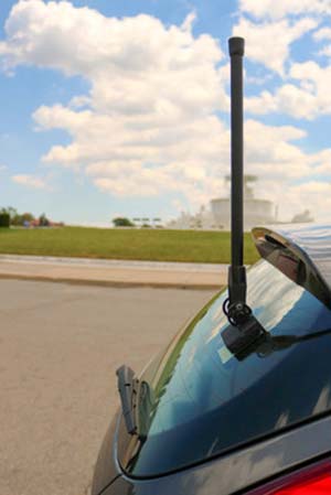
    The Trimble MX9 captures dense point-cloud data along with 360-degree immersive georeferenced imagery using a spherical camera, GNSS/INS technology and dual-head laser scanning sensors.

    Trimbe-MX9-mobilemapper-O

    The system’s innovative and lightweight design facilitates easy installation and setup on a variety of vehicles. Spatial data can be captured at highway speeds from inside the vehicle for safe operation in transportation corridors.

    The intuitive, browser-based field software, accessible via most tablets or any notebook, enables operators to quickly establish and conduct data-acquisition missions, monitor the status of the system, and assess the quality of the acquired data in real time.

    “The Trimble MX9 is our next-generation mobile mapping system, focused on simple operation and integrated workflows for a new generation of users and applications,” said Ron Bisio, vice president of Trimble Geospatial. “We believe there’s a tremendous potential for a system that offers high-quality performance, simple installation and easy operation.

    “Being able to capture high-fidelity and survey-grade data for a whole project site, a complete city or even a statewide road-network allows our customers to use mobile mapping data for a variety of surveying, engineering and mapping applications.”

    The Trimble MX9 is designed for applications including transportation infrastructure planning, as-built surveying, GIS mapping and asset management. Survey and engineering professionals can analyze road cross-sections, perform clearance inspections, conduct topographic mapping, and also use the data for machine control.

    Mapping professionals can utilize the same data for city mapping and planning, inventory mapping and 3D modeling of buildings and linework.

    Complete integration with Trimble office software allows users to seamlessly process the acquired data and generate deliverables for a wide variety of applications. Tools are available for survey and engineering applications as well as deriving and publishing GIS and asset management deliverables.

    Users can also easily export their data for use with third-party software.

    The Trimble MX9 is available for virtual or live demonstrations, depending on customer location, beginning in April. The MX9 system includes a roof rack. Optional accessories such as a GNSS azimuth measurement system (GAMS) or a distance measurement instrument (DMI) are available.

  • Fractus Antennas launches 5G chip antenna

    Fractus Antennas has launched a mobile antenna that enables coverage at 3G, 4G and 5G — the TRIO mXTEND chip antenna component.

    The TRIO mXTEND has been specifically designed to provide flexibility to operate any required frequency band inside any wireless device.

    It is capable of operating the main mobile communication standards, enabling worldwide coverage, as well as GNSS such as GPS, GLONASS and BeiDou (1561 MHz, 1575 MHz and 1598-1606 MHz) and the main short range wireless bands such as Bluetooth and Wi-Fi (2400-2500MHz and 4900-5875MHz) through the same antenna component.

    The TRIO mXTEND is a modular, multiband and multi-port antenna component that enables top-quality worldwide coverage at any mobile communication standard. Its reconfigurable and off-the-shelf nature allows multiple architectures so the antenna component can be assembled into any mobile or IoT device.

    It has been designed for providing mobile operation in three different frequency regions: 698-960 MHz, 1710-2690 MHz and 3400-3800 MHz. In addition, TRIO mXTEND is presented in an ultra slim component of 1 millimeter that enables easy placement into any device.

    The Fractus Antennas team will be at Mobile World Congress in Barcelona, either at the venue or in Fractus Antennas Headquarters, which is based in the city. Those interested are invited to arrange a meeting.

  • Mayflower delivers anti-jam antenna systems to U.S. Air Force

    Mayflower Communications Company has delivered its Multi-Platform Anti-Jam GPS Navigation Antenna–Federated (MAGNA-F) to the U.S. Air Force Special Operations Command (AFSOC) in August 2017.

    Mayflower’s MAGNA-F anti-jam antenna system.

    Mayflowers’ GPS anti-jam system (MAGNA) provides protection for multiple military GPS receiver types (C/A and SAASM).  The AFSOC platform has been proven in an operational environment.

    MAGNA-F can provide protected GPS signals to different receivers simultaneously. It protects critical mission systems on the platform and provides unwavering position, navigation and timing (PNT).

    The MAGNA-F system provides the fixed-wing platform with unsurpassed high-performance anti-jam capability.

    “The MAGNA-F is easy to install as a drop in FRPA replacement, provides high-performance GPS anti-jam, and is very reliable,” said Joe Thomas, director of government programs for Mayflower.

    The integration and testing of the MAGNA-F began in late January and February of 2017 and was led by the U.S. AFSOC Program Team at U.S. Special Operations Command (USSOCOM).

    The flight testing proved the Mayflower MAGNA-F provides the highest level of PNT assurance for size, weight and performance (SWaP) constrained fixed-wing and UAS platforms.

    The MAGNA-F is built on an open systems architecture and can be used with multiple military or civilian GPS receivers.

    The MAGNA-F enables growth capabilities across a variety SWaP constrained platforms including rotary wing, fixed wing, and small to large unmanned aerial systems (UAS). The MAGNA AJ systems are also adaptable for U.S. Army ground vehicle AJAS requirements.

    Over the past five years, Mayflower has delivered anti-jam systems across multiple aircraft (fixed wing, UAS) and U.S. Navy strategic-level submarine platforms.

    The Mayflower family of anti-jam systems have a wealth of military live tests (flight and ground) and “real-world” operational experience. The Mayflower SAS (NavGuard 500), SAGE (NavGuard 501) and MAGNA-F (NavGuard 502) assures a Technology Readiness Level (TRL 8/9) product. Each of these systems are software upgradable with capabilities such as direction of arrival, jammer characterization, and operational with U.S. Army pseudolites.

  • DoD offers $110K in startup contest for GNSS-denied navigation technologies

    The U.S. Department of Defense (DoD) and Israel’s Ministry of Defense are joining forces for the third time in setting up a startup competition to tap into new technologies to beat terrorism. More than $200,000 in prizes will be awarded to the most promising startups.

    “As terrorists become ever more sophisticated, technological innovations become an increasingly critical component of detecting and defeating them,” challenge organizers said.

    The challenge is is divided into two tracks.

    • The Urban Navigation Technologies Challenge focuses on navigating without GPS — an increasingly important issue for special forces, law enforcement and other anti-terrorism professionals who need to operate indoors or in environments where GPS is not available. (See more below.)
    • The General Technologies Challenge includes surveillance, social media analytics, image and video, cybersecurity, drones, robotics, personal protection, biometrics, reconnaissance, and detection of explosives or water contamination.

    Both tracks are open to all startups, entrepreneurs, and research groups worldwide, with a deadline of March 9. Entries will be reviewed by an international panel of judges from the DoD, Israel Defense and other organizations.

    The most promising startups will be invited to present at the Combating Terrorism Technology Conference in Tel Aviv University on June 17.

    Navigation Challenge

    Entries in Urban Navigation Challenge might include location services based on beacons, technologies incorporating pre-loaded maps, technologies that estimate a user’s position via dead-reckoning or step-counting, and any other technology for navigating or positioning with no GPS.

    Technologies may include: laser, inertial, vision, simultaneous localization and mapping, dead reckoning, pre-installed beacons or other infrastructure, pre-loaded maps, Wi-Fi, cellular or any other solution that operates in a GNSS-denied environment.

    The winning startup will receive a $100,000 prize and a runner-up receives $10,000.

    In addition, Navigation Challenge finalists will demonstrate their technologies in a dedicated urban navigation test facility in Israel.

  • Trimble introduces next-generation GNSS reference receiver

    Trimble has introduced its next-generation GNSS reference receiver for real-time network (RTN) applications: the Trimble Alloy GNSS reference receiver.

    With 672 channels, the continuously operating reference station (CORS) receiver provides users and operators with access to multiple constellations and signals, supplying robust and reliable reference data.

    With an IP68 rating for protection against dust and moisture, the Trimble Alloy performs even in the most rugged environments to meet the demands of professionals from the earth science, surveying, construction, mapping and agricultural industries.

    Delivering high-accuracy GNSS data to improve RTN performance and reliability, the Trimble Alloy GNSS receiver allows RTN owners and operators to:

    • Track and log all current and planned GNSS. Powered by the new Trimble Maxwell 7 GNSS dual chipsets, Trimble Alloy tracks and processes all of today’s current GNSS signals at data rates up to 100Hz, and is designed to be ready for planned signals and systems. The next generation receiver provides 672 channels for unrivaled GNSS constellation tracking including: GPS, GLONASS, BeiDou, Galileo, QZSS, IRNSS as well as the full range of SBAS.
    • Deliver absolute position monitoring. Leveraging Trimble RTX precise point positioning technology, the Trimble Alloy receiver is able to derive its position at centimeter-level accuracy in real-time. Combined with Trimble’s advanced Sentry monitoring technology, the receiver will automatically notify the operator of any status change including positional changes. The technology ensures users are receiving the most accurate correction data.
    • Realize new levels of user convenience. An all new intelligent receiver design brings an unprecedented level of usability to GNSS reference stations with the Trimble Alloy reference receiver. Featuring a tilted four-line OLED screen, Trimble Alloy displays key information without the need for scrolling through multiple menus. Dual hot swappable batteries, coupled with multiple power inputs, give users flexible installation options. Wi-Fi connectivity, multiple serial ports and remote access options allow users to configure the device easily, no matter how or where it’s installed.

    “Alloy provides a solution to address a variety of installation challenges faced by RTN owners and operators today,” said Mark Richter, marketing director of Trimble’s Advanced Positioning Division. “The receiver can track all satellite signals at the highest possible data rate while being easy to use, access and configure. All of these features make the receiver a compelling investment for owner/operators who are looking to modernize their networks or single station configurations. Trimble Alloy will carry them far into the future.”

    The Trimble Alloy GNSS reference station receiver is expected to be available in most of the world through Trimble’s Distribution Channel during the first quarter of 2018. For Asia and Latin America, the receiver is expected to be available in the second quarter of 2018.

  • SBG Systems offers industrial-grade IMU for high-volume projects

    SBG Systems has released the Ellipse 2 Micro series, a new product range designed to reduce the size and cost of high-performance inertial sensors for volume projects. The Ellipse 2 Micro series is available as an inertial measurement unit (IMU), or as an attitude and heading reference system (AHRS) or inertial navigation system (INS) running an extended Kalman filter.

    The new Ellipse 2 Micro is available as an IMU for calibrated sensor data, or as an AHRS/INS delivering accurate orientation and navigation using an external GNSS receiver.

    The Ellipse 2 Micro series provides excellent navigation data when connected to an external GNSS receiver. The INS fuses in real-time inertial and GNSS information to maintain the vehicle position in air, marine or land applications. For automotive projects, the inertial sensor comes with CAN protocol and connects to the odometer for higher performance in harsh environments, such as tunnels and urban canyons.

    “With the Ellipse 2 Micro, integrators benefit from SBG Systems high expertise in motion sensing and positioning in the smallest package,” said Alexis Guinamard, CTO of SBG Systems.

    The high-quality micro IMU is calibrated from -40 degrees to 85 degrees Celsius.  Combining state-of-the-art MEMS-based gyroscopes, accelerometers and magnetometers, the new Ellipse 2 Micro series is fully calibrated in temperature to eliminate measurement errors such as sensor bias, gain, linearity, alignment and g-sensitivity to provide a constant behavior in all conditions.

    Weighing 10 grams, the Ellipse 2 Micros provide a 0.1 degree accurate attitude and connects to external GNSS for navigation, offering a remarkable weight/performance ratio to integrators.

    All Ellipse 2 Micro models are now available for order. Product and pricing information is available from SBG Systems representatives and authorized dealers.

  • Esri workbook teaches top 20 GIS skills

    Esri-GIS-20-Essentials-cover-WEsri, the spatial analytics company, has published The GIS 20: Essential Skills, Third Edition, a book designed to quickly prepare those who need to use a geographic information system (GIS).

    The GIS 20 is aimed at readers who are new to or unfamiliar with GIS, such as a professional interested in using the technology on the job to conduct analysis and create maps, or a student majoring in a subject other than GIS who could benefit from geospatial knowledge.

    Avoiding a focus on the inner workings of a GIS and sticking instead to teaching the tasks and functions most frequently and commonly used, this quick-start guide provides clear, step-by-step instructions on how to do common GIS tasks.

    These include downloading shapefiles and using essential tools in the software, preparing data for a map, geocoding addresses, making thematic and other types of maps, mapping latitude and longitude points collected with a GPS, using aerial photography in maps, and publishing maps.

    Author Gina Clemmer is president of New Urban Research, Inc., a social research and training company based in Portland, Oregon. She has spent her career teaching everyone from executives in New York City to residents of fishing villages in Alaska to how understand the core concepts and use the tools of GIS for decision-making.

    “This book is an extension of my passion to help everyday people quickly learn the fundamentals of ArcGIS,” Clemmer wrote in The GIS 20. “Once you see the power of GIS and see that you yourself can create maps easily, you simply can’t unsee it. GIS will change the way you think about presenting data and solving problems.”

    The GIS 20: Essential Skills is available in print (ISBN: 9781589485129, 180 pages, US$49.99) and as an e-book (ISBN: 9781589485136, 180 pages, US$49.99). The print and e-book editions of the book can be obtained from online retailers worldwide, at esri.com/esripress, or by calling 1-800-447-9778. Outside the United States, visit esri.com/esripressorders for complete ordering options, or visit esri.com/distributors to contact your local Esri distributor. Interested retailers can contact Esri Press book distributor Ingram Publisher Services.

  • Airbus to provide near real-time access to its satellite data

    Airbus has launched near real-time satellite imagery capabilities together with its 24/7 Emergency Image Delivery Service to aid those facing emergency situations.

    By leveraging the Kongsberg Satellite Services (KSAT) polar ground station in Svalbard, Norway, Pléiades and SPOT constellation images are now retrieved at every orbit, resulting in ultra-fast image deliveries after collection, anywhere in the world.

    In addition to this advanced reactivity, the 24/7 Service gives customers easy, immediate and round-the-clock access to a dedicated team of satellite experts who provide timely support in case of unplanned events.

    “When facing crises, time is critical. With our 24/7 Emergency Service, offering an image delivery time averaging two hours after acquisition, emergency situations can be treated with an even higher priority and our customers and partners will receive their mission critical satellite images much faster,” said François Lombard, Head of the Intelligence Business at Airbus Defence and Space.

    The 24/7 Emergency Image Delivery Service, relying on advanced Near-Real Time capability, was developed to answer customers’ specific requirements when facing unplanned events, geopolitical crises, natural or man-made disasters. It provides timely, reliable and accurate satellite images to assess damage and help mitigate the impact on those affected.

    The service ensures that satellite resources, such as the wide-swath SPOT or very high-resolution Pléiades constellations, are booked with the highest tasking priority, guaranteeing accelerated access to data worldwide.

    The service is also designed to be flexible, providing the possibility of last-minute modifications or cancellations. With this improved performance and capability, Airbus further enhances its ability to deliver timely and accurate satellite images using its smart and complete optical and radar constellations consisting of Pléiades & SPOT 6/7 satellites, DMC Constellation as well as TerraSAR-X and TanDEM-X radar satellites.

  • Esri releases complete utility GIS platform

    New utility network management extension combines advanced system of record with location-based analytics.

    Esri, the geographic information system (GIS) technology and spatial analytics company, is releasing advanced network capabilities for utilities as part of the company’s ArcGIS platform.

    The ArcGIS Utility Network ManagementEsri-utilities_Analytics extension, which delivers the new utility network, lets users create, manage and share complete data about networks from source to demand, such as residential meters for electric, water, wastewater, gas, district heating and telecommunications companies.

    These network management capabilities enhance Esri’s current utility platform for handling billions of data elements while providing access to the utility network on any device, anytime, anywhere. For the first time, workers will be able to edit and trace the path of a network from a smart device while in the field and share information securely and more easily with those who need it. Previously, each utility subnetwork — like transmission lines, substations, and distribution and low-voltage networks — had its own separate GIS database.

    The utility network provides a holistic system for every component of the utility supply chain right down to the customer, as well as the ability to store unprecedented detail on each of these components, which will be very important as utilities evolve to provide higher fidelity information to operational systems.

    “We are very excited about the release of our next-generation utility platform,” said Jeff Rashid, Esri global director for utilities and communications. “These advanced capabilities will help utilities and telecoms provide greater details about their networks across their organization, at a rate of speed not seen in the past.”

    The ArcGIS Utility Network Management extension allows the utility network to be completely cross-platform capable, meaning it is not confined to users of desktop GIS software. Before this innovation, location data was not easily accessible for fieldworkers or executives, managers, service technicians, and accountants who needed to have accurate, real-time understanding of utility assets.

    In addition, Esri partners in the utility field will be able to use this network to add greater value to their workflow, create new solutions allowing personnel to be more efficient, and to better satisfy the needs of their customers.

    “We are excited about the new capabilities in Esri’s utility network management platform and look forward to evolving the ArcFM Solution XI Series to offer utilities unprecedented value,” said Jay Stinson, general manager, Schneider Electric Geospatial Business. “This next generation platform enables us to build a world class ecosystem for managing the design and construction workflow. The continued strength of the historic Esri and SE partnership will help utilities realize the full potential of their GIS investment, equipping them to address the challenges facing today’s digital utility.”

  • Next-generation EGNOS to combine Galileo, GPS for aviation

    Next-generation EGNOS to combine Galileo, GPS for aviation

    Satellite-based augmentation systems worldwide. (Image: ESA)

    News from the European Space Agency

    The next generation of Europe’s satellite navigation overlay service, EGNOS, will combine use of GPS and Galileo signals to improve accuracy and robustness of navigation for air traffic and other uses where lives are at stake.

    A contract was signed Jan. 26 at ESA’s technical centre in the Netherlands for the second  generation  of the European Geostationary Navigation Overlay Service, EGNOS V3, planned to enter service in 2025.

    ESA Director of Navigation Paul Verhoef signs the EGNOS V3 contract Jan. 26 with Senior Vice President of Airbus Defence and Space, Mathilde Royer Germain. (Photo: ESA)

    ESA Director of Navigation Paul Verhoef signed the contract with the senior vice president of Airbus Defence and Space, Mathilde Royer Germain,  in the presence of senior managers of the European Global Navigation Satellite System Agency (GSA) and of the European Commission.

    This improved version of the service will take advantage of in-operation Galileo signals as well as new frequencies from an improved class of GPS satellites. Use of the L5 second frequency will improve service robustness against errors and propagation delays caused by the ionosphere, an electrically active outer layer of Earth’s atmosphere.

    “This will be the first such regional satellite augmentation systems worldwide to employ dual frequency, GPS and Galileo signals,” comments Didier Flament, overseeing EGNOS development for ESA.

    For aircraft with the latest avionics, EGNOS V3 will be able to guide them accurately and safely down to Category 1, a 10 m Vertical Alert Limit (also called Cat1 Autoland capability), while also providing legacy users equipped with current avionics a more robust version of the current LPV200, or 35 m vertical limit vertical guidance service.

    As well as improving services for civil aviation, the plan is to introduce new services for other sectors such as maritime navigation and rail, and extend service coverage from the European continent to link up seamlessly with other interoperable augmentation systems worldwide.

    EGNOS is Europe’s other satellite navigation system, next to the global Galileo system.  Comparable to the US WAAS, the Wide Area Augmentation System, and other regional augmentation systems in the rest of the world, EGNOS is an overlay system based on a network of ground stations and transponders on geostationary satellites. These stations gather data on the current accuracy of US GPS signals and embed correction data in the EGNOS signal, which is uplinked via geostationary satellites to EGNOS users.

    The current EGNOS augments the accuracy of GPS signals across Europe and informs users of their current reliability level within six seconds. EGNOS belongs to a family of systems called Satellite Based Augmentation Systems (SBAS); the EGNOS V3 second generation will augment both GPS and Galileo.

    Designed against global standards set by the International Civil Aviation Organisation, EGNOS began offering its Open Service for non-safety-of-life uses in October 2009. In March 2011 its Safety-of-Life Service became available for aircraft navigation.

    Dozens of European airports are today employing EGNOS for vertical guidance approaches, as an economic alternative to ground-based infrastructure, like Instrument Landing Systems. It is estimated that that around 110 000 aircrafts worldwide are today equipped and using SBAS systems.

    The development of satellite-based augmentation systems around the world is being coordinated in particular by the international SBAS Interoperability Working Group, which last week held its 33rd meeting at ESA’s centre in Madrid, chaired by ESA and the US Federal Avigation Authority, joined by current or planned service providers from Africa, Australia, Canada, China, India, Japan, Russia and South Korea.

    Initiated by ESA in cooperation with the EU and Eurocontrol, the EGNOS Exploitation phase is managed by GSA and funded by the EU. ESA manages the EGNOS development under a working arrangement signed between GSA and ESA.

  • Danlaw releases through-glass integrated V2X antenna

    Danlaw Inc. has released its Through Glass Integrated V2X Antenna for vehicle-to-vehicle and vehicle-to-everything (V2X) communications.

    The design incorporates an integrated GNSS antenna on the interior coupler. Optional cellular, Wi-Fi, and other antennas are also available on request.

    The antenna pairs with dedicated short-range communications (DSRC) devices to enable vehicle-to-vehicle, and vehicle-to-infrastructure communications.

    Traditional aftermarket antennas require drilling holes or passing cables through window and door openings, which risks damaging vehicle seals.

    Danlaw’s dual-radio, glass-mounted antenna eliminates the risk of damaging the vehicle by using a coupling pair-to-pass DSRC signals between the vehicle’s interior and exterior.

    The easy-to-install antenna can be mounted on the rear, front or side windows using automotive grade glass adhesive. This flexible installation allows the shortest cable route to the V2X device, reducing signal losses due to cable length, the company said.

    “Our customers running pilot programs want to install V2X DSRC systems on vehicles with best-in-class RF performance without modifying their cars,” said Scott Morell, Danlaw’s vice president of engineering. “Combined with our Aftermarket V2X Safety Device, this enables V2X capabilities to be installed on vehicles simply and easily.”

    The antenna enhances Danlaw’s Connected Vehicle portfolio which includes an aftermarket safety device (ASD) and V2X development tools.

    The ASD has been selected by pilot programs supporting multiple applications, including critical safety advice, driver access solutions, and real-time road condition and congestion information.

    Danlaw development tools include the OmniAir-certified Mx-DSRC Conformance Test System and Mx-Drive Mobility Simulator.

    Detailed specifications for the antenna are available.

  • QZSS workshop comes to Sydney Feb. 6

    The Japan-Australia QZSS Industrial Utilisation Workshop will be held Feb. 6 at the University of New South Wales (Kensington Campus), Room Chemical Sc M18, Sydney, Australia.

    Download the event brochure for more information.

    The workshop will share information about QZSS and GPS related technologies and the latest developments in the applications of this technology in a range of sectors including in agriculture, autonomous driving, advanced route guidance and the maritime sector.

    The workshop will explore avenues for future cooperation with Australian organisations, both in the private and public sectors and report on trials undertaken in Australia using QZSS applications.

    The QZSS Workshop will feature a range of keynote speakers from key Japanese Ministries including: the Ministry of the Economy and Industry (METI), the National Space Policy Secretariat (Cabinet Office), the Ministry of Internal Affairs and Communications (MIC) , Ministry of Agriculture, Forestry and Fisheries (MAFF) and Japanese industry, including Toyota Tsusho, Mitsubishi Electric (MELCO), Global Positioning Augmentation Service Corporation (GPAS), Hitachi Zosen Corporation (HITZ), as well as keynote speakers from the Australian public and private sectors.

    Learn more at the workshop website.