Author: Tracy Cozzens

  • Sierra Wireless integrates GNSS, SIM, security into multi-mode LPWA modules

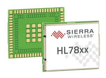
    Sierra Wireless, a provider of fully integrated device-to-cloud solutions for the Internet of Things (IoT), has introduced multi-mode, low-power wide-area (LPWA) cellular modules.

    The modules are targeted at rapidly growing markets in asset tracking and connected industrial equipment, smart cities, healthcare, agriculture and wearables.

    AirPrime HL78 modules, featuring Altair Semiconductor’s integrated ALT1250 chipset, deliver power performance that extends the life of battery-operated devices by 5-10X compared to older LTE-M/NB-IoT modules.

    The new level of power saving modes was designed for power-constrained IoT applications, and includes improved wake-up and sleep-mode responsiveness, as well as ultra-low sleep-mode power.

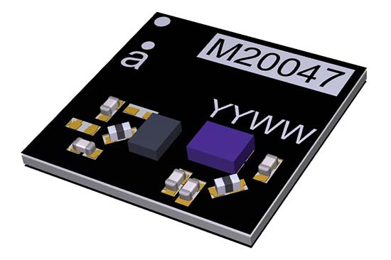
    The modules also integrate GNSS tracking capability, security and an embedded SIM in a new compact CF3 size (18  x 15 millimeters) that is pin-to-pin compatible with other HL Series modules.

    Customers have the flexibility to deploy the same device on global LTE-M (Cat-M1/eMTC) and NB-IoT (Cat-NB1) networks, with support for more than 20 LTE frequency bands in addition to optional 2G fallback.

    Built-in security, including HTTPS, secure socket, secure boot and free unlimited firmware over-the-air (FOTA) updates from the AirVantage device management IoT Platform, helps customers ensure HL78 deployments are future proof and secure.

    LTE-M and NB-IoT LPWA networks deliver a new class of wireless technology specifically designed for low-power IoT applications. LPWA technologies combine lower cost, broader coverage and better battery life with globally available and secure cellular networks ready to connect hundreds of millions more things to the internet.

    “With the HL78 modules, OEMs and system integrators have the most scalable, lowest power module platform to build their global IoT applications on,” said Dan Schieler, senior vice president and general manager, OEM solutions, Sierra Wireless. “And to make it even simpler for our customers, we’ve integrated the SIM and cloud, as well as GNSS and security features, to drive down the size of LPWA connected devices while enhancing tamper resistance and security.”

    “More than 690 million LTE-M and NB-IoT connected devices are expected by 2022, and the market needs a low-power, compact embedded module to connect their industrial, smart city, smart home and simpler static sensor applications,” said Dan Shey, managing director and vice president at ABI Research. “With the addition of the HL78 product line, Sierra Wireless has amassed a broad portfolio of low power devices to drive the billions of advanced IoT connections we expect in the next decade.”

    “The ability to switch seamlessly between any commercially deployed LTE-M or NB-IoT frequency band gives HL78 customers the flexibility to choose which network they want to deploy their low bandwidth application on. And for those regions where LPWAN coverage is not as widely available, optional 2G fallback ensures their devices stay online,” said Ilan Reingold, vice president, business development and marketing at Altair Semiconductor (a Sony Group company). “Incorporating Altair’s advanced IoT chipset, HL78 devices will also enjoy an extended life of up to 15 years on a single battery.”

    The AirPrime HL78 modules are fully compliant with the 3GPP Release 13 standard and are Release-14-ready to support NB2 features in the future.

    Sierra Wireless AirPrime HL and WP Series modules are interchangeable across 2G, 3G, 4G and LPWA technologies. They use the CF3 form factor, which is footprint compatible across product lines, providing customers with the option to develop smarter by building their connected IoT product or service on a single module.

    HL7800 and HL7802 modules are sampling with lead customers now, with general availability in the third quarter of this year.

  • China launches twin BeiDou-3 navigation satellites

    China launches twin BeiDou-3 navigation satellites

    China launched twin BeiDou-3 navigation satellites into space on Jan. 12 as part of efforts to enable its BeiDou system to provide navigation and positioning services to countries along the Belt and Road by the end of 2018, reports XinhuaNet.

    China’s Belt and Road Initiative aims to create the world’s largest platform for economic cooperation.

    The pair of satellites was launched at 7:18 a.m. local time aboard a Long March-3B carrier rocket from Xichang Satellite Launch Center in southwest China’s Sichuan Province. The twin satellites are coded the 26th and 27th satellites in the BeiDou Navigation Satellite System.

    This is the first launch of the BeiDou satellites in 2018, which will see intensive launches throughout the year.

    The twin satellites are coded MEO-7 and MEO-8, the 26th and 27th satellites in the BeiDou Navigation Satellite System.

  • Drone Delivery Canada to expand testing to the US

    Drone Delivery Canada (DDC) is expanding its commercial testing program to the United States at the New York Griffiss International Airport unmanned aircraft systems (UAS) test site in Rome, New York.

    DDC anticipates that the U.S. Pilot Program will begin in this quarter of 2018 and run through the balance of the year.

    The new initiative expands DDC’s testing program to include geographies within the U.S. using its Sparrow X1000 drone, which achieved Compliant UAV Status with Transport Canada in December 2017.

    For testing, DDCs will use its proprietary FLYTE management software to support semi-autonomous flight, as well as BVLOS (beyond visual line of site) flights designed for commercial drone deliveries.

    The Griffiss International Airport UAS test site in Rome is a Federal Aviation Administration (FAA)-approved facility designated to conduct research vital to integrating UAS into the national airspace system. The site is the fifth of six test sites that are operational in the U.S.

    The U.S. testing initiatives will complement DDC’s extensive Canadian testing program scheduled for 2018, which will include testing its BVLOS capabilities at the Transport Canada-approved UAS Centre of Excellence in Alma, Quebec.

  • Qualcomm Automotive Solutions chosen by Jaguar, Honda, more

    Qualcomm Automotive Solutions chosen by Jaguar, Honda, more

    Qualcomm Technologies Inc., a subsidiary of Qualcomm Incorporated, announced several automotive agreements at the Consumer Electronics Show (CES) 2018, at North Hall Booth 5616. The show took place Jan. 9-12 in Las Vegas.

    As the automotive industry advances toward 5G, highly advanced connectivity solutions are needed to support road safety, mission critical applications, as well as advanced capabilities, such as autonomy.

    With the Qualcomm Snapdragon automotive platform’s integrated GNSS and automotive dead reckoning, future vehicles are expected to have the increased capability to effectively be aware of its surroundings.

    2017 Jaguar Land Rover. (Photo: Jaguar)
    2017 Jaguar Land Rover. (Photo: Jaguar)

    Jaguar Land Rover. Jaguar will use the Qualcomm Snapdragon automotive platform in the Land Rover to power highly advanced telematics, infotainment and digital cluster with integrated connectivity and rear-seat entertainment. The platform will help meet the demand for rich, immersive and seamless connected in-vehicle experiences in future Jaguar Land Rover vehicles.

    For telematics units, Jaguar Land Rover will use the Snapdragon 820Am automotive platform to provide customers with ultra-quick and efficient connectivity throughout the vehicle by integrating 4G LTE Advanced, Wi-Fi and Bluetooth technologies.

    As Qualcomm Technologies’ most advanced automotive solution, the Snapdragon 820Am Automotive platform features a custom-built 64-bit Qualcomm Kryo  CPU, custom-built Qualcomm Adreno 530 GPU for virtualization advantages, and Qualcomm Hexagon 680 DSP Vector eXtension to stream high-definition videos seamlessly onto multiple displays.

    It also features the Snapdragon X12 LTE modem to support Category 12 speeds up to 600 Mbps download, as well as vehicle sensor integration and computer vision to support driver assistance using the Snapdragon Neural Processing Engine.

    2018 Honda Accord. The 2018 Honda Accord features the Snapdragon Automotive Platform to power applications for its in-vehicle infotainment and navigation system. The 2018 Honda Accord also features a Qualcomm 4G LTE modem designed to support the Hondalink vehicle connectivity system. 

    BYD Electric Vehicles. Chinese new energy company BYD Company Ltd. also selected Qualcomm Technologies’ automotive solutions for its upcoming electric vehicles. Anticipated to begin in 2019, BYD electric vehicles will feature integrated infotainment and digital cluster systems powered by the Qualcomm Snapdragon 820A Automotive platform.

    The software architecture, hypervisor support and integration capability of the 820A supports BYD’s efforts to integrate its infotainment and digital cluster systems into a single electronic control unit (ECU). This is designed to deliver significant optimization and integration benefits compared to previous architectures, which used several different ECUs within the vehicle.

    Qualcomm Technologies’ automotive solutions help improve power efficiency within the integrated ECU, which aids in enhancing the vehicle overall performance, battery life and driving range. The use of Qualcomm Technologies’ integrated infotainment and cluster system with Snapdragon 820A Automotive platform is designed to support a unified user interface, improvement in contextual awareness, and a rich in-vehicle user experience with multimedia.

    Visteon Cockpit. Visteon Corporation plans to deliver the next-generation of its SmartCore cockpit controllers using automotive solutions from Qualcomm.

    Future SmartCore cockpit controllers will feature the Qualcomm Snapdragon 820A Automotive platform to support automakers’ demand for highly advanced virtual cockpit controllers, which Visteon will design to support autonomous driving technology and applications.

    Visteon’s SmartCore domain controller, which can independently operate several cockpit domains on one system-on-a-chip (SoC) through a single driver interface, will be the first platform-based domain controller to incorporate the Snapdragon 820A Automotive platform.

    Using Snapdragon automotive solutions from Qualcomm Technologies, Visteon aims to make available technologies to support advanced virtual cockpits and autonomous driving through Visteon’s scalable hardware and software stack in SmartCore and its DriveCore  autonomous driving controller.

    DriveCore is an open platform consisting of the hardware, middleware and frameworks to develop machine learning algorithms for object classification, detection, path planning and execution.

    Visteon is scheduled to launch the first SmartCore-based solution in 2018 on a high-volume, global vehicle platform with a European automaker.

  • ComNav Technology tracks third-generation Beidou signals

    Following the successful launch of the third-generation BeiDou satellites, ComNav Technology has been tracking and decoding the BD-3 satellite signals to provide better high-precision positioning services in the near future.

    As the world’s fourth navigation satellite system, the construction of BeiDou satellite navigation network consists of three steps: experimental period from 2000 to 2003, regional coverage by 2012, and global reach by 2020.

    On Nov. 5, 2017, the launch of two third-generation BeiDou satellites indicates that China has begun to upgrade its BeiDou Navigation Satellite System with global-coverage capabilities, according to the China Satellite Navigation Office.

    The new-generation BeiDou satellites feature better accuracy, stability and signal clarity, thanks to improvements in laser communication devices, intersatellite links and atomic clocks.

    Moreover, 18 third-generation BeiDou satellites will be launched by the end of 2018 to cover all nations involved in the Belt and Road Initiative. By the end of 2020, worldwide high-precision GNSS users are able to benefit from global reach of the third-generation Beidou system.

    ComNav Technology has tracked and decoded the latest format BD-3 satellite signals: B1C and B2a from satellites Beidou-19 and Beidou-20.

    The following figure shows the BD-3 No. 20 signal tracked with the SinoGNSS K708 GNSS OEM board.

    Chart: ComNav
    Chart: ComNav

    According to ComNav, with its strong R&D capability in high-precision GNSS, ComNav Technology plans to grow with the third-generation BeiDou navigation system to bring better positioning services all the time.

  • Avenza Maps 3.4 adds custom US National Park Service symbols

    Avenza-Maps-34release-WAvenza Maps 3.4 for iOS and Android is now available. It contains new features and performance improvements, including the ability to add and manage new symbols to aid users in customizing their Avenza Maps experience with a built-in collection of U.S. National Park Service recreational symbols.

    Release highlights include enhanced support for point symbology. Also, users can package their own PNG symbols as (KMZ) files, import and use them in the app.

    Add and manage symbols. Avenza Maps Pro users can import and manage readily available collections of industry specific sets of symbols. such as the EMSINA Australasian All Hazards Symbology Set and the U.S. National Wildfire Coordinating Group GIS Standard Operating Procedures (GSTOP) Incidents Point Symbols. These symbol sets can be downloaded directly from the Avenza Support Centre.

    Add placemark workflow improvements. Improved add placemark workflow and screen to accommodate symbol selection and make it easier to add photos. The Add Placemark screen now appears every time the Add Placemark icon is tapped from the map view screen.

    This allows the user to conveniently change the symbol (or use the default one) as well as add any necessary information such as photos or collect data in a schema. Several of the most recently used symbols are listed for quick selection. A default symbol can still be set for the layer so one symbol can always be chosen.

    Learn more on the release blog.

    Screenshot: Avenza Maps

  • Antenova compact antenna boosts GNSS signals

    Antenova Ltd., manufacturer of antennas and RF antenna modules, has launched a new compact, all-in-one active GNSS antenna, part number M20047-1, at the Consumer Electronics Show (CES) show, Jan. 9-12, in Las Vegas.

    The M20047-1 antenna adds another option to the company’s existing range of positioning antennas and modules.

    It operates in the 1559–1609 MHz bands, and offers designers a useful, space-saving option for small tracking devices.

    It’s key features are the active components, the built-in LNA and filter, which act to boost the signal to the GNSS processor in environments where there is a restricted view of the sky and line-of-sight to the horizon is difficult. With the LNA and filtering already built into the antenna, designers will not need to add them, and can save space on their PCB.

    The M20047-1 is a very low profile rigid FR4 antenna measuring 7.0 x 7.0 x 1.1 millimeters, making it suitable for use in small tracking devices. It is suitable for tracking all kinds of moving objects, telematics and wearable sports devices.

    The M20047-1 antenna is named Active Sinica and is an alternative to Antenova’s existing Sinica antenna, part no SR4G008, which is marketed for accurate positioning.

    Antenova’s antennas are specifically designed for easy integration; however, the company provides full engineering support to help customers with all aspects of antenna testing, tuning and integration.

  • SuperSurv mobile app increases RTCM 3.1 support

    Makers of the mobile GIS app SuperSurv, developed by Supergeo Technologies Inc., are working to increase its GNSS positioning functionality.

    In recent weeks, the SuperSurv product team began to enhance SuperSurv’s NTRIP solution, aiming to adopt more RTCM versions and provide a better GNSS positioning service. NTRIP (Networked Transport of RTCM via internet protocol) is a protocol to send GNSS-related data through the internet, which enables users of differential GPS or network RTK to get correction parameters after connecting to the internet. The correction parameters can be used to calculate a more accurate GNSS location.

    Supergeo’s product team is developing the support for RTCM 3.1, including Type 1021 and 1023, two kinds of messages. Type 1021 contains the seven parameters for 3-axis coordinate transformation — three for 3-axis translation, another three for 3-axis rotation and a scale factor.

    Through the original projection method, users can only get rough coordinates. However, with NTRIP solution, users can send the current location to the server and then receive the parameters provided by it. This makes it easier to obtain a suitable local coordinates frame for more precise coordinates.

    The Type 1023 message provides more accurate grid residuals. By establishing a 4 x 4 mask window around the rover, users will receive the 3-axis corrections within these 16 grids. Accordingly, a more accurate GNSS positioning is achievable after interpolation.

    Image: SuperSurv
    Image: SuperSurv

    After completing the development, this technique will be implemented in the current version, SuperSurv 10.1. Combined with SuperSurv’s existing GIS features, Supergeo believes the newly supported RTCM 3.1 will bring a brand-new experience to fieldworkers.

    Launched in November 2017, current version 10.1 offers three major new features, including snapping, coordinate system customization and Layerset. Google Maps and TIFF are also supported.

    Supergeo’s product manager for mobile GIS, Zara Yu, recommend that users activate the point-data auto-collection with RTCM 3.1. This method not only helps users skip repeated operations but also enhances the data quality and efficiency.

    SuperSurv can be downloaded and tried at no cost. Online tutorials are also available.

  • Fleets go green — and get green — with GPS

    By Jason Penkethman, Chief Product Officer at Spireon

    Fleets looking to take their operations to the next level look to GPS solutions for the obvious benefits — driver/vehicle location tracking, driver behavior monitoring, improved efficiency — and some that are not so obvious, such as making a positive impact on the environment.

    “Going green” can be an arduous task, requiring constant calculations and adjustments to ensure that a fleet’s reduced environmental impact doesn’t negatively affect normal operations.

    Fortunately, GPS fleet management solutions have come a long way and go far beyond simple geolocation. We live in an age where technology empowers fleet managers to go green – both environmentally and fiscally. And with effective communication and transparency, even drivers who once may have perceived fleet tracking as “big brother” are now seeing how joining the green initiative puts green in their own pockets.

    The Case for Smarter, Eco-friendly Workdays

    No matter the size of the fleet, reducing unnecessary drive time saves time, gas, and reduces carbon footprint. When last minute changes or emergencies arise, fleet tracking allows managers to dispatch the nearest driver for faster, more effective resolution. Fleet tracking also allows better planning of a driver’s day with proximity as a guide.

    Image: Spireon
    Image: Spireon

    Eliminating Paper Waste. To properly manage a fleet, there is a seemingly endless stream of logs and diagnostics for drivers, cargo, vehicles and more. Implementing GPS tracking will cut back on the paperwork for managers and drivers alike by automating what once were manual processes and making compliance with new federal regulations such as the ELD mandate and the Food Safety Modernization Act a breeze.

    Cutting Unnecessary Emissions. Idling and abrupt acceleration or braking are the biggest culprits of wasting gas and producing excess emissions. Thanks to GPS logging, these can be avoided as feedback is provided to fleet managers and drivers, allowing active awareness for better driving habits.

    Better Maintenance, Better Mileage. Second to employees, vehicles are a fleet’s most important asset, and both need proper attention and care to succeed! While drivers can tell a fleet manager what they need, many vehicles won’t until it’s too late. With modern GPS devices, diagnostics are constantly run, keeping fleets informed and instantly aware of upcoming maintenance or surprises to keep drivers safe and vehicles running at maximum efficiency.

    Creating Driver Advocates

    While the benefits of GPS fleet tracking seem clear, overcoming driver apprehension sometimes causes pause for the business owner looking to implement a solution.

    However, drivers can become GPS’ greatest advocates with clear communication and transparency. It’s important to explain that GPS tracking works to a driver’s advantage when there are records of driver performance in the event of an accident, medical emergency or crime.

    Fleet managers can use the data to support drivers if they are accused of wrongdoing by customers or an insurance company. Additionally, the system can be used to offer incentives including higher base pay, recognition or bonuses to the best performing drivers.

    Fleets should convey that the main goal of GPS is not to point fingers at drivers or to spy on them, but rather to make the business enterprise more efficient and competitive.

    Part of the process necessarily means an overall improvement in their working conditions such as not having to call them all the time to keep track of their positions, sending the closest convenient driver to a location, establishing routes and schedules that are manageable and — yes — monitoring their behavior.

    This, however, is an incentive to keep drivers under the speed limit and make them feel more responsible — not least, protecting against legal and safety issues. In our experience, good employees have no problem with accountability and, in fact, welcome it as it sets them apart from less productive co-workers.

    Greenery on the Scenery

    Fleet tracking also helps to explain the savings in company costs made on fuel, maintenance and administration jobs.

    Fleet managers should explain to drivers how the new process can generate bonus programs, reduce customer call-backs, cancellations, complaints and paperwork (for timecards) and improve upon driver training.

    GPS will make for a better company with benefits everyone should realize and readily appreciate. The healthier the company, the more secure the jobs within it. Everyone benefits from a fatter bottom line, and job security is nonexistent without profitability. Helping drivers to understand why the fleet is adopting the solution will help recruit them toward a positive outcome.

    Whether a fleet business is interested in going green for the environment, or for its own profitability, GPS tracking solutions — and gaining driver buy-in — create a powerful catapult to achieving goals rapidly and effectively.


    Jason Penkethman is chief product officer at Spireon and is responsible for leading innovation in the company’s products and platform, and creating vehicle connectivity solutions to maximize customer value.

  • Long-flight Orion UAS contracted by U.S. Air Force

    Aurora’s Orion ultra-long-endurance UAS.

    The U.S. Air Force has awarded a $48 million contract to Aurora Flight Sciences for the continued development of the Orion unmanned aircraft system (UAS). Aurora Flight is a Boeing company.

    Orion is a twin-engine high-performance UAS that can stay aloft over 100 hours at a time with payloads in excess of 1,000 pounds.

    Development of the Orion started in 2006 and its first flight was in August 2013. In December 2014, the Orion established the UAS world endurance record with an 80-hour, 2-minute and 52-second flight.

    The new contract funds the development of a certified version of Orion that will be suitable for deployment anywhere in the world. The work will be performed in Columbus, Mississippi, and Manassas, Virginia.

    Boeing completed the acquisition of Aurora Flight Sciences in November 2017.

  • NovAtel technology showcased at CES 2018 with Renesas Electronics

    NovAtel technology showcased at CES 2018 with Renesas Electronics

    NovAtel technology will be on display at Consumer Electronics Show (CES) Jan. 9-12 in Las Vegas with Renesas Electronics Corporation.

    Renesas will use NovAtel’s high-performance SPAN tightly coupled GNSS and inertial navigation system (INS) technologies with GNSS correction services for live autonomous vehicles and advanced driver assistance systems (ADAS) demonstrations throughout CES.

    SPAN GNSS+INS products provide position, orientation and time solutions that are critical for autonomous applications.

    NovAtel’s assured positioning technology not only delivers solutions based on signals from satellite constellations but also uses vehicle behavior modelling, inertial sensor integration and GNSS correction signals to improve accuracy and significantly reduce interruptions in availability.

    Image: NovAtel
    Image: NovAtel

    Renesas relies on NovAtel products to provide high integrity and accurate positioning for autonomous driving, ADAS, connected car feature demonstrations and automotive solutions that will be showcased at CES 2018.

    With the commitment to ensure autonomous vehicles have assured positioning solution, a team of engineers formed the Safety Critical Systems Group at NovAtel to meet the exceptional performance and safety requirements of autonomous vehicles at the necessary production volumes and price point required.

    Since its formation, the group has made many positive partnerships in the automotive industry.

    NovAtel and Renesas are currently collaborating on implementing NovAtel’s high-performance GNSS+INS positioning solution with the Renesas R-Car H3 system-on-chip (SoC). The R-Car H3 is compliant with the ISO 26262 functional safety standard for automotive applications, which aligns with NovAtel’s automotive strategy.

    NovAtel has a long history providing industry leading high-precision GNSS solutions that are high quality and reliable. As an ISO 9001 certified company, NovAtel is also developing an extensive product line of receivers, antennas, correction signals, positioning algorithms, sensor fusion solutions and systems that fulfill specific safety requirements of the automotive industry such as ISO 26262.

  • BlackBerry and Baidu partner on connected car technology

    BlackBerry Limited and Baidu Inc. are collaborating to accelerate the deployment of connected and autonomous vehicle technology for automotive OEMs and suppliers worldwide.

    The companies have signed a statement of intent to make BlackBerry QNX‘s ISO26262 ASIL-D certified safety operating system (OS) the foundation for Baidu’s Apollo autonomous driving open platform.

    Also, BlackBerry and Baidu will work together to integrate Baidu’s CarLife, the leading smartphone integration software for connected cars in China, as well as its conversational artificial intelligence system DuerOS, and high-definition maps to run on the BlackBerry QNX Car (Infotainment) Platform.

    Blackberry QNX will host demonstrations of its foundational software for autonomous and connected vehicles at the Consumer Electronics Show (CES) 2018, at North Hall Booth 7523. The show takes place Jan. 9-12 in Las Vegas.

    “BlackBerry QNX has established itself as the OS platform for safety-certified production-based systems,” said Li Zhenyu, general manager of Intelligent Driving Group, Baidu. “We aim to provide automakers with a clear and fast path to fully autonomous vehicle production, with safety and security as top priorities. By integrating the BlackBerry QNX OS with the Apollo platform, we will enable carmakers to leap from prototype to production systems. Together, we will work toward a technological and commercial ecosystem for autonomous driving, intelligent connectivity and intelligent traffic systems.”

    “Joining forces with Baidu will enable us to explore integration opportunities for multiple vehicle subsystems including ADAS, infotainment, gateways and cloud services,” said John Wall, senior vice president and GM of BlackBerry QNX. “Baidu has made tremendous strides in artificial intelligence and deep learning. These advancements paired with their high-definition maps and BlackBerry’s safety-critical embedded software and expertise in security will be crucial ingredients for autonomous vehicles.”

    Announced by Baidu in April 2017, Apollo is an open platform that provides a comprehensive, secure, and reliable solution that consists of cloud services, an open software stack and reference hardware and vehicle platforms. It supports all major features and functions of an autonomous vehicle.

    More than 70 global partners are involved with Apollo, including OEMs, Tier 1 suppliers, developer platforms and technology start-ups. The project was named after the historic lunar landing program to illustrate its scale and complexity. BlackBerry provides OEMs with cybersecurity technology to protect and mitigate, including hardware, software, applications and end-to-end systems from cyberattacks.

    BlackBerry’s pedigree in security and continued innovation has led to recent automotive design wins with Delphi, Denso, Qualcomm, Visteon and others.