Norwegian insurer DNK will provide members with assured positioning, navigation and timing (A-PNT) services using Iridium Communications’ low-Earth orbit satellite network. DNK, Den Norske Krigsforsikring for Skib, specializes in war-risk insurance.
The new program allows its clients to select systems from specialized technology vendors to protect against GNSS interference while qualifying for insurance premium rebates.
The framework aligns with DNK’s aim of using digital technologies to safeguard Norwegian-owned or controlled vessels from war, terror, piracy and cyberattacks.
“Over the past five years, we have seen a sharp increase in GNSS interference, especially in the Black Sea, the Baltic Sea and more recently, in the Persian Gulf and Red Sea,” said Svein Ringbakken, CEO at DNK.
“GNSS signal interference can not only increase the risk of collision or grounding but also compromise critical safety systems. This program offers our members the opportunity to lower premiums by investing in cost-effective A-PNT solutions to maintain situational awareness, safety and positioning integrity.
“This program will not only help members lower premiums and ensure the safety of their vessels but help us collect data we can share with owners, managers and other stakeholders operating in known and emerging conflict zones.”
DNK evaluated alternative positioning frameworks based on Iridium’s global network of 66 low-Earth orbit (LEO) satellites. The vendors participating in the program offer subscription-based hardware systems with a configuration including an Above Deck Unit that transmits jamming and spoofing telemetry back to DNK, alongside an optional Below Deck Unit that provides real-time situational awareness directly to the vessel crew.
“GNSS jamming and spoofing not only compromise situational awareness, the intentional manipulation of positioning data can also lead vessels into sanctioned or restricted zones,” said Alan Belardinelli, Project Manager at DNK. “After extensive research, DNK found that the Iridium signal, which is 1,000 times more powerful than GNSS signals, is significantly more difficult to disrupt, adding a significant layer of enhanced positioning resilience. Signal attacks can also play havoc with onboard digital systems that rely on GNSS to provide a source of timing, necessary for safe navigation and efficient operations.”
The project has received formal support from Norwegian authorities, represented by Marianne Sivertsen Næss, Minister of Fisheries and Ocean Policy, alongside the Norwegian Shipowners’ Association, represented by Knut Arild Hareide, Chief Executive Officer.
“PNT Iridium stands as a powerful and effective complement to GNSS, ensuring continuity for vessels when traditional signals are degraded or denied,” said Rohit Braggs, vice president of PNT at Iridium. “More importantly, it acts as a resilient ‘source of truth’ by providing assured timing and positioning that maritime systems can depend on, whether in open waters or bustling ports.”
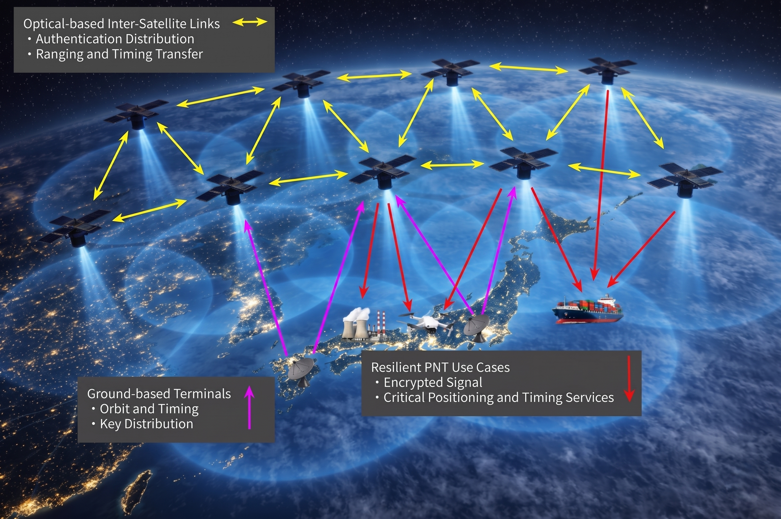
ArkEdge Space Inc. has completed a study commissioned by the Japan Aerospace Exploration Agency (JAXA) on “Elemental Technologies and Systems for a Dedicated, GNSS-Independent LEO-PNT Satellite System.”
Positioning, navigation and timing derived from GNSS is increasingly subject to interruption and interference, both through environmental and security challenges. Finding methods to protect PNT information against such interference is of paramount importance for governments and commercial actors alike.
The ArkEdge/JAXA project addressed such challenges by examining and categorizing the necessary elemental technologies — signal design, receiver technology, ground infrastructure, satellite sensors, and the overall system architecture — required to realize a LEO-PNT system capable of providing PNT without reliance on traditional GNSS.
The study’s focus included achieving satellite orbit determination and time synchronization without GNSS, one of the key challenges facing alternative PNT providers. It explored a new architecture for onboard time determination that avoids the need for large atomic clocks. Instead of onboard clocks, the system transmits precise timing information from combinations of ground-based reference clocks, pseudolites and inter-satellite optical links to disseminate information and enable on-orbit ODTS.
Concept art of the LEO-PNT satellite constellation. (Credit: ArkEdge Space)
The study considered diverse frequencies to strengthen anti-jamming measures. It also looked at novel signal design, receivers, encryption and signal authentication methods, and their suitability for LEO-PNT satellites. Results of the study will contribute to the next stage of development for a GNSS-independent LEO-PNT concept.
“This study is critical to advancing our understanding of Japan’s future relationship with PNT,” said ArkEdge Space Chief Strategy Officer Tomoaki Yasuda. “Across the world, users are facing denial of GNSS services, and that can have critical consequences for sectors including the economy, transport and emergency services, among others. We look forward to progressing the GNSS-independent LEO-PNT concept with the support of our partners.”
“Due to the prevalence of GNSS interference, alternative PNT systems are becoming increasingly important to protect users and assets such as critical national infrastructure,” said Masaya Murata, JAXA. “Following the successful conclusion of this GNSS-independent LEO-PNT study with ArkEdge Space, our investigation into a robust and resilient LEO-PNT system continues. We are also emphasizing international cooperation with other LEO-PNT providers to maximize users’ PNT experience and continue to engage in collaborative discussions.”
The addition of 44 antennas to Intuitive Machines’ network is expected to enhance support for customers’ GEO missions and accelerate progress toward Moon base and deep-space operations.
Intuitive Machines Inc. has entered into a definitive agreement to acquire Goonhilly Earth Station Ltd., a deep-space communications provider with major ground station assets in the United Kingdom and Goonhilly USA Inc. (dba COMSAT).
Goonhilly is a provider of lunar and deep space communications services. Since becoming the first commercial provider of these services in 2021, Goonhilly has supported more than 20 missions for space agencies NASA and ESA and private exploration companies, including Intuitive Machines and ispace, representing a vital UK contribution to the international space sector.
In 2024 and 2025, the company played a critical role in Intuitive Machines’ IM-1 and IM-2 lunar missions.
The acquisition will include the Goonhilly Lunar and Deep Space Communications, Commercial Satcom and Defense and Security divisions. It significantly expands global ground-station resources and capacity on Intuitive Machines’ integrated space-to-ground network.
Upon completion of the proposed acquisition, the expanded network is expected to deliver communications, data transport and position, navigation and timing (PNT) capabilities for sustained lunar and cislunar operations.
Goonhilly’s and COMSAT’s civil, commercial and government customers are expected to complement Intuitive Machines’ existing customer base and broaden the Company’s reach into adjacent industries. Upon completion of the acquisition, its strategic UK location will expand visibility across major Earth‑viewing arcs, increasing contact opportunities for lunar and deep‑space missions. With deep expertise in antenna planning, scheduling and station maintenance, Goonhilly’s ground station assets and competencies strengthen Intuitive Machines’ ability to deliver end‑to‑end mission support.
“Customers have been clear that they want a single, integrated, and resilient solution for their communications and PNT needs as they accelerate missions at an unprecedented pace,” said Steve Altemus, co‑founder and CEO of Intuitive Machines. “Our partners of integrated space‑to‑ground network are configured to support missions across LEO, lunar and cislunar environments through a single source for communications, PNT and data transport. Goonhilly will provide the backbone for this network, scales our global ground presence and will bring a strategic core competency to the Intuitive Machines team.”
The Intuitive Machines space-to-ground network combines a lunar data-relay constellation with a global ground segment to maintain persistent line-of-sight communications with the Moon. Goonhilly is expected to enhance this architecture with deep space assets, including the GHY6 32-meter antenna, the cryogenically cooled GHY3 30-meter antenna, and multiband support across X-band, S-band, and Ka-/Ku-band. This will give customers greater flexibility in mission design and more options for communicating with spacecraft throughout lunar and deep space operations.
“Goonhilly has spent years building a world class deep space communications capability,” said Kenn Herskind. Executive Chairman of Goonhilly. “Joining Intuitive Machines will allow us to scale that capability globally and directly support the next era of lunar exploration. Together, we will be creating a commercial lunar communications network that is interoperable, resilient, and ready to support Artemis and international missions.”
The transaction is expected to close in the third quarter of 2026, subject to customary closing conditions, including the receipt of applicable regulatory approvals, including under the UK National Security and Investment Act 2021 and from the U.S. Federal Communications Commission.
Iridium Communications Inc., a provider of global voice, data and positioning, navigation and timing (PNT) satellite services, has entered into a definitive agreement to acquire Aireon LLC.
Aireon is operator of the space-based Automatic Dependent Surveillance-Broadcast (ADS-B) air traffic surveillance system. The acquisition of Aireon is a defining step in Iridium’s strategy to provide the foundational architecture for global aviation safety, bringing space-based surveillance, safety communications, PNT and operational data together on a single network.
“Aireon has always been part of Iridium’s aviation safety strategy. We founded it in partnership with the world’s leading Air Navigation Service Providers (ANSPs), because we believed space-based aviation safety was a generational opportunity,” said Matt Desch, CEO, Iridium. “The aviation industry is now entering an era of growing air traffic, denser airspace, autonomous aircraft, and greater expectations for safety and resiliency. Bringing Aireon fully inside Iridium better positions us to build what’s needed to support the future of aviation, including more innovations like the future introduction of space-based VHF communications.”
Platform for Aviation Safety The acquisition unites Aireon’s surveillance and data services, including GPS jamming and spoofing detection, with Iridium’s global satcom network and PNT services that help keep GPS-dependent systems working in contested environments. This combination creates one company providing four critical aviation industry capabilities: knowing where every aircraft is, communicating with the pilots flying them, providing the navigation and timing integrity those aircraft rely on, and translating that information into operational insights that make airspace safer and more efficient. No other satellite operator delivers this combination of capabilities on a global scale.
The Aireon system, which is certified by theEuropean Union Aviation Safety Agency (EASA), flies as a payload on the Iridium satellite constellation and tracks an average of 190,000 flights per day. Commercial aircraft broadcast information such as an aircraft’s identity, location, altitude, speed, and heading. Aireon’s space-based ADS-B payload captures this information in real time, with 100% global coverage. ANSPs covering more than 50% of the global airspace rely on Aireon data to create safer and more efficient airspace.
The world’s leading ANSPs and investors in Aireon, including NAV CANADA and NATS (United Kingdom), AirNav Ireland, ENAV(Italy), and Naviair (Denmark), each played a vital role in launching the Aireon service, proving its reliability, and establishing it as a critical part of the global air traffic control infrastructure. NAV CANADA and NATS, which together manage the most heavily trafficked oceanic airspace in the world — the North Atlantic Tracks between Europe and North America, were the first to go live with the service. In connection with the acquisition, both ANSPs will sign extended data services agreements through 2035 and beyond, with provisions for continued cooperative development of space-based VHF communications and other new capabilities.
“Aireon and Iridium have been partners since day one, and that partnership is the reason we have been able to build the world’s only space-based air traffic surveillance system and a fast-growing aviation data services business alongside it,” said Don Thoma, CEO of Aireon. “Becoming part of Iridium is a natural next step for our team, our customers, and our roadmap, particularly as our data products expand into new areas like turbulence detection and aviation data analytics. Together, we are building the foundation for the future of global aviation.”
“NAV CANADA is proud of our foundational role in establishing Aireon’s world-first technology,” said Mark Cooper, President and CEO, NAV CANADA. “This sale sharpens our focus on our core expertise: keeping Canada’s skies safe. As a fellow founding partner, Iridium is the ideal owner to guide Aireon’s continued commercial growth. We wish the entire team continued success and look forward to our ongoing relationship as a customer.”
“We have been proud to be a part of Aireon’s successes, most notably making real-time aircraft surveillance over the Atlantic a reality for the first time in history, enabling even safer operations across the North Atlantic,” said Martin Rolfe, CEO, NATS. “As a shareholder for the past eight years, it is now the right time for us to divest. We are confident Aireon is well positioned for the future and wish the team every success in the next stage of its development.”
The Next Transition: Space-Based VHF Space-based VHF communications represent a major opportunity in air traffic management, extending pilot-to-controller VHF services into oceanic and remote airspace where ground infrastructure cannot reach, without the need for additional aircraft equipment. The model is similar to how aircraft already carry ADS-B transceivers, which enables Aireon to deliver space-based ADS-B surveillance without requiring fleet retrofits.
Aireon’s Growing Data Services Business Beyond surveillance for ANSPs, Aireon operates a fast-expanding aviation data services business that sells real-time and historical aviation data to airlines, airports, OEMs, governments, and aerospace operators. Product lines already available or launching this year include turbulence detection, GPS jamming and spoofing detection, and safety and efficiency analytics. Additional applications are also in development to support the rapidly evolving airspace environment.
Aireon’s data business is one of its highest-growth areas today and is expected to be a meaningful contributor to the combined company’s aviation growth.
Terms of the Transaction Iridium is an existing owner of Aireon and will acquire the remaining 61% of equity interests of Aireon in the transaction for a purchase price of approximately $366.7 million from the other owners, NAV CANADA, AirNav Ireland, ENAV, NATS and Naviair. The purchase price will be paid 50% at closing and 50% on the one-year anniversary. Iridium will also assume Aireon’s outstanding debt, expected to be approximately $155 million at closing.
The acquisition of Aireon is accretive to Iridium’s growth outlook; over the past three years, Aireon’s total revenue has grown at a compound annual growth rate (CAGR) of 10%. Iridium expects the acquisition will result in at least an additional consolidated $100 million of service revenue and $30 million of OEBITDA on an annualized basis.
Iridium expects to pay the purchase price with current liquidity, including borrowings under its revolving credit facility, and future cash from operations. After closing the transaction, Iridium expects net leverage to increase to approximately 4.0 times OEBITDA during Q3 2026, with net leverage planned to return to the current levels over the subsequent twelve months. Iridium’s long-term net leverage guide of 2.0 times OEBITDA by the end of the decade remains unchanged and assumes no change in its paused share buyback program.
Aireon will continue business-as-usual operations in the near term, with no planned changes to business strategy. The transaction is targeted to close in early July.
Evercore served as financial advisor and Cooley and Milbank served as legal counsel to Iridium. PJT Partners served as financial advisor and Hogan Lovells served as legal counsel to Aireon.
China’s BeiDou navigation industry in 2025 achieved a total output value of 1.33 trillion yuan (US$195 billion), according to a report released Monday by the GNSS and Location Based Services (LBS) Association of China, or GLAC, reports CGTN.
The BeiDou industry includes remote sensing and geographic information systems (GIS), mobile communications and indoor positioning. The satellite navigation sector generated 629 billion yuan (US$92 billion) in 2025, up 9.24% year on year, according to the report.
China has established a complete BeiDou industrial chain and supply chain, covering chips, modules, antennas, terminals, system integration and application services, , according to the report. Domestic capabilities are becoming increasingly self-reliant, with the cumulative shipments of BeiDou-compatible chips and modules reaching hundreds of millions, supporting a secure and robust industry supply chain.
Domestic sales of BeiDou-enabled terminals exceeded 410 million units in 2025, with more than 2.2 billion BeiDou-capable devices in use across the country.
Internationally, BeiDou services and related products have been exported to more than 140 countries and regions.
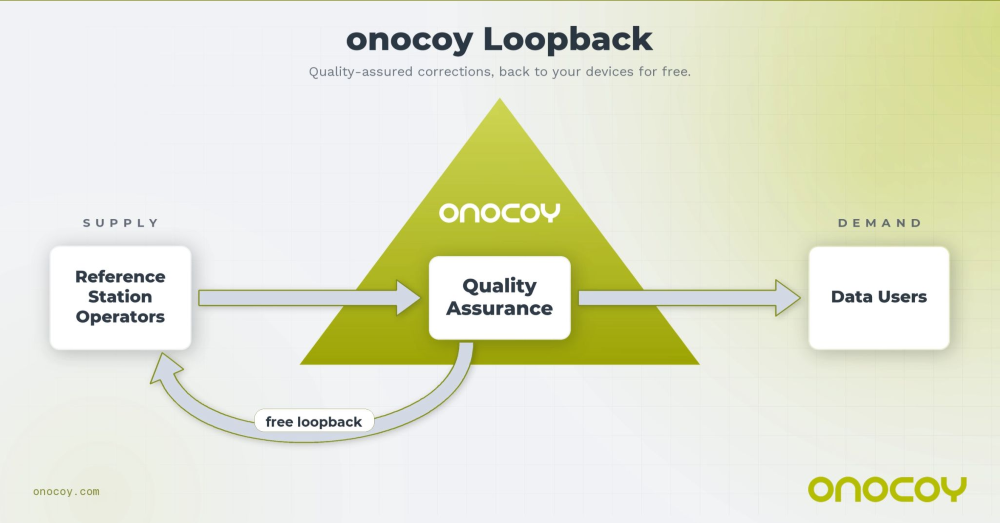
New feature eliminates the need for a self-hosted NTRIP caster and delivers enterprise-grade correction data to up to three devices simultaneously at no additional cost to the operator
Onocoy, a decentralized GNSS reference station network, is launching Loop Back, a new platform feature that routes quality-assured RTK correction data back to each station operator’s own devices free of charge. More than 7,800 active reference stations contribute to the onocoy network.
Operators who also needed precision positioning for their own drones, survey rovers, precision agriculture equipment, or autonomous machinery face a common friction point: the reference station they owned and operated produces valuable correction data, but routing that data back to their own field equipment requires either a separately maintained NTRIP caster or an additional subscription. Loop Back eliminates both.
Loop Back is immediately available to all onocoy station operators as a standard platform feature. Full documentation and setup guides are available at docs.onocoy.com.
How Loop Back works
When a GNSS reference station is connected to onocoy, raw observation data flows from the operator’s hardware into onocoy’s quality validation pipeline. The platform continuously checks position stability, multi-constellation health (GPS, GLONASS, Galileo, BeiDou), uptime and other parameters before producing a quality-assured RTCM 3 correction stream.
That validated stream has two destinations simultaneously: enterprise data clients who purchase GNSS reference station data through onocoy’s pay-per-use model, and the station operator’s own devices via Loop Back. The operator receives the same production-grade correction stream used by commercial clients, free of charge and with no data credits consumed.
Key capabilities at launch:
Up to three simultaneous active connections from an operator’s own devices to their own station’s corrections, with unlimited devices configurable
Compatible with any NTRIP-capable station regardless of hardware brand or model
Quality monitoring identical to that applied to enterprise client streams
No separate NTRIP caster required; onocoy manages the infrastructure
Free of charge: No data credits consumed for the operator’s own station data.
Who benefits
Loop Back is designed for the growing segment of professionals who both operate a reference station and rely on precision positioning in their daily work. Target use cases include:
Precision agriculture: Farmers running auto-steered machinery, UAV-based crop monitoring, and variable-rate application systems
Geomatics and surveying: Professionals running a base station and multiple rover units across a site, eliminating the overhead of a local base-rover setup
Autonomous systems, robotics and drones: Operators deploying multiple vehicles or aircraft requiring cm-accurate positioning for mapping, inspection, or delivery workflows
Research: Academic and scientific teams running parallel measurement campaigns from a shared base station.
Economics of station operation
Most professionals who deploy a GNSS reference station do so because their business in precision agriculture, surveying, drone operations and construction demands one. By connecting that station to onocoy, operators put the same hardware to work a second time: contributing data to onocoy’s global network and earning rewards worth several hundreds of U.S. dollars per year.
That additional income is enough to amortize the station in under two years before accounting for potential savings on subscriptions. Because onocoy applies continuous quality monitoring to every stream, operators also safeguard the positioning accuracy their business depends on.
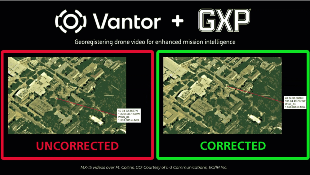
BAE Systems Geospatial eXploitation Products (GXP) and Vantor will be providing advanced intelligence and targeting capabilities for contested electronic warfare environments.
The delivery integrates part of Vantor’s Raptor, a vision-based software suite that enables autonomous systems to navigate, orient and extract accurate ground coordinates without relying on GNSS, with the GXP software ecosystem, ensuring intelligence continuity when sensors are degraded.
In modern conflict zones, the proliferation of inexpensive unmanned aerial systems (UAS) with equally low-quality sensors, in addition to widespread GPS spoofing and jamming, have rendered traditional drone video collection unreliable. Significant metadata drift in tactical video feeds leads to “targeting paralysis”: high-quality imagery is available, but the underlying geographic coordinates are too inaccurate for precision activities.
To solve this, Raptor Sync georegisters the full-motion video feed from the drone’s on-board camera with Vantor’s 3D terrain data in real time, enabling downstream GXP intelligence fusion, multi-domain interoperability across different sensors, and accurate ground coordinate extraction at a demonstrated absolute accuracy of <3 m. The system enables previously impossible intelligence and targeting workflows.
“In contested environments, the sensor’s imagery and video collections are only half the battle; the accuracy of the data it produces is what determines mission success,” said Kurt de Venecia, senior director of Product Development at BAE Systems GXP. “By including Raptor directly into our GXP intelligence workflows, we are providing analysts with the ability to maintain absolute targeting confidence, even when the platform’s systems or inertial sensors lack high absolute accuracy.”
Injecting corrected key-length-value (KLV) metadata from Raptor directly into the drone’s video stream at the edge enhances accuracy prior to exploitation in GXP software. This overrides inaccurate telemetry, enabling analysts using GXP solutions to extract weapon-quality coordinates and execute intelligence and targeting missions in real time.
“Analysts cannot afford to lose confidence in where a target actually is,” said Paul Millhouse, senior director ofRaptor Products at Vantor. “By using Raptor to correct video before it enters the GXP Ecosystem, we’re enhancing the performance of existing and new drone fleets. The result is a more resilient workflow for extracting accurate ground coordinates and maintaining operational tempo.”
These capabilities will be highlighted at GXP360° Professional Exchange & Workshop in San Diego, California (May 18-20).
Telit Cinterion and Swift Navigation have announced an expanded partnership. Telit Cinterion will offer Swift Navigation’s Skylark Precise Positioning Service as part of an integrated IoT positioning solution.
This service is available with Telit Cinterion’s dual-frequency GNSS modules and NExT cellular connectivity. IoT customers gain one source for the hardware, connectivity and Skylark Dx correction data needed for sub-meter positioning.
What began in 2024 as a technical partnership has grown into a comprehensive joint offering, uniting hardware, connectivity, and corrections into a seamless solution for IoT customers.
Telit Cinterion customers can now buy modules, connectivity and corrections under one contract. For many IoT projects, this cuts vendor coordination and avoids the cost and operational complexity of building or subscribing to an RTK base-station network.
Skylark is available in three variants — Skylark Dx, Cx, and Nx RTK — to meet a broad range of requirements for accuracy, coverage, bandwidth, and power consumption.
All Telit Cinterion dual-frequency L1 + L5 GNSS modules offer native support for Skylark Dx, which streams differential GNSS (DGNSS) corrections directly to the receiver over the cellular network. Skylark Dx runs over standard RTCM via Internet Protocol (NTRIP), using minimal bandwidth and power, and provides country-wide coverage. This makes it practical for IoT devices with limited bandwidth or tight power budgets.
Typical applications include:
e-mobility
fleet and asset tracking
robotics
drones
These are cases that don’t require centimeter-level RTK accuracy but do need reliable sub-meter positioning. Customers requiring higher accuracy can upgrade to Skylark Nx RTK on compatible module variants without redesigning their devices or changing suppliers.
“Customers tell us they want precise positioning without complexity,” said Neset Yalcinkaya, president of IoT hardware at Telit Cinterion. “We’re bundling Skylark Dx with the GNSS modules and cellular connectivity we already ship. This gives customers one supplier and a single integration approach, plus a clear path to RTK down the road.”
“At Swift Navigation, our mission is to make precise positioning a standard capability,” said Holger Ippach, chief operating officer at Swift Navigation. “This partnership advances that vision by embedding Skylark into Telit Cinterion’s GNSS modules and connectivity, giving customers direct access to reliable, sub-meter positioning without the integration overhead traditionally required.”
Service Availability
Skylark Dx is available now with Telit Cinterion solutions in Europe, North America, Japan, South Korea and Taiwan. Coverage will expand as Swift Navigation adds regions.
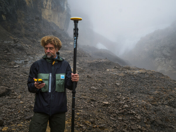
Data provides baseline measurement for tracking change at one of Earth’s last tropical ice fields in Puncak Jaya, Papua, Indonesia.
Trimble is supporting Project Pressure by providing advanced GNSS positioning technology and research funding for the nonprofit organization’s latest expedition to map the disappearing tropical glaciers of Puncak Jaya in Papua, Indonesia.
Project Pressure has released a centimeter-accurate, 3D model of the receding ice, created using Trimble positioning technology and drone-based photogrammetry. The model establishes a scientific baseline for calculating the rate of glacier recession and projecting the timeline of disappearance.
Puncak Jaya, the highest peak in Oceania and one of the Seven Summits, is expected to be the first of the seven continental peaks to lose its glaciers as global temperatures rise.
Puncak Jaya has the only snow in Indonesia. (Credit: Enda Kaban, CC BY-SA 4.0)
Local communities use the data to make informed choices about crop selection and prepare for expected water shortages caused by the loss of vital reservoirs.
This expedition marks the third successful outing in Project Pressure’s “Melting Topics”series, which focuses on mapping equatorial glaciers. Trimble provides its GNSS mapping technology and research funding from the Trimble Foundation Fund to support Project Pressure in gathering critical data in some of the world’s most remote and hostile environments.
“Mapping these glaciers before they disappear is of critical importance to establish a baseline to track the glacial regression and for the local communities to understand what is happening with their water source, allowing them to adapt to a changing climate,” said Eliot Jones, senior manager, strategy and partner development at Trimble. “Through a combination of precision technology, detailed project planning and rigorous science, the models created by Project Pressure are shared for scientific study and provide a visual reference for future generations.”
Precision under pressure in hostile terrain
Mapping glaciers at altitudes exceeding 4,800 meters (15,000 feet) presents extreme logistical and environmental challenges. Near-constant cloud cover and heavy rainfall in Papua often render satellite imagery unusable, making ground-based georeferencing essential.
The expedition team installed precise geolocation reference points directly on the glacial surface at multiple locations. Using the Trimble Catalyst DA2 GNSS system and Trimble TDC600 handheld, researchers captured the exact coordinates of those points with centimeter-level accuracy. Drone imagery was then processed against the Trimble coordinates to produce a scientifically reliable 3D model of the glacier.
“Trimble makes incredibly complex technology feel simple in the field,” said Klaus Thymann, scientist and lead explorer. “When you’re standing on a glacier in freezing conditions, wearing thick gloves and surrounded by clouds, you don’t have time to fight with equipment. With Trimble, I can capture centimeter-accurate readings and the interface is so intuitive that even someone with no prior training can help collect data. That kind of reliability and simplicity is critical when you’re working in some of the most remote and challenging environments in the world.”
This approach builds on methods developed during Project Pressure’s 2024 expedition to the Rwenzori Mountains in Uganda, which also used Trimble technology.
The lightweight Trimble Catalyst DA2 GNSS system was critical for the expedition, which required helicopter access to Basecamp, followed by a trek to the launch point.
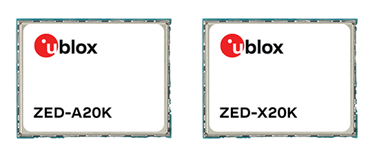
U-blox has expanded its automotive GNSS portfolio with the launch of two highly specialized modules: the ZED-X20K and the ZED-A20K. This dual release addresses engineering needs of both mass-market advanced driver assistance systems (ADAS) and safety-critical autonomous architectures.
Both modules feature pin-to-pin compatibility, enabling platform flexibility and simplifying product development across vehicle generations as well as jamming and spoofing detection to mitigate the impact of security risks.
The ZED-X20K is designed for mass-market ADAS L3 and TCU/IVI applications, delivering lane-level accuracy worldwide using all-band GNSS and native Galileo High Accuracy Service (HAS). By eliminating the need for paid correction services, backend infrastructure, or service management, it reduces total cost and accelerates time-to-market while maintaining consistent global performance.
For applications that require a functional-safety concept for GNSS sensors, the ZED-A20K introduces a new architectural approach. It provides ISO 26262 ASIL-B(D)-compliant GNSS RAW data simultaneously to high-performance QM positioning outputs within a single module. This enables OEMs to transition from traditional dual hardware based-GNSS systems to a single module approach, reducing system complexity and cost.
With flexible support of externally hosted positioning engines, especially for ADAS of Levels 3 and up, the A20 concept enables enhanced flexibility for SDV–based architectures. The form-factor compatibility between ZED-X20K and ZED-A20K allows the flexibility to equip different trim levels with or without functional safety requirements out of a single socket.
The ZED-X20K has reached the engineering sample stage, and its evaluation kit is available. Samples for the ZED-A20K will be available starting in August.
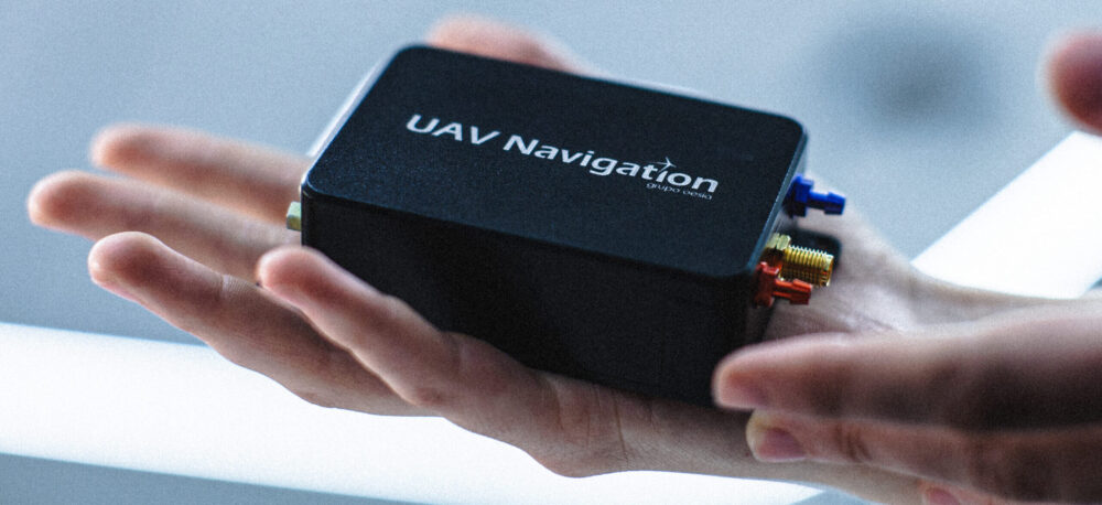
The new autopilot is engineered to provide reliable GNSS‑denied navigation and fully autonomous mission execution, including complex operational scenarios and seamless interoperability.
UAV Navigation — a division of Grupo Oesía specializing in advanced guidance, navigation and control solutions for unmanned vehicles — has launched the Vector-300high‑performance autopilot.
Vector-300 is designed to meet the industrial and operational requirements of mass‑produced, attritable unmanned aerial systems, with a clear focus on loitering munition and Counter-UAS (C-UAS) interceptor applications.
Vector‑300 has been engineered to combine advanced autonomous guidance, navigation and control (GNC) capabilities with scalability and manufacturability. Its architecture is designed to reduce technical complexity and enable agile, large‑scale production while ensuring consistent and reliable performance across high‑volume deployments.
Designed for high‑dynamic interception and terminal missions, Vector‑300 delivers strike‑to‑target precision guidance with bull’s eye accuracy. The autopilot supports the integration of AI‑based target identification and optical data directly into its autonomous GNC loops, enabling advanced engagement of both static and dynamic targets. This architecture supports real‑time trajectory adaptation during pursuit and terminal engagement phases, making Vector‑300 suitable for demanding loitering munition and C-UAS interceptor operations.
Vector‑300 is designed to operate in highly contested and GNSS‑denied environments, even under electronic warfare (EW) jamming, spoofing and meaconing. Its robust navigation core relies on advanced inertial algorithms and multisensor fusion to ensure mission continuity across all phases of operation and can be easily complemented with UAV Navigation–Grupo Oesía proprietary solutions such as the Visual Navigation System to enhance dead‑reckoning accuracy.
Building on the battlefield-proven capabilities of the Vectorautopilot family, Vector‑300 enables the full range of advanced operations already established across UAV Navigation–Grupo Oesía solutions. These include
fully autonomous mission execution
swarming and formation flight
4D trajectory management to reach targets at a predefined time
high‑dynamic maneuvers
manned‑unmanned teaming (MUT) operations
many other advanced autonomous capabilities.
Its open and modular architecture is designed to ensure interoperability with third‑party platforms, payloads and sensors through seamless integration with Vector‑MCC. This architecture also enables the integration of autonomous decision‑making software, allowing platforms equipped with Vector‑300 to adapt to evolving concepts of operation and advanced autonomy requirements.
Using Artec Jet, Artec Ray II and Artec Leo, 3D scanning experts have digitized Japan’s historic Odawara Castle for heritage preservation and potential future restoration projects
Challenge: Capturing a massive heritage site, including every detail from courtyards and buildings down to a drawbridge and individual rivets on castle gates.
Solution: Artec Jet, Artec Ray II, Artec Leo, Artec Twins
Result: A single, interconnected point cloud covering the entire facility — scanned mostly with Artec Jet, but with areas of interest captured more accurately using Artec Ray II & Leo. The resulting high-density dataset can be explored in 3D, making it suitable for virtual museum tours, or continuous monitoring to ensure Japan’s famed Odawara Castle stands the test of time.
Why Artec 3D? The highly maneuverable Artec Jet can be attached to a backpack and simply walked through an environment. Entire scenes can be captured from ground level in minutes, including tall structures from a range of up to 300 meters. Artec Ray II and Leo deliver higher accuracy for applications like long-term monitoring, damage assessment, and restoration.
Odawara Castle: A gateway into Japan’s past
Odawara Castle was built more than 500 years ago, with fortifications first erected during the Kamakura period — a time famous for the emergence of the Samurai and Japan’s first Shogun.
The site’s illustrious walls are steeped in history. Situated on a hill and surrounded by a moat, the castle has strong fortifications, so it was coveted and fought over for generations. Three sieges of Odawara took place from 1561-90 and the structure changed hands (and shape) multiple times over the next century as different leaders left their stamp on the property.
At times, the legacy of Odawara Castle has been difficult to protect. The entire site was shaken to its foundations by multiple earthquakes from 1703-1853 and the Meiji government of the late 19th century ordered that all feudal structures be destroyed, so it was mostly torn down.
In 1938, what remained of Odawara Castle was made a heritage site and slowly rebuilt. But over the years, it has remained a delicate piece of history in need of ongoing renovation. With this in mind, the Artec 3D support team — in Japan for a recent trade mission — opted to digitize the entire structure for future generations to enjoy using Artec Jet, Artec Ray II and Artec Leo.
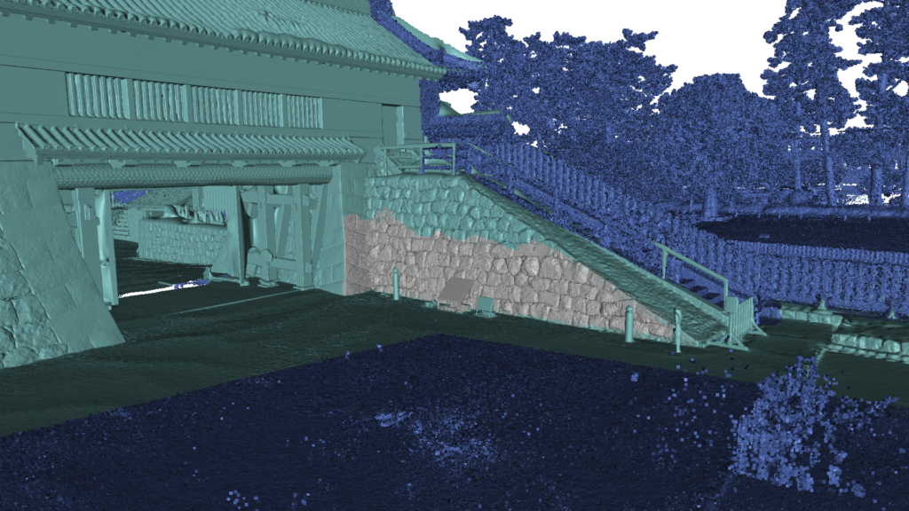
Artec Jet (dark blue), Artec Ray II (light blue), and Artec Leo (grey) point-cloud data fused together for high detail on every scale. (Credit: Artec 3D).
Capturing an entire castle in minutes
When they arrived at the castle, engineers immediately understood the scale of the challenge they were embarking on. Once one of medieval Japan’s largest fortifications, the site’s outer defensive perimeter is a whopping nine kilometers long. Odawara Castle is also a national landmark that’s open to visitors, so they didn’t have the facility all to themselves either.
This meant that speed and subtlety were critical. It would’ve been entirely possible to capture the site with a lidar, tripod-mounted Ray II, by positioning it around different areas of the fort. But this would take a prohibitive amount of time — especially when you consider that double scans are required to remove moving objects. Using Artec Jet was a lot more straightforward.
Attaching the device to a backpack meant the castle could be scanned on foot. Walking the site, almost as if they were a tourist, was enough to capture the entire scene. Artec Jet’s remote app gave real-time feedback on scan progress, so the team didn’t leave any detail uncaptured — and compared to capture with shorter-range scanners, the time savings were enormous.
“Artec Jet scans in a linear fashion. If it takes you two minutes to walk, it’ll take two minutes to scan — the complexity of the scene has little bearing,” explains Artec 3D scanning expert Keynan Tenenboim. “In the same time it took for Leo to scan 2-3 walls, Ray II scanned a building, and Jet digitized an entire castle. Adding in Ray II & Leo was great for areas with accessibility issues — and capturing higher detail around the walls, gate, and courtyard.”
A Trio of Scanners for the Task
Natural environments like trees, rivers, and larger connecting spaces often offer valuable site context, but don’t need to be captured with high accuracy. Artec Jet was perfect for picking up this sort of background information, generating a continuous point cloud, and connecting the site’s more interesting features: historic walls, ornate roofs, and courtyards around the castle.
Jet’s 300-meter range meant there was no need for ladders or scaffolding. The inner structure was captured from ground level without other visitors even noticing. Unlike Ray II, which scans from static viewpoints, Jet could also be maneuvered into difficult-to-reach areas. Both scanners are less accurate than Leo — but that’s why it’s best to combine datasets, for peak results.
In this case, Ray II was deployed to scan the inner courtyard and gate, with Leo being used to pick up smaller details like the confined area behind the entrance. Handheld 3D scanning was also perfect for capturing a nearby medieval wall. As you can see from the scan below, fine details like tile patterns, lettering, and the wall’s internals were all captured in a single sweep.
“This was the perfect project for demonstrating the benefits of all three scanners,” said Tenenboim. “The main castle wouldn’t be a good fit for Leo and it didn’t really fit Ray II. There was no good vantage point where we could see the facade from 100 meters away. Thanks to Jet’s range, we were able to scan from a ground level. Okay, we could’ve improved roof capture by flying Jet on a drone — but this would require more site preparation.”
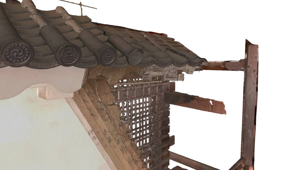
Fine details of an exterior wall captured just outside the castle with Artec Leo. (Credit: Artec 3D)
Heritage preservation with end-use potential
Once engineers had finished scanning, they sent data back to Artec’s Luxembourg HQ via cloud sharing for processing in Artec Twins. Specifically designed to handle large datasets, Artec Twins software allows Artec Jet, Ray & Leo scans to be merged — either into a unified point cloud, or a 3D mesh that can be measured and exported to industry platforms like Autodesk Revit.
In terms of applications, the resulting 3D point cloud would be perfect for building a virtual museum tour that allows visitors to virtually explore Odawara Castle. Regular data capture sessions would also allow site operators to monitor conditions over time. If a building’s traditional rooftop began to sag, for example, it’d be possible to carry out rapid repairs.
Deployable in seven modes: by-hand, backpack, pole, cage, robot, vehicle, or drone, Artec Jet adapts to any environment, allowing users to replace complicated multi-tool workflows. Clearly, Artec’s Odawara Castle scan is just the beginning, there are many more sites left to explore.