Author: Tracy Cozzens

  • GatesAir introduces GNSS timing and signal reference generator

    GatesAir introduces GNSS timing and signal reference generator

    New Maxiva GNSS-PTP solution for broadcast and telecom facilities seamlessly connects to second-generation GNSS and other timing sources

    GatesAir-LogoGatesAir, specialist in television and radio technology, will soon ship a new timing and signal reference solution for broadcast and telecom facilities, the Maxiva GNSS-PTP.

    GatesAir is demonstrating the Maxiva GNSS-PTP at the National Association of Broadcasters 2022 NAB Show, taking place April 23-26 in Las Vegas.

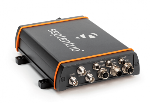
    The new Maxiva GNSS-PTP is a standalone one-rack-unit solution with a sophisticated switching algorithm that assures high-precision 10 MHz and 1 PPS reference signals to mission-critical components in the signal chain, including transmitters, networking and studio equipment.

    Each GNSS-PTP device feeds up to twelve 10 MHz and 1 PPS references in the technology infrastructure, removing the need to integrate a standalone timing source in each component. This substantially reduces equipment costs and installation timelines while providing a single, yet highly redundant, point of failure for engineers.

    Precise timing and frequency generation is assured because of the product’s high level of redundancy, according to GatesAir. The product design includes redundant AC power supplies with built-in battery backup for always-on protection, and diverse timing sources including redundant GNSS receivers.

    The GNSS receivers include OCXO temperature control to prevent frequency changes, and support GPS, GLONASS, Galileo, BeiDou and QZSS.

    Timing sources also include a hardware-based precision time protocol (PTP) module and an external 10 MHz and 1 PPS reference. Built-in switching control logic ensures reliability and flexibility for selecting the highest priority source as a reference at all times.

    Support for PTP v2  adds further reliability and flexibility for customers. Available as a modular option, users can prioritize PTP as a facility’s primary source, or configure PTP as a backup to one of the GNSS receivers. The PTP module can function as a master or slave and, as with the unit’s GNSS receivers, provide reliable timing and frequency reference to 12 external devices.

    “GatesAir has strong experience in the area of timing and synchronization for video, audio and telecom networks, and the Maxiva GNSS-PTP represents a major step forward in timing reliability, network redundancy and cost reduction,” said Keyur Parikh, Vice President of Engineering, GatesAir. “Our Intraplex SynchroCast solutions have long provided timing and frequency reference generation to synchronize SFN networks, and the GNSS-PTP product builds upon that capability to provide precision timing to broadcast and telecom networks. Our customers can rest assured that they have a proven solution that will work in any broadcast studio, RF plant and telco facility worldwide with the rock-solid reliability they expect from GatesAir.”

    GatesAir has further simplified the user experience with an integrated web interface that allows users to easily and flexibly select frequency bands for each GNSS constellation and configure timing source selection in automatic and manual modes. The user interface also offers useful visual aids, including detailed tracking maps and tables, satellite status and signal quality.

  • Esri, HALO Trust join to map unexploded bombs in Ukraine

    Esri, HALO Trust join to map unexploded bombs in Ukraine

    A Russian short-range ballistic missile, believed to be an unexploded Iskander missile, was found near Kramatorsk, Ukraine, in this photo released March 9 by Ukrainian authorities. (Photo: National Guard of Ukraine handout via Reuters)
    A Russian short-range ballistic missile, believed to be an unexploded Iskander missile, was found near Kramatorsk, Ukraine, in this photo released March 9 by Ukrainian authorities. (Photo: National Guard of Ukraine handout via Reuters)

    As a geopolitical and devastating humanitarian crisis unfolds in Ukraine, the HALO Trust is partnering with Esri to map unexploded ordnance as part of an immediate humanitarian response.

    More than 10 million Ukrainians have been displaced by the war and many are forced to move across a landscape littered with unexploded rockets, bombs and landmines.

    In response, Esri has committed its cutting-edge geographic information system (GIS) software resources, expertise and staffing in support of HALO’s mission in Ukraine.

    The organizations’ collaboration will allow them to map areas contaminated with explosives so HALO can remove the hazards when conditions allow. This will provide safe land to house displaced families and clear routes for humanitarian aid to reach those in desperate need.

    HALO is already using GIS to map the heaviest conflict zones, and the partnership with HALO will support planning for future clearance operations.

    As experts in their field, HALO is the world’s largest humanitarian landmine clearance and weapons disposal organization, clearing more than 13.9 million landmines and unexploded ordinance across 28 countries torn apart by conflict.

    In addition to technical expertise, HALO staff provide safety education for those in contaminated areas to avoid life-changing injuries and death, emergency medical aid, and humanitarian support for displaced persons as they face conflict, and in many cases are forced to flee their homes.

    Esri has collaborated with HALO since 2008 helping to map war-ravaged regions where specific locational awareness of landmines and other hazards is necessary to protect the lives of people in those areas.

  • US bans anti-satellite weapon tests, seeks global agreement

    US bans anti-satellite weapon tests, seeks global agreement

    Vice President Kamala Harris speaks to media representatives alongside leadership from the U.S. Space Force and U.S. Space Command during her visit to the Combined Space Operations Center (CSpOC). (Photo: USSF)
    Vice President Kamala Harris speaks to media representatives alongside leadership from the U.S. Space Force and U.S. Space Command during her visit to the Combined Space Operations Center (CSpOC). (Photo: USSF)

    Updated April 20 with additional information.


    The United States government has committed to ending the practice of anti-satellite missile tests, Vice President Kamala Harris announced April 18 at Vandenberg Space Force Base. She also urged other nations to follow its lead.

    On Nov. 15, 2021, the Russian military destroyed a defunct satellite with its anti-satellite technology (ASAT), a test it followed with verbal threats to the U.S. GPS.

    The Russian test created thousands of pieces of debris in low Earth orbit, and sent astronauts on the International Space Station into shelter as it passed through the debris field.

    Image: janiecbros/iStock/Getty Images Plus/Getty Images
    Image: janiecbros/iStock/Getty Images Plus/Getty Images

    Harris made the announcement during an all-call in front of more than 200 members of the Space Force and Air Force.

    Harris, who chairs the National Space Council, called on other nations to make similar commitments and to work together in establishing this as a norm, saying such efforts benefit all nations. “It is clear there is strong interest among our international partners to develop these norms. We must write the new rules of the road, and we will lead by example,” she said.

    “The destruction of space objects through direct-ascent ASAT missile testing is reckless and irresponsible,” Harris said. “The long-lived debris created by these tests now threaten satellites and other space objects that are vital to all nations’ security, economic, and scientific interests, and increases risk to astronauts in space. Overall, these tests jeopardize the long-term sustainability of outer space and imperil the exploration and use of space by all nations.”

    In addition to making this announcement, Harris toured the Combined Space Operations Center (CSpOC) and met with U.S. Space Force Maj. Gen. DeAnna Burt, Combined Force Space Component Command commander, as well U.S. and coalition personnel who work in space operations, to learn about U.S. efforts in space and the dangers posed by anti-satellite missiles.

    The CSpOC is comprised of both U.S. and allied partners and operates 24 hours a day, seven days a week. It executes the operational command and control of space forces to achieve theater and global objectives. Additionally, the CSpOC hosts a Commercial Integration Cell representative to enhance cooperation with several commercial partners.

    This was the first vice presidential visit to the nation’s premier West Coast launch installation since it was redesignated in May 2021 from an Air Force base to a Space Force base. The department of the Air Force announced April 4 that the base is the possible future home of the U.S. Space Force’s training headquarters.

    While Harris toured the CSpOC, her husband, Second Gentleman Douglas Emhoff, met with military and civilian spouses to discuss employment, mental health programs and diversity and inclusion.

    Also in attendance at the all-call were Deputy Secretary of Defense Kathleen Hicks; Gen. James Dickinson, U.S. Space Command commander; Gen. John “Jay” Raymond, chief of space operations for U.S. Space Force; Sen. Alex Padilla, Rep. Salud Carbajal and Rep. Ted Lieu.

  • Septentrio’s AsteRx-U3 receiver launched for machine control

    Septentrio’s AsteRx-U3 receiver launched for machine control

    Photo: Septentrio
    Photo: Septentrio

    Septentrio has launched the AsteRx-U3 ruggedized GNSS receiver, successor to the AsteRx-U for construction, mining and other machine control applications.

    The new receiver combines Septentrio’s latest triple-band precise positioning GNSS core with extended wireless communication features including Wi-Fi, UHF and 4G LTE. The versatile connectivity features of this receiver make it easy to fit it into any control system and enable simple and cost-effective overall design.

    “We are excited to introduce AsteRx-U3 to the market of industrial automation,” said Silviu Taujan, product manager at Septentrio. “Its advanced connectivity package offers manufacturers and integrators access to reliable high-accuracy positioning in a system which is versatile, easy to use and easy to integrate.”

    The AsteRx-U3 offers a unique feature, a guaranteed low latency of under 10 msec with a high data rate, which allows machines to work with rapid as well as accurate movements. An IP68-rated housing with fixing brackets and robust M12 connectors ensures a quick and reliable installation.

  • ComNav offers P300 high-precision, rugged tablet for machine control

    ComNav offers P300 high-precision, rugged tablet for machine control

    Photo: ComNav
    Photo: ComNav

    ComNav Technology has released the P300 Series GNSS tablet to the global market. Based on the company’s K8 GNSS OEM platform, the high-precision in-cab Android rugged tablet brings innovative performance and ease of use to various operations in precision agriculture, autonomous driving, machine control and other industries, the company said.

    Embedded with the new-generation K8 OEM module, the P300 series GNSS tablet can track all current and planned constellations (including GPS, BeiDou, BeiDou-3, GLONASS, Galileo, QZSS) and reach centimeter-level accuracy. Using the advanced Quantum III technology in combination with upgraded SinoGNSS ASIC chip and advanced microprocessor unit, the P300 series is capable of providing enhanced heading and positioning performance for everyday field use.

    Photo: ComNav
    Photo: ComNav

    Features of the P300 include dual-card, dual-standby, various interfaces, multiple wireless connections and data transmission modules for CAN, PPS and Event. The P300 can adapt to a variety of application scenarios to meet different needs of users. The aluminum-magnesium alloy body makes the P300 robust, able to cope with the rigors and demands of tough construction jobs and strenuous vibrations.

    The P300 series runs the Android operating system and is compatible with most Android apps. Compared to traditional GNSS receivers the high-definition color touchscreen and intuitive interface make it easy for both beginner and advanced users to operate.

    The P300 series tablet includes P300 Plus (10.1-inch) and P300 Mini (8-inch). Both deliver the same high performance, user-friendly design, powerful connectivity and rugged construction to users. Both sizes are available now.

  • Loss of Galileo puts UK PNT at risk, expert claims

    Loss of Galileo puts UK PNT at risk, expert claims

    Graphic: GPS World
    Graphic: GPS World

    An expert has warned the government of the United Kingdom that the lack of an alternative to Galileo threatens to put critical infrastructure at risk, according to a report in Daily Express.

    Andy Proctor, formerly with the satellite and positioning, navigation and timing (PNT) cabinet office, submitted evidence of his concerns to the UK’s ministers.

    “Our critical infrastructure is at risk from the loss of PNT, space-based or otherwise,” he wrote. “We are currently critically dependent upon GPS; the loss of which will have a major impact in capability and economically.”

    Proctor is director of Rethink PNT, a consultancy firm.

    He pointed out that the government disinvested in the eLoran terrestrial system that could have provided a backup, although this is slowly reversing.

    “For 20 or so years there have been calls for action, yet the current status of inaction regarding the PNT strategy puts our systems at increasing risk, especially given the clear and present electronic-warfare systems being used in Europe today,” Proctor wrote.

    Britain was removed from the Galileo project following Brexit, and has since been looking for an alternative PNT system.

  • FAA awards $4.4 million in drone research grants to 7 universities

    FAA awards $4.4 million in drone research grants to 7 universities

    Photo: PhonlamaiPhoto/iStock / Getty Images Plus/Getty Images
    Photo: PhonlamaiPhoto/iStock / Getty Images Plus/Getty Images

    The U.S. Department of Transportation’s Federal Aviation Administration (FAA) has announced $4.4 million in drone research, education and training grants to seven universities.

    Research will focus on three areas:

    • electromagnetic compatibility
    • detect-and-avoid classifications
    • cybersecurity oversight.

    “This funding and our ongoing partnerships with these universities will allow the FAA to safely integrate the airspace that has a growing number of diverse aircraft users,” said FAA Acting Administrator Billy Nolen.

    The research initiatives and grant awardees include:

    Evaluate Unmanned Aircraft Systems (UAS) Electromagnetic Compatibility

    This research will assess the risks, identify drone design vulnerabilities, identify material and procedural mitigations, and propose guidance for safer electromagnetic compatibility with emitted and static fields.

    • University of North Dakota, $325,042
    • University of Kansas, $325,000
    • Drexel University, $325,830

    Investigate Detect-and-Avoid Track Classification and Filtering

    This research will provide proposed metrics, guidance and test methods to assess the effects of false or misleading information on detect-and-avoid capabilities. The findings will support beyond-visual-line-of-sight operations.

    • The Ohio State University, $732,441
    • Embry-Riddle Aeronautical University, $371,000
    • Mississippi State University, $330,000
    • University of North Dakota, $80,000

    Illustrate the Need for UAS Cybersecurity Oversight and Risk Management

    This research will address UAS cybersecurity oversight and risk management as it pertains to the National Airspace System and other FAA systems.

    • University of Kansas, $651,982
    • Oregon State University, $609,226
    • Drexel University, $608,783

    Today’s announcement is the second round of Alliance for System Safety of UAS through Research Excellence (ASSURE) grants, which brings the total of 15 grants valued at $18.3 million for Fiscal Year 2022.

    The ASSURE Center of Excellence is one of six that the FAA has established to help advance technology and educate the next generation of aviation professionals. Research conducted through ASSURE is focused on helping the drone market safely grow and integrate into the nation’s airspace.

    More than 800,000 recreational and commercial drones are in the active drone fleet, and that number is expected to grow.

  • GNSS Research Center offers new version of PRIDE software

    GNSS Research Center offers new version of PRIDE software

    PRIDE logoThe latest version of the open-source PRIDE PPP-AR software is now available for GNSS researchers, students and professionals.

    “Based on the feedback of global users in the past two years, we have been improving the software to enhance its robustness and make it easy to use,” said Jianghui Geng, GNSS geodesy professor at the GNSS Research Center, Wuhan University.

    PRIDE PPP-AR V2.2 fully supports GPS, GLONASS, Galileo, BDS-2 and 3, and QZSS precise point positioning (PPP), as well as undifferenced ambiguity resolution (AR) for GPS, Galileo and BDS-2 and 3.

    Version 2.2 features improved high-precision GNSS data-processing capabilities. It supports kinematic positioning for mobile platforms such as aerial photogrammetry and ship-borne gravimetry.

    Other features include the following:

    • high-rate data up to 50 Hz can also be processed
    • the second-order ionospheric delays can be corrected
    • VMF3 for troposphere modeling is available
    • multi-day processing is allowed
    • satellite attitude quaternions are supported.

    Versions are available for the Linux, Windows and Mac operating systems to facilitate researchers and class teaching.

    The project is fully supported by the National Science Foundation of China (No. 42025401) and under the auspices of IAG Sub-Commission 4.4 “GNSS Integrity and Quality Control.” Direct questions to [email protected].

    An online training course will be held Sept. 19-23 through UNVACO.

  • ADVA software now protects third-party GNSS receivers from cyberattacks

    ADVA software now protects third-party GNSS receivers from cyberattacks

    Photo: ADVA
    Photo: ADVA

    GNSS assurance software Ensemble Sync Director now detects jamming and spoofing cyberattacks on third-party GNSS receivers

    ADVA has extended its Ensemble Sync Director GNSS assurance software to integrate any third-party vendor’s GNSS receiver observables at scale.

    A key pillar of ADVA’s aPNT+ technology, Ensemble Sync Director is now vendor-agnostic, providing resilient and assured positioning, navigation and timing (PNT) for more customers than before.

    Ensemble Sync Director can now transparently show and analyze GNSS observables from third-party receivers in large deployments.

    Synchronization based on satellite signals is vulnerable to failure, interference and cyberthreats, meaning network operators need to protect their critical timing with continuous monitoring and assurance. With the Adva software, network operators can remotely detect issues with GNSS receivers from any vendor, helping to maintain high-quality timing performance, avoid disruptions and reduce operating costs.

    “By extending our GNSS assurance application capabilities beyond our own timing equipment, we’re empowering many more customers to protect their mission-critical synchronization in new or deployed infrastructure,” said Gil Biran, GM of Oscilloquartz, ADVA. “Our Ensemble Sync Director, with comprehensive GNSS assurance for both resilient and assured PNT, provides a simple, scalable and highly cost-efficient way to harness our unique experience and expertise in managing a huge number of GNSS-dependent network elements.”

    ADVA’s Oscilloquartz GNSS assurance solution for integrating third-party receiver data is an extension of its Sync Director application, part of the Ensemble Controller network management platform. It offers centralized in-service monitoring and analysis of GNSS status and reliability as well as artificial-intelligence and machine-learning-based prediction and prevention of obstruction, jamming and spoofing.

    Using topology and timing chain mapping, Ensemble Sync Director displays the entire timing network infrastructure in a user-intuitive graphical format.

    ADVA’s GNSS assurance capabilities are aligned with the goals of the DHS Resilient PNT Conformance Framework and future IEEE P1952 Resilient PNT Standard to protect critical infrastructure.

    Available from ADVA Professional Services, the new solution is suitable for network operators in telecoms, power utilities, financial trading, data centers and more, who need to ensure robust, reliable and resilient GNSS timing. It also offers  value to system-integrator vendors looking to add vital GNSS protection capabilities to their synchronization portfolios.

    Further information is available in an ADVA presentation.

  • Trimble to divest four businesses to The Jordan Company

    Trimble to divest four businesses to The Jordan Company

    Logo: TrimbleTrimble announced today that it has entered into a definitive agreement to sell its Time and Frequency, LOADRITE, Spectra Precision Tools and SECO accessories businesses to Precisional LLC, an affiliate of The Jordan Company (TJC).

    The divestiture is in line with Trimble’s strategy to focus on areas core to its long-term growth and strategic product roadmap. The global transaction is subject to a number of customary closing conditions and is expected to close in the second quarter of 2022. Financial terms were not disclosed.

    “We are continually evaluating our product portfolio as we work on the execution of Trimble’s Connect and Scale 2025 strategy,” said Rob Painter, president and CEO of Trimble. “Trimble is focusing its efforts on the company’s connected industry platforms and digital transformation capabilities, making Precisional and TJC an ideal fit for the growth of the businesses.”

    TJC, a private equity firm, is completing the acquisition in partnership with industry executive Drew Ladau to form Precisional LLC, a global platform focused on precision measurement and data solutions driving efficiencies in demanding infrastructure end markets.

    “The Trimble businesses, which will join Precisional, have a long heritage of innovation, and each is a leader in the markets it serves,” said Drew Ladau, CEO of Precisional. “I’m excited to build upon this strong foundation alongside the dedicated employees that have served their customers so well over the years. In addition, we plan to accelerate the pace of innovation and growth with the focus of resources and investment on these core businesses supported by TJC.”

    “The acquisition of four industry-leading businesses from Trimble by Precisional forms the foundation of a new platform focused on precise measurement and analytical insights to improve productivity across a broad range of applications that rely upon accuracy and reliability,” said Erik Fagan, partner at TJC. “By supporting existing management to make investments in Precisional’s operations and product development to integrate precision measurement with data solutions and enhanced connectivity, we intend to accelerate growth opportunities while also pursuing synergistic acquisitions.”

    The Time and Frequency products use the accuracy of GNSS clocks to provide precise time, synchronization and frequency reference signals for many industries and applications. Communication systems, data centers, financial networks, utilities, factory automation, security and other infrastructure rely on precise timing for synchronization and operational efficiency.

    The Spectra Precision Tools business designs and manufactures high-quality leveling, positioning and alignment instruments used for general, exterior and underground construction. The instruments incorporate laser and optical technology for general contractors and specialty contractors serving large and small commercial jobsites as well as residential builders and remodelers.

    The LOADRITE business offers accurate scales for loaders, excavators, conveyor belts, tractors, refuse trucks and forklifts that connect with payload-reporting and monitoring systems for the waste, quarry and aggregates industry. The products improve user efficiency by weighing products while they are on a vehicle or belt, eliminating the need for a separate trip to a fixed-scale location.

    The SECO business designs and manufactures a wide variety of accessory products used in conjunction with surveying and construction instruments. The portfolio of accessory products includes tripods, telescopic poles, prisms, carrying cases, GPS antenna poles, safety vests and leveling rods.

    LOADRITE, Spectra Precision Tools and the SECO businesses have been reported as part of Trimble’s Buildings and Infrastructure segment. The Time and Frequency business has been reported as part of Trimble’s Geospatial segment.

    Orrick acted as legal advisor and Lincoln International acted as financial advisor to Trimble. Mayer Brown acted as legal advisor and BMO Capital Markets acted as financial advisor to TJC.

  • S.E.A. Datentechnik and M3 Systems partner on V2X and ADAS

    S.E.A. Datentechnik and M3 Systems partner on V2X and ADAS

    SEA-logo

    S.E.A. Datentechnik GmbH is partnering with M3 Systems on advanced GNSS emulation technology. The new partnership aims to provide high-quality GNSS tools for current and future automotive vehicle-to-everything (V2X) communication and advanced driver-assistance systems (ADAS) applications.

    Photo:S.E.A. Datentechnik is a developer and system integrator for advanced radio frequency and V2X test and measurement systems, serving chipset vendors, automotive suppliers and OEMs.

    The StellaNGC Software Suite by M3 Systems integrates seamlessly into automotive test environments to meet customer needs.

    The two companies are leading, well established partners for the National Instruments (NI) platform. The signed partnership ensures the availability of advanced and competitive technology for global test solutions.

    “We are sure that the cooperation of our companies provides a high value for customers for the development, validation and production test of actual and future V2X and Connected Car technologies,” said Gerd Schmitz, co-founder, and CEO of S.E.A. “The combination of the deep experience GNSS technology of M3 Systems with S.E.A. V2X products and competence provides tailored test solutions for reasonable cost.”

    “M3 Systems is pleased to be working with S.E.A. on V2X and ADAS using the NI platform,” said Marc Pollina, CEO of M3 Systems. “V2X expands the capability of M3 Systems to serve automotive suppliers, chipset vendors and other V2X/ADAS users. V2X is synergistic with M3 Systems’ expertise in GNSS technology and simulation.”

    V2X from S.E.A.

    Compact, automated turnkey S.E.A. test systems enable the efficient and reliable test of V2X technologies using scalable software and hardware components.

    The modular V2X test platform from S.E.A. is based on software-defined radio (SDR) technology and includes all aspects of automated V2X test, including measurements on the physical layer for RF-compliance, protocol or production testing, and integrated V2X traffic scenario simulation for the test of V2X applications.

    International V2X standards for North America, Europe and China are supported for scenario-based testing by open-loop or closed-loop hardware-in-the-loop (HIL) systems. Test catalogs for specific test applications such as RF-conformance measurements and V2X Day 1 Use Case testing are available for efficient use of the flexible test systems.

    GNSS from M3 Systems

    High-quality simulation of GNSS signals for the different constellations — GPS, Galileo, Glonass and Beidou — are required for V2X and ADAS test system applications.

    The M3 Systems StellaNGC Software Suite integrates seamlessly into the test environment and fulfills the high demands of customers. The application of the NI PXI platform for GNSS and communication emulation enables the powerful and seamless integration of GNSS as well as other sensor and communication technologies: radar, lidar and cameras for HIL ADAS/autonomous technology test systems.

  • DOD authorizes GPS signal processing for 5G shared spectrum

    DOD authorizes GPS signal processing for 5G shared spectrum

    iPosi’s in-building SMART 5G measures the loss profile to protect military and commercial spectrum from interference in shared or adjacent bands. (Image: iPosi)
    iPosi’s in-building SMART 5G measures the loss profile to protect military and commercial spectrum from interference in shared or adjacent bands. (Image: iPosi)

    The Defense Spectrum Office (DSO) of the U.S. Department of Defense (DOD) has contracted iPosi Inc. and Virginia Tech Applied Research Corporation (VT-ARC) to develop a GPS/GNSS system to measure radio frequency path loss that substantially increases shared spectrum without interference.

    The contract addresses the need for increased shared spectrum between DOD and wireless providers who require expanded access because of skyrocketing demand for broadband 5G spectrum.

    The iPosi loss-profile technology automates measurements of GPS/GNSS controlled satellite signal transmissions. Once compiled, these form precise intelligent arrays ultimately characterized as an intensity-based 3D loss-contour map.

    As satellites move across the sky, their signals illuminate radio path obstructions precisely. The 3D map is specific to each site sharing the channel. Each loss-map determines the extent of shared channel radio isolation with a low-error loss between wireless entities, and continuously updates to maintain interference-free channels.

    Though applied initially to sharing DOD ground-to-air systems with commercial wireless services, the technology has wide applications for other 5G services, iPosi said.

    “This relationship is an important foundation for DoD and commercial applications of our technology across a wide range of spectrum sharing initiatives,” said Richard Lee, CEO of iPosi. “We look forward to collaborating with our partners to enable greater spectrum sharing.”

    The agreement represents a collaboration among multiple academic and industry partners, one of several endeavors by the Defense Information Systems Agency and Defense Spectrum Organization under the Spectrum Sharing Test & Evaluation (SSTD) project as part of the DOD Advanced Wireless Systems–3 (AWS-3) spectrum transition program.

    The iPosi/VT-ARC technology would enable a substantial increase in protected, interference-free wireless service that operates in DoD or federal government bands. Once scaled, it could also support broader civilian and federal shared spectrum operations essential to both spectrum protection and growth of 5G.

    Lee cites iPosi’s three-year relationship with VT-ARC and DISA/DSO as an important foundation for commercial and government applications of iPosi’s GPS-based loss-profiling technology. The earlier collaboration led to field validation of new tomographic wireless propagation measurements that enable sharing between new 5G and DOD in common 1-10 GHz mid-band spectrum blocks.