Category: Defense

  • Defense small-vehicle navigation system designed for export

    Defense small-vehicle navigation system designed for export

    Photo: Etion Create
    Photo: Etion Create

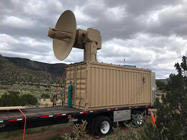
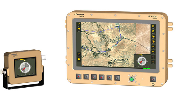
    A new military vehicle navigation system designed and developed by South Africa-based Etion Create is ready for the local and export markets.

    Designed for harsh environments and battlefield conditions, the CheetahNAV provides outstanding situational awareness, according to Etion Create. The crew of a light military vehicle can count on highly accurate position information, irrespective of whether they are denied satellite navigation. This is achieved through an advanced inertial measurement system (IMS), comprising several aids, including a gyro-compensated compass and an advanced Kalman filter-based algorithm.

    A brochure on CheetahNAV is available here.

    “We are confident that the system provides dead-reckoning horizontal position accuracy of 0.2% of distance travelled in a GNSS denied situation,” said Jan Hurter, senior product manager. “This translates, by way of example, to accuracy of just 200 metres over a distance of 100 kilometers.”

    The CheetahNAV can integrate with any number of different inertial navigation systems (INS) and can be aligned with any of the satellite navigation constellations. Combined with GNSS and compass information, the system enables dead-reckoning and accurate positioning of the vehicle in tactical situations. The tactical grade integral inertial measurement unit (IMU) ensures jamming-free operation.

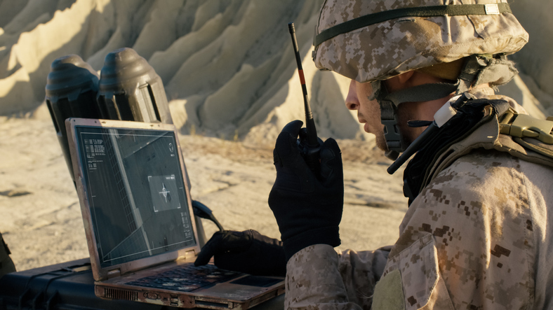
    Some of the guidance cues the system provides to the crew during tactical maneuvers include the vehicle’s current position, true heading and desired heading towards the next waypoint, current speed and desired speed to reach the next waypoint or destination on time, and the next waypoint or destination. It also shows the pitch and roll attitude of the vehicle and the track it has travelled.

    This data is displayed on a sunlight-readable touch-screen enabled moving map display unit measuring 11.6-inch diagonal, in 16:9 TFT format, with a 1920×1080 resolution. Etion Create is also offering a slave unit for the vehicle driver, as the main display might be positioned elsewhere in a space constrained vehicle. This slave unit, measuring 3.5-inch diagonal TFT, displays information that is specifically required by the driver.

    Significant benefits of the CheetahNAV system include ruggedness for extreme battlefield conditions and 28V or 12V DC operation in line with military standards. Moreover, it boasts a high operational reliability.

    “It is important to note that Etion Create, as original design manufacturer, is focusing the CheetahNAV on the export market, including the possibility of technology transfer for indigenous manufacturing,” said Hurter. “Besides we offer a multi-language option, which is certainly a key advantage in multinational operations that are almost the norm nowadays.”

    The CheetahNAV is non-ITAR controlled, which is the preference of most land forces around the world today to meet their battlefield management requirements.

    Having utilized the building blocks of previously developed military off-the-shelf technologies, Etion Create considers the system to be at a high TRL (technology readiness level), and thus available for the export market.

    Previously called Parsec, Etion Create is a South African original design manufacturer (ODM) with a long-standing international reach and a professional portfolio of technology offerings and experience across a wide range of business sectors, including defence and aerospace, information security, and mining and industrial sectors.

  • Northrop Grumman’s EGI-M navigation system completes critical design review

    Northrop Grumman’s EGI-M navigation system completes critical design review

    Northrop Grumman Corporation has successfully completed the critical design review (CDR) milestone for the Embedded Global Positioning System/Inertial Navigation System (INS)-Modernization, or EGI-M, program.

    EGI-M provides state-of-the-art airborne navigation capabilities with an open architecture that enables rapid responses to future threats. The fully modernized system integrates new M-code capable GPS receivers, provides interoperability with civil controlled air space, and implements a new resilient time capability.

    “The completion of this milestone is a key step in bringing necessary navigation capability upgrades to our warfighters,” said Brandon White, vice president, navigation and positioning systems, Northrop Grumman. “With its open architecture and government ownership of the key internal interfaces, EGI-M’s next-generation navigation solution allows the government to quickly insert emerging capabilities from third parties while maintaining cyber security and airworthiness.”

    The F-22 is one of the lead platforms for EGI-M integration. (Photo: Staff Sgt. Carlin Leslie/U.S. Air Force)
    The F-22 is one of the lead platforms for EGI-M integration. (Photo: Staff Sgt. Carlin Leslie/U.S. Air Force)

    Northrop Grumman’s unique, modular platform interface design enables backwards compatibility with existing platform footprint and interfaces (A-Kits), allowing current platforms to easily integrate and deploy Northrop Grumman’s EGI-M solution.

    At the same time, EGI-M’s modular software and hardware, coupled with government ownership of key interfaces, allows EGI-M to benefit from rapid upgrades with best of breed software and hardware technologies now and in the future.

    Northrop Grumman has been on contract for the engineering and manufacturing development (EMD) phase of EGI-M since November 2018. The CDR milestone marks the completion of detailed hardware and software design of the EGI-M product line.

    The launch platforms for Northrop Grumman’s EGI-M are the F-22 fighter jet and E-2D early warning aircraft. Additional fixed-wing and rotary-wing platforms across Department of Defense and allied forces have already selected Northrop Grumman’s EGI-M as their future navigation solution.

    The E-2D Hawkeye is an American all-weather, carrier-capable tactical airborne early-warning aircraft. (Photo: U.S. Navy)
    The E-2D Hawkeye is an American all-weather, carrier-capable tactical airborne early-warning aircraft. (Photo: U.S. Navy)
  • Spirent’s SimIQ software designed to speed GNSS product testing

    Spirent’s SimIQ software designed to speed GNSS product testing

    Enables greater collaboration and faster product development through I/Q data streaming

    Spirent Federal Systems has released SimIQ, software that allows for earlier and more efficient GNSS testing during product development.

    From software-in-the-loop through to final-form testing, SimIQ enables developers to collaborate across the full design lifecycle through the creation, sharing and replay of I/Q data files.

    “SimIQ Capture allows developers to test their receiver algorithms in the earliest stages of design, minimizing costs and giving designers confidence as they proceed to the hardware design phase.”

    SimIQ has been developed to meet the growing need to test GNSS capabilities earlier to accelerate product development, while simultaneously reducing costs by identifying issues prior to the purchase of hardware components.

    For developers using Spirent’s GSS9000 and GSS7000 simulators, SimIQ extends multi-frequency, multi-constellation simulation capabilities to cover software-only testing needs through the capture and replay of high-fidelity I/Q data files.

    Housed in a single system, SimIQ reads and generates I/Q data with two major components, SimIQ Capture and SimIQ Replay.

    • SimIQ Capture. Allows Spirent GNSS simulators to generate I/Q files containing all the GNSS signal data required to test the algorithms, conformance, and performance of software receivers. It enables the recording of GNSS I/Q data into files hosted in the simulator, helping development and testing teams to validate positioning, navigation and timing (PNT) algorithms before expensive hardware designs.
    SimIQ Capture: Record I/Q data from Spirent GNSS simulators into files. (Image: Spirent)
    SimIQ Capture: Record I/Q data from Spirent GNSS simulators into files. (Image: Spirent)
    • SimIQ Replay. Enables the simulator to read any I/Q file containing GNSS data. In addition, it facilitates the generation of RF from pre-recorded interference signals and custom waveforms. The flexibility and unrivalled signal generation architecture of Spirent’s hardware enables the generation of these signals from I/Q files, while maintaining fidelity and quality due to Spirent’s unrivalled signal generation architecture.
    SimIQ Replay: Generate RF with Spirent GNSS simulators form I/Q files. (Image: Spirent)
    SimIQ Replay: Generate RF with Spirent GNSS simulators form I/Q files. (Image: Spirent)

    Test engineers can accelerate development, and thus save time and resources, by using Spirent simulators during the entire design lifecycle. The new software will bring significant benefits to developers in the defense and aerospace sectors.

    “SimIQ Capture allows developers to test their receiver algorithms in the earliest stages of design, minimizing costs and giving designers confidence as they proceed to the hardware design phase,” said Jen Smith, Spirent Federal’s director of Business Development.

    SimIQ will be available to new and existing customers beginning in the fourth quarter of 2020.

  • Sept. 17 webinar addresses PNT monitoring of critical infrastructure

    Sept. 17 webinar addresses PNT monitoring of critical infrastructure

    Recent GPS World webinars have focused on a variety of proven, resilient technologies to combat GNSS and positioning, navigation and timing (PNT) vulnerabilities in critical infrastructure.

    Now a Sept. 17 GPS World webinar focuses on how PNT monitoring can further protect critical systems from these vulnerabilities through continuous monitoring and improvement.

    The Orolia-sponsored webinar is free. It is scheduled for 1 p.m. EDT / 10 a.m. PDT / 7 p.m. (1900h) Central European Time. Register here.

    Protecting critical infrastructure is now a national priority for the U.S. and allied countries. Similar to cybersecurity for network systems, effective GNSS and PNT protection involves identifying and monitoring weak entry points, knowing where and when an intrusion occurs, and providing data about new threats to help strengthen the system going forward. Its value applies across all critical infrastructure sectors such as telecom, power grids and data centers.

    Webinar speakers include:

    Photo: Orolia

    John Fischer
    Vice President, Advanced R&D, Orolia

    For more than 15 years, Fischer has been part of Orolia where he works with global navigation satellite systems, wireless, positioning navigation and timing, as well as specialized systems for its customers. Prior to joining Orolia, he specialized in wireless telecom as a founding member of two startups: Aria Wireless in 1990 and Clearwire Technologies in 1997. At Clearwire, he served as chief technology officer in creating wireless broadband equipment for internet connectivity. Early in his career, Fischer worked as a systems engineer in radar, EW, and command and control systems at Sierra Research and Comptek Research. He holds master’s and bachelor’s degrees in electrical engineering and computing engineering from the State University of New York at Buffalo.

    Tim Frost headshot

    Tim Frost
    Strategic Technology Manager, Calnex Solutions

    Tim Frost is a specialist in next-generation synchronisation techniques, having worked with Zarlink Semiconductor, Symmetricom and now Calnex Solutions on packet-based synchronisation technologies. He is an active contributor to the ITU-T, and has also contributed to the AVnu Alliance, Small Cell Forum, Metro Ethernet Forum and IETF. He has a BSc. in Electrical and Electronic Engineering from the University of Leeds, and a MSc. in Computer Systems Engineering from the University of Manchester.

    Francisco Girela headshot

    Francisco Girela
    Americas Tech Responsible, Seven Solutions

    Francisco Girela is the Americas Tech Responsible at Seven Solutions. He holds a Master’s degree in Telecommunications Engineering from the University of Granada. After some time in the private sector, Francisco joined the Timing Keepers group at the same university as a researcher. During his research, he specialized in ultra-accurate time transfer systems and he focused on the development of the White Rabbit technology. He combines his work for Seven Solutions with his studies for a Ph.D. in Telecommunications Engineering. This combination has provided Francisco with a strong technical background on high-accuracy time synchronization and deep knowledge on timing applications in industrial sectors.

    All previous webinars are available on demand and on the GPS World YouTube channel.

  • US Air Force awards $20M to Alion for autonomous navigation

    US Air Force awards $20M to Alion for autonomous navigation

    The U.S. Air Force Institute of Technology (AFIT) has awarded Alion Science and Technology a $20 million task order for a 60-month period to provide Autonomy and Navigation Technology (ANT) development.

    The ANT Center is a forward-looking research center within the AFIT seeking to identify and solve tomorrow’s most challenging autonomy and navigation problems.

    The ANT Center’s goal is to develop navigation technology that ensures the Department of Defense (DOD) can navigate anywhere, anytime, using anything, and to improve the DOD’s ability to conduct autonomous operations.

    Alion will research, assess, analyze and develop the ANT Center’s research in autonomous and cooperative systems, non-GPS precision navigation, and robust GNSS navigation/Navigation Warfare (NAVWAR). This effort supports the AFIT’s mission to advance air, space, and cyberspace power for the nation, its partners, and our armed forces by conducting relevant defense-focused research to enhance technical graduate and continuing education, while supporting the development and evolution of navigation and autonomy technologies, impacting weapon systems across the DOD.

    “Alion has some of the greatest engineering and technology minds in industry partnering side-by-side with our customers to face challenging issues and create technologies, solutions and advancements in innovation to keep our nation ahead,” said Eric Wright, Alion’s vice president of the Integrated Solutions Operation within the Advanced Technology Group. “We are privileged to be working with the U.S. Air Force Institute of Technology to achieve the goals of the ANT Center.”

    This task was awarded under the Department of Defense Information Analysis Center Multiple Award Contract (IAC MAC) issued by the Air Force Installation Contracting Center. This material is based upon work supported by the DOD Information Analysis Center Program Management Office (DOD IAC PMO), sponsored by the Defense Technical Information Center (DTIC) under Contract No. FA807518D0002.


    Photo: U.S. Air Force/Tech. Sgt. Anthony Nelson
    Photo: U.S. Air Force/Tech. Sgt. Anthony Nelson
  • US military chooses Spirent for anechoic chamber testing

    US military chooses Spirent for anechoic chamber testing

    Spirent Federal Systems has been awarded a contract to support anechoic chamber testing for a major U.S. military agency.

    Spirent’s GSS9790 multi-output, multi-GNSS RF constellation wave-front simulator will be used as the signal generator attached to multiple transmission antennas for broadcast into the chambers.

    Within this design, the antennas are structurally distributed to represent the correct arrival vectors of the simulated satellite signals on the device under test, creating the most realistic test environment possible. In addition, the GSS9790 supports interference sources located anywhere in the chamber to imitate different threat scenarios.

    Image: Spirent
    Image: Spirent

    “Interference can threaten GNSS signals in multiple ways,” explained Jeff Martin, VP Sales. “We recognize the need for controlled, repeatable conditions to combat these threats. The GSS9790 delivers all the tools needed to successfully mitigate them.”

    The GSS9790 simulator. (Photo: Spirent)
    The GSS9790 simulator. (Photo: Spirent)

    The Spirent GSS9790 supports classified Y-code, SAASM and M-code and can be found in key government labs across the country.

    The Spirent GSS9790 enables verification of CRPA systems, spatial testing of single-antenna devices, and real-world-time-synchronized indoor GNSS implementations. The system is a development of the Spirent GSS9000. Combined with Spirent’s SimGEN software, it offers a powerful test platform for anti-jam and interference testing.

  • IoT kit ready for heavy workloads

    IoT kit ready for heavy workloads

    logoCongatec is offering a workload consolidation kit for vision-based situational awareness applications such as machine control and vision-based collaborative robotics.

    The kit qualifies as an Intel internet of things (IoT) ready-for-production kit. It offers three virtual machines based on the hypervisor technology from Real-Time Systems.

    One runs a vision-based artificial intelligence application based on the Intel OpenVino situational awareness software. The second is real-time capable and operates deterministic control software, and the third acts as an industrial IoT/Industry 4.0 gateway.

  • Power of THOR ready to down enemy drones

    Power of THOR ready to down enemy drones

    The Air Force Research Laboratory (AFRL) has developed a counter-swarm high-power weapon to deter enemy drones — THOR.

    THOR stands for Tactical High-power Operational Responder, a counter-swarm electromagnetic weapon for airbase defense. Although AFRL’s THOR is not a hammer-wielding god associated with thunder and lightning, the system provides non-kinetic defeat of multiple targets. It operates from ground power and uses energy to disable drones.

    The THOR drone deterrent designed by the Air Force Research Laboratory. (Photo: AFRL)
    The THOR drone deterrent designed by the Air Force Research Laboratory. (Photo: AFRL)

    “THOR is essentially a high-powered electromagnetic source that we put together to specifically defeat drones,” said Stephen Langdon, chief of the High-Powered Microwave Technologies Branch of AFRL’s Directed Energy Directorate.

    AFRL is located at  Kirtland Air Force Base, New Mexico. A demonstration system has been built and tested on military test ranges near the base, where it has successfully engaged multiple targets. Further testing against a larger set of drone types in swarming configurations is being planned.

    THOR stores in a 20-foot transport container, which can be transported in a C-130 aircraft. The system can be set up within three hours and has a user interface that requires little training.

    The technology, which cost roughly $15 million to develop, uses high-power electromagnetics to counter electronic effect. When a target is identified, the silent weapon discharges with nearly instantaneous impact.

    With much of the necessary basic research previously completed at AFRL, THOR was rapidly developed and tested in 18 months.

    Although there are other drone defensive systems available, including guns, nets and laser systems, THOR will most likely to extend the engagement range to effect and decrease the engagement time over the other deterrent devices.

    Langdon said the THOR team hopes to transfer the technology to a System Program Office soon in order to get it into the hands of U.S. warfighters as soon as possible.

    AFRL exhibited THOR at the 2019 Air Force Association Air, Space and Cyber Conference at the Gaylord National Resort and Convention Center, located just across the Potomac River from Washington, D.C. and Virginia, Sept. 16-18.

  • VectorNav introduces miniature IMU and GNSS/INS product line

    VectorNav introduces miniature IMU and GNSS/INS product line

    Tactical Embedded series of GNSS/IMUs. (Photo: VectorNav)
    Tactical Embedded series of GNSS/IMUs. (Photo: VectorNav)

    Embedded navigation company VectorNav Technologies has introduced a new line of inertial products: the VectorNav Tactical Embedded series of GNSS/IMUs.

    Featuring a tactical-grade inertial measurement unit (IMU) and a multi-band GNSS receivers, the Tactical Embedded delivers milliradian attitude accuracy and centimeter-level positioning capability in a miniature 15-gram package.

    VectorNav’s Tactical Embedded line is in a new smaller size, and enables cost reductions for a wide range of autonomous pointing and geo-referencing applications. These include gimballed intelligence, surveillance and reconnaissance (ISR), SATCOM systems, lidar mapping and photogrammetry, among many others.

    The Tactical Embedded line supports external SAASM GPS for defense applications in ISR, electronic warfare, munitions and UAV navigation.

    “The Tactical Embedded is the culmination of years of development to bring milliradian-level attitude performance and robust positioning into a form factor that represents a disruptive step in inertial navigation capability,” said VectorNav President John Brashear. “Systems integrators worldwide can now embed tactical-grade inertial navigation capabilities into their electronics, unlocking a range of new applications and possibilities.”

    Designed and engineered at VectorNav’s AS9100-certified facility in Dallas, Texas, the Tactical Embedded line includes the VN-110E IMU/AHRS, the VN-210E GNSS-aided inertial navigation system (INS), and the VN-310E Dual Antenna GNSS/INS.

    Highlights include:

    • 0.05-0.1° heading; 0.015° pitch and roll
    • 1 m horizontal and 1.5 m vertical position accuracy
    • 1 cm RTK positioning accuracy
    • < 1°/hr gyro in-run bias; < 10 μg accel in-run bias
    • 184 channel, L1/L2/E1/E5b GNSS receiver
    • Support for external RTK, PPK and SAASM GPS
    • High update rates (800 Hz IMU; 400 Hz Nav)
    • Miniature footprint: (< 15 grams; 31 x 31 x 11 mm)
    • Low power: < 480 mA @ 3.3 V

    The Tactical Embedded line is available for purchase now and ships within two weeks.

  • The GPS Innovation Alliance adds BAE Systems as member

    The GPS Innovation Alliance adds BAE Systems as member

    The global security, defense and aerospace company joins alliance dedicated to protecting, promoting and enhancing the use of GPS technology

    GPSIA logoThe GPS Innovation Alliance (GPSIA) is welcoming BAE Systems Inc. as the newest member of the organization. BAE Systems, a global defense, security and aerospace company, joins member companies John Deere, Garmin, Trimble, Lockheed Martin and Collins Aerospace, a unit of Raytheon Technologies Corp., as well as 11 national organizations that make up GPSIA’s affiliates program.

    As the newest member of the alliance and the third aerospace and defense corporation to join the organization in eight months, BAE Systems will work with GPSIA to support its goal of enhancing GPS innovation, creativity and entrepreneurship — while advocating as the voice of the GPS industry in Washington.

    Logo: BAE Systems“We are excited to welcome BAE Systems as the newest member of the Alliance — a monumental addition that marks the doubling of our membership in the past eight months,” said GPSIA Executive Director J. David Grossman. “The continued growth of GPSIA demonstrates the criticality of protecting GPS and the substantial value our organization delivers through advocacy, information sharing, and technical standards. We remain committed to ensuring the economic and societal benefits of GPS are fully realized.”

    BAE Systems is a global leader in designing and implementing high-end technology to extend the reach and significance of GPS in defense. BAE Systems’ radiation-hardened electronics have been on board satellites and spacecraft for almost 30 years and are currently providing the high-performance onboard processing capability for the GPS III satellite mission. Promoting space resiliency for over 30 years, BAE Systems is a cornerstone of the growing importance of GPS technologies on the space frontier.

    BAE Systems has not only pioneered critical technologies suitable for GPS applications in space, but has also developed, manufactured, integrated and supported GPS receivers and guidance systems for advanced military applications on land, sea or air.

    The company was instrumental in the development of NAVWAR sensor technology, intended to meet growing challenges associated with maintaining military positioning, navigation and timing (PNT) advantage using satellite navigation, and has engineered top-tier jammers and navigation systems for decades. Their work has been critical in securing the safety and technological supremacy of our nation’s defenses.

    “GPS is an essential part of our world — from our infrastructure and economy to the security of our nation,” said Frank Ruggiero, senior vice president, government relations, BAE Systems. “As a leading provider of defense electronics and communications systems, we are excited to join the GPS Innovation Alliance to expand the development of cutting-edge GPS technologies.”

  • GPS military code installs complete at master control sites

    GPS military code installs complete at master control sites

    The United States Space Force’s Space and Missile Systems Center on July 27 completed the military code (M-code) Early Use (MCEU) hardware and software upgrade to the GPS Operational Control System (OCS).

    Completion of the upgrade is a major step toward Operational Acceptance of the long-awaited GPS M-code.

    Photo: U.S. Air Force photo/Dennis Rogers
    Photo: U.S. Air Force photo/Dennis Rogers

    The encrypted M-code signal enhances anti-jamming and anti-spoofing capabilities for the warfighter. M-code signals are currently available on all 22 GPS Block IIR-M, IIF and III space vehicles currently on orbit.

    The installs were completed at the Master Control Station at Schriever Air Force Base, Colorado, and Alternate Master Control Stations at Vandenberg Air Force Base, California.

    The MCEU upgrade allows the OCS Architecture Evolution Plan to task, upload and monitor M-code within the GPS constellation, as well as support testing and fielding of modernized user equipment.

    Operational Acceptance Set for November. MCEU will be in a trial period before Operational Acceptance in November. Once Operational Acceptance is granted, upcoming Military Ground User Equipment (MGUE) will be able to leverage the M-code signal-in-space to provide more secure position, navigation and timing (PNT) to warfighters.

    “Working closely with Lockheed Martin and our other mission partners — with the common national goal of providing enhanced PNT signal security and safety always in sharp focus — means we’re able to deliver the right mission capability faster to our warfighters,” said Lt. Col. Steven A. Nielson, program manager of the MCEU project.

    MCEU serves as a gap-filler for M-code operations before the entire GPS constellation’s operational transition to the Next Generation Operational Control System Block 1, which is now in development.

    A key to enabling M-code is a new software-defined receiver being installed at all six Space Force Monitoring Sites. The M-code Monitor Station Technology Improvement and Capability receiver uses commercial, off-the-shelf hardware to cost-effectively receive and process M-code signals, enabling OCS operators to monitor the signals.

  • Microchip introduces timing GPS with embedded M-code receiver

    Microchip introduces timing GPS with embedded M-code receiver

    New SyncServer S650 M-Code secures military communication systems, radar and networks reliant on GPS signals

    Photo: Microchip
    Photo: Microchip

    Threats from intentional jamming and spoofing of GPS signals, as well as cybersecurity risks to critical infrastructure, demonstrate the need for powerful and secure time and frequency systems that ensure continuing operability and performance.

    Microchip Technology’s SyncServer S650 M-Code time server has received approval from the U.S. Air Force GPS Directorate of the Los Angeles Air Force Base for use in support of military communication systems, radars and networks.

    M-code, an encrypted military signal broadcasted in GPS frequency bands, is required by congressional mandate for mission critical Department of Defense (DOD) applications in hostile environments. Microchip’s SyncServer S650 M-Code equipped time and frequency server provides a secure, accurate, flexible platform for synchronizing mission-critical electronic systems and instrumentation.

    For DOD programs requiring jam-resistant, encrypted time and frequency signals from the GPS military M-code Precise Positioning Service (PPS), the SyncServer S650 M-Code is a secure time and frequency instrument with a fully integrated M-code GPS receiver.

    “As the first time and frequency instrument enabling DOD compliance for M-code-based GPS systems, this technology demonstrates Microchip’s continuing commitment and investment in the security of time and frequency systems,” said Randy Brudzinski, vice president, Frequency and Timing Solutions business unit. “This time server represents a new level of security hardening built on Microchip’s proven commercial SyncServer S650 time server that provides extreme timing accuracy, security and flexibility.”

    The SyncServer S650 M-code equipped time and frequency instrument is a rack mounted server device that synchronizes to the atomic clocks aboard GPS satellites via M-code. The S650 M-code leverages new technology to provide enhanced anti-jamming protection and further hardening against spoofing, providing greater accuracy, and improving operator ease-of-use for key loading.

    Harder to jam than commercial CA-Code GPS, M-code provides a more secure signal than the commercial CA-Code or SAASM P(Y) signal, with greater accuracy. The instrument also is easier for operators to load crypto keys.

    Staff Sgt. Daniel Pennington, a flight engineer assigned to B Co "Big Windy," 1-214th General Support Aviation Battalion, takes in his 'office' view from the ramp of his CH-47 Chinook while flying over the island of Cyprus on Jan. 14, 2020. (Photo: U.S. Army/Maj. Robert Fellingham)
    Staff Sgt. Daniel Pennington, a flight engineer assigned to B Co “Big Windy,” 1-214th General Support Aviation Battalion, takes in his ‘office’ view from the ramp of his CH-47 Chinook while flying over the island of Cyprus on Jan. 14, 2020. (Photo: U.S. Army/Maj. Robert Fellingham)

    The SyncServer S650 M-Code can utilize Microchip’s FlexPort technology for multiport, user definable output signal configurations for Inter-Range Instrumentation Group (IRIG) timecodes, pulses and a variety of signal types essential for military communication, radars and network system synchronization. This is coupled with Microchip’s NTP Reflector technology for robust security, accuracy and reliability of network-based time services such as Network Time Protocol (NTP) and Precision Time Protocol (PTP). Other features include:

    • Four standard GbE ports, all with patented NTP hardware time stamping, with two additional 10 GbE ports optional
    • Contains most popular timing signal inputs/outputs standard in the base timing I/O module (IRIG B, 10 MHz, 1PPS)
    • Web-based management with high security cipher suite
    • Rubidium atomic clock or OCXO oscillator upgrades
    • Superior 10 MHz low phase noise options

    Microchip has been delivering the SyncServer S650 to synchronize business critical and mission critical operations, across all industry segments, since its commercial introduction in 2016.