Category: Machine Control / Agriculture

  • Taoglas introduces ultra-compact dual-band high-precision GNSS antenna

    Taoglas introduces ultra-compact dual-band high-precision GNSS antenna

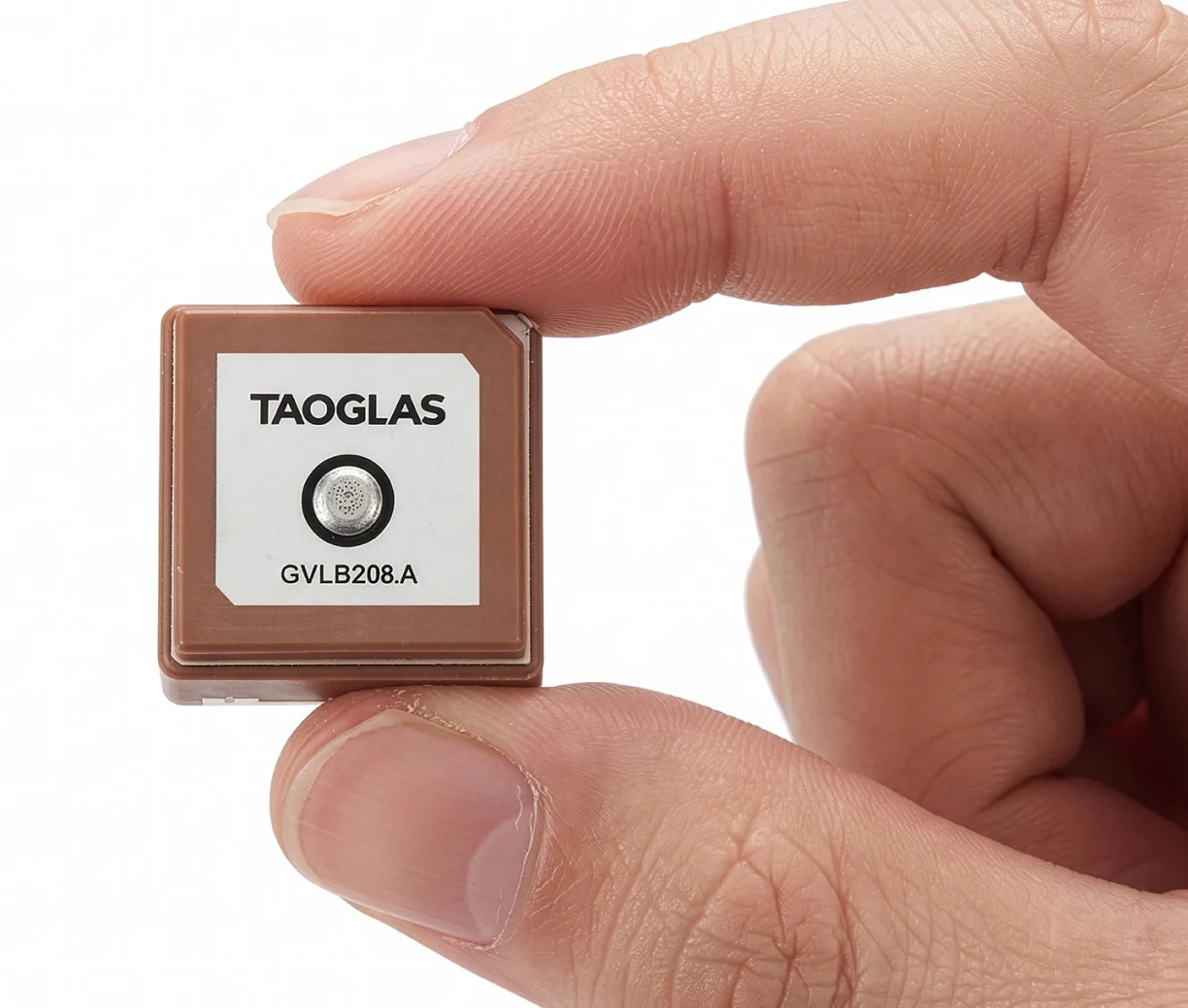
    Taoglas has launched the GVLB208 series, an active and passive dual-band GNSS L1/L5 stacked patch antenna — the first in a new family of ultra-compact antennas.

    Combining a tiny package with concurrent L1/L5 support and stable right-hand circular polarization (RHCP), the antennas deliver reliable centimeter-level positioning in a compact 20 x 20 x 8 mm footprint.

    The GVLB208 series is designed for applications that require high-precision positioning in a compact form factor. Its size, dual-band support and circular polarization make it suitable for designers looking to improve positioning performance without increasing device footprint.

    The new antennas address this challenge with a single-feed stacked patch design that supports concurrent L1 and L5 GNSS bands. By leveraging dual-band operation, they significantly reduce the impact of multipath interference, enabling more reliable positioning and improved accuracy in complex RF environments.

    The series delivers dual-band L1/L5 performance typically associated with larger GNSS patch antennas. The antenna achieves peak gain of up to 1.5 dBi, approximately 50% efficiency across both bands, and an axial ratio of around 4 dB, supporting stable RHCP signal reception and consistent positioning performance.

    Optimized for major global GNSS constellations, including GPS, Galileo, GLONASS and BeiDou, the GVLB208 series supports reliable operation across varied RF environments.

    • The passive GVLB208 A single-feed architecture enables dual-band L1/L5 performance without the complexity of multi-feed designs, while its pin-mount configuration simplifies RF layout and integration. It can be easily implemented on standard PCB designs, with optimal performance achieved on a typical 70 x 70 mm ground plane.
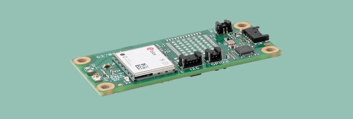
    • The active AGVLB208.A, including active electronics and filters, is supplied with 1.13 micro-coax cable and an I-PEX MHF I connector for easy integration with the latest multiband GNSS modules.

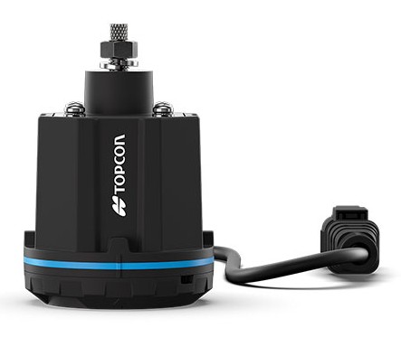
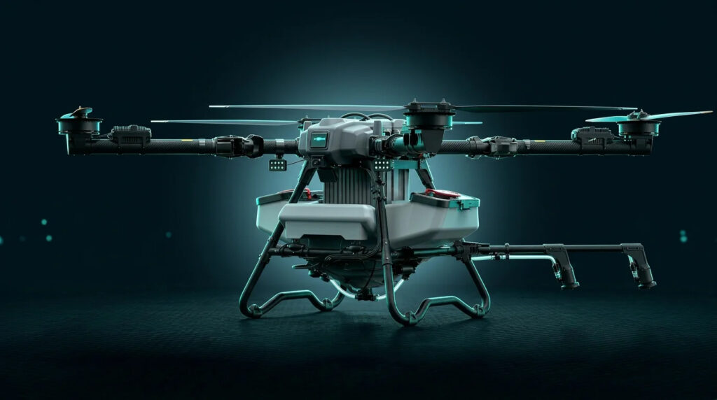
    The GVLB208 series is suitable for autonomous delivery robots requiring seamless sidewalk navigation and precise drop-offs, where every centimeter counts. It also supports applications including unmanned aerial vehicles (UAVs), telematics systems, fleet and asset tracking, precision agriculture, and industrial IoT deployments.

    Taoglas plans to expand the GVLB208 family later this year with an active SMD variant with integrated active electronic components, designed for automated high-volume manufacturing.

  • EUSPA tests prove suitability of Galileo HAS for precision agriculture

    EUSPA tests prove suitability of Galileo HAS for precision agriculture

    The Galileo High Accuracy Service (HAS) was tested under real farming conditions to assess its performance and suitability for precision agriculture

    The European GNSS Service Centre (GSC) of the European Union Agency for the Space Programme (EUSPA) partnered with Hemisphere GNSS and Case New Holland to test the suitability of the Galileo HAS service for precision agriculture.

    The tests were performed at the New Holland campus in Peñarrubias del Pirón, Segovia, Spain.

    The working width used for the test was 2.55 m, while the test area covered approximately 20,000 m² with a perimeter of about 740 meters. During the three-hour test, the teams collected GNSS data to analyze the pass-to-pass and absolute accuracy metrics. Pass-to-pass accuracy is the relative precision of a guidance system to maintain a consistent distance between adjacent, parallel machine passes within a short timeframe (usually 15 minutes). It is crucial for reducing gaps and overlaps during planting, spraying, and harvesting.

    Test campaign

    The test campaign aimed at proving that the tractor consistently maintained the specified path accuracy during consecutive passes. This would show that HAS can optimize agricultural operations by reducing costs associated with overlaps (reworking the same area), leading to savings such as reduced fuel consumption, minimal input waste, and improved crop yield.

    For the test setup, in addition to the onboard guidance system, an independent antenna was mounted on the tractor cab. This antenna was connected to two positioning solutions: one based on the Galileo HAS and another based on an RTK solution.

    An RTK base station deployed for the occasion provided the rover with precise RTK corrections and enabled generating a “reference path” against which to compare the tested Galileo HAS, in this case based on corrections obtained directly from the signal in space (SIS) via the Galileo E6 band.

    The driving was performed in automatic mode, with manual intervention required only for turning at the end of each pass. The autosteering system of the tractor would then automatically reconnect with the following path, as calculated at start-up.

    Test results

    The test began with the GNSS receiver in Cold Start mode, requiring it to obtain ephemerides and process satellite data before achieving precise positioning. The convergence time was calculated and is shown as the red area in the image below. The green area shows when the tractor started along the predefined paths and hence when the data was used for the pass-to-pass accuracy calculation.

    Converge time and data set during the test. (Credit: EUSPA)
    Converge time and data set during the test. (Credit: EUSPA)

    The data analysis showed that the Galileo HAS system consistently maintained horizontal errors of 3-6 cm.

    With a 95% horizontal error of 5.9 cm and its maximum value below 8 cm, the error remains well below the 20 cm HAS accuracy target.

    As regards the vertical axis, the 95% vertical error was 12.4 cm, with its maximum value below 25 cm, (remaining well below the 40 cm HAS accuracy target).

    Galileo HAS signal vertical error. (Credit: EUSPA)
    Galileo HAS signal vertical error. (Credit: EUSPA)


    The horizontal error of the HAS service relative to the RTK reference baseline is shown in the following figure.

    Galileo HAS signal horizontal error. (Credit: EUSPA)
    Galileo HAS signal horizontal error. (Credit: EUSPA)

    Regarding the pass-to-pass accuracy, the analysis shows an overall pass-to-pass accuracy of 1.18 cm, demonstrating highly stable performance throughout the test period.

    Year-to-Year accuracy was not part of this testing campaign but will be analysed in the next testing campaign.

    Galileo HAS potential confirmed

    The Galileo HAS service is an open, standardized correction service distributed directly via Galileo E6 or the internet (with global coverage) and the test campaign results confirm its potential to generate savings to farmers in terms of fuel consumption, fertilizers, seeds and other inputs, by reducing overlap in field operations.

  • Onocoy’s Loop Back gives reference station operators RTK corrections for their devices

    Onocoy’s Loop Back gives reference station operators RTK corrections for their devices

    New feature eliminates the need for a self-hosted NTRIP caster and delivers enterprise-grade correction data to up to three devices simultaneously at no additional cost to the operator

    Onocoy, a decentralized GNSS reference station network, is launching Loop Back, a new platform feature that routes quality-assured RTK correction data back to each station operator’s own devices free of charge. More than 7,800 active reference stations contribute to the onocoy network.

    Operators who also needed precision positioning for their own drones, survey rovers, precision agriculture equipment, or autonomous machinery face a common friction point: the reference station they owned and operated produces valuable correction data, but routing that data back to their own field equipment requires either a separately maintained NTRIP caster or an additional subscription. Loop Back eliminates both.

    Loop Back is immediately available to all onocoy station operators as a standard platform feature. Full documentation and setup guides are available at docs.onocoy.com.

    How Loop Back works

    When a GNSS reference station is connected to onocoy, raw observation data flows from the operator’s hardware into onocoy’s quality validation pipeline. The platform continuously checks position stability, multi-constellation health (GPS, GLONASS, Galileo, BeiDou), uptime and other parameters before producing a quality-assured RTCM 3 correction stream.

    That validated stream has two destinations simultaneously: enterprise data clients who purchase GNSS reference station data through onocoy’s pay-per-use model, and the station operator’s own devices via Loop Back. The operator receives the same production-grade correction stream used by commercial clients, free of charge and with no data credits consumed.

    Key capabilities at launch:

    • Up to three simultaneous active connections from an operator’s own devices to their own station’s corrections, with unlimited devices configurable
    • Compatible with any NTRIP-capable station regardless of hardware brand or model
    • Quality monitoring identical to that applied to enterprise client streams
    • No separate NTRIP caster required; onocoy manages the infrastructure
    • Free of charge: No data credits consumed for the operator’s own station data.

    Who benefits

    Loop Back is designed for the growing segment of professionals who both operate a reference station and rely on precision positioning in their daily work. Target use cases include:

    • Precision agriculture: Farmers running auto-steered machinery, UAV-based crop monitoring, and variable-rate application systems
    • Geomatics and surveying: Professionals running a base station and multiple rover units across a site, eliminating the overhead of a local base-rover setup
    • Autonomous systems, robotics and drones: Operators deploying multiple vehicles or aircraft requiring cm-accurate positioning for mapping, inspection, or delivery workflows
    • Research: Academic and scientific teams running parallel measurement campaigns from a shared base station.

    Economics of station operation

    Most professionals who deploy a GNSS reference station do so because their business in precision agriculture, surveying, drone operations and construction demands one. By connecting that station to onocoy, operators put the same hardware to work a second time: contributing data to onocoy’s global network and earning rewards worth several hundreds of U.S. dollars per year.

    That additional income is enough to amortize the station in under two years before accounting for potential savings on subscriptions. Because onocoy applies continuous quality monitoring to every stream, operators also safeguard the positioning accuracy their business depends on.

  • Topcon launches innovations aimed at farmers at Brazil Agrishow

    Topcon launches innovations aimed at farmers at Brazil Agrishow

    As Brazilian farmers face increasing pressure to improve efficiency while managing rising input costs, Topcon Agriculture has announced a new set of innovations designed to expand access to precision technology across Latin America.

    At Agrishow 2026, taking place April 27–May 1 in Brazil, Topcon will showcase solutions for row crop, coffee, citrus and sugarcane growers, including an expansion of its Value Line portfolio into vineyard and orchard spraying applications, as well as the introduction of a new modular GNSS receiver for precision agriculture.

    XR-1P GNSS receiver

    Modular GNSS receiver. Topcon is introducing the XR-1P GNSS receiver, designed to deliver reliable positioning and manual guidance in a cost-effective, durable unit. Engineered with modular architecture, the XR-1P can be used as a standalone solution or integrated into broader Topcon systems, offering flexibility for a wide range of farming operations.

    The receiver is designed to bridge the gap between entry-level positioning solutions and high-performance precision agriculture systems, making advanced GNSS technology more accessible without compromising reliability.

    CM-20 V spray controller

    Expanding precision spraying for specialty crops. The CM-20 V Spray Controller, part of Topcon’s vineyard and orchard spraying control portfolio, is now available for use with the Value Line Steering solution. Designed for front-wheel-drive, mid-range tractors, the system offers an economical and scalable approach to precision spraying for specialty crops such as coffee and citrus.

    The universal ISOBUS electronic control unit (ECU) integrates easily with existing farm equipment, regardless of brand, while on-the-go sensor-based control adjusts application rates based on crop density. This helps reduce input waste, minimize over- and under-application, and improve overall crop health and operational efficiency.

    Sugarcane solution preview. An advanced look at a pre-commercial Sugarcane Yield Monitoring Solution will be showcased at the event. In development with the specific needs of Brazilian agriculture in mind, the solution will provide accurate, real-time yield visibility designed to maximize harvester efficiency, optimize logistics and support precision agronomy. By enabling more precise decision-making, the solution will help reduce input usage while increasing productivity in one of the country’s most strategic crops.

    Boom height controller

    Brazil is a strategic market for Topcon Agriculture, as it is one of the world’s leading food producers. Topcon supports the region not only through innovations tailored to local agricultural needs but also through a strong and expanding network of distributors that provide access to technology, training, and ongoing support. Authorized dealers, including Agrosure, Alagro, Coopercitrus and WiseAgri in Brazil, as well as Nievas in Argentina and Gestecner in Paraguay, will be at the Topcon stand during Agrishow.

  • New Geodash intends to bring map-free, AI-driven precision spraying to industrial agriculture

    New Geodash intends to bring map-free, AI-driven precision spraying to industrial agriculture

    Joint venture between DroneDash and Geodnet targets oil palm, sugarcane and broad-acre operations across Southeast Asia, the United States and South America.

    DroneDash Technologies and Geonet are forming Geodash Aerosystems Pte. Ltd. — a Singapore-incorporated joint venture to develop a new class of agricultural spraying drone for large-scale, industrial farming operations. Commercial deployment is set for Q3 2026.

    Unlike conventional agriculture drones that require repeated manual pre-mapping before each deployment, Geodash Aerosystems’ platform uses real-time AI vision and centimeter-accurate RTK positioning to perceive, navigate, and adapt dynamically during flight. The result is faster deployment, lower operating costs, and continuous agronomic intelligence from the same system that does the spraying.

    The GDA80-120 heavy-lift agricultural UAV has with centimeter-level RTK accuracy and autonomous AI vision. (Credit: GeoDash)
    Credit: DroneDash

    Most agricultural spraying drones in operation were adapted from general-purpose UAV platforms. Before each deployment, operators must manually survey and map the field, generate static flight plans, and repeat the entire process whenever terrain, planting patterns, or canopy profiles change. In oil palm plantations and large-scale row-crop environments, this mapping overhead directly limits how many hectares a team can cover and how quickly they can respond to emerging crop conditions.

    The operational constraints are compounded the larger the estate. Manual pre-survey and field mapping is required before each deployment. Static flight plans must be recreated when terrain or canopy profiles change. Plans have limited adaptability to uneven terrain and mixed-age crops, when erosion or other changes occur.

    Geodash Aerosystems’ drone architecture removes pre-mapping from the deployment workflow entirely. Using DroneDash’s proprietary AI vision system, the aircraft performs real-time perception of plantation structure, canopy height, and terrain features during flight. Geodnet’s RTK correction network delivers centimeter-level positional accuracy throughout each mission.

    This combination enables:

    • deployment without pre-mapping or manual mission surveys
    • dynamic interpretation of rows, trees and operational zones
    • continuous altitude and spray-rate adjustment over variable terrain
    • rapid redeployment after replanting or field reconfiguration
    • tree-level and zone-specific variable-rate application.

    Situational awareness is generated dynamically during flight — not through a separate pre-deployment process. Each aircraft maintains geofencing controls, safety constraints, and full operational data logging for regulatory compliance and audit traceability.

    Agronomic Intelligence Layer

    Each GEODASH Aerosystems drone is integrated with DroneDash’s AI Smart Farming backend, which transforms every operational flight into a continuous data-collection activity. Spraying missions generate field data used to produce:

    • canopy density and uniformity analysis
    • crop stress and anomaly detection
    • zone-level health scoring
    • spray effectiveness validation
    • terrain and drainage profiling
    • historical trend analysis across blocks and seasons.

    Backend AI analytics then deliver actionable decision support to plantation managers and agronomy teams: early indicators of pest, disease, or nutrient stress; identification of underperforming zones; optimized spray timing and dosage; and data-informed planning for replanting and fertilization. The drone functions as a continuous aerial intelligence layer, not a standalone spraying machine.

    Geodash Aerosystems targets industrial agriculture markets where deployment speed, terrain adaptability, and precision matter most: oil palm plantations in Southeast Asia; sugarcane, soybean and corn operations in the United States; and palm, sugar and broad-acre estates in South America.

    Pilot deployments and system validation have been conducted throughout 2025 and into early 2026 in collaboration with plantation operators. Commercial deployment is targeted for Q3 2026, following completion of manufacturing readiness and regulatory approvals.

  • Septentrio extends its boxed receiver range with AsteRx EB

    Septentrio extends its boxed receiver range with AsteRx EB

    Septentrio, part of Hexagon, offers a new enclosed multi-frequency GNSS receiver: AsteRx EB.

    The cost-effective product offers uncompromised high-accuracy positioning and GNSS heading for industrial robots, port logistics, marine, and scalable automation applications. Its IP67 enclosure protects the receiver from harsh weather conditions, while built-in advanced GNSS+ algorithms ensure reliable operation in environments that are challenging for GNSS, such as areas with foliage or near GNSS interference sources.

    The RAIM+ integrity monitoring system ensures truthful positioning, which is essential for autonomous navigation. The compact enclosure of AsteRx EB enables easy installation, reducing time-to-market.

    “AsteRx EB is an ideal boxed receiver for customers who need reliable, resilient, and highly accurate positioning in a compact form factor and at a price point that makes rapid scale-up possible,” said Danilo Sabbatini, Product Manager at Septentrio, part of Hexagon.

    In a dual-antenna configuration, AsteRx EB delivers sub-degree GNSS heading for systems that require orientation in addition to RTK positioning. The built-in  AIM+ anti-jamming and anti-spoofing technology protects the receiver from intentional or unintentional GNSS interference.

    AsteRx EB extends Septentrio’s lineup of enclosed GNSS receivers. Like mosaic-go, it can be used for quick and easy testing or evaluation of Septentrio’s reliable positioning technology. Thanks to its robust housing, it can be deployed in a wide range of industrial applications. For systems exposed to very harsh weather conditions or intense mechanical stress, the AsteRx RB3 ultra-rugged receiver provides the highest level of protection.

  • Hemisphere GNSS and Calian produce new high-precision antenna

    Hemisphere GNSS and Calian produce new high-precision antenna

    Hemisphere GNSS, a brand of CNH, together with Calian Group Ltd, have released the A65 GNSS antenna, a jointly developed, next-generation solution engineered to deliver exceptional accuracy, superior interference protection, and robust GNSS tracking performance.

    The A65 is designed as a drop-in replacement for the widely deployed A45 antenna, offering users a seamless upgrade path to the latest precision technology.

    The collaboration reflects a shared focus on combining advanced RF design with real‑world application insight to address increasingly complex GNSS operating environments, with both teams working closely from the earliest stages of development to meet demanding original equipment manufacturer (OEM) performance requirements.

    The antenna architecture itself, including the stacked patch quad feed element and RF front end, was engineered by Calian, and provides Calian’s XF Filtering. Hemisphere GNSS contributed application expertise, system integration requirements, and performance validation within real-world machine control, agriculture, marine and survey environments.

    The result is a precision antenna that delivers:

    • outstanding multipath suppression
    • highly consistent phase center variation
    • accurate tracking across GPS (L1/L2/L5), Galileo (E1/E5/E6), BeiDou (B1/B2/B3), GLONASS (G1/G2/G3), NavIC L5, QZSS, and L-band correction services
    • lower power consumption and broad voltage compatibility

    Together, Hemisphere and Calian ensured the A65 meets demanding field requirements while exceeding the performance benchmarks of the A45.

    Calian XF Filtering for Interference Rejection

    A major advancement of the A65 is the integration of Calian’s XF Filtering. The interference mitigation system rejects out-of-band energy at the antenna level, significantly improving signal quality in RF-challenging environments.

    Calian XF Filtering provides protection against:

    • 4G / 5G cellular transmissions
    • Ligado and adjacent band interference sources
    • broadband marine and aviation systems
    • industrial and urban RF noise

    By combining Calian’s advanced filtering technology with Hemisphere GNSS’s application-level expertise, the A65 delivers cleaner signals, improved reliability, and more stable performance in harsh real-world environments.

    Engineered for rugged field use

    Validated through Hemisphere GNSS field testing and Calian engineering qualification, the A65 includes:

    • IP69K environmental protection
    • High-impact LEXAN radome and robust metallic base
    • Low noise amplifier (LNA) with high gain (2.5 dB NF, 28-30 dB gain)
    • 15 kV electrostatic discharge (ESD) protection
    • -40°C to +85°C operating range

    These specifications are designed to ensure the A65 provides long-term performance across agriculture, survey, machine control, marine and fixed-reference installations.

    The A65 GNSS antenna is available now through Hemisphere GNSS. OEM module versions based on the same Calian engineered design are also offered for integrators requiring embedded solutions.

  • Advanced Navigation provides navigation for underground mines following 2025 demo

    Advanced Navigation provides navigation for underground mines following 2025 demo

    Advanced Navigation has released a product for navigating underground mines, based on its technology demonstration in October 2025.

    Chimera Land is a 3D laser velocity sensor (LVS) designed to solve the primary challenge for underground mining: maintaining precise vehicle positioning in deep, dark, and unmapped environments where GPS cannot reach.

    When fused with an Advanced Navigation inertial navigation system (INS), Chimera Land allows underground vehicles to maintain stable navigation over extended distances and time. Instead of needing to “ask” an external beacon or satellite for its location, the sensor uses specialized lasers to measure a vehicle’s ground-relative 3D velocity with high accuracy. By feeding this precise data into the vehicle’s INS, the sensor eliminates the drift that typically comes with standalone INS.

    This integration uses AdNav Intelligence, the company’s proprietary software. Drawing on adaptive algorithms, the fusion engine dynamically weights the input from each sensor, adjusting reliance in real time based on their reliability scores, environmental conditions, and operational context.

    The result is a resilient, high-performance, infrastructure-light positioning solution that excels in the high-dust, zero-light conditions typical of underground mines.

    Chimera Land was demonstrated in Europe’s deepest underground mine as part of BHP’s Deep Mining Call. When integrated with Advanced Navigation’s high-performance Boreas D90 INS, the solution achieved a position accuracy of 99.9% of distance traveled. Crucially, this performance was maintained without relying on any fixed positioning infrastructure, pre-existing maps, or external aiding.

    Key performance benchmarks:

    • Precision at depth. The system delivered a final position error of 15.9m over a 22.9km transit (approx. 52 ft over 14 miles) at 1.4km underground.
    • INS drift reduction. Chimera Land actively reduced the drift rate to a mere 0.07% per distance traveled.
    • Repeatable accuracy. Validated across five separate runs, the system consistently hit an accuracy of better than 0.1%.
    • Infrastructure-light. Enables full vehicle autonomy even where fixed networks and infrastructure end.

    As mines move deeper and into more hostile geological frontiers, the cost of installing fixed infrastructure becomes prohibitive. Chimera Land is engineered to maintain high-confidence estimation in total darkness, heavy dust, and high-vibration mining environments.

    It allows for “infrastructure-lite” operations across the value chain.

    • Autonomous haulage systems (AHS). Enables continuous high-speed tramming in development areas without the need for pre-surveyed beacons.
    • High-Precision machine guidance. Provides the sub-decimeter velocity accuracy required for automated drill rig alignment and robotic scaling.
    • Dynamic Fleet Management. Real-time, sovereign localization allows for precise asset tracking and ore reconciliation, even in the deepest “dead zones.
    • Predictive collision avoidance. High-fidelity 3D velocity data improves the “time-to-collision” calculations for safety systems, reducing nuisance alarms.
  • Syslogic introduces cm-accurate navigation with computer expansion board with u-blox

    Syslogic introduces cm-accurate navigation with computer expansion board with u-blox

    Syslogic has introduced a GNSS expansion board for its rugged embedded computers.

    Based on u-blox GNSS technology, the board provides centimeter-level positioning, opening up new applications across industries such as autonomous field management, operation of construction machinery in remote areas, or navigation of automated guided vehicles and autonomous mobile robots.

    All-band, multi-frequency reception and HAS-ready

    Syslogic’s all-band GNSS board is powered by the u-blox X20 receiver, supporting all major GNSS constellations and frequencies, including L1, L2, L5, L6 and L-band. This enables the use of the upcoming Galileo High Accuracy Service (HAS).

    HAS supplements standard Galileo Open Service positioning with correction data transmitted directly over the E6/L6 band. The result is centimeter-level positioning via GNSS signals — without the need for traditional RTK base stations, costly reference networks, or 5G connectivity. HAS is free and globally available.

    The u-blox X20-based GNSS board also supports simultaneous multi-frequency reception. With additional frequencies compared to previous models, typical GNSS errors — such as multipath effects and signal blockage — are significantly reduced, particularly in urban environments. This is crucial for applications that demand highly precise and reliable positioning, including surveying, autonomous vehicles, agricultural machinery and industrial automation.

    The GNSS board is designed for worldwide use. The integrated u-blox receiver supports modern correction techniques such as RTK, PPP-RTK and PPP. For the first time, it has been fully optimized for PointPerfect Global, u-blox’s proprietary high-precision GNSS correction service, delivering centimeter-level positioning anywhere in the world. This is particularly useful in remote areas without cellular coverage. PointPerfect Global uses advanced PPP-AR technology (precise point positioning with ambiguity resolution), providing corrections via the Internet or L-band satellite transmission. The service achieves convergence times of less than 2 minutes and positioning accuracy within 10 centimeters.

    The new expansion board is compatible with Syslogic embedded computers, including both Nvidia Jetson-based and x86-based devices. It is available with either one or two receivers, enabling RTK and heading functions without additional hardware. Vehicles and machines can be positioned with centimeter-level accuracy.

    Several Syslogic customers are already using the GNSS functionality in pilot projects, including precision farming and construction machinery monitoring.

    Features of the Syslogic all-band GNSS board

      • Based on the u-blox X20
      • All-band, all-constellation GNSS receiver
      • RTK, PPP-RTK and global PPP, cm-level accuracy
      • PPS output to host system (GPIO)
      • Galileo HAS support on L6 band
      • Flexible integration into Syslogic products
      • Extended temperature: –40°C to +85°C
    • SES extends EGNOS GEO-1 satellite service to power precise navigation across Europe

      SES extends EGNOS GEO-1 satellite service to power precise navigation across Europe

      The agreement ensures Europe’s satellite-based augmentation continues enhancing navigation for aviation and other critical users and lowering emissions.

      SES, a space solutions company, and the European Union Agency for the Space Programme (EUSPA) have announced an extension of the European Geostationary Navigation Overlay Service (EGNOS) GEO-1 satellite service agreement through 2030, with an option to extend until 2032, helping maintain high-precision navigation services for aviation and other critical users across Europe.

      By improving the accuracy and integrity of satellite positioning signals, EGNOS supports aircraft in landing in low-visibility conditions, as well as planning more efficient routes, reducing fuel burn and CO₂ emissions.

      At the core of the EGNOS service is Europe’s regional satellite-based augmentation system (SBAS) that improves the accuracy and reliability of GNSS signals, such as GPS. Beyond aviation, EGNOS supports maritime navigation and precision-driven agriculture, contributing to efficient operations and sustainability by reducing fuel consumption and emissions.

      Under the extended GEO-1 contract, SES will continue operating an EGNOS-hosted payload on its SES-5 satellite, as well as the ground segment from its facilities in Europe.

      “This extension ensures a robust EGNOS space segment, ready for the transition towards its next version and the development of new services, while safeguarding high-precision navigation for aviation and other critical users across Europe,” said Rodrigo da Costa, EUSPA executive director.

      “EGNOS is a cornerstone of Europe’s aviation and broader navigation applications. The agreement underscores SES’ and EUSPA’s joint commitment to advancing satellite-based services that enable secure, reliable, and sustainable navigation solutions,” said Philippe Glaesener, senior vice president, Global Government at SES. “Thanks to the service, millions of users and operators will benefit from efficient and more reliable air transportation services across all of Europe. This commitment reflects our broader mission of delivering resilient satellite solutions for critical infrastructures.”

    • European PAVE-SCAN project aims to increase transport efficiency, safety

      European PAVE-SCAN project aims to increase transport efficiency, safety

      The European Union PAVE-SCAN project aims to build European GNSS-based and AI-driven technologies to detect and assess roadway pavement problems.

      The proposed project aims for the development to market (TRL8-9) of European GNSS-based integrated low-cost sensor technologies and artificial-intelligence-driven open-architecture software solution — machine learning (ML) and machine vision (MV) — for the detection, classification and georeferencing of roadway pavement surface anomalies, and for the low-cost assessment of roadway pavements using participatory sensing.

      The proposed system is of practical importance because it provides continuous information about roadway pavement surface anomalies — valuable for efficiently monitoring the transport infrastructure and for public safety. The vision for roadway condition assessment using smartphone-like technology is under the hypothesis that such technology can be used for crowd-sourced data collection and analysis in GIS-based pavement management systems (PMS).

      “The developed technology and related transport informatics are disruptive technologies that have the potential to reshape the transport and infrastructure industries,” according to the project description.

      The project is funded under Horizon Europe; with the University of Cyprus Department of Civil and Environmental Engineering serving as a partner.

      The project’s objectives are outlined below.

      Table 1. Project objectives
      #Project ObjectiveWP
      1Near-real-time analysis and classification of roadway anomaliesWP3,WP4,WP5
      2Geospatial mapping of transport infrastructure, roadway anomalies and condition-assessment heatmapsWP3,WP4,WP5
      3Geospatial mapping of transport infrastructure, roadway anomalies and condition-assessment heatmapsWP3,WP4,WP5
      4Improved roadway management practices, prioritisation of public works & lower costsWP4
      5Reduction in the transport-related environmental footprint through improved O&M of transport infrastructure and of mass transitWP4,WP6,WP7
      6Reduction in roadway-assessment costs by utilization of a fleet of vehicles/buses as participatory sensorsWP5,WP6,WP7
      7Integration with national transport initiatives (e.g., National Single Access Point), & with Digital Twin platforms, for dynamically updated roadway-condition models, and improvements in transport safety through roadway improvementsWP4, WP5
      8Open-access data and APIsWP1, WP8
      9Product to market and ‘Product as a Service’ (PaaS) business modelWP8
      10Dissemination of project resultsWP1
    • CHC Navigation brings PointX and StellaX positioning to smart lawn mowing

      CHC Navigation brings PointX and StellaX positioning to smart lawn mowing

      CHC Navigation announced at CES 2026 that MOVA has integrated CHCNAV PointX integrated satellite ground service and the StellaX high-precision positioning chip into its NAVAX 5000 AWD intelligent robotic lawn mower, unveiled at the show in Las Vegas last week.

      The integrated positioning solution is designed to support centimeter-level accuracy for wire-free mowing, without requiring users to install a local RTK base station or subscribe to cellular data plans.

      Wire-free robotic mowers are accelerating adoption of virtual boundaries and automated coverage. Many systems rely on local RTK reference stations, network RTK, or cloud connectivity, which can increase installation complexity and introduce ongoing service costs. CHCNAV and MOVA developed a positioning architecture designed to address these limitations through satellite delivered corrections combined with onboard sensor fusion.

      Wire-free mowing without local base stations

      NAVAX 5000 AWD uses CHCNAV PointX integrated satellite ground service to deliver GNSS enhancement signals via satellite. With the StellaX high-precision positioning chip, the mower can achieve centimeter-level positioning across supported regions without requiring users to deploy and maintain an RTK base station at home. This can reduce setup time, remove routine base station maintenance, and avoid recurring cellular data fees for positioning corrections.

      Residential yards often include trees, walls, fences and buildings that degrade satellite visibility and create multipath effects. NAVAX 5000 AWD combines satellite-based RTK positioning with binocular vision and lidar to strengthen navigation performance in these environments.

      With PointX and StellaX, the system is designed to deliver stable positioning and consistent path tracking in obstructed areas where traditional GPS RTK-only approaches can be difficult to sustain.

      PointX-integrated satellite ground services support rapid RTK initialization to reduce waiting time at startup. This enables power on and go operation for typical mowing sessions and supports repeated runs with minimal user intervention.