SCVNGR, makers of the location-based social game SCVNGR, and LevelUp, the app that lets users pay by phone, announced that it has 12 million in funding with participation from existing investors Highland Capital Partners, Google Ventures, Balderton Capital, and new investors Continental Investors and Transmedia Capital.
Part of a larger round of fundraising, the $12 million in financing will support the growth of LevelUp, the mobile payment app which is now available at more than 3,000 merchant partners in 8 U.S. cities, including well-known fast-casual chains like boloco, Johnny Rockets, and Ben & Jerry’s. LevelUp has nearly 200,000 users who are spending at a volume of $2 million per month with the app, and the fundraising round at large will be focused on the product’s nationwide expansion.
“LevelUp adds tremendous value for both merchants and consumers and has quickly accelerated to become a leading player in a highly competitive space,” said Google Ventures Partner Rich Miner. “We’re impressed by the product’s success to date and are excited to provide additional support as LevelUp scales nationally and the mobile payments industry continues to evolve at a fast pace.”
Launched by Boston-based SCVNGR in July 2011, LevelUp enables its users to pay with their phones by linking their credit or debit card to the app and scanning it at checkout. In turn, businesses on LevelUp are able to attract new customers with incentives while motivating them to become regular customers with loyalty rewards.
LevelUp is also expanding its staff to accommodate the product’s rapid growth, adding 40 new recruits to its sales team in recent months. At the executive level, LevelUp has also appointed Paul Purcell of Continental, a participant in the $12 million funding round , as an observer on the Board of Directors.
The Weather Channel Companies announced they will partner with hyperlocal data company PlaceIQ to provide advertisers with new audience targeting that can deliver highly contextually relevant ads to consumers. With 30 million monthly mobile users, The Weather Channel can offer hyperlocal audience targeting at scale. This targeting is now available on The Weather Channel iPhone App and will be rolling out on The Weather Channel Android App in July and all mobile platforms later this year.
PlaceIQ extracts intelligence from large amounts of place, social, and mobile location-based data to create hyperlocal, targetable audience profiles informed by time of day as well as location, giving advertisers the power to connect with consumers. These anonymous audience profiles can provide powerful targeting opportunities for advertisers. For example, financial services clients can target ads to mobile phones in areas with a high propensity for business travelers, such as airports during peak commuting hours, or in areas with a high concentration of hotels in the morning or evening that score high for business travelers. An ad on The Weather Channel app can be served during lunch on mobile phones on certain blocks populated with office workers, or served targeting late-night diners in an area that has a high concentration of nightlife and social activity.
"Consumers expect to receive the most accurate local weather news and information when they use The Weather Channel mobile products, which gives us the opportunity — and our advertisers the advantage — to deliver messages highly targeted to their location that will feel completely organic to their user experience," said Patrick McCormack, vice president, mobile sales and strategy, The Weather Channel Companies. "We feel strongly that our premium content and ability to target a specific mobile audience provides an unparalleled ad solution to our advertising clients."
"The combination of PlaceIQ's hyperlocal audience targeting, with The Weather Channel's tremendous reach and ability to transform hyperlocal impressions into specific audiences, is an extremely powerful one. The combination of weather, location and audience creates a set of offerings we think represent true innovation in mobile advertising, and we're extremely excited to partner with The Weather Channel to deliver this to market," said Duncan McCall, CEO and co-founder, PlaceIQ.
The product is launching with a number of high profile advertisers, including Chevy Silverado,Frito-Lay, and the Ram Truck brand, among others.
CMTINC.com Announced the Release of Deed Calls, Area, Perimeter App for iOS (iPad, iPhone, iTouch), enabling real-estate agents, property financing officers, title officers, attorneys, construction contractors, and anyone working with real property to quickly convert angles and distance data into a boundary map.
According to the announcement, the app will label the resultant deed plot and display the completed figure, its area and perimeter, as well as the closure error. There is an Auto-close option to automatically close the figure. The users may generate a PDF report containing the map drawing and the deed calls data. They may also save the Deed Calls data file and send it to other users via email.
If the users wish to pin the deed plot to a geographic location, they may specify the actual coordinates of the initial node. For devices equipped with GPS, this app provides the ability to pick the GPS position as the point of beginning. In these cases, the app can display the deed plot on top of a Google Earth map.
The Deed Calls – Area – Perimeter app is available from the App Store by clicking here.
Blue Sky Network has launched the SkyRouter, a fleet management portal for land mobile, aviation, and marine applications. SkyRouter is a feature-rich, cloud-based solution designed to support connectivity with remotely dispersed mobile assets including Blue Sky Network’s advanced dual-mode GSM and iridium tracking and communications services, the company said.
SkyRouter enables seamless connectivity with assets in problematic cellular reception areas, where only 10 percent of the Earth is covered, and in remote locations, Blue Sky Network said, adding that only Iridium-based communications devices and services work globally through connectivity via the world’s furthest reaching network.
Today’s fleet managers require around-the-clock communication with widely distributed mobile assets. Overall safety and fleet efficiency can be achieved through alerts, monitoring of position data, and unique event reporting. New SkyRouter leverages the integration of Blue Sky Network’s HawkEye 5300, which enhances coverage of GSM cellular tracking capabilities with global coverage to deliver dual-mode tracking and event reporting of assets located anywhere in the world. Fleet managers can receive real-time updates that include GPS location information, messages, and on board diagnostic (OBDII) alerts, among others, everywhere.
“Our next-generation New SkyRouter for land mobile fleet applications furthers our commitment to be a market leader in advanced tracking products for customers who demand customized solutions and exceptional customer service,” said Jon Gilbert, CEO and founder of Blue Sky Network. “This new platform, in concert with our superb products, means more mobile asset sectors can benefit from smooth integration of tracking hardware with a cloud-based portal for seamless command and control across multiple asset types and deployments.”
SkyRouter works in combination with Blue Sky Network’s certified hardware, which can be installed on land, aviation, and marine assets. Features include over-the-air parameter settings, automated event reporting, local sensor data capture, and two-way messaging capability.
“The new SkyRouter is an innovative solution from an important Iridium partner enabling fleet manager’s global visibility of their important assets though the cloud,” said Greg Ewert, executive vice president of global distribution channels at Iridium. “This level of visibility provides vital data delivery to fleet operators who are driving further efficiencies into their business, meeting regulatory requirements or protecting the safety of their personnel or assets.”
Telmap announced a partnership with Decell, a leading provider of traffic information including real-time road status and related transportation services. By collaborating with Decell, Telmap is now able to provide a unique navigation service to its users in Israel by providing them with real-time information on available parking spaces with regards to the users’ location.
According to the announcement, this innovative service is currently available to subscribers using the Telmap Mobile Location Platform on all four leading Israeli cellular operators (Orange, Pelephone, Cellcom and Hot Mobile). Users can at any time get recommendations on parking lots with available vacancies relative to their current proximity. Currently this service is available in a selection of car parks in Tel Aviv and in the coming weeks it will be expanded to include cooperation in dozens of car parks across the country.
“We are always seeking to provide added-value services to our users who are on-the-go and we classify finding a parking space as one of the recurring tasks that we all encounter while on-the-go. Our collaboration with Decell in Israel aims to provide a functional, innovative and substantially useful solution that empowers the Telmap user to find a parking spot on demand.” – Motti Kushnir, Chief Marketing Officer
Telmap reports that Decell is Telmap’s premium traffic information and services provider in Israel for the past four years. Decell’s traffic services are designed to shorten drivers’ arrival time to their final destination as much as possible. Real-time data regarding the availability of parking lots holds a great value to drivers by saving time not only on the roads, but throughout their entire journey.
“We are very proud to present another unique service in cooperation with Telmap. Relevant information regarding parking spaces at any given time is a natural completion to Decell’s rich real-time traffic data. As a premium traffic information provider, Decell constantly expands its offering and promotes the best experience for drivers.”- Jonathan Silverberg, CEO of Decell
GPS/GNSS is now moving beyond cellular and traditional navigation markets, representing a market worth more than $3.3 billion in 2016, according to a new report by ABI Research.
GPS/GNSS has always been strongly tied to navigation in the in-car, PND, and cellular space, ABI Research said. However, GPS/GNSS is now finding applications in cameras, gaming, and tablets. Furthermore, femtocells and small cells represent huge volume opportunities, with companies like u-blox, Fastrax, and iPosi all developing specific GPS/GNSS solutions to meet the unique requirements of this market.
Location technologies such as Wi-Fi, Bluetooth, MEMs, and proprietary technologies from companies such as NextNav and Boeing will all see strong penetration. For example, the tablet market will be dominated by Wi-Fi location over the forecast period.
“Ultimately, GPS/GNSS manufacturers will need to combine an increasing number of technologies, supporting ubiquitous indoor and outdoor location,” said Patrick Connolly, senior analyst, telematics and navigation. “In 2012, CSR, Broadcom, and Qualcomm have all made announcements around increasing convergence of location technologies in the handset. This will meet the outdoor requirements of today, as well as supporting the emerging precision indoor location market.”
ABI Research’s market data, “GPS IC and Devices Forecasts, Global,” provides forecasts of GPS/GNSS ICs and market shares across nine key CE devices. It also provides forecasts for alternative/hybrid location technologies, providing a complete picture of the future location market.
NEW ORLEANS — CTIA was both about new offerings and the issues retarding industry growth. The hyper local mobile advertising contingency proclaimed 2012 as the year of its breakthrough. Indoor location companies hoped that 2012 would be their year. Although the car manufacturers didn’t exhibit, mobile apps for the connected vehicle were prominent. Mobile wallet and safety apps were hot. The connected home raised its hopeful head once again. Winning back consumers’ trust that their privacy would be safeguarded, including location information, was acknowledged as standing in the way of deeper, more personalized offerings. Carriers sounded alarms about running out of spectrum to support ballooning mobile data consumption.
Industry leaders provided their perspectives on where our industry is headed:
“The reputation of our industry has dropped to the lowest of any major industry. Even the cable and oil industries rate higher with consumers than we do. That’s a bummer.” Dan Hesse, Sprint Nextel
“We are waiting for the Steve Jobs of automotive. We need a platform that lets apps run with zero friction. Jobs listened to consumers; we need that for connectivity to the vehicle.” Alon Atsmon, iOnRoad Technologies
“In two years we will see more vehicle connectivity, indoor location, and mobile based advertising. We are not pursuing indoor location now, but it is on our radar. In the future we will see incremental map updates. Map updates are now done on a country or state basis. We can’t yet pull out a tile of the map and just update it.” Darianna Gessner, TomTom
“There will be advances in location accuracy, reliability, ubiquity and indoor position. We will see a more connected infotainment system in the vehicle. It will connect to the vehicle and make phone calls, provide safety and security, understand proximity, and give lane guidance.” BrianMacLeod, Trimble
“Companies need to be concerned about monetization, distribution, and functionality. Some companies are putting money into developing apps when it doesn’t make sense, and they don’t need to be in an app store. The Financial Times pulled their app out of the app store, because they no longer wanted to share the revenue.” Todd Simpson, Mozilla
How would you like to pay for that? The credit card companies, carriers, and Google are vigorously vying for best market position in the mobile payment industry. Has Ralph de la Vega of AT&T found a new reality plane? During a keynote, he predicted that mobile payments would replace the wallet by next year. With public concerns about privacy and security, a shift needs to occur in the U.S. before it will be widely adopted. Strong, simple, and convincing privacy controls that win consumers’ trust will the first step.
Location Protects Location Labs is the provider of the Sprint “Safely Bundle,” which offers families a way to monitor or restrict their phone-carrying children through location checks and limits on texting, such as while driving or at school. “We are working on developing a way to offer geo-fencing,” says Tasso Roumeliotis of Location Labs. “The challenge is that continuous location checks drain a phone battery greatly.” The goal is always-on location. Geo-fencing has long been used for asset tracking in devices that draw power from the car battery.
Eye on the Road. iOnRoad showed off its clever driver assistance app and came away with the show’s Mobile Application Automotive Driving and Transportation prize. A cell phone, placed in a dashboard mount, provides a forward collision warning by monitoring the distance to the vehicle ahead. It also provides a lane departure warning if the vehicle is traveling over 37 mph and the wheel touches a solid line (not dotted line). The product is being sold for $4.99, a one-time license fee.
CTIA Reveals. TechnoCom has launched a new division dedicated to the LocationSmart platform, a location integration solution. “This cloud-based location and messaging service adds device location awareness to enterprise and consumer applications,” says Mario Proietti of TechnoCom. “It is a cross-carrier platform for location and messaging.” Asked for his perceptions of CTIA, Proietti summed it up as the year of the credit-card companies (mobile payment), mobile solutions for in-car experience, and swarms of booth babes. I would like to see new product reveals, not skin.”
Lost? How far can Hertz NeverLost go without expanding its market beyond their rental cars? Hertz was at CTIA showing off expanded city guides that will provide enhancements to their users. When asked if they had plans to enlarge their market beyond customers of their rental fleets, Linda Senigaglia of Hertz seemed surprised by the question, and asserted that their play is solely with Hertz customers. Ouch.
Sprint Mobile Ad Policy. Sprint Nextel plans to introduce a new mobile advertising privacy policy that it will distribute to all new subscribers, allowing them to opt-out of services. Sprint reported that an independent third party would audit Sprint’s compliance. “We must ensure customers are fully informed of our data collection practices,” explained Dan Hesse of Sprint. “As an industry, we’ve got to work together to get this right.” Hesse has previously called for stricter guidelines on driving while using cell phones and for the use of renewable and reusable materials.
Spectrum Shortage. Verizon Wireless and T-Mobile executives complained that the future of data use is at risk if more spectrum isn’t put to use. FCC Chairman Julius Genachowski defended the agency’s decision to block the AT&T T-Mobile deal with a rejoinder about spectrum shortage. “Some have argued that transactions — let’s be frank, one transaction — is somehow causing a shortage,” said Genachowski. “But the overall amount of spectrum hasn’t changed.” While this is true, spectrum is a concern. CTIA reports that U.S mobile data traffic surged 123 percent in 2011.
Rumors. The grapevine is buzzing with rumors that Deutsche Telekom is in talks with MetroPCS about combining with T-Mobile. Sanford Bernstein’s Craig Moffett had a field day with the possibility, “Oh, my, what an ugly baby,” he writes. Bloomberg reports that MetroPCS is in discussion with other partners as well.
At the movies. Have you seen the fabulous new Norwegian thriller Headhunters? Spoiler alert: the main character is tracked via nano-sized location devices smeared somewhere on his body. See the movie to find out where.
Two prominent tech magazines are tolling the death knell for portable GPS devices today, spurred in large part by Apple’s announcement of Maps, its own mapping and GPS navigation service.
“Apple made a number of significant announcements at its Worldwide Developer Conference (WWDC) yesterday, but one of the most insidious was its widely expected move to launch Maps, the company’s homespun mapping and GPS navigation service,” reads PC World’s article “Apple Moves to Kill GPS Devices, Reduce Dependence on Google.
“The updated app marks the first time the iPhone will have free, voice-enabled GPS navigation. It also includes real-time traffic, Yelp integration, crowd-sourced traffic data (hello Waze), Siri support, and the ability to work in the lock screen. In a move to match Google, Apple is also working on 3D modeling for buildings and terrain data, which it will acquire by flying planes over U.S. cities.”
Wired Magazine was even more dire; its article titled “Apple, Google Just Killed Portable GPS Devices,” begins, “If it wasn’t obvious before, it’s crystal clear today. The dedicated portable GPS device is dead, with Apple and Google playing pallbearer to Garmin, Magellan and TomTom’s hardware businesses.
“Between last week’s hastily organized Google Maps event, where the search giant showed off a new interface, new features and — most importantly for Android users — offline map downloading, and Apple’s new Maps app announcement at WWDC, a dedicated device for mapping and navigation comes across as superfluous. Or even worse, incredibly low-tech.
Leica Geosystems announced a further enhancement to the Leica Zeno GIS family – the Leica Zeno 5, an entry-level, rugged PDA for organizations that require a durable compact device with integrated modem and high-sensitive GPS. The new Leica Zeno 5 supports field workers by combining a mobile phone with asset collection and management capabilities.
Senior Product Manager Johannes Hotz comments ”Together with our Leica Zeno Field and Zeno Connect applications, the Zeno GIS family continues to grow and further addresses all mobile GIS market segments ranging from utilities and natural resources to municipalities”.
The new Leica Zeno 5 provides a complete, integrated package of positioning, imaging and communications tools:
GSM HSPA+ and CDMA with full phone capabilities, Wi-Fi and Bluetooth
Texas Instruments latest high performance processor, the Sitara 3715 (OMAP3) at 800 MHz
Large 3.7” full VGA transflective display
Windows Embedded Handheld 6.5.3 Operating System
Rechargeable and hot-swappable all-day battery (10 hours +)
Full range of interactive sensors including camera, digital compass, gyroscope, light sensor, proximity sensor and accelerometer
“The new Leica Zeno 5 is the fastest and best equipped rugged PDA for a mobile user”, said Johannes Hotz. “Designed to be, at the same time, a mobile phone, GPS-enabled data collector and a controller for our out-standing Leica GG02 plus GNSS SmartAntenna. This new handheld will help users to get the maximum out of from their investment. Together with our Zeno Field application, the Zeno 5 provides an easy-to-use, streamlined GIS data collection and management solution. The Zeno Connect, as stand-alone application or SDK, enables our software partners to combine their industry specific solution with our high-accuracy data collection solutions”.
According to the announcement, the Leica Zeno 5 is shock resistant, withstands a drop from to 1.8 m, and is protected against water and dust. The large 3.7 inch screen is optimized for sunlight readability and maintains exceptional clarity in outdoor conditions, including direct sunlight. Field workers can collect features and descriptive information using the in-built, high-sensitive GPS data, attach photos to the collected assets, and synchronize, with high-speed up- and download times, with the office using a single and compact device, all in a full working day without re-charging the Zeno 5.
Google’s recent announcement that it plans to enhance its 3D maps on the Android platform was seen as a preemptive strike against Apple, which is planning a similar announcement. In other recent news, some analysts and trade press are saying Verizon is paying way too much for Hughes Telematics. All of this is making for an interesting summer for the location industry.
Google recently demonstrated new 3D capability for Google Earth, in a move that some say preempted a similar announcement by Apple, which will roll out its own product at our deadline during the Worldwide Developers Conference.
While Apple is set to announce its own version of a mapping program for iOS that does not use Google Maps, some in the industry are wondering if the 3D capability is enough for developers to stay with Google, particularly with the fees the company is charging high-volume users. The big winner in the Apple announcement was TomTom, which has signed a global agreement with Apple for maps and related information. No further details of the agreement will be provided, the company said.
In terms of upstaging Apple via 3D, one company executive thinks that is overblown. “I don’t think Google was trying to do that directly on just that feature. I think they are very concerned about the Apple announcement — not just because they will lose Apple as a customer, they will, but because they fear a ‘wow’ factor upstaging them despite all the great work [Google] has done to date,” said Kim Fennell, deCarta president and CEO. “Their press conference last week was more about reminding everyone how hard it is to do this stuff really well, and I think they wanted to remind Apple, and the market, it takes a lot do the complete mapping solution really well. I think their Google Earth capabilities with street views and their new 3D modeling is a major investment and they wanted to set the overall bar high for Apple.”
DeCarta says half of its new developers are coming from Google Maps. The company says that, in the last 90 days, 488 new companies have signed up to its developer’s program.
In a white paper, de Carta says: “The timing of this surge confirms that Google is no longer seen as the ‘Benevolent Provider of Free Stuff’ that it once was. What is more surprising is that not all of the companies jumping ship are big guys…in fact some are not even close to the 25,000/day map threshold that Google uses to trigger the hounds.”
The company contends that there is a common theme that developers want to work within clearly defined partnerships, how much they will need to pay, and whether or not they can execute their business model — especially if that involves advertising. “They want to create some differentiation and most of all, they want to know whether or not their partner will one day decide to compete with them,” the company white paper says. This restriction trickles down to real estate, travel, local search, and other sites, the company says.
Fennell said deCarta started working with Google competitor OpenStreetMap in 2009 when it was early in the market and there were almost no takers. “We were too early, the market wasn’t really looking for an alternative yet — and the map data quality wasn’t good enough. Three years later, it is looking much more interesting both from supply (map data availability) and demand (customer interest),” he said.
Verizon’s Purchase of Hughes Telematics a Financial Reach?
To strengthen its presence in the machine-to-machine and connected car market, Verizon Communications said it plans to buy Atlanta-based Hughes Telematics Inc. for $612 million, or $12 per share. The high price has some analysts scratching their heads — particularly because Hughes was trading at only $4.35 per share the day the deal was announced.
Hughes Telematics, which competes with OnStar, began to provide LBS, connected safety and convenience services to Mercedes-Benz customers in 2009.
“I was frankly surprised at the valuation considering HTI’s financial position. I assume Verizon sees a lot of value in the Mercedes account and potential value in HTI’s VW account — and at least one other OEM account which they are expected to get,” said Clem Driscoll, president of CJ Driscoll Associates. “I think it is also clear that Verizon’s plans called for increasing its role in telematics through acquisition of a telematics service provider. A previous attempt at a TSP acquisition was unsuccessful. HTI clearly has some good technology, as evidenced by the Mercedes Mbrace solution.”
Driscoll said that Hughes Telematics’ financial problems probably discouraged some auto OEMs from using them in the past, but those issues should now be resolved.
The Verizon-Hughes Telematics acquisition is expected to close in the third quarter. Verizon plans to retain Hughes Telematics’ management, operate the company as a subsidiary of its Verizon Enterprise Solutions group, and keep the company headquartered in Atlanta.
ITS America Holds Small Annual Meeting — Why?
It isn’t big news that private companies still court government contracts and attend the ITS America Annual meeting in Washington to work on connected vehicle committees. However, this is the first time I’ve covered this conference, and I’ve attended off-and-on since 1993, to notice attendance has reached the point that only a few die-hard private sector companies are going to this government-focused meeting.
Remember, the ITS America meeting was the only game in town in the 1990s and early 2000s, with two of the dominant players at that time, Navteq and Etak (later to be purchased by Tele Atlas) anchoring a growing navigation and location industry.
Instead of ITS America dominating the entire connected vehicle conference market, most private companies choose to attend the pricier Telematics Update Detroit meeting. What made the meeting more disappointing is the fact that ITS America does attempt to focus on the connected vehicle. The U.S. Transportation Department invited delegates and the press to a connected vehicle demonstration with Ford, General Motors, and Toyota, among other team members. The demonstration highlights this summer’s testing of 3,000 vehicles, which will test crash-avoidance technologies in Ann Arbor, Michigan, in a year-long government program.
Still, some companies attended such as Inrix, Beat the Traffic, and TomTom. The Virginia Transportation Department is partnering with TomTom to analyze where travelers entered and exited the I-95/I-64 corridor.
Some companies are getting ITS grants, such as Xerox, which grabbed $15 million from the U.S. DOT for a pilot program incorporating real-time parking guidance systems, among other projects. These parking systems, using smartphone apps from Streetline, enable motorists to view spaces based on price, location, and real-time availability.
Simulators Keeping LBS Companies on Target
Spirent Communications, which is monitoring the popularity of LBS, said its new GNSS simulator supports simulation of signals from individual or combined GPS/SBAS, GLONASS, and Galileo constellations, with eight satellites per constellation.
The company, which said it recognizes the increase in LBS’ momentum and the market need for improved positioning performance on mobile devices, has expanded its LBS LTE test product to support an LTE Positioning Protocol and Observed Time Difference of Arrival. The company says both are critical enablers for LBS adoption.
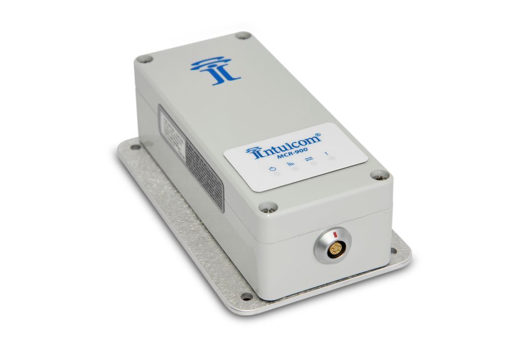
Intuicom Inc. announced the MCR-900 to help increase productivity by extending the reach of wireless communications. Utilizing superior frequency hopping spread spectrum (FHSS) technology, the MCR-900 provides long-range data transport with continuous throughput of 115 Kbps. The MCR-900 offers the capability and flexibility to meet a variety of wireless networking challenges.
According to the announcement, designed for broad functionality, the MCR- 900 offers the flexibility to serve in simple point to point communication or in more complex multipoint and IP-bridged networks. For example, when combined with the Intuicom RTK Bridge™-C, the MCR-900 provides a way to extend the reach of RTK corrections far beyond normal cellular coverage. This application will enable precision applications such as farming, survey, and construction that use GPS/GNSS-based RTK corrections to work in areas where it would otherwise be impossible.
“The MCR-900 has been tested in the most extreme environments and continues to run day in and day out. It fits in perfectly with our overall Machine Control portfolio at Leica Geosystems and we’re proud to offer it to our customers,” said Nick Guadagnoli, OEM Business Development Manager for Leica Geosystems Machine Control Division.
Abaqus, Inc., developer of a device-neutral, cloud-based location and messaging platform, and 1Shop Wireless, national sales agent for T-Mobile USA, have teamed to provide the cloud-based myGeoTracking mobile workforce management service for T-Mobile customers.
The Abaqus myGeoTracking platform provides a cloud-hosted solution that combines network-derived and phone-based GPS location information with fine-grained privacy control options, location-enhanced SMS, and a powerful rules engine to let companies quickly and easily manage their field-personnel and assets, the companies said. It does not require special devices or smartphones, expensive data plans, cumbersome applications, or software.
Peter Giansante, director of Sales for 1Shop Wireless, called the service “an ideal device-neutral location-based-solution for companies that want to equip their employees with feature phones and smartphones, and want to avoid the deployment and training issues associated with mobile apps-based MRM services.”
“Abaqus’myGeoTracking bizTeam service is a great fit for any field-force oriented T-Mobile customer that needs to deploy a mobile management solution,” said Gillian Foley, vice president of One Shop Wireless. “T-Mobile is constantly seeking innovative ways to meet customer demands. myGeoTracking fits the bill with its cloud-based approach that provides a lot of flexibility and choice to companies seeking a better way to affordably manage their mobile workforce.”
Unlike smartphone-based applications that require special phones and client applications, the location-enhanced, SMS-based myGeoTracking mobile workforce management solution from Abaqus can locate any phone on a cellular network using either cell ID information, or a precise location using GPS inside the device. The platform provides fine-grained controls to the dispatcher or the employee in the field to pull or push location data using simple SMS commands.
The myGeoTracking platform has a rich web API which can be used to integrate with a range of back-office Enterprise systems, the companies said. The service provides SMS-based messaging for team job status reports, and has a powerful rules engine that can use geofencing, time, device identity, workgroup, and other terms to integrate into a company’s mobile workflow needs on a day-to-day basis.
The myGeoTracking bizTeam service is an MRM solution which is completely cloud-based and does not require special GPS devices, special phones or any new software.
The myGeoTracking bizTeam MRM service can use any standard feature phone to send location and event information, and complies with USPS location standards.
The myGeoTracking bizTeam MRM service provides fine-grained privacy controls, which can be managed by the end-user from their mobile phones or from the web site
Location-enhanced SMS (myGeoText) lets mobile workers actively send the date, time, and location stamped status message from the field and trigger additional dispatch functions.
The myGeoTracking bizTeam MRM service provides geofencing, geo-corridors, and a variety of other events-based rules to enable easy integration of real-world alerts into a company’s workflow
The myGeoTracking bizTeam service provides rich reporting tools which can be exported to a company’s backoffice systems
The myGeoTracking MRM bizTeam service provides an Enterprise SMS feature which lets customer’s enhance their dispatch and operations by messaging individuals, groups, or the whole company.
The myGeoTracking Platform integrates with a range of back-office programs through a rich web API.
“We’re thrilled to team up with 1Shop Wireless and T-Mobile to provide the myGeoTracking bizTeam service as a light MRM solution for small-to-medium business customers,” said Shailendra Jain, CEO/Founder or Abaqus, Inc. “We look forward to working with 1Shop Wireless and T-Mobile to grow the adoption of cloud-based location and messaging services with strong privacy controls, and help their customers achieve clear ROI and real bottom-line benefits from the service.”